


Abstract
The aim of this publication was to analyse the interdependence between the location of pedestrian bridges and revitalisation processes using the example of downtown Cracow. Particular emphasis was placed on the ‘green–blue’ corridor of the Vistula River Park. The thesis is that pedestrian bridges located in river valleys influence the distribution of revitalisation projects. Interpreting the threshold theory of B. Malisz, referring to the theory of K. Lynch, and using the principles of integrating the spatial structure of cities with the help of synergy phenomena, three types of design situations were distinguished. They examined the influence of spatial solutions in the course of the revitalisation process. The studies carried out mainly concern the identification of the elements of the urban construction (nodes, corridors), as well as the analysis of the geometric features of pedestrian and bicycle route systems against the background of the distribution of existing and planned revitalisation projects. In conclusion, the thesis was proven, pointing out the interdependencies leading to synergies between pedestrian bridges and revitalisation projects.
1. Introduction
River parks are a unique element of the functional and spatial structure of cities. They are increasingly regarded as important corridors for development [1]. Many theorists and practitioners highlight the development potential of watercourses and also draw attention to their landscape aspects [2,3]. The subject of rivers and riverside areas features repeatedly in the book The Image of the City, in which K. Lynch describes these areas in the context of the city’s relationship with the perception of space (1990) [4]. K. Wejchert treats the hydrographic network in the city as one of the main elements of spatial composition, as well as part of the green system embedded in the city’s structure [5]. W. Czarnecki emphasises that a river in a large city can become the axis of composition [1].
In the case of Cracow discussed here, the corridor of the Vistula River—the “Vistula River Park”—is the compositional backbone of the city’s new urban construction. In this “blue-green corridor” the city’s subsequent metropolitan projects developing its cultural functions should be located [6] (p. 249). The revitalisation of waterfronts and riverside areas is one of the most significant issues in urban planning and spatial planning [7,8,9]. As P. Lorens notes, over the past twenty years, a new phenomenon has manifested itself in most port cities—the revitalisation of waterfronts (2001) [10]. The regeneration and revitalisation of riverside areas is currently one of the most interesting trends in urban development. These initiatives are in line with the principles of contemporary urban planning, in which proximity to water is regarded as a key factor in supporting sustainable development [11]. Modern urban regeneration policy places particular emphasis on the implementation of eco-friendly solutions [12], whilst also examining how individual elements of infrastructure affect the sustainability of these projects [13]. These transformations mainly concern city centre areas, and their overarching aim is to generate new impetus for local development based on tradition, culture, history and the identity of the place [14,15].
The revitalisation of waterfronts is also a response to the slogan ‘the city open to the river’ [16]. It is essential to turn towards the river and move as close to it as possible [17] (p. 114). These measures promote the development of cities and their functional and spatial structure. They also enhance their competitiveness. In riverside areas, footbridges play a significant role; indeed, they are a prerequisite for the city’s spatial development and the integration of newly incorporated urban areas [18] (pp. 123–124). Here, A. Pancewicz notes that the more bridge connections there are, and the shorter the distances between them, the greater the likelihood that the river will serve as an element that connects and crystallizes the city’s spatial structure [18] (p. 124). B. Jałowiecki supplements these observations by writing: the river and the bridge often form a clear landmark allowing for easy recognition of the city [19] (p. 131).
Footbridges located in river valleys are an integral part of river parks, constituting a significant factor in integrating the urban structure of cities [20,21]. In the book Footbridges as New Urban Spaces. A cultural project for contemporary landscape, footbridges are treated as a new type of public space [22]. The author emphasizes that footbridges are an expression of a cultural revolution. This new way of perceiving them is the result of changes in their architectural form, but also of the metaphorical significance attributed to them. Referring to K. Lynch’s theory (in his book The Image of the City, K. Lynch describes his theory based on five indicators that determine the spatial structure of a city. The author distinguishes the following elements: 1. landmarks—recognisable, attractive and characteristic objects of the architectural or natural environment (churches, towers, mountains, rivers); 2. nodes—places where different areas of space intersect—e.g., road nodes, squares; 3. paths—communication channels (streets, roads); 4. edges—lines forming barriers or discontinuities in space, e.g., rivers, railway embankments, fences, etc.; 5. areas—elements functioning as surfaces, e.g., parks, districts, housing estates), F. Zorzenon notes that the concept of a footbridge encompasses three dimensions: a path, a node and a landmark (the path is understood here as an element shaping the new structures of the city, the node is a strategic element; the source and destination of movement; the author considers a landmark as an essential element for the identification of space).
Pedestrian bridges are a key element of sustainable development and modern urban mobility. As an integral part of the walking and cycling infrastructure, these structures not only fit into the layout of walking and cycling routes, but also define new corridors for socio-economic activity. The practice of siting them allows for the seamless integration of the city’s functional and spatial structure, the natural consequence of which is improved accessibility.
In the context of regeneration processes, a key question arises: how do footbridges influence the revitalisation of the city centre?
This study attempts to answer this question by analysing the multidimensional impact of footbridges on their surroundings. This impact is examined on three levels: physical, social and economic. These dimensions form a coherent methodological basis for the analyses presented in the article.
Pedestrian bridges integrate urban space by consciously linking pedestrian and cycle routes. In the physical sphere, they define new corridors of activity and crystallize the spatial structure. They contribute to strengthening the identity of a place. In many cases, footbridges activate the community and improve residents’ quality of life. They also contribute to economic and social change by promoting local enterprise, increasing the volume of new investment and boosting property values. Project experience confirms that footbridges have a significant impact on increasing pedestrian and cycle traffic, as well as on economic, recreational and cultural revitalisation.
2. Materials and Methods
The construction of pedestrian bridges forms the basis of sustainable development strategies and the concept of a walkable city [23]. Contemporary urban planning prioritises the development of sustainable mobility infrastructure, aiming to increase pedestrian and cycle traffic [24,25]. The expansion of safe pedestrian routes, cycle paths, bicycle parking facilities and bridge crossings not only creates a modern image and enhances the city’s market competitiveness, but above all serves to reduce pollution emissions and improve residents’ quality of life.
Pedestrian bridges located in river valleys are elements that shape the city centre model and can also influence the dynamics of regeneration. The study analysed the relationship between pedestrian bridges and regeneration in terms of synergy effects [26]. In accordance with the aforementioned assumptions, the assessment of the structure-forming potential of the Vistula corridor and its relationship with other elements of the urban structure takes into account the phenomenon of synergy (in urban planning, synergy refers to aspects of integration in the broadest sense; it involves integrating the structure of a city at its nodal points) between transport nodes and regeneration projects. Particular attention was paid to assessing the functional and spatial relationships between pedestrian bridges and elements of the city centre’s urban construction [27]. The densification of connections defines new corridors of activity, which determine a new course for the integration of regeneration areas and strategic projects. One can therefore speak of the structure forming potential of pedestrian bridges.
2.1. Assumptions
In accordance with the adopted assumptions and the principles of contemporary urban planning, the new urban layout of the city centre will be based on the priority development of a network of footpaths and cycle routes [28]. Their layout will directly determine the location of new pedestrian bridges. These corridors, forming a natural extension of the footbridges, will define the city’s key integration axes and identify precise locations for future strategic investments and urban regeneration.
2.2. Study Area
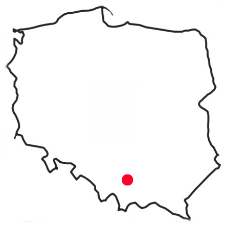
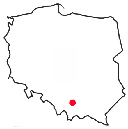
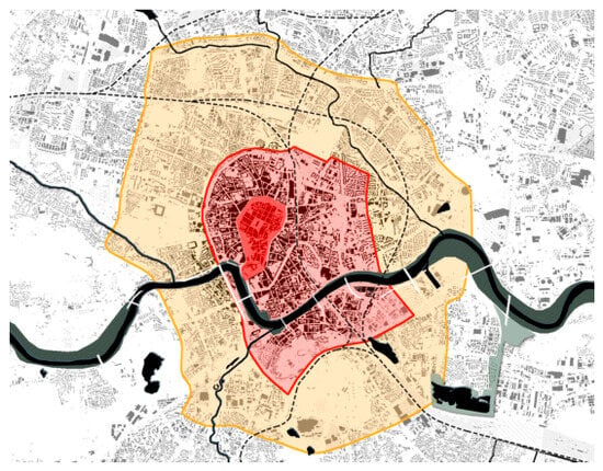
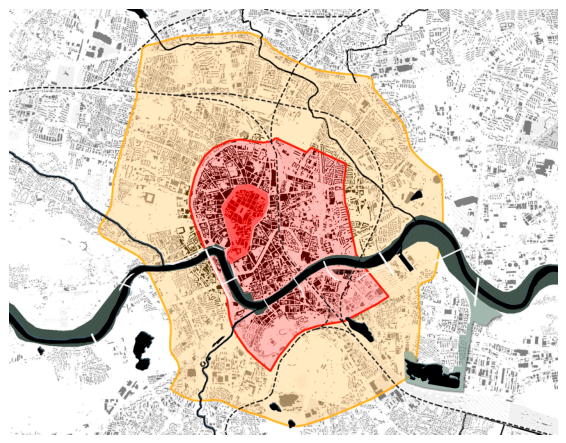
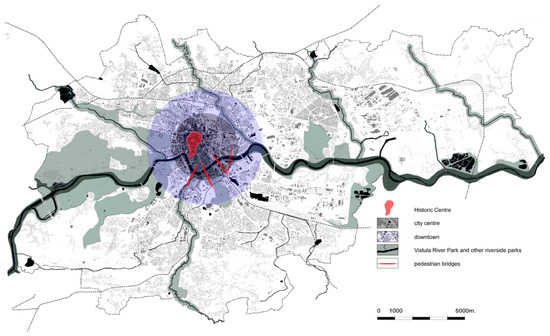
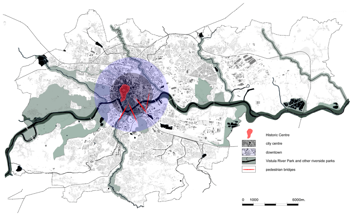
The study covered the city centre of Cracow, the boundaries of which were defined in accordance with the applicable planning documents. Cracow is situated in southern Poland, on the Vistula River (Figure 1). The city centre of Cracow forms the compositional and functional core of the city, bringing together within its area the most attractive structures, including buildings of particular aesthetic and cultural value. The spatial structure of the city centre is characterized by a compact and orderly built environment with a clear urban layout (Figure 2). An important element of its functional and spatial structure is the ‘blue-green’ network, particularly the Vistula valley, which runs east–west. In terms of pedestrian and cycle traffic, the Vistula constitutes a spatial barrier. From this perspective, B. Malisz’s threshold theory appears interesting, in light of which there is a close analogy between the concept of a development threshold and that of a spatial barrier [29] (p. 15). According to this theory, rivers constitute a spatial barrier; when considering the mechanism of an agglomeration’s spatial expansion, one must in turn consider the possible limits to its growth. (…) this may be a wide river, which necessitates costly bridge investments [30] (pp. 73–74). B. Malisz distinguishes between physical, functional, technological and structural constraints. These constraints are not absolute, as each can be overcome; however, this always requires significant investment, since exceeding these thresholds demands expenditure that only yields results once it has been made [30]. The primary role of footbridges is to integrate public spaces, resulting in a denser network of connections. The new geometry of pedestrian and cycle routes significantly enhances the attractiveness of public spaces and also strengthens the system of ‘green’ corridors.
Figure 1.
Study area: the city of Cracow: The red dot marks the location of Cracow on the map of Poland. Source: author’s study.
Figure 2.
Spatial structure of downtown Cracow: The Old Town is marked in red, the city centre in light red, and downtown in yellow. Source: author’s study.
The section of the Vistula valley running through the city centre exhibits a diversity of landforms. Vistula Park brings together, within its boundaries, historical and contemporary buildings of the highest architectural and cultural merit. The role of historical landmarks was to define the compositional axes; contemporary architecture complements the urban composition. Together, they form attractive streetscapes. An important element of this space is greenery, which complements the built environment and also provides a backdrop for individual buildings. It forms part of the city centre’s public space system. The degree to which urban layouts are connected to the river determines the attractiveness of this space. An important element of this corridor are cross-connections (pedestrian bridges).
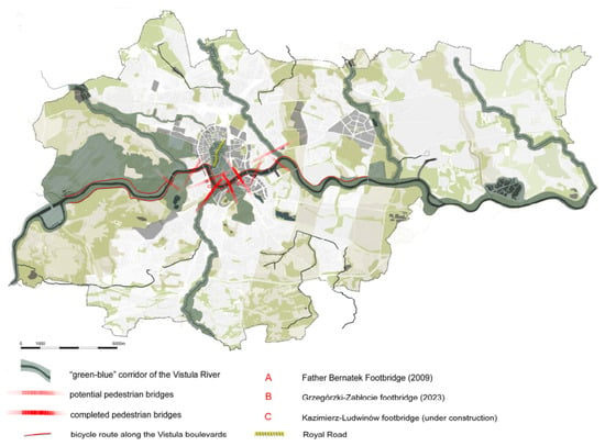
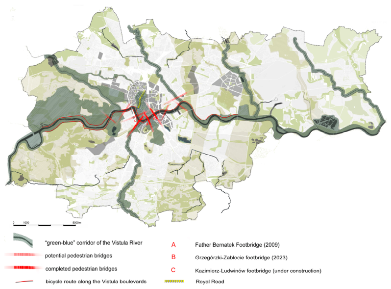
In the case study of Cracow, in accordance with the guidelines of the current development strategy, the Vistula River Park—as a key ‘green–blue’ corridor—is treated as one of the city’s main development axes [31]. The Vistula, flowing in an east-west direction, defines the primary compositional axis and constitutes a fundamental element of Cracow’s urban structure (Figure 3). Detailed studies were conducted on the cross-connections in the form of footbridges that cross the river in the city centre.
Figure 3.
Vistula River Park in the functional and spatial structure of Cracow. Source: author’s study.
2.3. Methods
The aim of this manuscript is to formulate a methodology for assessing the location of footbridges in the context of their impact on regeneration processes. The research tool was developed on the basis of a critical analysis of the relevant literature, national and international academic output, and case studies of completed projects in the city centre of Cracow. The adopted working method is based on an integrated approach. It combines three key layers: spatial analysis, critical analysis of planning documents, and qualitative research.
An examination of the factors determining the location of footbridges must take into account their links with the structure of public spaces. This network, together with its geometry, is analysed primarily in terms of the routing of pedestrian and cycle routes. The introduction of new bridge connections initiates functional and spatial transformation processes. In turn, the densification of the network of connections between individual nodes directly stimulates the development and crystallisation of the entire system of public spaces.
In this context, the relationship between user movement and spatial structure is key:
- The network’s impact on movement: The geometry and layout of routes determine travel behaviour and the directions in which people move.
- The impact of movement on the network: The intensity and flows of movement subsequently modify and shape the geometry of connections.
2.3.1. Urban Construction
A key aspect of the research methodology was the identification of elements of the urban construction and the assessment of the structure-forming potential of selected nodes and corridors. The classification of spatial planning elements that form part of the urban construction was crucial for the research and for assessing the suitability of the locations of footbridges. The urban construction is understood as the arrangement of structural elements that form a kind of skeleton of the urban structure. In other words, the urban structure is the arrangement of natural, technical and cultural elements of spatial development, which integrates it in functional, compositional and technical terms. The urban structure is formed by urban and natural corridors, as well as various types of nodes [27]. In the case of Cracow, the Vistula River Park constitutes a corridor with the highest development potential due to its exceptional natural, cultural and spatial qualities (Figure 4).
Figure 4.
Vistula River Park: locations of pedestrian bridges. Source: author’s study.
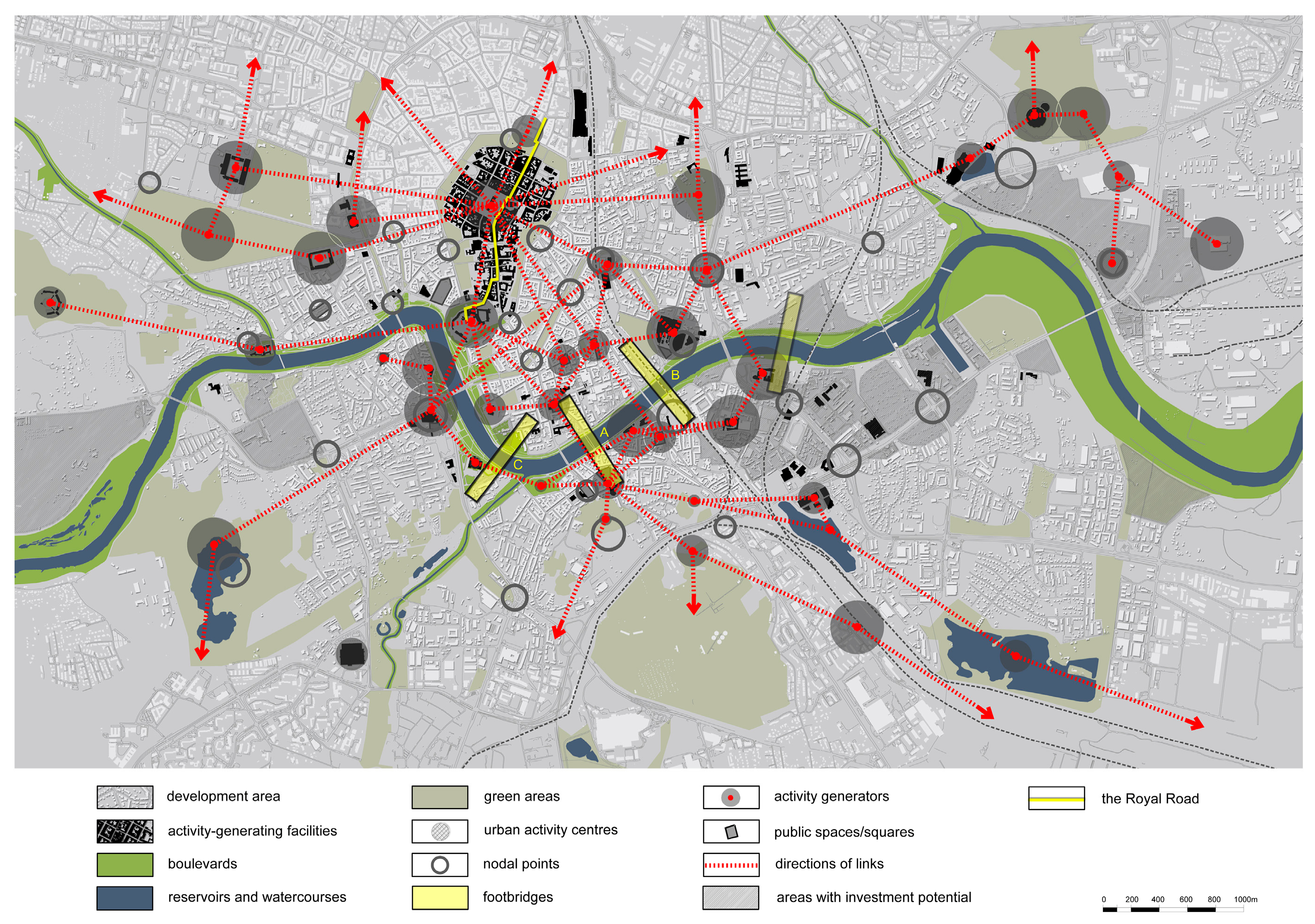
It was assumed that the appropriate location for a pedestrian bridge must connect functions that are important on a city-wide scale. Therefore, the first stage of the research involved identifying activity generators that serve as both sources and destinations of traffic. An activity generator is defined here as a building, structure or public space with particular aesthetic, functional and cultural qualities. The identification and distribution of these points created a network of interconnections (Figure 5).
Figure 5.
Activity generators in Cracow’s city centre against the background of the location of pedestrian bridges: A: Father Bernatek Footbridge, B: footbridge connecting Grzegórzki and Zabłocie, C: footbridge connecting Kazimierz and Ludwinów. Source: author’s study.
Field research indicates an even distribution of activity generators and areas of new developments in the immediate vicinity of the Vistula. These primarily include the western part of Dębniki, Grunwaldzkie Roundabout and the ICE Congress Centre, the area around the mouth of the Wilga, Zabłocie and Grzegórzki. To a large extent, the new developments are residential in nature. This function predominates on the eastern side of the city centre (Grzegórzki and Zabłocie). On this basis, a correlation was identified between key locations (concentrated activity generators, strategic projects) and the location of footbridges. It appears that the even distribution of regeneration projects on both banks of the river enhances the potential for strengthening pedestrian connections.
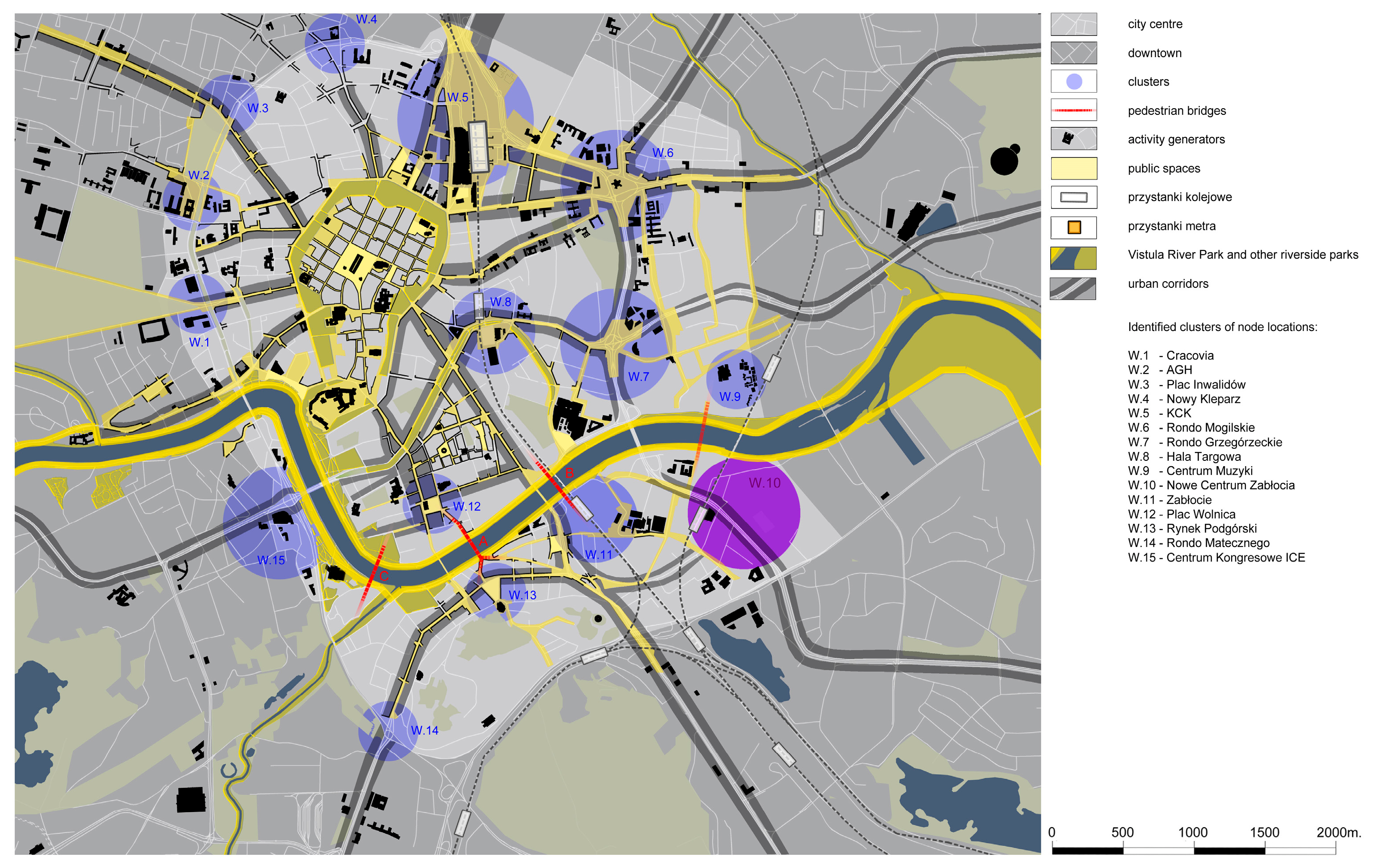
In the next stage, areas with high development potential were linked together to form clusters of node locations. A node location was defined as an area that concentrates important urban functions and stands out in cultural, functional, aesthetic and natural terms. According to the adopted definition, a cluster consists of at least two such locations that are linked spatially, compositionally and functionally (Figure 6).
Figure 6.
Identification of clusters in the layout of Cracow’s city centre against the background of the location of pedestrian bridges: A: Father Bernatek Footbridge, B: footbridge connecting Grzegórzki and Zabłocie, C: footbridge connecting Kazimierz and Ludwinów. Source: author’s study.
Overlaying the locations of footbridges onto the identified clusters clearly confirmed the strong functional and spatial links between pedestrian routes and elements of the urban structure. The fulfilment of the condition whereby a footbridge fits into the geometry of the city centre model demonstrates the effectiveness of regeneration measures, a perfect example of which is the Father Bernatka Footbridge.
2.3.2. Planning Documents
The first stage in identifying regeneration projects involved a critical analysis of the successive regeneration programmes in force since 2006: the Local Regeneration Programme for the Old Town (LPR Stare Miasto 2008) [32], the Local Revitalisation Programme for Zabłocie (LPR Zabłocie 2006, 2010) [33], the Cracow Urban Revitalisation Programme (MPRK 2008, 2016) [34], and the Cracow Municipal Revitalisation Programme (GPRK 2025) [35].
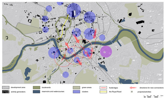
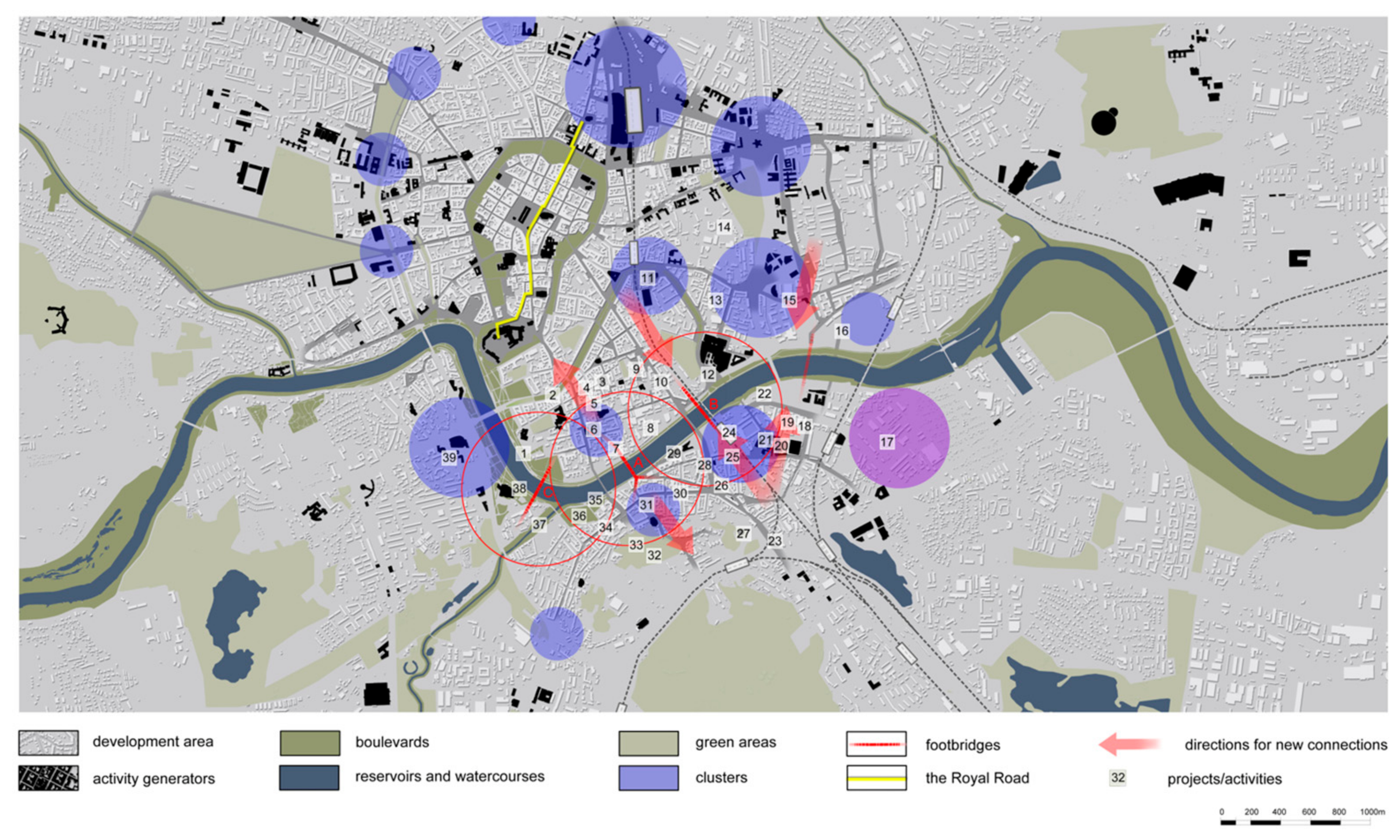
The regeneration projects identyfied on the basis of the documents are shown in Figure 7 and listed in the following tables.
Figure 7.
Identification of revitalisation projects against the background of the location of pedestrian bridges: A: Father Bernatek Footbridge, B: footbridge connecting Grzegórzki and Zabłocie, C: footbridge connecting Kazimierz and Ludwinów. Source: author’s study based on planning documents.
Based on the analysed documents, revitalisation projects were identified, with those initiatives that combine at least two spatial policy priorities in the area of sustainable development being selected for detailed analysis (Table 1). The projects under study play a key role in defining the methodology for the deployment of footbridges and determining their relationship with revitalisation processes. The comparison of revitalisation measures with existing nodes and corridors allows for the identification of new areas of strategic investment focus. An analysis of the provisions in regeneration programmes also indicates that they can serve as a tool for shaping the urban construction by generating new nodes and corridors. The logic of their functional and spatial relationships should stem from their interconnections and other interdependencies.
Table 1.
Identification of spatial policy priorities, taking into account the principles of sustainable development. Author’s study.
2.3.3. Typology
In order to precisely define the role of footbridges within the city’s spatial structure, ten key elements of spatial planning have been identified. It is these elements that determine the typology of design scenarios and dictate the direct mechanism of operation for a given crossing.
The fundamental element of spatial planning is pedestrian bridges, which have been divided into three groups based on their impact on revitalisation processes (induction, consequence, weak relationships).
The study was based on an assessment of the morphological and functional–spatial structure of the areas in the immediate vicinity of the footbridges. These areas were delineated using an isochrone with a radius of 500 m. In the relevant literature, this range is considered to correspond to the most comfortable pedestrian journey, adapted to the ‘human scale’ [36], or defines the space of convenient pedestrian access in accordance with the neighbourhood unit theory. In the context of footbridges, the adopted isochrone defines the maximum radius of influence of the footbridge [37]. From an engineering perspective, the construction of such a structure is economically and socially justified when the area within the isochrone is characterised by spatial proximity and contains key traffic generators, such as public facilities or public transport stops [38].
The key evaluation criterion in the typology of design and planning situations is what are known as ‘activity generators’, which are selected elements of the spatial structure (Table 2). Based on the adopted indicators, these have been divided into two main categories: volumetric elements and spatial elements. This classification served as the direct basis for developing the typology of design situations.
Table 2.
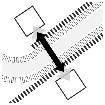
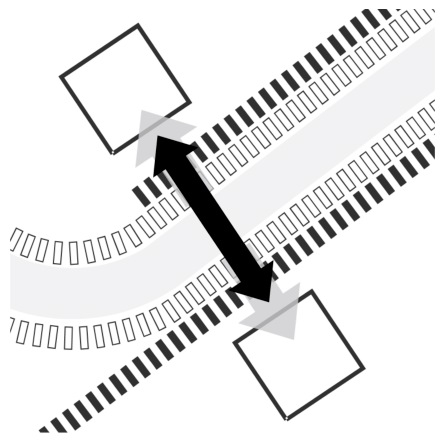
Typological diagrams of design situations, compiled by the author.
The fundamental element of spatial development is pedestrian bridges, which have been divided into three groups based on their impact on revitalisation processes (induction, consequence, weak relationships).
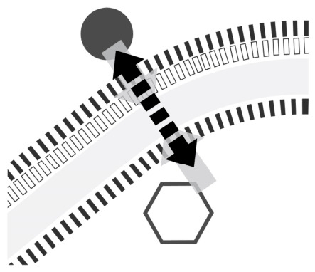
In every case, footbridges connect networks of pedestrian and cycle routes, and sometimes also mixed-use routes. In the case of mixed-use routes, an additional advantage that enhances the accessibility of waterfront areas is the presence of public transport stops, which generate traffic. The directions of these new connections identify potential areas for regeneration projects. The direction of the arrows: from the bridge and to the bridge, reflects the mechanisms of ‘induction’ and ‘consequence’.
‘Induction’, that is, the role of a footbridge as a catalyst for further functional and spatial changes in the city’s structure. This confirms the structure forming role of footbridges, which revitalize the city centre and pave the way for further regeneration projects. For this reason, selecting the optimal location is the most critical and complex part of the process. This decision carries long-term social and economic consequences, and the actual effects of the changes do not always correspond to the original planning assumptions. In this case, identifying the location requires interdisciplinary analyses taking into account structural, architectural and urban planning, functional, compositional, transport and landscape aspects.
We speak of market induction in the context of a footbridge’s construction when the project generates measurable economic changes. These include an increase in property prices in the immediate vicinity, the development of the retail and services sector, the revitalisation of the construction sector, and the emergence of new urban development projects. These processes initiate comprehensive regeneration in economic, financial and functional-spatial terms. A direct and natural consequence of the footbridge’s construction is also an increase in pedestrian and cycle traffic, as well as the creation of a new quality of public space.
‘Consequence’ is the opposite of spatial induction. In this model, the construction of a footbridge is not an impulse for change, but a direct result of intensive regeneration processes. Planning decisions regarding the location of such a structure are precisely defined and stem from the actual needs of the urban structure.
’Weak Relationships’ mean that the connections between footbridges and regeneration processes are negligible or non-existent. This situation arises when the structure merely integrates transport routes, without generating impetus for socio-economic revitalisation or improving the functional and spatial structure of the surrounding area. In this context, the infrastructure fulfils only a basic transport function, facilitating pedestrian and cycle traffic.
The results of the analyses confirm the city-forming role of footbridges. This infrastructure effectively attracts investments that strengthen local development and brings about lasting changes in the layout and connections of neighbouring public spaces.
3. Results
In accordance with the adopted methodology, results were compiled for individual footbridge locations, taking into account three key areas: physical, social and economic.
3.1. Father Bernatek Footbridge
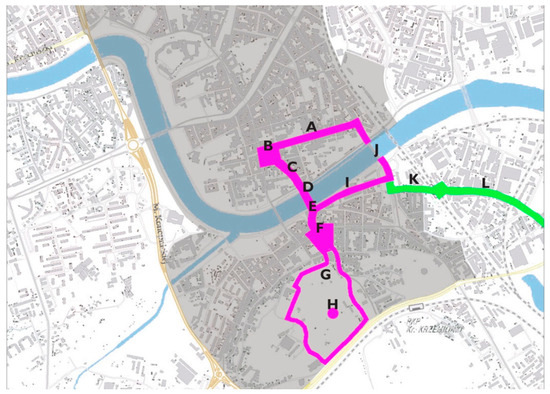
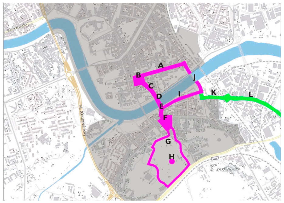
The first footbridge to be completed is the result of a pilot project in accordance with the Local Revitalisation Programme for the Old Town (LPR 2008) [32]. This programme involved the regeneration of key urban spaces, including the streets of Św. Wawrzyńca, Mostowa, Brodzińskiego and Staromostowa, as well as Wolnica Square, Podgórski Square, Bednarski Park and the ‘Benedykt’ fort (Figure 8).
Figure 8.
Pilot project according to the provisions of the Local Revitalisation Programme for the Old Town. A—Św. Wawrzyńca Street, B—Wolnica Square, C—Mostowa Street, D—Father Bernatek Footbridge, E—Brodzińskiego, Staromostowa Streets, F—Podgórski Square, G—Bednarski Park, H—Sports Club Korona, I—Nadwiślańska, Brodzińskiego Streets, J—Na Zjeździe, Starowiślna Streets, K—Kącik Street, L—Lipowa Street. Source: Lokalny Program Rewitalizacji dla Starego Miasta (2008) [32], Urząd Miasta Krakowa, Kraków.
The Father Bernatek Footbridge—connecting Wolnica Square on the Kazimierz side with Podgórski Square on the Podgórze side—has become a model example of the induction mechanism (Figure 9 and Figure 10). This phenomenon, referred to in urban planning as the “bridge effect”, involves the strong, stimulating impact of new infrastructure on the revitalisation processes of the surrounding area.
Figure 9.
Father Bernatek Footbridge: diagram of the design situation typology (induction). Source: author’s study.
Figure 10.
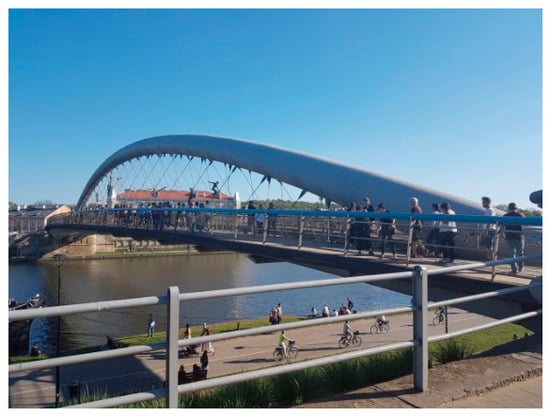
Father Bernatek Footbridge. View from Kazimierz. Source: photo by the author.
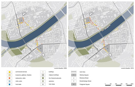
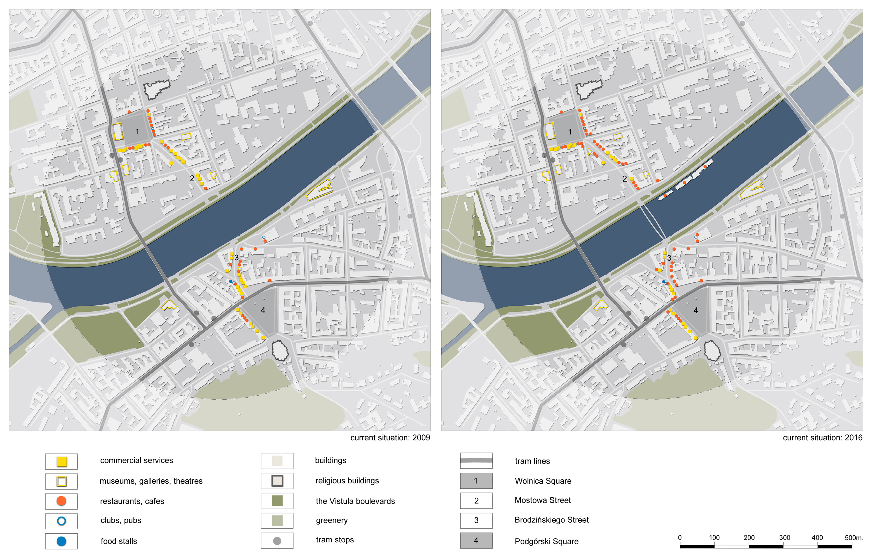
In relation to the adopted methodology, the main characteristics and effects of the footbridge’s construction have been identified. Spatially, the footbridge links the main public spaces of Kazimierz and Podgórze. Its location clearly connects activity generators, meaning it fits into the urban construction of Cracow’s city centre. A new corridor has emerged along its extension, which has ‘sprung up’ with new activities (we are speaking about a number of catering establishments, retail and service facilities, cultural facilities, etc.) [39]. Surveys among premises owners confirmed the growth of services in Kazimierz and Podgórze. A key manifestation of this revival was the commercialisation of Mostowa and Brodzińskiego Streets, where field research revealed the emergence of around 20 new catering establishments (Figure 11).
Figure 11.
An inventory of the use of ground-floor properties along Mostowa and Brodzińskiego Streets. Source: author’s study based on interviews with the property owners.
The construction of the Father Bernatek Footbridge also provided a direct impetus for dynamic functional and spatial changes. This synergy effect also extended to the Św. Wawrzyniec quarter, initiating revitalisation processes on the sites of the former tram depot and gasworks. The findings of the analyses of the Local Revitalisation Programme for the Old Town (2008) and the Municipal Revitalisation Programmes (2008, 2016, 2025) confirm a significant intensification of revitalisation activities (Table 3). Research into property prices and the dynamics of investment pressure revealed clear market reactions. These manifested themselves, among other things, in a roughly threefold increase in property values, particularly in the Podgórze area. Although the acquisition of new private capital is a multifaceted component of revitalisation processes, it carries social risks. For example, a side effect of the regeneration efforts in Cracow’s Kazimierz district has been progressive gentrification [40]. The construction of the Father Bernatek Footbridge provided a direct impetus for dynamic functional, spatial and economic changes in the adjacent areas. The new infrastructure integrated both banks of the Vistula, stimulating the development of services in Kazimierz and Podgórze. The project also accelerated the modernisation of urban green spaces, including Bednarski Park, Nowacki Planty and the area surrounding St Benedict’s Fort. In spatial terms, the footbridge revitalised the left bank of the Vistula, whilst on the right bank it triggered intensive construction development towards the east, encompassing Podgórze and Zabłocie.
Table 3.
Identification of revitalisation projects related to Father Bernatek Footbridge, as shown in Figure 7. Source: author’s study based on planning documents.
A summary of the aspects examined—taking into account spatial, economic and social factors—is presented in Table 4.
Table 4.
Summary of the impact of the Father Bernatek Footbridge. Source: author’s study.
The example of the Father Bernatek Footbridge confirms that links crossing the Vistula corridor serve a centralising and structuring function. In this case, the footbridge is more than just infrastructure. It integrates Kazimierz and Podgórze both spatially and functionally. It also connects local nodes of activity. A particularly interesting phenomenon is the new public space that has emerged along the footbridge–Cricoteka axis. The footbridge is an example of a flagship project generating a revitalisation effect. In this context, there is often talk of the ‘bridge effect’. This refers directly to the socio-economic–cultural phenomenon that followed the construction of the Guggenheim Museum in Bilbao.
3.2. Footbridge Connecting Zabłocie—Grzegórzki
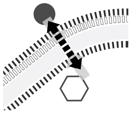
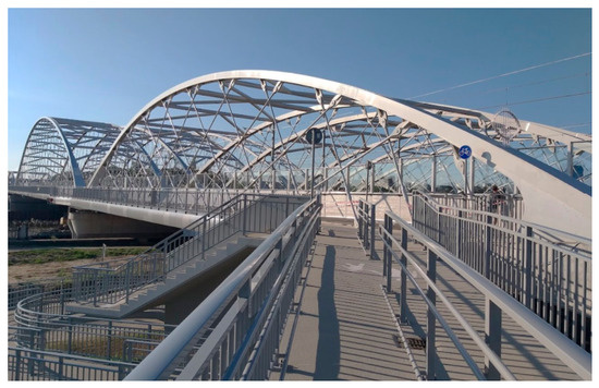
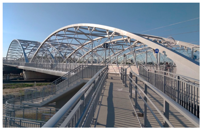
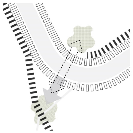
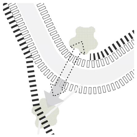
The footbridge between Grzegórzki and Zabłocie clearly links key nodes, connecting the railway stop with the market hall (Figure 12 and Figure 13). This means that the footbridge fits seamlessly into the urban construction of Cracow’s city centre. The design situation is the opposite of that of the Father Betnatek Footbridge. Here, the mechanism is a consequence.
Figure 12.
Footbridge connecting Zabłocie and Grzegórzki: diagram of the design situation typology (consequence). Source: author’s study.
Figure 13.
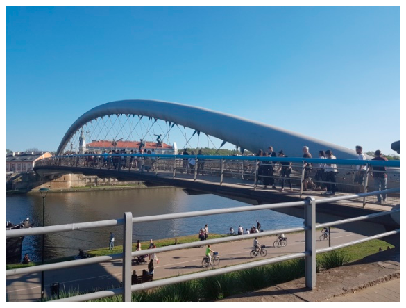
Pedestrian bridge connecting Zabłocie and Grzegórzki. Source: photo by the author.
Zabłocie and Grzegórzki are key areas for regeneration. In the case of Zabłocie, former post-industrial sites are being dynamically transformed into a modern residential and commercial district. The impetus for these changes came from cultural investments, the construction of the MOCAK Museum of Contemporary Art and the Oskar Schindler Enamel Factory branch of the Historical Museum of the City of Cracow. The district owes its rapid pace of change to its strategic location close to the city centre and excellent transport links, based, among other things, on a major transport hub (Table 5).
Table 5.
Identification of revitalisation projects in Zabłocie and Grzegórzki forcing the connection of the two districts, as shown in Figure 7. Source: author’s study based on planning documents.
However, intensive construction development is exposing significant infrastructure problems, as the regeneration of public spaces is not keeping pace with the rate of private investment. The greatest challenges currently are the lack of green spaces, the poor quality of public spaces, and the need to revitalize the area around Lipowa Street and the Vistula Boulevards.
In the case of Grzegórzki, one of the most important issues at present is the regeneration of the Wesoła Street area, which is entering a phase of key investments. The site of the former University Hospital is being transformed into a creative and cultural district, combining culture, education and recreation. Although the city’s current policy focuses on the development of pedestrian and cycle traffic, the existing footbridge (integrated with the railway bridge) does not fully integrate the space or create a new corridor for activity.
Urban planning analyses indicate that the key to a coherent connection between Zabłocie and Grzegórzki is the location of a footbridge to the east of the railway line. This is in line with the Local Revitalisation Programme (LPR 2010) and the Local Spatial Development Plan (MPZP). It would then provide a new impetus for urban development and integrate the network of public spaces on both sides of the Vistula River. A footbridge situated in the central part of both districts would help to define the layout of the public space.
In accordance with the methodology adopted, the impact of the footbridge was assessed across three dimensions. The results of these analyses are presented in the Table 6.
Table 6.
Summary of the impact of the footbridge between Grzegórzki and Zabłocie. Source: author’s study.
3.3. Footbridge Connecting Kazimierz–Ludwinów
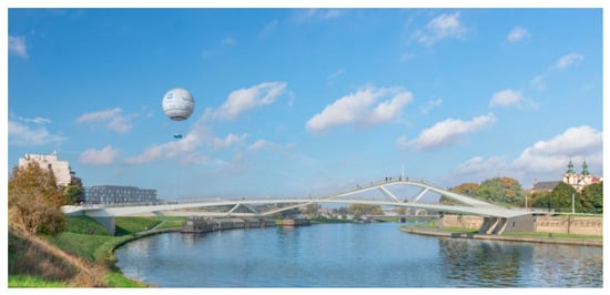
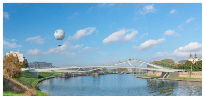
A third example of a design situation is the pedestrian bridge currently under construction linking Kazimierz with Ludwinów. Analyses of the spatial structure of Cracow’s city centre indicate that a footbridge in this location does not connect the generators of key location clusters (Figure 14 and Figure 15).
Figure 14.
Footbridge connecting Kazimierz and Ludwinów: diagram of the design situation typology (weak relationship). Source: author’s study.
Figure 15.
Visualisation of the footbridge connecting Kazimierz and Ludwinów. Source: https://lewicki-latak.com.pl/projekt/kladka-kazimierz-ludwinow-krakow/, accessed on 15 May 2026.
In light of the presented assumptions, it does not fit into the urban construction of the city centre, and therefore its relationship with the regeneration will be weak. The analyses carried out confirm that the issue of public space at the ICE Congress Centre remains unresolved. Furthermore, a design decision has caused a conflict between the city authorities and the public.
As the above examples indicate, the identified types of design situations relate to various aspects of regeneration.
Table 7 sets out the criteria for assessing the relationship between the footbridge and the regeneration.
Table 7.
Summary of the impact of the footbridge between Kazimierz and Ludwinów. Source: author’s study.
4. Conclusions
This publication examines the interrelationships between the construction of footbridges and urban regeneration processes. The findings confirm that such engineering structures are a key factor in economic and social revitalisation and play a decisive role in the development of city centres. However, the effectiveness of these links depends on the close integration of the bridges with the existing urban construction. For research purposes, the methodology was based on a model of Cracow’s city centre, in which nodes and corridors were identified as key elements of the spatial structure. The results of the analyses demonstrate that footbridges integrate the urban structure and create new axes of activity. Based on the relationships examined, three universal types of design situations were classified: induction, consequence and weak relationships.
In the context of contemporary sustainable development doctrines, footbridges connecting areas separated by spatial barriers have a key impact on social inclusivity. By creating safe spaces, these structures stimulate the integration of local communities, directly improving residents’ quality of life. They promote active mobility and eco-friendly modes of transport, thereby reducing carbon dioxide emissions, air pollution and traffic congestion [41]. By removing spatial barriers, they also ensure full accessibility for people with disabilities. In this context, walking is an integral part of a sustainable public transport system, which directly reflects the global urban development policy promoted by the United Nations Economic Commission for Europe (UNECE) [42].
Research and analyses concerning the relationship between footbridges and urban regeneration show that footbridges revitalize the area and contribute to the revitalisation of the network of public spaces. They are public spaces in their own right, but they also create a new type of public space. From the perspective of the functional-spatial structure model, footbridges fulfil important functions: they define new elements of the urban structure (riverfront) and enrich the city’s architecture through new architectural connections. They shape the geometry of spatial layouts by compositionally linking urban interiors. The construction of footbridges results in new corridors and, consequently, new amenities, food outlets, street furniture and new vantage points. An example confirming these patterns is the Father Bernatek Footbridge. The pedestrian route designated along its extension has become a significant development corridor, whilst also serving as a natural extension of the Royal Way (the historically formed layout of the main public spaces was the basic pedestrian route of the historic centre of Cracow; the direction set on the north-south axis was the criterion for the development of the downtown structure). Here, we can speak about the structure forming role of pedestrian bridges in the context of shaping the environment of the Vistula River Park. The example of Father Bernatek Footbridge also confirms the synergistic effects. They consist in revitalizing successive fragments of the downtown area through the implementation of successive revitalisation projects (the so called ‘bridge effect’).
Taking into account the criteria for the location of the link currently being implemented between Ludwinów and Kazimierz, the location of the pedestrian bridge is inappropriate and unrelated to revitalisation. In light of the assumptions presented, the pedestrian bridge in its current location does not fit into the urban design of the downtown area. The problem of public space near the ICE Congress Center also remains unresolved.
The footbridge connecting Grzegórzki and Zabłocie is an example where the greatest links with revitalisation can be observed. Here, strong revitalisation measures are forcing the creation of a structural link between the two districts on opposite sides of the Vistula River. Another important issue is the development of the riverfront in Zabłocie. The rank of the other locations is of equal importance and will depend on the adopted revitalisation strategy.
The results of analyses conducted on the example of Cracow clearly confirm that new corridors of activity, designated by pedestrian bridges, result from the need to integrate revitalisation projects. The logic behind these projects is reflected in synergistic effects and the revitalisation of the city centre structure. In other words, the highest intensity of pedestrian and bicycle traffic occurs between nodes and revitalisation projects, where the highest concentration of traffic sources and destinations is observed.
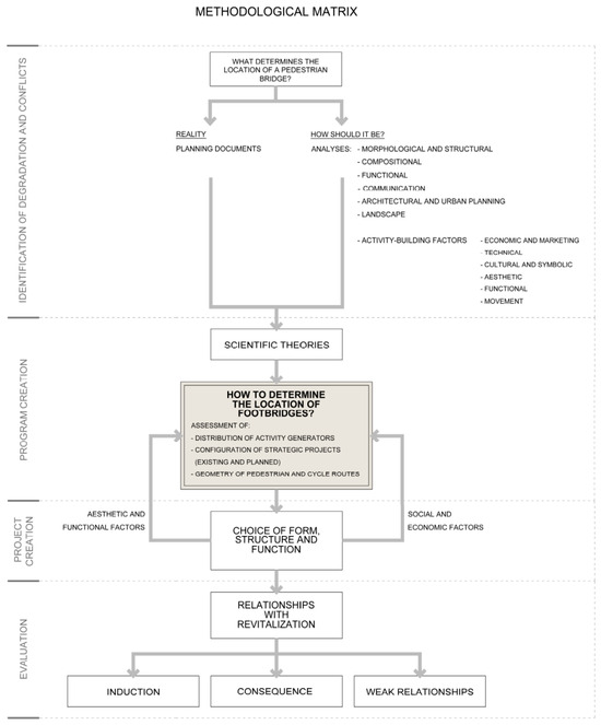
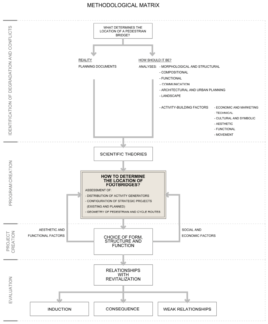
Analyses of the city centre section of the Vistula River Park regarding changes resulting from the ‘bridge effect’ can serve as a universal method for assessing the location of footbridges in such a way as to achieve a revitalisation effect (Figure 16). It consists of analysing planning documents and the strategic projects indicated therein against the background of elements of the functional and spatial structure model (nodes and corridors).
Figure 16.
Methodological matrix for the location of footbridges. Source: author’s study.
- One of the criteria for the location of pedestrian bridges is their integration into the geometry and logic of the continuity of the pedestrian and bicycle network. A coherent and clear layout of public spaces affects the quality of the space and improves the functioning of the city. Properly defining the location of a pedestrian bridge leads to morphological integration with the city. This means that pedestrian bridges fit into the urban structure. They, then, have the potential to physically redesign the surrounding area. The attractiveness of the boulevards is also an important factor.
- An important determinant of the location of footbridges is the connection of clusters of activity generators (node points). The highest intensity of pedestrian and bicycle traffic is observed between areas of concentration of traffic sources and destinations.
- Pedestrian bridges correspond well with landmarks, often becoming icons themselves and contributing to the formation of a new identity for a place.
To summarise the discussion on the location of footbridges, it should be emphasised that footbridges can influence the shaping of the city centre. The corridors established along their routes form the backbone of the urban construction, pointing to new directions for development and regeneration. The relationship between the effectiveness of regeneration and footbridges lies in successive functional and spatial changes. As the above analyses show, the integration of spaces by footbridges can become an important criterion for configurating strategic projects. Footbridges can define and shape new regeneration projects.
Funding
This research received no external funding.
Institutional Review Board Statement
Not applicable.
Informed Consent Statement
Not applicable.
Data Availability Statement
The original contributions presented in the study are included in the article, further inquiries can be directed to the author.
Conflicts of Interest
The author declares no conflict of interest.
References
- Czarnecki, W. Planowanie Miast i Osiedli, t.III, Krajobraz i Tereny Zielone; PWN: Warszawa, Poland; Poznań, Poland, 1968. [Google Scholar]
- Böhm, A. System Parków Rzecznych w Krakowie, In Doliny Rzeczne: Przyroda, Krajobraz, Człowiek; Myga-Piątek, U., Ed.; Prace Komisji Krajobrazu Kulturowego T.: Sosnowiec, Poland, 2007; Volume VII, pp. 277–284. [Google Scholar]
- Januchta-Szostak, A. Błękitna krew miasta. Woda jako ożywcza siła przestrzeni publicznych. The blue blood of the city. Water as invigorating power of public spaces. In Serce Miasta. The Heart of the City; Gyurkovich, J., Ed.; Czasopismo Techniczne, Architektura z. 3-A/2008, zeszyt 8 (rok 105); Wydawnictwo Politechniki Krakowskiej: Kraków, Poland, 2008; pp. 21–27. [Google Scholar]
- Lynch, K. The Image of the City; The MIT Press: Cambridge, MA, USA, 1990. [Google Scholar]
- Wejchert, K. Elementy Kompozycji Urbanistycznej; Wydawnictwo ARKADY: Warszawa, Poland, 1984. [Google Scholar]
- Zuziak, Z.K. Centrum i architektura miasta. Przesłanie z Krakowa. In Centra Miast Metropolitalnych w Polsce. Urbanistyka z Polityka Przestrzenna; Zuziak, Z.K., Grzybowski, A., Eds.; Wydawnictwo Wyższej szkoły Technicznej w Katowicach: Katowice, Poland, 2018. [Google Scholar]
- Lorens, P. Rewitalizacja frontów wodnych jako element procesu odnowy miast. In Przestrzeń w Zarządzaniu Rozwojem Regionalnym Lokalnym; Markowski, K., Ed.; Biuletyn KPZK PAN, z. 211; PG: Gdańsk, Poland, 2004; pp. 179–205. [Google Scholar]
- Muszyńska-Jeleszyńska, D. Tereny nadrzeczne w aspekcie rozwoju i rewitalizacji miast = Riverside areas in terms of development and urban regeneration. J. Health Sci. 2013, 3, 99–107. [Google Scholar]
- Vallega, A. Urban waterfront facing integrated coastal management. Ocean Coast. Manag. 2001, 44, 379–410. [Google Scholar] [CrossRef] [Scilit]
- Lorens, P. Large. Scale Urban Developments; Wydawnictwo Politechniki Gdańskiej: Gdańsk, Poland, 2001; p. 7. [Google Scholar]
- Gordon, D.L.A. Managing the changing political environment in urban waterfront development. Urban Stud. 1997, 34, 61–83. [Google Scholar]
- Horbliuk, S.; Dehtiarova, I. Approaches to urban revitalization policy in light of the latest concepts of sustainable urban development. Balt. J. Econ. Stud. 2021, 7, 46–55. [Google Scholar] [CrossRef] [Scilit]
- Yildiz, S.; Kivrak, S.; Arslan, G. Contribution of built environment design elements to the sustainability of urban renewal projects: Model proposal. J. Urban Plan. Dev. 2019, 145, 04018045. [Google Scholar] [CrossRef] [Scilit]
- Parysek, J.; Tölle, A. (Eds.) Wybrane Problemy Rozwoju i Rewitalizacji Miast: Aspekty Poznawcze i Praktyczne; Biuletyn Instytutu Geografii Społeczno-Ekonomicznej Uniwersytetu im. A. Mickiewicza w Poznaniu, Seria: Rozwój Regionalny i Polityka Regionalna, nr 5; Bogucki Wydawnictwo Naukowe: Poznań, Poland, 2008. [Google Scholar]
- Januchta-Szostak, A. Kreowanie Tożsamości na Styku Wody i Miasta. Urbanista 2008, 8, 31–33. [Google Scholar]
- Uffelen, C. Waterscapes Contemporary Landscaping; Baun Publishing AG: Salenstein, Switzerland, 2011. [Google Scholar]
- Gzell, S. Nawodna lokalizacja—Co to dziś znaczy dla miasta? Przestrz. Forma 2015, 24, 113–128. [Google Scholar]
- Pancewicz, A. Rzeka w Krajobrazie Miasta; Wydawnictwo Politechniki Śląskiej: Gliwice, Poland, 2004. [Google Scholar]
- Jałowiecki, B. Przestrzeń społeczna rzek. In Rzeki. Kultura, Cywilizacja, Historia, t. 7; Kołtuniak, J., Ed.; Wydawnictwo „Śląsk”: Katowice, Poland, 1998; pp. 121–137. [Google Scholar]
- Renfro, R. Pedestrian/Bicycle Overcrossings: Lessons Learned. Master’s Thesis, Portland State University, Portland, OR, USA, 2007. [Google Scholar]
- Plasencia-Lozano, P. Role of footbridges in waterfront rehabilitation. J. Bridge Eng. 2014, 20, 02514002. [Google Scholar]
- Zorzenon, F. Footbridges as New Urban Spaces. A Cultural Project for Contemporary Landscape; Edizioni Accademiche Italiane: Saarbrücken, Germany, 2014. [Google Scholar]
- Chu, S.C.H. When and why do people walk in the city: The influence of urban elements on time-pattern of pedestrian movement. In Proceedings of the 6th International Walk 21 Conference in Zurich, Zurich, Switzerland, 22–23 September 2005. [Google Scholar]
- Fonseca, F.; Ribeiro, P.J.; Conticelli, E.; Jabbari, M.; Papageorgiou, G.; Tondelli, S.; Ramos, R.A. Built environment attributes and their influence on walkability. Int. J. Sustain. Transp. 2021, 16, 660–679. [Google Scholar] [CrossRef] [Scilit]
- Ellis, G.; Hunter, R.; Tully, M.A.; Donnelly, M.; Kelleher, L.; Kee, F. Connectivity and physical activity: Using footpath networks to measure the walkability of built environments. Environ. Plan. B Plan. Des. 2016, 43, 130–151. [Google Scholar]
- Skalski, K. Komplementarność i synergia projektów w Programach Rewitalizacji. In Proceedings of the Stowarzyszenie Forum Rewitalizacji Instytut Spraw Publicznych Uniwersytetu Jagiellońskiego, Kraków, Poland, 7 April 2008. [Google Scholar]
- Zuziak, Z.K.; Ogrodnik, D.; Derlatka, A.; Synowiec, A. Konstrukcja Urbanistyczna Krakowa. In Proceedings of the Rola Śródmieścia a Korytarze Rozwoju—Jako Wskazanie do Opracowania Kierunków Rozwoju dla Sporządzanego Studium Uwarunkowań i Kierunków Zagospodarowania Przestrzennego Miasta Krakowa, Kraków, Poland, 16 July 2018. [Google Scholar]
- Batty, M. Agent-Based Pedestrian Modelling; Centre for Advanced Spatial Analysis: London, UK, 2003. [Google Scholar]
- Rykiel, Z. Rozwój Regionów Stykowych w Teorii i w Badaniach Empirycznych; Zakład Narodowy Imienia Ossolińskich, Wydawnictwo Polskiej Akademii Nauk: Wrocław, Poland; Warszawa, Poland; Kraków, Poland, 1991. [Google Scholar]
- Malisz, B. Metoda analizy progowej w zastosowaniu do planowania rozwoju miast i regionów. In Metoda Analizy Progowej; Malisz, B., Żurkowski, J., Eds.; Studia KPZK PAN, 34; Państwowe Wydawnictwo Naukowe: Warszawa, Poland, 1971. [Google Scholar]
- Gyurkovich, M.; Szarata, A.; Zuziak, Z.K.; Faron, A.; Ogrodnik, D.; Ziobro, A.; Matusik, A.; Sotoca Garcia, A.; Baran, S.; Derlatka, A. Model Przestrzennej Struktury Krakowa. Perspektywa Planistyczna. Etap II—Założenia Modelu Strukturalnych Zmian w Zagospodarowaniu Przestrzennym Miasta. Kraków, Poland. 2017; Unpublished Work.
- Uchwała Nr LIII/673/08 Rady Miasta Krakowa z dnia 8 Października 2008 r. w Sprawie Przyjęcia Lokalnego Programu Rewitalizacji Starego Miasta. Available online: https://bip.krakow.pl/?dok_id=167&sub_dok_id=167&sub=uchwala&query=id%3D17517%26typ%3Du (accessed on 12 September 2025).
- Uchwała Nr XC/1193/10 Rady Miasta Krakowa z dnia 13 Stycznia 2010 r. w Sprawie Przyjęcia Aktualizacji Programu Rewitalizacji i Aktywizacji Poprzemysłowego Obszaru Zabłocia. Available online: https://bip.krakow.pl/?dok_id=167&sub_dok_id=167&sub=uchwala&query=id%3D18074%26typ%3Du (accessed on 12 September 2025).
- Uchwała Nr LIX/1288/16 Rady Miasta Krakowa z dnia 7 Grudnia 2016 r. w Sprawie Przyjęcia Miejskiego Programu Rewitalizacji Krakowa. Available online: https://www.bip.krakow.pl/?dok_id=167&sub_dok_id=167&sub=uchwala&query=id%3D21962%26typ%3Du (accessed on 12 September 2025).
- Uchwała Nr XLI/844/25 Rady Miasta Krakowa z dnia 19 Listopada 2025 r. w Sprawie Przyjęcia Gminnego Programu Rewitalizacji Miasta Krakowa. Available online: https://www.bip.krakow.pl/?dok_id=167&sub_dok_id=167&sub=uchwala&query=id%3D28769%26typ%3Du (accessed on 20 January 2026).
- Gehl, J. Miasta dla Ludzi; Wydawnictwo RAM: Kraków, Poland, 2014. [Google Scholar]
- Flaga, A. Mosty dla Pieszych; Wydawnictwo Komunikacji i Łączności: Warszawa, Poland, 2011. [Google Scholar]
- Stangel, M. Kształtowanie Współczesnych Obszarów Miejskich w Kontekście Zrównoważonego Rozwoju; Wydawnictwo Politechniki Śląskiej: Gliwice, Poland, 2013. [Google Scholar]
- Sarga, A. Wpływ kładki „Bernatka” na strukturę funkcjonalno-przestrzenną krakowskiego Kazimierza i Podgórza. Przestrz. Forma 2014, 21, 473–484. [Google Scholar]
- Romańczyk, K. Pułapki rewitalizacji. Przypadek Krakowa. In Studia Regionalne i Lokalne Nr 4(74)/2018; Wydawnictwo Uniwersytetu Warszawskiego: Warszawa, Poland, 2018. [Google Scholar]
- Baobeid, A.; Koç, M.; Al-Ghamdi, S.G. Walkability and Its Relationships With Health, Sustainability, and Livability: Elements of Physical Environment and Evaluation Frameworks. Front. Build. Environ. 2021, 7, 721218. [Google Scholar] [CrossRef] [Scilit]
- UNECE. Walk 21, Policy Brief, Leading the Walking Movement, Integrating Walking + Public Transport. April 2024. Available online: https://unece.org/sites/default/files/2024-04/Walk21%200124%20-%20Walk21%20Intgd%20Walking_Public%20Transport_v8%20FINAL%20version_0.pdf (accessed on 15 May 2026).









Disclaimer/Publisher’s Note: The statements, opinions and data contained in all publications are solely those of the individual author(s) and contributor(s) and not of MDPI and/or the editor(s). MDPI and/or the editor(s) disclaim responsibility for any injury to people or property resulting from any ideas, methods, instructions or products referred to in the content. |
© 2026 by the author. Licensee MDPI, Basel, Switzerland. This article is an open access article distributed under the terms and conditions of the Creative Commons Attribution (CC BY) license.