Review

Identification of Paddy Croplands and Its Stages Using Remote Sensors: A Systematic Review

by
Manuel Fernández-Urrutia
1,2,
Manuel Arbelo
1 and
Artur Gil
3,*
1
Departamento de Física, Universidad de La Laguna, 38200 San Cristobal de La Laguna, Spain
2
Irish Centre for High-End Computing (ICHEC), University of Galway, H91TK33 Galway, Ireland
3
Research Institute for Volcanology and Risks Assessment (IVAR), University of the Azores (UAc), 9500-321 Ponta Delgada, Portugal
*
Author to whom correspondence should be addressed.
Sensors 2023, 23(15), 6932; https://doi.org/10.3390/s23156932
Submission received: 14 June 2023 / Revised: 24 July 2023 / Accepted: 28 July 2023 / Published: 3 August 2023

Abstract

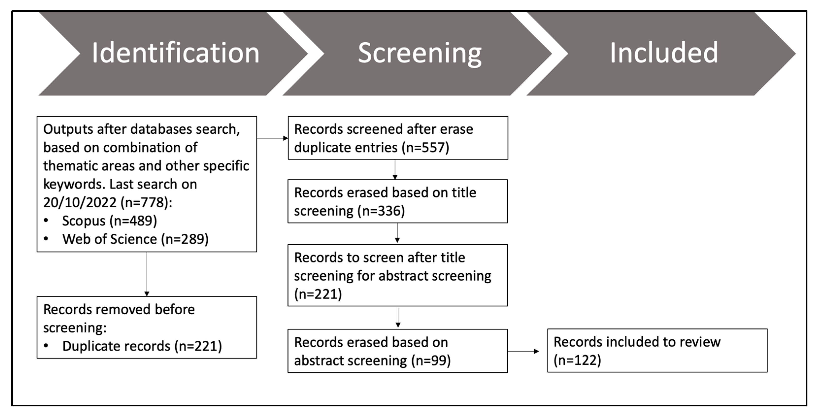
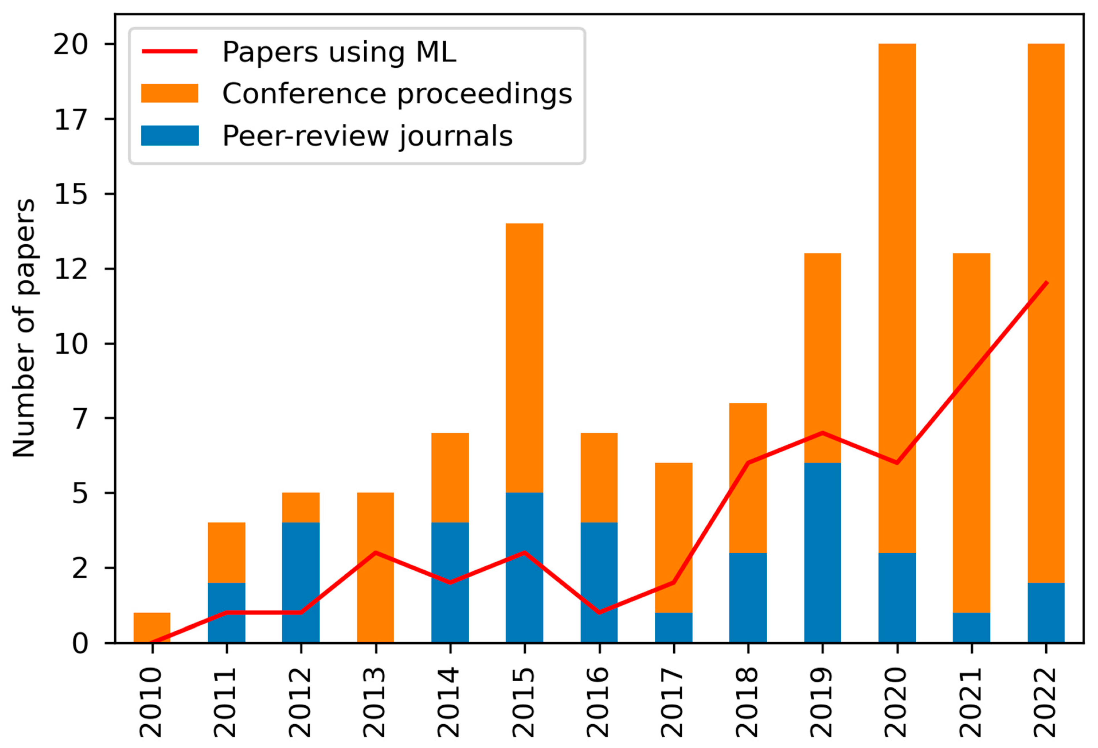
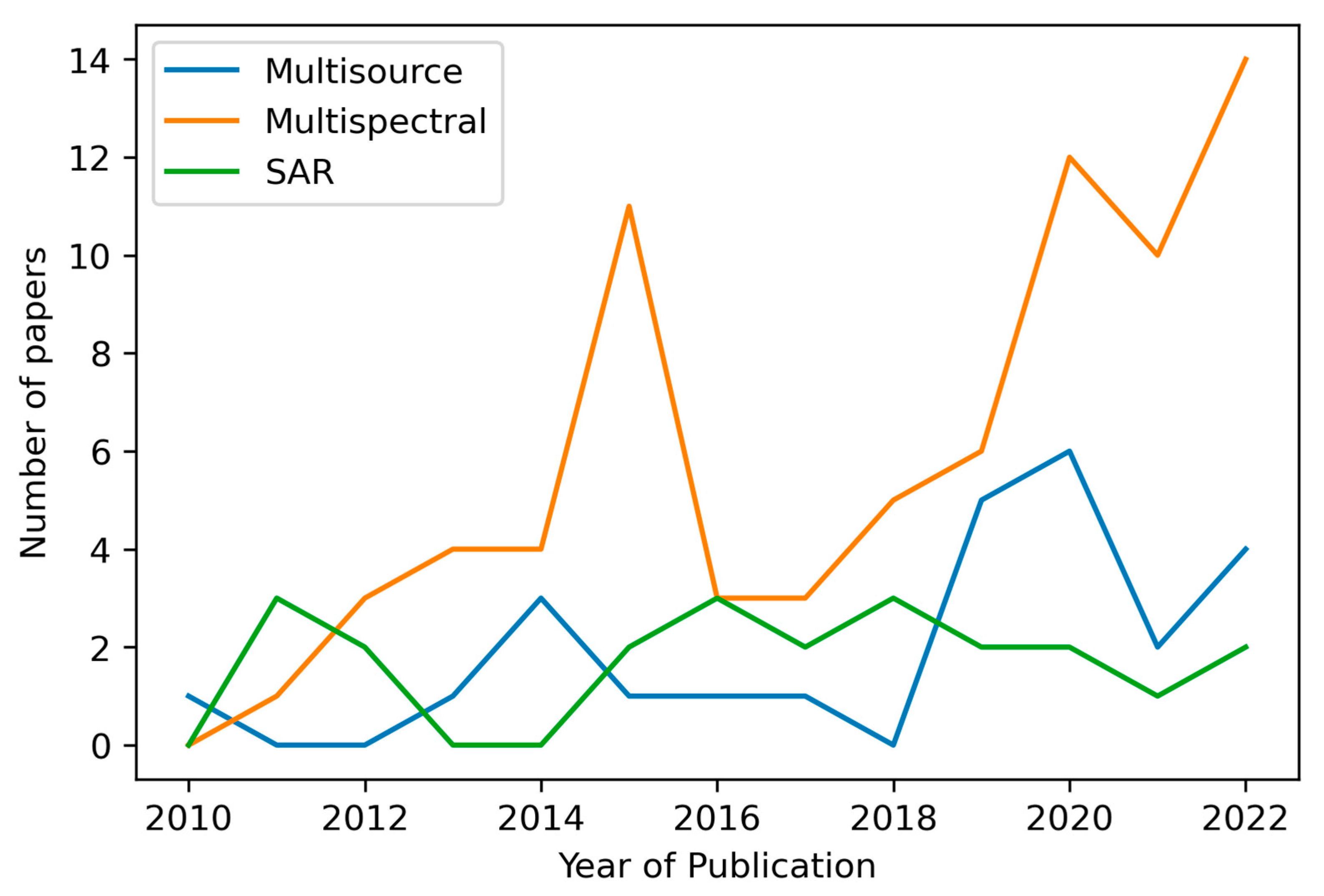
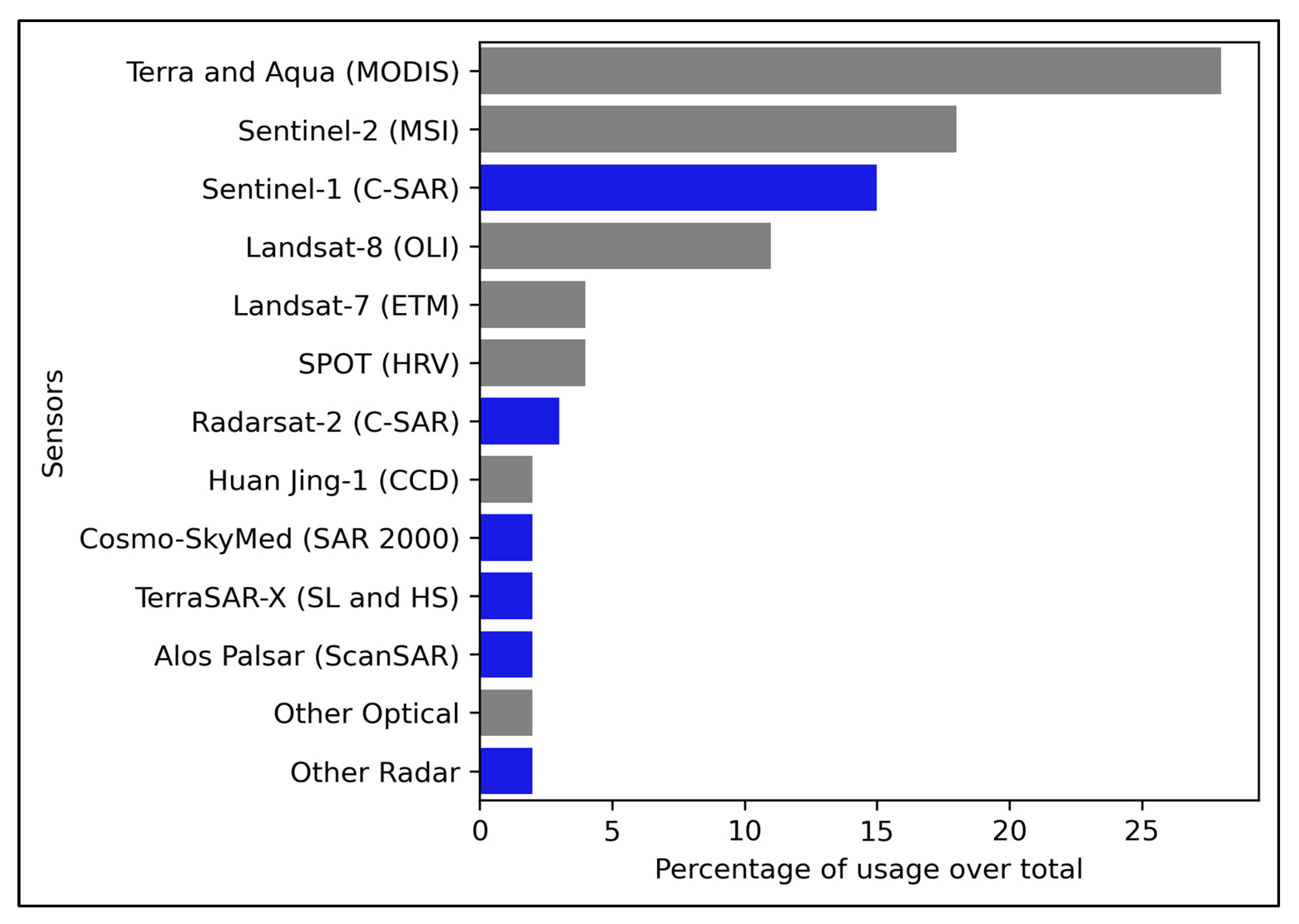
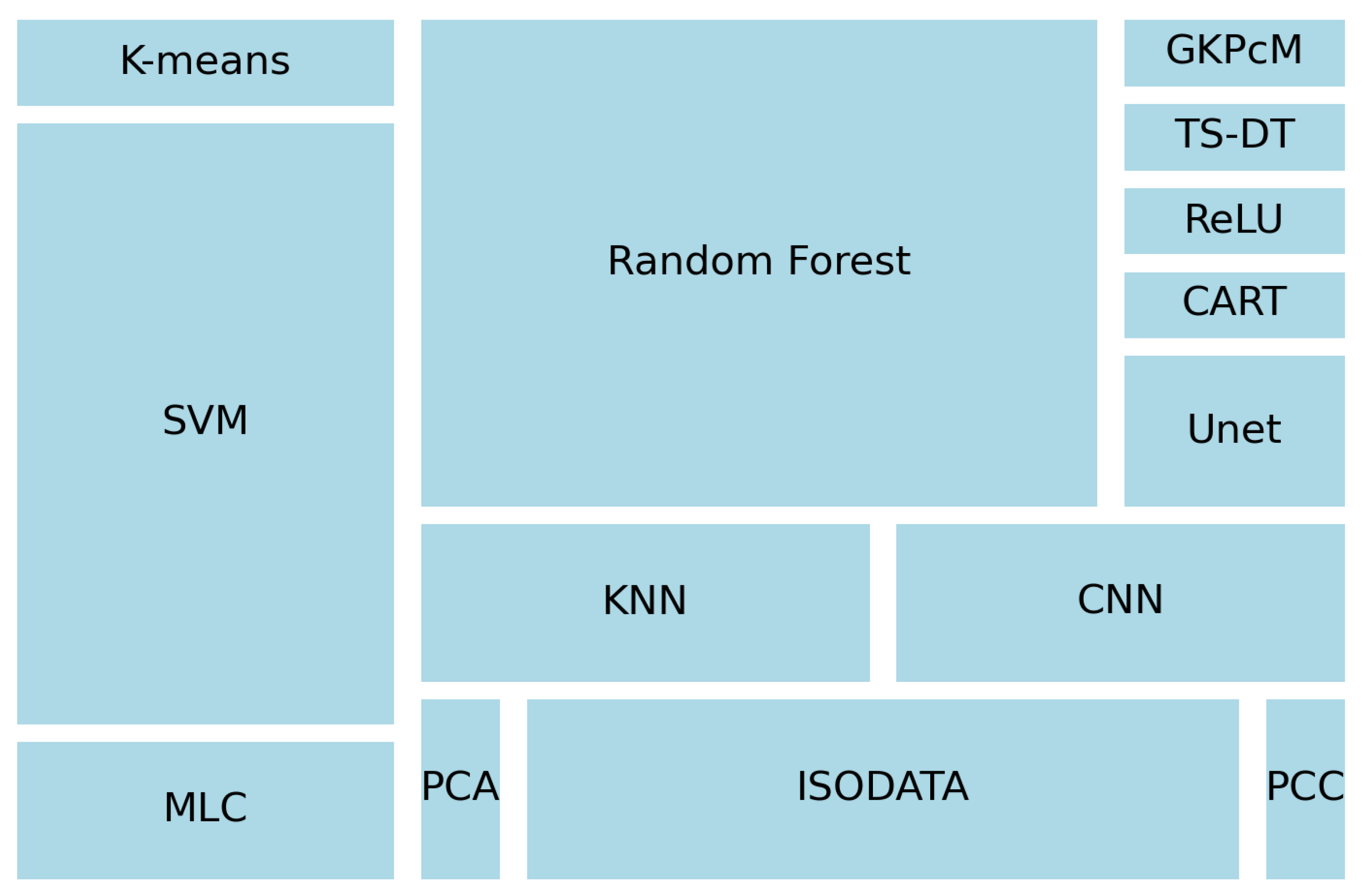
Rice is a staple food that feeds nearly half of the world’s population. With the population of our planet expected to keep growing, it is crucial to carry out accurate mapping, monitoring, and assessments since these could significantly impact food security, climate change, spatial planning, and land management. Using the PRISMA systematic review protocol, this article identified and selected 122 scientific articles (journals papers and conference proceedings) addressing different remote sensing-based methodologies to map paddy croplands, published between 2010 and October 2022. This analysis includes full coverage of the mapping of rice paddies and their various stages of crop maturity. This review paper classifies the methods based on the data source: (a) multispectral (62%), (b) multisource (20%), and (c) radar (18%). Furthermore, it analyses the impact of machine learning on those methodologies and the most common algorithms used. We found that MODIS (28%), Sentinel-2 (18%), Sentinel-1 (15%), and Landsat-8 (11%) were the most used sensors. The impact of Sentinel-1 on multisource solutions is also increasing due to the potential of backscatter information to determine textures in different stages and decrease cloud cover constraints. The preferred solutions include phenology algorithms via the use of vegetation indices, setting thresholds, or applying machine learning algorithms to classify images. In terms of machine learning algorithms, random forest is the most used (17 times), followed by support vector machine (12 times) and isodata (7 times). With the continuous development of technology and computing, it is expected that solutions such as multisource solutions will emerge more frequently and cover larger areas in different locations and at a higher resolution. In addition, the continuous improvement of cloud detection algorithms will positively impact multispectral solutions.
Keywords: rice crops; multispectral; multisource; radar; machine learning; vegetation indices rice crops; multispectral; multisource; radar; machine learning; vegetation indices