Topic Editors

College of Plant Protection, Yangzhou University, Yangzhou, China
College of Geography and Environmental Sciences, Zhejiang Normal University, Jinhua 321004, China
GeoInformatic Unit, Geography Section, School of Humanities, Universiti Sains Malaysia, Penang, Malaysia
Dr. Kwok Pan Chun
CATE School of Architecture and Environment, University of the West of England, Bristol BS16 1QY, UK

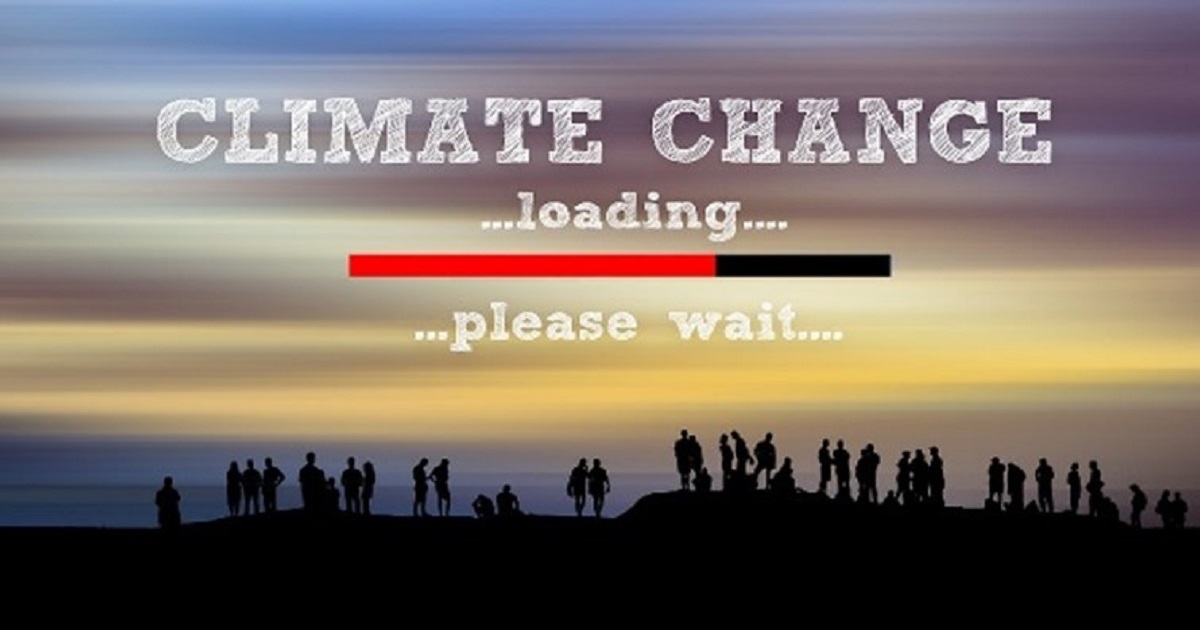
Climate Change Impacts and Adaptation: Interdisciplinary Perspectives, 2nd Edition

Abstract submission deadline
31 March 2026
Manuscript submission deadline
30 June 2026
Viewed by
10964

Topic Information

Dear Colleagues,

With the increasing concentration of greenhouse gases in the atmosphere, climate change is now an indisputable fact, posing great challenges to the environment, economies, and communities. These challenges are further compounded by inaction, which can lead to severe impacts on human health, food security, and global stability. Fortunately, a number of studies have been made in acquiring knowledge of climate change and its impacts on the ecosystem and national sectors such as agriculture, forestry, water resources, etc. However, there are still a lot of uncertainties that impact assessment results and practical adaptive measures due to limited data, methodology, and the scale of study. Therefore, case studies should be strengthened and broadened to reduce the uncertainties and develop practical adaptive measures to cope with climate change.

This Special Issue seeks to bring together interdisciplinary perspectives to address the ever-expanding importance of climate change impacts and adaptation. Despite a wide range of research undertaken by countries, organizations and industries to address climate change, a great deal of very important work remains to be carried out to effectively assess the impacts of climate change and to understand the extent to which adaptation measures can reduce the negative impacts of climate change.

For this Special Issue, we warmly invite scientists working in climatology, ecology, geography, remote sensing and GIS, environmental science, and social science to contribute novel theories, observations, and modeling studies on climate change impacts and adaptation across different time scales (historical to future) and spatial scales (regional to global). Contributions can include but are not limited to the following topics: observation-based regional climate change analysis, detection and attribution of regional climate change, the measurement and modeling of land surface–atmosphere interaction, impacts and risks of climate change on different regions (or sectors), meteorological disaster risk management, climate change and sustainable development, international climate governance, etc.

Dr. Cheng Li
Prof. Dr. Fei Zhang
Dr. Mou Leong Tan
Dr. Kwok Pan Chun
Topic Editors

Keywords

  • regional climate change
  • land–atmosphere interactions
  • greenhouse gas emissions
  • climate and vegetation relationships
  • impacts of climate change
  • risk management
  • climate change adaptation
  • climate governance
  • climate change education
  • remote sensing and GIS
  • machine learning and numerical modeling methods

Participating Journals

Journal Name Impact Factor CiteScore Launched Year First Decision (median) APC
Agronomy
agronomy
3.4 6.7 2011 17.2 Days CHF 2600 Submit
Applied Sciences
applsci
2.5 5.5 2011 19.8 Days CHF 2400 Submit
Climate
climate
3.2 5.7 2013 21.6 Days CHF 1800 Submit
Forests
forests
2.5 4.6 2010 17.1 Days CHF 2600 Submit
ISPRS International Journal of Geo-Information
ijgi
2.8 7.2 2012 34.2 Days CHF 1900 Submit
Sustainability
sustainability
3.3 7.7 2009 19.3 Days CHF 2400 Submit
Plants
plants
4.1 7.6 2012 17.7 Days CHF 2700 Submit

Preprints.org is a multidisciplinary platform offering a preprint service designed to facilitate the early sharing of your research. It supports and empowers your research journey from the very beginning.

MDPI Topics is collaborating with Preprints.org and has established a direct connection between MDPI journals and the platform. Authors are encouraged to take advantage of this opportunity by posting their preprints at Preprints.org prior to publication:

  1. Share your research immediately: disseminate your ideas prior to publication and establish priority for your work.
  2. Safeguard your intellectual contribution: Protect your ideas with a time-stamped preprint that serves as proof of your research timeline.
  3. Boost visibility and impact: Increase the reach and influence of your research by making it accessible to a global audience.
  4. Gain early feedback: Receive valuable input and insights from peers before submitting to a journal.
  5. Ensure broad indexing: Web of Science (Preprint Citation Index), Google Scholar, Crossref, SHARE, PrePubMed, Scilit and Europe PMC.

Published Papers (11 papers)

Order results
Result details
Journals
Select all
Export citation of selected articles as:
27 pages, 2513 KB  
Article
Disability, Perceptions of Climate Change Impacts, and Inclusive Climate Action Priorities in Abia State Nigeria
by Queensley C. Chukwudum, David O. Anyaele, Godwin Unumeri, Penelope J. S. Stein and Michael Ashley Stein
Sustainability 2025, 17(20), 9229; https://doi.org/10.3390/su17209229 - 17 Oct 2025
Viewed by 119
Abstract
Persons with disabilities are disproportionately and differentially impacted by climate change, particularly in low-income settings. Our novel study reports findings from a survey of 104 Nigerians with disabilities and focus groups; examines the climate change impacts perceived by persons with disabilities; enumerates the [...] Read more.
Persons with disabilities are disproportionately and differentially impacted by climate change, particularly in low-income settings. Our novel study reports findings from a survey of 104 Nigerians with disabilities and focus groups; examines the climate change impacts perceived by persons with disabilities; enumerates the barriers to climate responses they experience; and identifies disability-inclusive key climate action priorities and climate solutions in Abia State, Nigeria. Our findings indicate that the dominant climate impacts perceived by respondents with disabilities were poverty, loss of agricultural productivity and livelihood, and effects on wellbeing. Climate response measures were predominantly inaccessible to participants with disabilities facing structural barriers including stigma and discrimination, a lack of meaningful inclusion in decision-making, and a scarcity of disability-inclusive climate resources. Key climate action priorities identified by respondents included advancing understanding of the disparate impact of climate change on persons with disabilities, promoting inclusive disaster risk reduction, centering and prioritizing disability equity within climate action, and enabling inclusive sustainable livelihoods. Experiential insights at the micro-level from persons with disabilities are vital to formulating climate-related policy and climate decision-making. We recommend innovative cross-cutting policies and interventions to repair structural disability discrimination and promote urgent inclusive climate action that benefits all of society. Full article
Show Figures

Figure 1

26 pages, 1339 KB  
Article
Do Physical and Transition Climate Risks Drive the Volatility and Dynamic Correlations Between Fossil Energy Markets and Stocks Prices of Clean Energy?
by Ying Zhang, Weifeng Li and Li Yang
Sustainability 2025, 17(20), 9044; https://doi.org/10.3390/su17209044 - 13 Oct 2025
Viewed by 223
Abstract
Climate risks are one of the major challenges facing sustainable development. This study examines how physical and transition climate risks influence the volatility and correlation of fossil energy futures and clean energy stock indices, using a mixed-frequency modeling framework. Taking the Paris Agreement [...] Read more.
Climate risks are one of the major challenges facing sustainable development. This study examines how physical and transition climate risks influence the volatility and correlation of fossil energy futures and clean energy stock indices, using a mixed-frequency modeling framework. Taking the Paris Agreement as the starting point for the global energy transition, we aim to compare the impacts of climate risks on various fossil energy assets and clean energy assets and investigate how the dynamic linkages between clean energy and fossil energy assets have evolved under the influence of climate risks. The results show that climate risks have increased the volatility of fossil energy and clean energy assets to varying degrees. Correlation patterns vary by energy type: crude oil futures and clean energy indices exhibit a decoupling trend under climate risks, while natural gas futures show a more consistent, positive linkage. These findings not only provide useful guidance for investors in formulating more effective strategies under increasing climate risks but also offer policymakers valuable insights into designing optimal approaches to balance decarbonization objectives with energy security. Full article
Show Figures

Figure 1

17 pages, 1996 KB  
Article
Yield Potential of Silage Sorghum: Cultivar Differences in Biomass Production, Plant Height, and Tillering Under Contrasting Soil Conditions in Central Europe
by Lenka Porčová, Nicole Frantová, Michal Rábek, Ivana Jovanović, Vladimír Smutný, Michal Řiháček and Eva Mrkvicová
Agronomy 2025, 15(10), 2352; https://doi.org/10.3390/agronomy15102352 - 7 Oct 2025
Viewed by 372
Abstract
We conducted a three-year field study to evaluate the above-ground biomass yield, plant height, and tillering capacity of eight Sorghum bicolor (L.) Moench varieties under two contrasting soil conditions (heavy clay soil and sandy soil) with different water retention. At the Field Experimental [...] Read more.
We conducted a three-year field study to evaluate the above-ground biomass yield, plant height, and tillering capacity of eight Sorghum bicolor (L.) Moench varieties under two contrasting soil conditions (heavy clay soil and sandy soil) with different water retention. At the Field Experimental Station Žabčice of Mendel University in Brno, Czech Republic, we assessed yield performance and yield stability across years and environments. We applied standard agronomic practices and recorded detailed soil and climatic data. Significant differences were found among varieties and between locations in terms of plant height and tillering. KWS SOLE showed the most stable yield (11.80–15.63 t ha−1), while LATTE, KWS TARZAN, and KWS HANNIBAL achieved the highest average yields (up to 20.16 t ha−1). Plant height showed a strong positive correlation with biomass yield. This relationship underscores plant height as a valuable trait for selecting sorghum varieties with improved productivity and drought resilience. Variations in tillering capacity and environmental conditions also significantly influenced yield outcomes, highlighting the complex interaction between genotype and environment. These findings offer practical insights for cultivar selection and breeding strategies that aim to enhance the performance of sorghum varieties under the variable climatic conditions of Central Europe. Full article
Show Figures

Figure 1

26 pages, 9026 KB  
Article
Assessment of the Impact of Climate Change on the Ecological Resilience of the Yangtze River Economic Belt
by Jianglin Yao, Hongliang Wu and Feng Yan
Sustainability 2025, 17(18), 8265; https://doi.org/10.3390/su17188265 - 15 Sep 2025
Viewed by 370
Abstract
With climate change and frequent extreme weather events, ecological stability is facing threats. This study constructs a quantitative assessment model coupling climate change and ecological resilience (ER), explores the impact of future climate change on ER, and identifies key meteorological risks that affect [...] Read more.
With climate change and frequent extreme weather events, ecological stability is facing threats. This study constructs a quantitative assessment model coupling climate change and ecological resilience (ER), explores the impact of future climate change on ER, and identifies key meteorological risks that affect ER. Taking the Yangtze River Economic Belt (YREB) as the research area, the main research results are as follows: (1) Under the four future scenarios, the Climate Change Impact Index (CCI) values for ER are −0.8005, −0.8924, −0.9540, and −1.2298, respectively, indicating a general decline in ER across the YREB. (2) The extent of climate change impacts varies significantly among scenarios, with the ranking SSP5-8.5 > SSP4-6.0 > SSP2-4.5 > SSP1-2.6. The SSP5-8.5 scenario exhibits the most severe impacts, with CCI values of −0.7015, −1.2910, −1.3124, and −1.6144. (3) Spatially, climate change exerts the greatest impact on the upstream regions, followed by the downstream and midstream areas. Among these, very high resilience and very low resilience levels experience the most pronounced changes. (4) Temperature (Temp) and the Normalized Difference Vegetation Index (NDVI) are the main meteorological risks for the deterioration of ER. In future scenarios, Temp demonstrates an increasing trend while NDVI shows a significant decline. Full article
Show Figures

Figure 1

23 pages, 6204 KB  
Article
Bio-Ecological Indicators for Gentiana pneumonanthe L. Climatic Suitability in the Iberian Peninsula
by Teresa R. Freitas, Sílvia Martins, Joaquim Jesus, João Campos, António Fernandes, Christoph Menz, Ernestino Maravalhas, Helder Fraga and João A. Santos
Plants 2025, 14(18), 2857; https://doi.org/10.3390/plants14182857 - 12 Sep 2025
Viewed by 1254
Abstract
Gentiana pneumonanthe L., a wetland specialist and exclusive host of the Alcon Blue (Phengaris alcon), is highly vulnerable to climate change. This study assessed the future climate suitability of the Iberian Peninsula (IP) for G. pneumonanthe. From 14 bioclimatic variables [...] Read more.
Gentiana pneumonanthe L., a wetland specialist and exclusive host of the Alcon Blue (Phengaris alcon), is highly vulnerable to climate change. This study assessed the future climate suitability of the Iberian Peninsula (IP) for G. pneumonanthe. From 14 bioclimatic variables (ISIMIP3b, processed by CHELSA method at 1 km2) and two topographic variables, four bio-ecological indicators were selected using Pearson correlation and Variance Inflation Factors: Thermicity Index, Ombrothermic Index, Accumulated summer precipitation from June to August, and Maximum of the daily maximum temperature of August. A species distribution model platform (Biomod2) was applied for historical (1995–2014) and future periods (2041–2060, 2081–2100) under two anthropogenic radiative forcing scenarios (SSP3-7.0, SSP5-8.5). The ensemble model created shows a strong predictive performance (BOYCE: 0.98). Historically, 13.4% of the IP was climatically suitable, mainly in mountain areas. Under SSP3-7.0, suitable areas are projected to decline by 74.2% (2041–2060) and 99.3% (2081–2100); under SSP5-8.5, by 75.5% and 99.9%, respectively. While small gains may occur in the Pyrenees, most conservation protected areas (Natura 2000, RAMSAR) may lose suitability for species persistence. Such losses could disrupt ecological ecosystems and directly threaten the survival of P. alcon. These findings highlight the urgent need for climate-informed land-use planning and effective habitat conservation. Full article
Show Figures

Figure 1

24 pages, 13599 KB  
Article
Optimized Extrapolation Methods Enhance Prediction of Elsholtzia densa Distribution on the Tibetan Plateau
by Zeyuan Liu, Youhai Wei, Liang Cheng, Hongyu Chen and Hua Weng
Sustainability 2025, 17(18), 8206; https://doi.org/10.3390/su17188206 - 11 Sep 2025
Viewed by 443
Abstract
Species distribution models (SDMs) grapple with uncertainty. To address this, a parameter-optimized MaxEnt model was used to predict habitat suitability for Elsholtzia densa, a predominant agricultural weed on the Tibetan Plateau. Through multiparameter optimization with 149 occurrence points and three climate variable [...] Read more.
Species distribution models (SDMs) grapple with uncertainty. To address this, a parameter-optimized MaxEnt model was used to predict habitat suitability for Elsholtzia densa, a predominant agricultural weed on the Tibetan Plateau. Through multiparameter optimization with 149 occurrence points and three climate variable sets, we systematically evaluated how the three MaxEnt extrapolation approaches (Free Extrapolation, Extrapolation with Clamping, No Extrapolation) influenced model outputs. The results showed the following: (1) Model optimization using the Kuenm R package version (1.1.10) identified seven critical bioclimatic variables (Feature Combinations = LQTH, Regularization Multipliers = 2.5), with optimized models demonstrating high accuracy (Area Under Curve > 0.9). (2) Extrapolation approaches exhibited negligible effects on variable selection, though four bioclimatic variables “bio1 (annual mean temperature)”, “bio12 (annual precipitation)”, “bio2 (mean diurnal range)”, and “bio7 (temperature annual range)” predominantly drove model predictions. (3) Current high-suitability areas are clustered in the eastern and southern regions of the Tibetan Plateau, and with Free Extrapolation yielding the broadest current distribution. Climate change projections suggest habitat expansion, particularly under conditions of No Extrapolation. (4) Multivariate Environmental Similarity Surface (MESS) and Most Dissimilar Variable (MoD) are not affected by the extrapolation method, and extrapolation risk analyses indicate that future climate anomalies are mainly concentrated in the western and southern parts of the Tibetan Plateau and that future warming will further increase the unsuitability of these regions. (5) Variance analysis showed that the extrapolation methods did not significantly affect the 10-replicate results but influenced the parameter and emission scenarios, with No Extrapolation methods showing minimal variance changes. Our findings validate that multiparameter optimization improves species distribution model robustness, systematically characterizes extrapolation impacts on distribution projections, and provides a conceptual framework and early warning systems for agricultural weed management on the Tibetan Plateau. Full article
Show Figures

Figure 1

23 pages, 2122 KB  
Article
Climate Change of Near-Surface Temperature in South Africa Based on Weather Station Data, ERA5 Reanalysis, and CMIP6 Models
by Ilya Serykh, Svetlana Krasheninnikova, Tatiana Gorbunova, Roman Gorbunov, Joseph Akpan, Oluyomi Ajayi, Maliga Reddy, Paul Musonge, Felix Mora-Camino and Oludolapo Akanni Olanrewaju
Climate 2025, 13(8), 161; https://doi.org/10.3390/cli13080161 - 1 Aug 2025
Cited by 1 | Viewed by 1829
Abstract
This study investigates changes in Near-Surface Air Temperature (NSAT) over the South African region using weather station data, reanalysis products, and Coupled Model Intercomparison Project Phase 6 (CMIP6) model outputs. It is shown that, based on ERA5 reanalysis, the average NSAT increase in [...] Read more.
This study investigates changes in Near-Surface Air Temperature (NSAT) over the South African region using weather station data, reanalysis products, and Coupled Model Intercomparison Project Phase 6 (CMIP6) model outputs. It is shown that, based on ERA5 reanalysis, the average NSAT increase in the region (45–10° S, 0–50° E) for the period 1940–2023 was 0.11 ± 0.04 °C. Weak multi-decadal changes in NSAT were observed from 1940 to the mid-1970s, followed by a rapid warming trend starting in the mid-1970s. Weather station data generally confirm these results, although they exhibit considerable inter-station variability. An ensemble of 33 CMIP6 models also reproduces these multi-decadal NSAT change characteristics. Specifically, the average model-simulated NSAT values for the region increased by 0.63 ± 0.12 °C between the periods 1940–1969 and 1994–2023. Based on the results of the comparison between weather station observations, reanalysis, and models, we utilize projections of NSAT changes from the analyzed ensemble of 33 CMIP6 models until the end of the 21st century under various Shared Socioeconomic Pathway (SSP) scenarios. These projections indicate that the average NSAT of the South African region will increase between 1994–2023 and 2070–2099 by 0.92 ± 0.36 °C under the SSP1-2.6 scenario, by 1.73 ± 0.44 °C under SSP2-4.5, by 2.52 ± 0.50 °C under SSP3-7.0, and by 3.17 ± 0.68 °C under SSP5-8.5. Between 1994–2023 and 2025–2054, the increase in average NSAT for the studied region, considering inter-model spread, will be 0.49–1.15 °C, depending on the SSP scenario. Furthermore, climate warming in South Africa, both in the next 30 years and by the end of the 21st century, is projected to occur according to all 33 CMIP6 models under all considered SSP scenarios. The main spatial feature of this warming is a more significant increase in NSAT over the landmass of the studied region compared to its surrounding waters, due to the stabilizing role of the ocean. Full article
Show Figures

Figure 1

24 pages, 6762 KB  
Article
Spatiotemporal Dynamics of Vegetation Net Primary Productivity (NPP) and Multiscale Responses of Driving Factors in the Yangtze River Delta Urban Agglomeration
by Yuzhou Zhang, Wanmei Zhao and Jianxin Yang
Sustainability 2025, 17(13), 6119; https://doi.org/10.3390/su17136119 - 3 Jul 2025
Viewed by 659
Abstract
Against the backdrop of global climate change and rapid urbanization, understanding the spatiotemporal dynamics and driving mechanisms of vegetation net primary productivity (NPP) is critical for ensuring regional ecological security and achieving carbon neutrality goals. This study focuses on the Yangtze River Delta [...] Read more.
Against the backdrop of global climate change and rapid urbanization, understanding the spatiotemporal dynamics and driving mechanisms of vegetation net primary productivity (NPP) is critical for ensuring regional ecological security and achieving carbon neutrality goals. This study focuses on the Yangtze River Delta Urban Agglomeration (YRDUA) and integrates multi-source remote sensing data with socioeconomic statistics. By combining interpretable machine learning (XGBoost-SHAP) with multiscale geographically weighted regression (MGWR), and incorporating Theil–Sen trend analysis and Mann–Kendall significance testing, we systematically analyze the spatiotemporal variations in NPP and its multiscale driving mechanisms from 2001 to 2020. The results reveal the following: (1) Total NPP in the YRDUA shows an increasing trend, with approximately 24.83% of the region experiencing a significant rise and only 2.75% showing a significant decline, indicating continuous improvement in regional ecological conditions. (2) Land use change resulted in a net NPP loss of 2.67 TgC, yet ecological restoration and advances in agricultural technology effectively mitigated negative impacts and became the main contributors to NPP growth. (3) The results from XGBoost and MGWR are complementary, highlighting the scale-dependent effects of driving factors—at the regional scale, natural factors such as elevation (DEM), precipitation (PRE), and vegetation cover (VFC) have positive impacts on NPP, while the human footprint (HF) generally exerts a negative effect. However, in certain areas, a dose–response effect is observed, in which moderate human intervention can enhance ecological functions. (4) The spatial heterogeneity of NPP is mainly driven by nonlinear interactions between natural and anthropogenic factors. Notably, the interaction between DEM and climatic variables exhibits threshold responses and a “spatial gradient–factor interaction” mechanism, where the same driver may have opposite effects under different geomorphic conditions. Therefore, a well-balanced combination of land use transformation and ecological conservation policies is crucial for enhancing regional ecological functions and NPP. These findings provide scientific support for ecological management and the formulation of sustainable development strategies in urban agglomerations. Full article
Show Figures

Figure 1

17 pages, 897 KB  
Article
The Gender–Climate–Security Nexus: A Case Study of Plateau State
by T. Oluwaseyi Ishola and Isaac Luginaah
Climate 2025, 13(7), 136; https://doi.org/10.3390/cli13070136 - 30 Jun 2025
Viewed by 2591
Abstract
This study investigates the gendered nexus between climate change, food insecurity, and conflict in Plateau State, Nigeria. This region in north-central Nigeria is marked by recurring farmer–herder clashes and climate-induced environmental degradation. Drawing on qualitative methods, including interviews, gender-disaggregated focus groups, and key [...] Read more.
This study investigates the gendered nexus between climate change, food insecurity, and conflict in Plateau State, Nigeria. This region in north-central Nigeria is marked by recurring farmer–herder clashes and climate-induced environmental degradation. Drawing on qualitative methods, including interviews, gender-disaggregated focus groups, and key informant discussions, the research explores how climate variability and violent conflict interact to exacerbate household food insecurity. The methodology allows the capture of nuanced perspectives and lived experiences, particularly emphasizing the differentiated impacts on women and men. The findings reveal that irregular rainfall patterns, declining agricultural yields, and escalating violence have disrupted traditional farming systems and undermined rural livelihoods. The study also shows that women, though they are responsible for household food management, face disproportionate burdens due to restricted mobility, limited access to resources, and a heightened exposure to gender-based violence. Grounded in Conflict Theory, Frustration–Aggression Theory, and Feminist Political Ecology, the analysis shows how intersecting vulnerabilities, such as gender, age, and socioeconomic status, shape experiences of food insecurity and adaptation strategies. Women often find creative and local ways to cope with challenges, including seed preservation, rationing, and informal trade. However, systemic barriers continue to hinder sustainable progress. This study emphasized the need for integrating gender-sensitive interventions into policy frameworks, such as land tenure reforms, targeted agricultural support for women, and improved security measures, to effectively mitigate food insecurity and promote sustainable livelihoods, especially in conflict-affected regions. Full article
Show Figures

Figure 1

19 pages, 1200 KB  
Article
Effects of Rice–Fish Coculture on Greenhouse Gas Emissions: A Case Study in Terraced Paddy Fields of Qingtian, China
by Qixuan Li, Lina Xie, Shiwei Lin, Xiangbing Cheng, Qigen Liu and Yalei Li
Agronomy 2025, 15(6), 1480; https://doi.org/10.3390/agronomy15061480 - 18 Jun 2025
Cited by 1 | Viewed by 1047
Abstract
Rice–fish coculture, a traditional integrated agriculture–aquaculture system, has been recognized as a “Globally Important Agricultural Heritage System” due to its ecological and socio-economic benefits. However, the impact of rice–fish coculture on greenhouse gas emissions remains controversial. This study investigated the effects of rice–fish [...] Read more.
Rice–fish coculture, a traditional integrated agriculture–aquaculture system, has been recognized as a “Globally Important Agricultural Heritage System” due to its ecological and socio-economic benefits. However, the impact of rice–fish coculture on greenhouse gas emissions remains controversial. This study investigated the effects of rice–fish coculture on methane (CH4) and nitrous oxide (N2O) emissions in the Qingtian rice–fish system, a 1200-year-old terraced paddy field system in Zhejiang Province, China. A field experiment with two treatments, rice–fish coculture (RF) and rice monoculture (RM), was conducted to examine the relationships between fish activities, water and soil properties, microbial communities, and greenhouse gas fluxes. Results showed that the RF system had significantly higher CH4 emissions, particularly during the early rice growth stage, compared to the RM system. This increase was attributed to the lower dissolved oxygen levels and higher methanogen abundance in the RF system, likely driven by the grazing, “muddying”, and burrowing activities of fish. In contrast, no significant differences in N2O emissions were observed between the two systems. Redundancy analysis revealed that water variables contributed more to the variation in greenhouse gas emissions than soil variables. Microbial community analysis indicated that the RF system supported a more diverse microbial community involved in methane cycling processes. These findings provide new insights into the complex interactions between fish activities, environmental factors, and microbial communities in regulating greenhouse gas emissions from rice–fish coculture systems. The results suggest that optimizing water management strategies and exploring the potential of microbial community manipulation could help mitigate greenhouse gas emissions while maintaining the ecological and socio-economic benefits of these traditional integrated agriculture–aquaculture systems. Full article
Show Figures

Figure 1

32 pages, 11121 KB  
Article
Construction of a Cold Island Spatial Pattern from the Perspective of Landscape Connectivity to Alleviate the Urban Heat Island Effect
by Qianli Ouyang, Bohong Zheng, Junyou Liu, Xi Luo, Shengyan Wu and Zhaoqian Sun
ISPRS Int. J. Geo-Inf. 2025, 14(6), 209; https://doi.org/10.3390/ijgi14060209 - 23 May 2025
Viewed by 1204
Abstract
This study presents an innovative approach to mitigating the urban heat island (UHI) effect by constructing a cold island spatial pattern (CSP) from the perspective of landscape connectivity, integrating three-dimensional (3D) urban morphology and meteorological factors for the first time. Unlike traditional studies [...] Read more.
This study presents an innovative approach to mitigating the urban heat island (UHI) effect by constructing a cold island spatial pattern (CSP) from the perspective of landscape connectivity, integrating three-dimensional (3D) urban morphology and meteorological factors for the first time. Unlike traditional studies that focus on isolated patches or single-city scales, we propose a hierarchical framework for urban agglomerations, combining morphological spatial pattern analysis (MSPA), landscape connectivity assessment, and circuit theory to a construct CSP at the scale of urban agglomeration. By incorporating wind environment data and 3D building features (e.g., height, density) into the resistance surface, we enhance the accuracy of cooling network identification, revealing 39 cold island sources, 89 cooling corridors, and optimal corridor widths (600 m) in the Changsha–Zhuzhou–Xiangtan urban agglomeration (CZXUA). Ultimately, a three-tiered heat island mitigation framework for urban agglomerations was established based on the CSP. This study offers an innovative perspective on urban climate adaptability planning within the context of contemporary urbanization. Our methodology and findings provide critical insights for future studies to integrate multiscale, multidimensional, and climate-adaptive approaches in urban thermal environment governance, fostering sustainable urbanization under escalating climate challenges. Full article
Show Figures

Figure 1

Back to TopTop