Next Issue
Volume 6, June
Previous Issue
Volume 5, December


Earth, Volume 6, Issue 1 (March 2025) – 17 articles

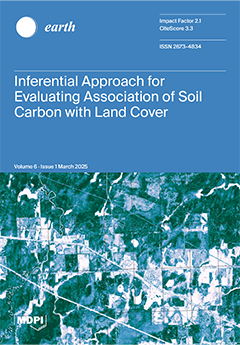
Cover Story (view full-size image): Discerning impacts of land cover conversion with soil carbon are crucial for boreal regions. Confronting limitations with conventional inferential approaches, this study adopted methods appropriate for smaller sample sizes subjected to skewed distributions with soil properties. A two-step inferential process was implemented. The Kruskal–Wallis (KW) test assessed dissimilarities within soil properties across cover types, followed by more refined analysis with generalized estimating equations (GEEs). For a boreal study region, the KW test substantiated median differences within soil properties, and GEEs corroborated mean differences in soil carbon between specific cover types. These significances yielded support with the selection of predictors relating to cover types for digital soil mapping.  View this paper
  • Issues are regarded as officially published after their release is announced to the table of contents alert mailing list.
  • You may sign up for e-mail alerts to receive table of contents of newly released issues.
  • PDF is the official format for papers published in both, html and pdf forms. To view the papers in pdf format, click on the "PDF Full-text" link, and use the free Adobe Reader to open them.
Order results
Result details
Select all
Export citation of selected articles as:
18 pages, 6774 KiB  
Article
Assessing Potential Land and Soil for Nature-Based Solutions (NBS) for United Nations (UN) Initiatives: An Example of the Contiguous United States of America (USA)
by Elena A. Mikhailova, Hamdi A. Zurqani, Lili Lin, Zhenbang Hao, Christopher J. Post, Mark A. Schlautman, Gregory C. Post, Lauren N. Landis, Leah C. Roberts and George B. Shepherd
Earth 2025, 6(1), 17; https://doi.org/10.3390/earth6010017 - 18 Mar 2025
Viewed by 513
Abstract
The concept of nature-based solutions (NBS) is widely promoted as an approach to effectively counteract climate change and land degradation (LD) as well as simultaneously add environmental and socio-economic benefits. To have a worldwide impact from NBS, it is important to consider potential [...] Read more.
The concept of nature-based solutions (NBS) is widely promoted as an approach to effectively counteract climate change and land degradation (LD) as well as simultaneously add environmental and socio-economic benefits. To have a worldwide impact from NBS, it is important to consider potential land and soil resources at various scales, including administrative units (e.g., country, state, county, etc.). Nature-based solutions are considered by many United Nations (UN) initiatives, including the Paris Agreement and the UN Convention to Combat Desertification (UNCCD). Currently, there is no consensus on how to define NBS and their indicators. The innovation of this study is that it defines and evaluates soil- and land-based NBS potential while suggesting indicators for land- and soil-based NBS using the contiguous United States of America (USA) as an example. This study defines potential land for NBS as the sum of the individual satellite-identified areas of barren, shrub/scrub, and herbaceous land covers, which are linked to climate and inherent soil quality (SQ), so that NBS could be implemented without changing other land uses. The potential soil for NBS, based on SQ, is a subset of land available for potential NBS. As of 2021, anthropogenic LD affected 2,092,539.0 km2 in the contiguous USA, with 928,618.0 km2 (15.1% of the contiguous US area) of actual potential land for NBS. The contiguous USA had a negative balance between anthropogenic LD and actual potential land for NBS to compensate for anthropogenic LD of −1,163,921.0 km2. Thirty-seven states also exhibited a negative balance for LD compensation with Iowa having the worst balance of −124,497.0 km2. Many states with positive anthropogenic LD and NBS balances showed that most of the potential NBS land was of low SQ and, therefore, may not be suitable for NBS. Planning for NBS should involve a feasibility analysis of “nationally determined NBS” (NDNBS) through site and context-specific NBS. Full article
Show Figures

Figure 1

16 pages, 4847 KiB  
Article
Impact of Climate Variability on Maize Yield Under Different Climate Change Scenarios in Southern India: A Panel Data Approach
by Samiappan Senthilnathan, David Benson, Venkatraman Prasanna, Tapas Mallick, Anitha Thiyagarajan, Mahendiran Ramasamy and Senthilarasu Sundaram
Earth 2025, 6(1), 16; https://doi.org/10.3390/earth6010016 - 11 Mar 2025
Viewed by 792
Abstract
The changes in frequency and intensity of rainfall, variation in temperature, increasing extreme weather events, and rising greenhouse gas emissions can together have a varying impact on food grain production, which then leads to significant impacts on food security in the future. The [...] Read more.
The changes in frequency and intensity of rainfall, variation in temperature, increasing extreme weather events, and rising greenhouse gas emissions can together have a varying impact on food grain production, which then leads to significant impacts on food security in the future. The purpose of this study is to quantify how maize productivity might be affected due to climate change in Southern India. The present study examines how the projected changes to the northeast monsoon will affect maize yield in Tamil Nadu during the rabi season, which spans from September to December, by using a three-step methodology. Firstly, global climate models that accurately represent the large-scale features of the mean monsoon were chosen. Secondly, baseline and future climate data were extracted from the selected global models and the baseline data were compared with observations. Thirdly, the panel data regression model was fitted with the India Meteorological Department’s (IMD) observed climate data to generate the baseline coefficients and projected the maize production using future climate data generated from the global climate model. The Representative Concentration Pathways (RCPs) of RCP4.5 and RCP8.5 were used from two global climate model outputs, namely GFDL_CM3 and HadGEM2_CC, to predict the climate change variability on maize yields during the middle (2021–2050) and the end (2071–2100) of this century. The maize yield is predicted to increase by 3 to 5.47 per cent during the mid-century period and it varies from 7.25 to 14.53 per cent during the end of the century for the medium- (RCP4.5) and high-emission (RCP8.5) climate change scenarios. The maize grain yield increasing during the future periods indicated that the increase in rainfall and temperature during winter in Southern India reduced the possibility of a negative impact of temperature on the maize yield. Full article
Show Figures

Figure 1

31 pages, 24230 KiB  
Article
A Python Framework for Crop Yield Estimation Using Sentinel-2 Satellite Data
by Konstantinos Ntouros, Konstantinos Papatheodorou, Georgios Gkologkinas and Vasileios Drimzakas-Papadopoulos
Earth 2025, 6(1), 15; https://doi.org/10.3390/earth6010015 - 6 Mar 2025
Viewed by 1278
Abstract
Remote sensing technologies are essential for monitoring crop development and improving agricultural management. This study investigates the automation of Sentinel-2 satellite data processing to enhance wheat growth monitoring and provide actionable insights for smallholder farmers. The objectives include (i) analyzing vegetation indices across [...] Read more.
Remote sensing technologies are essential for monitoring crop development and improving agricultural management. This study investigates the automation of Sentinel-2 satellite data processing to enhance wheat growth monitoring and provide actionable insights for smallholder farmers. The objectives include (i) analyzing vegetation indices across phenological stages to refine crop growth monitoring and (ii) developing a cost-effective user-friendly web application for automated Sentinel-2 data processing. The methodology introduces the “Area Under the Curve” (AUC) of vegetation indices as an independent variable for yield forecasting. Among the indices examined (NDVI, EVI, GNDVI, LAI, and a newly developed RE-PAP), GNDVI and LAI emerged as the most reliable predictors of wheat yield. The findings highlight the importance of the Tillering to the Grain Filling stage in predictive modeling. The developed web application, integrating Python with Google Earth Engine, enables real-time automated crop monitoring, optimizing resource allocation, and supporting precision agriculture. While the approach demonstrates strong predictive capabilities, further research is needed to improve its generalizability. Expanding the dataset across diverse regions and incorporating machine learning and Natural Language Processing (NLP) could enhance automation, usability, and predictive accuracy. Full article
Show Figures

Figure 1

21 pages, 4689 KiB  
Article
Human Comfort and Environmental Sustainability Through Wetland Management: A Case Study of the Nawabganj Wetland, India
by Kirti Avishek, Pranav Dev Singh, Abhrankash Kanungo, Pankaj Kumar, Shamik Chakraborty, Suraj Kumar Singh, Shruti Kanga, Gowhar Meraj, Bhartendu Sajan and Saurabh Kumar Gupta
Earth 2025, 6(1), 14; https://doi.org/10.3390/earth6010014 - 27 Feb 2025
Cited by 1 | Viewed by 596
Abstract
Wetlands play a vital role in ecosystem sustainability by regulating atmospheric temperature and enhancing human comfort levels. This study aims to evaluate the temperature regulation function of the Nawabganj Wetland, Uttar Pradesh (India), a Ramsar site designated in January 2020, located in a [...] Read more.
Wetlands play a vital role in ecosystem sustainability by regulating atmospheric temperature and enhancing human comfort levels. This study aims to evaluate the temperature regulation function of the Nawabganj Wetland, Uttar Pradesh (India), a Ramsar site designated in January 2020, located in a semi-arid region vulnerable to increasing heat waves. The primary objective is to assess the wetland’s influence on microclimatic conditions and human thermal comfort across different seasons. Field surveys were conducted to collect temperature, humidity, wind speed, and vegetation data over three consecutive days in each season: 15–17 May 2019 (pre-monsoon), 12–14 August 2019 (monsoon), and 5–7 October 2019 (post-monsoon). The human comfort index was calculated using field data, while vegetation density and frequency were analyzed based on seasonal variations using the quadrant method. The results indicate that the wetland significantly contributes to local temperature reduction and improved comfort levels. Vegetation plays a crucial role in amplifying this cooling effect, particularly during summer when temperatures range from an average low of 23 °C to a high of 40 °C. In winter, temperatures vary between an average low of 6 °C and a high of 22 °C, with a consistently high humidity level of approximately 94%, further influencing microclimatic conditions. The extent of weed cover varied between 10% and 60% from December to May, reflecting seasonal fluctuations in water levels and wetland health. The study highlights the necessity of effective water and vegetation management, especially during summer, to sustain the wetland’s cooling capacity. Integrating wetland-based strategies into urban planning can enhance environmental sustainability, mitigate climate extremes, and improve human well-being in rapidly urbanizing regions. Full article
Show Figures

Figure 1

20 pages, 7569 KiB  
Article
Relationship Between the Water Vapor Transport from the Amazon Basin and the Rainfall Regime over a Watershed on Brazil’s Southern Border
by Maicon Moraes Santiago, André Becker Nunes, Flavio Tiago Couto, Danielle de Almeida Bressiani, Rose Ane Pereira de Freitas and Iulli Pitone Cardoso
Earth 2025, 6(1), 13; https://doi.org/10.3390/earth6010013 - 24 Feb 2025
Viewed by 685
Abstract
The climate of the south of Brazil is characterized by northern winds in a hegemonic way for the transfer of moisture. Thus, the goal here is to verify the impact of the meridional water vapor transport on the rainfall of the Mirim–São Gonçalo [...] Read more.
The climate of the south of Brazil is characterized by northern winds in a hegemonic way for the transfer of moisture. Thus, the goal here is to verify the impact of the meridional water vapor transport on the rainfall of the Mirim–São Gonçalo Watershed (MSGW), located in the extreme south of Brazil and essential for regional development. The study is based on the precipitation data from MSGW weather stations and ERA5 reanalysis data for the period 1981–2020, which allowed the analysis of the interactions between different climatological variables. The water vapor transport was analyzed using the vertically integrated water vapor flux (VIVF). Coefficients were obtained according to the VIVF values in two locations placed between the Amazon basin and southern Brazil, namely in Bolivia and Paraguay. The results show that the MSGW is directly impacted by moisture transport from the north in all seasons, and this transport is most significant at the 850 hPa level. In addition, the moisture and rainfall in the MSGW are also influenced by changes in the magnitude and direction of this flow, with an increase in transport in periods of El Niño, especially during spring. Therefore, the study brings insights into how changes in tropical South American climate, through a cascading effect, may affect the Mirim–São Gonçalo Watershed development in the middle latitudes from changes in the meridional water vapor transport, highlighting the importance of studying the tropical and extratropical interactions in South America for the MSGW management and sustainable development. Full article
Show Figures

Figure 1

4 pages, 1845 KiB  
Opinion
The Origins of Modern Species Distribution Modelling: Some Comments on the Vasconcelos et al. (2024) Review
by Trevor H. Booth
Earth 2025, 6(1), 12; https://doi.org/10.3390/earth6010012 - 19 Feb 2025
Viewed by 513
Abstract
A recent review of species distribution modelling (SDM) published in Earth contains much useful information. However, the introductory paragraphs lack basic information about the first SDM package called BIOCLIM, which became available in January 1984. For example, BIOCLIM-related advances underpinned the development of [...] Read more.
A recent review of species distribution modelling (SDM) published in Earth contains much useful information. However, the introductory paragraphs lack basic information about the first SDM package called BIOCLIM, which became available in January 1984. For example, BIOCLIM-related advances underpinned the development of the most used SDM variables and data. The first SDM climate change studies published in 1988 highlighted the importance of ex situ and native distribution data. This brief note highlights the importance of the early SDM work and its continuing relevance. Full article
Show Figures

Figure 1

21 pages, 1341 KiB  
Review
‘We Herders Are Often Chased About by Drought’: A Systems Analysis of Natural Resource Degradation Within the Climate–(Im)mobility–Violence–Health Nexus in Sahel
by Sonja Ayeb-Karlsson, Gemma Hayward and Dominic Kniveton
Earth 2025, 6(1), 11; https://doi.org/10.3390/earth6010011 - 13 Feb 2025
Viewed by 732
Abstract
This study applies a systems analysis to further our understanding of the many pathways linking climate stress to human (im)mobility and interpersonal violence via natural resource stress within eight countries (Burkina Faso, Chad, Mali, Mauritania, Niger, Nigeria, Senegal, and Sudan) across the Sahel [...] Read more.
This study applies a systems analysis to further our understanding of the many pathways linking climate stress to human (im)mobility and interpersonal violence via natural resource stress within eight countries (Burkina Faso, Chad, Mali, Mauritania, Niger, Nigeria, Senegal, and Sudan) across the Sahel region. To illustrate the multiple pathways within the climate–(im)mobility–violence–health nexus, contextual and conceptual systems maps were drawn out based on secondary qualitative data from 24 peer-reviewed journal articles selected from a search result of 394 publications. Even though the geography, environment, socio-political context, traditions, and cultural history were highly diverse, the overarching factors that determined people’s (im)mobility and health outcomes, in association with natural resource stress and violence, were very similar. These vulnerability pathways included gendered immobility, interpersonal conflict, and lack of social protection, which provide important lessons and offer tangible opportunities for policy interventions. The vulnerability pathways often eroded access to natural resources and positive (im)mobility and (mental) health outcomes, which ended up entrapping people in extended cycles of violence and exploitation—especially certain intersectional positions and disadvantaged groups (whether within a household, society, or country). Full article
Show Figures

Figure 1

19 pages, 4488 KiB  
Article
Exploring Habitat Quality Dynamics in an Equatorial Andean Basin Under Scenarios of Land Use Change
by Lorena González, Darío Xavier Zhiña, Alex Avilés, Ana Astudillo, Ximena Peralta and Teodoro Verdugo
Earth 2025, 6(1), 10; https://doi.org/10.3390/earth6010010 - 12 Feb 2025
Viewed by 595
Abstract
Globally, ecosystem services face significant degradation due to land use and land cover change (LULC) driven by human development. Despite numerous habitat quality assessments, comprehensive studies in high-mountain equatorial region basins remain scarce. This research addresses assessing habitat quality in Ecuador’s sub-basins of [...] Read more.
Globally, ecosystem services face significant degradation due to land use and land cover change (LULC) driven by human development. Despite numerous habitat quality assessments, comprehensive studies in high-mountain equatorial region basins remain scarce. This research addresses assessing habitat quality in Ecuador’s sub-basins of the Aguilán and Tabacay Rivers, with projections extending to 2050. This study considered anthropogenic threats and examined two land use change scenarios. The “Integrated Valuation of Ecosystem Services and Tradeoffs” (InVEST) model was used for the evaluation. A habitat quality index (HQI) was developed and categorized into five classes. The results showed that in 2018, over 50% of the study area had medium, high, and very high habitat quality levels, partly due to implementing policies, such as Reciprocal Water Agreements, developed by local initiatives. However, future projections suggest a declining trend, particularly in urban and cropland areas, highlighting the need to reinforce proactive policies. The findings of this study contribute to addressing existing gaps in habitat quality research in high-mountain regions, providing key scientific evidence to support conservation strategies, land use planning, and watershed management. Full article
Show Figures

Figure 1

22 pages, 5921 KiB  
Article
Optimizing Air Pollution Forecasting Across Temporal Scales: A Case Study in Salamanca, Mexico
by Francisco-Javier Moreno-Vazquez, Felipe Trujillo-Romero and Amanda Enriqueta Violante Gavira
Earth 2025, 6(1), 9; https://doi.org/10.3390/earth6010009 - 9 Feb 2025
Viewed by 666
Abstract
Air pollution forecasting is essential for understanding environmental patterns and mitigating health risks, especially in urban areas. This study investigates the forecasting of criterion pollutants—CO,O3,SO2,NO2,PM2.5, [...] Read more.
Air pollution forecasting is essential for understanding environmental patterns and mitigating health risks, especially in urban areas. This study investigates the forecasting of criterion pollutants—CO,O3,SO2,NO2,PM2.5, and PM10—across multiple temporal frames (hourly, daily, weekly, monthly) in Salamanca, Mexico, utilizing temporal, meteorological, and pollutant data from local monitoring stations. The primary objective is to identify robust models capable of short- and mid-term predictions, despite challenges related to data inconsistencies and missing values. Leveraging the low-code PyCaret framework, a benchmark analysis was conducted to identify the best-performing models for each pollutant. Statistical evaluations, including ANOVA and Tukey HSD tests, were employed to compare model performance across different time frames. The results reveal significant variations in prediction accuracy depending on both the pollutant and temporal windows, with stronger predictive performance observed in the weekly and monthly frames. The research indicates that the incorporation of temporal and environmental variables enhances forecast accuracy and highlights the value of low-code AutoML tools, such as PyCaret, in streamlining model selection and improving overall forecasting efficiency. Full article
Show Figures

Figure 1

16 pages, 2403 KiB  
Article
Enriching Earth Science Education with Direct and Proximal Remote Sensing of Soil Using a Mobile Geospatial Application
by Elena A. Mikhailova, Christopher J. Post, Hamdi A. Zurqani, Philip C. Hutton and Davis G. Nelson
Earth 2025, 6(1), 8; https://doi.org/10.3390/earth6010008 - 7 Feb 2025
Viewed by 994
Abstract
Earth science education can be enriched by adding technological knowledge to enable monitoring human earth impacts by using soil science as an example. Modern sensing technologies and a mobile mapping platform can enhance an existing field laboratory exercise to expand students’ knowledge beyond [...] Read more.
Earth science education can be enriched by adding technological knowledge to enable monitoring human earth impacts by using soil science as an example. Modern sensing technologies and a mobile mapping platform can enhance an existing field laboratory exercise to expand students’ knowledge beyond the core subject matter. This multi-year study’s objectives were to enrich laboratory exercise content on soil compaction using a soil penetration resistance (PR) tester (penetrometer) with the concepts of direct (soil PR) and proximal remote sensing (cellphone photos of the sample area), and crowdsourcing of field data using a GPS-enabled mobile phone application in an introductory soil science course at Clemson University, South Carolina (SC), United States of America (USA). Students from multiple Science, Technology, Engineering, and Mathematics (STEM) disciplines (forestry, wildlife biology, and environmental and natural resources) participated in the study. They completed a set of reusable learning objects (RLOs) in the following sequence: pre-testing questionnaire, laboratory video, quiz, and post-testing questionnaire. Students had increased familiarity with the concepts from this exercise, as demonstrated by the post-assessment survey. The quiz, which was taken by 113 students online, had an average total correct score of 9 out of a possible 10. A post-assessment survey indicated that the laboratory exercise was an effective way to learn about field soil PR data, direct and proximal remote sensing, and crowdsourcing with a GPS-enabled cellphone application. Results from the two study years (2022 and 2024) were consistent, indicating validity and confidence in the findings. Full article
Show Figures

Figure 1

26 pages, 3091 KiB  
Review
Research Trends Concerning the Danube Delta: A Specific Social-Ecological System Facing Climate Uncertainty
by Mircea-Iosif Rus, Ionela Munteanu, Natașa Vaidianu and Kamer-Ainur Aivaz
Earth 2025, 6(1), 7; https://doi.org/10.3390/earth6010007 - 31 Jan 2025
Viewed by 1125
Abstract
This study seeks to examine the development of scientific literature concerning the Danube Delta, an exceptional ecosystem characterized by its rich biodiversity, which is facing challenges from both climate change and human activities. It aims to identify significant trends in research publications from [...] Read more.
This study seeks to examine the development of scientific literature concerning the Danube Delta, an exceptional ecosystem characterized by its rich biodiversity, which is facing challenges from both climate change and human activities. It aims to identify significant trends in research publications from 1862 to 2023. The methodology employed involves a thorough bibliometric examination of articles catalogued in the Scopus database, utilizing specific criteria to ensure the direct applicability of the research to the Danube Delta. The analysis centers on factors such as publication frequency, citation rates, as well as collaborations among institutions and across international borders, thus shedding light on the scientific contributions and their practical implications in protecting the region’s unique ecosystem. The research findings indicate a notable surge in scholarly interest in the Danube Delta, particularly amidst growing global concerns regarding climate change. Furthermore, it is observed that highly cited studies often address issues related to habitat preservation, human impacts, and strategies for adapting to changing environmental conditions. The significance of international collaboration emerges as a crucial aspect in enhancing the caliber and relevance of research, underscoring the necessity for a coordinated global endeavor to study and safeguard this vital ecosystem. The research emphasizes the necessity of adopting a comprehensive and interdisciplinary methodology in studying the Danube Delta, offering insights for crafting conservation policies that address both local and global environmental concerns. Its findings offer a robust framework for steering future research endeavors and conservation initiatives, underscoring the crucial significance of international scientific cooperation in sustainably managing biodiversity amidst climate change challenges. While the study offers valuable insights, it is essential to acknowledge certain limitations, like underrepresentation of non-English language studies and methodological or modeling limitations. By acknowledging these limitations and exploring the suggested research avenues, future studies can further enhance our comprehension and management of the Danube Delta within the context of prevailing and forthcoming global challenges. Full article
Show Figures

Figure 1

30 pages, 8125 KiB  
Article
Enhancing Watershed Management Through the Characterization of the River Restoration Index (RRI): A Case Study of the Samian Watershed, Ardabil Province, Iran
by Zeinab Hazbavi, Elham Azizi, Elnaz Ghabelnezam, Zahra Sharifi, Aliakbar Davudirad and Solmaz Fathololoumi
Earth 2025, 6(1), 6; https://doi.org/10.3390/earth6010006 - 26 Jan 2025
Viewed by 558
Abstract
The mountainous Samian Watershed hosts important rivers recently, significantly triggered by fast and unplanned urbanization, population growth, environmentally hazardous industrialization, and inappropriate dam construction. Nonetheless, this watershed has not yet been evaluated through the lens of river restoration. Therefore, this study aims (1) [...] Read more.
The mountainous Samian Watershed hosts important rivers recently, significantly triggered by fast and unplanned urbanization, population growth, environmentally hazardous industrialization, and inappropriate dam construction. Nonetheless, this watershed has not yet been evaluated through the lens of river restoration. Therefore, this study aims (1) to apply the River Restoration Index (RRI), (2) to assess the significance of each river restoration criterion and sub-index, and (3) to identify priority hotspots for immediate restoration efforts across 27 sub-watersheds in this case study. First, we built a database containing meteorological, hydrological, land use, physiographic, soil, and economic data. Then, we calculated the general state of the watershed (GSW), connectivity (Con), riverbank conditions (RbC), and hydraulic risk reduction (HRR) sub-indices to develop a multi-domain RRI. Finally, the MEREC-ORESTE hybrid method supported sustainable government planning. The findings reveal significant environmental issues, notably in sanitation conditions, transversal connectivity, and urban encroachment on riverbanks. Sanitation risks were high throughout the watershed, while other eco-environmental risks varied across regions. The weights of 0.36, 0.16, 0.32, and 0.16 were assigned for GSW, Con, RbC, and HRR, respectively, highlighting the importance of GSW and RbC in river restoration activities. Priority management areas (with RRI below 0.50) cover 78% of the watershed. Full article
Show Figures

Figure 1

22 pages, 14333 KiB  
Article
Causes of Changes in Mineralization of Underground Drinking Water in the Shaim Oil and Gas Region of the West Siberian Megabasin
by Yulia Rusakova, Andrey Plavnik, Rimma Abdrashitova, Yulia Salnikova, Xiaopu Wang, Mikhail Poluyanov and Albert Zaliatdinov
Earth 2025, 6(1), 5; https://doi.org/10.3390/earth6010005 - 24 Jan 2025
Viewed by 775
Abstract
Mineralization of groundwater for drinking purposes is a complex parameter of groundwater chemical composition. In the Shaim oil- and gas-bearing area, as in the whole West Siberian megabasin, the main target horizon for solving the issues of domestic and technical water supply is [...] Read more.
Mineralization of groundwater for drinking purposes is a complex parameter of groundwater chemical composition. In the Shaim oil- and gas-bearing area, as in the whole West Siberian megabasin, the main target horizon for solving the issues of domestic and technical water supply is the Oligocene aquifer. It has significant groundwater reserves to cover the needs of the population and production requirements. However, it also faces a huge anthropogenic load in the form of water withdrawal and possible contamination from the surface with oil products. In Western Siberia, various deviations in the chemical composition of groundwater of the Oligocene horizon are recorded in connection with significant water withdrawal; for example, a sharp increase in chromaticity or total iron concentration, with changes in mineralization acting as a factor necessarily accompanying these deviations. Based on the data obtained in the course of monitoring for the period from 2013 to 2023, the main factors and trends of changes in the components of mineralization of the Oligocene horizon were determined. The lithological and mineralogical peculiarities of the water-bearing rocks of the horizon, the paleogeographic conditions of its formation and their relation to trends in mineralization change were studied. Water withdrawal data were processed for two cluster water withdrawal sites (50 and 5 wells, respectively). Analysis of the results showed that the increase in water withdrawal leads to an increase in infiltration from the overlying Neogene-Quaternary aquifer, which leads to the dilution of groundwater of the Oligocene horizon and a decrease in its mineralization. Here, we show that, during further monitoring, it is necessary to pay attention to the appearance of sites where significant amounts of chloride ions are fixed in the anion composition, which can potentially lead to a sharp deterioration in the quality of drinking groundwater. Full article
Show Figures

Figure 1

24 pages, 5707 KiB  
Article
Future Evolutions of Precipitation and Temperature Using the Statistical Downscaling Model (SDSM), Case of the Guir and the Ziz Watershed, Morocco
by Safae Dafouf, Abderrahim Lahrach, Hassan Tabyaoui and Lahcen Benaabidate
Earth 2025, 6(1), 4; https://doi.org/10.3390/earth6010004 - 24 Jan 2025
Viewed by 899
Abstract
The current study is essential for obtaining an accurate representation of weather conditions in the Ziz and Guir watersheds, characterized by an arid climate. This study combined climate data from the ERA5 model with data from observation stations in order to evaluate the [...] Read more.
The current study is essential for obtaining an accurate representation of weather conditions in the Ziz and Guir watersheds, characterized by an arid climate. This study combined climate data from the ERA5 model with data from observation stations in order to evaluate the ERA5 model in Morocco’s arid environment and increase the temporal and geographical coverage of climate data. From the data collected, precipitation, minimum and maximum temperatures were predicted under the RCP4.5 and RCP8.5 scenarios by applying the SDSM model in the two watersheds for the 2025 and 2100 periods. These forecasts contribute to the development of adaptation strategies in the face of climate change by giving precise indications of future trends and providing local communities with tools for enhancing their resilience capacity. At all climatic stations, the temperature changes predicted under these scenarios showed a marked positive trend for both minimum and maximum temperatures. By the end of the century, minimum temperatures may increase by 1.84 °C and 2.39 °C under the RCP4.5 and RCP8.5 scenarios, respectively. Similarly, maximum temperatures may increase by 1.78 °C and 2.9 °C under the RCP4.5 and RCP8.5 scenarios, respectively. In addition, the precipitation forecast under the RCP 4.5 scenario showed a significant negative trend at the Ait Haddou station, while under the RCP 8.5 scenario, significant negative trends were predicted for the Sidi Hamza, Ait Haddou, Tit N’Aissa, and Bouanane stations. Full article
Show Figures

Figure 1

27 pages, 4621 KiB  
Article
Analyzing the Impact of Geoenvironmental Factors on the Spatiotemporal Dynamics of Forest Cover via Random Forest
by Hendaf N. Habeeb and Yaseen T. Mustafa
Earth 2025, 6(1), 3; https://doi.org/10.3390/earth6010003 - 14 Jan 2025
Viewed by 1131
Abstract
Understanding the dynamic relationships between geoenvironmental factors and forest vegetation cover is crucial for effective forest management and planning. This study investigates the spatiotemporal dynamics of forest cover in the Duhok District in the Kurdistan Region of Iraq over a decade (2013–2023), emphasizing [...] Read more.
Understanding the dynamic relationships between geoenvironmental factors and forest vegetation cover is crucial for effective forest management and planning. This study investigates the spatiotemporal dynamics of forest cover in the Duhok District in the Kurdistan Region of Iraq over a decade (2013–2023), emphasizing the impact of geoenvironmental factors via Random Forest algorithms and Landsat data. This research integrates datasets including fractional vegetation cover (FVC), groundwater levels, climate data, topography, and soil moisture data, offering a comprehensive analysis of the factors influencing forest cover. The results show that in 2013, altitude and rainfall were the primary factors influencing FVC, with areas of higher altitudes and adequate rainfall exhibiting up to 30% denser forest cover. By 2023, soil moisture and groundwater levels had emerged as the dominant factors, with soil moisture levels accounting for 25% of the variation in FVC. This shift underscores the increasing importance of water management strategies to maintain forest health. The Random Forest model demonstrated high predictive accuracy, achieving an R2 value of 0.918 (RMSE of 0.016 and MAE of 0.013) for 2013 and 0.916 (RMSE of 0.018 and MAE of 0.014) for 2023, underscoring the model’s robustness in handling nonlinear ecological processes. This study’s insights are crucial for guiding sustainable forest management practices and assisting decision-makers in formulating strategies for resource management, environmental preservation, and future planning. This study underscores the necessity of adaptive management strategies that consider evolving climatic and hydrological conditions, emphasizing continuous monitoring and advanced technologies to ensure the resilience of forest ecosystems. Full article
Show Figures

Figure 1

22 pages, 4351 KiB  
Article
Assessing Climate Change Impact on Rainfall Patterns in Northeastern India and Its Consequences on Water Resources and Rainfed Agriculture
by Debasish Chakraborty, Aniruddha Roy, Nongmaithem Uttam Singh, Saurav Saha, Shaon Kumar Das, Nilimesh Mridha, Anjoo Yumnam, Pampi Paul, Chikkathimme Gowda, Kamni Paia Biam, Sandip Patra, Thippeswamy Amrutha, Braj Pal Singh and Vinay Kumar Mishra
Earth 2025, 6(1), 2; https://doi.org/10.3390/earth6010002 - 9 Jan 2025
Viewed by 1395
Abstract
To understand the impact of climate change on water resources, this research investigates long-term rainfall trends and anomalies across Northeastern India (NEI), covering Assam and Meghalaya (A&M); Nagaland, Manipur, Mizoram, and Tripura (NMMT); and Sub-Himalayan West Bengal and Sikkim (SHWB&S) using different statistical [...] Read more.
To understand the impact of climate change on water resources, this research investigates long-term rainfall trends and anomalies across Northeastern India (NEI), covering Assam and Meghalaya (A&M); Nagaland, Manipur, Mizoram, and Tripura (NMMT); and Sub-Himalayan West Bengal and Sikkim (SHWB&S) using different statistical tests including innovative trend analysis (ITA). The study scrutinizes 146 years of rainfall statistics, trend analyses, variability, and probability distribution changes to comprehend its implications. Furthermore, the change in the assured rainfall probabilities was also worked out to understand the impact on rainfed agriculture of Northeastern India. Comparative analysis between all India (AI) and NEI reveals that NEI receives nearly double the annual rainfall compared to AI (2051 mm and 1086 mm, respectively). Despite resembling broad rainfall patterns, NEI displays intra-regional variations, underscoring the necessity for region-specific adaptation strategies. Statistical characteristics like the coefficient of skewness (CS) and coefficient of kurtosis indicate skewed rainfall distributions, notably during the winter seasons in NMMT (CS~1.6) and SHWB&S (CS~1.5). Trend analyses reveal declining rainfall trends, especially conspicuous in NEI’s winter (−1.88) and monsoon (−2.9) seasons, where the rate of decrease was higher in the last three decades. The return periods of assured rainfall at 50% and 75% probability levels also increased sharply during the winter and monsoon seasons by over 30% during the recent half, posing challenges for rainfed upland hill farming. Furthermore, this study highlights increasing variability and negative anomalies in monsoon rainfall over NEI, exacerbating decreasing rainfall trends and significantly impacting agricultural productivity. These findings underscore the urgency for adaptive measures tailored to evolving rainfall patterns, ensuring sustainable agricultural practices and efficient water resource management. Full article
Show Figures

Figure 1

21 pages, 4407 KiB  
Article
Inferential Approach for Evaluating the Association Between Land Cover and Soil Carbon in Northern Ontario
by Rory Pittman, Baoxin Hu, Tyler Pittman, Kara L. Webster, Jiali Shang and Stephanie A. Nelson
Earth 2025, 6(1), 1; https://doi.org/10.3390/earth6010001 - 1 Jan 2025
Cited by 2 | Viewed by 900
Abstract
Resolving the status of soil carbon with land cover is critical for addressing the impacts of climate change arising from land cover conversion in boreal regions. However, many conventional inferential approaches inadequately gauge statistical significance for this issue, due to limited sample sizes [...] Read more.
Resolving the status of soil carbon with land cover is critical for addressing the impacts of climate change arising from land cover conversion in boreal regions. However, many conventional inferential approaches inadequately gauge statistical significance for this issue, due to limited sample sizes or skewness of soil properties. This study aimed to address this drawback by adopting inferential approaches suitable for smaller samples sizes, where normal distributions of soil properties were not assumed. A two-step inference process was proposed. The Kruskal–Wallis (KW) test was first employed to evaluate disparities amongst soil properties. Generalized estimating equations (GEEs) were then wielded for a more thorough analysis. The proposed method was applied to soil samples (n = 431) extracted within the southern transition zone of the boreal forest (49°–50° N, 80°40′–84° W) in northern Ontario, Canada. Sites representative of eight land cover types and seven dominant tree species were sampled, investigating the total carbon (C), carbon-to-nitrogen ratio (C:N), clay percentage, and bulk density (BD). The KW test analysis corroborated significance (p-values < 0.05) for median differences between soil properties across the cover types. GEEs supported refined robust statistical evidence of mean differences in soil C between specific tree species groupings and land covers, particularly for black spruce (Picea mariana) and wetlands. In addition to the proposed method, the results of this study provided application for the selection of appropriate predictors for C with digital soil mapping. Full article
Show Figures

Figure 1

Previous Issue
Next Issue
Back to TopTop