


Abstract
Landslide activity represents a significant geotechnical hazard to mountain road infrastructure, particularly where roadbeds and pavement structures interact with unstable slope materials under complex geological and hydroclimatic conditions. This study assesses roadbed displacement and pavement distress at two mountain road sites in southeastern Kazakhstan: the Zharkent–Koktal-Arasan and Ayusai–Kosmostation highways. Field investigations included visual assessments of pavement and roadbed conditions, geodetic measurements of roadbed geometry and displacement, monitoring of pavement cracking, assessment of pavement technical and operational parameters, and characterization of geological materials. At the Zharkent–Koktal-Arasan site, the archived 2008 field dataset reported roadbed displacement of up to 4.5 m along the landslide-affected section. At the Ayusai–Kosmostation site, repeated surveys between 2021 and 2023 showed progressive development of transverse and longitudinal pavement cracking. Cumulative longitudinal-crack length increased at all monitored positions within the five test subsections, while the number of transverse cracks increased across all investigated crack-length classes. For one test subsection, an exploratory relationship between transverse-crack length and occurrence frequency was examined using three crack-length observations (R2 = 0.987); this relationship is interpreted only as a descriptive site-specific trend. The results indicate that road deterioration at the investigated mountain-road sections occurs within a multi-factor geotechnical environment involving slope-material movement, water-related processes, climatic effects, and pavement and operational conditions. The findings demonstrate that slope–road interactions can be manifested through contrasting infrastructure responses, ranging from progressive pavement distress to large-scale roadbed displacement, and highlight the need to integrate slope, drainage, roadbed, and pavement monitoring in the management of mountain roads exposed to unstable geological conditions.
1. Introduction
Mountain roads are particularly vulnerable to slope instability because of their direct interaction with complex geological, geomorphological, and hydrogeological environments. Unlike transportation infrastructure constructed on relatively stable terrain, mountain road alignments frequently cross steep slopes, deeply incised valleys, weathered rock masses, and unconsolidated deposits susceptible to progressive downslope movement. Landslides and related slope processes can affect both roadbed stability and the structural and functional condition of pavement. Landslide-induced ground displacement may produce longitudinal and transverse cracking, distortion, differential deformation, and progressive loss of pavement serviceability [1]. Consequently, assessment of slope–road interactions is an important component of geotechnical investigation, monitoring, maintenance, and risk management of mountain road infrastructure. Mountain slope stability is controlled by interacting geological, geometrical, hydrogeological, and climatic factors. Water infiltration is particularly important because rainfall and surface runoff can alter hydraulic conditions and contribute to progressive deformation. Fissures may act as preferential infiltration pathways, modifying seepage fields and reducing slope stability [2]. Recent highway-slope investigations have therefore combined field monitoring with numerical simulation to evaluate deformation under rainfall infiltration [2,3]. Li et al. [3], for example, integrated multi-source monitoring with numerical modeling of a steep highway slope and demonstrated that rainfall-related changes in hydrological conditions were associated with progressive deformation and reduced slope stability. In cold and high-altitude environments, these processes may be compounded by repeated freeze–thaw cycles. Investigations along the Tianshan Road demonstrated progressive deterioration of rock masses and structural discontinuities under freeze–thaw cycling, potentially contributing to slope failure and road damage [4,5,6]. Research on slope-related transportation damage has increasingly shifted from isolated visual observations toward quantitative and spatial monitoring. Nappo et al. [1] demonstrated the applicability of UAV-based photogrammetry for detecting and classifying asphalt-road damage in landslide-affected areas, linking observable pavement fractures with ground deformation [7,8,9]. At the geotechnical scale, differential deformation of the supporting ground or subgrade may also generate pavement cracking, even when deterioration of pavement materials is not the primary mechanism [10,11,12]. These findings indicate that pavement distress in unstable terrain should be interpreted together with the mechanical response of the supporting geological environment rather than attributed solely to traffic loading or asphalt deterioration. Recent advances in monitoring technologies further demonstrate the importance of integrating surface and subsurface observations [13,14]. Whiteley et al. [15] applied automated time-lapse electrical resistivity tomography to an unstable slope above a major highway on the England–Wales border. Their monitoring identified complex subsurface moisture dynamics related to rainfall infiltration, storage, drainage, and displacement-induced jointing; comparison with LiDAR and InSAR confirmed the absence of contemporary surface displacement. Importantly, the resistivity data revealed potentially destabilizing subsurface processes that may precede observable displacement, illustrating the value of monitoring the slope as part of the transportation infrastructure system. Other recent studies have extended this approach through integrated geophysical, remote-sensing, and numerical methods. Highway embankment investigations have combined electrical resistivity imaging, UAV surveys, and finite-element modeling to characterize slope failures and their contributing geotechnical and climatic factors. At the corridor scale, SBAS-InSAR has been applied along the Karakoram Highway to monitor multi-year deformation associated with landslides and glacial instability, demonstrating the potential of satellite observations for identifying spatially distributed threats to critical mountain road infrastructure [16]. Recent research has also incorporated InSAR and high-resolution precipitation datasets into landslide hazard assessment for highway planning in mountainous terrain [17]. Collectively, these developments show a transition toward integrated monitoring frameworks capable of connecting environmental forcing, slope deformation, and infrastructure exposure. Probabilistic and reliability-based approaches have also become increasingly important in slope stability assessment because geotechnical parameters and environmental forcing are inherently uncertain. Cho [18] demonstrated that the spatial variability of hydraulic conductivity can substantially influence the probability of rainfall-induced slope failure. Reliability-based methods have subsequently been extended to geotechnical design and slope assessment, including inverse first-order reliability analysis for earth slopes [19] and permanent-displacement-based reliability analysis under seismic loading [20]. More recently, hybrid approaches combining physically based Newmark displacement with data-driven models have been applied to coseismic landslide susceptibility assessment [21]. These studies demonstrate the increasing role of probabilistic, reliability-based, and displacement-oriented methods in slope hazard assessment. However, comparatively less attention has been given to field evidence of how slope deformation is expressed directly through contrasting forms of road infrastructure response, which is the focus of the present study. In Kazakhstan, hazardous slope processes are particularly relevant to the mountainous and foothill regions of the southeast and east. Previous regional investigations documented the influence of geological structure, geomorphological conditions, groundwater, seismicity, and other environmental factors on slope instability [7]. More recent studies have introduced quantitative approaches to hazard assessment. Zhakyp et al. [8] evaluated the stability of the Kok-Tobe slope in Almaty using numerical slope stability analysis with seismic loading, demonstrating the importance of incorporating regional seismic conditions.
Zhanabayev et al. [9] applied an analytical hierarchy process and GIS-based approach to landslide susceptibility mapping in eastern Kazakhstan, integrating geological, geomorphological, and environmental conditioning factors. Recent research involving Kazakhstan-based researchers has further addressed artificial intelligence approaches to landslide susceptibility assessment [10]. These studies demonstrate substantial progress in regional slope hazard assessment but focus primarily on slope stability and susceptibility rather than on the direct structural response of mountain roads. Despite advances in numerical slope analysis, susceptibility mapping, remote sensing, and multi-source monitoring, comparatively limited field evidence directly links measured slope or ground displacement with contrasting forms of road infrastructure response. Existing studies increasingly provide sophisticated tools for detecting and modeling unstable slopes, yet the manner in which progressive slope deformation is expressed within individual road structures remains less clearly documented. In particular, the distinction between large-scale roadbed displacement and progressively developing pavement distress has received limited comparative field assessment. This distinction is important because pavement cracking may represent a less pronounced manifestation of slope–road interactions, whereas substantial roadbed displacement indicates deformation involving the road structure and its supporting geological environment. Southeastern Kazakhstan provides a suitable setting for investigating these contrasting response modes. The Dzungarian Alatau and northern Tianshan are characterized by steep slopes, weathered rock masses, unconsolidated slope deposits, pronounced seasonal temperature variations, and complex surface-water and groundwater conditions [7]. Mountain roads in these environments are exposed to interacting slope movement, erosion, water infiltration, and freeze–thaw weathering. Although the investigated sites are located in Kazakhstan, these conditions are characteristic of many landslide-prone mountain road environments; therefore, the cases provide an opportunity to derive insights applicable to comparable mountainous regions. Accordingly, the aim of this study is to assess the effects of landslide and slope-movement processes on the geotechnical and operational condition of mountain roads in southeastern Kazakhstan. The investigation combines field observations, geodetic measurements of roadbed displacement, pavement distress surveys, assessment of pavement technical and operational parameters, and characterization of geological materials. Particular attention is given to two contrasting response modes: (i) large-scale roadbed displacement associated with a progressively moving landslide mass along the Zharkent–Koktal-Arasan Highway, and (ii) progressive pavement cracking occurring within an unstable mountain-slope environment along the Ayusai–Kosmostation Highway. The novelty of this study lies in the joint assessment of these contrasting slope–road response modes and in linking geological and environmental conditions with measurable roadbed and pavement responses. By considering the slope, roadbed, and pavement as interacting components of a coupled geotechnical system, this study provides field-based evidence for monitoring and maintenance strategies relevant to landslide-prone mountain roads in Kazakhstan and comparable mountainous environments.
2. Materials and Methods
2.1. Study Sites
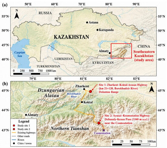
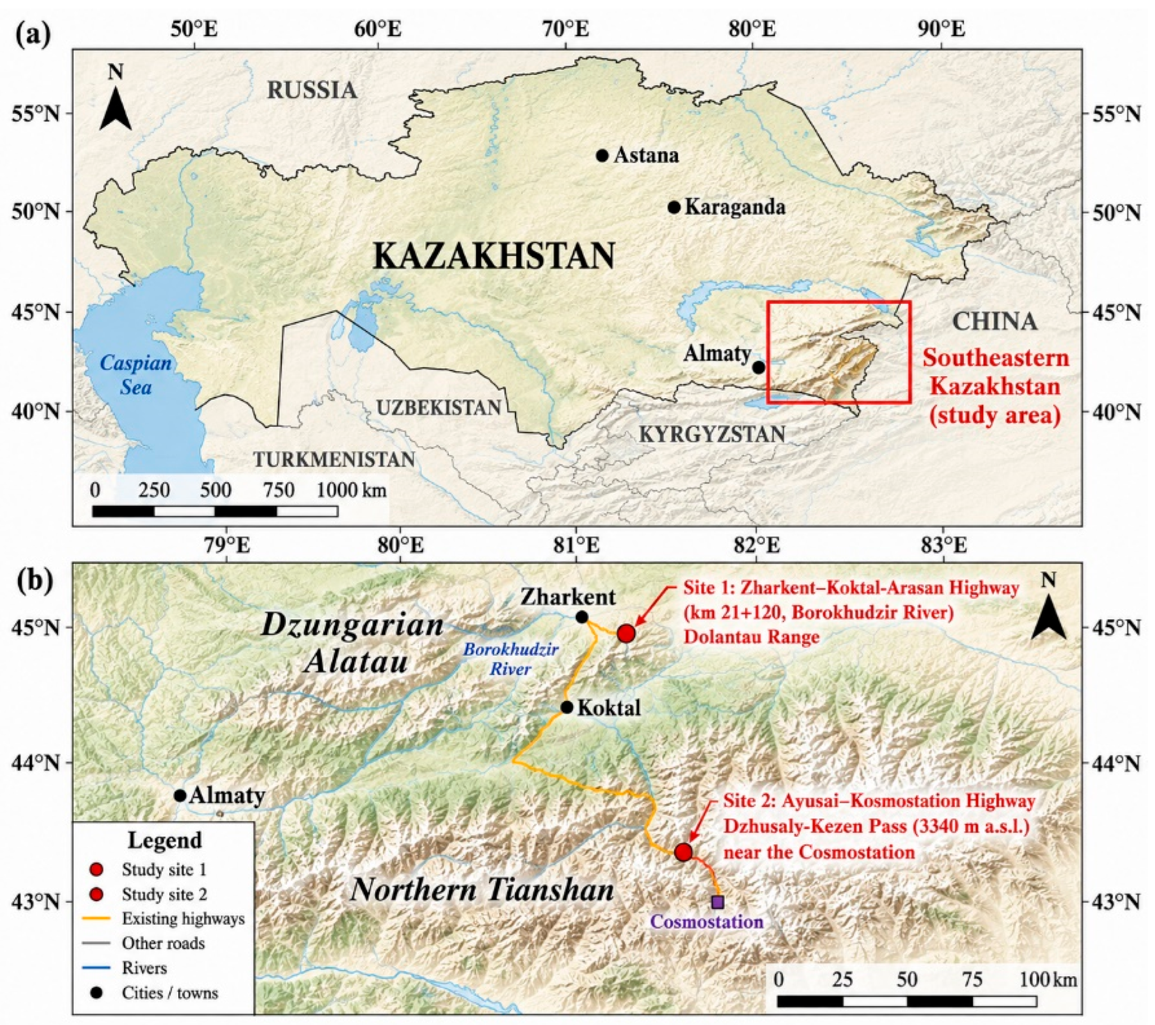
This study was conducted at two mountain road sites in southeastern Kazakhstan representing contrasting manifestations of slope–road interactions: a section of the Zharkent–Koktal-Arasan Highway within the Dzungarian Alatau and a section of the Ayusai–Kosmostation Highway crossing the Dzhusaly-Kezen Pass in the northern Tianshan Mountains. The geographical locations of the two study sites are shown in Figure 1. The investigated areas are characterized by steep mountain slopes, deeply incised valleys and gorges, and heterogeneous geological and geomorphological conditions that influence the stability and performance of road infrastructure. The sites were selected because they represent two contrasting forms of road response under unstable slope conditions: pronounced roadbed displacement at the Zharkent–Koktal-Arasan site and progressive pavement distress at the Ayusai–Kosmostation site.
Figure 1.
Location of the investigated mountain road sections in southeastern Kazakhstan: (a) Zharkent–Koktal-Arasan Highway, Dzungarian Alatau; (b) Ayusai–Kosmostation Highway, Dzhusaly-Kezen Pass, northern Tianshan.
The mountainous part of southeastern Kazakhstan includes the Zailiyskiy Alatau, Kungey Alatau, Terskey Alatau, Kendyktas, and Ketmen ranges of the northern Tianshan, as well as the Dzungarian Alatau. The highest parts of these mountain systems reach elevations of approximately 4000–4500 m above sea level and exhibit glacial landforms. The regional geological structure is dominated by Paleozoic sedimentary and volcanogenic formations and Cenozoic sedimentary deposits. The principal lithologies include crystalline schists, quartzites, gneisses, granites, diorites, porphyrites, tuffs, carbonate rocks, carbonate–siliceous siltstones, sandstones, and conglomerates. Unconsolidated deposits within valleys, basins, and piedmont areas include aeolian sands, alluvial–proluvial sands and sandy loams, and lacustrine–alluvial silty sands and sandy loams [7].
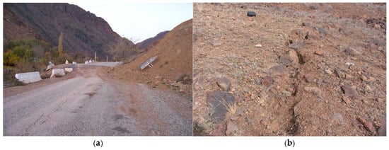
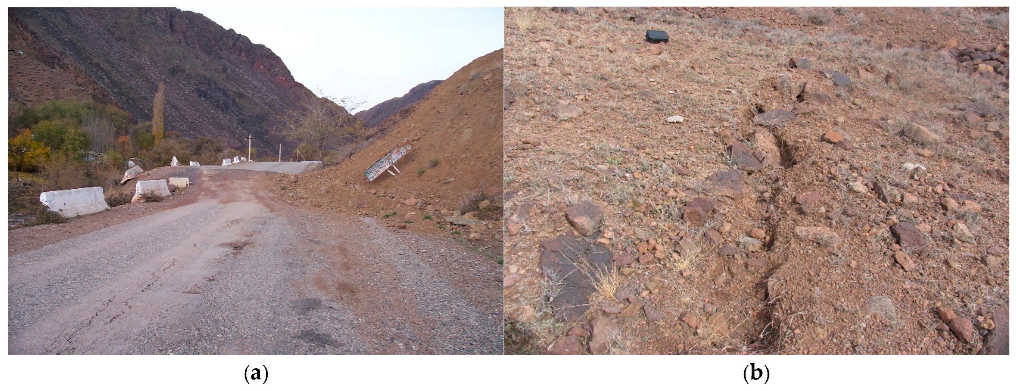
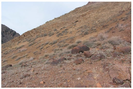
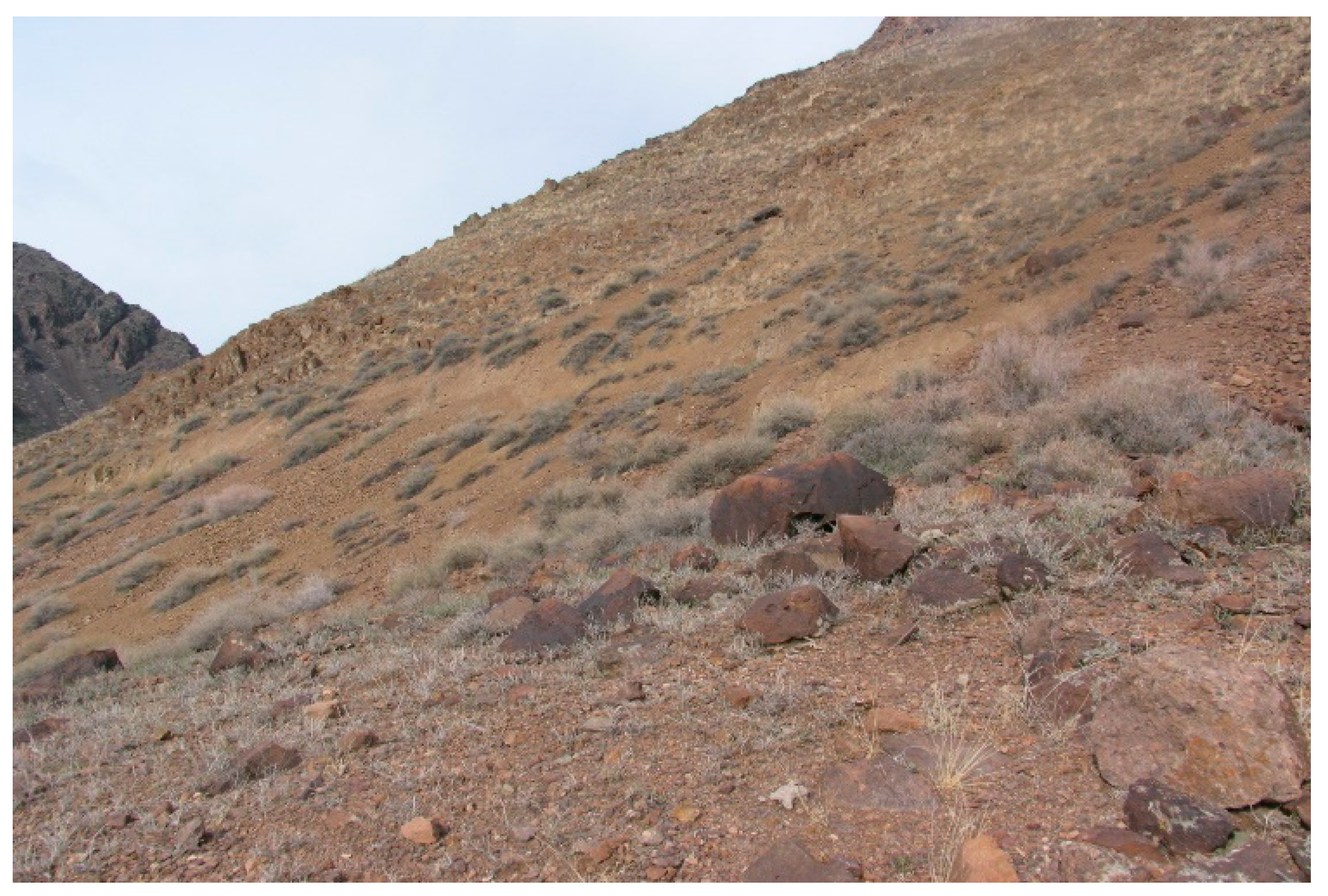
The first study site is located in the Panfilov District of the Almaty Region, along the Zharkent–Koktal-Arasan Highway near km 21 + 120 and the Borokhudzir River. The elevation of the investigated road section ranges from approximately 605 to 628 m above sea level. The site is situated on a south-facing slope of the southern spur of the Dolantau Range in the Dzungarian Alatau. Field observations revealed an extensive landslide body and secondary rupture features on the affected slope (Figure 2).
Figure 2.
General view of the landslide-affected slope along the Zharkent–Koktal-Arasan Highway: (a) landslide body adjacent to the road section; (b) secondary rupture feature on the slope.
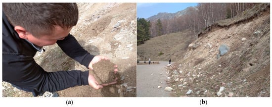
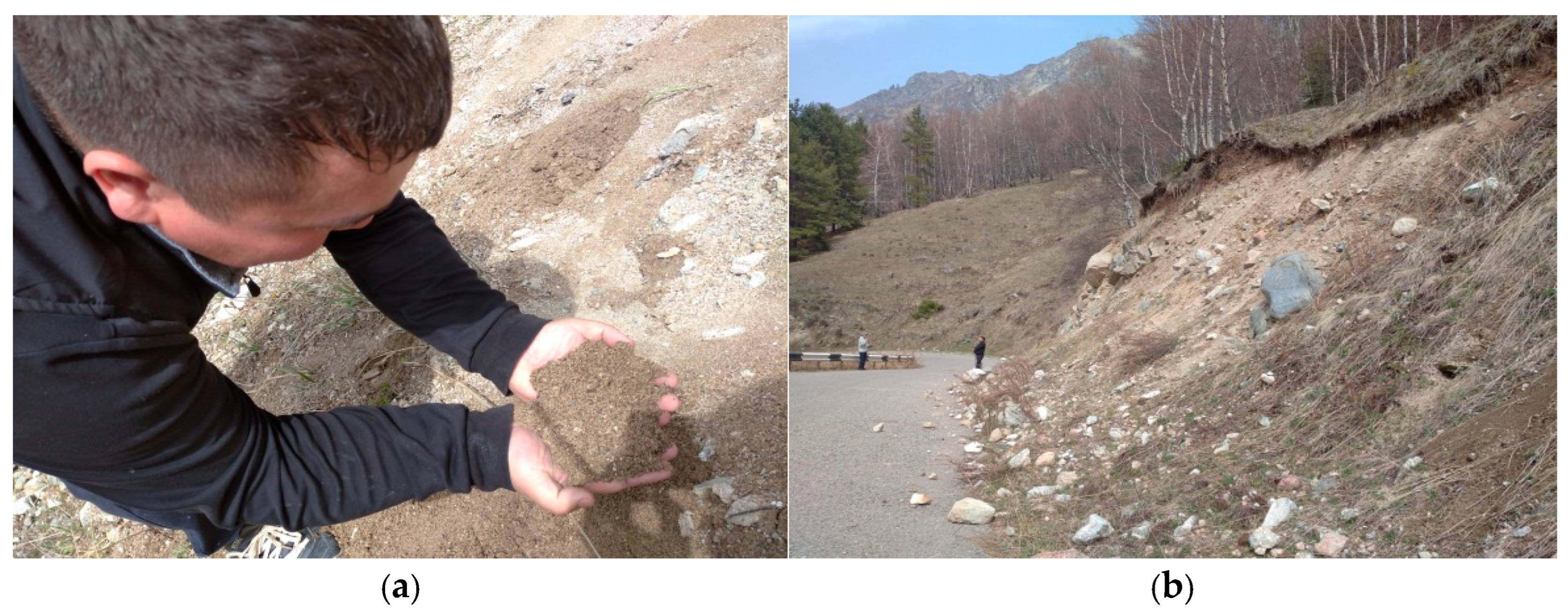
The surrounding slopes are extensively covered by talus deposits. The geological structure includes Carboniferous volcanic formations represented by intermediate-composition tuffs of Tournaisian–Visean age and Middle–Upper Carboniferous tuffs and tuff-lavas of intermediate to acidic composition. These formations are strongly deformed and weathered. Loose Neogene and Paleogene clastic deposits occur approximately 300–400 m southeast of the investigated slope. The second study site is located at the Dzhusaly-Kezen Pass along the Ayusai–Kosmostation Highway at an elevation of approximately 3340 m above sea level. The road is bordered by slope materials susceptible to downslope movement, as illustrated in Figure 3.
Figure 3.
General view of slope conditions adjacent to the Ayusai–Kosmostation Highway at the Dzhusaly-Kezen Pass: (a,b) slope materials adjacent to the investigated road section.
Bedrock exposed in the upper parts of the slopes undergoes intensive frost weathering associated with repeated daily freezing and thawing during the autumn, winter, and spring seasons. Annual precipitation is reported to be approximately 300–400 mm. Field observations indicate that water infiltration into the slope deposits contributes to increased moisture conditions and may facilitate downslope displacement of the slope material. More detailed site-specific lithological and stratigraphic information for the Ayusai–Kosmostation site was not available in the field documentation used in the present study; therefore, the geological description of Site 2 is limited to the characteristics directly documented during the field investigation.
2.2. Research Design
The investigation was designed as a field-based assessment of two contrasting manifestations of slope–road interactions documented at different study sites and during different investigation periods. Field investigations along the Zharkent–Koktal-Arasan Highway were conducted in 2008 by researchers of the Kazakh Automobile and Road Institute (KazADI), and the resulting archived field dataset is used in the present study as a documented historical case. Investigations along the Ayusai–Kosmostation Highway were conducted during 2021–2023.
The first study site was investigated to identify the characteristics of soil and rock mass displacement from the adjacent mountain slope and to quantify its effects on the geometry and structural condition of the roadbed. The investigation included visual inspection of the pavement, roadbed, and drainage system and geodetic measurements of road cross-sections and displacement caused by the moving slope material.
The second study site was investigated to assess progressive pavement distress associated with the interaction between the road structure and unstable slope materials. The investigation included visual pavement-condition surveys, measurement and classification of longitudinal and transverse cracks, and assessment of selected technical and operational pavement parameters. The overall investigation framework therefore considered two contrasting slope–road response modes: roadbed displacement at the Zharkent–Koktal-Arasan site and progressive pavement cracking at the Ayusai–Kosmostation site.
2.3. Field Investigation of Roadbed Displacement
At the Zharkent–Koktal-Arasan study site, the structural condition of the pavement and roadbed was assessed visually, with particular attention to deformation of the roadway, roadbed slopes, and drainage facilities. Field observations were used to identify visible manifestations of slope movement, including displacement of the road structure, erosion, accumulation of slope material, and the development of tension and detachment cracks within the landslide body.
Geodetic measurements were performed along the investigated road section to determine the actual geometric parameters of the roadbed and quantify displacement associated with the movement of slope material. Roadway and shoulder widths were recorded at selected chainages between km 21 + 000 and km 22 + 700. The measured parameters were subsequently used to characterize the spatial variation in roadbed deformation along the landslide-affected section.
2.4. Pavement Distress Survey
At the Ayusai–Kosmostation study site, pavement distress was assessed visually in accordance with PR RK 218-27-2016, Guidelines for the Diagnosis and Evaluation of the Transport and Operational Condition of Highways [22]. Five test subsections, each 5 m long, were selected for detailed pavement crack measurements.
Transverse cracks were classified according to crack-length intervals of 0–1, 1–2, 2–3, 3–4, and 4–5 m. Longitudinal cracks were recorded according to their position within the roadway—left side, road axis, or right side—and their cumulative length within each test subsection. Crack networks and other visible pavement defects were also recorded during the field surveys.
Repeated observations conducted in 2021 and 2023 were used to evaluate temporal changes in the number and extent of longitudinal and transverse cracks. The pavement structural condition was additionally classified according to the assessment categories specified in PR RK 218-27-2016. Representative pavement distress identified during the survey is presented later, with the corresponding quantitative results in Section 3.
2.5. Geodetic Measurements of Roadbed Displacement
Geodetic survey data obtained during the 2008 KazADI field investigation at the Zharkent–Koktal-Arasan site were used to characterize roadbed deformation at five chainages between km 21 + 000 and km 22 + 700. The archived field dataset reports roadway and shoulder geometry together with roadbed-displacement values at these chainages. The reported displacement values range from 1.5 to 4.5 m and represent the deformation of the roadbed associated with movement of the adjacent landslide mass; they were not calculated from the roadway or shoulder widths. However, the available archival documentation does not preserve sufficient information on the original survey reference baseline, instrument and measurement accuracy, displacement components, or number of repeated measurements. Accordingly, these values are treated in the present study as reported archival field measurements and are used to characterize the magnitude and spatial distribution of roadbed deformation rather than as a newly derived geodetic displacement dataset.
2.6. Data Processing and Analysis
For the Zharkent–Koktal-Arasan site, roadbed geometry and displacement measurements were compared among the surveyed chainages to characterize the magnitude and spatial variation of roadbed deformation along the landslide-affected section.
For the Ayusai–Kosmostation site, longitudinal and transverse pavement-crack measurements obtained during the 2021 and 2023 surveys were compared to evaluate temporal changes in pavement distress. The number of transverse cracks was analyzed according to crack-length class, whereas longitudinal cracking was evaluated using cumulative crack length according to its position within the roadway. For the selected test subsection, the relationship between transverse-crack length and occurrence frequency was evaluated using linear regression. The coefficient of determination (R2) was used to characterize the goodness of fit of the resulting relationship.
3. Results
3.1. Landslide Characteristics and Slope Movement Evidence
Field investigations along the Zharkent–Koktal-Arasan Highway identified a progressively moving landslide body affecting the road section between approximately km 21 + 000 and km 22 + 700. The investigated slope is extensively covered by talus deposits composed of coarse rock fragments and finer soil material. Visible evidence of slope movement included secondary tension cracks and detachment features within the upper part of the landslide body (Figure 4).
Figure 4.
Surface cracking and detachment features observed within the landslide-affected slope along the Zharkent–Koktal-Arasan Highway.
Field observations indicated a slow, progressive pattern of landslide movement. The main landslide scarp had formed before the field investigation and showed evidence of continued development. The archived field documentation characterizes the landslide as a multi-block slope movement comprising two principal blocks rather than as displacement of a single coherent block. The upper block, extending approximately from km 21 + 000 to km 21 + 500, was estimated at about 120 m in length, 60 m in width, and 7 m in thickness. The lower block, extending from approximately km 21 + 500 toward km 22 + 700, was estimated at about 130 m in length, 110 m in width, and 10 m in thickness. These values are reported as historical field estimates from the 2008 investigation.
The landslide material was heterogeneous and contained boulder-, crushed-stone-, gravel-, sand-, and silt/clay-sized fractions. The grain-size distribution varied along the landslide profile (Table 1). Coarse fractions dominated the middle and lower parts of the landslide body, with crushed stone and gravel together accounting for 62% of the material in the middle section and 70% at the landslide toe.
Table 1.
Grain-size distribution of landslide materials along the Zharkent–Koktal-Arasan study site.
The field observations also indicated that drainage conditions were locally impaired by the accumulation of rock debris. Collector wells located near the road were observed to be clogged with slope material. In addition, erosion and deformation were identified along the roadbed and adjacent slope sections.
3.2. Roadbed Displacement Along the Zharkent–Koktal-Arasan Highway
The archived geodetic survey data indicate substantial spatial variation in the reported roadbed displacement along the investigated section of the Zharkent–Koktal-Arasan Highway. Data were reported at five chainages between km 21 + 000 and km 22 + 700 (Table 2). The reported displacement ranged from 1.5 to 4.5 m, with the maximum value occurring at km 21 + 120. A similarly high value of 4.4 m was reported at km 21 + 500. The available field records indicate that the affected road section was not restored for an extended period following the documented deformation, with rehabilitation works resuming in spring 2023. However, the archival documentation does not provide sufficient information to reconstruct the continuity or conditions of traffic operation over this period.
Table 2.
Roadway geometry and reported roadbed displacement along the Zharkent–Koktal-Arasan Highway.
3.3. Physical and Mechanical Properties of Slope Materials
The physical and mechanical properties presented in Table 3 and Table 4 characterize geological materials associated with the first study area, the Zharkent–Koktal-Arasan Highway and the adjacent Dolantau Range in the Dzungarian Alatau. These data originate from the geological and geotechnical dataset used to characterize the investigated landslide environment and should not be interpreted as material properties of the second study site at the Dzhusaly-Kezen Pass. The available source documentation reports parameter ranges and associated summary values but does not preserve sufficiently detailed information on the original laboratory testing procedures and standards used to determine all parameters. Accordingly, the values are reported here as source geotechnical data rather than as results of new laboratory testing conducted within the present study.
Table 3.
Selected physical and mechanical properties of rock formations in the study region.
Table 4.
Reported ranges of selected physical and mechanical properties of quaternary alluvial–proluvial soils at the first study site.
At the Zharkent–Koktal-Arasan study site, the slope materials include weathered Paleozoic rock formations and Quaternary alluvial–proluvial deposits composed predominantly of coarse clastic material with a sandy–clayey matrix. The rock formations exposed within the Dzungarian Alatau include porphyritic and dioritic rocks, effusive and pyroclastic rocks, carbonate–siliceous schists, and carbonaceous–carbonate and carbonaceous–clayey schists. The reported physical and mechanical properties of the principal rock groups are summarized in Table 3.
The density data indicate relatively dense rock materials, whereas the reported ranges of porosity and internal friction angle demonstrate substantial variability among the investigated lithological groups. In particular, the internal friction angle ranges from 30° to 50° across the reported rock types.
Quaternary alluvial–proluvial deposits are widely developed in the foothill areas of the Dzungarian Alatau and occur within the landslide-affected slope of the Dolantau Range. These deposits consist primarily of boulder- and gravel-sized material embedded in a sandy–clayey matrix and are locally overlain by loamy deposits approximately 5–10 m thick. The values presented in Table 4 represent the overall reported ranges of physical and mechanical properties for the Quaternary alluvial–proluvial sandy loam and loam materials documented within the first study area. These values characterize the Zharkent–Koktal-Arasan/Dolantau study area and are not measurements from the Ayusai–Kosmostation site.
A reduction in the reported internal friction angle after water saturation is evident for the soil groups for which both natural moisture and saturated values are available. This behavior is relevant to the investigated slope environment because infiltration and moisture accumulation can modify the shear resistance characteristics of unconsolidated slope deposits. The implications of these material properties for slope movement and road deformation are considered in Section 4.
3.4. Pavement Distress Development Between 2021 and 2023
Repeated pavement-condition surveys along the Ayusai–Kosmostation Highway revealed a clear increase in pavement distress between 2021 and 2023. The five detailed test subsections exhibited both transverse and longitudinal cracking, although the magnitude and spatial distribution of the observed distress varied among the investigated locations.
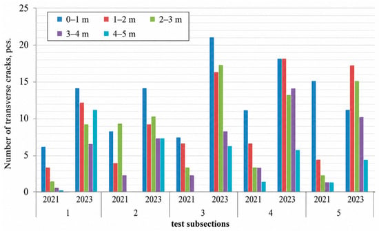
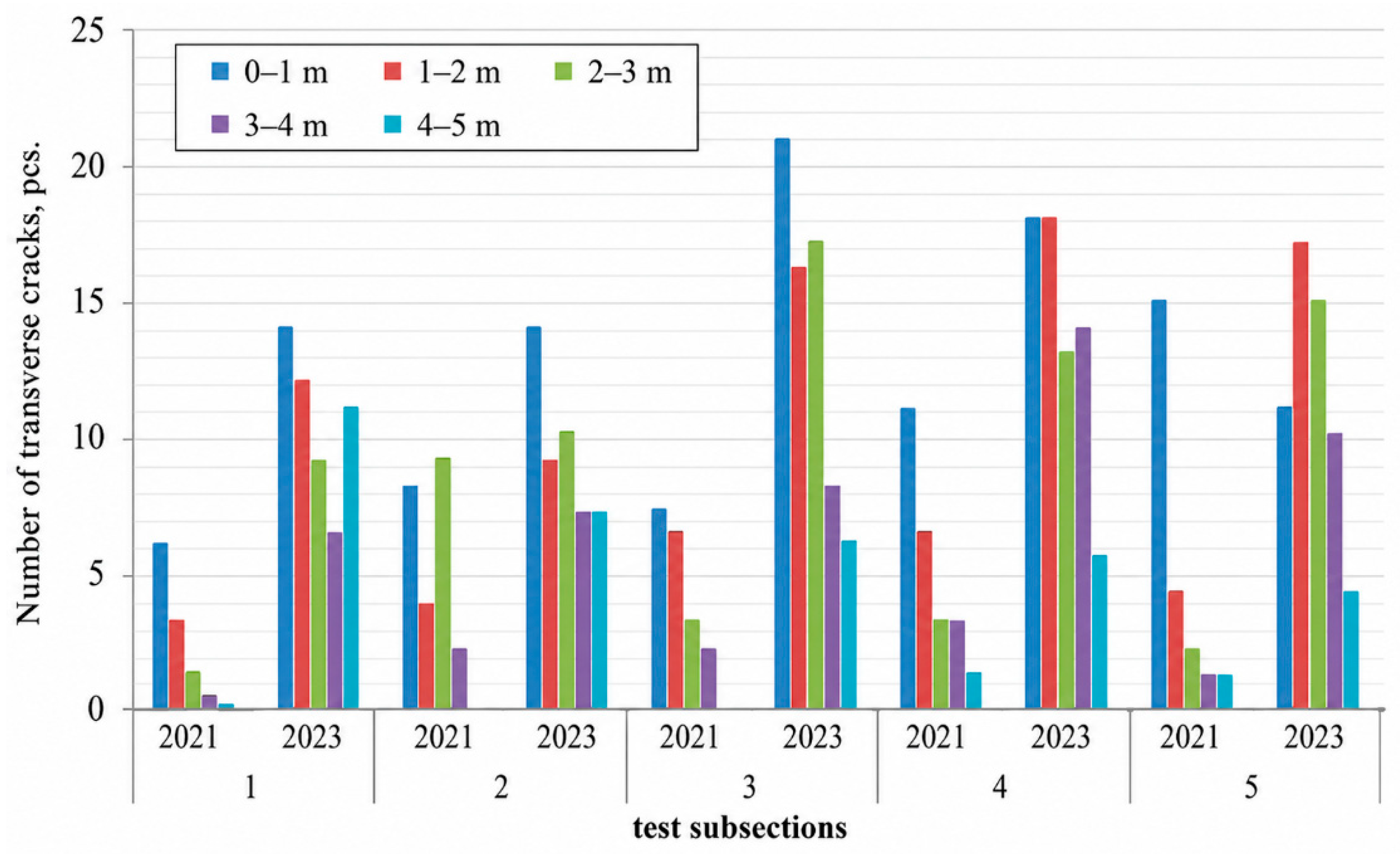
Transverse cracking increased across all crack length classes during the observation period. Short cracks (0–1 m) were the most frequent at all five test subsections, whereas cracks in the 4–5 m class occurred less frequently. The temporal development of transverse cracking between 2021 and 2023 is illustrated in Figure 5.
Figure 5.
Changes in the number of transverse pavement cracks within different crack length classes at five test subsections between 2021 and 2023.
The increase in cracking was also evident from measurements of cumulative longitudinal-crack length. Longitudinal cracks were recorded separately along the left side of the roadway, the road axis, and the right side. Table 5 summarizes the measured cumulative crack lengths for the five test subsections in 2021 and 2023.
Table 5.
Cumulative longitudinal-crack lengths recorded at the five test subsections in 2021 and 2023.
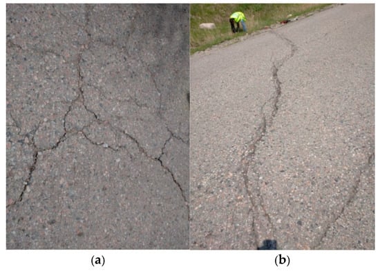
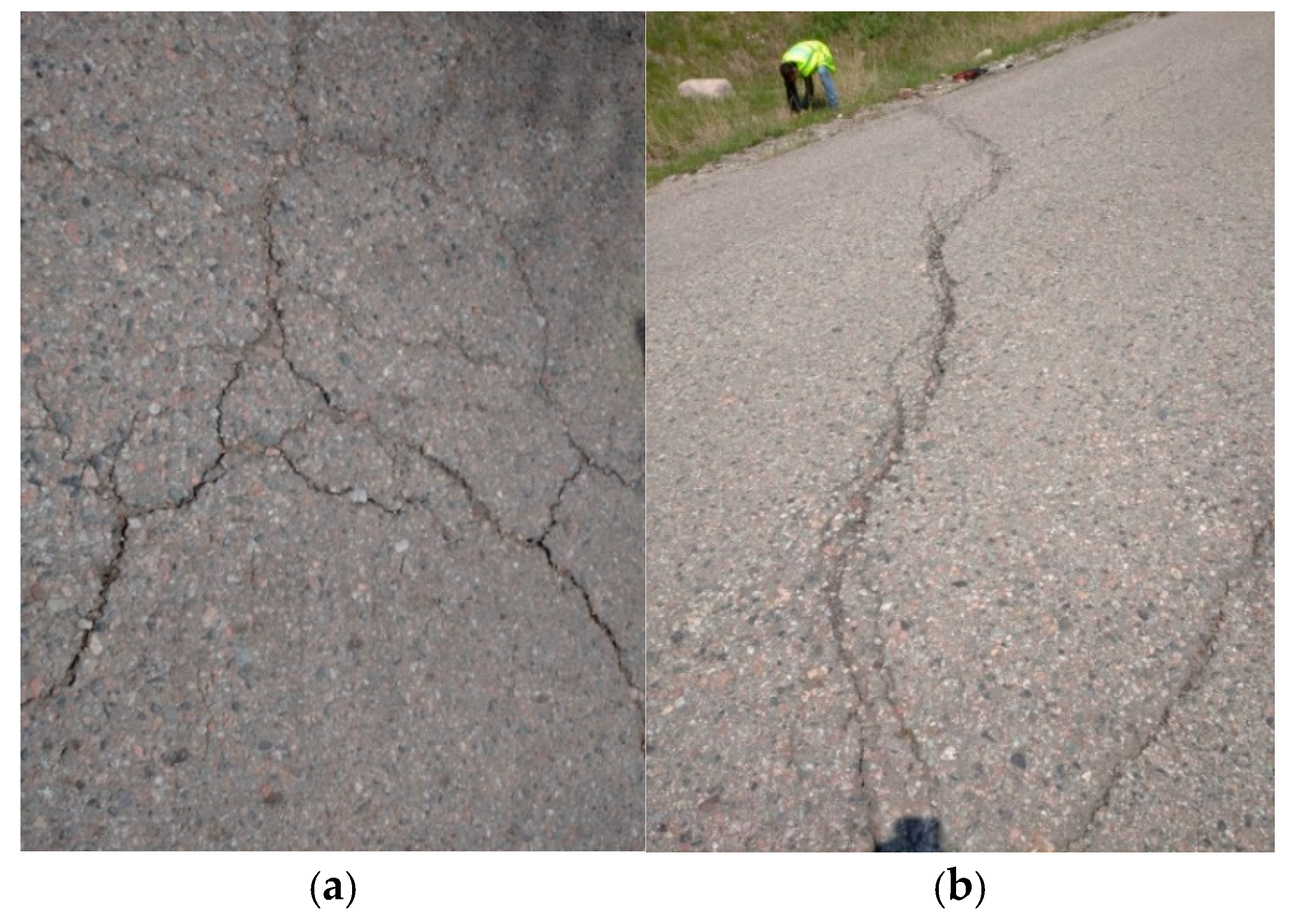
The measurements show that cumulative longitudinal cracking increased between 2021 and 2023 at every monitored position within all five test subsections. The largest absolute increase along the left side of the roadway occurred at Test Subsection 2, where cumulative crack length increased from 8.0 to 27.0 m. Along the road axis, Test Subsection 3 increased from 19.25 to 31.6 m, while on the right side the largest reported cumulative length in 2023 was 29.7 m at Test Subsection 4. Representative forms of pavement distress observed during the field survey included interconnected crack networks and deep transverse cracks (Figure 6). Unlike Site 1, no direct instrumental measurements of slope or roadbed displacement were available for Site 2. Therefore, the observed increase in longitudinal and transverse cracking between 2021 and 2023 is interpreted as progressive pavement distress rather than as a direct measurement of slow slope movement, and no displacement rate is assigned to this site.
Figure 6.
Representative pavement distress observed along the Ayusai–Kosmostation Highway: (a) interconnected pavement crack network; (b) deep transverse crack.
The broader visual condition assessment of the road section also indicated deterioration between the 2021 and 2023 surveys. According to the PR RK 218-27-2016 assessment categories, several road sections that had been classified as I/1 in 2021 were classified between I/2 and I/4 in 2023. The most pronounced deterioration was recorded at several sections where the 2023 condition reached category I/4 (Table 6).
Table 6.
Pavement structural condition assessment along the Ayusai–Kosmostation Highway in 2021 and 2023.
The newly constructed section at km 16–17 also exhibited transverse cracks at intervals of approximately 2–3 m. According to the field records, the occurrence of small transverse and longitudinal cracks on this section increased by approximately two to three times over the monitoring period. These observations indicate that pavement deterioration was not confined to a single localized section but was recorded across multiple parts of the investigated road.
The observed temporal changes establish the occurrence of progressive pavement distress between 2021 and 2023. The possible contribution of slope-material movement, water-related processes, pavement condition, and other environmental and operational factors to this deterioration is evaluated in Section 4.
3.5. Pavement Technical and Operational Parameters
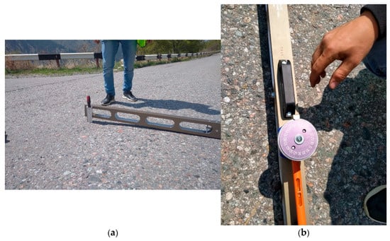
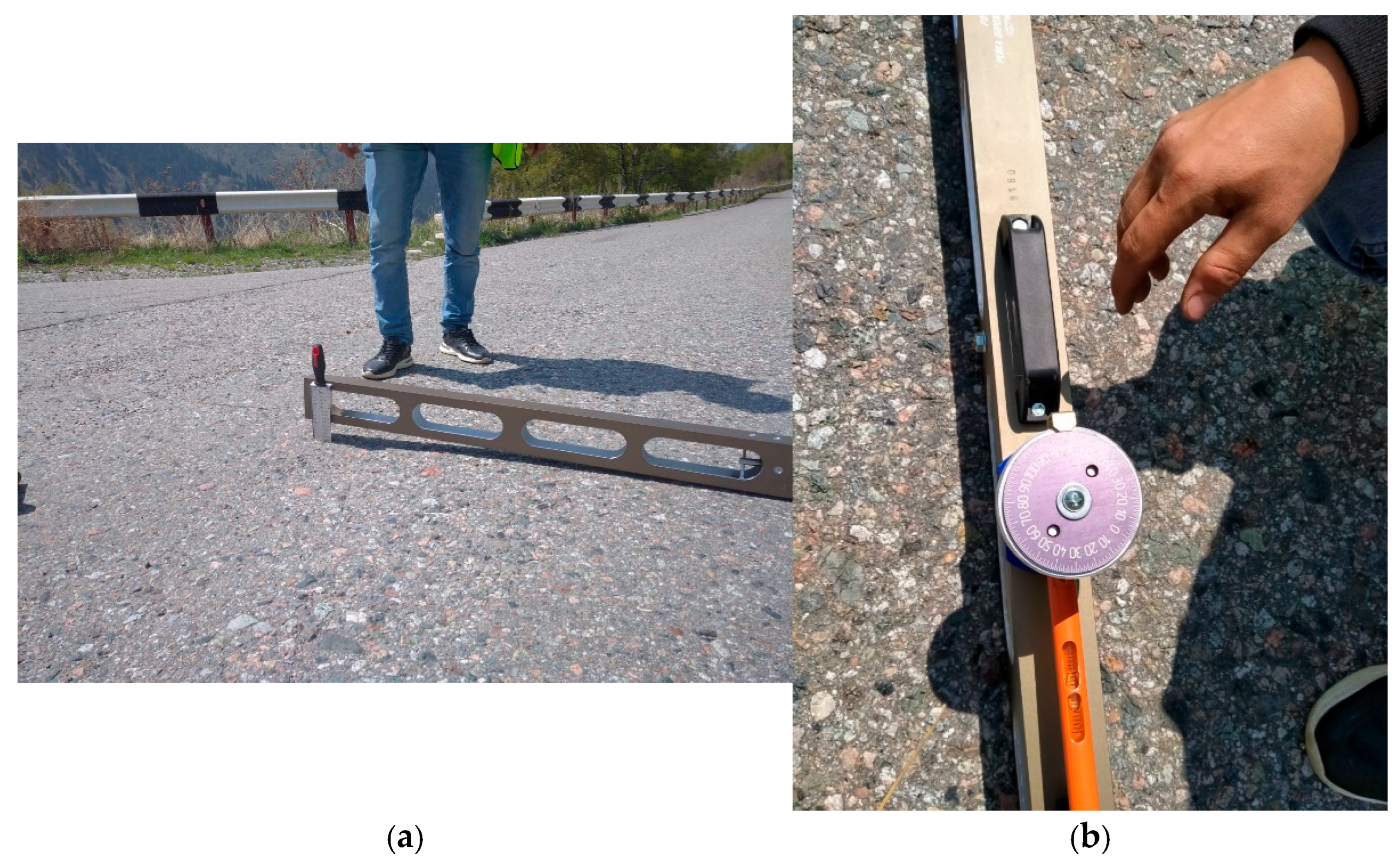
In addition to pavement-distress mapping, selected technical and operational characteristics of the pavement were measured at the five test subsections. The evaluated parameters included transverse slope, longitudinal and transverse surface evenness measured using a 3 m straightedge, longitudinal and transverse skid-resistance coefficients, and pavement hardness. The field measurement procedure is illustrated in Figure 7.
Figure 7.
Field measurement procedures used to assess pavement geometry and surface condition at the Ayusai–Kosmostation study site: (a) pavement evenness measurement using a 3 m straight edge; (b) measurement of longitudinal and transverse pavement slopes.
The individual measurements of pavement technical and operational parameters obtained at the five test subsections are presented in Table 7. Multiple measurements were recorded within individual test subsections; therefore, the values are presented as reported rather than averaged.
Table 7.
Individual measurements of pavement technical and operational parameters at the five test subsections.
Across the five test subsections, the reported skid-resistance coefficients generally ranged from 0.70 to 0.88 in the longitudinal direction and from 0.70 to 0.80 in the transverse direction. The reported hardness values ranged from 2.8 to 5.5 mm. Greater variability was observed in the surface-evenness measurements, particularly in the transverse direction at Test Subsections 2 and 4. To facilitate comparison among the test subsections, the available replicate measurements were additionally summarized using the mean, observed range, and number of measurements (n), as presented in Table 8.
Table 8.
Summary statistics of pavement technical and operational parameters at the five test subsections.
The summary statistics indicate substantial spatial variability among the investigated test subsections. The greatest mean transverse surface deviation was recorded at Test Subsection 2 (40.0 mm), followed by Test Subsection 4 (34.7 mm), whereas substantially smaller values were observed at Test Subsections 1 and 5 (2.7 mm). The observed ranges also reveal pronounced local variations in pavement geometry. In particular, the transverse slope ranged from 3‰ to 87‰ across the investigated test subsections, while the maximum transverse surface deviation reached 55 mm at Test Subsection 2. The very low transverse slope values indicate locally reduced cross-fall, whereas the highest values indicate substantial local deformation of the pavement profile. Together with the large transverse surface deviations observed at Test Subsections 2 and 4, these measurements provide direct quantitative evidence of the non-uniform deformation of the roadway surface.
For reference, pavement evenness in Kazakhstan is assessed using a 3 m straight edge in accordance with ST RK 1219-2017 [23]. The applicable acceptance limits depend on the road category; the current national quality control requirements specify transverse clearances of 5 mm for Category I roads, 7 mm for Category II–III roads, and 15 mm for Category IV roads, with limited measurements permitted to reach 10, 14, and 30 mm, respectively. Against these reference values, the maximum transverse deviation of 55 mm recorded at Test Subsection 2 represents a pronounced local departure from the typical acceptance limits and provides additional quantitative evidence of substantial pavement deformation [23].
3.6. Relationship Between Transverse-Crack Length and Occurrence Frequency
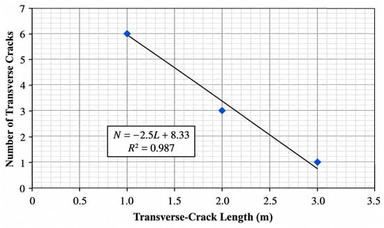
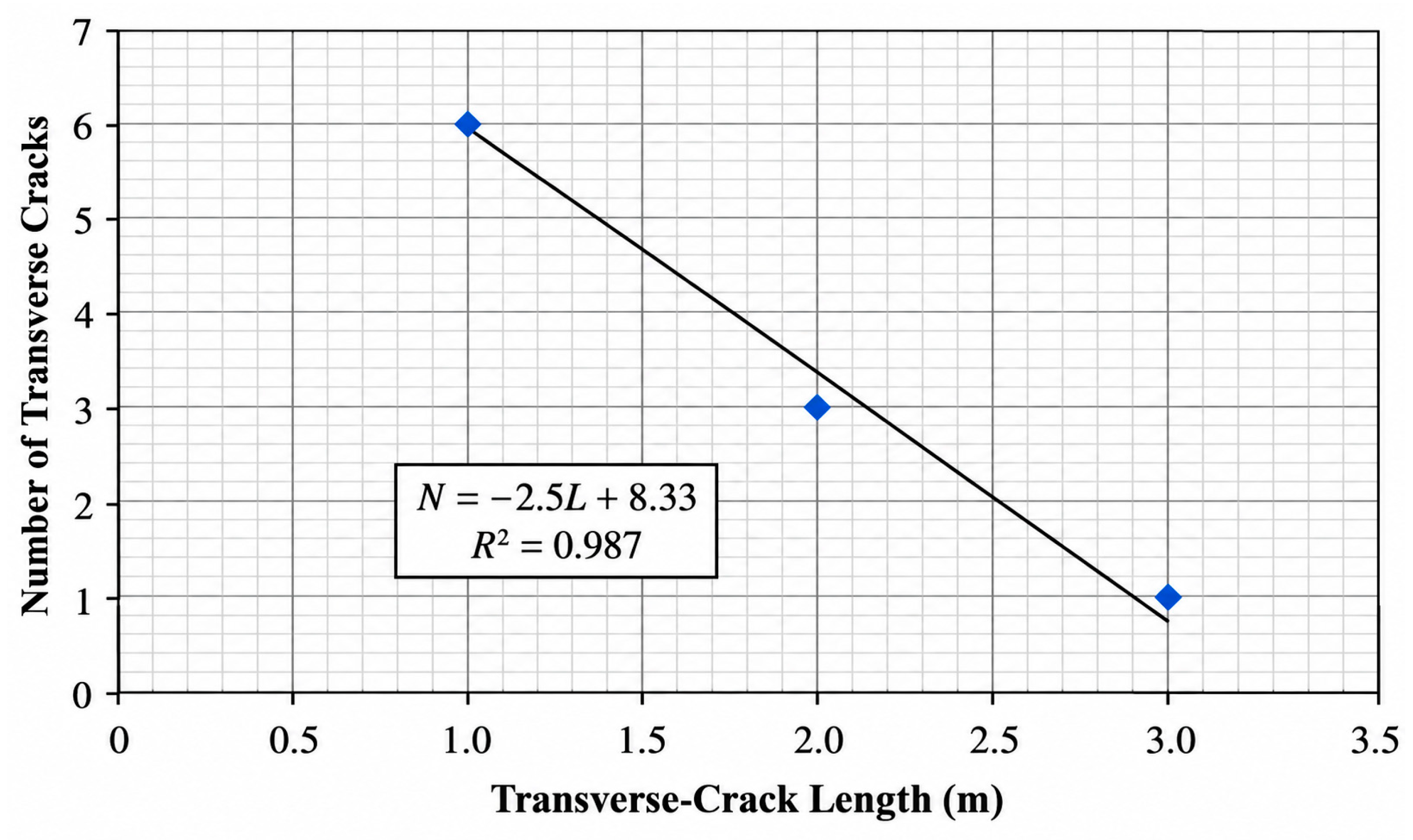
The relationship between transverse-crack length and occurrence frequency was examined for Test Subsection No. 1. Within this subsection, the analyzed transverse cracks were concentrated within the shorter crack length classes, and the maximum crack length included in the regression analysis was 3 m.
A linear regression showed a pronounced negative relationship between crack length and occurrence frequency (Figure 8). The fitted relationship was:
where N is the observed number of transverse cracks within a given crack length category, and L is the corresponding transverse-crack length (m). Thus, L represents the crack length rather than the cumulative or total length of all transverse cracks. The coefficient of determination was R2 = 0.987, indicating a strong linear association within the analyzed dataset. The frequency of transverse cracks therefore decreased with increasing crack length. Because the regression was based on three crack-length observations within a single test subsection, the relationship should be interpreted as a descriptive site-specific trend rather than as a predictive model applicable to other road sections.
N = −2.5L + 8.33,
Figure 8.
Relationship between transverse-crack length and occurrence frequency at Test Subsection No. 1.
4. Discussion
4.1. Mechanisms Controlling Slope–Road Interactions
The results obtained at the two study sites demonstrate that slope instability can affect mountain road infrastructure through substantially different deformation responses. At the Zharkent–Koktal-Arasan site, slope movement was expressed as large-scale displacement of the roadbed, whereas at the Ayusai–Kosmostation site, the most evident response was the progressive development of pavement cracking. These observations support the interpretation of slope–road interactions as a coupled geotechnical process in which geological structure, slope materials, water conditions, weathering, and road structure characteristics jointly influence the form and magnitude of observed deformation.
At the Zharkent–Koktal-Arasan site, the observed slope movement occurred within heterogeneous slope deposits containing substantial proportions of coarse clastic material. The middle and lower parts of the landslide body contained particularly high proportions of crushed stone and gravel (Table 1). Field observations also identified talus accumulation, secondary tension and detachment cracks, and locally impaired drainage conditions. Together with the measured roadbed displacement, these features indicate progressive downslope redistribution of the slope material rather than an isolated pavement-level failure.
Water is likely to be an important contributing factor in this process. Rainfall and surface-water infiltration can alter hydraulic conditions within fissured and unconsolidated slope materials, while preferential infiltration through cracks can modify seepage conditions and reduce slope stability [2,3]. Similar mechanisms have been reported for highway slopes subjected to rainfall infiltration, where changes in moisture and seepage conditions contribute to progressive deformation [2,3]. At the investigated Zharkent–Koktal-Arasan site, the presence of slope deposits, visible cracking, and impaired drainage provides field evidence consistent with the potential importance of water-related processes. However, because pore-water pressure and groundwater levels were not monitored directly during the reported investigation, the hydraulic contribution cannot be quantified from the present dataset.
Freeze–thaw weathering represents another potentially important mechanism, particularly at the high-altitude Ayusai–Kosmostation site. Previous investigations of mountain-road slopes in the Tianshan region have shown that repeated freeze–thaw cycling can promote progressive deterioration of rock masses, opening of discontinuities, development of microcracks, and reduction in slope stability [4]. The Dzhusaly-Kezen Pass is characterized by repeated seasonal and daily freezing and thawing, and the original field observations indicate intensive frost weathering of exposed bedrock. These environmental conditions provide a plausible mechanism for the progressive weakening and mobilization of slope materials adjacent to the road.
The present results therefore suggest that the observed road deformation should be interpreted within a multi-factor framework rather than being attributed to a single trigger. Geological heterogeneity, slope geometry, weathering, water infiltration, drainage condition, and freeze–thaw action may act together to control the transfer of slope deformation to the road structure. This interpretation is consistent with previous research emphasizing the combined influence of geological and environmental factors on landslide development and highway-slope stability [2,3,4,7].
4.2. Roadbed Displacement and Pavement Distress Response
The most important distinction between the two investigated sites concerns the manner in which slope movement is manifested within the road infrastructure. At the Zharkent–Koktal-Arasan site, geodetic measurements recorded roadbed displacement ranging from 1.5 to 4.5 m, with the largest values concentrated around km 21 + 120–21 + 500 (Table 2). Displacements of this magnitude indicate that deformation extends beyond the pavement layer and involves the roadbed and supporting geological environment.
At the Ayusai–Kosmostation site, by contrast, the field surveys did not identify comparably large roadbed displacement. Instead, repeated observations between 2021 and 2023 documented progressive pavement deterioration. Cumulative longitudinal-crack length increased at all monitored positions within the five detailed test subsections (Table 5), while the broader visual condition assessment showed deterioration of multiple road sections toward categories I/3–I/4 by 2023 (Table 6). These results indicate a different road-infrastructure response from that observed at the first site.
Previous studies have demonstrated that localized ground displacement associated with landslides can be reflected in longitudinal and transverse pavement cracking and other forms of surface deformation [1]. Differential deformation of the supporting ground or subgrade can similarly generate pavement cracking even when deterioration of the asphalt material itself is not the sole controlling mechanism [5,6]. The cracking observed at the Ayusai–Kosmostation site is therefore compatible with a geotechnical contribution from the supporting slope and subgrade environment.
Nevertheless, the present field data do not justify attributing all observed pavement cracking exclusively to slope movement. Pavement distress may also be influenced by freeze–thaw action, drainage conditions, material deterioration, construction quality, and traffic loading. The measured skid-resistance, surface-evenness, and pavement-condition parameters further indicate that the road sections exhibit multiple forms of operational deterioration. Consequently, the pavement cracking results should be interpreted as evidence of progressive road distress occurring within an unstable mountain slope environment rather than as proof of a single causal mechanism.
Considered together, the two cases illustrate contrasting modes of slope–road interactions. The Zharkent–Koktal-Arasan case represents a response dominated by reported roadbed displacement associated with progressive slope movement, whereas the Ayusai–Kosmostation case is characterized primarily by progressive pavement distress without a similarly large documented roadbed displacement. This contrast suggests that slope–road interactions may become evident through different modes of infrastructure response, ranging from progressive pavement cracking to large-scale deformation of the roadbed.
4.3. Engineering Implications for Mountain Road Monitoring and Maintenance
The results of this study have practical implications for the monitoring and maintenance of mountain roads exposed to slope instability. The two investigated sites demonstrate that slope-related road deterioration may be expressed through different observable indicators. At the Zharkent–Koktal-Arasan site, the dominant manifestation was large-scale roadbed displacement, whereas at the Ayusai–Kosmostation site, progressive pavement cracking represented the more evident form of deterioration. Consequently, monitoring strategies based solely on major slope displacement or visible landslide failure may not be sufficient to identify all road sections affected by progressive slope–road interactions.
For road sections where substantial displacement has already developed, repeated geodetic monitoring should be used to quantify changes in roadbed geometry and the spatial progression of deformation. Particular attention should also be given to drainage facilities because the field investigation at the Zharkent–Koktal-Arasan site identified collector wells obstructed by rock debris. Maintaining effective drainage is important in mountain road environments where infiltration and surface runoff may contribute to the mobilization of unconsolidated slope materials.
At road sections where large-scale roadbed displacement is not evident, systematic pavement-distress surveys may provide complementary information on progressive deterioration. The increase in longitudinal and transverse cracking recorded between 2021 and 2023 at the Ayusai–Kosmostation site demonstrates the value of repeated observations rather than single-condition inspections. Changes in crack number, cumulative crack length, crack orientation, and the development of interconnected crack networks can be documented together with measurements of roadbed and slope deformation to identify locations requiring more detailed geotechnical investigation.
The results therefore support an integrated monitoring approach combining: (i) visual inspection of slopes, roadbeds, pavements, and drainage facilities; (ii) repeated geodetic measurements at deformation-prone road sections; (iii) systematic mapping of longitudinal and transverse pavement cracking; and (iv) assessment of surface-water and drainage conditions. Where progressive movement is detected, these observations should be supplemented by more detailed geotechnical and hydrogeological investigations.
For high-altitude road sections such as the Dzhusaly-Kezen Pass, seasonal environmental conditions should also be considered when planning monitoring activities. Because freeze–thaw processes and water infiltration can modify the mechanical response of slope materials [2,3,4], repeated surveys conducted at comparable seasonal stages would provide a more reliable basis for distinguishing long-term deformation trends from short-term seasonal changes.
The practical implication is that pavement distress should not be evaluated independently from the surrounding geological environment on mountain roads. Conversely, slope monitoring should consider the road structure itself as a potential indicator of progressive ground deformation. Integrating these two perspectives can improve the identification of potentially unstable road sections and support prioritization of maintenance and stabilization measures.
4.4. Study Limitations
Several limitations should be considered when interpreting the results of this study. First, the two investigated sites were examined during different observation periods. The Zharkent–Koktal-Arasan dataset originates from field investigations conducted by researchers of the Kazakh Automobile and Road Institute (KazADI) in 2008, whereas the Ayusai–Kosmostation site was investigated during 2021–2023. The 2008 dataset is used in the present study as a documented field case of large-scale roadbed displacement associated with slope movement and is not interpreted as representing the current condition of the road section. No recent re-survey data for the Zharkent–Koktal-Arasan section were available for the present analysis. Accordingly, the two cases are used to illustrate contrasting manifestations of slope–road interactions rather than to establish synchronous temporal trends between the sites.
Second, the available investigation did not include continuous instrumental monitoring of slope displacement, groundwater levels, or pore-water pressure. Although field observations indicate that water infiltration, drainage conditions, and freeze–thaw processes may contribute to slope instability, their individual effects cannot be quantitatively separated using the present dataset. The proposed mechanisms should therefore be interpreted in conjunction with the field evidence and previous research rather than as independently quantified causal relationships.
Third, the pavement distress assessment identifies temporal changes in longitudinal and transverse cracking but does not provide sufficient information to isolate the individual contributions of slope movement, traffic loading, pavement-material deterioration, construction characteristics, drainage conditions, and freeze–thaw action. Although the reported traffic volume was relatively low, detailed data on vehicle composition, axle loads, and changes in traffic characteristics during the observation period were not available. Therefore, the contribution of traffic loading to the observed pavement deterioration cannot be quantitatively evaluated or separated from other contributing factors. Detailed data on changes in traffic volume, vehicle composition, axle loads, and site-specific meteorological conditions between the 2021 and 2023 surveys were not available; therefore, their possible contribution to the observed temporal changes in pavement condition cannot be quantified independently. Fourth, the regression between transverse-crack length and occurrence frequency was derived from only three crack length observations within a single test subsection. Although a high coefficient of determination (R2 = 0.987) was obtained, the relationship should be regarded as a descriptive site-specific trend rather than as a predictive model applicable to other road sections. Future investigations should combine repeated geodetic or GNSS measurements with groundwater and pore-pressure monitoring, seasonal temperature and moisture observations, and systematic pavement-distress mapping. Where feasible, remote sensing, UAV-based photogrammetry, or other spatial monitoring techniques could also be incorporated to quantify slope deformation over larger areas and to relate changes in slope geometry to the development of roadbed and pavement distress.
5. Conclusions
This study assessed the effects of slope instability on the geotechnical and operational condition of two mountain-road sections in southeastern Kazakhstan using field observations, geodetic measurements, pavement distress surveys, assessment of pavement technical and operational parameters, and characterization of geological materials. The investigated sites demonstrated two contrasting manifestations of slope–road interactions: large-scale roadbed displacement along the Zharkent–Koktal-Arasan Highway and progressive pavement distress along the Ayusai–Kosmostation Highway.
The main conclusions are as follows:
At the Zharkent–Koktal-Arasan study site in the Dzungarian Alatau, field observations identified a progressively moving landslide body characterized by heterogeneous coarse clastic deposits, talus accumulation, secondary tension and detachment cracks, and locally impaired drainage conditions. The archived 2008 geodetic survey data reported roadbed displacement ranging from 1.5 to 4.5 m. The maximum reported displacement of 4.5 m occurred at km 21 + 120, while a similarly high value of 4.4 m was reported at km 21 + 500. These results demonstrate that the deformation at this site extends beyond pavement-level distress and involves substantial displacement of the roadbed and its supporting geological environment.
At the Ayusai–Kosmostation study site at the Dzhusaly-Kezen Pass, repeated pavement surveys between 2021 and 2023 showed progressive development of both longitudinal and transverse cracking. Cumulative longitudinal-crack length increased at all monitored positions within the five detailed test subsections, while the broader pavement-condition assessment documented deterioration of multiple road sections toward categories I/3–I/4 by 2023. Considered as two distinct field cases, the study sites illustrate contrasting modes of infrastructure response under unstable slope conditions. The Zharkent–Koktal-Arasan site demonstrates pronounced roadbed displacement associated with progressive slope movement, whereas the Ayusai–Kosmostation site demonstrates progressively developing pavement distress without direct instrumental evidence of comparable slope or roadbed displacement. The field evidence indicates that road deterioration in mountain environments should be evaluated within a multi-factor geotechnical framework. Geological conditions, slope-material characteristics, water infiltration and drainage, weathering, and freeze–thaw processes may interact with pavement and operational factors. The available data do not permit the individual contribution of each factor to be quantified; therefore, the observed pavement cracking should not be attributed exclusively to slope movement. For mountain roads exposed to unstable slope conditions, monitoring should integrate visual inspection of slopes and drainage systems, repeated geodetic measurements of roadbed deformation, and systematic mapping of pavement distress. Progressive changes in longitudinal and transverse cracking may provide complementary evidence of deterioration and can be used to identify locations requiring more detailed geotechnical investigation.
Overall, the results demonstrate the value of considering the slope, roadbed, and pavement as interacting components of a single geotechnical system. Taken together, the two field cases provide a basis for improving the identification, monitoring, and maintenance of mountain road sections affected by progressive slope processes in southeastern Kazakhstan and comparable mountainous environments.
Author Contributions
Conceptualization, A.A. (Asset Aimurzayev) and A.S. (Akmaral Sagybekova); methodology, A.A. (Asset Aimurzayev), B.K. and A.S. (Akmaral Sagybekova); investigation, A.A. (Asset Aimurzayev), B.K., A.A. (Aida Adiyeva), A.K. and D.M.; data curation, A.A. (Aida Adiyeva), A.K. and D.M.; formal analysis, A.A. (Asset Aimurzayev), B.K. and A.S. (Akmaral Sagybekova); visualization, A.A. (Aida Adiyeva) and D.M.; writing—original draft preparation, A.A. (Asset Aimurzayev) and A.S. (Akmaral Sagybekova); writing—review and editing, A.S. (Akmaral Sagybekova) and A.S. (Aimash Slyambayeva); supervision, A.S. (Akmaral Sagybekova) and A.S. (Aimash Slyambayeva). All authors have read and agreed to the published version of the manuscript.
Funding
This research received no external funding.
Data Availability Statement
The data supporting the findings of this study are available from the corresponding author upon reasonable request.
Conflicts of Interest
Authors Asset Aimurzayev, Baibossyn Kutlumuratov, Akmaral Sagybekova, Aida Adiyeva, Abdy Kiyalbayev, and Daniyar Mukashev are employed by the L.B. Goncharov Kazakh Automobile and Road Institute, Department of Transport Construction and Urban Planning. Author Aimash Slyambaeva is employed by the International Educational Corporation, School of Construction. The authors declare that their employers had no role in the design of the study; in the collection, analysis, or interpretation of data; in the writing of the manuscript; or in the decision to publish the results.
References
- Nappo, N.; Mavrouli, O.; Nex, F.; van Westen, C.; Gambillara, R.; Michetti, A.M. Use of UAV-based photogrammetry products for semi-automatic detection and classification of asphalt road damage in landslide-affected areas. Eng. Geol. 2021, 294, 106363. [Google Scholar] [CrossRef] [Scilit]
- Jia, J.; Mao, C.; Tenorio, V.O. Slope stability considering multi-fissure seepage under rainfall conditions. Sci. Rep. 2024, 14, 11662. [Google Scholar] [CrossRef] [Scilit] [PubMed]
- Li, P.; Li, Q.; Feng, Q.; Huang, Z.; Gan, X.; Ding, H.; Xu, C. Multi-Source Monitoring and Numerical Simulation Deformation on Highway Steep Slopes Under Rainfall Effects. Buildings 2024, 14, 3473. [Google Scholar] [CrossRef] [Scilit]
- Wang, L.; Zhang, Y.; Guo, J.; Ou, Q.; Liu, S.; Wang, L. Study on the Catastrophic Evolution of Tianshan Road Slope under the Freeze-Thaw Cycles. Geofluids 2021, 2021, 6128843. [Google Scholar] [CrossRef] [Scilit]
- Hoek, E.; Carranza-Torres, C.; Corkum, B. Hoek–Brown failure criterion—2002 edition. In Proceedings of the North American Rock Mechanics Symposium, Toronto, ON, Canada, 7–10 July 2002; pp. 267–273. [Google Scholar]
- Li, A.J.; Merifield, R.S.; Lyamin, A.V. Stability charts for rock slopes based on the Hoek–Brown failure criterion. Int. J. Rock Mech. Min. Sci. 2008, 45, 689–700. [Google Scholar] [CrossRef] [Scilit]
- Mustafayev, S.T.; Smolyar, V.A.; Burov, B.V. Hazardous Geological Processes in Southeastern Kazakhstan; Gylym: Almaty, Kazakhstan, 2008. [Google Scholar]
- Zhakyp, A.; Mirlas, V.; Auelkhan, Y.; Zapparov, M.; Kulbekova, S. Slope Stability Coefficient Calculation of the Kok-Tobe Mount with Considering Seismic Activity Using GEO5 Program. J. Geogr. Environ. Manag. 2022, 67, 68–79. [Google Scholar] [CrossRef] [Scilit]
- Zhanabayev, D.; Dzhanaleeva, K.; Atasoy, E.; Efe, R. Landslide Susceptibility Mapping Using Analytical Hierarchy Process and Geographical Information System in Rudny Altai Region, East Kazakhstan. Geogr. Tech. 2024, 19, 151–165. [Google Scholar] [CrossRef] [Scilit]
- Kudaibergenov, M.; Nurakynov, S.; Iskakov, B.; Iskaliyeva, G.; Maksum, Y.; Orynbassarova, E.; Akhmetov, B.; Sydyk, N. Application of Artificial Intelligence in Landslide Susceptibility Assessment: Review of Recent Progress. Remote Sens. 2025, 17, 34. [Google Scholar] [CrossRef] [Scilit]
- Bondarik, G.K.; Yang, L.A. Engineering Geological Investigations; KDU Publishers: Moscow, Russia, 2007; 440p. [Google Scholar]
- Semenov, M.P. Deformations of the landslide type in rock masses. Hydrotech. Struct. 1954, 6, 12–15. [Google Scholar]
- GEOSLOPE International Ltd. Stability Modeling with SLOPE/W. 2007 Version: An Engineering Methodology, 4th ed.; GEOSLOPE International Ltd.: Calgary, AB, Canada, 2008. [Google Scholar]
- Kiyalbayev, A.K.; Kiyalbai, S.N.; Madanbekova, N.Z.; Espayeva, G.A. Theoretical and Experimental Methods of Transportation Construction. Part 2. Methods for Improving and Controlling the Quality of Strength Properties of Construction Materials and Fundamentals of Roadside Infrastructure Development; ADAL KITAP: Almaty, Kazakhstan, 2023. (In Russian) [Google Scholar]
- Whiteley, J.; Inauen, C.; Wilkinson, P.; Meldrum, P.; Swift, R.; Kuras, O.; Chambers, J. Assessing the risk of slope failure to highway infrastructure using automated time-lapse electrical resistivity tomography monitoring. Transp. Geotech. 2023, 43, 101129. [Google Scholar] [CrossRef] [Scilit]
- Khan, B.A.; Zhao, C.; Kakar, N.; Chen, X. SBAS-InSAR Monitoring of Landslides and Glaciers Along the Karakoram Highway Between China and Pakistan. Remote Sens. 2025, 17, 605. [Google Scholar] [CrossRef] [Scilit]
- Wang, Z.; Jia, Y.; Li, S.; Zhang, R.; Xu, B.; Sun, X. Landslide-Hazard-Avoiding Highway Alignment Selection in Mountainous Regions Based on SAR Images and High-Spatial-Resolution Precipitation Datasets: A Case Study in Southwestern China. Remote Sens. 2024, 16, 1303. [Google Scholar] [CrossRef] [Scilit]
- Cho, S.E. Probabilistic stability analysis of rainfall-induced landslides considering spatial variability of permeability. Eng. Geol. 2014, 171, 11–20. [Google Scholar] [CrossRef] [Scilit]
- Ji, J.; Zhang, C.; Gao, Y.; Kodikara, J. Reliability-based design for geotechnical engineering: An inverse FORM approach for practice. Comput. Geotech. 2019, 111, 22–29. [Google Scholar] [CrossRef] [Scilit]
- Ji, J.; Zhang, W.; Zhang, F.; Gao, Y.; Lü, Q. Reliability analysis on permanent displacement of earth slopes using the simplified Bishop method. Comput. Geotech. 2020, 117, 103286. [Google Scholar] [CrossRef] [Scilit]
- Liu, L.-L.; Duan, C.; Xu, C.; Wu, Z.-H. A hybrid model for coseismic landslide susceptibility assessment in Wenchuan using Newmark displacement and convolutional neural network. Georisk Assess. Manag. Risk Eng. Syst. Geohazards 2026, 20, 141–165. [Google Scholar] [CrossRef] [Scilit]
- PR RK 218-27-2014; Instruction on Diagnostics and Evaluation of the Transport and Operational Condition of Highways. Committee of Roads, Ministry for Investment and Development of the Republic of Kazakhstan: Astana, Kazakhstan, 2014; with amendments as of 25 December 2020.
- ST RK 1219-2017; Automobile Roads and Aerodromes. Methods for Measuring Unevenness of Substrates and Coatings. National Standard of the Republic of Kazakhstan: Astana, Kazakhstan, 2017.

Disclaimer/Publisher’s Note: The statements, opinions and data contained in all publications are solely those of the individual author(s) and contributor(s) and not of MDPI and/or the editor(s). MDPI and/or the editor(s) disclaim responsibility for any injury to people or property resulting from any ideas, methods, instructions or products referred to in the content. |
© 2026 by the authors. Licensee MDPI, Basel, Switzerland. This article is an open access article distributed under the terms and conditions of the Creative Commons Attribution (CC BY) license.