

GeoHazards, Volume 6, Issue 2 (June 2025) – 17 articles
Cover Story (view full-size image):
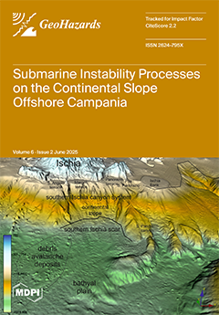
A revision of the submarine instability processes offshore the Campania region is presented herein. The areas covered include the chrono-stratigraphic framework of the submarine instability events and their correlation with seismicity, volcanism, and tectonic activity; the implementation of technologies and databases for the acquisition and processing of morpho-bathymetric, seismo-stratigraphic, and sedimentological data in the submarine slopes of Campania, characterized by submarine gravitational instabilities. The principles of slope stability have been revised: being independent from the slope height, in submarine slopes mainly composed of sands, the stability depends on the slope inclination angle with respect to the horizontal (β) being equal to or smaller than the internal friction angle of loose sand (ϕ). View this paper
- Issues are regarded as officially published after their release is announced to the table of contents alert mailing list.
- You may sign up for e-mail alerts to receive table of contents of newly released issues.
- PDF is the official format for papers published in both, html and pdf forms. To view the papers in pdf format, click on the "PDF Full-text" link, and use the free Adobe Reader to open them.
Previous Issue
Next Issue