Next Issue
Volume 8, August
Previous Issue
Volume 8, June


Climate, Volume 8, Issue 7 (July 2020) – 6 articles

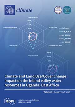
Cover Story (view full-size image): The impact of climate and land use/land cover (LULC) change continues to threaten water resources availability for agriculturally used inland valley wetlands and their catchments in East Africa. LULC management and climate change will individually cause changes in the water balance components of inland valleys. More pronounced changes are expected if the drivers are combined, although future LULC management will have a significant influence on the catchment hydrological processes. The adoption of functional landscape management approaches like conservation, slope conservation, and protection of the headwater catchment would reduce climate change impacts on the inland valley water resources, thus increasing the availability of water resources for human consumption and agricultural production in the inland valleys. View this paper.
  • Issues are regarded as officially published after their release is announced to the table of contents alert mailing list.
  • You may sign up for e-mail alerts to receive table of contents of newly released issues.
  • PDF is the official format for papers published in both, html and pdf forms. To view the papers in pdf format, click on the "PDF Full-text" link, and use the free Adobe Reader to open them.
Order results
Result details
Section
Select all
Export citation of selected articles as:
23 pages, 15657 KiB  
Article
Investigating the Role of Extreme Synoptic Patterns and Complex Topography During Two Heavy Rainfall Events in Crete in February 2019
by Konstantinos Lagouvardos, Stavros Dafis, Christos Giannaros, Athanassios Karagiannidis and Vassiliki Kotroni
Climate 2020, 8(7), 87; https://doi.org/10.3390/cli8070087 - 16 Jul 2020
Cited by 8 | Viewed by 4717
Abstract
During February 2019, two severe storms affected the island of Crete, located in south Greece. Both storms produced excessive rainfall, provoking severe damages, especially in the western part of Crete. The role of the prevailing synoptic patterns and the interaction of the flow [...] Read more.
During February 2019, two severe storms affected the island of Crete, located in south Greece. Both storms produced excessive rainfall, provoking severe damages, especially in the western part of Crete. The role of the prevailing synoptic patterns and the interaction of the flow with the high mountains of Crete were investigated. For this purpose, a variety of observational and numerical model data were exploited, including data from a dense rain gauge network, satellite imagery, and model analysis of various parameters describing the stability of the impinging flow. The first storm was a long-lasting event, with convective outbreaks embedded in a more stratiform rainfall pattern. The second storm was brief but mostly convection dominated. The analysis of the available data underlined the role of the low-level convergence upstream of the mountains during both storms, highlighting similarities and differences, as well as the role of the stability of the impinging flow. High soil moisture content was also evidenced as a key ingredient for the severe flooding that occurred during the second storm. This work complements similar studies on the role of Mediterranean islands and their topography on the spatial and temporal distribution of extreme rainfall. Full article
(This article belongs to the Special Issue Precipitation: Forecasting and Climate Projections)
Show Figures

Figure 1

11 pages, 1988 KiB  
Review
Climatology of the Mascarene High and Its Influence on Weather and Climate over Southern Africa
by Nkosinathi G. Xulu, Hector Chikoore, Mary-Jane M. Bopape and Nthaduleni S. Nethengwe
Climate 2020, 8(7), 86; https://doi.org/10.3390/cli8070086 - 07 Jul 2020
Cited by 38 | Viewed by 22004
Abstract
Globally, subtropical circulation in the lower troposphere is characterized by anticyclones over the oceans. Subtropical anticyclones locate over subtropical belts, modulating weather and climate patterns in those regions. The Mascarene High is an anticyclone located over the Southern Indian Ocean and has a [...] Read more.
Globally, subtropical circulation in the lower troposphere is characterized by anticyclones over the oceans. Subtropical anticyclones locate over subtropical belts, modulating weather and climate patterns in those regions. The Mascarene High is an anticyclone located over the Southern Indian Ocean and has a vital role in weather and climate variability over Southern Africa. The warm Western Indian Ocean is a major source of moisture for the subcontinent also permitting tropical cyclone genesis. In this study, we review the dynamics of the Mascarene High, its interactions with the ocean, and its impact on weather and climate over Southern Africa. We also review studies on the evolution of subtropical anticyclones in a future warmer climate. The links between SST modes over the Indian Ocean and the strengthening and weakening of the Mascarene High have been demonstrated. One important aspect is atmospheric blocking due to the Mascarene High, which leads to anomalous rainfall and temperature events over the subcontinent. Blocking leads to landfall of tropical cyclones and slow propagation of cut-off lows resulting in severe weather and flooding over the subcontinent. Understanding how expansion of the Mascarene High due to warming will alter trade winds and storm tracks and change the mean climate of Southern Africa is crucial. Full article
Show Figures

Figure 1

21 pages, 9353 KiB  
Article
Bias Correction of RCM Precipitation by TIN-Copula Method: A Case Study for Historical and Future Simulations in Cyprus
by Georgia Lazoglou, George Zittis, Christina Anagnostopoulou, Panos Hadjinicolaou and Jos Lelieveld
Climate 2020, 8(7), 85; https://doi.org/10.3390/cli8070085 - 04 Jul 2020
Cited by 7 | Viewed by 3448
Abstract
Numerical models are being used for the simulation of recent climate conditions as well as future projections. Due to the complexity of the Earth’s climate system and processes occurring at sub-grid scales, model results often diverge from the observed values. Different methods have [...] Read more.
Numerical models are being used for the simulation of recent climate conditions as well as future projections. Due to the complexity of the Earth’s climate system and processes occurring at sub-grid scales, model results often diverge from the observed values. Different methods have been developed to minimize such biases. In the present study, the recently introduced “triangular irregular networks (TIN)-Copula” method was used for the bias correction of modelled monthly total and extreme precipitation in Cyprus. The method was applied to a 15-year historical period and two future periods of the same duration. Precipitation time-series were derived from a 12-km resolution EURO-CORDEX regional climate simulation. The results show that the TIN-Copula method significantly reduces the positive biases between the model results and observations during the historical period of 1986–2000, for both total and extreme precipitation (>80%). However, the level of improvement differs temporally and spatially. For future periods, the model tends to project significantly higher total precipitation rates prior to bias correction, while for extremes the differences are smaller. The adjustments slightly affect the overall climate change signal, which tends to be enhanced after bias correction, especially for total precipitation and for the autumn period. Full article
(This article belongs to the Special Issue Precipitation: Forecasting and Climate Projections)
Show Figures

Figure 1

26 pages, 7045 KiB  
Article
Using the CHIRPS Dataset to Investigate Historical Changes in Precipitation Extremes in West Africa
by Didi Sacré Regis M., Ly Mouhamed, Kouadio Kouakou, Bichet Adeline, Diedhiou Arona, Coulibaly Houebagnon Saint. J., Kouadio Koffi Claude A., Coulibaly Talnan Jean H., Obahoundje Salomon and Savané Issiaka
Climate 2020, 8(7), 84; https://doi.org/10.3390/cli8070084 - 30 Jun 2020
Cited by 26 | Viewed by 5693
Abstract
This study aims to provide improved knowledge and evidence on current (1986–2015) climate variation based on six rainfall indices over five West African countries (Senegal, Niger, Burkina Faso, Ivory Coast, and Benin) using the Climate Hazards Group InfraRed Precipitation with Station (CHIRPS) dataset. [...] Read more.
This study aims to provide improved knowledge and evidence on current (1986–2015) climate variation based on six rainfall indices over five West African countries (Senegal, Niger, Burkina Faso, Ivory Coast, and Benin) using the Climate Hazards Group InfraRed Precipitation with Station (CHIRPS) dataset. On average, precipitation has increased over the central Sahel and the western Sahel. This increase is associated with increase in the number of rainy days, longer wet spells and shorter dry spells. Over the Guinea Coast, the slight increase in precipitation is associated with an increase in the intensity of rainfall with a shorter duration of wet spells. However, these mean changes in precipitation are not all statistically significant and uniform within a country. While previous studies are focused on regional and sub-regional scales, this study contributes to deliver a climate information at a country level that is more relevant for decision making and for policy makers, and to document climate-related risks within a country to feed impact studies in key sectors of the development, such as agriculture and water resources. Full article
Show Figures

Figure 1

27 pages, 4493 KiB  
Article
Impact of Climate and Land Use/Land Cover Change on the Water Resources of a Tropical Inland Valley Catchment in Uganda, East Africa
by Geofrey Gabiri, Bernd Diekkrüger, Kristian Näschen, Constanze Leemhuis, Roderick van der Linden, Jackson-Gilbert Mwanjalolo Majaliwa and Joy Apiyo Obando
Climate 2020, 8(7), 83; https://doi.org/10.3390/cli8070083 - 29 Jun 2020
Cited by 20 | Viewed by 5800
Abstract
The impact of climate and land use/land cover (LULC) change continues to threaten water resources availability for the agriculturally used inland valley wetlands and their catchments in East Africa. This study assessed climate and LULC change impacts on the hydrological processes of a [...] Read more.
The impact of climate and land use/land cover (LULC) change continues to threaten water resources availability for the agriculturally used inland valley wetlands and their catchments in East Africa. This study assessed climate and LULC change impacts on the hydrological processes of a tropical headwater inland valley catchment in Uganda. The hydrological model Soil and Water Assessment Tool (SWAT) was applied to analyze climate and LULC change impacts on the hydrological processes. An ensemble of six regional climate models (RCMs) from the Coordinated Regional Downscaling Experiment for two Representative Concentration Pathways (RCPs), RCP4.5 and RCP8.5, were used for climate change assessment for historical (1976–2005) and future climate (2021–2050). Four LULC scenarios defined as exploitation, total conservation, slope conservation, and protection of headwater catchment were considered. The results indicate an increase in precipitation by 7.4% and 21.8% of the annual averages in the future under RCP4.5 and RCP8.5, respectively. Future wet conditions are more pronounced in the short rainy season than in the long rainy season. Flooding intensity is likely to increase during the rainy season with low flows more pronounced in the dry season. Increases in future annual averages of water yield (29.0% and 42.7% under RCP4.5 and RCP8.5, respectively) and surface runoff (37.6% and 51.8% under RCP4.5 and RCP8.5, respectively) relative to the historical simulations are projected. LULC and climate change individually will cause changes in the inland valley hydrological processes, but more pronounced changes are expected if the drivers are combined, although LULC changes will have a dominant influence. Adoption of total conservation, slope conservation and protection of headwater catchment LULC scenarios will significantly reduce climate change impacts on water resources in the inland valley. Thus, if sustainable climate-smart management practices are adopted, the availability of water resources for human consumption and agricultural production will increase. Full article
(This article belongs to the Special Issue Climate Change and Water-Related Agricultural Risks)
Show Figures

Figure 1

26 pages, 2252 KiB  
Article
Willingness to Pay for Urban Heat Island Mitigation: A Case Study of Singapore
by Natalia Borzino, Samuel Chng, Muhammad Omer Mughal and Renate Schubert
Climate 2020, 8(7), 82; https://doi.org/10.3390/cli8070082 - 27 Jun 2020
Cited by 15 | Viewed by 8022
Abstract
In many countries, urban heat island (UHI) effects come along with urbanization in metropolitan areas. They have relevant adverse effects on the health and wellbeing of citizens. Singapore is strongly affected by UHI. In this study, we assess Singaporeans’ willingness to pay (WTP) [...] Read more.
In many countries, urban heat island (UHI) effects come along with urbanization in metropolitan areas. They have relevant adverse effects on the health and wellbeing of citizens. Singapore is strongly affected by UHI. In this study, we assess Singaporeans’ willingness to pay (WTP) for UHI mitigation by implementing a contingent valuation analysis. Specifically, we employ a double-bounded dichotomous survey design on a representative sample of 1822 online respondents. We find that Singaporeans are willing to sacrifice on average 0.43% of their annual income to mitigate UHI. The total WTP for mitigation strategies among Singapore citizens and permanent residents is estimated at SGD$783.08 million per year, the equivalent of USD$563.80 per year. Our findings suggest that there is a positive and significant relationship between the size of UHI effects and the citizens’ WTP. People living in the region with the highest intensity of UHI are willing to pay 3.09 times more than those living in the region with the lowest UHI intensity. Furthermore, demographic and socio-economic characteristics are significant determinants of Singaporeans’ WTP. The WTP increases with income and education but decreases with age. Students, men, and people with children are willing to pay more. Additional analyses show that the level of UHI awareness, positive attitudes towards UHI mitigation strategies as well as preferences for outdoor activities are positively correlated with the WTP. Our findings suggest that citizens are aware of the impacts of UHI and support UHI mitigation measures to be financed by their taxes. Policy interventions to promote UHI-related education and disseminating UHI-related information might increase the support of UHI mitigation policies. Full article
(This article belongs to the Special Issue Urban Heat Islands)
Show Figures

Figure 1

Previous Issue
Next Issue
Back to TopTop