

Agriculture, Volume 9, Issue 3 (March 2019) – 24 articles
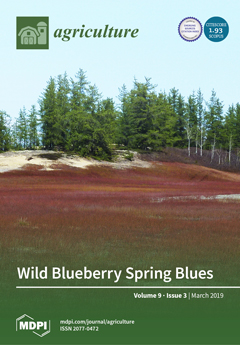
Cover Story (view full-size image):
Typical wild blueberry field in early spring from Northern Lac Saint-Jean (Saint-Eugène-D'Argentenay, Québec, Canada). Agricultural practices performed on wind-sensitive sand dunes can result in the development of unproductive areas marked by bare soils. Coupled with current practices, the application of apatite could lead blueberry landowners to rehabilitate such unproductive areas through increased glomalin-related soil protein deposition. View Paper here.
- Issues are regarded as officially published after their release is announced to the table of contents alert mailing list.
- You may sign up for e-mail alerts to receive table of contents of newly released issues.
- PDF is the official format for papers published in both, html and pdf forms. To view the papers in pdf format, click on the "PDF Full-text" link, and use the free Adobe Reader to open them.
Previous Issue
Next Issue