


Featured Application
A BIM-based digital twin of roads for operation and maintenance.
Abstract
The implementation of digital twin (DTw) in infrastructure management is becoming increasingly important. Although digitalization in the Architecture, Engineering, Construction, and Operations (AECO) sector is progressing slowly, enabling technologies such as Building Information Modelling (BIM), Geographic Information Systems (GIS), Internet of Things (IoT) and data management allow for more informed and efficient management of ageing and highly complex assets. With the aim of improving the operation and maintenance (O&M) of transport infrastructure, the use of an integrated BIM–GIS model is proposed as the basis for a future DTw for an existing highway, the M-30 urban ring road in Madrid. This study develops an as-built digital model based on real GIS data, point clouds and BIM (LOD 300), adapting it to existing management systems using a relational database with unique identifiers. The infrastructure is modelled in a segmented and georeferenced manner, incorporating roads, tunnels, bridges and equipment as independent entities. Access to the model is guaranteed through 3D GIS scenes, interactive panels and BIM viewers geared towards management. In addition, a cost–benefit analysis is carried out using a Return On Investment (ROI) that evaluates the implementation of BIM in the management of this infrastructure.
1. Introduction
The digital transformation of the Architecture, Engineering, Construction, and Operations (AECO) sector is progressing, although at a slower pace than expected [1,2,3,4]. This process is driven by data-enabled enabling technologies such as the Internet of Things (IoT) [5], collaborative common data environments (CDE) [6], a cloud-based management platform [7] or more recently, the use of Artificial Intelligence algorithms (AI) [8,9]. These enabling technologies are redefining asset and utility management. Therefore, it is essential to explore how these tools can be applied in an integrated and effective approach to the Operation and Maintenance (O&M) of transportation infrastructure [7], towards more informed and higher-quality decision-making. However, the digitization of the AECO sector continues to lag significantly behind other sectors [10]. The enabling technology for the AECO sector is Building Information Modelling (BIM). This technology has at times been relegated to the design and construction phases in the building sector. However, its use encompasses all phases of an asset’s life cycle of the infrastructure [11].
An ageing infrastructure stock in developed economies [12], the rational use of available resources is essential, wherever higher standards of quality and service are increasingly demanded. All this information and Communication Technologies (ICTs) facilitate a greater information level, from an increase in the capture of the real environment to its transformation into useful information [13]. Therefore, BIM and all the above must play a key role in the O&M of civil infrastructure. On the other hand, some of these transport infrastructures, such as ports, roads, or urban environments, have been managed using Geographic Information Systems (GIS); therefore, BIM–GIS integration is becoming increasingly relevant [7,14,15,16]. This is the basis for building a digital twin (DTw) that combines the geometric and semantic representation of the built environment in a virtual model [17,18,19]. According to ISO/IEC 30173, a DTw is defined as a digital representation of a physical entity that enables convergence between the physical and digital states throughout the asset lifecycle [20]. However, implementing BIM entails certain costs, such as software licences, qualified professionals and training for other project stakeholders, and the production of the digital model itself [21]. Thus, the question arises as to whether investing in the adoption of BIM in the management of existing infrastructure has a positive impact on consolidated O&M.
Despite the growing literature on the use of BIM, GIS and DTw concepts in infrastructure management, most previous studies have focused on the design and construction phases or on pilot-scale applications. In contrast, this research addresses the digitalisation of an existing road infrastructure on a large scale under real operating conditions. The novelty of this work lies in the development of a management-oriented BIM–GIS integration workflow, specifically tailored to legacy infrastructure environments, where data fragmentation, long-term maintenance requirements and organisational constraints represent some of the key challenges. This study contributes to the state of the art by:
- Proposing a structured process for transforming existing GIS-based inventories into a semantically rich BIM model linked to a relational asset DB.
- Ensuring interoperability using open standards and unique identification strategies compatible with current management systems.
- Demonstrating the feasibility of segmenting and georeferencing complex infrastructure assets to enable scalable digital modelling.
- Incorporating a preliminary economic assessment focused on the O&M phase.
This last point stands out due to the limited number of real cases published in the literature. These contributions provide a practical and transferable framework to support the progressive implementation of DTw environments capable of supporting long-term infrastructure resilience and performance optimisation. To this end, a real case study will be used: the M-30 Madrid urban ring road.
2. Motivation and Methodology
Society demands higher standards of quality and safety in its transport infrastructure. With ageing civil infrastructure in developed countries, its management requires high operational costs. Despite the growing adoption of digital technologies in infrastructure management, current asset management systems remain largely fragmented and rely on heterogeneous and unconnected data sources [22,23]. This fragmentation limits data interoperability, reduces traceability throughout the asset lifecycle, and limits the implementation of data-driven decision-making approaches. Furthermore, existing GIS environments often lack the semantic and parametric richness needed to support advanced lifecycle management [24] and predictive maintenance strategies.
This is the case of the M-30 urban ring highway in Madrid (Spain), with nearly 488 million users per year along its more than 200 km of roadways, 48 km of which are tunnel sections [25]. The M-30 road has been managed through an integrated maintenance contract that has ensured high standards of quality and service. In a continuous quest for constant improvement in its management, the idea arose to implement measures focused on digitisation through the construction of a DTw. This road is managed using GIS tools and a monitoring and control system. This system includes more than 400 status and service indicators, or Key Performance Indicators (KPIs), covering all asset categories such as structures, pavements, road equipment, and tunnel facilities.
The BIM methodology has demonstrated strong performance throughout all phases of the life cycle of the infrastructure, with an increasing number of case studies during the O&M phase [7,26,27]. For this reason, the development of a digital model of this road in BIM was proposed, using real inventory data following a BIM–GIS integration process. This BIM–GIS integration is achieved by linking digital models developed in BIM based on the 2D GIS data layers used in the current inventory. These digitalised models are semantically enriched from the spatial dataset and relational databases with the KPIs used in the management of this infrastructure. The union of both environments, geometric and semantic, is achieved in a 3D GIS scene.
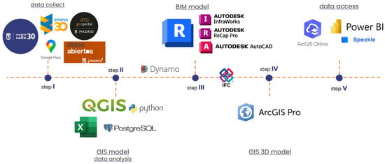
Section 3 addresses the most relevant aspects of this process, identifying three key points that ensure the development of the DTw, plus an assessment in Section 3.5 on its implementation. These key aspects have been the organisation of the information necessary for the management of existing infrastructure, which can be summarised as the creation of a relational database. This is based on the spatial data currently used in the management of this road. Next, the BIM digital model is constructed from this spatial data. Finally, the geometric and semantic model is exported to a management platform that guarantees access to and visualisation of the digital model in a user-friendly environment focused on infrastructure management. Figure 1 summarises this process and the main applications used. The main software tools used in this study together with their corresponding versions, are specified in Appendix A.
Figure 1.
Research outline.
This digital model was developed using mid-range hardware tools and widely adopted tools under educational licences. One of the key premises of digital transformation is information exchange. Therefore, this research has assumed interoperability through the standardised BIM format, the Industry Foundation Classes (IFC), together with the use of an external database that ensures that all management information remains linked and continuously updated. Consequently, the development of the digital model is independent of the application used.
Therefore, the proposed research methodology combines qualitative and quantitative components. The qualitative component is based on the analysis and development of workflows for the integration of heterogeneous data sources, including legacy GIS inventories, point clouds, and relational asset management databases, using BIM modelling processes. This component focuses on defining procedures for structuring this data, interoperability, and the accessibility of digital models for O&M activities. The quantitative component is developed through an economic evaluation of BIM adoption using a cost–benefit analysis based on Return On Investment (ROI). This evaluation estimates the implementation costs and potential operational benefits derived from the digitisation of infrastructure management processes.
The research, therefore, takes a predominantly inductive approach, drawing conclusions from the implementation and analysis of a real digitisation process for this specific infrastructure. The methodology is structured in three main stages:
- Organisation and structuring of management data.
- Development of the geometric and semantic BIM model integrated with GIS data sets.
- Deployment of visualisation and management environments that allow access to the digital model and associated operational data.
3. Building the Digital Twin of a Road
The development of any DTw must address several key aspects related to data management. First, the organisation and structure of information, from data capture in the real environment to its processing and transformation into useful information. Secondly, the development of the virtual representation of the asset. And finally, making the model useful by ensuring its accessibility and integration into the infrastructure management system. Consequently, when approaching the development of a digital model of an existing infrastructure, some preliminary issues must be considered. Table 1 summarises some of these preliminary issues.
Table 1.
Issues to consider before embarking on the development of a digital twin.
The following subsections address these issues by responding to the key aspects identified for this case study.
3.1. Road Overview
The M-30 is the Spanish capital’s first high-capacity ring road. This ring road connects with the main radial highways. It is a road that mainly consists of two three-lane carriageways, although up to 21 lanes run parallel to each other in order to cope with the volume of traffic. All of its carriageways, including branches, total more than 200 kilometres in length. This highway takes on various configurations, from motorway sections to urban sections, including 48 km of tunnels. In addition, to provide service and continuity to traffic within the city, the infrastructure has 84 bridges and 16 footbridges under direct management.
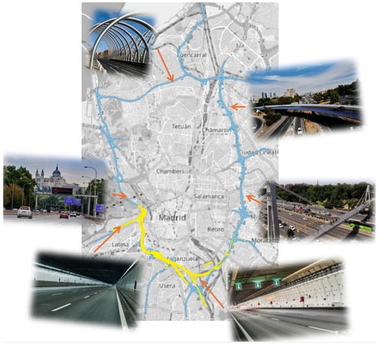
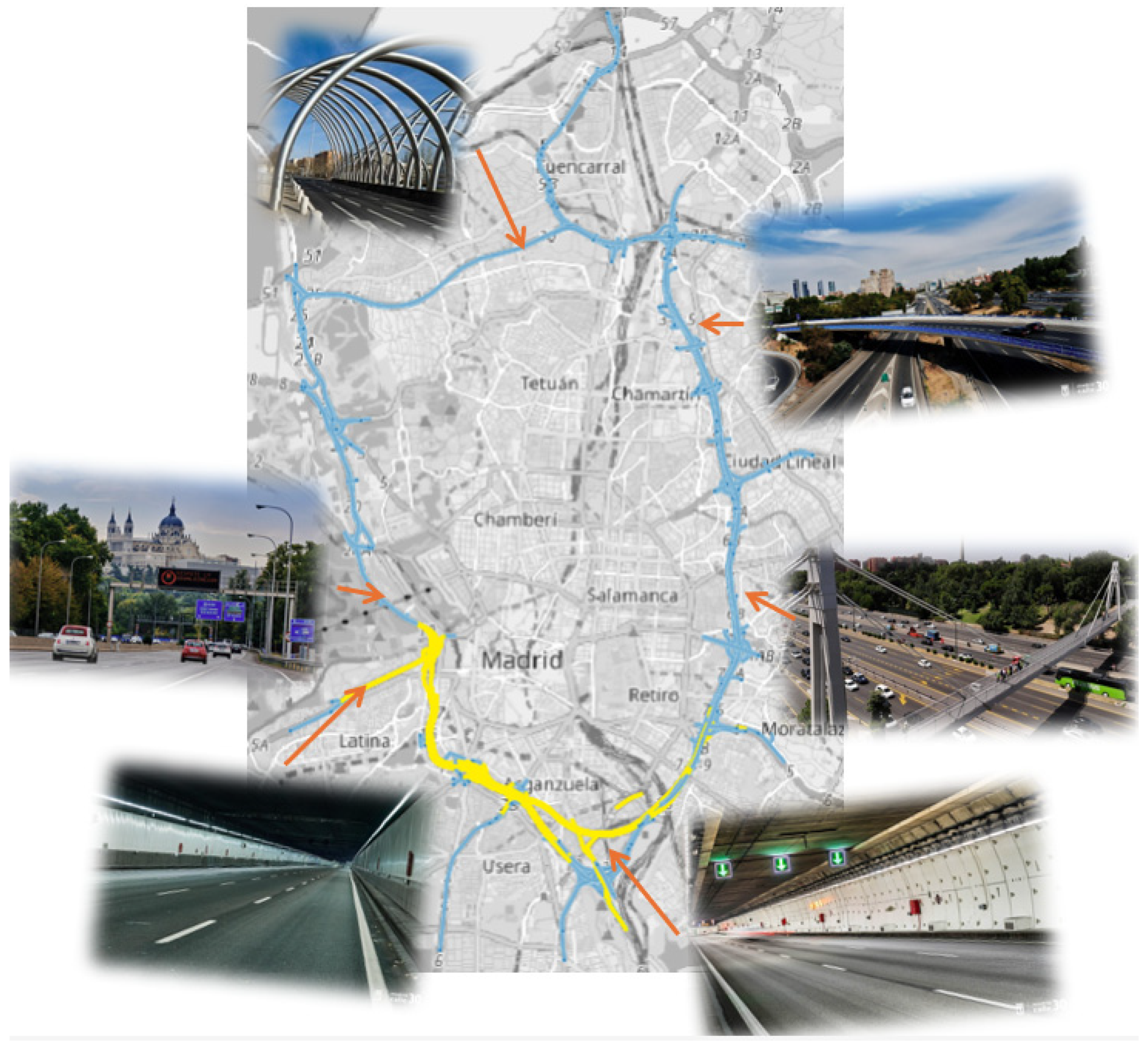
Other noteworthy numbers include more than 3000 road signs, 5000 luminaires, 93,000 linear metres of gutters, 100,000 rigid barriers and 140,000 flexible barriers, as well as more than 200 emergency exits, 100,000 metres of fire protection pipes, and the same number of fibre optic cables, 900 fans, and 53,000 lighting screens in tunnels. All this road equipment and tunnel facilities must form part of the digital model as independent entities. Figure 2 shows the footprint of the M-30 on the city of Madrid, with the tunnels highlighted in yellow.
Figure 2.
Overview of the M-30 ring road in Madrid [28] (Photos adapted from Madrid Calle 30).
3.2. The Management-Oriented Database
The management of a road such as the M-30 is carried out by monitoring and controlling KPIs that assess the condition of each of the elements that make up the road. In addition, the inventory is carried out using GIS tools. All this information is stored in a large relational database in which each of the entities is identified by a unique alphanumeric code or ID following the linear reference of the road. This ID is the primary key of the relational database. The current coding has been adopted, with new codes having to be generated for those entities that were not previously inventoried.
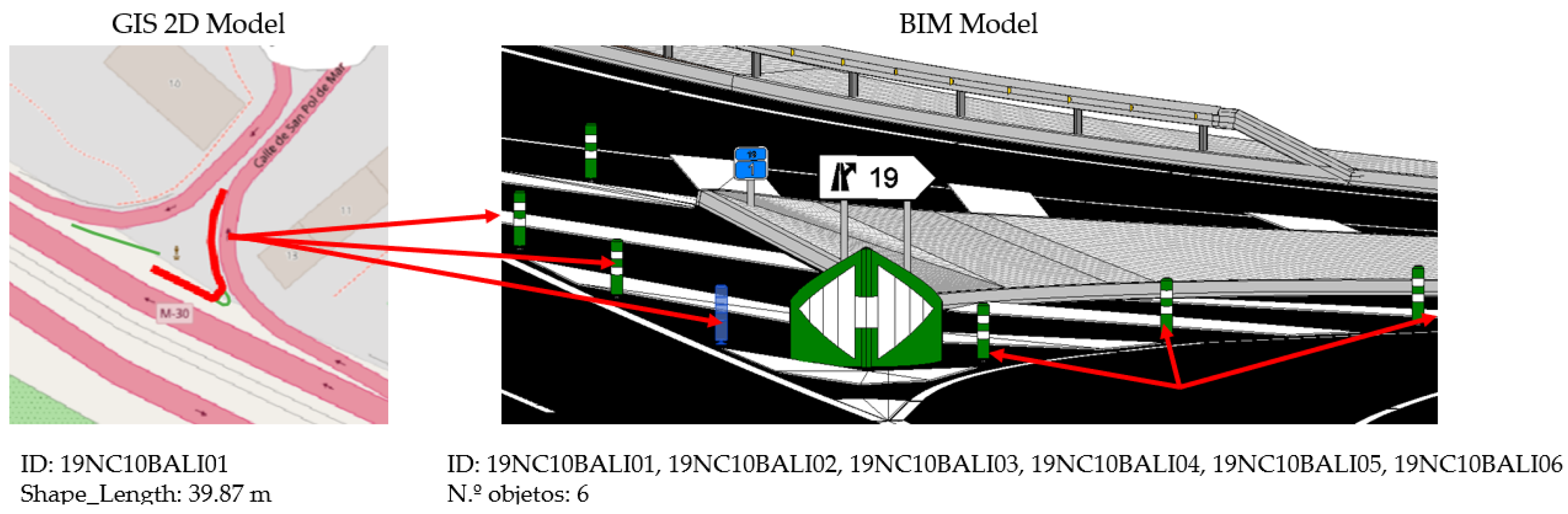
To ensure the adoption of BIM methodology in road management, it must be adapted to the existing database. This allows for secure migration between the current data model and the proposed model. However, there are some aspects to consider. Firstly, the geometric model of the data increases considerably in detail, both due to the accuracy of the model (macro scale of GIS versus micro scale of BIM) and the segregation of some elements. In other words, some families represented by simple line or polygon symbology in a 2D GIS layer become individual entities in the BIM model. Therefore, it is necessary to scale the relational database vertically. Similarly, the hierarchical structure of the BIM model (category, family, type, element) generates a new definition in the organisation of entities compared to the layered structure of the 2D GIS model. Therefore, it is also necessary to scale the database horizontally. Figure 3 shows the increase in data between the representation as a line in 2D GIS and the representation by individual elements of the BIM model.
Figure 3.
GIS representation vs. BIM model representation.
On the other hand, establishing all relationships within the database and between the semantic data model and the geometric model is essential. The unique identification codes that define each entity in the geometric model must be added as attributes in the database, which will function as foreign keys within the organisational structure of the database. These codes are generated automatically in the modelling applications. However, for this case study, duplicates were detected in the keys generated for the geometric model in the BIM standard, the IFC. In other words, the same IFC-GUID code was generated for different entities. Therefore, before linking the current database, it is necessary to debug these codes to maintain the principle of unique identification in the relational database.
3.3. Geometric Model
The construction of a geometric model for a large-scale infrastructure such as an urban ring road faces several challenges. First, the processing capacity of the resources used. For this reason, this case study opted to segment the infrastructure into sections, generating the models independently. To ensure their subsequent joining, each model must be correctly georeferenced. In this case, the official ETRS 89 Cartesian Coordinate Reference System (CRS) used in Spain was employed. Most of the source data, mainly spatial data in GIS layers, were in this CRS.
It should be noted that each of the structures that cross the road and allow movement and reduce the barrier effect of the road in the city is treated independently. Therefore, a model has been developed for each bridge or footbridge to enable individualised management.
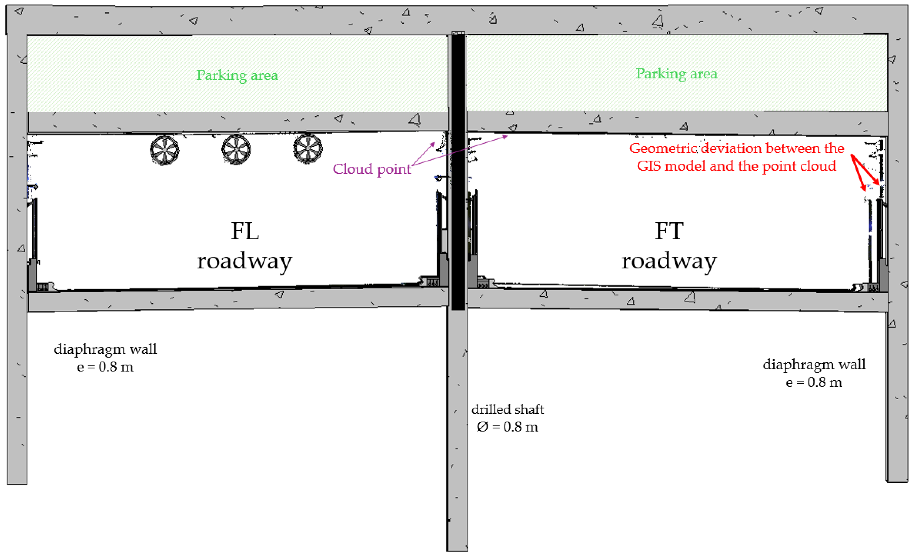
These models were developed automatically based on the XYZ coordinates of each piece of road equipment [29] and using object-based visual programming [30]. These models have been generated with a BIM Level of Development (LOD) 300. However, the accuracy of the 2D GIS layers is not sufficient for their correct placement, requiring some manual corrections to be made. Automated processes include coordinate-based placement of road equipment, rule-based generation of parametric families, and batch assignment of attributes through visual programming. Manual corrections were required mainly in areas affected by geometric inaccuracies in legacy GIS layers, both in the XY plane and in Z altitude. These inaccuracies have affected most of the modelled point elements. Additionally, point clouds have also been made available, both from inside and outside the tunnels. Using a Point Cloud to BIM process, the as-built models developed have taken a qualitative leap forward, becoming more realistic and improving the location of each element, especially the Z coordinate. This has improved the understanding of relevant data, such as the depth of the tunnels, and enabled the obtaining of longitudinal and transverse profiles of the road. Figure 4 shows a section of the BIM model of the tunnel.
Figure 4.
Digital model section of the tunnel.
For the construction of all these models, a large library has been developed with all the parametric families representing all the road equipment on the surface and part of the installations in the tunnels, making it necessary to delve deeper into the installation system of the latter.
3.4. Access and Visualisation of the Digital Model
The final step is to guarantee access to information. On the one hand, the use of modelling applications is one of the typical limitations of BIM due to the lack of staff training in this area. Furthermore, the performance of these applications can be exceeded for massive models such as this one. This performance can be achieved using 3D GIS scenes, where each of the developed models can be assembled and all the information updated at any given time can be linked following the relationships in the DB.
These scenes have been generated from BIM models exported to the IFC 4×3 standard [31], which then had to be converted to a format for 3D GIS objects. In this case, the SLPK standard [32] was used, which maintains the class structure of the IFC format. The use of the IFC standard and relational DB allows us to have all the information available on a detailed BIM model. This model, in turn, improves the degree of atomicity of the 3D model compared to the 2D GIS layered model, facilitating a direct link between the geometric models and the maintenance management system. Furthermore, the integration of the BIM model into the 3D GIS scene gives us a global view of the entire infrastructure as a whole and its surroundings. The proposed integration goes beyond data coexistence and enables semantic and relational interoperability between asset models and spatial DB. This integration allows us to better analyse the infrastructure itself and how it relates to the rest of the facilities in the city. Moreover, these GIS scenes are optimised and provide an overview of the infrastructure in its environment, facilitating performance and access from any connected device.
On the other hand, the objective must be to improve infrastructure management. Information panels are becoming increasingly important, allowing interaction with data and transforming it into useful information. For this research, panels have been developed that include BIM viewers that allow information about the 3D object to be visualised. This is possible because all the information is related by these foreign keys and the primary key of the DB, allowing all the updated information to be linked to the geometric model.
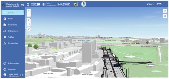
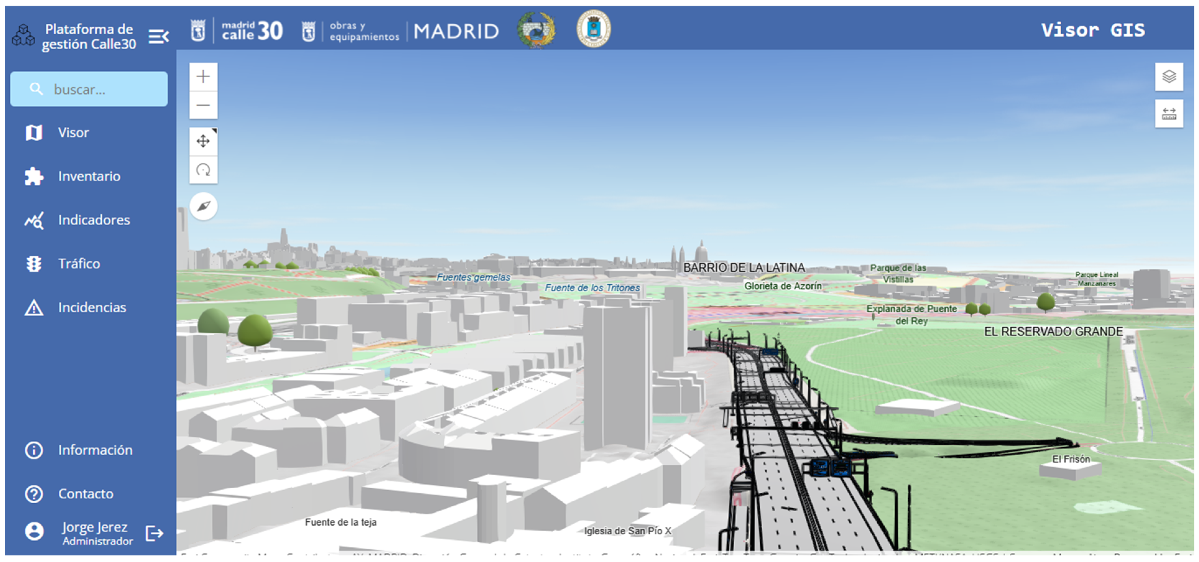
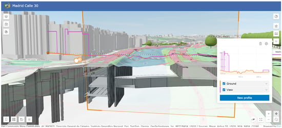
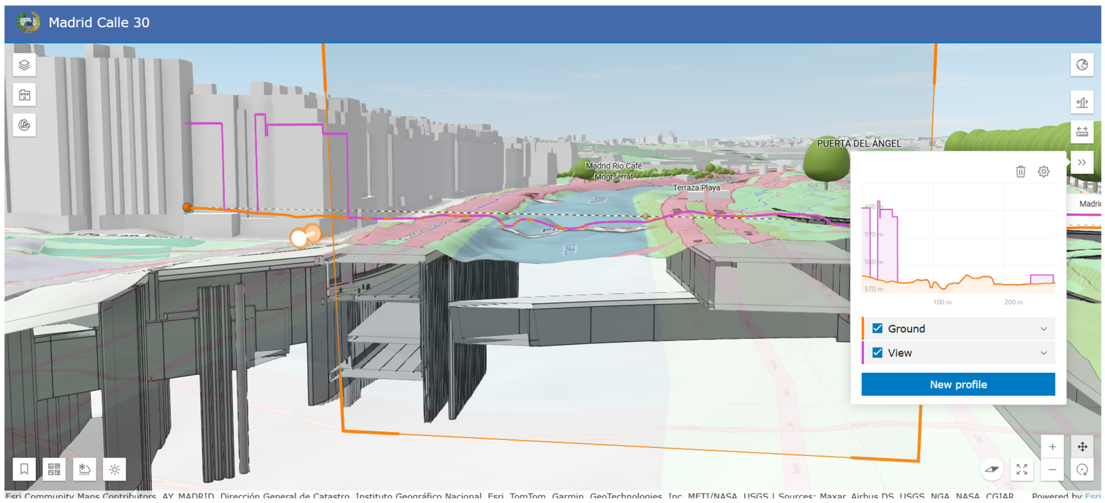
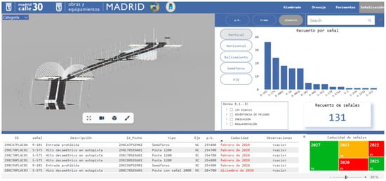
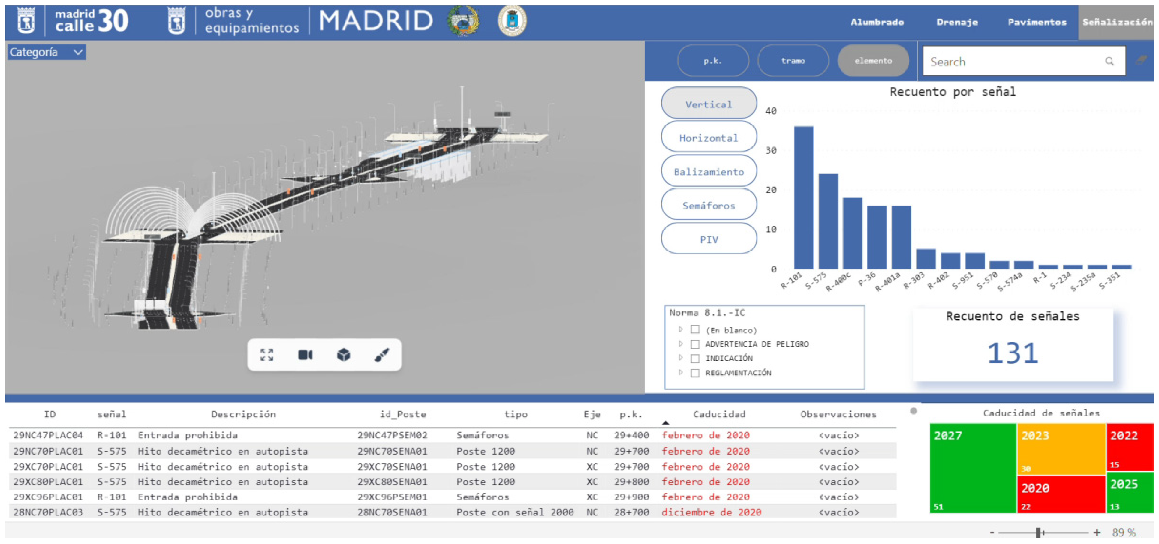
Finally, both GIS 3D scenes and information panels can be handled independently in native applications, or you can develop your own online applications that meet the requirements for each project. The adoption of one technology or the other will depend on the maturity of the project. The following figures show screenshots of the application generated for road management. Figure 5 shows a screenshot of the 3D GIS scene from the management application. Figure 6 shows a screenshot of the maintenance application with one of the basic tools of the 3D GIS scene, the section box, and the obtaining of profiles in the BIM model of the road. Figure 7 shows the interactive dashboard of the maintenance application dedicated to the management of vertical road sign conditions.
Figure 5.
Screenshot of the 3D GIS scene from the management application.
Figure 6.
A screenshot of the maintenance application with basic tools of the 3D GIS scene.
Figure 7.
A screenshot of the maintenance application with the dashboard.
3.5. Cost–Benefit Analysis
The AECO sector is slowly moving towards digitalisation, but it is worth asking how much infrastructure management improves qualitatively and quantitatively after the implementation of these new technologies. Regarding the adoption of BIM, some authors point to certain benefits measured by percentage ranges, including some intangible benefits [21,33]. In this regard, the European Commission, in its drive for the digital transformation of the AECO sector, launched a tool to evaluate the performance of BIM methodology adoption in public procurement [34]. The use of this tool for an existing infrastructure such as the M-30 returns positive results, with a benefit–cost ratio B/C around 4.
The research has proposed a slightly more accurate analysis using ROI. In the case of costs, the following costs have been calculated, which are summarised in Table 2:
Table 2.
Cost estimate for adopting BIM on the M-30 ring road.
- BIM project personnel costs. The current management of the road has sufficient employees, so only a team of two people has been considered, including a BIM Manager and a BIM Modeller who will be responsible for the strict maintenance of the BIM digital model.
- Software costs. The costs associated with the annual licence for BIM tools have been considered. However, the current road management already has a CDE, so it is not considered necessary to provide a new one.
- Costs of an external audit related to training the rest of the staff, drafting the associated technical documentation, and quality control of the final deliverables.
- Modelling costs. These costs have been estimated for the generation of an as-built LOD 300 model of the entire road, including bridges and tunnel sections. A price of 10,000.00 € per kilometre of modelled road has been considered. The sum of all roadways, including service roads and branches, exceeds 200 kilometres in length.
In terms of benefits, most publications focus on quantifying them as percentages. In many studies, the adoption of BIM has been surveyed in the design and construction phases, with many studies focusing on these phases and, therefore, the estimates suggested. As for the O&M phase, some studies point to high percentage ranges, between 21% and 40% for asset maintenance over asset operating costs, or between 1% and 20% in construction work costs [33]. These values are aligned with reported ranges in infrastructure digitalisation and predictive maintenance literature, although their validation requires long-term empirical monitoring.
The maintenance budget for the M-30 amounts to more than €30 Million dedicated solely to the maintenance and upkeep of the motorway. Other relevant items can be added to this budget, such as personnel and the availability of own resources for management or motorway renovation and refurbishment projects. This budget varies from year to year but usually adds another €10 Million annually. Detailed information on operating costs is limited by the confidentiality restrictions imposed by road operators. With these figures, the benefits of BIM in this case study have been estimated at the lower limit of the percentage ranges mentioned above. Table 3 shows the estimated benefits.
Table 3.
Estimated benefits of adopting BIM on the M-30 ring road.
The expected ROI is calculated as follows:
This represents a positive result, although it is lower than that obtained by the European Commission tool, which estimates higher benefits. However, these results deserve more thorough discussion. The costs must be reviewed with a more specific assessment, while the benefits deserve critical reflection on the added value that BIM methodology can bring.
From a financial perspective, the present analysis has focused on a simplified cost–benefit framework aimed at providing an initial estimation of potential economic value. However, due to the exploratory nature of the study and the current lack of long-term operational data, advanced financial indicators such as Net Present Value (NPV) and Internal Rate of Return (IRR) have not been calculated. Future work will focus on incorporating these metrics once sufficient empirical performance and cost data become available, enabling a more robust economic evaluation.
4. Discussion
Despite growing interest in DTw applications in the AECO sector, most existing research has focused on conceptual frameworks or pilot-scale implementations in newly designed buildings and infrastructure. For example, studies such as those by Pan & Zhang [11] and Ammar et al. [17] propose advanced DTw architectures but are primarily oriented towards project management or smart building environments. Similarly, the work of Nour El-Din et al. [18] highlights the role of BIM standards in DTw development but does not address the challenges associated with legacy infrastructure systems. In the field of road infrastructure, previous research has explored BIM–GIS integration and data modelling techniques. However, these approaches are often limited to isolated components or experimental test beds and rarely consider actual operational constraints, long-term asset management, or the integration of legacy relational DB.
This study contributes to the state of the art by developing an advanced digital model-oriented framework for large-scale existing road infrastructures under real O&M conditions. Unlike previous work, the proposed approach is not limited to geometric or semantic modelling, but is structured around asset management requirements, ensuring interoperability between BIM, GIS and existing management systems through unique identification strategies in relational DB. Furthermore, this research demonstrates a scalable segmentation and georeferencing strategy for modelling complex infrastructure environments, enabling progressive digitisation in line with organisational and technological maturity. In this context, the model proposed in this research represents an initial stage of implementation of a DTw for existing road infrastructure. The BIM–GIS framework developed establishes a structured and interoperable digital representation, linked to a database of operational assets, which allows for the continuous updating of semantic information. Although real-time data integration via IoT devices has not yet been incorporated, the proposed system provides the necessary foundations for future bidirectional data exchange and dynamic monitoring of infrastructure performance.
First, this case study has demonstrated the possibility of developing a digital as-built model of a complex existing infrastructure. A BIM–GIS integration process supported by point clouds was followed. The use of point clouds has made it possible to compensate for the lack of detail in the current model, which is based on 2D GIS layers. The proposed model has been designed to adapt to current management practices. It makes use of all available information and codifies digital elements according to the unique identification system used in the existing asset management platform. In this way, the new digital model, both its geometric environment and the BIM processes, is subordinated to the current management of the road, making it operational from the outset.
It should be noted that the terminology used in this work—LOD 300—refers exclusively to the geometric model and its associated information. However, in line with the terminology of ISO 7817-1 [35], LOIN defines the exact, necessary and proportionate data (geometric, alphanumeric and documentary) required for BIM elements at specific project milestones. In this case study, the implementation of BIM followed the principles of structured information management, aligned with ISO 19650 [36]. The main requirements included organisational, asset and exchange information needs, ensuring traceability, interoperability and asset management geared towards the O&M phase. Priority was given to the unique identification of assets, their geolocation, standardised classification, technical and functional attributes, intervention history and links to associated documentation (manuals, technical data sheets, inspection reports and maintenance procedures). The model was also structured to facilitate integration with GISs and the current DB used in the management of this road.
The use of the BIM model in the IFC standard can lead to some loss of information. On the one hand, the class structure is still closely linked to building construction, and although the most recent version (IFC 4x3) includes some specific classes for civil engineering, most road equipment does not have a defined class and must be adapted to one of the predefined classes. Similarly, information relevant to management, such as status indicators, is not defined within the parameters of its rigid class structure. For this case study, all information is stored externally in the DB and linked by secondary keys that establish the relationship between the semantic model and the geometric model, so there is no loss of information. This allows, firstly, all the information used in current management to be migrated from the GIS model to the BIM model and, secondly, all the information to be kept available and up to date. This data is variable over time, unlike the geometric model, which will remain unchanged unless there are major renovations to the infrastructure. In this sense, the construction of a digital model based on BIM–GIS integration is possible. In addition, implementation costs have been reduced thanks to the reuse of spatial data used by the current management system.
The implementation of the proposed BIM–GIS framework enables significant qualitative improvements in several O&M workflows. Although fully monitored quantitative performance indicators are not yet available, a structured comparison between traditional and digital approaches has been carried out based on current management practices and pilot implementation experience. Table 4 summarises the main expected improvements in terms of efficiency, traceability, and decision support.
Table 4.
Comparative analysis of traditional and BIM–GIS-based workflows for O&M tasks.
The adoption of BIM methodology in an existing organisation, such as a road administration, must address several challenges, such as staff training, the creation of secure collaboration processes and environments, and the development of the as-built model. In this case study, an estimate of this investment has been made. To this end, a conservative approach has been taken, maximising costs and minimising expected returns, with positive results. In terms of costs, this case study has addressed the creation of several sections of the road based on available data and with limited resources, obtaining acceptable results for the management of this road. Consequently, a drastic reduction in modelling costs is foreseeable. In terms of benefits, the management of the M-30 operates with a high maintenance budget, so the expected benefits, calculated as a percentage of this budget, are also high. However, this road has been maintained to high standards of quality and service, so the potential added value provided by the BIM methodology should be assessed more thoroughly.
However, aside from the potential advantages presented by this proposed BIM–GIS digital model, the case study presented has some limitations. Firstly, the evaluation of the proposed approach is based mainly on a qualitative assessment of improvements in workflow and accessibility to information. At the time of writing, the digital model is in the implementation and consolidation phase within the road management organisation, which has limited the availability of quantitative performance indicators related to time savings, error reduction or productivity gains in specific O&M tasks. Secondly, the complexity and scale of the M-30 infrastructure, together with the heterogeneity of the GIS data, have influenced the level of automation achievable during the modelling process, requiring manual corrections in some cases. These aspects may affect the generalisation of the results to other infrastructures with different levels of data maturity or management practices.
Finally, the cost–benefit analysis presented should be interpreted as a preliminary estimate based on conservative assumptions and industry benchmarks. This approach reflects the early stage of maturity of digital twin-oriented asset management in road infrastructure, where long-term empirical data sets are still limited. Future work will focus on collecting empirical performance data over extended operational periods, which will enable a more rigorous quantitative validation of the benefits associated with adopting BIM–GIS integration for the O&M of this infrastructure. In this regard, the potential uses of the digital model, which forms the basis of a foundation for DTw of the road, play a fundamental role. These uses can range from basic applications, such as a three-dimensional inventory, to more advanced uses, such as work simulation or the training of operators and emergency services, which are essential in an infrastructure such as this with so many tunnel sections and facilities. The BIM model is more detailed than the 2D GIS model, allowing the extraction of the Z coordinate in the event of flooding or the depth of tunnels and their relationship with other city infrastructures and services.
According to ISO/IEC 30173 [20], a fully functional DTw requires real-time data acquisition, automated synchronisation, and closed feedback loops that enable predictive and prescriptive decision-making. The system presented in this study does not yet incorporate these capabilities. However, it represents an initial step towards the implementation of this DTw, providing a semantically structured and interoperable advanced digital model that enables the future integration of real-time monitoring, predictive analysis and simulation-based control. This phased approach is consistent with the progressive digital transformation strategies described in the literature [19], where integrated information models are considered a prerequisite for advanced DTw environments.
Beyond technological integration, the successful implementation of an integrated BIM–GIS model, the basis of DTw, also depends on the preparedness of the infrastructure manager. This includes staff training, digital skills development, process re-engineering, and stakeholder alignment throughout the asset lifecycle. Cultural resistance to change and the lack of clear governance frameworks remain significant obstacles to digital transformation. Therefore, future implementation strategies must consider not only technological aspects but also change management and institutional capacity building.
5. Conclusions and Future Research
The O&M of infrastructure requires high operating costs. In an economic context characterised by scarce resources, ageing infrastructure and greater societal demands for quality and service standards, it is essential to optimise available resources. In this regard, digital transformation provides a greater level of knowledge about the state of the infrastructure. BIM is the enabling technology for the AECO sector. However, for effective implementation in the O&M phase, BIM is accompanied by other data-based technologies. BIM–GIS integration is one such technology, providing the level of detail and organisation of BIM methodology processes and the performance and collaboration of GIS. This case study addresses the creation of a digital model based on BIM–GIS integration for a complex infrastructure, the M-30 highway. It also provides an economic assessment of its implementation, calculating the costs and estimating the benefits. In this case, a positive ROI is obtained. Public administrations must continue to commit to introducing these new technologies into infrastructure management, as a positive return is expected both economically and in terms of their impact on society.
In this regard, although this study is based on a specific infrastructure, the M-30, the proposed workflow was designed with a modular and transferable structure. The main components of the framework—including BIM–GIS semantic integration, database structuring, asset classification, and lifecycle information management—are generic and can be adapted to other large-scale transport infrastructures. However, some elements, such as organisational workflows, regulatory requirements and legacy information systems, are context-dependent. These factors influence the implementation strategy and the level of automation that can be achieved. Therefore, while the methodological framework is transferable, its implementation requires adaptation to the operational, institutional and technological conditions specific to each infrastructure.
Finally, future research will focus on the progressive evolution of the proposed framework. The advanced BIM–GIS digital model will thus be developed into a fully operational DTw through the integration of real-time IoT data monitoring and the current management system. The performance of process re-engineering and change management within the organisation will also need to be evaluated. In addition, future work will seek to validate the expected benefits through empirical long-term performance indicators, advanced economic metrics such as NPV and IRR, and the development of predictive maintenance capabilities to support decision-making.
Author Contributions
Conceptualization, J.J.C. and M.G.A.; methodology, J.J.C. and M.G.A.; software, J.J.C. and M.G.A.; validation, J.J.C. and M.G.A.; formal analysis, J.J.C. and M.G.A.; investigation J.J.C. and M.G.A.; resources, J.J.C. and M.G.A.; data curation, J.J.C. and M.G.A.; writing—original draft preparation, J.J.C.; writing—review and editing, M.G.A.; visualisation, J.J.C. and M.G.A.; supervision, M.G.A.; project administration, M.G.A.; funding acquisition, M.G.A. All authors have read and agreed to the published version of the manuscript.
Funding
Enterprise University Chair Madrid Calle30-UPM and Ministry of Economy, Industry and Competitiveness of Spain by means of the Research Fund Project PID2024-159695OB-C21.
Institutional Review Board Statement
Not applicable.
Informed Consent Statement
Not applicable.
Data Availability Statement
The original contributions presented in the study are included in the article, further inquiries can be directed to the corresponding author.
Conflicts of Interest
The authors declare no conflict of interest.
Abbreviations
The following abbreviations are used in this manuscript:
| AECO | Architecture, Engineering, Construction, and Operations |
| AI | Artificial Intelligence |
| BIM | Building Information Modelling |
| CDE | Common Data Environment |
| CRS | Coordinate Reference System |
| DTw | Digital Twin |
| GIS | Geographic Information Systems |
| ICT | Information and Communication Technology |
| IFC | Industry Foundation Classes |
| IoT | Internet of Things |
| KPI | Key Performance Indicator |
| LOD | Level Of Development |
| LOIN | Level Of Information Need |
| O&M | Operation and Maintenance |
| ROI | Return On Investment |
Appendix A
Appendix A lists the main software tools used in this study together with their corresponding versions. This information is provided to ensure transparency and to facilitate the reproducibility of the proposed BIM–GIS integration workflow.
Table A1.
Main software used and its version.
References
- Dou, Y.; Li, T.; Li, L.; Zhang, Y.; Li, Z. Tracking the Research on Ten Emerging Digital Technologies in the AECO Industry. J. Constr. Eng. Manag. 2023, 149, 03123003. [Google Scholar] [CrossRef] [Scilit]
- Nyqvist, R.; Peltokorpi, A.; Lavikka, R.; Ainamo, A. Building the digital age: Management of digital transformation in the construction industry. Constr. Manag. Econ. 2025, 43, 262–283. [Google Scholar] [CrossRef] [Scilit]
- Hallén, K.O.; Forsman, M.; Eriksson, A. Which Aspects of Leadership Are Associated with Trustful Use of BIM and Other Digital Technologies in Construction? Buildings 2025, 15, 1670. [Google Scholar] [CrossRef] [Scilit]
- European Commission. Digitalisation in the Construction Sector; European Commission: Brussels, Belgium, 2021.
- Tang, S.; Shelden, D.R.; Eastman, C.M.; Pishdad-Bozorgi, P.; Gao, X. A review of building information modeling (BIM) and the internet of things (IoT) devices integration: Present status and future trends. Autom. Constr. 2019, 101, 127–139. [Google Scholar] [CrossRef] [Scilit]
- Chang, Z. Development of a Collaborative Design Platform Based on Bim (Building Information Modeling) and Cloud Computing. In Proceedings of the 2025 IEEE International Conference on Electronics, Energy Systems and Power Engineering, EESPE 2025, Hangzhou, China, 25–27 April 2025; pp. 1657–1662. [Google Scholar] [CrossRef] [Scilit]
- Zhou, D.; Pei, B.; Li, X.; Jiang, D.; Wen, L. Innovative BIM technology application in the construction management of highway. Sci. Rep. 2024, 14, 15298. [Google Scholar] [CrossRef] [Scilit]
- Alves, J.L.; Palha, R.P.; de Almeida Filho, A.T. Towards an integrative framework for BIM and artificial intelligence capabilities in smart architecture, engineering, construction, and operations projects. Autom. Constr. 2025, 174, 106168. [Google Scholar] [CrossRef] [Scilit]
- Kutá, D.; Faltejsek, M. The Role of Artificial Intelligence in the Transformation of the BIM Environment: Current State and Future Trends. Appl. Sci. 2025, 15, 9956. [Google Scholar] [CrossRef] [Scilit]
- Kozlovska, M.; Klosova, D.; Strukova, Z. Impact of Industry 4.0 platform on the formation of Construction 4.0 concept: A literature review. Sustainability 2021, 13, 2683. [Google Scholar] [CrossRef] [Scilit]
- Pan, Y.; Zhang, L. A BIM-data mining integrated digital twin framework for advanced project management. Autom. Constr. 2021, 124, 103564. [Google Scholar] [CrossRef] [Scilit]
- Žnidarič, A.; Pakrashi, V.; O’Brien, E.; O’Connor, A. A review of road structure data in six European countries. Proc. Inst. Civ. Eng. Urban Des. Plan. 2011, 164, 225–232. [Google Scholar] [CrossRef] [Scilit]
- Begić, H.; Galić, M. A systematic review of construction 4.0 in the context of the BIM 4.0 Premise. Buildings 2021, 11, 337. [Google Scholar] [CrossRef] [Scilit]
- Barazzetti, L.; Previtali, M.; Scaioni, M. Roads Detection and Parametrization in Integrated BIM-GIS Using LiDAR. Infrastructures 2020, 5, 55. [Google Scholar] [CrossRef] [Scilit]
- Tang, L.; Chen, C.; Li, H.; Yat, D.; Mak, Y. Developing a BIM GIS–integrated method for urban underground piping management in China: A case study. J. Constr. Eng. Manag. 2022, 148, 04022096. [Google Scholar] [CrossRef] [Scilit]
- Yang, Y.; Ng, S.T.; Dao, J.; Zhou, S.; Xu, F.J.; Xu, X.; Zhou, Z. BIM-GIS-DCEs enabled vulnerability assessment of interdependent infrastructures—A case of stormwater drainage-building-road transport Nexus in urban flooding. Autom. Constr. 2021, 125, 103626. [Google Scholar] [CrossRef] [Scilit]
- Ammar, A.; Nassereddine, H.; AbdulBaky, N.; AbouKansour, A.; Tannoury, J.; Urban, H.; Schranz, C. Digital Twins in the construction industry: A perspective of practitioners and building authority. Front. Built Environ. 2022, 8, 834671. [Google Scholar] [CrossRef] [Scilit]
- El-Din, M.N.; Pereira, P.F.; Martins, J.P.; Ramos, N.M.M. Digital Twins for construction assets using BIM standard specifications. Buildings 2022, 12, 2155. [Google Scholar] [CrossRef] [Scilit]
- Aragón, A.; Arquier, M.; Tokdemir, O.B.; Enfedaque, A.; Alberti, M.G.; Lieval, F.; Loscos, E.; Pavón, R.M.; Novischi, D.M.; Legazpi, P.V.; et al. Seeking a Definition of Digital Twins for Construction and Infrastructure Management. Appl. Sci. 2025, 15, 1557. [Google Scholar] [CrossRef] [Scilit]
- ISO/IEC 30173:2023; Digital Twin—Concepts and Terminology. International Organization for Standardization (ISO): Geneva, Switzerland, 2023. Available online: https://www.iso.org/es/contents/data/standard/08/14/81442.html (accessed on 17 February 2026).
- Gharaibeh, L.; Eriksson, K.; Lantz, B. Quantifying BIM investment value: A systematic review. J. Eng. Des. Technol. 2024, 23, 1384–1403. [Google Scholar] [CrossRef] [Scilit]
- Romualdo-Suzuki, L.; Finkelstein, A. Data as Infrastructure for Smart Cities: Linking Data Platforms to Business Strategies. arXiv 2020. [Google Scholar] [CrossRef] [Scilit]
- Alsofiani, M.A. Digitalization in Infrastructure Construction Projects: A PRISMA-Based Review of Benefits and Obstacles. arXiv 2024. [Google Scholar] [CrossRef] [Scilit]
- Şenol, H.İ.; Gökgöz, T. Integration of Building Information Modeling (BIM) and Geographic Information System (GIS): A new approach for IFC to CityJSON conversion. Earth Sci. Inform. 2024, 17, 3437–3454. [Google Scholar] [CrossRef] [Scilit]
- Madrid Calle 30. Documento de Trabajo Con Las Principales Magnitudes; Madrid Calle 30: Madrid, Spain, 2024. [Google Scholar]
- Wijeratne, P.U.; Gunarathna, C.; Yang, R.J.; Wu, P.; Hampson, K.; Shemery, A. BIM enabler for facilities management: A review of 33 cases. Int. J. Constr. Manag. 2024, 24, 251–260. [Google Scholar] [CrossRef] [Scilit]
- Miao, C.; Wang, H.; Meng, X.; Hou, X.; Yan, Y.; Liu, S.; He, Y. BIM-Supported Knowledge Collaboration: A Case Study of a Highway Project in China. Sustainability 2024, 16, 9074. [Google Scholar] [CrossRef] [Scilit]
- Madrid Calle 30|MC30. Available online: https://mc30.es/ (accessed on 30 May 2024).
- Cepa, J.J.; Pavón, R.M.; Alberti, M.G.; Caramés, P. Towards BIM-GIS integration for road intelligent management system. J. Civ. Eng. Manag. 2023, 29, 621–638. [Google Scholar] [CrossRef] [Scilit]
- Seghier, T.E.; Khosakitchalert, C.; Liu, Z.; Ohueri, C.C.; Lim, Y.W.; Zainazlan, A.F.B. From BIM to computational BIM: A systematic review of visual programming application in building research. Ain Shams Eng. J. 2024, 16, 103173. [Google Scholar] [CrossRef] [Scilit]
- OGC Indexed 3d Scene Layer (I3S) and Scene Layer Package (*.slpk) Format Community Standard Version 1.3. Available online: https://docs.ogc.org/cs/17-014r9/17-014r9.html (accessed on 3 March 2026).
- IFC 4.3.2 Documentation. Available online: https://ifc43-docs.standards.buildingsmart.org/ (accessed on 3 March 2026).
- Gharaibeh, L.; Matarneh, S.; Lantz, B.; Eriksson, K. Quantifying the influence of BIM adoption: An in-depth methodology and practical case studies in construction. Results Eng. 2024, 23, 102555. [Google Scholar] [CrossRef] [Scilit]
- European Commission. Calculating Costs and Benefits for the Use of Building Information Modeling in Public Tenders—Methodology Handbook; Executive Agency for Small and Medium-sized Enterprises: Brussels, Belgium, 2021. [CrossRef]
- ISO 7817-1:2024; Building Information Modelling—Level of Information Need—Part 1: Concepts and Principles. 2024. Available online: https://www.iso.org/standard/82914.html (accessed on 27 February 2026).
- ISO 19650-1; Organization and Digitization of Information About Buildings and Civil Engineering Works, Including Building Information Modelling (BIM)-Information Management Using Building Information Modelling. Part I: Concepts and Principles. UNE: Madrid, Spain, 2020.

Disclaimer/Publisher’s Note: The statements, opinions and data contained in all publications are solely those of the individual author(s) and contributor(s) and not of MDPI and/or the editor(s). MDPI and/or the editor(s) disclaim responsibility for any injury to people or property resulting from any ideas, methods, instructions or products referred to in the content. |
© 2026 by the authors. Licensee MDPI, Basel, Switzerland. This article is an open access article distributed under the terms and conditions of the Creative Commons Attribution (CC BY) license.