


Abstract
This paper presents the 3D modelling and virtual reconstruction of the church of Carmo Convent in Lisbon, Portugal, as part of an advanced project aimed at integrating architectural heritage with digital technologies for structural diagnosis. Through photogrammetric surveys and extensive historical research, a comprehensive virtual church of Carmo Convent model was developed, encompassing both its current state and a reconstruction of its pre-1755 Lisbon earthquake state. The research explores the potential of Virtual Reality (VR) platforms to facilitate heritage visualization and non-destructive diagnostic techniques. These include ground-penetrating radar (GPR) and an ultrasonic tomography system (UTS). Key challenges addressed in the project included data gaps due to the limited accessibility of certain structural elements and the need for hypothetical historical reconstructions. These were tackled through collaborative efforts with museum experts and the examination of historical models and engravings. The reconstructed VR model offers visitors an immersive experience, providing insights into hidden architectural features and structural compositions often inaccessible in physical environments. Furthermore, the virtual platform created under the Heritage Within (HWITHIN) project lays the groundwork for the future development of fully interactive digital twins for heritage sites. This information communication technology (ICT) demonstrates the potential of VR as a tool for storytelling, conservation, and public engagement, fostering a deeper understanding of architectural heritage through participatory and immersive virtual experiences.
1. Introduction
1.1. Digital Surveying and 3D Documentation of Architectural Heritage
Over the last two decades, digital surveying technologies have profoundly transformed the documentation of architectural heritage. Terrestrial Laser Scanning (TLS) and image-based photogrammetry, particularly Structure-from-Motion (SfM) workflows, enable the acquisition of highly detailed and metrically accurate three-dimensional point clouds of complex historical structures [1,2]. These non-invasive methodologies have become fundamental in conservation-oriented documentation processes.
The integration of TLS and Unmanned Aerial Vehicle (UAV)-based photogrammetry is now considered best practice for large-scale monuments with complex geometries, improving data completeness and multi-scale representation [3]. Recent integrated workflows such as Scan-to-HBIM-to-VR pipelines further enhance interoperability between survey data and visualization environments [4].
Despite the maturity of acquisition technologies, the transformation of raw point clouds into semantically structured and analysis-ready models remains challenging. The need for manual segmentation and interpretation limits scalability and introduces subjectivity, particularly in irregular masonry structures [5]. Consequently, while geometric precision has significantly improved, the integration of 3D survey data with structural diagnostic information remains an area of ongoing development [6].
1.2. HBIM and Semantic Enrichment for Heritage Structures
Historic Building Information Modelling (HBIM) extends BIM methodologies to heritage contexts by embedding geometric and semantic information within parametric digital models [7]. HBIM enables the integration of historical stratigraphy, construction techniques, and material attributes into structured datasets.
However, heritage buildings are characterized by irregular geometries and non-standardized components, complicating parametric modelling processes. Scan-to-HBIM workflows frequently require geometric simplifications that may compromise structural fidelity [8]. Recent research explores artificial intelligence and machine learning techniques to automate point cloud segmentation and semantic enrichment processes, reducing modelling time and improving reproducibility [9,10]. Bibliometric assessments highlight the evolution of HBIM toward hybrid and semi-automated frameworks integrating AI-driven recognition and semantic enrichment [11].
Emerging integration paradigms aim to bridge geometric accuracy and heritage knowledge within unified digital environments, enhancing interdisciplinary collaboration and decision-making processes [12]. HBIM-based approaches have also been explored for planning diagnostic and restoration activities and for the archaeological reconstruction of historical contexts [13,14]. Nevertheless, full interoperability between HBIM platforms and structural analysis software remains limited, particularly when detailed irregular masonry geometries are required.
1.3. 3D Modelling and Structural Diagnosis of Masonry Heritage
Structural assessment of historical masonry buildings traditionally relies on simplified two-dimensional representations. Advances in 3D modelling have enabled the integration of high-resolution survey data into structural workflows, notably through Scan-to-FEM methodologies [15]. The use of TLS-derived geometries in non-linear finite element modelling improves reliability in seismic vulnerability and collapse mechanism analyses [16]. Accurate geometric representation is particularly relevant for irregular masonry structures, where deviations from idealized geometries significantly influence structural behaviour.
Despite these advances, converting high-resolution meshes into computationally manageable finite element models without oversimplification remains challenging. Additionally, the integration of non-destructive testing (NDT) data within structural simulations is still limited and often handled separately from geometric modelling [17]. These techniques included ground-penetrating radar (GPR) and an ultrasonic tomography system (UTS), both widely used for the non-invasive investigation of historic structures and archaeological heritage.
Consequently, most existing approaches address survey acquisition, structural modelling, and diagnostic testing independently rather than within a unified digital framework.
1.4. Virtual Reality Platforms and Digital Twins in Cultural Heritage
Virtual Reality (VR) [18], Augmented Reality (AR) [19], and Extended Reality (XR) [20] technologies are increasingly adopted in cultural heritage for dissemination and interactive engagement. Immersive environments enable spatial exploration of complex sites and facilitate layered information visualization. Recent research extends beyond visualization toward integrated XR environments based on HBIM models, allowing real-time interaction and enhanced accessibility through WebVR technologies [21]. These developments support both expert-oriented analysis and public dissemination. The concept of the digital twin is gaining relevance in heritage conservation, promoting dynamic digital replicas capable of integrating geometric data, structural simulations, monitoring systems, and predictive analytics [22]. HBIM-based approaches have also been explored for diagnostic and restoration activities and for the archaeological reconstruction of historical contexts. However, fully operational platforms integrating high-resolution 3D survey data, structural simulation, diagnostic datasets, and immersive visualization within a coherent workflow remain limited. The fragmentation between documentation, modelling, and immersive technologies restricts the development of decision-support systems for structural diagnosis.
1.5. Research Gap and Contribution
Although significant progress has been achieved in digital surveying, HBIM semantic modelling, structural simulation, and immersive visualization, these domains are often treated independently. The absence of integrated workflows capable of combining geometric accuracy, semantic enrichment, diagnostic data integration, and immersive VR environments limits the operative use of digital models in structural conservation practice. This research proposes an integrated methodology applied to the Church of the Carmo Convent synthesizing high-resolution 3D documentation, semantic enrichment, diagnostic data integration, and immersive VR interfaces within a cohesive digital twin-oriented framework. The proposed workflow aims to bridge current methodological silos and support both technical structural diagnosis and heritage dissemination.
The structure of the paper is as follows: Section 2 presents the history of the case study, Section 3 describes the current modelling towards achieving a 3D rationalized model based on heterogeneous data, Section 4 reviews the historical reconstruction hypothesis, and Section 5 shows the case study reconstruction process by presenting two models throughout time. Section 6 discusses the integration of GPR and UTS results into the 3D models, Section 7 presents their integration into the HWITHIN virtual platform, and Section 8 summarizes the conclusions and future lines of work.
2. The Church of the Carmo Convent: History and Current State
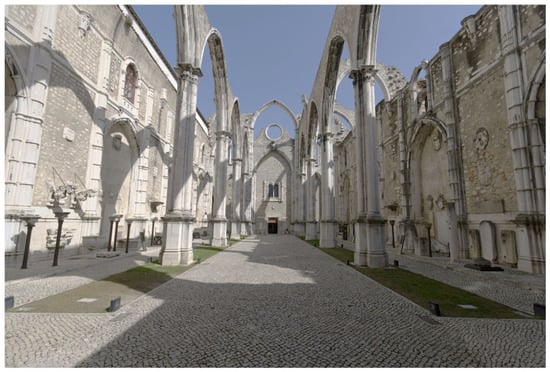
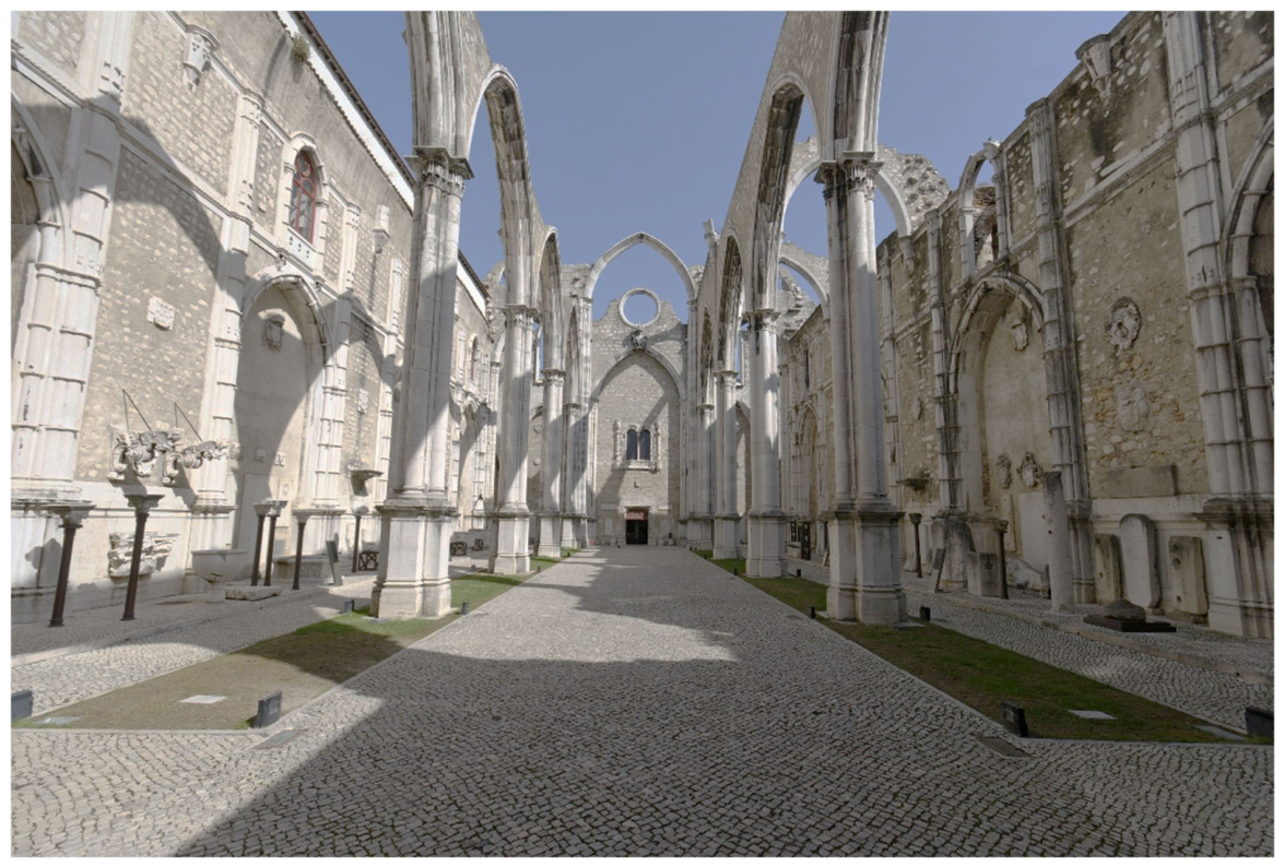
The Carmo Convent is located in Lisbon, the capital of Portugal, more precisely in the centre of the city, in the Chiado area, and over the centuries the building has undergone several transformations, both in its form and in its use (Figure 1). Its origins date back to the end of the 14th century, in 1389, when Nuno Álvares Pereira, Constable of the Portuguese Kingdom, decided to build a convent in honour of the Lady of Monte Carmelo (Carmo in Portuguese), for her divine protection during the battles against the Castilians [23].
Figure 1.
General view of the central nave and remaining Gothic arches of the Church of the Carmo Convent in Lisbon (Portugal), looking east toward the chevet.
The construction commenced shortly after royal authorization was received from King João I and the then-current Pope Urban VI. The initial two attempts to lay the foundations failed due to issues with land stability and soil settlements, which compromised the safety of the building. To ensure the structure would not collapse, Nuno Álvares acquired additional land around the building to reinforce the main nave by adding flying buttresses on both the north and south façades.
Prior to the first half of the 15th century the church was completed, shortly after in 1423, the construction of additional minor convent buildings was initiated. The convent exhibits a Latin cross plan configuration, comprising three naves, the primary nave accompanied by two lateral naves, which are divided into five distinct sections.
Regarding the original vaulting ceiling of the naves was most likely composed of gothic-ribbed cross vaults, a style that is similar to the remaining vaults of the apse chapels. The primary façade has been largely preserved, retaining its original features and late Gothic embellishments, including the original rosette window. The north and south lateral naves each contain ten chapels, dedicated to different saints and featuring decorative elements and enriched artwork.
The chevet area, located on the eastern side of the complex, showcased the five primary chapels, with the central chapel, designated as the Capela-mor in Portuguese, being the most significant. A direct entrance to the cloister was situated on the northern wall, while a passageway connected the last chapel to the sacristy. At the inception of the 18th century, the Carmo convent, in conjunction with its affiliated dependencies, was considered to be one of the most significant architectural and artistic ensembles in the city, until the Lisbon earthquake occurred.
The great Lisbon earthquake impacted Portugal, the Iberian Peninsula, and Northwest Africa on the morning of Saturday, November 1st, Feast of All Saints. In combination with subsequent fires and a tsunami, the earthquake caused severe damage to Lisbon and the surrounding regions. Seismologists calculated the magnitude of the earthquake to be 7.7 on the Richter scale, with its epicentre located in the Atlantic Ocean, approximately 290 km southwest of Lisbon [24].
In the immediate aftermath of the earthquake, the Carmo Convent suffered significant damage, with the roof and ribbed vaults in the main and lateral naves, as well as the transept, being destroyed. The walls sustained substantial damage, with only the chevet, the west façade, and the lower parts of the north and south façades remaining intact. As previously mentioned, the earthquake generated a conflagration that consumed all the artwork inside the building (paintings, sculptures and the chapels as well), marking a pivotal moment in the history of the Carmo convent.
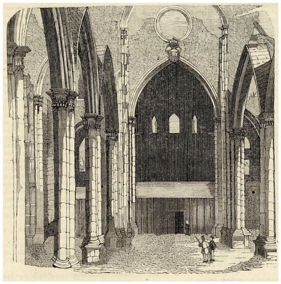
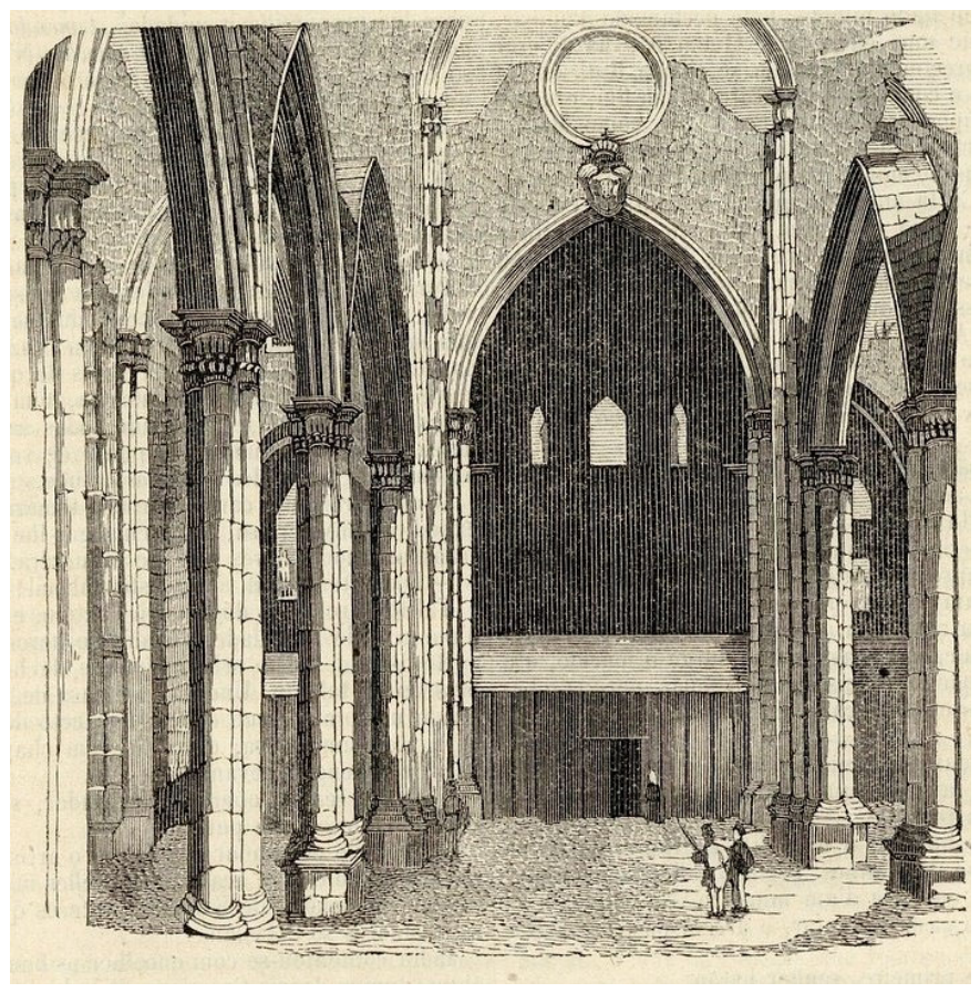
Despite the occurrence of the event, the convent was continuously inhabited by the monks, who promptly initiated the reconstruction in 1756, employing a neo-Gothic architectural style. Nevertheless, in 1834, the Portuguese Government initiated the expropriation of ecclesiastical assets, thereby withdrawing the property from the Carmelite Order. Consequently, by the mid-19th century, the Carmo convent was in a state of abandonment, having accumulated a substantial amount of waste material, reaching a height commensurate with the columns’ shafts, as depicted in Figure 2.
Figure 2.
Carmo ruins historical engraving of the site published in Arquivo Pittoresco (1858), https://hemerotecadigital.cm-lisboa.pt/Periodicos/ArquivoP/1858/TomoI/N51/N51_item1/index.html (accessed on 10 August 2026).
Decades later, in 1863, Joaquim Possidonio Narciso da Silva (the royal architect at that time) established the Association of Portuguese Civil Architects, selecting the Convent ruins as the group’s headquarters. This event marked the inception of the first Museum of Art and Archaeology in the country.
Since then, the building has undergone numerous transformations to reach its current state, known as MAC, an acronym for Museu Arqueológico do Carmo (Carmo Archaeological Museum). The museum functions as a private secular institution, housing a collection of artefacts ranging from prehistory to the present day. The naves and transept remain in the open air, while the chevet area has been closed for conservation purposes.
3. Modelling the Carmo Convent Present-Day State
With regard to the project’s early development, the Heritage Within encountered challenges due to the global pandemic, which resulted in significant alterations to the anticipated schedule and the documentation process of the case study. It is therefore essential to emphasize the considerable effort and dedication exhibited by the project’s collaborators, as well as the invaluable support received from the Carmo Archaeological Museum and the Associação dos Arqueólogos Portugueses (AAP) during the experimental campaigns.
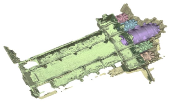
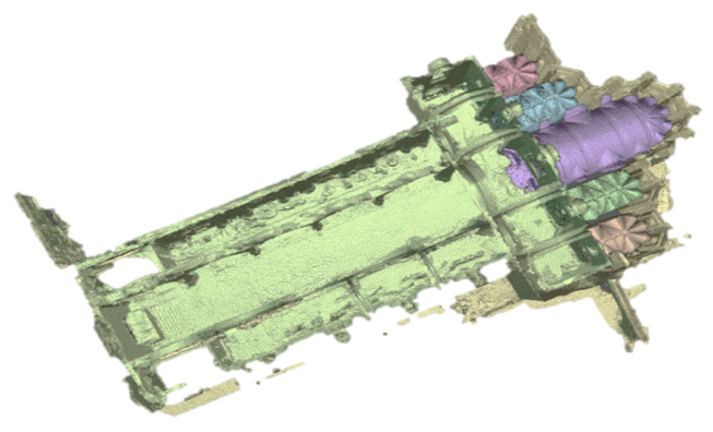
The initial phase of the project entailed the creation of a three-dimensional model of the Carmo Convent, commencing with the compilation of the contemporary state, utilizing the photogrammetric survey conducted by the University of Minho [25], which served as the primary investigative framework. The information was then divided into several smaller groups or monument parts, including the exterior façades (east, south and west), the main and lateral naves, the roofing system and the chevet chapels (Figure 3).
Figure 3.
Photogrammetric models of the Carmo Convent: interior, exterior, and chevet chapels.
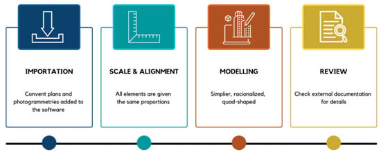
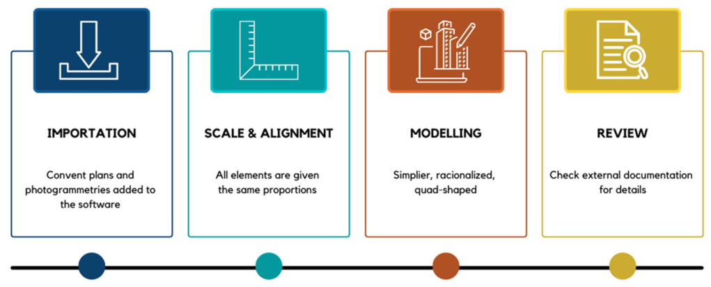
In order to scale and manipulate the photogrammetric datasets, the software of choice was Blender [26], a free and open-source 3D content creation suite utilized for the creation of animated films, visual effects, art, printed models, motion graphics, interactive 3D applications, virtual reality, and video games. The workflow process is summarized in Figure 4.
Figure 4.
Present-day model workflow in Blender.
The dense point-cloud-derived mesh required rationalization and simplification, resulting in a lighter mesh predominantly composed of quadrilateral faces rather than triangular faces. This mesh configuration has been shown to improve the modelling process, facilitating the individualization of each element of the convent, irrespective of size. Upon completion, the mesh will be exported to the virtual reality application.
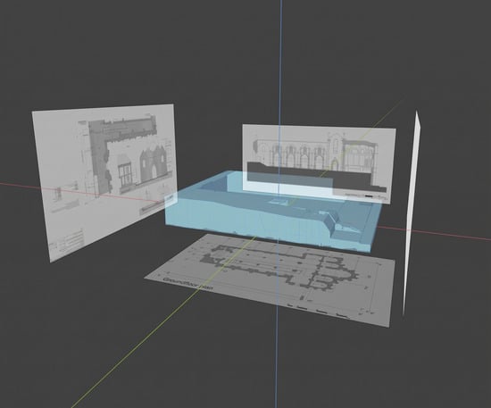
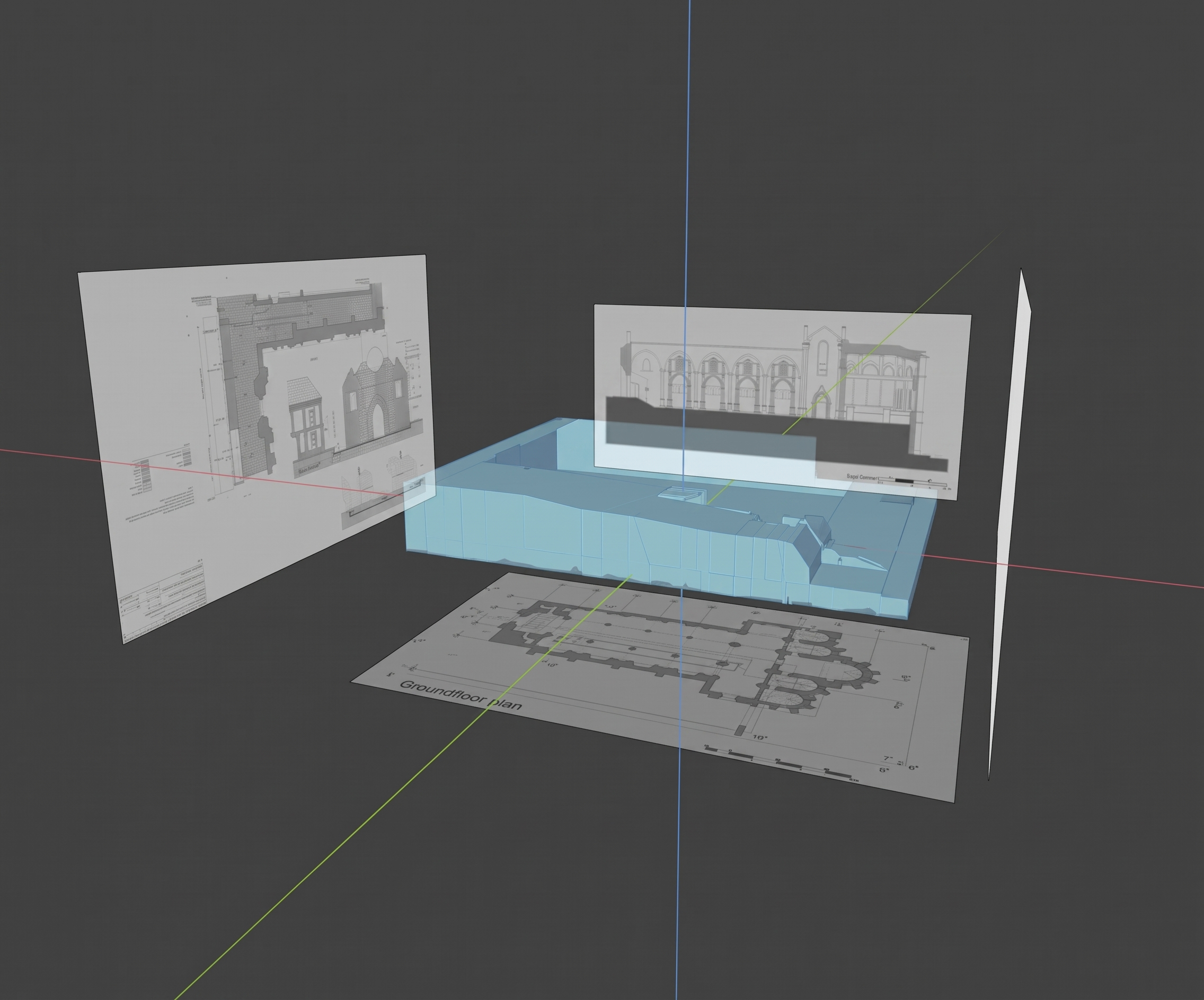
The process was initiated with the importation of the church plans into a three-dimensional working space, encompassing the floor plan, cross section, and east and west façade. Each of these plans was then scaled to the same size. Subsequently, the convent grounds were modelled to ensure a common base for the building. Thereafter, all photogrammetric models were imported into Blender, utilizing the (.obj) format, with the aim of preserving as much information as possible. These were then scaled to align with the pre-existing plans.
With both plans and photogrammetric models aligned, the reconstruction of the Carmo Convent’s present state commenced, with both elements being compared to ensure maximum proximity to the actual building (Figure 5).
Figure 5.
Church of the Carmo Convent plans aligned in Blender.
However, due to the substantial dimensions of the Church of the Carmo Convent, certain architectural and constructive elements were not captured in the photogrammetric survey, as they lacked comprehensive coverage or were not available due to the drones’ inability to access higher areas during the survey. To address this deficit, external documentation was obtained, including photographs provided by museum personnel and additional plans.
This was the case for the sacristy, located on the north side of the Carmo convent and connected with the chevet chapels by a small passage. The model was based on the first experimental campaign, which took place between 2 November and 12 November 2020. During the campaign, the team performed several photogrammetric surveys to improve the previous ones, especially from the chevet chapels. The entire convent modelling lasted from August 2020 until December 2020.
Regarding technical details and mesh data, the 3D modelling was executed in Blender (v2.90) at a 1:1 metric scale, referencing georeferenced point clouds and architectural plans. The finalized master 3D model comprises a total of 155 semantically structured objects, containing approximately 1,220,000 vertices, 1,200,000 faces (predominantly quad-remeshed topology), and 2,415,000 triangles. The mesh was rationalized from the raw high-density photogrammetric point-cloud data to optimize computational performance during rendering and WebVR deployment.
Present-Day Model Distribution
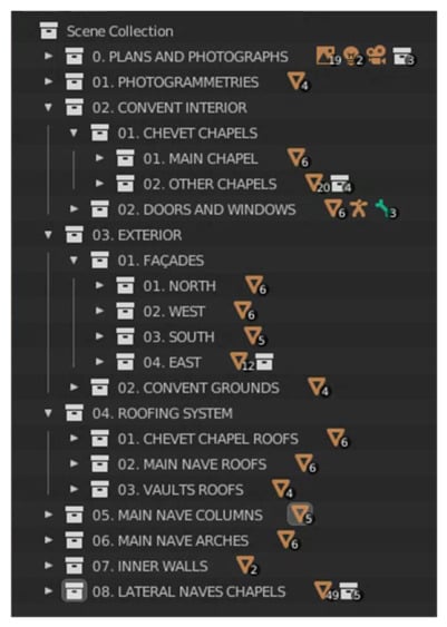
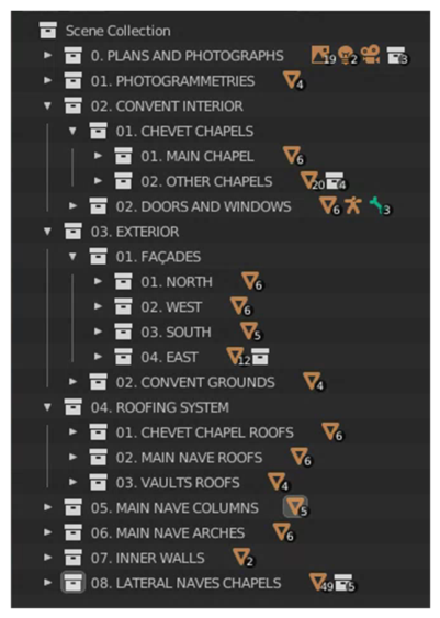
During the modelling process, it became apparent that the large amount of information provided by the photogrammetric survey of the Carmo Convent, together with the considerable file size of the resulting datasets, necessitated the subdivision of the present-day model into smaller, more manageable elements. Consequently, the structure was categorized according to two criteria: firstly, its location and, secondly, its architectural typology (see Figure 6).
Figure 6.
Blender screenshot presenting the work groups for the present-day model division.
As previously mentioned, the convent grounds were fundamental to the creation of the model, since certain parts of the photogrammetry did not offer information, such as the surrounding streets and nearby premises. The Carmo church exteriors consist of three façades: east, south and west. The nearest building, the Portuguese Republic National Guard, obscures the north façade. This was built in the 18th century, and prior to that, the space was occupied by the convent cloister.
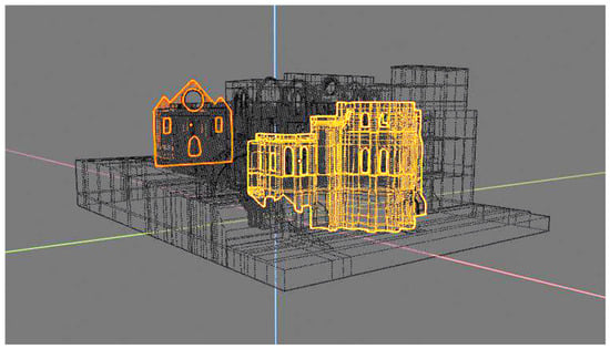
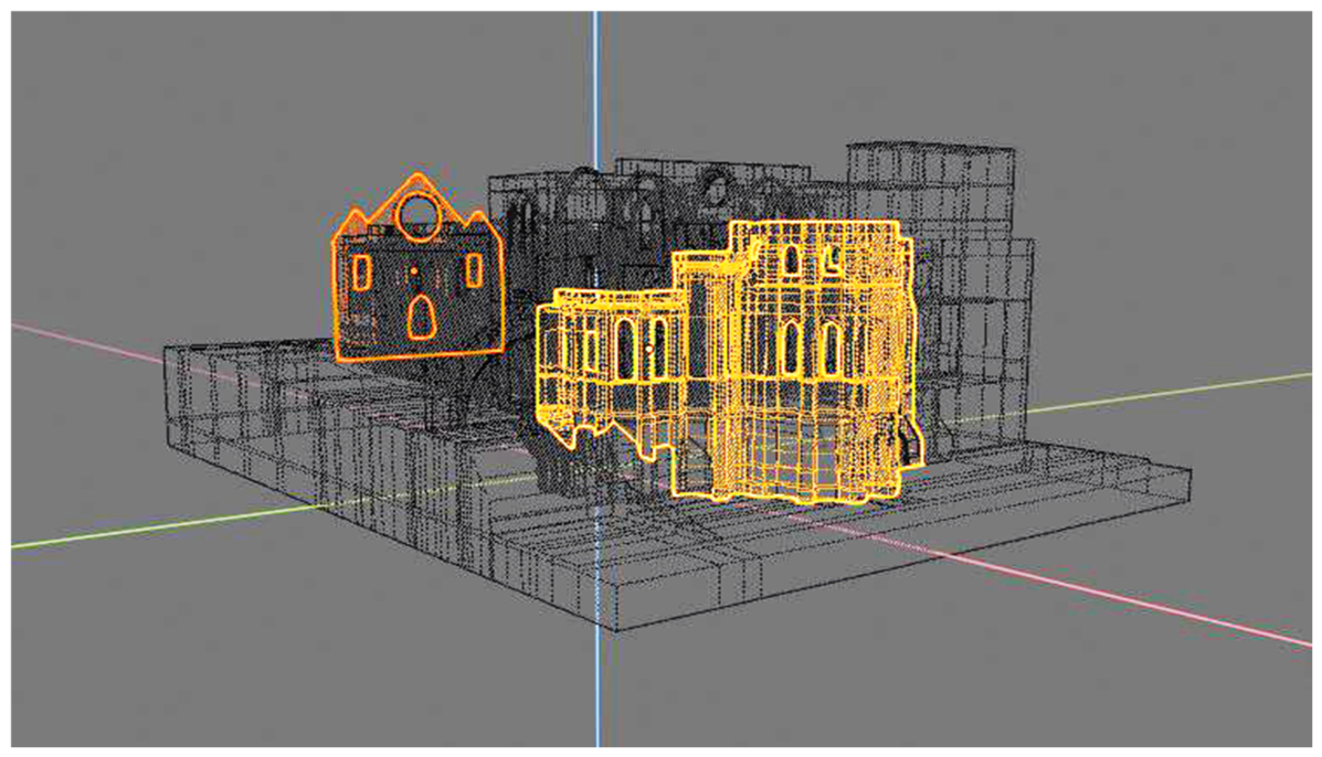
The east façade (Figure 7) is among the model’s most complex sections, featuring five chevet chapels and the structure’s highest elevation. Modelling this façade was particularly challenging due to its height and numerous architectural details obscured from photogrammetry.
Figure 7.
Blender screenshot depicting the east and west façade during the modelling.
Furthermore, the external survey was unable to deduce certain internal measurements, including the thickness of the wall and the distance between the chapel vaults and the roofing system. The church south façade is situated adjacent to Dom Pedro de Menezes passing Street, in which the transept entrance is located, in close proximity to the sole remaining flying buttress that provides support to the building walls. Proceeding in a westerly direction, the terrain is found to be partially leaning, with four regular buttresses present until the next façade is reached.
As for the west façade, it faces Largo do Carmo Street, which features a substantial rectangular plaza. This plaza provides access to the Carmo Archaeological Museum, which is reached by descending the steps from the convent entrance, which is situated below street level. The rosette window, situated in the upper center of the wall, suffered partial destruction during the 1755 earthquake and has remained in a damaged state ever since. This unique element was instrumental in determining the precise height of the roofing system and the vaults in the reconstruction hypothesis.
Proceeding to the internal section of the edifice, the absence of certain architectural elements in the photogrammetry was addressed through the utilization of on-site images provided by the museum personnel during the pandemic lockdown, prior to the inaugural experimental campaign in November 2020. During this period, the primary structural elements of the naves were modelled, commencing with the ticket office entrance, the stairway, and culminating in the doors of the transept. The office buildings situated on the inner side of the western façade were also modelled.
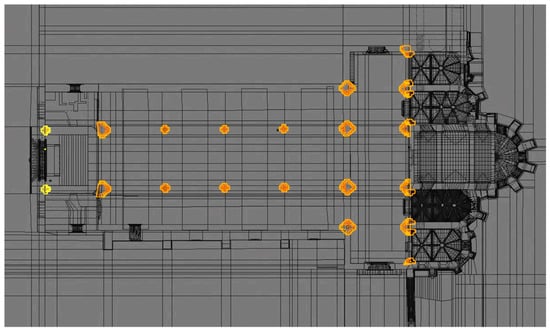
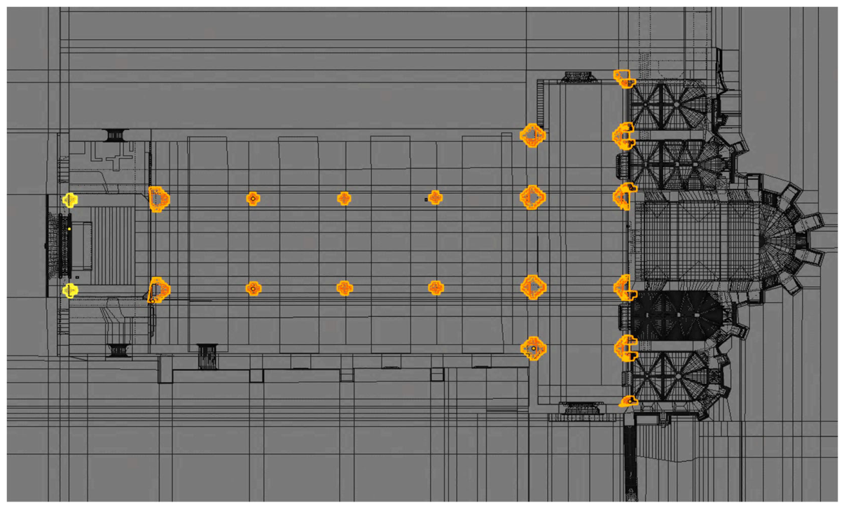
The subsequent phase involved the meticulous erection of the limestone masonry columns from the primary nave, a process that demanded significant time and effort to ensure an accurate representation of their heights and internal divisions. This phase of the reconstruction was of paramount importance, as the columns were subjected to non-destructive testing (NDT) techniques during the experimental campaigns. These techniques included ground penetrating radar (GPR) and ultrasonic tomography system (UTS).
Immediately after the test results were acquired, all data were integrated into the virtual model. The arches of the naves and transept were subsequently constructed based on the column models, although these exhibited several deformations due to their dimensions, which differed from the pristine aspect depicted in the church plans (Figure 8).
Figure 8.
Blender screenshot of the cross plan with all the columns marked in orange.
Other remarkable features of the convent’s interior include the small chapels located on both the north and south walls. These chapels were reconstructed after the earthquake, and they all share the same design. Of particular interest is a passage situated on the south wall, above the chapels, known as the clerestory, the primary function of which was to increase the amount of light inside the convent.
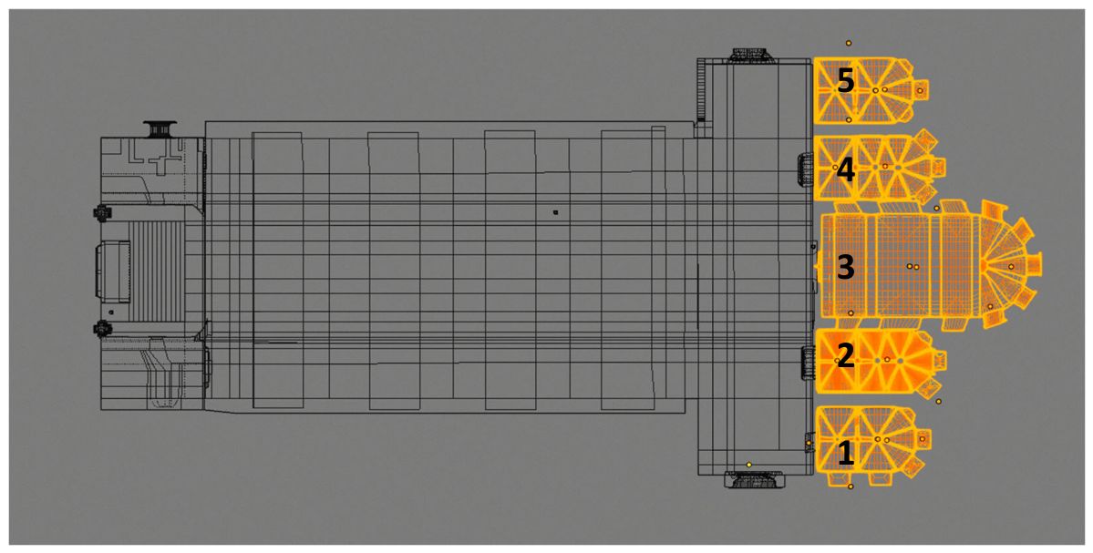
The final component of the present-day model is the chevet chapels, as illustrated in Figure 9. All five rooms were interconnected by a small entrance on the lateral walls and present three different heights. Starting with the main and widest one in the centre, known as Capela-mor, dedicated to Our Lady of Mount Carmel; the roofing system has been reconstructed after the earthquake, changing the original six rib vault gothic model with a simpler cannon vault.
Figure 9.
Blender screenshot of the cross plan with the five-chevet chapels marked in orange.
The following two chapels, situated in closer proximity to the primary structure, are both of a reduced size and height. In contrast, the lateral chapels, while exhibiting the same width, possess a diminished height. The modelling process necessitated a substantial investment of effort, as each chapel was meticulously subdivided into its constituent elements, including vaults, ribs, arches, keystones, and windows. This approach was adopted to facilitate the eventual conversion of the model into a building information model (BIM).
With regard to the church’s roofing system, it should be noted that the chevet chapels are the only part of the existing building that is currently covered. The photogrammetry information facilitated the reconstruction of this section of the building, and during the initial campaign, the team visited the area, which could only be accessed via the nearest building, the Portuguese Republic National Guard, where the facilities of the former Carmo convent were located. Several photographs were taken, and the model was implemented once again to commence the subsequent task: the historical reconstruction hypothesis.
4. Historical Reconstruction Hypothesis Based on Heterogeneous Data
The subsequent phase of the project involved the formulation of a reconstruction hypothesis of the Carmo church in its original state, drawing upon the contemporary model and the additional information gathered from the ruins during the inaugural experimental campaign in November 2020. It is acknowledged that one of the primary challenges in the reconstruction of historical buildings is the scarcity of information, particularly the absence of components, in the present case. The convent has been partially rebuilt, incorporating elements from various styles and artistic periods.
In light of this, the Heritage Within project sought to ‘reimagine’ the Carmo church by leveraging data from diverse sources to formulate a reconstructed model of optimal fidelity. It is acknowledged, however, that further information and research may yet modify these proposals.
In this process, the role of Célia Nunes Pereira, the leading art conservator at the Carmo Archaeological Museum, was essential for developing a viable reconstruction hypothesis, given her more than a decade of research into the building’s archives.
Throughout the course of the project, and in conjunction with the two experimental campaigns, the team engaged in numerous online meetings and deliberations, examining various hypotheses against the backdrop of historical documentation and studies. This process culminated in the identification of the most suitable proposal.
4.1. Reconstruction Hypothesis Sources: Mock-Up Model
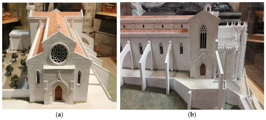
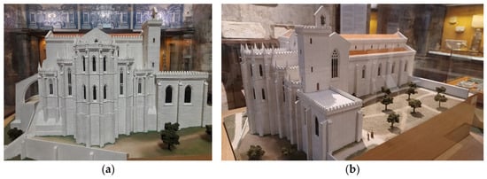
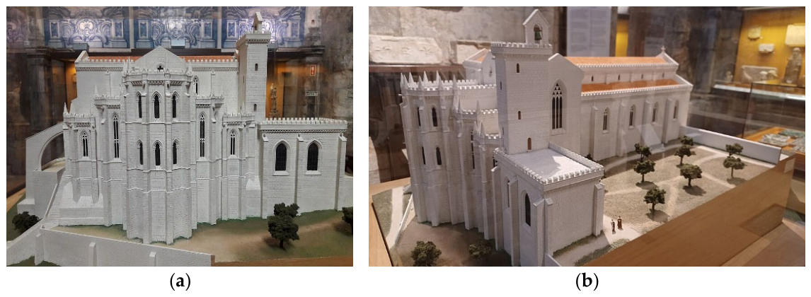
In order to validate the proposed ideas, the reconstruction process was initiated using one of the primary sources, namely a mock-up model located at the Carmo museum, specifically within the chevet-chapels. This model, constructed by Carlos Loureiro in 2001 and based on the Archaeological documentation, provided a valuable foundation for the reconstruction of the building’s external form. It exhibits the original configuration of the convent shortly after its establishment in the 14th century, as shown in Figure 10a.
Figure 10.
(a) Scale model of the Carmo Convent western entrance and (b) south façade https://commons.wikimedia.org/wiki/File:Scale_model_of_the_Carmo_Convent_in_Lisbon_in_the_14th_century.jpg (accessed on 10 August 2026).
The main difference compared to the present-day building is the lack of the roofing system covering the main nave, the two lateral naves and the transept. The model presents a simpler design of a gable roof with a pitch or steepness lower on the lateral ones and higher in the main nave and transept.
The height of the structure is defined by the rosette window and the vaults situated above it, as evidenced by the main entrance on the west façade. It is noteworthy that the model does not provide any information pertaining to the internal structure. A subsequent discrepancy between the model and the extant building is evident in the presence of Gothic windows on both sides of the walls, a subject to be addressed in greater detail in Section 4.4.
Turning to the south section, a notable detail emerges from the model: the walls on this side are thinner than those in the current building. The historical archives of the convent documented a minor earthquake in 1531, after which different interventions were made, thus changing its original configuration.
The construction of the actual clerestory on this side of the wall necessitated an increase in wall thickness. Furthermore, the incorporation of four flying buttresses during the foundation stage was a structural measure undertaken to mitigate the risk of the convent’s collapse, a concern precipitated by the subsoil’s unstable nature, characterized by the prevalence of weak sands and clays. These buttresses bear a resemblance to the remaining one situated in closer proximity to the transept entrance. It is noteworthy that by the time the convent was constructed at the summit of the hill, no other structures were present in the surrounding area, as depicted in Figure 10b.
The following section will examine the west façade, which is the one closest to the present-day configuration. It should be noted that some windows in the chevet area were added later, specifically in the southern one, closer to the transept door (chapel 1), with the intention of increasing the amount of light inside. The pillars that support each of the five-chevet chapels also serve the function of buttresses, which are inserted until the base, thus reinforcing the entire structure. The model offers insights into the configuration of the roofing system at the apex of the chevet, adorned with Gothic embellishments and pinnacles that have since been lost due to the seismic event. Additionally, it provides a measurement of the height of chapel 5, which presently constitutes a part of the adjacent structure and serves as the access point for examining the roofing system (see Figure 9).
The mock-up model presents a hypothetical representation of the north area’s appearance shortly after the convent’s establishment. It is imperative to acknowledge that this design serves merely as an idealized depiction of the case study for educational purposes. Consequently, a thorough re-evaluation of each component is necessary prior to incorporating it into our hypothesis model. With regard to the north façade, Célia Nunes has noted that it too featured four flying buttresses, akin to those on the south side, which were employed to reinforce the structure during the construction process in the 15th century, as illustrated in Figure 11b.
Figure 11.
(a) Scale model of the original Carmo Convent east façade and (b) north façade. https://commons.wikimedia.org/wiki/File:Museu_do_Carmo,_Lisboa_85.jpg (accessed on 10 August 2026) and https://commons.wikimedia.org/wiki/File:Portugal_20170512_112215_(33930750243).jpg (accessed on 10 August 2026).
As the convent expanded, additional structures were erected, and a cloister was appended to the northern perimeter, obscuring the windows on the walls. This information prompted the team to formulate two distinct hypotheses concerning the state of the convent at different points in time. The objective was to compare these hypotheses in order to elucidate the historical evolution of the building over the course of several centuries.
4.2. Reconstruction Hypothesis Sources: Coeval Buildings
In the process of formulating a hypothesis regarding the state of the Carmo convent prior to the earthquake, it is imperative to consider analogous historical examples from the same period. Célia Nunes once again indicated the relevant sources, based on all the data gathered after years of investigations.
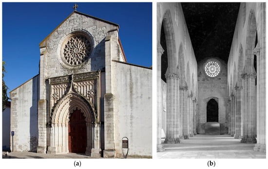
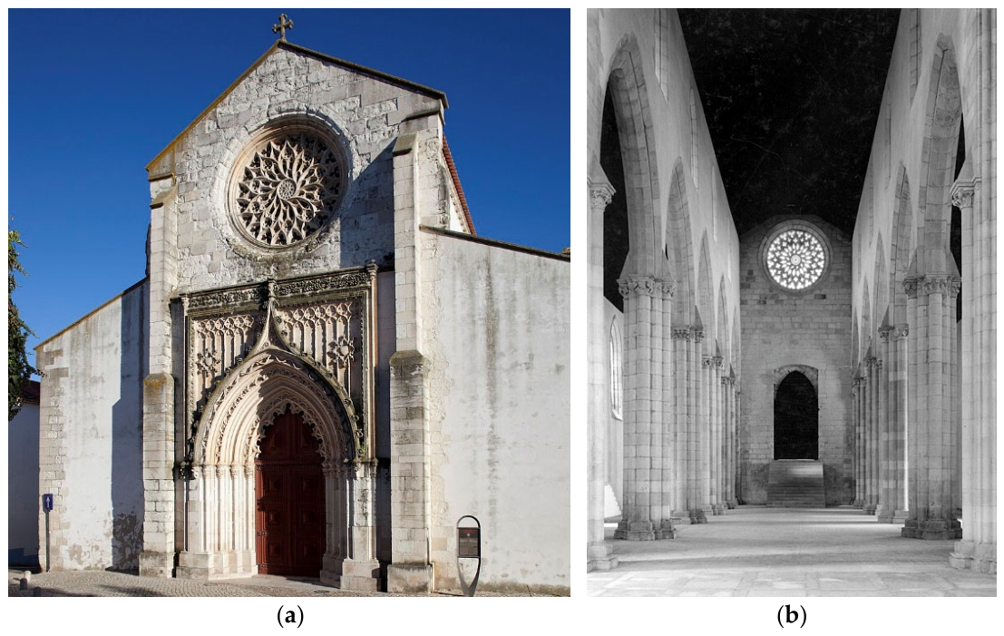
The primary and most significant reference is the Santa Maria da Graça church, situated in the city of Santarém, north of Lisbon. Constructed in the 14th century, more specifically in 1380, it is regarded as an emblematic monument of the city and a paramount exemplar of Gothic art in the Portuguese countryside.
The commission was initiated by D. Afonso Telo de Menezes, the inaugural Count of Ourem. The convent’s primary façade is distinguished by a rosette window, meticulously crafted from a solitary stone block, as seen in Figure 12a. Despite the passage of time, the edifice has withstood the elements and has not required significant reconstruction. Following the dissolution of the male religious orders in 1834, the convent was closed and sold. During the mid-20th century, a comprehensive restoration initiative was undertaken, with the objective of removing all elements that predated the 16th century. This intervention entailed the dismantling of Mannerist and Baroque elements, including the high choir, the coverings and altarpieces of the altars and chapels, Figure 12b.
Figure 12.
(a) Santa Maria da Graça church in Santarém, main entrance and (b) interior: https://commons.wikimedia.org/wiki/File:1_Igreja_da_Gra%C3%A7a_Santar%C3%A9m_IMG_9342.jpg (accessed on 10 August 2026) and https://commons.wikimedia.org/wiki/File:Igreja_da_Gra%C3%A7a,_Santar%C3%A9m,_Portugal_(2719445965).jpg (accessed on 10 August 2026).
This monument has been instrumental in providing a constant source of information, given that the mason workers who constructed it were subsequently employed at the Carmo convent. Consequently, numerous architectural elements pertaining to the internal structure of the church have been taken into consideration during the formulation of reconstruction hypotheses, with particular emphasis on the vaults within the naves and transept.
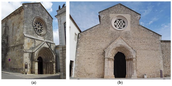
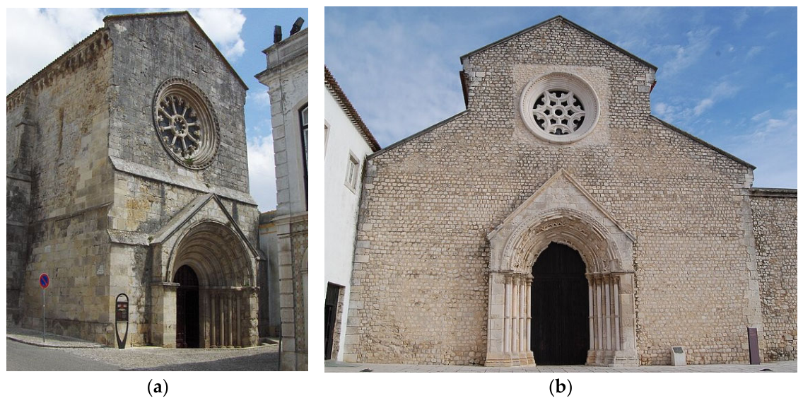
The subsequent two edifices considered in the reconstruction process were also located in Santarém: São João de Alporão church and São Francisco convent. The former, located in the city center, was constructed in the 12th century and features a combination of Romanesque and Gothic styles, as depicted in Figure 13a. It possesses a single nave, with an apse featuring a double arcade separated by columns, from which the ribs of the vault emerge. The roof features a ribbed vault with triple ribbed semi-circular arches.
Figure 13.
(a) São João de Alporão church and (b) São Francisco convent main entrances https://imovel.patrimoniocultural.gov.pt/detalhes.php?code=70434 (accessed on 10 August 2026) and https://commons.wikimedia.org/wiki/File:Convento_de_S%C3%A3o_Francisco_(3).jpg (accessed on 10 August 2026).
The second, the São Francisco convent, is a notable exemplar of Mendicant Gothic architecture in Portugal. Founded in 1242 by Sancho II after the Franciscans established themselves in the city, the convent was closed during the 19th century. In 1875, the building began a period of degradation that culminated in a fire in 1940, leading to the transfer of the tombs of D. Fernando I and his mother to the Carmo Archaeological Museum. Following decades of closure, the city of Santarém restored and reopened the site on 24 July 2009 (Figure 13b).
As demonstrated in the case study, several images of architectural elements from the inner chapels and vault systems were instrumental in articulating the proposed reconstruction of the inner roofing system and the rose windows on the west façade.
4.3. Reconstruction Hypothesis Sources: Historical Documentation and Engravings
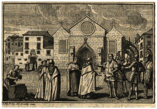
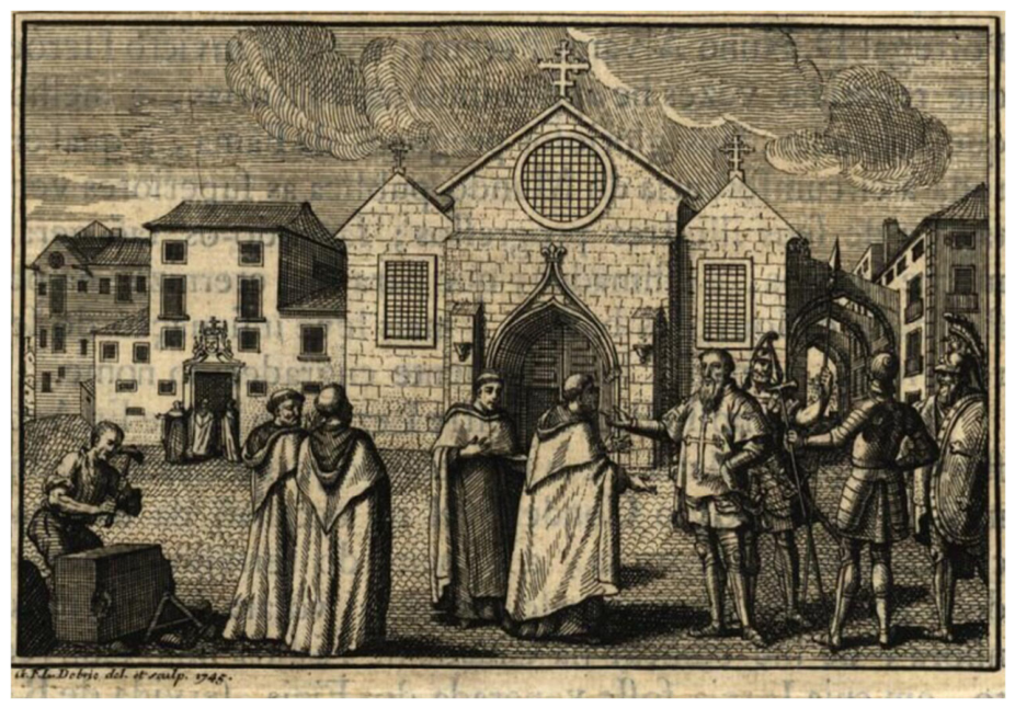
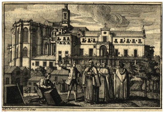
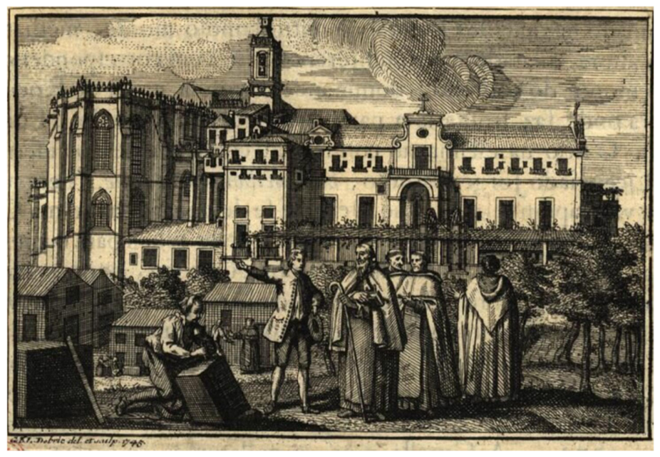
In order to consolidate the data collected, a specific bibliography dedicated to the Carmo convent was taken into consideration, particularly when endeavouring to develop highly specific concepts, such as the hypothesis concerning the existence of a high choir situated directly above the main entrance on the western wall. A seminal work that merits particular attention is the Carmelite Chronicles (https://bndigital.bnportugal.gov.pt/records/item/36939-chronica-dos-carmelitas accessed on 10 August 2026) from 1745, a time period that coincides precisely with the decade preceding the seismic event that struck Lisbon. The front page of the third part, chapter one, features an engraving by Guilherme Francisco Lourenço Debrie.
The paucity of information regarding this painter, engraver and illustrator, whose nationality is uncertain but may be French or of French descent, is striking. His establishment in Portugal is documented by payroll records from 1734 to 1754 at the Royal Academy, and it is assumed that he died as a result of the 1755 earthquake, as no further information has been found since the marriage certificate of his son in 1762, which states that Debrie had already passed away.
With regard to the engraving, it facilitated comprehension of the evolution of the Carmo convent over the centuries, whilst other dependencies were constructed within its area of influence [27]. This resulted in alterations to the external configuration of the west façade, the windows on the lateral naves, and ultimately the flying buttresses embedded in the adjacent structure on the south side (see Figure 14).
Figure 14.
West façade of Carmo Convent by Debrie from Chronica dos Carmelitas (1745–1751).
Furthermore, within the same book, specifically in the fourth part of the Carmelite Chronicles, there is an additional engraving by Debrie. This engraving depicts the western view of the Carmo convent, as illustrated in Figure 15. The convent buildings at the west façade were divided into two sections, with the ground floor featuring five windows and a main portal, accompanied by a balcony; in addition to the lower floor, which had an entrance to the convent facilities.
Figure 15.
East side of Carmo Convent by Debrie from Chronica dos Carmelitas (1745–1751).
4.4. Reconstruction Hypothesis Sources: Archaeological and Physical Evidences
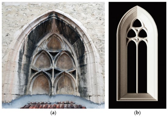
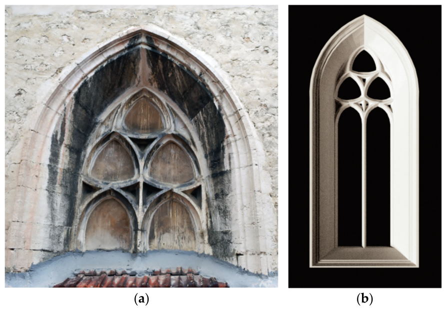
During the campaign held in November 2020, the Heritage Within team, which was responsible for the UTS and the GPR inspection, had the opportunity to document the Carmo Archaeological Museum in great detail with the assistance of the museum’s personnel. Prior studies and documentation had revealed that a fragment of the original Gothic windows was located on the inner side of the north façade, at the summit of the roof of the extant office buildings, see Figure 16a.
Figure 16.
(a) North wall showing the remaining Gothic window located on the roof of the northern office building and (b) Blender screenshot of the Gothic window model.
Photographic documentation was obtained, and subsequently utilized to create a high-definition photogrammetry model. This model was then simplified, and employed as the default window for the entire building, as illustrated in Figure 16b.
A second key piece of archaeological evidence assisted in modelling the hypothesized inner vaults that covered the lateral naves. In this case, the evidence was located on both walls from the west façade, above the windows that connect the convent with the Carmo plaza.
A substantial black line could be observed from the top of the office-building roof, a remnant of the conflagration that ensued after the 1755 earthquake, which not only delineates the building’s wreckage but also the potential initial elevation of the naves’ vault system. This facilitates the formulation of the reconstruction hypothesis (see Figure 17).
Figure 17.
Carmo inner west façade, detail of the black line marking the original vault height https://digital.csic.es/handle/10261/265373 (accessed on 10 August 2026).
To summarize and assess the historical rigor of the proposed hypothesis, Table 1 categorizes the primary reconstructed architectural elements, their supporting sources of evidence, and the assigned confidence levels.
Table 1.
Reconstructed architectural elements, supporting historical/physical sources, and assigned confidence levels.
4.5. Technical and Logistical Challenges
Generating high-fidelity multi-temporal 3D models for a complex historic structure like the Carmo Convent involved significant technical and logistical constraints across both data acquisition and processing phases:
Acquisition Challenges: On-site geometric recording was constrained by complex spatial features, such as high Gothic vaults, narrow vertical masonry piers, and fluctuating ambient lighting. High-resolution photogrammetry required specialized hardware—including full-frame sensors and elevated mounting platforms—to resolve upper-level occlusions, along with precise flight-path planning and Ground Control Point (GCP) network optimization.
Processing and Data Management: Handling multi-gigabyte point-cloud and mesh datasets demanded high-performance GPU processing and dedicated memory allocation. Removing visual artifacts, aligning heterogeneous spatial datasets (photogrammetry, GPR grids, and UTS measurements), and performing semantically structured retopology required advanced 3D modelling expertise to minimize polygon counts without compromising structural fidelity for WebVR deployment.
To maximize the replicability of this methodology for future digital twins and virtual reconstruction studies on historic monuments, Table 2 summarizes the step-by-step workflow, the main technical and logistical obstacles encountered, and the practical solutions implemented.
Table 2.
Methodological workflow, technical challenges, and practical solutions implemented for the virtual reconstruction pipeline.
5. Historical Reconstruction Process. Two Models Throughout Time
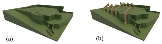
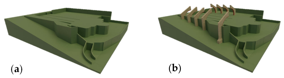
The construction of the historical model of the Carmo Convent followed a similar approach to that used for the existing-state model, beginning with the reconstruction of its foundations. The reconstruction of the convent grounds involved the transformation of the stairs located on the south side of the building, as depicted in Figure 18a, illustrating the new distribution. With regard to the flying buttresses, both the southern and northern examples were incorporated due to the existence of evidence substantiating their presence prior to the construction of the cloister on the northern façade, Figure 19b.
Figure 18.
(a) Convent grounds model and (b) flying buttresses in both north and south façades.
Figure 19.
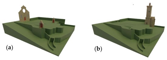
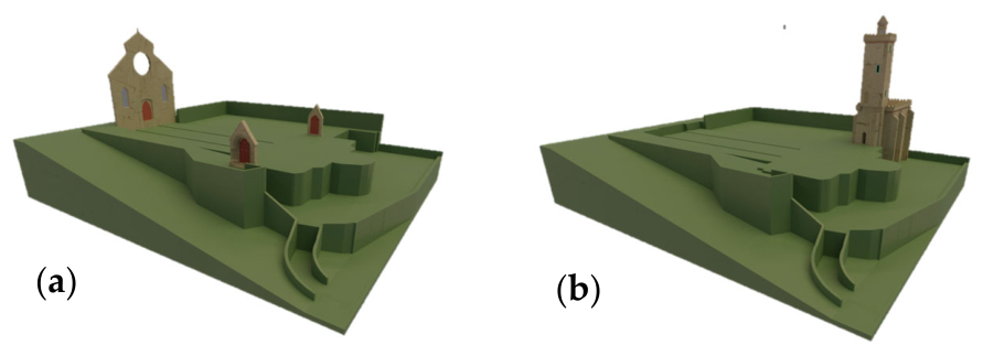
(a) Blender screenshot of the model access and (b) sacristy building and bell tower.
In the case of the convent outer elements, the entrances were modelled, the main one being located at the west façade and the transept. This was achieved by replicating the south door on the north exit, which on the extant building has been blinded, see Figure 19a. The sacristy and the bell tower were both remodelled to a state of near-original condition, as the only extant guidance was the floor plan and the scale model, Figure 19b.
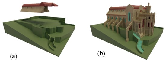
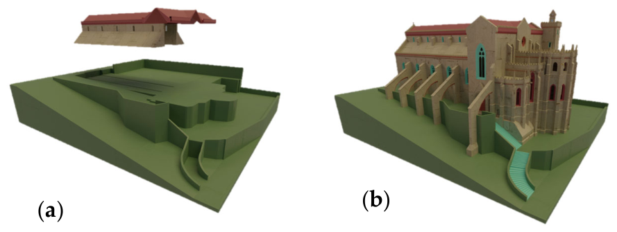
With regard to the roofing system, this was reimagined through the use of a scale model, which incorporated the main nave, lateral ones and the transept, see Figure 20a. The final additions included significant details such as the reconstructed rose window, the pinnacles adorning the chapels, and decorative elements along the outer walls. It should be noted that the use of colors is solely for illustrative purposes, to distinguish between the various elements, as seen in Figure 20b.
Figure 20.
(a) Blender screenshot of the roofing system and (b) decorative elements on the final model.
Following the completion of the external modelling, the team identified two distinct stages in the evolution of the convent over time. This phenomenon is not uncommon in the context of historical buildings, which often undergo transformations throughout the centuries, resulting in alterations to their style and the addition of new elements. In the specific case under study, prior to the 1755 earthquake, a previous transformation occurred in 1531, following which several interventions were implemented.
It was thus determined that the virtual reconstruction should be continued through the establishment of two distinct models. Firstly, the foundation model, dating from 1389, when Nuno Álvares Pereira commissioned the convent, and which is devoid of any surrounding buildings. Conversely, the second model is intended to depict the state of the Carmo convent as it existed prior to the Lisbon earthquake of 1755, and is thus designated as the pre-earthquake model. The subsequent discussion will address the primary distinctions between these two models:
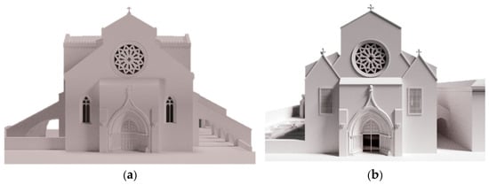
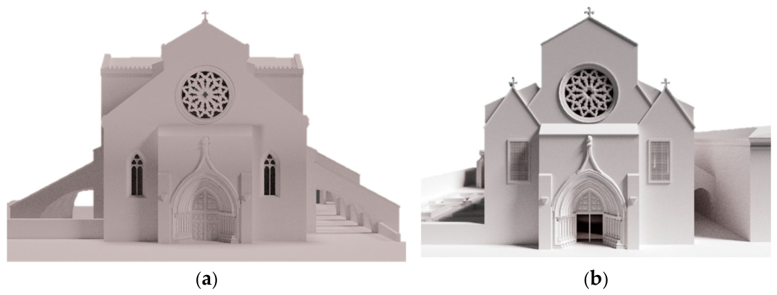
A comparison of the two west façades reveals that the foundation model is analogous to the scale model design, with the decorative elements comprising six archivolts linked by an elegant counter-curved arch, finally crowned by a fleur-de-lis. On the side naves, Gothic windows are present, though these are smaller than the actual ones, portrayed in Figure 21a.
Figure 21.
Model comparison (a) foundation model and (b) pre-earthquake model: west façade.
By way of contrast, the pre-earthquake model endeavours to emulate the engraving made by Debrie for the Carmelite chronicles, exhibiting three distinct bodies, with the central body characterized by an increased height relative to the foundation one, a consequence of the presence of vaults within. The lateral naves are distinguished by square windows, which are protected by a grid, as illustrated in Figure 21b. The observation that the roof is visible from behind the façade may appear to be an irregularity; however, the use of drone photographs taken in that area has facilitated the elucidation of the space between the walls and the roof.
As previously mentioned, the presence of four flying buttresses on each façade is explained by the instability of the terrain. Indeed, at that time, the south façade presented thinner walls compared to the pre-earthquake design, since the clerestory was not planned yet, Figure 21a. Conversely, by the 18th century, the surrounding area had several convent buildings, though not all of them have been modelled due to their being beyond the scope of the present case study.
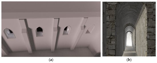
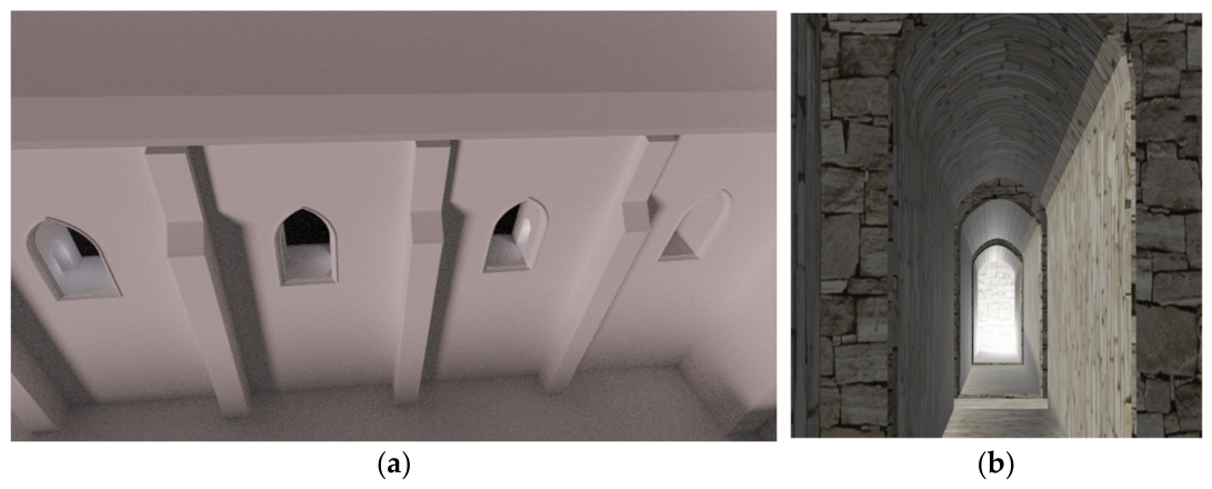
However, on the north side, a two-floor cloister that partially obstructs the level of illumination within the convent has been erected in place of the flying buttresses. Consequently, in the 16th century, following renovations prompted by a minor seismic event, the Carmelite order opted to construct the clerestory on the southern side, with the objective of restoring illumination through the windows of the aforementioned passageway, Figure 22b.
Figure 22.
(a) Clerestory passage view from outside and (b) interior perspective.
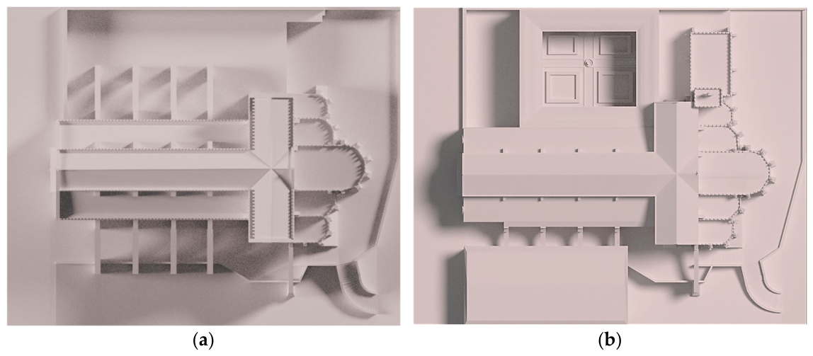
Consequently, the walls had to be thickened to ensure the structure’s resilience, while the flying buttresses were partially embedded into the adjacent edifice, the Valadares Palace, as illustrated in Figure 23b.
Figure 23.
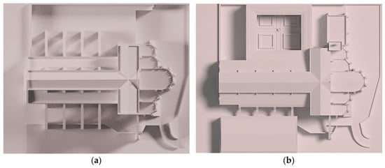
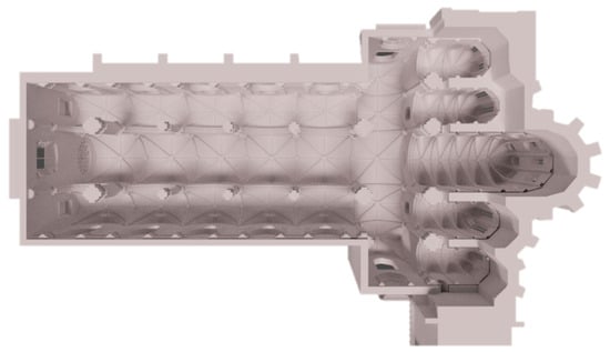
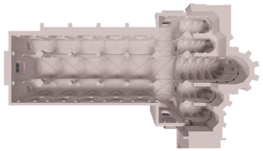
Model comparison (a) foundation model and (b) pre-earthquake Model ground plan.
The eastern façade exhibited minimal disparities between the two models. The structural configuration of the chevet remained unaltered on the exterior; however, the pre-earthquake model incorporated additional structures, such as the sacristy and the bell tower, which were not present in the foundation model. The sacristy, in particular, was already constructed in the foundation model but exhibited reduced dimensions.
An analysis of the inner walls in both lateral naves revealed slight variations in the small chapels dedicated to various saints. The foundation of these chapels was constrained by the thickness of the walls, resulting in a configuration that is similar to the pre-earthquake model.
However, the current model exhibits a distinct arrangement. With regard to the roofing system, following the compilation of extensive documentation, a traditional gable roof was modelled, incorporating a simple wooden system to sustain the structure, with a king post in the center and several struts in the main naves, the lateral ones and the transept (see Figure 24).
Figure 24.
Inner roofing system inside the vaults, render detail.
Following the delineation of the external forms of the two models, the team developed a hypothesized reconstruction of the original vault configuration within the Carmo Convent. This component of the reconstruction hypothesis was arguably the most challenging, given the paucity of available information on the subject. The Heritage Within project team, in collaboration with the Art Conservator from the Archaeological Museum, proposed an adaptation of the original Gothic vault configuration in the chevet chapels and the sacristy to align with the rest of the building, as illustrated in Figure 25a.
Figure 25.
(a) Detail of the actual sacristy vaults configuration and (b) Nuno Álvares family shield modelled in the Gothic sexpartite vault.
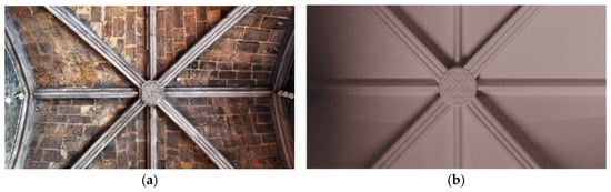
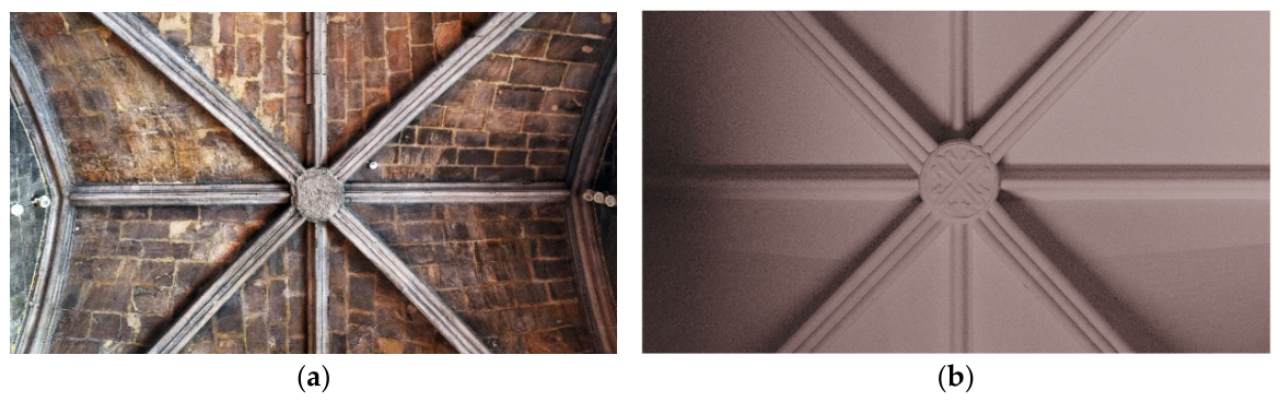
The construction of the vault was simplified, incorporating two diagonal ribs, a longitudinal rib, and a traverse rib, which were combined with two wall ribs. This modification introduced a distinctive architectural detail, namely the Nuno Álvares Pereira family shield, which was placed in the key vault to honor his devotion to the convent. This design was based on descriptions from the original temple, as depicted in Figure 25b. Subsequently, the default vault model underwent adaptation to the primary nave.
In order to accommodate the spaces and the convent deformations and irregularities, which are not easily discernible to the naked eye, it was necessary to refine the measurements for each vault. Furthermore, the reconstruction of the rose window proved to be instrumental in determining the final height of the building.
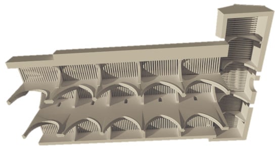
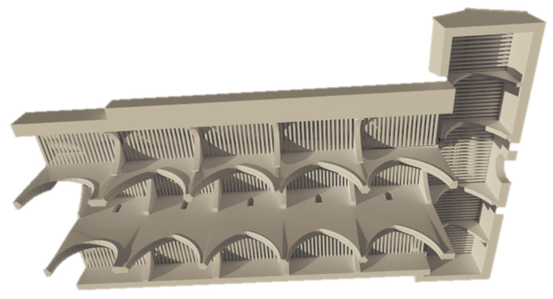
Ultimately, the process was concluded by incorporating the remaining arch mouldings from the current reconstruction. The transept vaults were subsequently incorporated, as were the lateral naves, albeit at a reduced height. Ultimately, the default vault configuration was employed to model the main chapel from the chevet. The Carmo convent model was implemented into the virtual reality application, thus concluding the historical reconstruction in September 2021, (Figure 26).
Figure 26.
Rendered model of the Carmo Convent sexpartite vaults viewed from below.
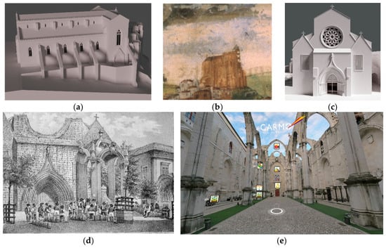
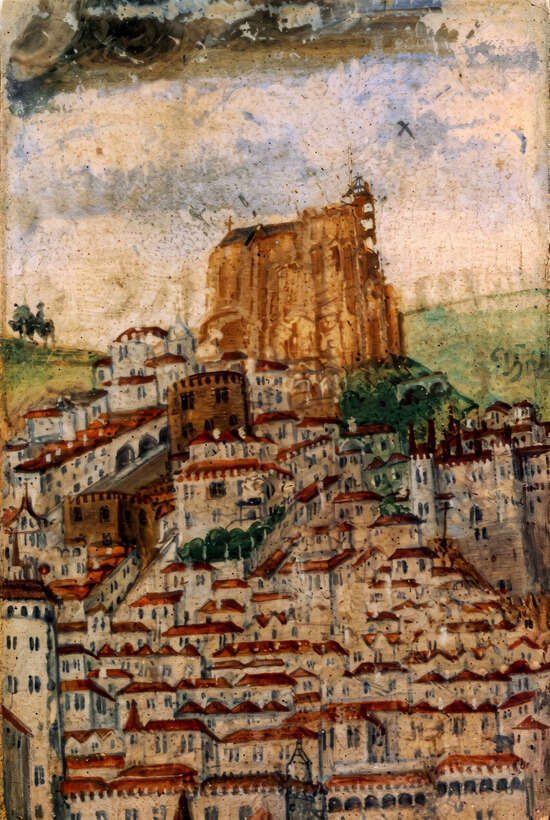
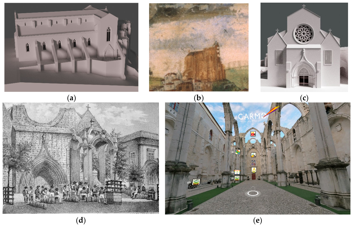
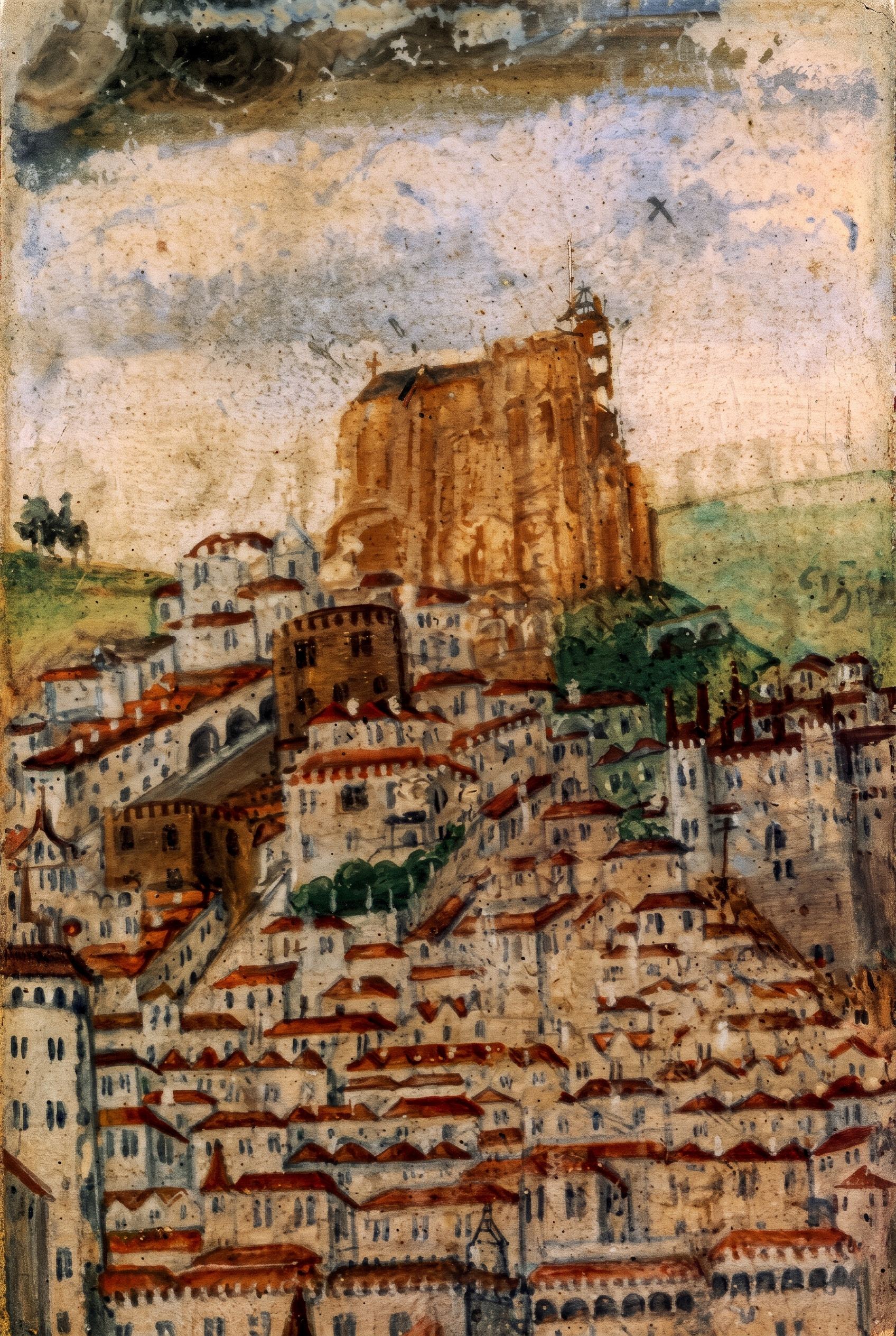
To synthesize the multi-temporal transformations of the Carmo Convent, Figure 27 illustrates its structural evolution across five key historical milestones: starting with the reconstructed 3D hypothesis for the 1389 foundation, Figure 27a and its early 16th-century representation in the Crónica de D. Afonso Henriques Figure 27b [28]. The sequence continues with the 1745 pre-earthquake configuration, Figure 27c, concluding with the post-1755 seismic ruins documented in 19th-century lithography, Figure 27d (https://commons.wikimedia.org/wiki/File:BAR000844-Chafariz_do_largo_do_Carmo_em_Lisboa.jpg accessed on 10 August 2026) and the present-day VR-integrated museum platform Figure 27e.
Figure 27.
Sequential structural evolution of the Carmo Convent across five key historical phases: (a) 1389 foundation 3D hypothesis; (b). 1500–1510 Gothic illumination; (c) 1745 pre-earthquake 3D model; (d) post-1755 seismic ruins; (e) present-day VR diagnostic platform.
6. 3D Virtualization of the Ground-Penetrating Radar (GPR) and the Ultrasonic Tomography System (UTS) Results
The Heritage Within project included, among its main objectives, the three-dimensional representation of the results obtained through non-destructive testing (NDT) conducted during in situ experimental campaigns at the Carmo convent; this task was carried out by a multidisciplinary team from three institutions: the University of Minho, which led the project; the School of Telecommunications Engineering (ETSIT) at the Technical University of Madrid (UPM); and the G-CARMA group, specialized in material characterization through non-destructive evaluation techniques, at the Institute of Physical and Information Technologies ‘Leonardo Torres Quevedo’ (ITEFI), a center of the Spanish National Research Council (CSIC). The accurate visualization of the resulting data was a key aspect to ensure clear and intuitive interpretation, facilitating its comprehension by museum visitors.
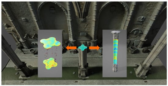
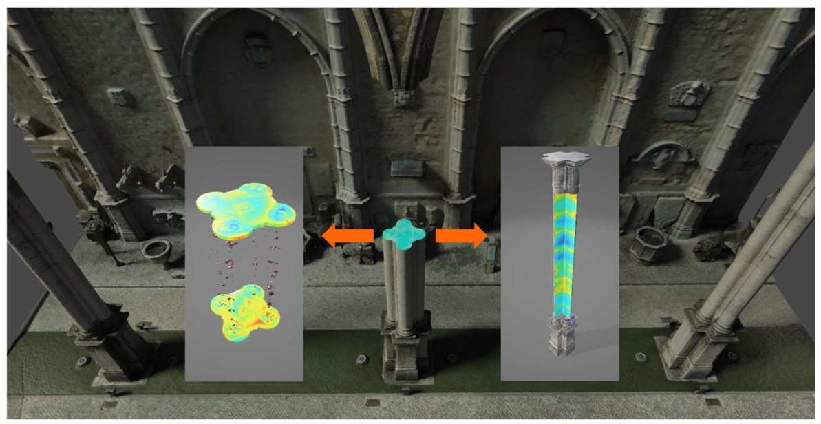
Among the applied methodologies, Ground Penetrating Radar (GPR) was employed as an inspection technique based on the propagation of high-frequency electromagnetic waves through the studied material. The system consists of a transceiver antenna that records reflections generated by internal discontinuities, such as structural defects or variations in material composition. For the analysis of the column pedestal, a systematic mapping was implemented using a predefined grid, allowing data acquisition in both horizontal and vertical directions. The collected records were subsequently processed to enhance resolution and facilitate the interpretation of the stone’s internal structure (see Figure 28).
Figure 28.
3D models of the GPR and UTS results.
The results are presented in a color-coded image, where external regions appear in blue tones, while the internal core is depicted in warm colors (yellow and red), enabling a clear differentiation of the pedestal’s structural components. The integration of these data enabled the reconstruction of a three-dimensional model of the pedestal, which was later incorporated into the virtual tour of the heritage site [29].
Additionally, UTS was employed to complement the internal characterization of the architectural structure. This technique enables the acquisition of cross-sectional images of the analyzed elements by emitting and receiving ultrasonic waves around their perimeter. To optimize data acquisition, an automated system was designed with four reconfigurable axes, each equipped with ultrasonic sensors capable of functioning as both transmitters and receivers. Water was used as the transmission medium, requiring the implementation of a recirculation system for efficient management.
UTS results were processed to generate chromatic representations, in which attenuation values correlate with the material’s density and homogeneity. In this scheme, blue tones indicate regions with low attenuation, representing a homogeneous structure, whereas reddish tones signal the presence of defects or voids within the stone.
All the data refined by the HWithin team in MATLAB 2015 were exported in image format (.jpg), subsequently scaled, and linked to the digital models of the column base and shaft. This procedure enabled a detailed visualization of the internal morphology of the structural elements, enhancing their interpretation through a graphical and scientific approach.
7. Reconstruction Model Integration on the HWITHIN Integrated Analyses Platform
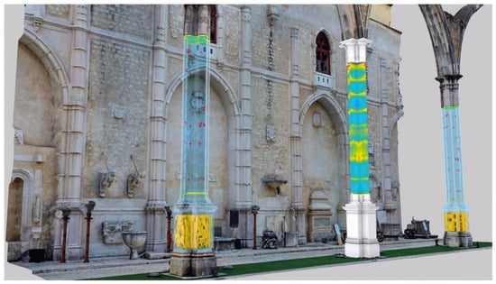
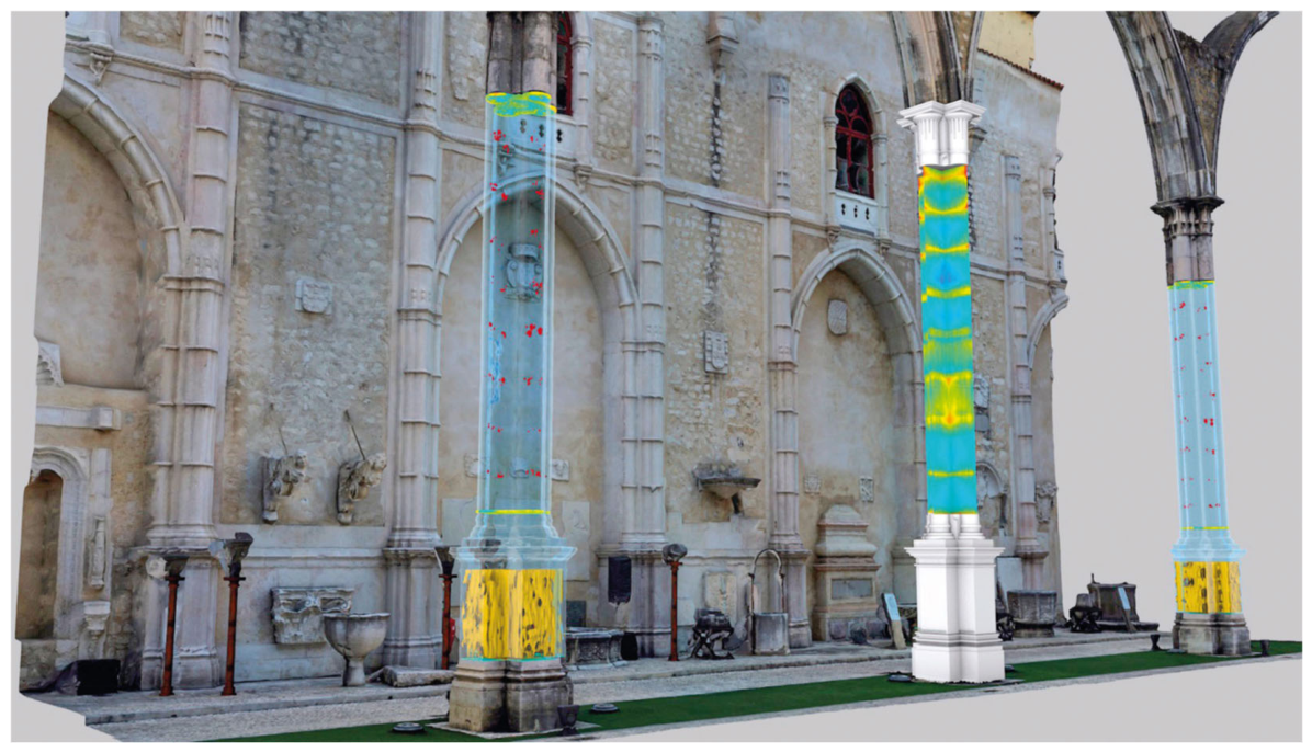
The final task of the Heritage Within project was to construct a virtual reality prototype branded as HWITHIN Integrated Analyses, in which all the data gathered and the non-destructive techniques are displayed: GPR and UTS (Figure 29). At this stage, the decision was taken to present the pre-earthquake model, given its historical proximity to the actual museum. The integration of the virtual historical reconstruction model within the platform was conducted by the Italian National Research Council (CNR) from September to November 2021.
Figure 29.
GPR imaging results inside the pillars, with tomographic results in the center and 3D representations of the GPR results on the sides [30].
In the last two decades, there has been a growing need for the public to access facilities that enhance their understanding of both the tangible and intangible aspects of cultural heritage. Information and communication technology (ICT) has played a crucial role in addressing this need by providing broad accessibility; it not only allows users to acquire information about individual objects but also enables them to place these objects within a broader context, thereby fostering a deeper and more comprehensive understanding of the overall history [22].
The potential exists for the virtual platform to be developed in the future to transform into a complete digital twin of the Carmo Archaeological Museum; the purpose of this would be threefold: firstly, to present the integrated information in an open, remote access for all users on laptops, mobile and tablet devices; secondly, to disseminate cultural heritage and transfer technical and scientific information to the general public; and thirdly, to enable remote operation by technicians and managers of the heritage asset to interact dynamically with real-time data obtained through the monitoring system in the future.
The use of virtual content to visualize and interpret multiparametric information has been demonstrated to enhance conventional approaches to communicating information on the physical characteristics and state of conservation of architectural heritage. This approach constitutes a system for storytelling, teaching, as well as a system for storing and analysing heterogeneous data, which has been developed for several historic buildings, depending on their state of conservation [31].
In relation to the virtual tour itself, the navigation will not be conceived as a real-time 3D visit, but rather based on pre-calculated panoramas. These panoramas provide a stereoscopic view comparable to that of a 3D model while requiring minimal hardware resources. The webApp will be available on desktop or mobile, allowing visitors to connect their devices. The information elements are available in various forms, including text, audio, images, virtual reconstructions and videos, all of which have been meticulously developed to facilitate a comprehensive understanding of the Carmo convent, in conjunction with the analysis results [32].
The overarching objective of the Carmo Virtual tour is to transform conventional digital scenarios into smart visits of architectural heritage, encompassing its construction components and materials, within immersive and participatory virtual environments, facilitated by enabling platforms. It is anticipated that this initiative will enhance the virtual tour, rendering it more collective, interactive and participatory, whilst also facilitating the evaluation of the public’s comprehension level of the presented contents (Figure 30).
Figure 30.
Carmo Integrated Analyses platform (a) Current state panorama and (b) 3D historical reconstruction of the convent.
8. Conclusions
This study demonstrates an integrated digital workflow synthesizing high-resolution photogrammetry, semantically structured 3D modelling, historical research, and non-destructive testing (NDT) within a Virtual Reality (VR) environment for the Church of the Carmo Convent in Lisbon. By bridging the methodological gap between raw geometric acquisition, historical reconstruction, and structural diagnostic datasets, the proposed platform provides a foundation for the future development of an operational Digital Twin tailored to complex architectural heritage.
The multi-temporal modelling strategy successfully captured two critical historical milestones—the 1389 foundation model and the 1745 pre-earthquake model—alongside the present-day state. The rigorous cross-referencing of physical traces (such as vault burn lines and remaining Gothic window fragments) with archival prints and coeval structures in Santarém enabled a reconstruction of lost structural systems with confidence levels reflecting the available evidence, notably the sexpartite nave vaults and original buttressing.
Furthermore, the 3D spatial integration of GPR and UTS data directly onto structural elements (such as column shafts and pedestals) demonstrates the platform’s potential as both a diagnostic decision-support system for heritage conservationists and an immersive, participatory storytelling tool for public dissemination.
Building upon these diagnostic capabilities, this multi-layered framework offers a broader contribution to heritage management across three key operational dimensions. From a conservation standpoint, embedding geometry alongside diagnostic evidence provides a non-destructive baseline that can support the tracking of material degradation over time [13,32]. In terms of historical research, the platform acts as an interactive repository where heterogeneous archival sources and spatial hypotheses can be continually tested and updated. Finally, regarding educational outreach, the immersive interface translates complex structural data into accessible visual narratives, fostering public engagement and supporting remote academic access to vulnerable monuments.
Future research will focus on evolving this WebVR framework into a fully dynamic Digital Twin by integrating real-time structural health monitoring (SHM) sensor networks and automating point-cloud segmentation via machine learning algorithms. This approach is expected to enable digital documentation to directly support preventive conservation strategies while broadening public engagement with vulnerable architectural heritage.
Author Contributions
Conceptualization, R.M.N., C.N.P. and J.O.H.; methodology, R.M.N., F.G. and N.M.; software, R.M.N.; validation, C.N.P. and M.G.H.; data curation, C.N.P., N.M. and F.G.; writing—original draft preparation, R.M.N. and M.G.H.; writing—review and editing, J.O.H., N.M., F.G. and C.N.P.; visualization, R.M.N.; supervision, M.G.H. and J.O.H.; project administration, N.M. and J.O.H.; funding acquisition, J.O.H., N.M. and M.G.H. All authors have read and agreed to the published version of the manuscript.
Funding
This research was funded by Creative Europe for cross-sectoral bridging culture and audiovisual content through digital, grant number 614719-CREA-1-2019-1-PT-CROSS-SECT-INNOVLAB. J.O. acknowledges financial support from the Ramón y Cajal Fellowship RYC2023-044886-I, funded by MICIU/AEI/10.13039/501100011033 and FSE+. R.M.N. acknowledges financial support from PTA2022, funded by MCIU/AEI/10.13039/501100011033 and FSE+.
Institutional Review Board Statement
Not applicable.
Informed Consent Statement
Not applicable.
Data Availability Statement
The data are available from the corresponding author upon reasonable request.
Acknowledgments
The author gratefully acknowledges the support of the Associação dos Arqueólogos Portugueses (AAP) and the Archaeological Museum of Carmo (MAC), which served as the case study for this research project. Special thanks are extended to Célia Nunes Pereira and José Arnaud for their invaluable assistance and close collaboration with the research team, as well as for facilitating access to the museum for the Heritage Within project members.
Conflicts of Interest
The authors declare no conflicts of interest.
References
- Remondino, F.; Campana, S. 3D Recording and Modelling in Archaeology and Cultural Heritage: Theory and Best Practices; Archaeopress: Oxford, UK, 2014. [Google Scholar]
- Fassi, F.; Achille, C.; Fregonese, L.; Monti, C. Multiple data source for survey and modelling of very complex architecture. Int. Arch. Photogramm. Remote Sens. Spat. Inf. Sci. 2010, 38, 226–231. [Google Scholar]
- Grussenmeyer, P.; Landes, T.; Voegtle, T.; Ringle, K. Comparison methods of terrestrial laser scanning, photogrammetry and tacheometry data for recording of cultural heritage buildings. Int. Arch. Photogramm. Remote Sens. Spat. Inf. Sci. 2008, 37, 213–218. [Google Scholar]
- Tini, M.A.; Forte, A.; Girelli, V.A.; Lambertini, A.; Roggio, D.S.; Bitelli, G.; Vittuari, L. Scan-to-HBIM-to-VR: An integrated approach for the documentation of an industrial archaeology building. Remote Sens. 2024, 16, 2859. [Google Scholar] [CrossRef] [Scilit]
- Liu, J.; Li, B. Heritage Building Information Modelling (HBIM): A review of published case studies. In Proceedings of the International Archives of the Photogrammetry, Remote Sensing and Spatial Information Sciences—ISPRS Archives, Online, 11 May 2024; Volume XLVIII-2/W4-2024, pp. 387–393. [Google Scholar] [CrossRef] [Scilit]
- Barrile, V.; Bernardo, E.; Fotia, A.; Bilotta, G. Integration of laser scanner, ground-penetrating radar, 3D models and mixed reality for artistic, archaeological and cultural heritage dissemination. Heritage 2022, 5, 1529–1550. [Google Scholar] [CrossRef] [Scilit]
- Murphy, M.; McGovern, E.; Pavia, S. Historic Building Information Modelling—Adding intelligence to laser and image-based surveys of European classical architecture. ISPRS J. Photogramm. Remote Sens. 2013, 76, 89–102. [Google Scholar] [CrossRef] [Scilit]
- Banfi, F. BIM orientation: Grades of generation and information for different type of analysis and management process. Int. Arch. Photogramm. Remote Sens. Spat. Inf. Sci. 2017, 42, 57–64. [Google Scholar] [CrossRef] [Scilit]
- Şentürk, H.S.; Şimşek, C.F. A review on HBIM modelling process from 3D point clouds by applying artificial intelligence algorithms in cultural heritage. Politek. Derg. 2025, 28, 897–908. [Google Scholar] [CrossRef] [Scilit]
- Banfi, F.; Liu, W. The state of HBIM in digital heritage: A critical and bibliometric assessment of six emerging frontiers (2015–2025). Appl. Sci. 2026, 16, 906. [Google Scholar] [CrossRef] [Scilit]
- Zhao, J.; Yu, H.; Hua, X.; Wang, X.; Yang, J.; Zhao, J.; Xu, A. Semantic segmentation of point clouds of ancient buildings based on weak supervision. Herit. Sci. 2024, 12, 232. [Google Scholar] [CrossRef] [Scilit]
- Wang, X.; Wu, C.; Zhang, X.; Pan, R. Bridging heritage knowledge and digital models: An HBIM integration framework. ISPRS Ann. Photogramm. Remote Sens. Spat. Inf. Sci. 2025, 10, 365–372. [Google Scholar] [CrossRef] [Scilit]
- Morero, L.; Visone, F.; Abate, N.; Vitale, V.; Minervino Amodio, A.; Prodomo, M.; Gioia, D.; Scavone, M.; Sileo, M.; Loperte, A.; et al. Towards the creation of an Open Source HBIM tool for planning diagnostic and restoration activities: The example of the Troia Cathedral rose window. In Proceedings of the 2022 IMEKO TC-4 International Conference on Metrology for Archaeology and Cultural Heritage (MetroArchaeo 2022), Cosenza, Italy, 19–21 October 2022; pp. 273–277. [Google Scholar] [CrossRef] [Scilit]
- Abate, N.; Prodomo, M.; Frisetti, A.; Masini, N. HBIM and Extended Matrix for the archaeological reconstruction of the excavated medieval contexts: The case of the castle of Monteforte Irpino (AV). In Proceedings of the 2022 IMEKO TC-4 International Conference on Metrology for Archaeology and Cultural Heritage (MetroArchaeo 2022), Cosenza, Italy, 19–21 October 2022; pp. 360–364. [Google Scholar] [CrossRef] [Scilit]
- Castellazzi, G.; D’Altri, A.M.; Bitelli, G.; Selvaggi, I.; Lambertini, A. From laser scanning to finite element analysis of complex buildings by using a semi-automatic procedure. Sensors 2015, 15, 18360–18380. [Google Scholar] [CrossRef] [Scilit] [PubMed]
- Valente, M.; Milani, G. Seismic assessment of historical masonry towers by means of simplified approaches and standard FEM. Constr. Build. Mater. 2016, 108, 74–104. [Google Scholar] [CrossRef] [Scilit]
- Castellazzi, G.; D’Altri, A.M.; Bitelli, G.; Selvaggi, I.; Lambertini, A. Cloud2FEM: A finite element mesh generator based on point clouds of existing/historical structures. Remote Sens. 2015, 7, 13460–13470. [Google Scholar]
- Kersten, T.P.; Tschirschwitz, F.; Deggim, S. A systematic review of virtual 3D reconstructions of cultural heritage in immersive virtual reality. Heritage 2024, 7, 1827–1852. [Google Scholar]
- Cheng, H.; Cang, M.; Zhou, W. Evaluating knowledge transfer mechanisms and outcomes of VR/AR for cultural-heritage serious games. Herit. Sci. 2025, 13, 2247. [Google Scholar] [CrossRef] [Scilit]
- Innocente, C.; Ulrich, L.; Moos, S.; Vezzetti, E. A framework study on the use of immersive XR technologies in the cultural heritage domain. J. Cult. Herit. 2023, 62, 268–283. [Google Scholar] [CrossRef] [Scilit]
- Banfi, F.; Cazzani, A.; Liu, W. XR technologies for enhanced cultural engagement: From HBIM to a comparative analysis of VR and WebVR development tools. Int. Arch. Photogramm. Remote Sens. Spat. Inf. Sci. 2025, 48, 95–102. [Google Scholar] [CrossRef] [Scilit]
- Gabellone, F. Digital twin: A new perspective for cultural heritage management and fruition. ACTA IMEKO 2022, 11, 7. [Google Scholar] [CrossRef] [Scilit]
- Monteiro, J.G. Nuno Álvares Pereira (1360–1431): De general a carmelita. Medievalismo 2018, 28, 219–250. [Google Scholar] [CrossRef] [Scilit]
- Gutscher, M.A. What caused the Great Lisbon Earthquake? Science 2004, 305, 1247–1248. [Google Scholar] [CrossRef] [Scilit] [PubMed]
- Scacco, J.; Salazar, L.G.; Bianchini, N.; Mendes, N.; Cullimore, C.; Jain, L. Seismic Assessment of the Church of Carmo Convent. Master’s Thesis, University of Minho, Guimarães, Portugal, 2019. [Google Scholar]
- Blender Online Community. Blender—Free and Open-Source 3D Creation Suite; Blender Foundation: Amsterdam, The Netherlands; Available online: https://www.blender.org/ (accessed on 10 August 2026).
- Brum, J.Z.M. Estampas Gravadas por Guilherme Francisco Lourenço Debrie; Officinas de Artes Graphicas da Bibliotheca Nacional: Rio de Janeiro, Brazil, 1908. [Google Scholar]
- Galvão, D. Frontispiece Illumination: Panorama of Lisbon and the Carmo Convent. In Crónica de D. Afonso Henriques (Illuminated Manuscript, c. 1530–1545); Inv. 14; Museu Condes de Castro Guimarães: Cascais, Portugal, 1545; Available online: https://cultura.cascais.pt/sites/default/files/virtual_tour/mccg/ebook/files/basic-html/page16.html (accessed on 10 August 2026).
- CNR-ISPC. H-WITHIN: Heritage Within Project; Institute of Heritage Science, National Research Council: Rome, Italy, 2026; Available online: https://h-within.ispc.cnr.it/ (accessed on 10 August 2026).
- Gabellone, F.; Masini, N. VR/AR based data integration for the diagnosis of the state of conservation of the Convento do Carmo. Towards a digital twin of architectural heritage. In Heritage Within. European Research Project; Sersilito-Empresa Gráfica, Lda.: Maia, Portugal, 2021; pp. 101–116. [Google Scholar]
- Hassani, F. Documentation of Cultural Heritage Techniques–Potentials and Challenges. Int. Arch. Photogramm. Remote Sens. Spat. Inf. Sci. 2015, XL-5/W7, 207–214. [Google Scholar]
- Campi, M.; di Luggo, A.; Scandurra, S. 3D modelling for the knowledge of architectural heritage and virtual reconstruction of its historical memory. Int. Arch. Photogramm. Remote Sens. Spat. Inf. Sci. 2017, 42, 133–139. [Google Scholar] [CrossRef] [Scilit]

Disclaimer/Publisher’s Note: The statements, opinions and data contained in all publications are solely those of the individual author(s) and contributor(s) and not of MDPI and/or the editor(s). MDPI and/or the editor(s) disclaim responsibility for any injury to people or property resulting from any ideas, methods, instructions or products referred to in the content. |
© 2026 by the authors. Licensee MDPI, Basel, Switzerland. This article is an open access article distributed under the terms and conditions of the Creative Commons Attribution (CC BY) license.