


Abstract
This study evaluates the stability and failure probability of rock slopes at Mount Uhud, Madinah, Saudi Arabia, with particular attention to a representative slope in the densely populated southern part. A combined deterministic–probabilistic approach was adopted using a two-dimensional, nonlinear elastoplastic finite element model to capture realistic slope behavior. Uncertainty in key geomechanical parameters—slope angle, cohesion, and internal friction angle—was quantified through Li’s Point Estimate Method, resulting in probabilistic simulations. Slope performance was assessed in terms of both factor of safety (FoS) and probability of failure (Pf). Deterministic analysis yielded a factor of safety of 0.813, while probabilistic simulations produced a factor of safety range between 0.468 and 1.052, with a mean value of approximately 0.73. The corresponding probability of failure was estimated at about 5.16%. Sensitivity analysis indicates that cohesion and internal friction angle exert the strongest influence on stability outcomes. Although the slope shows noticeable sensitivity to reductions in these parameters, the overall probability of failure remains relatively low under current conditions. The results demonstrate that integrating deterministic and probabilistic analyses provides a robust basis for evaluating rock slope reliability in complex geological environments, particularly in rapidly urbanizing mountainous areas such as Mount Uhud.
1. Introduction
Mount Uhud is located immediately north of Al Madinah Al Munawwarah, Saudi Arabia, and constitutes one of the most prominent geological features in the region, in addition to its exceptional religious and historical significance. The mountain extends approximately 5–6 km from the Prophet’s Mosque and forms a natural geomorphological barrier that has historically limited urban expansion toward the north, while development has progressed predominantly in the southern, eastern, and western directions. In recent decades, accelerated urbanization has increasingly encroached upon the southern foothills of Mount Uhud, intensifying interactions between engineered infrastructure and steep natural slopes. This expansion has elevated exposure to slope-related hazards, particularly rockfalls and flash flooding, highlighting the necessity for systematic and reliable geotechnical evaluation of the mountain’s rock slopes [1].
Slope stability is controlled by a complex interaction of factors, including slope geometry, rock mass properties, discontinuity networks, groundwater conditions, and external loading. Conventional deterministic approaches typically evaluate slope performance by computing a single factor of safety (FoS) based on the balance between driving and resisting forces. Although these methods remain widely used due to their simplicity and transparency, they rely on fixed or representative parameter values and therefore provide limited insight into the inherent uncertainty and spatial variability characteristic of geotechnical materials. As a result, deterministic outcomes alone may offer an incomplete or potentially misleading representation of slope behavior, particularly in heterogeneous or highly fractured rock masses. To address these limitations, contemporary research increasingly incorporates probabilistic concepts, allowing slope stability to be expressed not only in terms of FoS but also as a probability of failure [2,3,4].
Slope stability analysis occupies a central position in geotechnical engineering and engineering geology, serving as a fundamental tool for understanding and mitigating mass-movement processes. At its core, the analysis examines the relationship between shear resistance mobilized within soil or rock masses and the gravitational forces promoting downslope movement. When resisting forces are exceeded, slopes may fail through mechanisms such as landslides, rockfalls, or debris flows. Seminal contributions by Hoek and Bray [5] established the theoretical basis for rock slope stability analysis, with subsequent studies expanding these concepts through analytical, empirical, and numerical approaches capable of addressing increasingly complex geological conditions [6,7].
A comprehensive slope stability investigation generally involves several interrelated stages, including detailed characterization of geological and hydrogeological conditions, selection of appropriate analytical or numerical models, and evaluation of stability indices or risk-related metrics. Deterministic techniques such as limit equilibrium analysis (LEA) provide efficient estimates of FoS and remain widely applied in engineering practice. However, recognition of the inherent variability and uncertainty associated with geotechnical parameters has led to the growing adoption of probabilistic methods, which enable explicit quantification of uncertainty, estimation of reliability indices, and calculation of failure probabilities, thereby improving confidence in stability assessments and supporting risk-informed decision-making [8,9,10].
Recent methodological advances increasingly promote integrated deterministic–probabilistic frameworks that couple numerical modeling techniques—such as finite element or finite difference methods—with stochastic representations of material properties. These hybrid approaches allow complex mechanical behavior to be simulated while explicitly accounting for uncertainty in input parameters, resulting in a more comprehensive and realistic assessment of slope reliability [11,12,13]. Despite these advantages, many probabilistic studies rely heavily on Monte Carlo simulation techniques, which can be computationally demanding and difficult to implement in nonlinear numerical models or in situations where statistical data are limited.
In parallel with these developments, machine learning (ML) techniques have emerged as a rapidly growing research direction in slope stability assessment. Recent studies (2020–2025) have applied supervised ML algorithms—including support vector machines, random forests, gradient boosting methods, and deep neural networks—to predict factors of safety, classify slope stability states, and capture complex nonlinear interactions among geotechnical variables [14,15,16,17,18]. Ensemble learning and hybrid ML–optimization frameworks have further improved predictive performance and robustness [19,20]. While these data-driven approaches demonstrate strong predictive capability, their effectiveness typically depends on the availability of large, high-quality datasets for training and validation. Moreover, ML models may offer limited physical interpretability, which can be a critical limitation in engineering applications where transparent reasoning, traceability of results, and understanding of failure mechanisms are essential—particularly at culturally sensitive sites such as Mount Uhud.
The primary objective of slope stability analysis is to ensure the safety and long-term performance of both natural and engineered slopes under variable geological, hydrological, and loading conditions. Stability assessments inform the design, construction, and maintenance of infrastructure such as transportation corridors, dams, foundations, and mining operations constructed on or adjacent to inclined terrain. Beyond design considerations, slope stability analysis supports risk management by identifying potentially unstable zones, anticipating failure mechanisms, and guiding the implementation of mitigation measures, including drainage systems, slope reinforcement, and protective barriers. Probabilistic insights further contribute to hazard zoning, early-warning strategies, and informed urban planning decisions [21,22,23].
From a broader perspective, slope stability assessment contributes to sustainable development by balancing engineering performance with environmental protection and societal safety. In regions such as Mount Uhud—where rapid urban expansion intersects with areas of exceptional cultural and religious importance—this balance becomes particularly critical. In such settings, slope instability represents not only a geotechnical challenge but also a potential threat to heritage preservation and public safety [24,25].
Slopes may be classified according to their origin and material composition. Natural slopes evolve through geological processes such as tectonic activity, weathering, and erosion, whereas engineered slopes result from human activities including excavation, embankment construction, and mining. From a mechanical standpoint, slopes are commonly distinguished as soil or rock slopes, depending on whether their behavior is governed primarily by soil mechanics or by rock mass structure. In rock slopes, stability is often controlled by structural features such as joints, bedding planes, and faults, which may exert a greater influence than intact rock strength alone [26,27,28,29]. This structural complexity introduces additional uncertainty, particularly in volcanic or highly fractured rock masses.
Despite the extensive body of literature on slope stability analysis, a clear research gap remains. Many studies continue to rely solely on deterministic methods that cannot quantify uncertainty, while others adopt probabilistic or ML-based approaches that are computationally intensive, data-hungry, or difficult to interpret in practical engineering contexts. Moreover, relatively few investigations have applied computationally efficient hybrid deterministic–probabilistic frameworks to volcanic, highly fractured rock slopes located in arid environments at the urban fringe of culturally significant sites such as Mount Uhud [30,31,32].
Accordingly, the present study addresses this gap by focusing on the southern flank of Mount Uhud, where dense residential development is closely juxtaposed with steep rock slopes. A hybrid deterministic–probabilistic methodology is adopted that integrates limit equilibrium and nonlinear finite element analyses with a computationally efficient probabilistic technique, namely Li’s Point Estimate Method (PEM). This approach enables uncertainty in key geotechnical parameters to be quantified using a limited number of simulations, avoiding the substantial computational burden associated with large-scale Monte Carlo analyses. The novelty of this study lies in the application of an interpretable and efficient hybrid framework to a culturally significant volcanic rock slope in an arid urban environment, providing a practical and transparent basis for slope reliability assessment, hazard mitigation, and sustainable land-use planning.
The remainder of this paper is organized as follows. Section 2 presents the Mount Uhud case study, including geological conditions, slope geometry, and the surrounding urban context. Section 3 describes the materials and methods, detailing the deterministic analyses, nonlinear finite element modeling, and the probabilistic formulation based on Li’s Point Estimate Method. Section 4 presents and discusses the results of deterministic and probabilistic analyses, including sensitivity trends and implications for slope stability. Section 5 summarizes the main conclusions and contributions of the study, while Section 6 outlines the limitations and identifies directions for future research.
2. Case Study
2.1. Study Area and General Features
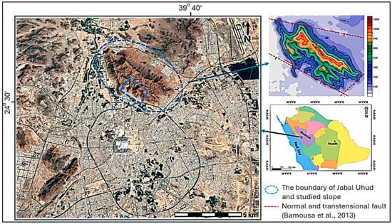
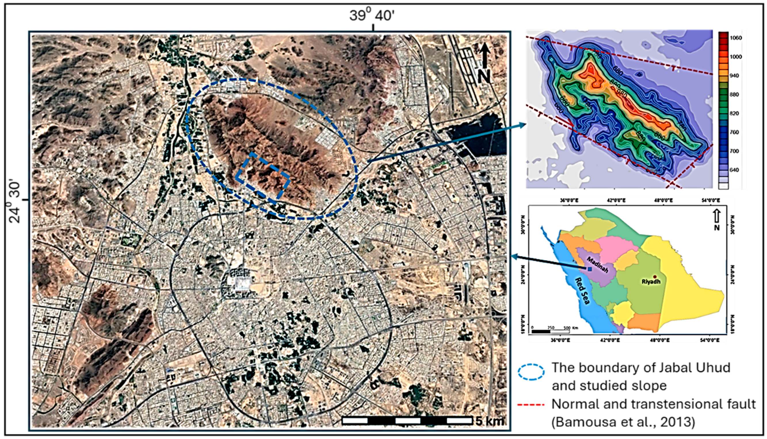
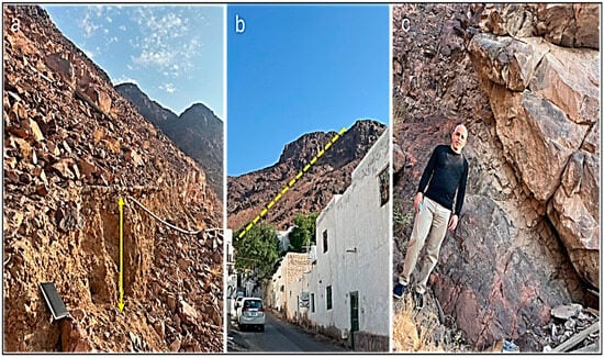
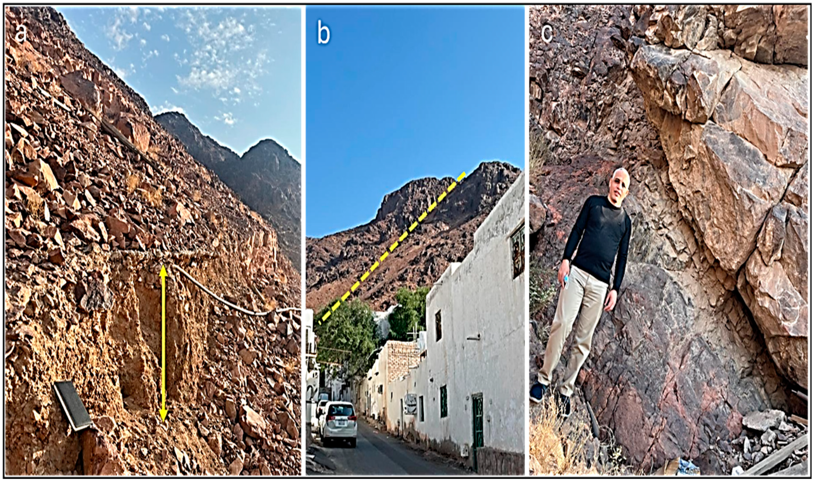
Mount Uhud (Jabel Uhud) is situated in the northern part of Al-Madinah Al-Munawarah, in the western part of the Kingdom of Saudi Arabia (Figure 1), about 150 km east of the Red Sea coast, and its geological structure is part of the overall geological structure of the Arabian Shield [26]. It occupies about 28 km2 and is characterized by very rugged relief, with the highest elevation point being 1070 m asl. The field observations, Landsat image and geological map [27] indicate that Mount Uhud belongs to the Al Ays Group of the Proterozoic and consists mainly of rhyolite, ignimbrite, rhyolite breccia and tuff. Intrusions of dacite and diorite are also found. These rock units are inclined toward a southwestern direction with an inclined angle ranging between 30° and 40°. They are highly fractured with columnar fractures, close to moderate spacing, and persistent systematic joint sets, which facilitate enhanced different types of weathering as indicated by the occurrence of distinctly weathered beds (Figure 2a), which represents a key controlling factor in the slope instability. According to Bamousa et al. [26], the study area is affected by the NW–SE Najd Fault system, which may reactivate as a transtensional fault along the southern cliff (Figure 1) of the Mount. Numerous normal faults and cross-cutting fractures-oriented opposite to the main fault [28] are also documented (Figure 2b). As a result, different dimensions of potentially unstable rock masses were observed (Figure 2c), indicating structurally controlled rock failure processes.
Figure 1.
Location of Al Madinah Al Munawarah and the boundary of Mount (Jabal) Uhud.
Figure 2.
Photographs of different features showing (a). strongly altered rock that represents a potential failure plane; (b). the NE-SW normal fault; (c). an open fracture in the southwestern part of Mount Uhud.
The area under investigation is characterized by arid to semi-arid climatic conditions, with an average annual rainfall of approximately 62 mm. Relative humidity also varies considerably throughout the year, averaging around 30% during the summer and rising to about 60% in the winter [29].
2.2. Importance of the Study
The slopes of Mount Uhud present a dual significance: geological complexity and cultural sensitivity. Their steep topography, coupled with variable rock mass conditions, demands careful assessment of stability to prevent potential hazards to nearby communities and visitors. From a sustainability perspective, understanding these slopes contributes to balancing religious heritage conservation with urban growth and public safety. Consequently, this study applies an integrated deterministic–probabilistic approach to quantify the likelihood of slope instability and assess performance criteria through the factor of safety (FoS) and failure probability estimates [2,17].
2.3. Field Observations and Rock Slope Description
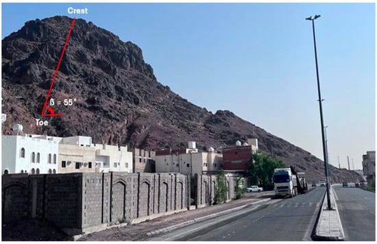
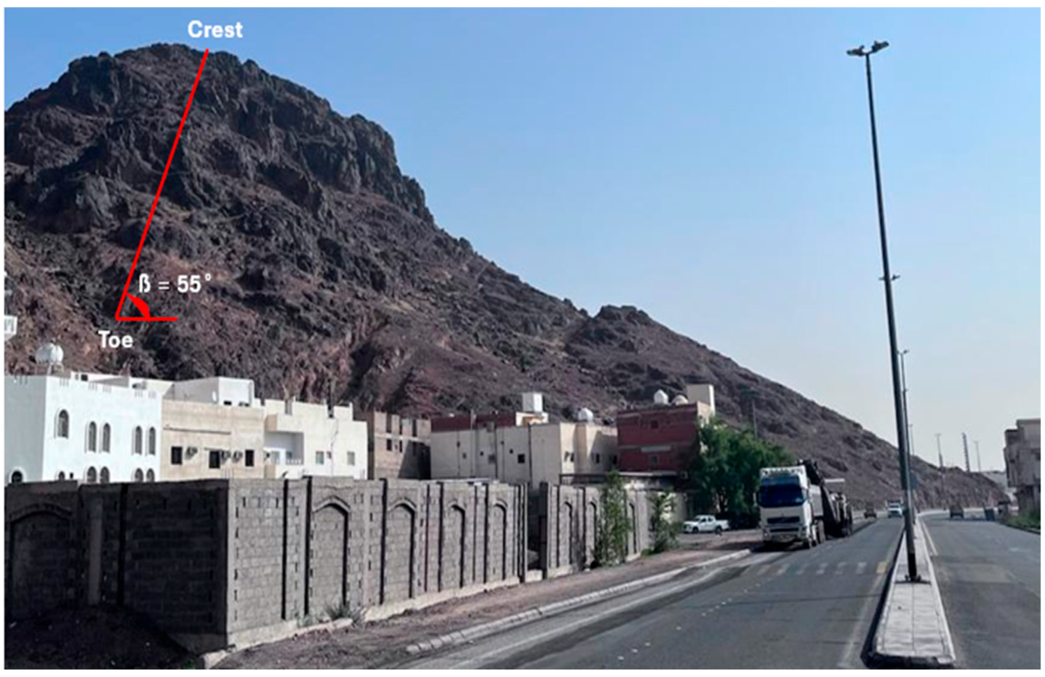
The examined slope is located on the southwestern sector of Mount Uhud, a prominent ridge north of Al-Madinah Al-Munawwarah (Figure 3). The slope appears as a planar surface with a consistent inclination, characteristic of a planar slope as described by Finlayson et al. [30]. Such slopes are typically found in upper valley regions, marked by steep gradients and limited fluvial modification. In the study area, straight slopes often appear sequentially along the mountain’s flanks and occasionally in the lower sectors as well.
Figure 3.
A southwest rock slope connecting Mount Uhud.
The investigated slope face measures approximately 18 m in vertical height, 40 m in length, and an average width of 25 m from crest to toe, with an overall inclination of 55°. Laboratory testing of collected rock samples yielded a cohesion value of 27.5 kPa and an internal friction angle of 36°, which serve as key input parameters for shear strength and stability evaluation.
Comparable methodologies—combining geomorphological mapping, borehole investigations, and GIS-based modeling—have been effectively applied in previous studies on Mount Uhud [1,17,31,32,33], emphasizing the importance of integrating field data with numerical modeling for accurate slope stability assessment.
A field study was conducted on the southwestern flank of Mount Uhud, where lithological variations, slope angles, and discontinuity patterns are observed. The fieldwork provided essential practical experience in geological mapping and rock mass characterization, contributing to a more comprehensive understanding of the slope’s mechanical behavior.
2.4. Rock Slope Geometry and Modeling Setup
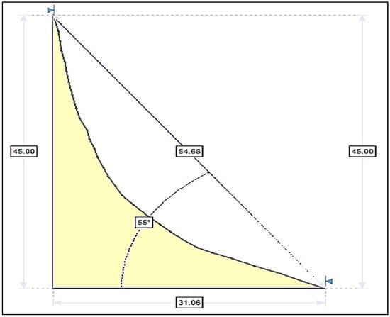
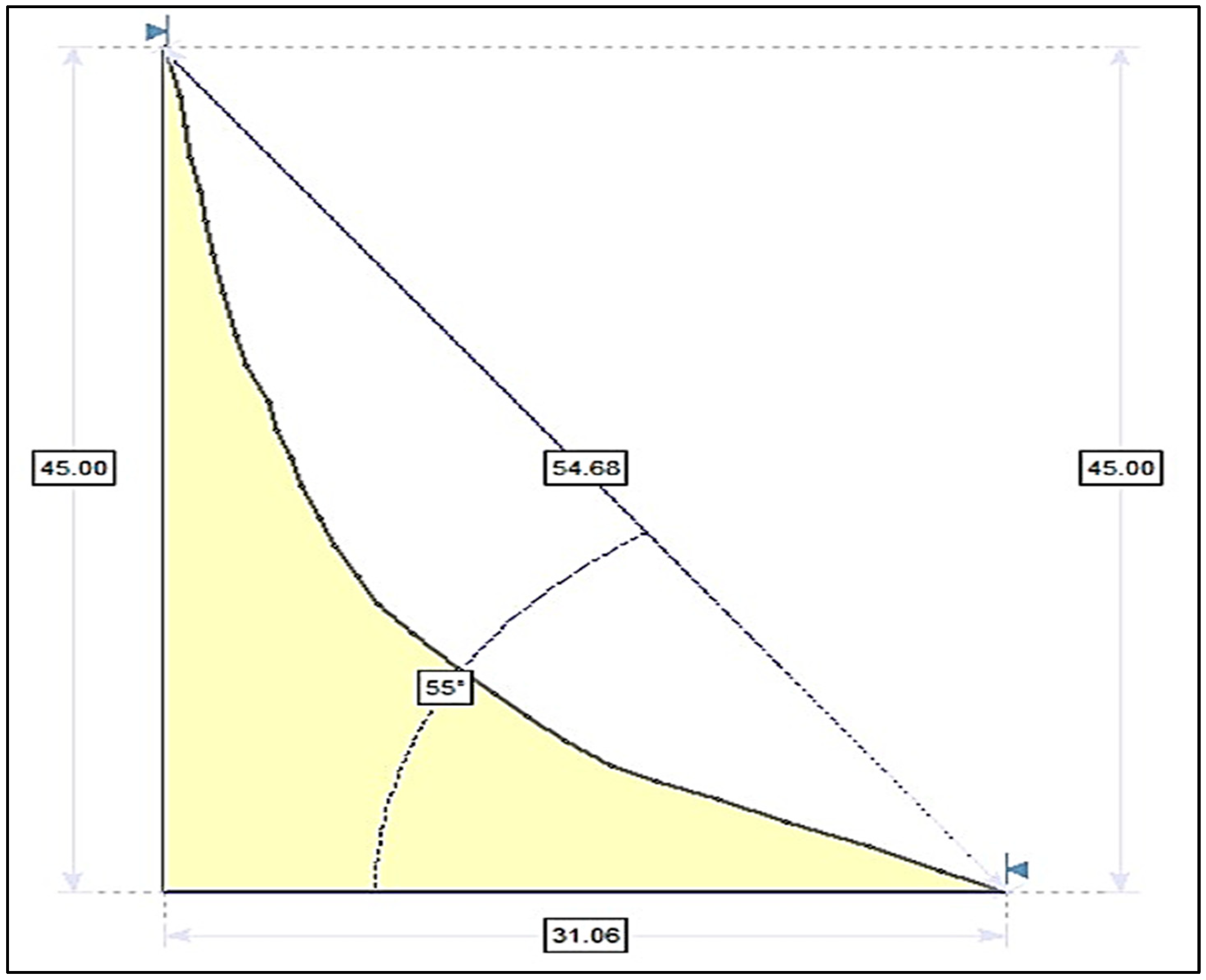
A two-dimensional stability model was constructed using Slide software (version 9.3) to analyze the geometric and mechanical parameters of the slope (Figure 4). The modeled slope has a height of 45 m and a base length of 31.06 m, forming an approximately right-angled profile.
Figure 4.
Geometry of the slope model constructed in SLIDE software, showing slope height (45 m), base length (31.06 m), slip surface (54.68 m), and failure surface inclination (55°).
The potential slip surface—modeled as a circular arc—intersects the slope at an inclination of 55° and a slip surface length of 54.68 m. Boundary conditions were assigned such that the top and lateral boundaries were fixed horizontally, while the base was fixed in both the horizontal and vertical directions, replicating realistic ground confinement conditions. The potential failure mass was delineated within the model as a shaded region, representing the zone under consideration in the limit equilibrium and probabilistic analyses. The resulting geometry and parameterization provide a robust framework for subsequent deterministic and probabilistic evaluations of slope stability under varying material properties and loading conditions.
3. Materials and Methods
This study adopts an integrated deterministic–probabilistic approach to evaluate the stability of rock slopes in the southwestern sector of Mount Uhud. Deterministic analysis provides the baseline safety factor under fixed input conditions, while probabilistic modeling quantifies the likelihood of slope instability by incorporating the variability of geotechnical parameters. The combination of these approaches ensures a comprehensive understanding of the slope’s mechanical behavior under both average and uncertain conditions [2,17].
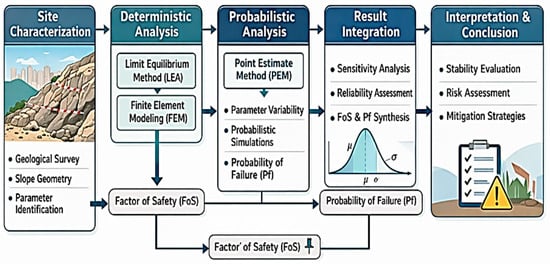
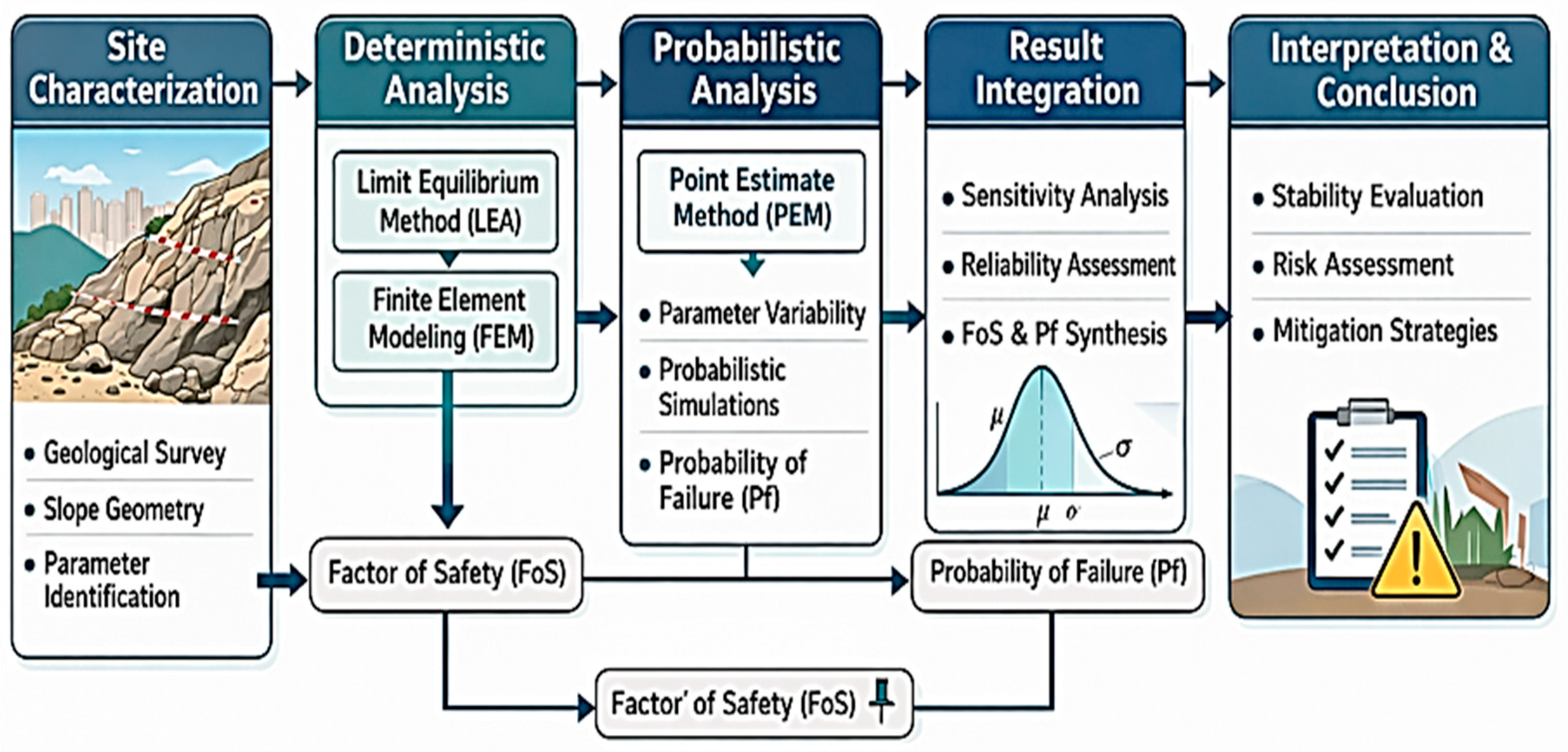
Figure 5 summarizes the overall methodological framework adopted in this study, highlighting the systematic integration of geological characterization, deterministic stability analysis, and probabilistic assessment. The workflow demonstrates how field investigations and laboratory data were used to define slope geometry and rock mass parameters, which were then analyzed using the limit equilibrium method implemented in Slide2 (Version 9.3, Rocscience, Toronto, ON, Canada) and the nonlinear finite element method implemented in RS2 (Version 11.026, Rocscience, Toronto, ON, Canada) to compute factor of safety. Uncertainty in key input parameters was subsequently incorporated through Li’s Point Estimate Method to evaluate failure probability and slope reliability. This integrated approach provides a transparent, efficient, and robust framework for assessing rock slope stability in data-limited, urban, and culturally sensitive environments, supporting informed hazard mitigation and sustainable land-use planning.
Figure 5.
Hybrid deterministic–probabilistic methodology for slope stability analysis.
3.1. Slide Software
The stability analyses were conducted using Slide, a two-dimensional limit equilibrium software developed by Rocscience for geotechnical engineering applications. Slide enables evaluation of the factor of safety (FoS) and probability of failure (Pf) for both soil and rock slopes. The software supports circular and non-circular failure mechanisms using various limit equilibrium methods, such as the Bishop Simplified, Janbu, and Spencer methods, and includes a built-in finite element groundwater seepage module for both steady-state and transient conditions. Furthermore, Slide provides integrated probabilistic and sensitivity analysis capabilities, allowing input parameters such as cohesion, internal friction angle, and unit weight to be defined as statistical distributions rather than single values. The program also offers a library of reinforcement options (e.g., soil nails, anchors, and geosynthetics), advanced search algorithms for identifying critical slip surfaces, and compatibility with CAD-based geometry import (e.g., DXF format), thereby facilitating accurate model construction and computational efficiency [34].
3.2. Failure Evaluation Criteria
The stability of the analyzed slopes was assessed using the factor of safety (FoS), which expresses the balance between the available shear strength and the mobilized shear stress along a potential failure surface, as per Equation (1). If FoS is greater than 1.0, it indicates stable condition, while values near or below unity suggest possible failure.
where
- is the actual shear strength of the rock mass;
- is the mobilized shear stress.
Among the available approaches, limit equilibrium methods (LEMs) remain widely adopted for slope stability evaluation due to their simplicity and proven reliability through field validation [5,8]. However, LEMs do not fully capture stress–strain behavior or deformation patterns. To complement this limitation, numerical approaches such as the finite element and finite difference methods are often used, as they account for complex geometries and nonlinear material behavior [23,35].
In this study, the Slide2D software was employed to calculate the FoS of rock slopes using limit equilibrium analysis, ensuring accurate and computationally efficient evaluation of Mount Uhud’s slope stability.
3.3. Deterministic Analysis
Deterministic numerical modeling is a fundamental computational technique used to predict the mechanical response of natural and engineered systems based on fixed and precisely defined input parameters. In this approach, geotechnical properties such as cohesion, internal friction angle, and unit weight are treated as constant values, and the model geometry and boundary conditions are explicitly defined to yield a unique solution representing the slope’s stability state [36,37].
In this study, deterministic analysis was carried out using the Bishop Simplified Method within Slide to compute the FoS for a circular failure surface representative of the observed slope morphology. The base boundary was fixed in both the horizontal and vertical directions, while the top and lateral boundaries were constrained horizontally only, simulating realistic field conditions. Groundwater influence was neglected due to the arid climate and absence of significant subsurface seepage in the Mount Uhud area. Deterministic modeling provides a baseline measure of slope stability, serving as a benchmark for the probabilistic simulations that account for uncertainty in the input parameters.
Model’s Input Parameters
The input parameters for the slope stability model represent the geotechnical and geometrical characteristics of Mount Uhud’s rock slopes, derived from field observations, laboratory testing, and published data on volcanic rock masses in comparable geological settings [38,39,40]. Cohesion values were set between 20 and 35 kPa (average 27.5 kPa), reflecting moderately weathered rhyolite and dacite affected by fracturing and mineral alteration. The internal friction angle (φ) ranged from 32° to 40° (representative 36°), based on rock mass classification and the degree of interlocking between discontinuities. These ranges align with laboratory shear and direct-shear tests on site-specific samples and are supported by published studies on weathered volcanic and granitic rocks with similar structural characteristics, providing a solid basis for probabilistic analysis. The unit weight (γ) was taken between 24 and 27 kN/m3 (average 25.5 kN/m3), consistent with density values from both field measurements and laboratory tests conducted on representative samples, as listed in Table 1 [1, 35].
Table 1.
Average rock mass properties and slope geometry adopted as input parameters in the deterministic analysis [1, 35].
Geometric parameters were selected according to field topography: slope heights varied between 30 and 60 m, with an average of 45 m, and slope angles ranged from 45° to 60°, with an adopted value of 55°, typical of natural volcanic rock slopes in the Al-Madinah region. These ranges collectively provide a realistic framework for assessing slope stability under site-specific conditions and align with reference data from similar volcanic terrains.
3.4. Probabilistic Analysis
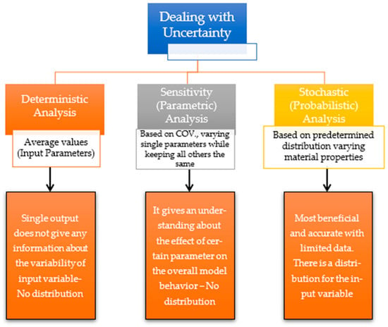
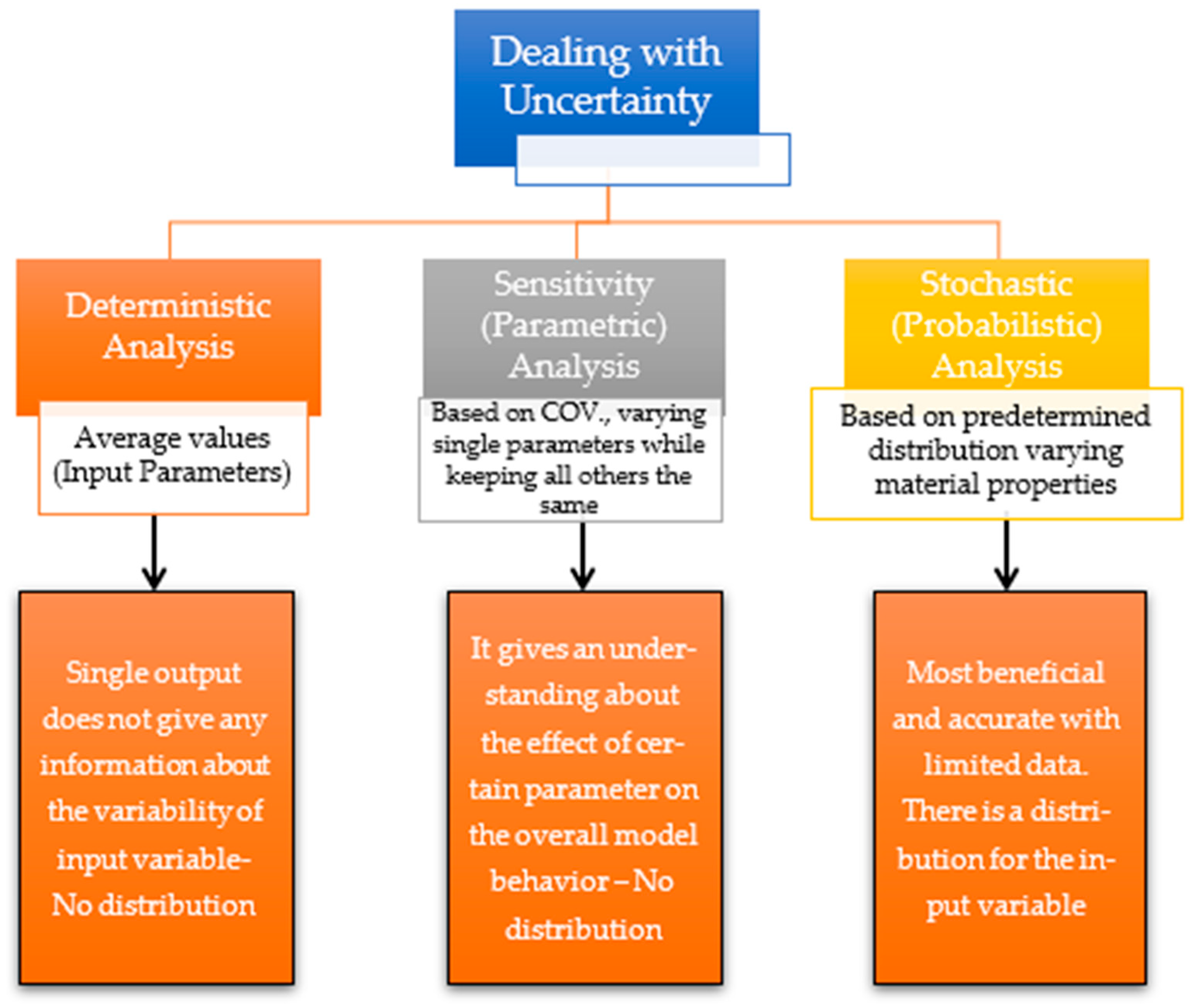
Geotechnical data are inherently variable due to natural heterogeneity and measurement limitations, making uncertainty a key factor in slope stability design. To address this, probabilistic approaches such as the First-Order Reliability Method (FORM), Point Estimate Method (PEM), and Monte Carlo simulation (MCS) are used to quantify variability in parameters like cohesion, friction angle, and rock strength [41,42,43,44]. These methods complement deterministic analyses by translating input uncertainty into failure probabilities, enabling more reliable designs. When integrated with numerical modeling, probabilistic tools provide a robust framework for assessing both the safety and confidence level of slope performance, guiding risk-informed engineering decisions. Figure 6 lists the principal approaches to tackle the inherent uncertainty associated with rock mass properties.
Figure 6.
Adopted Methods for Dealing with Uncertainty.
Consequently, a probabilistic approach was implemented using Li’s Point Estimate Method (n3) to quantify the uncertainty associated with slope stability parameters. This method involves varying the key input parameters according to a coefficient of variation (COV) of 25%, assuming a normal distribution for the random variables.
The assumption of a normal distribution with a uniform COV of 25% for all input variables is based on standard practice in preliminary probabilistic assessments of rock slopes, as widely adopted in published studies for jointed granitic rock masses [45,46,47,48]. Given the limited site-specific statistical data, this approach provides a reasonable approximation of parameter variability while ensuring conservative and transparent evaluation of uncertainty [49,50,51,52,53]. The manuscript has been updated to briefly state this justification. The analysis was performed for 27 simulation runs, each representing a unique combination of input parameters and corresponding factor of safety (FoS) outcomes.
Based on the parametric sensitivity study by Musunuri et al. [54], the most influential parameters affecting slope stability include Young’s modulus (E), cohesion (c), internal friction angle (φ), and slope geometry (slope angle, β and height, H). In this study, cohesion (c), friction angle (φ), and slope angle (β) were identified as the governing parameters, and the Mohr–Coulomb failure criterion was adopted. The statistical parameters of the input variables are summarized in Table 2.
Table 2.
Randomized properties for rock slope associated with Mount Uhud.
Each variable was assigned three representative values—minimum (μ−σ), mean (μ), and maximum (μ+σ)—resulting in 33 = 27 unique scenarios, as summarized in Table 3. For cohesion, friction angle, and slope angle, the respective ranges were 20.6–34.4 kPa, 27–45°, and 41.2–68.8°.
Table 3.
Input stochastic parameters generated using Li’s Point Estimate Method (n3 = 27 runs).
4. Results and Discussion
4.1. Deterministic Analysis Results
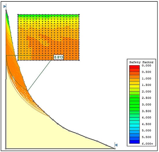
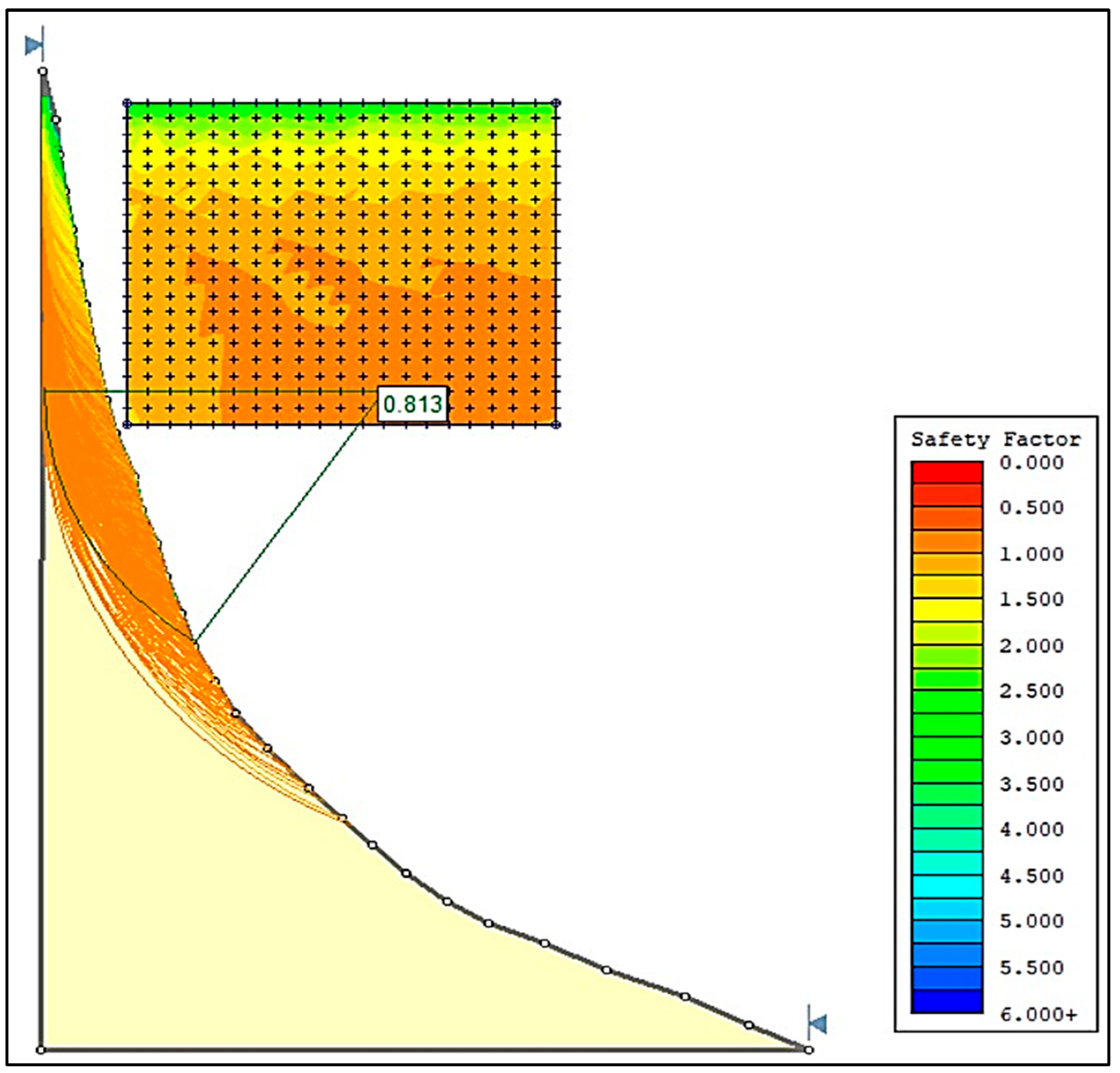
Figure 7 illustrates the factor of safety (FoS) for the analyzed rock slope, calculated as 0.813 using deterministic analysis. This value indicates that the slope is unstable, as it falls below the safety threshold of unity (e.g., FoS < 1). However, deterministic analysis alone does not provide information on the variability or probability of instability and thus cannot capture the uncertainties inherent in rock mass properties.
Figure 7.
Deterministic stability analysis showing the critical slip surface and the computed factor of safety (FoS = 0.813).
As highlighted by Duncan [35], deterministic approaches depend heavily on single-value input parameters, which may oversimplify complex natural conditions. Similarly, Griffiths and Fenton [36] emphasized that probabilistic methods are necessary to quantify variability and assess the likelihood of failure. Abdellah et al. [45] further demonstrated that reliance solely on deterministic models may lead to misleading interpretations of slope stability, particularly in heterogeneous volcanic terrains. Therefore, a probabilistic assessment was undertaken to complement the deterministic results and represent the uncertainty of input parameters.
4.2. Probabilistic Analysis Results
In this study, the key parameters influencing slope stability were cohesion (c), internal friction angle (φ), and overall slope angle (β). Li’s Point Estimate Method (PEM) with an N3 formulation was adopted, performing 27 simulation runs to evaluate the probabilistic stability of the slope. The computed FoS values from the hybrid deterministic–probabilistic simulations varied from 0.468 (minimum stability: c = 20.6 kPa, φ = 27°, β = 68.8°) to 1.052 (maximum stability: c = 34.4 kPa, φ = 45°, β = 41.2°), as listed in Table 4. These results confirm that friction angle (φ) and slope angle (β) exert the most significant influence on slope stability, whereas cohesion (c) plays a secondary role. Higher friction angles and lower slope angles yield the most stable configurations.
Table 4.
Computed factors of safety (FoSs) obtained using Li’s Point Estimate Method (n3 = 27 runs), corresponding to variations in the stochastic input parameters.
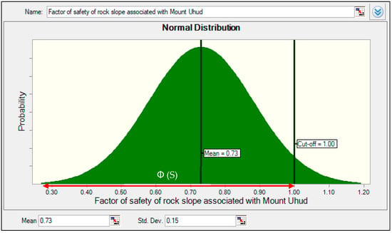
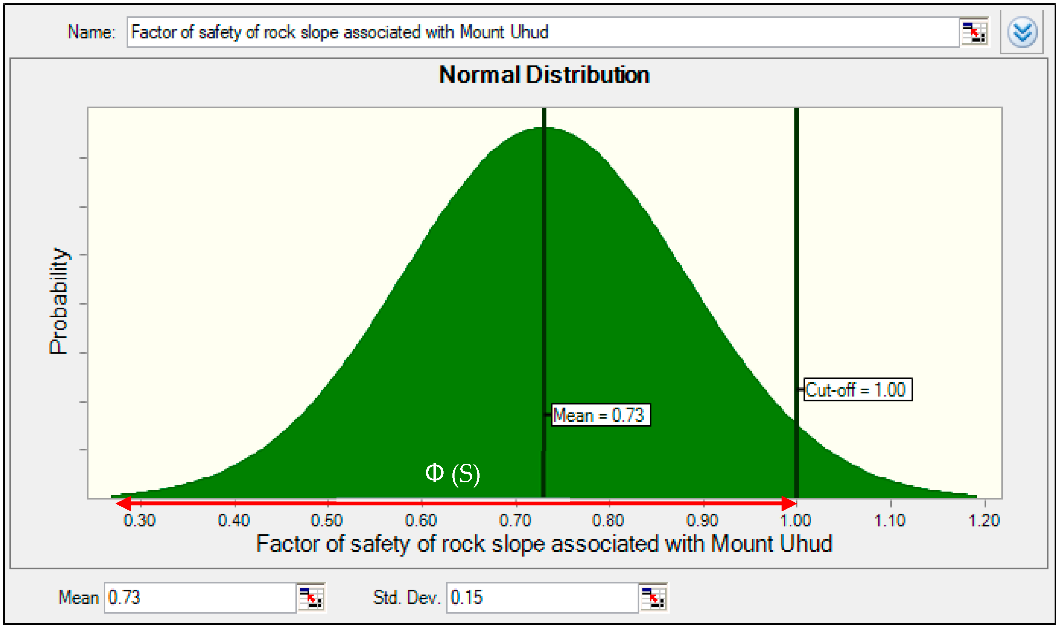
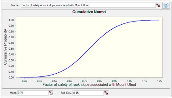
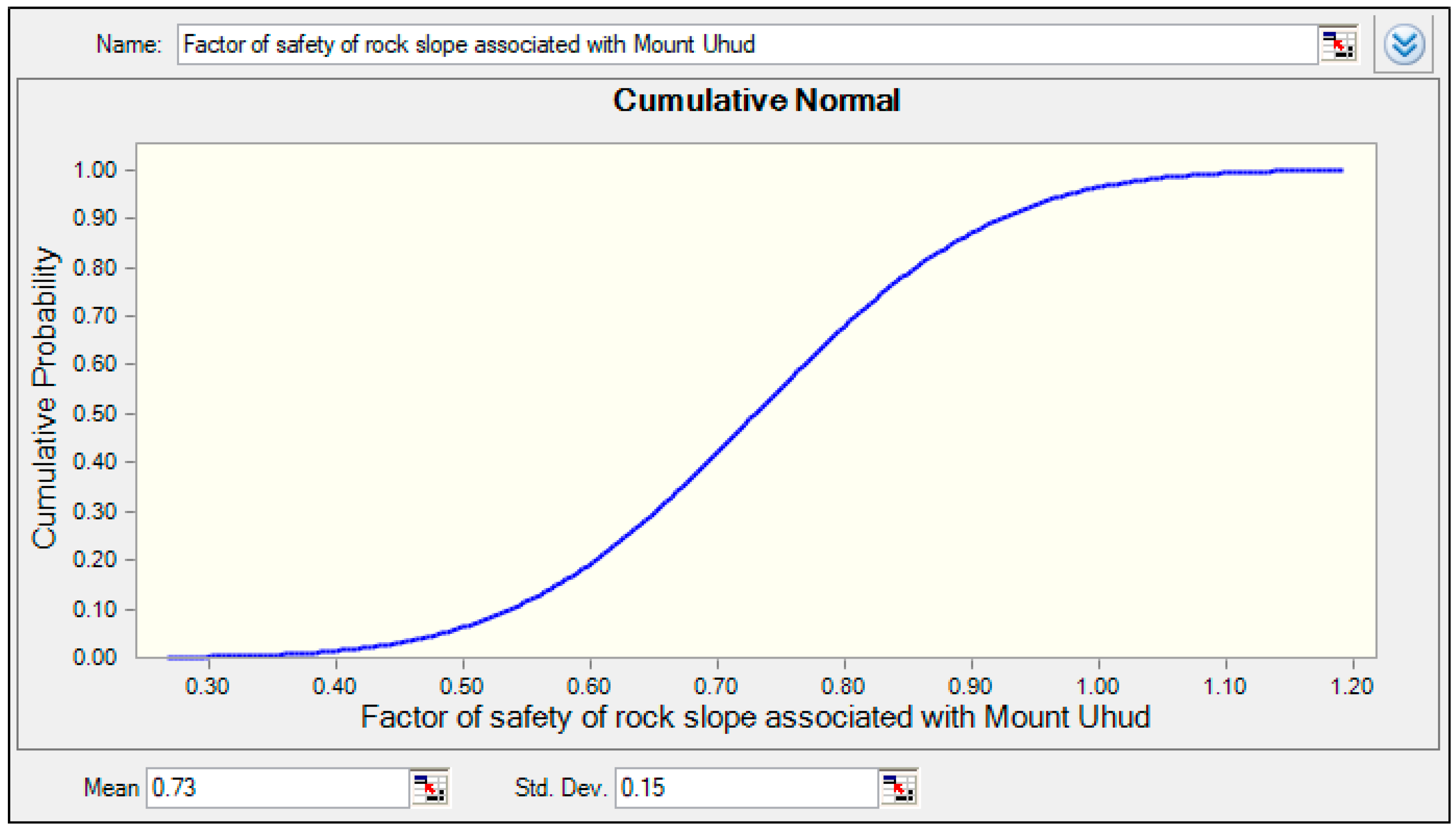
A probability density function (PDF) for the FoS values was generated using Oracle Crystal Ball software, as depicted in Figure 8. A cutoff threshold of FoS = 1.00 was used to estimate the probability of failure (Pf) by integrating the area under the curve for FoS < 1.00, based on standard Z-tables. The resulting analysis indicated a failure probability of 5.16%, signifying conditions were unlikely to be unstable in the southwestern part of Mount Uhud. Figure 9 presents the cumulative probability density function. Table 5 gives a comparison between the Probability Density Function (PDF) and Cumulative Probability Distribution Function (CDF). Table 6 lists the mathematical procedures adopted to estimate the probability of unsatisfactory performance, Pf.
Figure 8.
Probability Density Function (PDF) of factor of safety (FoS) after 27 simulations.
Figure 9.
Cumulative probability distribution curve of the factor of safety based on 27 simulation runs.
Table 5.
Comparison between Probability Density Function (PDF) and Cumulative Probability Distribution Function (CDF) with reference to slope stability analysis.
Table 6.
Procedures used to calculate the probability of slope failure.
A comparison between deterministic and probabilistic analyses demonstrates clear differences in the assessment of slope stability. The deterministic method, which relies on mean input parameters, produced a factor of safety (FoS) of 0.813, indicating an unstable condition since the value is less than unity. Conversely, the probabilistic approach accounted for the variability of input parameters through statistical distributions, resulting in an average FoS of 0.73 across 27 simulation runs. Based on Z-table computations, the area under the probability distribution curve corresponding to FoS < 1.0 was determined to be 0.9484, indicating a 5.16% probability of failure, while the area representing FoS > 1.0 equaled 0.0516.
Thus, the probability of slope failure (Pf) can be expressed as: Pf = 1 − 0.9484 = 0.0516 (5.16%).
Based on the probabilistic analysis rating and ranking presented in Table 7, the rock slope located on the southwestern side of Mount Uhud is classified as “Unlikely” to experience instability, with a rating of two corresponding to a probability of occurrence between 5% and 20%. This indicates that failure could occur at some time, although it is not expected under normal conditions.
Table 7.
Suggested rating and ranking of the likelihood of failure [50].
Although the deterministic analysis produced a factor of safety of 0.813, indicating an unstable condition, the probabilistic assessment yielded a relatively low probability of failure (≈5.16%), suggesting that failure is generally unlikely. This apparent contrast reflects the fundamental difference between the two approaches. The deterministic result represents a single, conservative scenario based on fixed “average” input parameters, which does not account for variability or potential combinations of more favorable strength and geometric conditions. In contrast, the probabilistic analysis incorporates the full range and likelihood of parameter variability, demonstrating that while certain parameter sets may lead to instability, their occurrence probability is relatively low. Therefore, the deterministic result highlights a critical condition under conservative assumptions, whereas the probabilistic outcome places this condition within a broader reliability perspective.
Appropriate mitigation measures may still be considered to minimize potential risks, as discussed below.
4.3. Recommended Actions for Stabilizing the Mount Uhud Rock Slope
The probabilistic analysis indicated a 5.16% probability of failure, confirming that the southwestern slope of Mount Uhud is generally stable. Nevertheless, to further minimize potential risks and ensure long-term safety, a comprehensive stabilization and management strategy is recommended. This strategy integrates three complementary components: engineering interventions, monitoring and early warning, and policy, planning, and community engagement.
4.3.1. Engineering and Slope Stabilization
- ▪
- Rock reinforcement: Strengthen critical zones using rock bolts, anchors, and shotcrete to enhance rock mass integrity and reduce surface erosion.
- ▪
- Retaining structures: Construct retaining walls or reinforced earth structures at the slope base to resist lateral movement.
- ▪
- Drainage management: Implement surface and subsurface drainage systems to control pore pressure and limit water infiltration, reducing the driving forces for instability.
- ▪
- Slope regrading: Where feasible, reduce slope angles to lower driving forces.
- ▪
- Rockfall protection: Install barriers, nets, or berms to safeguard nearby infrastructure.
4.3.2. Monitoring and Early Warning
- ▪
- Instrumentation: Deploy inclinometers, extensometers, and piezometers to track deformation and groundwater pressures.
- ▪
- Surface monitoring: Conduct periodic LiDAR or drone surveys to detect slope changes over time.
- ▪
- Early warning systems: Establish automated alerts and predefined evacuation procedures to ensure rapid response in the event of instability.
4.3.3. Policy, Planning, and Community Engagement
Strengthen land-use and construction regulations around potentially unstable zones, restricting access until full stabilization is achieved. Promote public awareness through hazard mapping, signage, and emergency preparedness training. Ensure long-term maintenance through regular inspection, probabilistic reassessment, and secure funding to support continuous stability management. Collectively, these measures aim to reduce failure risk, protect the surrounding community, and ensure sustainable management of Mount Uhud’s rock slopes.
To enhance the practical applicability of the proposed mitigation strategies, it is important to consider their relative priority and implementation sequence. Immediate, low-cost, and high-benefit measures such as regular slope inspections, rockfall scaling, and installation of warning signage should be prioritized as short-term actions. Intermediate measures, including localized rock bolting, shotcrete, and installation of rockfall barriers or mesh systems, can be implemented in areas identified as higher risk through field assessment. Long-term solutions, such as engineered retaining structures, comprehensive drainage improvements, and continuous monitoring systems, should be planned where critical infrastructure is exposed or where progressive deterioration is anticipated. This staged approach ensures effective risk reduction while optimizing resources and enhancing decision-making for stakeholders and planners.
- ▪
- Land-use regulation: Strengthen construction and zoning restrictions around potentially unstable areas, limiting access until stabilization is achieved.
- ▪
- Public awareness: Use hazard mapping, signage, and emergency preparedness programs to inform the community.
- ▪
- Maintenance and funding: Ensure long-term slope management through regular inspections, periodic probabilistic reassessment, and secure funding for continued monitoring and maintenance.
4.3.4. Staged Implementation Framework
To enhance practical applicability, the proposed measures are prioritized based on risk level, cost, and effectiveness:
- Short-term, low-cost, high-benefit actions: Regular slope inspections, rockfall scaling, and warning signage to address immediate risks.
- Medium-term, localized interventions: Targeted rock bolting, shotcrete application, and installation of barriers or mesh in areas identified as higher risk by field assessment and probabilistic analysis.
- Long-term, systemic solutions: Engineered retaining structures, comprehensive drainage improvements, and continuous monitoring systems in zones with critical infrastructure or where progressive deterioration is expected.
This staged, risk-informed approach ensures that interventions are proportionate to the assessed hazard, effectively reducing risk while optimizing resources and enhancing decision-making for stakeholders and urban planners.
5. Conclusions
This study presented a comprehensive deterministic–probabilistic assessment of the southwestern rock slope of Mount Uhud to evaluate its stability and quantify associated risks. Through integrated geotechnical characterization, numerical simulation, and statistical analysis, the findings indicate that while deterministic results suggest potential instability, the probabilistic assessment shows that the overall likelihood of slope failure is low.
Using the Slide 2 software and the Bishop Simplified Method, the deterministic analysis produced a factor of safety (FoS) of 0.813, indicating instability, since the value is below the critical threshold of 1.0. However, when parameter variability was incorporated using Li’s Point Estimate Method (PEM) with a coefficient of variation (COV) of 25%, the probabilistic analysis revealed that the probability of failure is relatively low, corresponding to a rating of two (“Unlikely”) with an estimated probability of occurrence between 5% and 20%. This implies that while slope failure could occur at some time, it is not expected under normal conditions.
The main contribution of this study lies in its hybrid deterministic–probabilistic framework, which provides a balanced representation of slope behavior by accounting for both mean performance and parameter uncertainty. The application of Li’s PEM proved to be a practical and computationally efficient approach for incorporating geotechnical variability, particularly valuable in data-limited volcanic terrains. This integrated approach enhances the reliability of slope stability evaluations and supports risk-informed engineering decision-making.
Although the probability of failure is classified as “Unlikely,” implementing preventive and monitoring measures remains advisable to ensure long-term slope safety. Recommended interventions include slope reinforcement using rock bolts, anchors, and shotcrete, coupled with surface and subsurface drainage systems to control water infiltration. Additional strategies such as slope regrading, rockfall barriers, and continuous monitoring (inclinometers, piezometers, and remote sensing) should also be employed. Beyond engineering solutions, policy enforcement and community awareness programs are essential to regulate land-use, restrict access to potentially hazardous zones, and promote public safety.
6. Limitations
Despite its comprehensive framework, the study has some limitations. The analysis assumes uniform rock mass conditions and excludes time-dependent effects such as weathering and groundwater fluctuation. Future work should incorporate three-dimensional modeling, real-time monitoring data, and long-term stability assessments to enhance predictive accuracy.
Overall, this research advances the application of hybrid stability analysis in volcanic rock environments and provides a scientifically grounded framework for slope risk management. The findings not only confirm the instability of the Mount Uhud slope but also offer actionable guidance for engineering design, monitoring, and safety planning in similar geotechnical contexts.
Author Contributions
Conceptualization, W.R.A.; methodology, W.R.A. and H.A.M.A.; software, H.A.M.A. and W.R.A.; validation, M.A.M.A., W.R.A. and A.M.A.K.; formal analysis, H.A.M.A. and W.R.A.; investigation, A.M.A.K.; resources, M.A.M.A.; data curation, W.R.A.; writing—original draft preparation, W.R.A.; writing—review and editing, W.R.A. and A.M.A.K.; visualization, M.A.M.A. and H.A.M.A.; supervision, A.M.A.K.; project administration, W.R.A.; funding acquisition, W.R.A. and M.A.M.A. All authors have read and agreed to the published version of the manuscript.
Funding
This research received no external funding.
Institutional Review Board Statement
All research procedures were conducted in accordance with accepted ethical guidelines.
Data Availability Statement
The data supporting this study are available from the corresponding author upon request.
Conflicts of Interest
The authors declare no conflicts of interest.
Abbreviations
The following abbreviations are used in this manuscript:
| FoS | Factor of safety |
| Shear strength of rock mass at failure (Resisting Force) | |
| Mobilized shear stress (Driving Force) | |
| C | Cohesion of rock mass |
| Angle of internal friction of rock mass | |
| Density or unit weight of rock mass | |
| H | Height of rock slope |
| Overall slope angle of rock slope | |
| Mean or average value of factor of safety | |
| Standard deviation (measure variability) | |
| Coefficient of variation | |
| n | Number of variables |
| Probability Density Function | |
| Probability of failure or unsatisfactory performance | |
| CDF | Cumulative Density Function |
| ζ | Lognormal standard deviation |
| λₓ | Lognormal mean |
| S | Standardized variable |
| Φ(S) | Cumulative probability |
References
- Ismail, D.S.A. Geomorphological Characteristics of the Slopes of Mount Uhud in Al-Madinah Al-Munawwarah: An Applied Study Using Geographic Information Systems. J. Fac. Arts Qena 2023, 32, 767–830, (Translated from Arabic). [Google Scholar]
- Abdulai, M.; Sharifzadeh, M. Probability Methods for Stability Design of Open Pit Rock Slopes: An Overview. Geosciences 2021, 11, 319. [Google Scholar] [CrossRef] [Scilit]
- Ali, M.A.; Morteza, O. Determination and Stability Analysis of Ultimate Open-Pit Slope under Geomechanical Uncertainty. Int. J. Min. Sci. Technol. 2014, 24, 105–110. [Google Scholar] [CrossRef] [Scilit]
- Deng, D.P.; Zhao, L.H.; Li, L. Limit Equilibrium Analysis for Rock Slope Stability Using Basic Hoek–Brown Strength Criterion. J. Cent. South Univ. 2017, 24, 2154–2163. [Google Scholar] [CrossRef] [Scilit]
- Hoek, E.; Bray, J.W. Rock Slope Engineering, 3rd ed.; Institution of Mining and Metallurgy: London, UK, 1981. [Google Scholar]
- Aladejare, A.E.; Akeju, V.O. Design and Sensitivity Analysis of Rock Slope Using Monte Carlo Simulation. Geotech. Geol. Eng. 2020, 38, 573–585. [Google Scholar] [CrossRef] [Scilit]
- Wyllie, D.C.; Mah, C.W. Movement Monitoring. In Rock Slope Engineering; CRC Press: Boca Raton, FL, USA, 2017; pp. 320–333. [Google Scholar]
- Christian, J.T.; Ladd, C.C.; Baecher, G.B. Reliability Applied to Slope Stability Analysis. J. Geotech. Eng. 1994, 120, 2180–2207. [Google Scholar] [CrossRef] [Scilit]
- Low, B.K. Reliability Analysis of Rock Wedges. J. Geotech. Geoenviron. Eng. 1997, 123, 498–505. [Google Scholar] [CrossRef] [Scilit]
- Low, B.K. Reliability Analysis of Rock Slopes Involving Correlated Nonnormals. Int. J. Rock Mech. Min. Sci. 2007, 44, 922–935. [Google Scholar] [CrossRef] [Scilit]
- Basahel, H.; Mitri, H. Probabilistic Assessment of Rock Slopes Stability Using the Response Surface Approach: A Case Study. Int. J. Min. Sci. Technol. 2019, 29, 357–370. [Google Scholar] [CrossRef] [Scilit]
- Reale, C.; Xue, J.; Pan, Z.; Gavin, K. Deterministic and Probabilistic Multi-Modal Analysis of Slope Stability. Comput. Geotech. 2015, 66, 172–179. [Google Scholar] [CrossRef] [Scilit]
- Jimenez-Rodriguez, R.; Sitar, N.; Chacón, J. System Reliability Approach to Rock Slope Stability. Int. J. Rock Mech. Min. Sci. 2006, 43, 847–859. [Google Scholar] [CrossRef] [Scilit]
- Bardhan, A.; Samui, P. Application of artificial intelligence techniques in slope stability analysis: A short review and future prospects. Int. J. Geotech. Earthq. Eng. (IJGEE) 2022, 13, 1–23. [Google Scholar] [CrossRef] [Scilit]
- Pham, K.; Kim, D.; Park, S.; Choi, H. Ensemble learning-based classification models for slope stability analysis. Catena 2021, 196, 104886. [Google Scholar] [CrossRef] [Scilit]
- Merghadi, A.; Yunus, A.P.; Dou, J.; Whiteley, J.; ThaiPham, B.; Bui, D.T.; Avtar, R.; Abderrahmane, B. Machine learning methods for landslide susceptibility studies: A comparative overview of algorithm performance. Earth-Sci. Rev. 2020, 207, 103225. [Google Scholar] [CrossRef] [Scilit]
- Arif, A.; Zhang, C.; Sajib, M.H.; Uddin, M.N.; Habibullah, M.; Feng, R.; Feng, M.; Rahman, M.S.; Zhang, Y. Rock Slope Stability Prediction: A Review of Machine Learning Techniques. Geotech. Geol. Eng. 2025, 43, 124. [Google Scholar] [CrossRef] [Scilit]
- Ragam, P.; Kushal Kumar, N.; Ajith, J.E.; Karthik, G.; Himanshu, V.K.; Sree Machupalli, D.; Ramesh Murlidhar, B. Estimation of slope stability using ensemble-based hybrid machine learning approaches. Front. Mater. 2024, 11, 1330609. [Google Scholar] [CrossRef] [Scilit]
- Yadav, D.K.; Chattopadhyay, S.; Tripathy, D.P.; Mishra, P.; Singh, P. Enhanced slope stability prediction using ensemble machine learning techniques. Sci. Rep. 2025, 15, 7302. [Google Scholar] [CrossRef] [Scilit]
- Yang, Y.; Zhou, W.; Jiskani, I.M.; Lu, X.; Wang, Z.; Luan, B. Slope stability prediction method based on intelligent optimization and machine learning algorithms. Sustainability 2023, 15, 1169. [Google Scholar] [CrossRef] [Scilit]
- Baecher, G.B.; Christian, J.T. Reliability and Statistics in Geotechnical Engineering; Wiley: Chichester, UK, 2003. [Google Scholar]
- Karam, K.; He, M.; Sousa, L.R. Slope Stability Risk Management in Open Pit Mines. In Proceedings of the 7th GiT4NDM and 5th EOGL International Conference, Abu Dhabi, United Arab Emirates, 14–16 March 2015. [Google Scholar]
- Kamal, A.M.; Hossain, F.; Ahmed, B.; Rahman, M.Z.; Sammonds, P. Assessing the Effectiveness of Landslide Slope Stability by Analysing Structural Mitigation Measures and Community Risk Perception. Nat. Hazards 2023, 117, 2393–2418. [Google Scholar] [CrossRef] [Scilit]
- Rotaru, A.; Bejan, F.; Almohamad, D. Sustainable Slope Stability Analysis: A Critical Study on Methods. Sustainability 2022, 14, 8847. [Google Scholar] [CrossRef] [Scilit]
- Larsson, L. Slope Stability Evaluation from a Risk Management Perspective: Case Study: The Slussen Project in Stockholm; Digitala Vetenskapliga Arkivet: Uppsala, Sweden, 2018. [Google Scholar]
- Chowdhury, R. Slope Analysis; Elsevier: Amsterdam, The Netherlands, 2012; Volume 22. [Google Scholar]
- Liu, S.; Huang, X.; Zhou, A.; Hu, J.; Wang, W. Soil–Rock Slope Stability Analysis by Considering the Nonuniformity of Rocks. Math. Probl. Eng. 2018, 2018, 3121604. [Google Scholar] [CrossRef] [Scilit]
- Huang, X.W.; Yao, Z.S.; Wang, W.; Zhou, A.Z.; Jiang, P. Stability Analysis of Soil–Rock Slope (SRS) with an Improved Stochastic Method and Physical Models. Environ. Earth Sci. 2021, 80, 649. [Google Scholar] [CrossRef] [Scilit]
- Yu, J.; Zhang, Q.; Wu, C.; Jia, C. Investigation on Stability of Soil–Rock Mixture Slope with Discrete Element Method. Environ. Earth Sci. 2023, 82, 449. [Google Scholar] [CrossRef] [Scilit]
- Duzgun, H.S.B.; Yucemen, M.S.; Karpuz, C. A Methodology for Reliability-Based Design of Rock Slopes. Rock Mech. Rock Eng. 2003, 36, 95–120. [Google Scholar] [CrossRef] [Scilit]
- Kirsten, H.A.D. Significance of the Probability of Failure in Slope Engineering. Civ. Eng. Siviele Ingenieurswese 1983, 25, 17–29. [Google Scholar]
- Dai, Y.; Fredlund, D.G.; Stolte, W.J. A Probabilistic Slope Stability Analysis Using Deterministic Computer Software. In Probabilistic Methods in Geotechnical Engineering; CRC Press: Boca Raton, FL, USA, 1993; pp. 267–274. [Google Scholar]
- Bamousa, A.O.; Matar, S.S.; Daoudi, M.; Al-Doaan, M.I. Structural and Geomorphic Features Accommodating Groundwater of Al-Madinah City, Saudi Arabia. Arab. J. Geosci. 2013, 6, 3127–3132. [Google Scholar] [CrossRef] [Scilit]
- Pellaton, C. Geologic Map of the Al Madinah Quadrangle, Sheet 24D, Kingdom of Saudi Arabia; Ministry of Petroleum and Mineral Resources: Jeddah, Saudi Arabia, 1981. [Google Scholar]
- Daoudi, M.B.A. Geomorphology of the Slopes of Uhud Mountain in Al-Madinah Al-Munawwarah (1965–2021). Arab. Geogr. J. 2022, 53, 201–223. [Google Scholar] [CrossRef] [Scilit]
- Metwaly, M.; Abdalla, F.; Taha, A.I. Hydrogeophysical Study of Sub-Basaltic Alluvial Aquifer in the Southern Part of Al-Madinah Al-Munawwarah, Saudi Arabia. Sustainability 2021, 13, 9841. [Google Scholar] [CrossRef] [Scilit]
- Finlayson, B.; Statham, I. Hillslope Analysis; Butterworths: London, UK, 1981. [Google Scholar]
- Shroder, J.F., Jr.; Bishop, M.P. Mountain Geomorphic Systems. In Geographic Information Science and Mountain Geomorphology; Springer: Berlin, Germany, 2004; pp. 33–66. [Google Scholar]
- Elassal, M. Geomorphological Heritage Attractions Proposed for Geotourism in Asir Mountains, Saudi Arabia. Geoheritage 2020, 12, 78. [Google Scholar] [CrossRef] [Scilit]
- Alharbi, T.; El-Sorogy, A.S.; Al-Kahtany, K.; Salem, Y.; Rikan, N.A. Landslide Susceptibility Assessment Using the Analytic Hierarchy Process (AHP): A Case Study of Al Figrah Road, Al-Madinah, Saudi Arabia. Preprints 2024. Available online: https://www.preprints.org/manuscript/202410.1125 (accessed on 5 December 2025).
- Rocscience Software. Available online: https://www.rocscience.com/software/slide2 (accessed on 4 December 2025).
- Aqeel, A.; Zaman, H.; Abd El Aal, A. Slope Stability Analysis of a Rock Cut in a Residential Area, Madinah, Saudi Arabia: A Case Study. Geotech. Geol. Eng. 2019, 37, 1765–1778. [Google Scholar] [CrossRef] [Scilit]
- Duncan, J.M. State of the Art: Limit Equilibrium and Finite-Element Analysis of Slopes. J. Geotech. Eng. 1996, 122, 577–596. [Google Scholar] [CrossRef] [Scilit]
- Griffiths, D.V.; Fenton, G.A. Probabilistic Slope Stability Analysis by Finite Elements. J. Geotech. Geoenviron. Eng. 2004, 130, 507–518. [Google Scholar] [CrossRef] [Scilit]
- Villeneuve, M.C.; Heap, M.J. Calculating the Cohesion and Internal Friction Angle of Volcanic Rocks and Rock Masses. Volcanica 2021, 4, 279–293. [Google Scholar] [CrossRef] [Scilit]
- Janardhana, M.R.; Abdul-Aleam, A.; Al-Qadhi, A.D. Slope Stability Assessment in and Around Taiz City, Yemen Using Landslide Possibility Index (LPI). Eur. J. Adv. Eng. Technol. 2018, 5, 8–17. [Google Scholar]
- Lasheen, E.S.R.; Sami, M.; Hegazy, A.A.; Arman, H.; Sanislav, I.V.; Ahmed, M.S.; Rashwan, M.A. Petrological Characteristics and Physico-Mechanical Properties of Dokhan Volcanics for Decorative Stones and Building Material Applications. Buildings 2024, 14, 3418. [Google Scholar] [CrossRef] [Scilit]
- Rosenblueth, E. Point Estimates for Probability Moments. Proc. Natl. Acad. Sci. USA 1975, 72, 3812–3814. [Google Scholar] [CrossRef] [Scilit]
- Christian, J.T.; Baecher, G.B. Point-Estimate Method as Numerical Quadrature. J. Geotech. Geoenviron. Eng. 1999, 125, 779–786. [Google Scholar] [CrossRef] [Scilit]
- Abdellah, W.; Mitri, H.S.; Thibodeau, D.; Moreau-Verlaan, L. Stability of Mine Development Intersections—A Probabilistic Analysis Approach. Can. Geotech. J. 2014, 51, 184–195. [Google Scholar] [CrossRef] [Scilit]
- Hoek, E.; Carranza-Torres, C.; Corkum, B. Hoek-Brown failure criterion—2002 Edition. In Proceedings of the Fifth North American Rock Mechanics Symposium (NARMS-TAC), Toronto, ON, Canada, 7–10 July 2002; pp. 267–273. [Google Scholar]
- Barton, N.R.; Choubey, V. The shear strength of rock joints in theory and practice. Rock Mech. 1977, 10, 1–54. [Google Scholar] [CrossRef] [Scilit]
- Goodman, R.E. Introduction to Rock Mechanics, 2nd ed.; Wiley: Hoboken, NJ, USA, 1989. [Google Scholar]
- Musunuri, A.; Wei, W.; Mitri, H.S.; Thibodeau, D. Assessment of Drift Stability Using Probability of Failure. In Proceedings of the 18th International Symposium on Mine Planning and Equipment Selection, Banff, AB, Canada, 16–18 November 2009; pp. 987–996. [Google Scholar]

Disclaimer/Publisher’s Note: The statements, opinions and data contained in all publications are solely those of the individual author(s) and contributor(s) and not of MDPI and/or the editor(s). MDPI and/or the editor(s) disclaim responsibility for any injury to people or property resulting from any ideas, methods, instructions or products referred to in the content. |
© 2026 by the authors. Licensee MDPI, Basel, Switzerland. This article is an open access article distributed under the terms and conditions of the Creative Commons Attribution (CC BY) license.