Next Issue
Volume 15, March
Previous Issue
Volume 15, January


Geosciences, Volume 15, Issue 2 (February 2025) – 41 articles

Cover Story (view full-size image): 
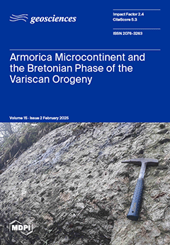
In collision belts, the upper plate is often less deformed than the lower one. During the Variscan orogeny, the Armorica microcontinent was in the upper plate of the collision system. In Brittany (France), Armorica exposes poly-metamorphic micaschists. An early event with biotite–garnet–staurolite–kyanite assemblage crystallized at 0.9 GPa and 500 °C. It was followed by a HT event at 800–900 °C, dated by LA-ICP-MS on monazite at 351 Ma. This tectono-metamorphic evolution shows that Armorica was not rigid but underwent a syn-metamorphic ductile deformation during the Variscan collision at 360–355 Ma, redefined as the late episode of the “Bretonian phase”, whereas the pre-Famennian Bretonian episode is ascribed to oceanic subduction. These new data allow us to reassess the geodynamics of the Variscan orogen. View this paper
  • Issues are regarded as officially published after their release is announced to the table of contents alert mailing list.
  • You may sign up for e-mail alerts to receive table of contents of newly released issues.
  • PDF is the official format for papers published in both, html and pdf forms. To view the papers in pdf format, click on the "PDF Full-text" link, and use the free Adobe Reader to open them.
Order results
Result details
Section
Select all
Export citation of selected articles as:
22 pages, 6103 KiB  
Article
Causes of Slope Deformations in Built-Up Areas and the Elimination of Emergencies with Regard to Population Protection
by Miroslav Betuš, Martin Konček, Marian Šofranko, Andrea Rosová, Marek Szücs and Kristína Horizralová
Geosciences 2025, 15(2), 74; https://doi.org/10.3390/geosciences15020074 - 19 Feb 2025
Viewed by 506
Abstract
The presented article discusses the possibilities and methods of carrying out evacuation works in the event of an emergency associated with slope deformation in the built-up area of Šalgovík, Slovak Republic. From the point of view of extraordinary events, slope deformations are a [...] Read more.
The presented article discusses the possibilities and methods of carrying out evacuation works in the event of an emergency associated with slope deformation in the built-up area of Šalgovík, Slovak Republic. From the point of view of extraordinary events, slope deformations are a negative phenomenon for every country. Besides the most serious natural disasters such as floods, landslides and earthquakes, slope deformations are in third place in terms of the extent of direct or indirect damage. Moreover, for the above reasons, the presented article discusses the possibilities of area evacuation in the event of an emergency in a given built-up area, where, as described in the article, it is a location that is susceptible to slope deformation. Given that it is a built-up area that is not stabilized for slope deformations and is also active, the article explains the activities of the Integrated Rescue System components in the event of an emergency in the said area. The aim was also to carry out a widespread evacuation, which has different characteristics than normal evacuations in the case of other emergencies since a large part of the territory with a certain number of inhabitants is affected. It should be noted that the evacuation of the said territory must be carried out in a rapid time frame so that the consequences for health and human life are minimal, which is explained in the present article. The activities the individual rescue services perform to carry out the evacuation will have to be conducted in a different way than normal, and for this reason, the cooperation and activities required are different from the activities normally carried out. Full article
(This article belongs to the Section Natural Hazards)
Show Figures

Figure 1

32 pages, 1768 KiB  
Article
Assessment of Chemical Pollution Load in Surface Waters of the Turkestan Region and Its Indirect Impact on Landscapes: A Comprehensive Study
by Dana Akhmetova, Zhanar Ozgeldinova, Nurgul Ramazanova, Saltanat Sadvakassova, Zhansulu Inkarova, Rabiga Kenzhebay, Zhadra Shingisbayeva, Roza Abildaeva, Zakhida Kozhabekova, Manira Alagujayeva and Zhamila Sikhynbayeva
Geosciences 2025, 15(2), 73; https://doi.org/10.3390/geosciences15020073 - 19 Feb 2025
Viewed by 378
Abstract
This study is aimed at a comprehensive assessment of the chemical composition of surface waters in the Turkestan region and their impact on regional landscapes. The primary objective of the research is to systematically evaluate the level of chemical pollution in the region’s [...] Read more.
This study is aimed at a comprehensive assessment of the chemical composition of surface waters in the Turkestan region and their impact on regional landscapes. The primary objective of the research is to systematically evaluate the level of chemical pollution in the region’s water resources and determine its indirect effects on landscape-ecological stability. In August 2024, water samples from eight sampling points (S1–S8) were analyzed for 24 physicochemical parameters, including total hardness (mg*eq/L), pH, dry residue (mg/L), electrical conductivity (µS/cm), total salinity (mg/L), Al, As, B, Ca, Cd, Co, Cr, Ti, Fe, Pb, Cu, Mg, K, Mn, Na, Ni, Zn, SO42−, and C6H5OH. To determine the degree of pollution, variational-statistical analysis, principal component analysis (PCA), as well as the calculation of the OIP, NPI, and HPI indices were performed. For land use and land cover change (LULC) analysis, LULC classification was carried out based on Landsat data from 2000 to 2020, forming the basis for land resource management and planning. The research results showed a deterioration in the ecological condition of water resources and an increasing anthropogenic impact. Specifically, at point S8, the concentration of Al was found to be 56 times higher than the maximum allowable limit, while the concentration of Fe was 42 times higher. High levels of pollution were also recorded at points S1, S4, S5, and S6, where the increase in Al and Na concentrations caused a sharp rise in the OIP value. The main factors influencing water pollution include industrial effluents, agricultural waste, and irrigation drainage waters. The pollution’s negative impact on regional landscapes has led to issues related to the distribution of vegetation, soil fertility, and landscape stability. To improve the current ecological situation and restore natural balance, the phytoremediation method is proposed. The research results will serve as the foundation for developing water resource management strategies for the Turkestan region and making informed decisions aimed at ensuring ecological sustainability. Full article
(This article belongs to the Section Geochemistry)
Show Figures

Figure 1

29 pages, 18997 KiB  
Article
Variscan Plutonism in the Geodynamic Evolution of the Central Iberian Zone of Portugal: Castelo Branco Pluton as Another Piece of the Puzzle
by Cláudia Cruz, Helena Sant’Ovaia, Helena C. B. Martins, Isabel M. H. R. Antunes, Armando Rocha and Fernando Noronha
Geosciences 2025, 15(2), 72; https://doi.org/10.3390/geosciences15020072 - 19 Feb 2025
Viewed by 444
Abstract
A multidisciplinary analysis of the Pennsylvanian Castelo Branco pluton of Central Iberian Zone (Iberian Variscan belt) was made, focusing on its magnetic behavior and fabric, microstructures, microfractures, and radiometric and gravimetric anomalies. The findings reveal that the Castelo Branco pluton is an ilmenite-type [...] Read more.
A multidisciplinary analysis of the Pennsylvanian Castelo Branco pluton of Central Iberian Zone (Iberian Variscan belt) was made, focusing on its magnetic behavior and fabric, microstructures, microfractures, and radiometric and gravimetric anomalies. The findings reveal that the Castelo Branco pluton is an ilmenite-type granite, characterized by low magnetic susceptibility values. The petrographic observations and high-temperature solid-state deformation indicate that pluton was emplaced during the latest compression phase (D3) of the Variscan tectonic regime. Magnetic fabric and gravimetric data show that the Castelo Brano pluton has a flat-shaped geometry with a depth of approximately 2–3 km, a feeding zone corresponding to NE-SW-trending regional faults, and that its fabric is oriented parallel to the NW-SE-trending regional foliation of the host rocks. The concentric magnetic foliation in the Alcains granite suggests an earlier ascent and emplacement compared to the Rio de Moinhos and S. Miguel da Acha granites, with Alcains demonstrating a laccolithic shape indicative of significant upward force. The ascent pathways of the different granites seem to have occurred along pre-existing NE-SW faults. The Castelo Branco pluton displays zoned nesting, with fluid inclusion planes indicating NNE-SSW to NE-SW and ENE-WSW trends in biotite-rich granites, and NNE-SSW to NE-SW and ESE-WNW trends in two-mica granites. Structural alignments in the study area show both NE-SW and NW-SE trends. The NE-SW faults and thrust faults are supported by residual gravimetric anomaly data, and NW-SE alignments are evident in magnetic fabric and regional folded structures. These findings enhance our understanding of the geodynamic processes influencing the Variscan plutonism in the Central Iberian Zone, positioning the Castelo Branco pluton as a key component in this geological puzzle. Full article
(This article belongs to the Section Structural Geology and Tectonics)
Show Figures

Figure 1

30 pages, 32058 KiB  
Article
Geochronology, Petrogenesis, and Geological Significance of the Longchahe Granite, Gejiu Sn Polymetallic Ore District, SW China
by Rong Yang, Yongqing Chen and Ian M. Coulson
Geosciences 2025, 15(2), 71; https://doi.org/10.3390/geosciences15020071 - 18 Feb 2025
Viewed by 365
Abstract
Longchahe porphyritic granite is the largest pluton within the western Gejiu complex, a series of mainly intermediate to felsic alkali intrusions in southwestern China. Our research indicates that the pluton intruded during the Late Cretaceous (82–84 Ma). The pluton is primarily a medium- [...] Read more.
Longchahe porphyritic granite is the largest pluton within the western Gejiu complex, a series of mainly intermediate to felsic alkali intrusions in southwestern China. Our research indicates that the pluton intruded during the Late Cretaceous (82–84 Ma). The pluton is primarily a medium- to coarse-grained porphyritic granite, which shows weakly peraluminous (A/CNK = 0.92–1.82, with an average of 1.09) and alkali (shoshonitic) characteristics, exhibiting an affinity with highly differentiated I-type granite. The porphyritic granite is enriched in K and Rb, but depleted in Ba, P, and Ti, and displays significant enrichment of light rare earth elements with minor negative Eu anomalies (Eu/Eu* = 0.46–0.66). It has elevated (87Sr/86Sr)i ratios (0.71243–0.71301), negative εNd(t) values (−8.42–−6.46), and a broad range of εHf(t) values (−13.80–9.17). These geochemical characteristics indicate that the formation of Longchahe granite involved both crust–mantle assimilation and strong crystal fractionation. Additionally, the pluton demonstrates a significant enrichment of W. A factor analysis study suggests that the formation of granites is associated with F1 (Nb–Ta–Th–LREE–HREE–[W]), whilst F2 represents Sn–Pb–U–[Zn] polymetallic mineralisation in western Gejiu. Further, a score diagram indicates that the granites exhibit a high abundance of ore-forming elements, with potential for Pb and Zn mineralisation. Our study favours that the Longchahe granites likely formed within a continental arc–tectonic setting, related to subduction and subsequent rotation processes experienced by the Paleo-Pacific plate. Full article
(This article belongs to the Section Geochemistry)
Show Figures

Figure 1

22 pages, 34927 KiB  
Article
Testing Semi-Automated Landforms Extraction Using Field-Based Geomorphological Maps
by Salvatore Ivo Giano, Eva Pescatore and Vincenzo Siervo
Geosciences 2025, 15(2), 70; https://doi.org/10.3390/geosciences15020070 - 17 Feb 2025
Viewed by 409
Abstract
The semi-automated extraction of landforms using GIS analysis is one of the main topics in computer analyses. The use of digital elevation models (DEMs) in GIS applications makes the extraction and classification procedure of landforms easier and faster. In the present paper, we [...] Read more.
The semi-automated extraction of landforms using GIS analysis is one of the main topics in computer analyses. The use of digital elevation models (DEMs) in GIS applications makes the extraction and classification procedure of landforms easier and faster. In the present paper, we assess the accuracy of semi-automated landform maps by means of a comparison with hand-made landform maps realized in the Pleistocene Agri intermontane basin (southern Italy). In this study, landform maps at three different scales of 1:50,000, 1:25,000, and 1:10,000 were used to ensure a good level of detail in the spatial distribution of landforms. The semi-automated extraction and classification of landforms was performed using a GIS-related toolbox, which identified ~48 different landform types. Conversely, the hand-made landform map identified ~57 landforms pertaining to various morphogenetic groups, such as structural, fluvial, karst landforms, etc. An overlap of the two landform maps was produced using GIS applications, and a 3D block diagram visualization was realized. A visual inspection of the overlapping maps was conducted using different spatial scales of patch frames and then analyzed to provide information on the accuracy of landform extraction using the implemented tools. Full article
Show Figures

Figure 1

21 pages, 4777 KiB  
Article
Foundations for an Operational Earthquake Prediction System
by Angelo De Santis, Gianfranco Cianchini, Loredana Perrone, Maurizio Soldani, Habib Rahimi and Homayoon Alimoradi
Geosciences 2025, 15(2), 69; https://doi.org/10.3390/geosciences15020069 - 17 Feb 2025
Viewed by 496
Abstract
Earthquake prediction is one of the most challenging enterprises of science. Any prediction system must be based on the search for a precursor appearing during the preparation phase of an earthquake in the ground, atmosphere, or ionosphere that can anticipate its occurrence. We [...] Read more.
Earthquake prediction is one of the most challenging enterprises of science. Any prediction system must be based on the search for a precursor appearing during the preparation phase of an earthquake in the ground, atmosphere, or ionosphere that can anticipate its occurrence. We present methods to detect potential pre-earthquake anomalies. In particular, we show the analysis of lithospheric, atmospheric, and ionospheric data and the detection of anomalies under specific criteria. When we apply these methods retrospectively, we find that their accuracy goes from 69% to 83%. The combination of two or more methods is expected to improve the accuracy. Full article
(This article belongs to the Special Issue Earthquake Hazard Modelling)
Show Figures

Figure 1

22 pages, 10150 KiB  
Review
A Review of Carboniferous-Triassic Tectonic-Magmatic Evolution of Luang Prabang–Loei Metallogenic Belt in Laos and Thailand and Implications for Gold–Copper Mineralization
by Linnan Guo, Khin Zaw, Shusheng Liu, Yongfei Yang, Fei Nie, Songyang Wu, Meifeng Shi, Chunmei Huang, Xiangfei Zhang, Huimin Liang, Xiangting Zeng and Siwei Xu
Geosciences 2025, 15(2), 68; https://doi.org/10.3390/geosciences15020068 - 16 Feb 2025
Viewed by 596
Abstract
The Luang Prabang (Laos)–Loei (Thailand) metallogenic belt is located on the northwestern margin of the Indochina Block. It is one of the most important gold–copper metallogenic belts in Southeast Asia. This region underwent tectonic and magmatic evolution in the late Paleozoic-Mesozoic period within [...] Read more.
The Luang Prabang (Laos)–Loei (Thailand) metallogenic belt is located on the northwestern margin of the Indochina Block. It is one of the most important gold–copper metallogenic belts in Southeast Asia. This region underwent tectonic and magmatic evolution in the late Paleozoic-Mesozoic period within the Paleo-Tethys realm, resulting in complex metallogenic processes. Consequently, epithermal Au-Ag, porphyry-skarn Au-Cu, and hydrothermal vein-type gold deposits were formed. However, the genetic type of the vein-type gold deposits is still not fully understood. The relationship between the three types of gold deposits and the regional tectonic evolution has not been summarized up until today. We summarize the previous mineralization characteristics and exploration data of commonly known deposits and combine them with new evidence and ore deposit insights from our recent studies on the source and evolution of ore-forming fluids in the region. We confirm that the hydrothermal vein-type gold deposits in the belt are typical orogenic gold deposits. Based on previous regional tectonic-magmatic-metallogenic studies, metallogenic characteristics, and temporal and spatial distribution of three types of typical gold–copper deposits in the belt, we synthesize and establish a regional metallogenic model related to the subduction-closure of the Paleo-Tethys Ocean and subsequent continental–continental collision process, resulting in the formation of epithermal Au-Ag during the late Permian-early Triassic subduction, porphyry-skarn Au-Cu in the early–middle Triassic period during the closure of the ocean, and orogenic Au during the late Triassic collision. Since there are few reports on the geochemical characteristics of gold–copper deposits and their related magmatic rocks, the potential for gold–copper mineralization and their links to the magmatic rocks in the belt still needs further study. Full article
(This article belongs to the Special Issue Zircon U-Pb Geochronology Applied to Tectonics and Ore Deposits)
Show Figures

Figure 1

21 pages, 20678 KiB  
Article
Estimation of Equivalent Pore Aspect Ratio in Rock Physics Models and Validation Using Digital Rocks
by Luiz Eduardo Queiroz, Dario Grana, Celso Peres Fernandes, Tapan Mukerji, Leandro Passos de Figueiredo and Iara Frangiotti Mantovani
Geosciences 2025, 15(2), 67; https://doi.org/10.3390/geosciences15020067 - 15 Feb 2025
Viewed by 544
Abstract
Complex pore structures with multiple inclusions challenge the predictive accuracy of rock physics models. This study introduces a novel method for estimating a single equivalent pore aspect ratio that optimizes rock physics model predictions by minimizing discrepancies with experimental measurements in porous rocks [...] Read more.
Complex pore structures with multiple inclusions challenge the predictive accuracy of rock physics models. This study introduces a novel method for estimating a single equivalent pore aspect ratio that optimizes rock physics model predictions by minimizing discrepancies with experimental measurements in porous rocks with multiple inclusions with variable aspect ratios and proportions. The proposed methodology uses digital rock physics numerical simulations for validation. A comparative analysis is conducted between the equivalent aspect ratio derived from optimized rock physics models, numerical simulations, and the aspect ratio distribution estimated from digital rock samples. The approach is tested on both synthetic and real core samples, demonstrating its robustness and applicability to field data, including core samples and well log data. The validation results confirm that the method enhances predictive accuracy and offers a versatile framework for addressing pore complexity in subsurface rock formations. Full article
(This article belongs to the Section Geophysics)
Show Figures

Figure 1

26 pages, 41968 KiB  
Article
Historical Evolution of the Salento Leccese Coastal Landscape (Southern Apulia, Italy)
by Stefano Margiotta and Paolo Sansò
Geosciences 2025, 15(2), 66; https://doi.org/10.3390/geosciences15020066 - 13 Feb 2025
Viewed by 608
Abstract
The Salento Leccese coast (southern Apulia, Italy) is marked both by primary and secondary coasts (cliffs and beaches); beaches, in particular, constitute about a quarter of the coastal perimeter. The Salento Leccese coast experienced dramatic change over the last two centuries due to [...] Read more.
The Salento Leccese coast (southern Apulia, Italy) is marked both by primary and secondary coasts (cliffs and beaches); beaches, in particular, constitute about a quarter of the coastal perimeter. The Salento Leccese coast experienced dramatic change over the last two centuries due to natural and anthropic causes. This change was reconstructed through a geomorphological survey, historical cartography, and an aerial photo analysis. In particular, two case studies are described: the first one stretches along the Adriatic coast of the peninsula (Torre dell’Orso locality), and the second one is located along the Ionian coast (Torre Pali locality). For these coastal tracts, the main geomorphological features and the natural evolution that occurred during the Holocene are described, along with the anthropic modifications induced in the coastal landscape over the last two centuries. This study represents a useful knowledge background for coastal planners and decision makers, which will be utilized by the National Restoration Plans to be implemented in the near future, with the aim of restoring degraded ecosystems according to the recent Nature Restoration Law of the European Commission (2024). Full article
Show Figures

Figure 1

22 pages, 9608 KiB  
Article
Research and Application of Geomechanics Using 3D Model of Deep Shale Gas in Luzhou Block, Sichuan Basin, Southwest China
by Ye Chen, Wenzhe Li, Xudong Wang, Yuan Wang, Li Fu, Pengcheng Wu and Zhiqiang Wang
Geosciences 2025, 15(2), 65; https://doi.org/10.3390/geosciences15020065 - 13 Feb 2025
Cited by 1 | Viewed by 516
Abstract
The deep shale gas resources of the Sichuan Basin are abundant and constitute an important component of China’s natural gas production. Complicated by fault zones and other geostructures, the in situ stress state of the deep shale gas reservoirs in the Luzhou block [...] Read more.
The deep shale gas resources of the Sichuan Basin are abundant and constitute an important component of China’s natural gas production. Complicated by fault zones and other geostructures, the in situ stress state of the deep shale gas reservoirs in the Luzhou block remains poorly understood. This study integrated multiple datasets, including acoustic logging, diagnostic fracture injection testing (DFIT), imaging logging, and laboratory stress measurements, for calibration and constraint. A high-precision geomechanical model of the Luzhou block was constructed using the finite element method. This model characterizes the geomechanical properties of the reservoir and explores its applications in optimizing shale gas horizontal well placement, drilling processes, and fracture design. The study findings indicate that the Longmaxi Formation reservoir demonstrates abnormally high pore pressure, with gradients ranging from 16.7 to 21.7 kPa/m. The predominant stress regime is strike-slip, with an overburden stress gradient of 25.5 kPa/m and a minimum horizontal principal stress gradient ranging from 18.8 to 24.5 kPa/m. Based on a three-dimensional geomechanical model, a quantitative delineation of areas conducive to density reduction and pressure control drilling was conducted, and field experiments were implemented in well Y65-X. Utilizing an optimized drilling fluid density of 1.85 g/cm3, the deviated horizontal section was completed in a single trip, resulting in a 67% reduction in the drilling cycle compared to adjacent wells. Similarly, the Y2-X well demonstrated a test daily output of 506,900 cubic meters following an optimization of segmentation clustering and fracturing parameters. Studies indicate that 3D geomechanical modeling, informed by multi-source data constraints, can markedly enhance model precision, and such geomechanical models and their results can effectively augment drilling operational efficiency, elevate single-well production, and are advantageous for development. Full article
(This article belongs to the Section Geomechanics)
Show Figures

Figure 1

20 pages, 5913 KiB  
Article
The Use of Azimuthal Variation in ScS–S Differential Travel Times to Investigate Possible Anisotropy in the Lowermost Mantle Beneath the Philippines
by Satoru Tanaka
Geosciences 2025, 15(2), 64; https://doi.org/10.3390/geosciences15020064 - 13 Feb 2025
Viewed by 421
Abstract
We collected approximately 500 ScS–S differential travel times passing beneath the Philippines with various azimuths to discuss whether there were azimuthal variations in the ScS–S time residuals. By correcting for mantle heterogeneity using a three-dimensional (3D) mantle velocity model, we found a large [...] Read more.
We collected approximately 500 ScS–S differential travel times passing beneath the Philippines with various azimuths to discuss whether there were azimuthal variations in the ScS–S time residuals. By correcting for mantle heterogeneity using a three-dimensional (3D) mantle velocity model, we found a large variance reduction in the ScS–S residuals. In addition, the strong negative correlation between the S and ScS–S time residuals was greatly reduced, while the positive correlation between the ScS and ScS–S time residuals moderately improved, indicating that the corrected ScS–S residuals are manifestations of the lower half of the lower mantle structure. Next, we corrected for the local-scale heterogeneity in the lower mantle by subtracting the bin-averaged ScS–S residuals, and we experimented with fitting the trigonometric functions in terms of the propagation azimuth θ to the ScS–S residuals, suggesting that a 2θ variation is significant. If we accept the hypothesis of azimuthal anisotropy in the lowermost mantle, the fastest direction of the S-wave velocity was east-southeast–west-northwest (N97.5° E– N82.5° W), and the amplitude of the azimuthal anisotropy was approximately 1.4% anisotropy if we assume a D″ thickness of 300 km. Full article
(This article belongs to the Special Issue Seismology of the Dynamic Deep Earth)
Show Figures

Figure 1

22 pages, 50116 KiB  
Article
Shallow-Marine Late Thanetian Lockhart Limestone from the Hazara Basin, Pakistan: Insights into Foraminiferal Biostratigraphy and Microfacies Analysis
by Muneeb Ahmad, Urooba Farman Tanoli, Muhammad Umar, Tofeeq Ahmad and Alaa Ahmed
Geosciences 2025, 15(2), 63; https://doi.org/10.3390/geosciences15020063 - 13 Feb 2025
Viewed by 776
Abstract
The Palaeocene Lockhart Formation, a carbonate-rich succession abundant in Larger Benthic Foraminifera, represents a significant potential hydrocarbon reservoir extending throughout the Kohat, Potwar and Hazara basins of Pakistan. This study examines two stratigraphic sections of the Lockhart Formation in the Hazara Basin—Bagran and [...] Read more.
The Palaeocene Lockhart Formation, a carbonate-rich succession abundant in Larger Benthic Foraminifera, represents a significant potential hydrocarbon reservoir extending throughout the Kohat, Potwar and Hazara basins of Pakistan. This study examines two stratigraphic sections of the Lockhart Formation in the Hazara Basin—Bagran and Karhaki—providing crucial insights into its biostratigraphy and microfacies analysis. The formation comprises medium- to fine-grained limestone with shale intercalations, exhibiting argillaceous to compacted textures. Biostratigraphic analysis revealed a diverse assemblage of Larger Benthic Foraminifera, with 23 species identified across 9 genera, including Miscellanea miscella, Lockhartia haimei, Lockhartia conditi and Ranikothalia sindensis. These fossils indicate deposition within Shallow Benthic Zone (SBZ) 4 during the Late Thanetian, suggesting a dynamic palaeoenvironment. Seven distinct microfacies types were identified: bioclastic mudstone, mixed bioclastic wackestone, miliolidal bioclastic wackestone, foraminiferal wackestone–packstone, foraminiferal wackestone, foraminiferal packstone and bioclastic foraminiferal packstone. These microfacies indicate varied depositional settings, from shallow subtidal and lagoonal to shallow restricted and open marine environments, spanning inner ramp to distal mid-ramp conditions. This research advances our understanding of Late Thanetian depositional environments within the Lockhart Limestone, with implications for regional sedimentology, palaeogeographic reconstruction and reservoir characterisation. Full article
(This article belongs to the Section Sedimentology, Stratigraphy and Palaeontology)
Show Figures

Figure 1

2 pages, 130 KiB  
Correction
Correction: Nazzareni et al. Characterisation of Fault-Related Mn-Fe Striae on the Timpa Della Manca Fault (Mercure Basin, Southern Apennines, Italy). Geosciences 2024, 14, 299
by Sabrina Nazzareni, Luciana Mantovani, Mattia Pizzati, Danilo Bersani, Tiziano Boschetti, Ambra Palmucci, Daniele Cirillo and Francesco Brozzetti
Geosciences 2025, 15(2), 62; https://doi.org/10.3390/geosciences15020062 - 12 Feb 2025
Viewed by 271
Abstract
There was an error in the original publication [...] Full article
25 pages, 2639 KiB  
Review
Review of Carbonate Rock Experiments at Different Pressure and Temperature Conditions in the Context of Geothermal Energy Exploitation
by Ozioma Carol Uwakwe, Sylvia Riechelmann, Thomas Reinsch, Mathias Nehler and Adrian Immenhauser
Geosciences 2025, 15(2), 61; https://doi.org/10.3390/geosciences15020061 - 11 Feb 2025
Viewed by 528
Abstract
Geothermal energy exploitation has emerged as a critical solution to combat global climate crises, such as reducing CO2 emissions and climate warming. Scaling is the process of mineral precipitation in fluid pathways and geothermal equipment. It is known to significantly hamper geothermal [...] Read more.
Geothermal energy exploitation has emerged as a critical solution to combat global climate crises, such as reducing CO2 emissions and climate warming. Scaling is the process of mineral precipitation in fluid pathways and geothermal equipment. It is known to significantly hamper geothermal energy production by decreasing the rates of heat extraction. Numerous research efforts are dedicated to characterising dissolution and precipitation processes, not only to provide know-how for further and safer developments in geothermal energy, but also to adapt such findings to the ever emerging field of geothermal energy recovery. This paper presents an overview of experiments—performed under variable pressure and temperature conditions—with a focus on scaling. We assess the different factors that influence disequilibrium reactions in carbonate rocks, the different experimental setups, and their application to the field. The influence of experimental variables (such as temperature and pressure) on mineral dissolution and precipitation is discussed, and the main learning points from experiments are compared and contrasted. We address techniques for preventing and controlling scaling in geothermal wells based on a comprehensive analysis of experimental studies in carbonate rocks. We propose that the intelligent combination of fieldwork, numerical approaches, and laboratory experience provides a foundation for the success of future work in this field. Full article
Show Figures

Figure 1

29 pages, 15871 KiB  
Article
How Stiff Was Armorica During the Variscan Orogeny? A Reappraisal of the “Bretonian” Phase in Central Brittany
by Michel Faure, Eric Marcoux, Marc Poujol and Clément Masson
Geosciences 2025, 15(2), 60; https://doi.org/10.3390/geosciences15020060 - 10 Feb 2025
Viewed by 824
Abstract
In collision belts, the upper plate is generally less deformed than the lower one that underwent syn-metamorphic ductile shearing, and frequently late-collisional crustal melting. Concerning the Variscan orogeny, it is widely accepted that the Armorica microcontinent represented the upper plate of the collision [...] Read more.
In collision belts, the upper plate is generally less deformed than the lower one that underwent syn-metamorphic ductile shearing, and frequently late-collisional crustal melting. Concerning the Variscan orogeny, it is widely accepted that the Armorica microcontinent represented the upper plate of the collision system. In France, the Central-North-Armorican Domain belonged to this upper plate whose southern margin in the Pontivy–Coray area exposes metamorphic rocks. There, structural and metamorphic studies indicate that an early tectono-metamorphic event (M0-M1) with biotite–garnet–staurolite–kyanite assemblage, crystallized at 0.9 GPa and 500 °C, is characterized by a top-to-the NW shearing. This event was followed by an HT event (M2) at ca 800–900 °C, coeval with a domal structure. In micaschists, monazite yields an LA-ICP-MS age at 351 Ma ascribed to M2. M0-M1-M2 events developed before the Late Carboniferous pluton emplacement at ca 315 Ma (M3 event). The tectono-metamorphic succession documents that Armorica was not a rigid block but underwent a synmetamortphic ductile deformation during the Famennian–Tournaisian (360–355 Ma) collision redefined here as the late episode of the “Bretonian orogenic phase”, whereas the pre-Famennian Bretonnian episode is ascribed to oceanic subduction. These new data allow us to reassess the geodynamic evolution of this part of the Variscan orogen. Full article
Show Figures

Figure 1

46 pages, 17465 KiB  
Article
Enhancing Preparedness and Resilience for Seismic Risk Reduction: The “Minoas 2024” Full-Scale Exercise for Earthquakes and Related Geohazards in Crete (Southern Greece)
by Spyridon Mavroulis, Efthymios Lekkas, Alexia Grambas, Maria Mavrouli, Vasileios Mokos, Asimina Kourou, Thekla Thoma, Fotis Karagiannis, Eleftheria Stamati, George Kaviris, Vasiliki Kouskouna, Stylianos Lozios, Emmanuel Vassilakis, Nikos Kalligeris, Marinos Charalampakis and Nikos Stefanou
Geosciences 2025, 15(2), 59; https://doi.org/10.3390/geosciences15020059 - 10 Feb 2025
Viewed by 925
Abstract
In early 2024, the largest full-scale exercise (FSE) for earthquakes and related geohazards in Greece was implemented in Crete Island (southern Greece). Crete is characterized by intense seismicity with historical and recent destructive earthquakes with considerable impact on both the natural and built [...] Read more.
In early 2024, the largest full-scale exercise (FSE) for earthquakes and related geohazards in Greece was implemented in Crete Island (southern Greece). Crete is characterized by intense seismicity with historical and recent destructive earthquakes with considerable impact on both the natural and built environment and subsequently on the population. The uniqueness of this FSE lies in the creation and coordination of a multi-agency, multijurisdictional, and multidisciplinary environment in which a multitude of central, regional, and local stakeholders and a large percentage of the total population of Crete actively participated. This paper constitutes a descriptive study focusing on the main steps of the exercise management cycle comprising planning, implementation, and evaluation of the FSE. Furthermore, emphasis is given on its purpose and objectives, its main events and subsequent incidents, the participants and their roles, as well as the material developed and distributed to the participants. Through this study, the implemented actions for increasing preparedness of the Civil Protection mechanism in case of earthquakes and related geohazards are highlighted aiming to inform the scientific community and operational staff and to contribute to the seismic risk reduction of regions worldwide with similar seismotectonic and demographic characteristics with Crete. Furthermore, suggestions are made for the integration of multi-hazard episodes in the FSE scenario in order that the Civil Protection authorities will be prepared to handle the synergy of hazards of different types that may arise during a post-earthquake period that create compounding challenges during the emergency response and further increase recovery time. Full article
(This article belongs to the Section Natural Hazards)
Show Figures

Figure 1

17 pages, 3174 KiB  
Article
The Trace Element Geochemistry of the Vali–Janlou Kaolin Deposit, Urmia–Dokhtar Magmatic Belt, Central-Northern Iran
by Ali Abedini, Ali Asghar Calagari and Maryam Khosravi
Geosciences 2025, 15(2), 58; https://doi.org/10.3390/geosciences15020058 - 9 Feb 2025
Viewed by 551
Abstract
The Vali–Janlou kaolin deposit is located in the northern part of the Urmia–Dokhtar magmatic belt, central-northern Iran, and is hosted by middle Eocene rhyodacitic volcanic rocks. The Vali–Janlou kaolin deposit is one of the most important sources of raw material for ceramics industries [...] Read more.
The Vali–Janlou kaolin deposit is located in the northern part of the Urmia–Dokhtar magmatic belt, central-northern Iran, and is hosted by middle Eocene rhyodacitic volcanic rocks. The Vali–Janlou kaolin deposit is one of the most important sources of raw material for ceramics industries in Iran. No trace element geochemical characterizations of this deposit have been conducted in detail before, and this is the main objective of the current research work. Kaolinite and quartz are the major mineral phases present in this deposit, accompanied by some minor phases like illite, rutile, pyrophyllite, dickite, alunite, diaspore, and chlorite. The calculation of mass balance changes revealed that the kaolinization of the rhyodacitic rocks was accompanied by the enrichment of Sr, Zr, Hf, Ta, Nb, U, Th, Y, La, and Pr, leaching–fixation of Sm, Nd, and HREEs, and depletion of Rb, Cs, Ba, Pb, V, Cr, Zn, Eu, and Ce. The behavior of trace elements during kaolinization was controlled by factors such as variation in the pH and temperature of the hydrothermal fluids, the residual concentration, and the presence of mineral phases resistant to alteration. The occurrence of negative Eu anomalies during kaolinization indicates plagioclase destruction by high-temperature hydrothermal solutions and also the liberation of Eu2+ during a decreasing intensity of hydrothermal alteration. The presence of diaspore, dickite, and pyrophyllite together with the differentiation of HREEs from one to another, the occurrence of robust negative Ce anomalies, the strong positive correlation between P2O5 and LOI, and geochemical parameters like Ce + La + Y, Nb + Cr, Rb + Sr, and Y/Ho are all indicative of the effective role of hypogene processes in the evolution of this deposit. Full article
(This article belongs to the Section Geochemistry)
Show Figures

Figure 1

16 pages, 5173 KiB  
Review
Tools for Predicting Long Runout Landslides
by Paul Santi, Russell Lockyear, Jon McKenna, Caroline Scheevel and Cory Wallace
Geosciences 2025, 15(2), 57; https://doi.org/10.3390/geosciences15020057 - 8 Feb 2025
Viewed by 625
Abstract
One of the most important issues in landslide hazard management is predicting the runout of a landslide event. Current technology and modeling help to analyze landslides in terms of overall stability, triggers, and sensitivity to environmental changes, but the length of the runout [...] Read more.
One of the most important issues in landslide hazard management is predicting the runout of a landslide event. Current technology and modeling help to analyze landslides in terms of overall stability, triggers, and sensitivity to environmental changes, but the length of the runout remains a difficult variable to predict. In this study, we review how runout is measured and conclude that the landslide length divided by the square root of the landslide area is a value that scales well and also is not biased by the overall topographic slope. The more common measurement of runout, i.e., landslide height divided by length, is biased by topography, yet correlates well to specific predictive parameters. Next, we explore tools to predict landslide runout. Regional inventories of landslides can establish typical runout ranges as a function of the landslide area. The soil density can be used predict contractive behavior and flow-like responses in long runout landslides. Topographic curvature also correlates to runout, with concave slopes that accumulate moisture being more likely to generate long runout events. Sites with previous landslide movement are likely to travel farther upon reactivation, as are landslide sites close to water sources and those with larger upslope contributing areas. Full article
(This article belongs to the Special Issue Landslides Runout: Recent Perspectives and Advances)
Show Figures

Figure 1

43 pages, 36735 KiB  
Review
Reassessing the Global Significance of Geological Heritage in the Miné-Akiyoshidai Karst Plateau Aspiring UNESCO Global Geopark
by Koji Wakita, Hokuto Obara, Nozomu Oyama and Takashi Murakami
Geosciences 2025, 15(2), 56; https://doi.org/10.3390/geosciences15020056 - 7 Feb 2025
Cited by 1 | Viewed by 693
Abstract
The Miné-Akiyoshidai Karst Plateau aspiring UNESCO Global Geopark (aUGGp) in western Japan hosts several geologically significant heritage sites, including the Late Paleozoic Akiyoshi Limestone, the Late Triassic Mine Group, the Late Cretaceous Naganobori copper deposits, and the Akiyoshido Cave and karst plateau. The [...] Read more.
The Miné-Akiyoshidai Karst Plateau aspiring UNESCO Global Geopark (aUGGp) in western Japan hosts several geologically significant heritage sites, including the Late Paleozoic Akiyoshi Limestone, the Late Triassic Mine Group, the Late Cretaceous Naganobori copper deposits, and the Akiyoshido Cave and karst plateau. The Akiyoshi Limestone at the Kaerimizu site originated as an atoll reef atop a seamount on an oceanic plate. It preserves approximately 80 million years of ancient marine environments and subduction-related tectonic histories. The Mine Group at the Momonoki site, with its coal-bearing strata, contains fossils of the earliest members of Diptera and Hymenoptera. The Naganobori copper mine at the Naganobori site played a vital role in Japanese society from the 8th to the 20th centuries. Meanwhile, the Akiyoshido site, renowned for its scenic beauty, is one of Japan’s most iconic tourist destinations. Using the IUGS guidelines and geoheritage assessment methodology, we reassessed the value and utilization of these geological heritage sites. The Kaerimizu and Momonoki sites were identified as internationally significant and ideal for scientific research. The Naganobori site was determined to be well-suited for educational purposes with national significance, while the Akiyoshido site was deemed optimal for geotourism with national significance. Full article
(This article belongs to the Section Geoheritage, Geoparks and Geotourism)
Show Figures

Figure 1

22 pages, 17353 KiB  
Article
Crustal Structure of Northwestern Iran on the Basis of Regional Seismic Tomography Data
by Amir Talebi, Irina Medved and Ivan Koulakov
Geosciences 2025, 15(2), 55; https://doi.org/10.3390/geosciences15020055 - 7 Feb 2025
Viewed by 592
Abstract
This study presents a 3D seismic velocity model of the crust beneath northwestern Iran. The data include arrival times of 76,589 P-waves and 10,796 S-waves from 7245 events recorded by 233 stations. The seismic velocity model presented in this research provides a detailed [...] Read more.
This study presents a 3D seismic velocity model of the crust beneath northwestern Iran. The data include arrival times of 76,589 P-waves and 10,796 S-waves from 7245 events recorded by 233 stations. The seismic velocity model presented in this research provides a detailed understanding of the crustal structure and tectonic processes shaping northwestern Iran. The interplay between volcanism, fault activity and mantle dynamics has produced a complex velocity structure. The findings in the region offer new insights into the geodynamic evolution of this tectonically active area. Understanding these features is crucial for assessing the region’s seismic hazard and geothermal potential, particularly in light of its active tectonic faults and volcanic systems. Moreover, the crust of northwestern Iran represents a two-layered structure: a high P-velocity upper crust and low-velocity lower crust. The authors documented a similar structure on the basis of tomographic data of different collision regions, such as Eastern Anatolia, Tien Shan and Pamir–Hindu Kush. The structure concerned is supposed to be due to delamination processes in the upper mantle. Full article
(This article belongs to the Section Geophysics)
Show Figures

Figure 1

25 pages, 5469 KiB  
Article
Natural Hydrogen in Uruguay: Catalog of H2-Generating Rocks, Prospective Exploration Areas, and Potential Systems
by Marcos Sequeira, Ethel Morales, Isabelle Moretti, Gerardo Veroslavsky, Facundo Plenc, Roberto d’Avila and Hector de Santa Ana
Geosciences 2025, 15(2), 54; https://doi.org/10.3390/geosciences15020054 - 5 Feb 2025
Viewed by 1295
Abstract
The increasing demand for carbon-free energy in recent years has positioned hydrogen as a viable option. However, its current production remains largely dependent on carbon-emitting sources. In this context, natural hydrogen, generated through geological processes in the Earth’s subsurface, has emerged as a [...] Read more.
The increasing demand for carbon-free energy in recent years has positioned hydrogen as a viable option. However, its current production remains largely dependent on carbon-emitting sources. In this context, natural hydrogen, generated through geological processes in the Earth’s subsurface, has emerged as a promising alternative. The present study provides the first national-scale assessment of natural dihydrogen (H2) potential in Uruguay by developing a catalog of potential H2-generating rocks, identifying prospective exploration areas, and proposing H2 systems there. The analysis includes a review of geological and geophysical data from basement rocks and onshore sedimentary basins. Uruguay stands out as a promising region for natural H2 exploration due to the significant presence of potential H2-generating rocks in its basement, such as large iron formations (BIFs), radioactive rocks, and basic and ultrabasic rocks. Additionally, the Norte Basin exhibits potential efficient cap rocks, including basalts and dolerites, with geological analogies to the Mali field. Indirect evidence of H2 in a free gas phase has been observed in the western Norte Basin. This suggests the presence of a potential H2 system in this area, linked to the Arapey Formation basalts (seal) and Mesozoic sandstones (reservoir). Furthermore, the proposed H2 system could expand exploration opportunities in northeastern Argentina and southern Brazil, given the potential presence of similar play/tramp. Full article
Show Figures

Figure 1

13 pages, 3676 KiB  
Article
Three-Dimensional Modelling Approach for Low Angle Normal Faults in Southern Italy: The Need for 3D Analysis
by Asha Saxena, Giovanni Toscani, Lorenzo Bonini and Silvio Seno
Geosciences 2025, 15(2), 53; https://doi.org/10.3390/geosciences15020053 - 5 Feb 2025
Viewed by 619
Abstract
This paper presents three 3D reconstructions of different analogue models used to reproduce, interpret, and describe the geological setting of a seismogenic area in Southern Italy—the Messina Strait. Three-dimensional analysis is a technique that allows for less sparse and more congruent and coherent [...] Read more.
This paper presents three 3D reconstructions of different analogue models used to reproduce, interpret, and describe the geological setting of a seismogenic area in Southern Italy—the Messina Strait. Three-dimensional analysis is a technique that allows for less sparse and more congruent and coherent information about a study zone whose complete understanding reduces uncertainties and risks. A thorough structural and geodynamic description of the effects of low-angle normal faulting in the same region through analogue models has been widely investigated in the scientific literature. Sandbox models for fault behaviour during deformation and the effects of a Low Angle Normal Fault (LANF) on the seismotectonic setting are also studied. The deformational patterns associated with seismogenic faults, rotational behaviour of faults, and other related problems have not yet been thoroughly analysed. Most problems, like the evolution of normal faults, fault geometry, and others, have been cited and briefly outlined in earlier published works, but a three-dimensional approach is still significant. Here, we carried out a three-dimensional digital model for a complete and continuous structural model of a debated, studied area. The aim of this study is to highlight the importance of fully representing faults in complex and/or non-cylindrical structures, mainly when the shape and dimensions of the fault(s) are key parameters, like in seismogenic contexts. Full article
Show Figures

Figure 1

14 pages, 835 KiB  
Article
Geochemical Feed Zone Analysis Based on the Mineral–Solution Equilibrium Hypothesis
by Luigi Marini, Stefano Orlando, Giovanni Vespasiano and Carmine Apollaro
Geosciences 2025, 15(2), 52; https://doi.org/10.3390/geosciences15020052 - 4 Feb 2025
Viewed by 562
Abstract
In this work we propose a method of geochemical feed zone (FZ) analysis based on the assumption of thermochemical equilibrium between geothermal fluids and hydrothermal minerals, for each FZ contributing to well discharge. Using our method, it is possible to calculate the mass [...] Read more.
In this work we propose a method of geochemical feed zone (FZ) analysis based on the assumption of thermochemical equilibrium between geothermal fluids and hydrothermal minerals, for each FZ contributing to well discharge. Using our method, it is possible to calculate the mass fraction and the chemistry of each FZ fluid, namely (1) the pH and the concentrations of SiO2, CO2, Na, K, Ca, Mg, HCO3, SO4, F, and Cl of FZ liquids, and (2) the concentrations of SiO2 and CO2 of FZ vapors. The method can be applied to wells with two single-phase FZs and to wells with either three single-phase FZs or two FZs, one single-phase and the other two-phase, with different temperature and fluid chemistry. Full article
(This article belongs to the Special Issue Geochemistry in the Development of Geothermal Resources)
Show Figures

Figure 1

22 pages, 44963 KiB  
Article
Passive Multichannel Analysis of Surface Waves: A Two-Dimensional Seismic Dataset Acquired with Geophones and Distributed Acoustic Sensing at a Mineral Exploration Site in the Pilbara Region of Western Australia
by Emad Al-Hemyari, Roman Isaenkov, Pavel Shashkin, Roman Pevzner and Konstantin Tertyshnikov
Geosciences 2025, 15(2), 51; https://doi.org/10.3390/geosciences15020051 - 2 Feb 2025
Viewed by 821
Abstract
Passive seismic surveys have attracted interest for use in many geological and geotechnical applications in the past few decades, mainly in reconstructing models of near-surface properties. They are also of interest in the mineral exploration of shallow deposits where targets lay on or [...] Read more.
Passive seismic surveys have attracted interest for use in many geological and geotechnical applications in the past few decades, mainly in reconstructing models of near-surface properties. They are also of interest in the mineral exploration of shallow deposits where targets lay on or within the bedrock and are covered by loose sediments above. The goal of this article was to test the effectiveness of cheap methods to understand the cover thickness and its lateral variations, which is essential to map the top of the bedrock. We investigated the use of passive seismic surveys to retrieve Rayleigh surface waves and invert them by analyzing their dispersion to reconstruct near-surface shear-wave velocity profiles. Using readily available passive seismic sources is advantageous compared to using costly active sources. Passive seismic data acquired by geophones and DAS showed the potential and challenges of using different sensing technologies. We demonstrated an approach combining passive seismic interferometry and multichannel analysis of surface waves (MASW). Computed dispersion images from both geophone and DAS data provided an improved understanding of their usability for subsurface model building and factors affecting their quality. Some of these factors are related to the surrounding environment, present noise sources, acquisition setup, and the methods used in reconstructing the dispersion images and inverting them. Successful demonstration of MASW was achieved with a relatively short period of continuous recording using a 2D array of geophones at a mineral exploration site in the Pilbara region of Western Australia. Full article
(This article belongs to the Section Geophysics)
Show Figures

Figure 1

23 pages, 5140 KiB  
Review
Remote Sensing and Geophysical Applications in the Dead Sea Region: Insights, Trends, and Advances
by Damien Closson and Al-Halbouni Djamil
Geosciences 2025, 15(2), 50; https://doi.org/10.3390/geosciences15020050 - 2 Feb 2025
Viewed by 1119
Abstract
The Dead Sea ecosystem, with its hypersaline conditions, base-level fluctuations, and active tectonics, presents a unique challenge for geological studies. Its equilibrium is increasingly unbalanced due to overexploitation of water and mineral resources. Remote sensing, including drone-based photogrammetry and satellite imaging, monitors large-scale [...] Read more.
The Dead Sea ecosystem, with its hypersaline conditions, base-level fluctuations, and active tectonics, presents a unique challenge for geological studies. Its equilibrium is increasingly unbalanced due to overexploitation of water and mineral resources. Remote sensing, including drone-based photogrammetry and satellite imaging, monitors large-scale surface changes, while geophysical methods like electromagnetic and seismic surveys reveal subsurface structures. The integration of these methods has transformed our understanding. Combined studies now monitor hazards such as sinkholes, subsidence, and landslides with greater precision. Advances in artificial intelligence further enhance analysis by processing vast datasets to uncover previously undetectable trends. This synergy between remote sensing, geophysics, and AI offers efficient solutions for studying the disrupted ecosystem. Critical challenges include environmental degradation, rapid water loss, and sinkhole formation, threatening infrastructure, industries, and habitats. Remote sensing has been pivotal in monitoring and mitigating these hazards. Together with geophysics, it provides a robust framework for addressing these extreme conditions. By combining these methods, researchers gain valuable insights into the unique dynamics of the Dead Sea ecosystem, advancing scientific knowledge and supporting sustainable management strategies. Full article
(This article belongs to the Section Hydrogeology)
Show Figures

Figure 1

14 pages, 3346 KiB  
Article
Tectonic Setting and Spatiotemporal Earthquake Distribution in Northern Nubia and Iberia
by Enzo Mantovani, Marcello Viti, Caterina Tamburelli, Daniele Babbucci, Massimo Baglione and Vittorio D’Intinosante
Geosciences 2025, 15(2), 49; https://doi.org/10.3390/geosciences15020049 - 2 Feb 2025
Viewed by 795
Abstract
The spatiotemporal distribution of major earthquakes in the study area (1600–2024) is analyzed to tentatively recognize the possible connections with the short-term (from decades to centuries) evolution of the ongoing tectonic processes. This study suggests that during the period considered, seismic activity has [...] Read more.
The spatiotemporal distribution of major earthquakes in the study area (1600–2024) is analyzed to tentatively recognize the possible connections with the short-term (from decades to centuries) evolution of the ongoing tectonic processes. This study suggests that during the period considered, seismic activity has been predominantly related to the shortening processes accommodating the convergence of northwestern Nubia with the Iberian and Moroccan plates that mainly involve the westward escape of the Alboran wedge and the NNE-ward escape of the Iberian block. This deformation pattern is inferred from the seismic activity in the North Atlantic domain, the Rif and Betics belts, the western Iberian fault system (onshore and offshore), the Transmoroccan fault system and the Pyrenean thrust front. Seismic activity in the Tell is mainly driven by the Nubia–Eurasia convergence, even though it can be also influenced by the major westward displacements of the Anatolian–Aegean–Adriatic–Pelagian system. This hypothesis could explain the marked increase in seismic activity that occurred in the Tell in the last decades, when that zone may have been affected by the perturbation triggered by the large post-1939 westward displacement of Anatolia. The pieces of evidence and the arguments reported in this study might provide insights into the possible spatial distribution of major earthquakes in the next decades. Full article
Show Figures

Figure 1

40 pages, 14218 KiB  
Article
Geochemistry and Petrogenesis of Permo–Triassic Silicic Volcanic Rocks from the Circum-Rhodope Belt in the Vardar/Axios Zone, Northern Greece: An Example of a Post-Collision Extensional Tectonic Setting in the Tethyan Realm
by Argyro Asvesta
Geosciences 2025, 15(2), 48; https://doi.org/10.3390/geosciences15020048 - 2 Feb 2025
Viewed by 748
Abstract
The western side of the Vertiskos Unit crystalline basement in northern Greece is fringed by a Permo–Triassic low-grade metamorphic volcano-sedimentary complex that belongs to the Circum-Rhodope Belt (CRB), which is an important part of the Vardar/ Axios oceanic suture zone. The silicic volcanic [...] Read more.
The western side of the Vertiskos Unit crystalline basement in northern Greece is fringed by a Permo–Triassic low-grade metamorphic volcano-sedimentary complex that belongs to the Circum-Rhodope Belt (CRB), which is an important part of the Vardar/ Axios oceanic suture zone. The silicic volcanic rocks from the CRB are mainly rhyolitic to rhyodacitic lavas with aphyric and porphyritic textures as well as pyroclastic deposits. In this study, geochemical data obtained with X-ray fluorescence (XRF) for the CRB silicic volcanic rocks are reported and discussed to constrain their petrogenesis and tectonic setting. The rocks are peraluminous and show enrichment in K, Rb, Th, Zr, Y, and Pb while being depleted in Ba, Sr, Nb, P, and Ti, and they have Zr + Nb + Y + Ce > 350 ppm, which are characteristic features of anorogenic A-type granites. They have a Y/Nb ratio > 1.2 and belong to A2-subtype granitoids, implying crust-derived magma in a post-collisional tectonic setting. The high Rb/Sr ratio (3.45–39.14), the low molar CaO/(MgO + FeOt) ratio, and the CaO/Na2O ratio (<0.5), which they display, indicate that metapelites are the magma sources. Their low Al2O3/TiO2 ratio (<100), consistent with their high zircon saturation temperatures (average TZr = 886 °C), and their low Pb/Ba ratio (average 0.06) reveal that they were generated by biotite dehydration melting. The increased Rb/Sr ratio relative to that of presumable parental metapelites of the Vertiskos Unit, coupled with their low Sr/Y ratio (0.12–1.08), reflects plagioclase and little or no garnet in the source residue, indicating magma derivation at low pressures of 0.4–0.8 GPa that correspond to a depth of ~15–30 km. The nearby tholeiitic basalts and dolerites, interstratified with the Triassic pelagic sediments, indicate bimodal volcanism in the region. They also support a model involving an upwelling asthenosphere that underplated the Vertiskos Unit basement, supplying the heat required for crustal melting at low pressures. The Permo–Triassic magmatism marks the transition from an orogenic to an anorogenic environment during the initial stage of continental breakup of the Variscan basement in a post-collision extensional tectonic framework, leading to the formation of the nascent Mesozoic Neo-Tethyan Maliac–Vardar Ocean. This apparently reveals that the Variscan continental collision between the Gondwana-derived Vertiskos and Pelagonian terranes must have been completed by at least the earliest Late Permian. Full article
(This article belongs to the Section Geochemistry)
Show Figures

Figure 1

25 pages, 11268 KiB  
Article
Optimized Random Forest Models for Rock Mass Classification in Tunnel Construction
by Bo Yang, Danial Jahed Armaghani, Hadi Fattahi, Mohammad Afrazi, Mohammadreza Koopialipoor, Panagiotis G. Asteris and Manoj Khandelwal
Geosciences 2025, 15(2), 47; https://doi.org/10.3390/geosciences15020047 - 2 Feb 2025
Cited by 1 | Viewed by 821
Abstract
The accurate prediction of rock mass quality ahead of the tunnel face is crucial for optimizing tunnel construction strategies, enhancing safety, and reducing geological risks. This study developed three hybrid models using random forest (RF) optimized by moth-flame optimization (MFO), gray wolf optimizer [...] Read more.
The accurate prediction of rock mass quality ahead of the tunnel face is crucial for optimizing tunnel construction strategies, enhancing safety, and reducing geological risks. This study developed three hybrid models using random forest (RF) optimized by moth-flame optimization (MFO), gray wolf optimizer (GWO), and Bayesian optimization (BO) algorithms to classify the surrounding rock in real time during tunnel boring machine (TBM) operations. A dataset with 544 TBM tunneling samples included key parameters such as thrust force per cutter (TFC), revolutions per minute (RPM), penetration rate (PR), advance rate (AR), penetration per revolution (PRev), and field penetration index (FPI), with rock classification based on the Rock Mass Rating (RMR) method. To address the class imbalance, the Borderline Synthetic Minority Over-Sampling Technique was applied. Performance assessments revealed the MFO-RF model’s superior performance, with training and testing accuracies of 0.992 and 0.927, respectively, and key predictors identified as PR, AR, and RPM. Additional validation using 91 data sets confirmed the reliability of the MFO-RF model on unseen data, achieving an accuracy of 0.879. A graphical user interface was also developed, enabling field engineers and technicians to make instant and reliable rock classification predictions, greatly supporting safe tunnel construction and operational efficiency. These models contribute valuable tools for real-time, data-driven decision-making in tunneling projects. Full article
(This article belongs to the Special Issue Fracture Geomechanics—Obstacles and New Perspectives)
Show Figures

Figure 1

22 pages, 29370 KiB  
Article
Investigating the Structure of Detachment Faulting and Its Role in Ore Formation: The Kallintiri Detachment System and the Associated Polymetallic Ore Deposit (Rhodope, NE Greece)
by Konstantinos Soukis, Christos Kanellopoulos, Panagiotis Voudouris, Constantinos Mavrogonatos, Ilias Lazos, Sotiris Sboras, Alexandre Tarantola, Daniel Koehn and Robert Moritz
Geosciences 2025, 15(2), 46; https://doi.org/10.3390/geosciences15020046 - 1 Feb 2025
Viewed by 1317
Abstract
The Kallintiri area (SW Byala Reka–Kechros Dome, Rhodope) hosts a polymetallic (critical, base, and precious metals) ore deposit, tectonically controlled by the late Eocene–Oligocene, top-to-SW Kallintiri Detachment System. The earliest structure associated with the Kallintiri Detachment is a ductile shear zone at the [...] Read more.
The Kallintiri area (SW Byala Reka–Kechros Dome, Rhodope) hosts a polymetallic (critical, base, and precious metals) ore deposit, tectonically controlled by the late Eocene–Oligocene, top-to-SW Kallintiri Detachment System. The earliest structure associated with the Kallintiri Detachment is a ductile shear zone at the interface between the high-grade footwall gneisses of the Lower and Intermediate Rhodope Terranes. The detachment zone encompasses the uppermost part of the gneisses and the ultramylonitic Makri Unit marble. The marble is bound by a brittle–ductile shear zone at the base and a knife-sharp, low-angle normal fault at the roof, exhibiting considerable brecciation and ultracataclasite development. The hanging wall includes the Makri Unit phyllites and the overlying mid–late-Eocene–Oligocene supra-detachment sediments, which show syn-depositional slump structures and brittle deformation with low- and high-angle faulting and non-cohesive cataclasites. Extensive hydrothermal fluid circulation along the detachment zone and through NW tension gashes and high-angle faults led to pronounced silicification and ore deposition. Field observations and mineralogical and geochemical analyses revealed two primary types of ore mineralization spatially and temporally associated with different structures. Base and precious metals-rich ores are associated with the detachment, while Sb ore deposition is localized mostly within the NW-trending tension gashes and high-angle faults. Full article
Show Figures

Figure 1

16 pages, 6946 KiB  
Article
Earthquake Damage Susceptibility Analysis in Barapani Shear Zone Using InSAR, Geological, and Geophysical Data
by Gopal Sharma, M. Somorjit Singh, Karan Nayak, Pritom Pran Dutta, K. K. Sarma and S. P. Aggarwal
Geosciences 2025, 15(2), 45; https://doi.org/10.3390/geosciences15020045 - 1 Feb 2025
Cited by 1 | Viewed by 960
Abstract
The identification of areas that are susceptible to damage due to earthquakes is of utmost importance in tectonically active regions like Northeast India. This may provide valuable inputs for seismic hazard analysis; however, it poses significant challenges. The present study emphasized the integration [...] Read more.
The identification of areas that are susceptible to damage due to earthquakes is of utmost importance in tectonically active regions like Northeast India. This may provide valuable inputs for seismic hazard analysis; however, it poses significant challenges. The present study emphasized the integration of Interferometric Synthetic Aperture Radar (InSAR) deformation rates with conventional geological and geophysical data to investigate earthquake damage susceptibility in the Barapani Shear Zone (BSZ) region of Northeast India. We used MintPy v1.5.1 (Miami INsar Timeseries software in PYthon) on the OpenSARLab platform to derive time series deformation using the Small Baseline Subset (SBAS) technique. We integrated geology, geomorphology, gravity, magnetic field, lineament density, slope, and historical earthquake records with InSAR deformation rates to derive earthquake damage susceptibility using the weighted overlay analysis technique. InSAR time series analysis revealed distinct patterns of ground deformation across the Barapani Shear Zone, with higher rates in the northern part and lower rates in the southern part. The deformation values ranged from 6 mm/yr to about 18 mm/yr in BSZ. Earthquake damage susceptibility mapping identified areas that are prone to damage in the event of earthquakes. The analysis indicated that about 46.4%, 51.2%, and 2.4% of the area were low, medium, and high-susceptibility zones for earthquake damage zone. The InSAR velocity rates were validated with Global Positioning System (GPS) velocity in the region, which indicated a good correlation (R2 = 0.921; ANOVA p-value = 0.515). Additionally, a field survey in the region suggested evidence of intense deformation in the highly susceptible earthquake damage zone. This integrated approach enhances our scientific understanding of regional tectonic dynamics, mitigating earthquake risks and enhancing community resilience. Full article
(This article belongs to the Special Issue Earthquake Hazard Modelling)
Show Figures

Figure 1

Previous Issue
Next Issue
Back to TopTop