Next Issue
Volume 14, August
Previous Issue
Volume 14, June


Geosciences, Volume 14, Issue 7 (July 2024) – 22 articles

Cover Story (view full-size image): 
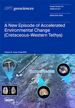
This article presents a new episode of accelerated environmental change recorded during the late Barremian. The study is based on a multi-proxy approach integrating C-isotope stratigraphy, a high-resolution quantitative study of nannofossil assemblages, major and trace elements, and biomarkers. Our results outline the paleoenvironmental conditions recorded during the early stages of the Taxy Episode. A disturbance has been identified in the C-isotope record, called the IFeNE (Intra-Feradianus negative C-excursion), which predates the well-known ISNE (Intra-Sarasini negative C-excursion). This study unveils a separate episode of warming heralding the ISNE, resulting in the acceleration of the hydrological cycle and a consequent increase in continental inputs and the fertilization of surface waters, which is linked to the early phases of the Ontong Java Plateau. View this paper
  • Issues are regarded as officially published after their release is announced to the table of contents alert mailing list.
  • You may sign up for e-mail alerts to receive table of contents of newly released issues.
  • PDF is the official format for papers published in both, html and pdf forms. To view the papers in pdf format, click on the "PDF Full-text" link, and use the free Adobe Reader to open them.
Order results
Result details
Section
Select all
Export citation of selected articles as:
17 pages, 12934 KiB  
Article
Geological Assessment of Faults in Digitally Processed Aerial Images within Karst Area
by Laszlo Podolszki, Nikola Gizdavec, Mateo Gašparović and Tihomir Frangen
Geosciences 2024, 14(7), 195; https://doi.org/10.3390/geosciences14070195 - 18 Jul 2024
Viewed by 648
Abstract
The evolution of map development has been shaped by advancing techniques and technologies. Nevertheless, field and remote mapping with cabinet data analysis remains essential in this process. Geological maps are thematic maps that delineate diverse geological features. These maps undergo updates reflecting changes [...] Read more.
The evolution of map development has been shaped by advancing techniques and technologies. Nevertheless, field and remote mapping with cabinet data analysis remains essential in this process. Geological maps are thematic maps that delineate diverse geological features. These maps undergo updates reflecting changes in the mapped area, technological advancements, and the availability of new data. Herein, a geological assessment example focused on enhancing mapped data using digitally processed historical (legacy) aerial images is presented for a case study in the Dinarides karst area in Croatia. The study area of Bribirske Mostine is covered by the Basic Geological Map of Yugoslavia (BGMY) at a 100,000 scale, which was developed during the 1960s. As the BGMY was developed 60+ years ago, one of its segments is further analyzed and discussed, namely, faults. Moreover, applying modern-day technologies and reinterpretation, its data, scale, presentation, and possible areas of improvement are presented. Georeferenced digital historical geological data (legacy), comprising BGMY, archive field maps, and aerial images from 1959 used in BGMY development, are reviewed. Original faults were digitalized and reinterpreted within the geographic information system with the following conclusions: (i) more accurate data (spatial positioning) on faults can be gained by digitally processing aerial photographs taken 60+ years ago with detailed review and analysis; (ii) simultaneously, new data were acquired (additional fault lines were interpreted); (iii) the map scale can be up-scaled to 1:25,000 for the investigated area of Bribirske Mostine; and (iv) a newly developed map for the Bribirske Mostine study area is presented. Full article
(This article belongs to the Section Structural Geology and Tectonics)
Show Figures

Figure 1

22 pages, 10199 KiB  
Article
Regional-Scale Evaluation of Landslide Distribution and Its Relation to Climate in Southern Alberta, Canada
by Nima Mirhadi and Renato Macciotta
Geosciences 2024, 14(7), 194; https://doi.org/10.3390/geosciences14070194 - 18 Jul 2024
Viewed by 624
Abstract
This work illustrates a semi-quantitative approach to evaluate changes in regional landslide distribution as a consequence of forecasted climate change, which can be adopted at other regions. We evaluated the relationship between climate conditions and landslide distribution at a regional scale. In this [...] Read more.
This work illustrates a semi-quantitative approach to evaluate changes in regional landslide distribution as a consequence of forecasted climate change, which can be adopted at other regions. We evaluated the relationship between climate conditions and landslide distribution at a regional scale. In this study, landslides on parts of the Battle, Red Deer, and Bow Rivers that are located within the Bearpaw Formation in Southern Alberta, Canada, were mapped, and their characteristics were compared. In order to find a relationship between the climate conditions and the mapped landslides, 30-year annual precipitation and other factors, such as slope aspect and geology, were compared between the river valleys. The results show that climatic conditions and the size and shape of the landslides are different in the Battle River area compared to the Red Deer and Bow Rivers regions. The weak Bearpaw overconsolidated shale and the bentonite layers throughout the region are sensitive to moisture and create favorable conditions for landslides in the river valleys. Further investigations into the long-term impact of climate on the formation of river valleys and the Bearpaw Formation support the argument that climate is one of the main factors in causing variations in landslide distribution across the study areas. These findings provide insight into possible changes in regional landslide distribution as a consequence of climate change. Full article
Show Figures

Figure 1

15 pages, 2273 KiB  
Article
Experimental Investigation on the Effect of Sequences of Unsteady Flows on Bedload Sediment Transport
by Zahra Askari, Luca Mao, Saeed Reza Khodashenas and Kazem Esmaili
Geosciences 2024, 14(7), 193; https://doi.org/10.3390/geosciences14070193 - 17 Jul 2024
Viewed by 604
Abstract
Flash floods in ephemeral streams are rare, short and difficult to forecast and thus to monitor. During these events, bedload transport reaches very high rates and most sediment transport occurs within a limited number of hours during the course of a year. Because [...] Read more.
Flash floods in ephemeral streams are rare, short and difficult to forecast and thus to monitor. During these events, bedload transport reaches very high rates and most sediment transport occurs within a limited number of hours during the course of a year. Because monitoring of bedload in ephemeral rivers is challenging, here we present the results of a series of flume experiments designed to simulate short, flashy floods. Since most flume experiments usually involve single events, here we add to existing evidence by testing the effects of sequences of multiple floods in rapid succession. The flume is 10 m long, 0.3 m wide and 0.5 m deep. Two bed sediment mixtures (well sorted and poorly sorted) with similar median grain size but a different standard deviation were used. Bedload was monitored continuously during each hydrograph, but no sediment was fed. The flume experiments used six triangular hydrographs with peak flows ranging from 0.0147 to 0.02 m3s1 and durations ranging from 150 to 400 s. Results indicate that the sediment transport rate decreases progressively from the first to the third hydrograph, and that this pattern is consistent for all permutations of peak discharge and flood duration. In all of the runs, the sediment transport rate at a specified flow was higher during the rising limb than the falling limb of the hydrograph, indicating clockwise hysteresis. Furthermore, in the subsequent repetitions of the same hydrograph, the degree of hysteresis generally diminishes in magnitude from the first to the last repetition for all the experiments, irrespective of their magnitude and duration. Full article
Show Figures

Figure 1

27 pages, 1079 KiB  
Article
A PLL-Based Doppler Method Using an SDR-Receiver for Investigation of Seismogenic and Man-Made Disturbances in the Ionosphere
by Nazyf Salikhov, Alexander Shepetov, Galina Pak, Vladimir Saveliev, Serik Nurakynov, Vladimir Ryabov and Valery Zhukov
Geosciences 2024, 14(7), 192; https://doi.org/10.3390/geosciences14070192 - 16 Jul 2024
Viewed by 715
Abstract
The article describes in detail the equipment and method for measuring the Doppler frequency shift (DFS) on an inclined radio path, based on the principle of the phase-locked loop using an SDR receiver for the investigation of seismogenic and man-made disturbances in the [...] Read more.
The article describes in detail the equipment and method for measuring the Doppler frequency shift (DFS) on an inclined radio path, based on the principle of the phase-locked loop using an SDR receiver for the investigation of seismogenic and man-made disturbances in the ionosphere. During the two M7.8 earthquakes in Nepal (25 April 2015) and Turkey (6 February 2023), a Doppler ionosonde detected co-seismic and pre-seismic effects in the ionosphere, the appearances of which are connected with the various propagation mechanisms of seismogenic disturbance from the lithosphere up to the ionosphere. One day before the earthquake in Nepal and 90 min prior to the main shock, an increase in the intensity of Doppler bursts was detected, which reflected the disturbance of the ionosphere. A channel of geophysical interaction in the system of lithosphere–atmosphere–ionosphere coupling was traced based on the comprehensive monitoring of the DFS of the ionospheric signal, as well as of the flux of gamma rays in subsoil layers of rocks and in the ground-level atmosphere. The concept of lithosphere–atmosphere–ionosphere coupling, where the key role is assigned to ionization of the atmospheric boundary layer, was confirmed by a retrospective analysis of the DFS records of an ionospheric signal made during underground nuclear explosions at the Semipalatinsk test site. A simple formula for reconstructing the velocity profile of the acoustic pulse from a Dopplerogram was obtained, which depends on only two parameters, one of which is the dimension of length and the other the dimension of time. The reconstructed profiles of the acoustic pulses from the two underground nuclear explosions, which reached the height of the reflection point of the sounding radio wave, are presented. Full article
Show Figures

Figure 1

20 pages, 9973 KiB  
Article
The Preparation Phase of the 2022 ML 5.7 Offshore Fano (Italy) Earthquake: A Multiparametric–Multilayer Approach
by Martina Orlando, Angelo De Santis, Mariagrazia De Caro, Loredana Perrone, Saioa A. Campuzano, Gianfranco Cianchini, Alessandro Piscini, Serena D’Arcangelo, Massimo Calcara, Cristiano Fidani, Adriano Nardi, Dario Sabbagh and Maurizio Soldani
Geosciences 2024, 14(7), 191; https://doi.org/10.3390/geosciences14070191 - 16 Jul 2024
Viewed by 774
Abstract
This paper presents an analysis of anomalies detected during the preparatory phase of the 9 November 2022 ML = 5.7 earthquake, occurring approximately 30 km off the coast of the Marche region in the Adriatic Sea (Italy). It was the largest earthquake [...] Read more.
This paper presents an analysis of anomalies detected during the preparatory phase of the 9 November 2022 ML = 5.7 earthquake, occurring approximately 30 km off the coast of the Marche region in the Adriatic Sea (Italy). It was the largest earthquake in Italy in the last 5 years. According to lithosphere–atmosphere–ionosphere coupling (LAIC) models, such earthquake could induce anomalies in various observable variables, from the Earth’s surface to the ionosphere. Therefore, a multiparametric and multilayer approach based on ground and satellite data collected in each geolayer was adopted. This included the revised accelerated moment release method, the identification of anomalies in atmospheric parameters, such as Skin Temperature and Outgoing Longwave Radiation, and ionospheric signals, such as Es and F2 layer parameters from ionosonde measurements, magnetic field from Swarm satellites, and energetic electron precipitations from NOAA satellites. Several anomalies were detected in the days preceding the earthquake, revealing that their cumulative occurrence follows an exponential trend from the ground, progressing towards the upper atmosphere and the ionosphere. This progression of anomalies through different geolayers cannot simply be attributed to chance and is likely associated with the preparation phase of this earthquake, supporting the LAIC approach. Full article
Show Figures

Figure 1

25 pages, 4396 KiB  
Article
The Manhattan Schist, New York City: Proposed Sedimentary Protolith, Age, Boundaries, and Metamorphic History
by John H. Puffer, John R. McGann and James O. Brown
Geosciences 2024, 14(7), 190; https://doi.org/10.3390/geosciences14070190 - 15 Jul 2024
Viewed by 760
Abstract
There are some persistent basic questions pertaining to the bedrock schist of New York City (NYC). How many mappable schist formations are exposed in NYC, and what was the sedimentary protolith of the Manhattan schists? Our proposed answers are based in part on [...] Read more.
There are some persistent basic questions pertaining to the bedrock schist of New York City (NYC). How many mappable schist formations are exposed in NYC, and what was the sedimentary protolith of the Manhattan schists? Our proposed answers are based in part on a blending of published paleontological and radiometric dating results that constrain the timing of Taconic subduction and the best choice of a pelitic protolith for the schists of NYC. We have chemically analyzed some samples of schist and shales at key locations to evaluate the plausibility of our proposals. The compelling published evidence indicates that the Taconic Orogeny began about 475 Ma, when peri-Laurentian plates began the process of east-dipping subduction under the Moretown Terrane, resulting in a magmatic flareup of the Shelburne Falls arc that carried the Moretown Terrane west across NYC. East-dipping subduction accounts for early Ordovician metamorphism until an oceanic slab break-off event at about 466 Ma. Our review of the biostratigraphic data indicates a continuation of subduction and the deposition of pelitic sediments until about 455 Ma, during the transition to deep-water turbiditic sediment deposition. This disqualifies all post-455 Ma turbidites as viable protoliths for the NYC Manhattan schists but does include the Late Cambrian to lowermost Late Ordovician pelites of the Jutland Sequence that are exposed directly west of NYC in New Jersey. Our new chemical analyses of Jutland sediments and each of the three named schists from the NYC plot as a single geochemical population. We, therefore, propose that the schists of NYC could collectively be referred to as the Manhattan schist of the Late Cambrian to lower Late Ordovician. Full article
(This article belongs to the Section Geochemistry)
Show Figures

Figure 1

16 pages, 5734 KiB  
Article
Elemental Geochemistry on Paleoenvironment Reconstruction: Proxies on Miocene-Pliocene of Marine to Fluvial Sediment in Serpong, Banten, Indonesia
by Heri Syaeful, Syaiful Bakhri, Budi Muljana, Agus Sumaryanto, I. Gde Sukadana, Hendra Adhi Pratama, Adi Gunawan Muhammad, Ngadenin, Frederikus Dian Indrastomo, Roni Cahya Ciputra, Susilo Widodo, Nunik Madyaningarum, Puji Santosa, Muhammad Burhannudinnur and Zufialdi Zakaria
Geosciences 2024, 14(7), 189; https://doi.org/10.3390/geosciences14070189 - 13 Jul 2024
Viewed by 783
Abstract
Research of the depositional environment using geological mapping, petrography, gamma-ray (GR) log, palynology, and foraminifera fossils of the Bojongmanik Formation has led to the formation of several different conclusions about the transition to the marine environment, which are attractive to revisit. The expected [...] Read more.
Research of the depositional environment using geological mapping, petrography, gamma-ray (GR) log, palynology, and foraminifera fossils of the Bojongmanik Formation has led to the formation of several different conclusions about the transition to the marine environment, which are attractive to revisit. The expected results of this research are to determine the paleoenvironment of the Bojongmanik and Serpong Formations based on elemental geochemistry, the development of paleoenvironment proxies based on portable X-ray fluorescence (pXRF) in fluvial to transitional environments studies, and the contribution of paleoenvironment analysis to GR-log facies interpretation. The research methodology starts with GR-log facies analysis, Pearson’s correlation, paleoenvironment analysis based on elemental affinity and elemental ratio, and comparing the paleoenvironment with GR-log-based facies. The paleoenvironment analysis based on elemental geochemistry resulted in the Bojongmanik Formation in the research area deposited at the tidal point bar, lagoon, and shoreface, while the Serpong Formation was deposited at the fluvial point bar and floodplain. Compared to previous research, the Bojongmanik Formation in the research area could be stratigraphically related to the upper Bojongmanik Formation. Proxies based on elemental geochemical affinities of carbonate-associated, carbonate-productivity, terrigenous-associated elements, and redox-sensitive trace elements show contrast changes between facies. Proxies based on the specific ratio show a detailed paleoenvironment for paleoclimate (Sr/Cu), paleosalinity (Sr/Ba), paleoredox (Cu/Zn), paleo-hydrodynamics and water depth (Zr/Rb and Fe/Mn), sediment provenance (Cr/Zr), and siliciclastic-dominated (Zr + Rb)/Sr. Adding a geochemistry element-based paleoenvironment analysis benefits from a more specific justification for GR-log facies interpretation. Full article
(This article belongs to the Section Geochemistry)
Show Figures

Figure 1

22 pages, 9954 KiB  
Article
Grain Size Distribution and Provenance of Holocene Sand from the Sava River (Zagreb, Croatia)
by Uroš Barudžija, Matteo Blatančić and Tomislav Malvić
Geosciences 2024, 14(7), 188; https://doi.org/10.3390/geosciences14070188 - 13 Jul 2024
Viewed by 764
Abstract
This study involves an investigation into the grain size distribution and provenance of the sand deposited near Zagreb (Croatia) in the riverbed of the regionally important, almost 1000 km long Sava River, which connects several SE European countries. Recent research in the study [...] Read more.
This study involves an investigation into the grain size distribution and provenance of the sand deposited near Zagreb (Croatia) in the riverbed of the regionally important, almost 1000 km long Sava River, which connects several SE European countries. Recent research in the study area has mainly focused on the deposits forming the Zagreb alluvial aquifer system, rather on the Sava River sediment deposited in its riverbed, which is the focus of this study. The grain size distribution results obtained by dry sieving and laser granulometry showed a predominately fine and medium sand deposition at riverbanks and sand point bars. Medium sand increased downstream towards the east, within the artificially more channelized riverbed in the urban area. Fine sand prevailed 50 km further downstream in a more meandering low-relief area, near the city of Sisak and Lonjsko Polje Nature Park. Provenance analysis showed predominately carbonate sand in the western part of the city of Zagreb, originating from distant (Alpine) and local (Medvednica Mt. and Samobor Hills) sources. More siliciclastic sand was deposited in the Sava riverbed in the middle and eastern parts of Zagreb, originating mainly from the Medvednica Mt. The prevailing siliciclastic sand further downstream of the Sava River is probably sourced from the Kupa River tributary. Although various studies of the Zagreb alluvial aquifer system have been conducted so far, this study represents a novelty in its investigation into the grain size distribution of the Sava riverbed sand itself, setting the foundations for investigations in the future. Full article
Show Figures

Figure 1

12 pages, 12874 KiB  
Article
New Evidence for an Episode of Accelerated Environmental Change in the Late Barremian: Geochemical and Paleontological Records from the Subbetic Basin (Western Tethys)
by Ginés A. de Gea, José Manuel Castro, Miguel Company, Luis O’Dogherty, José Sandoval, María Luisa Quijano, Cristina Sequero, Sandro Froehner and Roque Aguado
Geosciences 2024, 14(7), 187; https://doi.org/10.3390/geosciences14070187 - 11 Jul 2024
Viewed by 772
Abstract
We investigate a new event of accelerated environmental change that was recorded during the late Barremian in the pelagic Subbetic Basin (Western Tethys). Two pelagic sections have been studied using a multi-proxy approach based on C-isotope stratigraphy and a high-resolution quantitative study of [...] Read more.
We investigate a new event of accelerated environmental change that was recorded during the late Barremian in the pelagic Subbetic Basin (Western Tethys). Two pelagic sections have been studied using a multi-proxy approach based on C-isotope stratigraphy and a high-resolution quantitative study of nannofossil assemblages, along with major and trace elements and biomarkers. Our results provide a detailed biostratigraphy and C-isotope stratigraphy, and outline the paleoenvironmental conditions recorded during the early stages of the Taxy Episode. A disturbance has been identified in the C-isotope record, called the IFeNE (Intra-Feradianus negative C-excursion), which is coeval with environmental and biotic changes that predate the well-known ISNE (Intra-Sarasini negative C-excursion). The combined analysis of nannofossil associations, C-isotopes, major and trace elements, and biomarker distributions indicates a separate episode of warming heralding the ISNE, resulting in the acceleration of the hydrological cycle and a consequent increase in continental inputs and the fertilization of surface waters. The origin of the Taxy Episode (the IFeNE and ISNE) has been related to orbital factors (high-eccentricity cycles), and to a global increase in volcanism, probably related to the early phases of the Ontong Java Plateau. Full article
Show Figures

Figure 1

21 pages, 10962 KiB  
Article
Mapping Seafloor Sediment Distributions Using Public Geospatial Data and Machine Learning to Support Regional Offshore Renewable Energy Development
by Connor W. Capizzano, Alexandria C. Rhoads, Jennifer A. Croteau, Benjamin G. Taylor, Marisa L. Guarinello and Emily J. Shumchenia
Geosciences 2024, 14(7), 186; https://doi.org/10.3390/geosciences14070186 - 11 Jul 2024
Viewed by 858
Abstract
Given the rapid expansion of offshore wind development in the United States (US), the accurate mapping of benthic habitats, specifically surficial sediments, is essential for mitigating potential impacts on these valuable ecosystems. However, offshore wind development has outpaced results from environmental monitoring efforts, [...] Read more.
Given the rapid expansion of offshore wind development in the United States (US), the accurate mapping of benthic habitats, specifically surficial sediments, is essential for mitigating potential impacts on these valuable ecosystems. However, offshore wind development has outpaced results from environmental monitoring efforts, compelling stakeholders to rely on a limited set of public geospatial data for conducting impact assessments. The present study therefore sought to develop and evaluate a systematic workflow for generating regional-scale sediment maps using public geospatial data that may pose integration and modeling challenges. To demonstrate this approach, sediment distributions were characterized on the northeastern US continental shelf where offshore wind development has occurred since 2016. Publicly available sediment and bathymetric data in the region were processed using national classification standards and spatial tools, respectively, and integrated using a machine learning algorithm to predict sediment occurrence. Overall, this approach and the generated sediment composite effectively predicted sediment distributions in coastal areas but underperformed in offshore areas where data were either scarce or of poor quality. Despite these shortcomings, this study builds on benthic habitat mapping efforts and highlights the need for regional collaboration to standardize seafloor data collection and sharing activities for supporting offshore wind energy decisions. Full article
(This article belongs to the Special Issue Progress in Seafloor Mapping)
Show Figures

Figure 1

14 pages, 6874 KiB  
Article
Core Flooding Experiments on the Impact of CO2-EOR on the Petrophysical Properties and Oil Recovery Parameters of Reservoir Sandstones in Kazakhstan
by Ainash Shabdirova, Ashirgul Kozhagulova, Yernazar Samenov, Rinat Merbayev, Ainur Niyazbayeva and Daryn Shabdirov
Geosciences 2024, 14(7), 185; https://doi.org/10.3390/geosciences14070185 - 11 Jul 2024
Viewed by 882
Abstract
This study investigates the impact of CO2-enhanced oil recovery (CO2-EOR) on the petrophysical properties and oil recovery potential of sandstone reservoirs in the oilfields located in the east-southern Precaspian region of Kazakhstan. Despite the recognized potential of CO2 [...] Read more.
This study investigates the impact of CO2-enhanced oil recovery (CO2-EOR) on the petrophysical properties and oil recovery potential of sandstone reservoirs in the oilfields located in the east-southern Precaspian region of Kazakhstan. Despite the recognized potential of CO2-EOR for improving oil recovery and aiding carbon sequestration, there is limited understanding of how CO2-EOR specifically affects the petrophysical properties of sandstone reservoirs in this region. Laboratory experiments were conducted using two core samples from the selected oilfields to examine changes in porosity, permeability, and oil recovery coefficients. The results demonstrated that porosity changes ranged from a slight increase of 1.1% to a decrease of 1.5%, while permeability reduction was significant, with decreases ranging from 29% to 50% due to clay alteration and halite precipitation. The oil recovery coefficient after CO2 flooding was found to be between 0.49 and 0.54. These findings underscore the complex interactions between CO2 and reservoir rocks, emphasizing the need for tailored EOR strategies in different geological settings. Full article
Show Figures

Figure 1

10 pages, 6787 KiB  
Article
Remarkable Carapace Morphology of Nanhsiungchelys (Testudines: Nanhsiungchelyidae) Revealed by New Material from Ganzhou Basin, Jiangxi Province, China
by Haiyan Tong, Lu Li, Yuzheng Ke, Yanyin Wang, Gongqing Jie and Laiping Yi
Geosciences 2024, 14(7), 184; https://doi.org/10.3390/geosciences14070184 - 11 Jul 2024
Cited by 1 | Viewed by 800
Abstract
Two nanhsiungchelyid carapaces from the Upper Cretaceous of Ganzhou Basin, Jiangxi Province, Southern China, are reported and assigned to Nanhsiungchelys sp. The new material reveals an unusual carapace morphology that was either not or poorly preserved in previously known Nanhsiungchelys specimens, including differentiated [...] Read more.
Two nanhsiungchelyid carapaces from the Upper Cretaceous of Ganzhou Basin, Jiangxi Province, Southern China, are reported and assigned to Nanhsiungchelys sp. The new material reveals an unusual carapace morphology that was either not or poorly preserved in previously known Nanhsiungchelys specimens, including differentiated neurals, alternating costals, significantly modified scutes with vertebrals 4–5 contacting each other at a point, reduced pleurals 2–4 and greatly expanded lateral and posterior marginals. The discovery extends the geographical distribution of Nanhsiungchelys to the Ganzhou Basin. Full article
(This article belongs to the Section Sedimentology, Stratigraphy and Palaeontology)
Show Figures

Figure 1

13 pages, 4329 KiB  
Article
Domain Adaptation from Drilling to Geophysical Data for Mineral Exploration
by Youngjae Shin
Geosciences 2024, 14(7), 183; https://doi.org/10.3390/geosciences14070183 - 9 Jul 2024
Viewed by 806
Abstract
This study utilizes domain adaptation to enhance the integration of diverse geoscience datasets, aiming to improve the identification of ore bodies. Traditional mineral exploration methods often face challenges in merging different geoscience data types, which leads to models that do not perform well [...] Read more.
This study utilizes domain adaptation to enhance the integration of diverse geoscience datasets, aiming to improve the identification of ore bodies. Traditional mineral exploration methods often face challenges in merging different geoscience data types, which leads to models that do not perform well across varying domains. Domain adaptation is a deep learning strategy aimed at adapting a model developed in one domain (source) to perform well in a different domain (target). To adapt models trained on detailed, labeled drilling data (source) to interpret broader, unlabeled geophysical data (target), Domain-Adversarial Neural Networks (DANNs) were applied, chosen for their robust performance in scenarios where the target domain does not provide labels. This approach was indirectly validated through the minimal overlap between regions identified as candidate ore and borehole locations marked as host rocks, with qualitative validation provided by t-Distributed Stochastic Neighbor Embedding (t-SNE) visualizations showing improved data integration across domains. Full article
(This article belongs to the Section Geophysics)
Show Figures

Figure 1

16 pages, 4229 KiB  
Article
Advancements in Soft Soil Stabilization by Employing Novel Materials through Response Surface Methodology
by Pooja Somadas, Purushotham G. Sarvade and Deepak Nayak
Geosciences 2024, 14(7), 182; https://doi.org/10.3390/geosciences14070182 - 8 Jul 2024
Viewed by 754
Abstract
Stabilization using industrial by-products is presently gaining importance in the construction sector for improving the geotechnical characteristics of soft soils. The optimum dosage of stabilisers has become of great interest to experimenters in terms of improved strength, time, and economy for construction projects. [...] Read more.
Stabilization using industrial by-products is presently gaining importance in the construction sector for improving the geotechnical characteristics of soft soils. The optimum dosage of stabilisers has become of great interest to experimenters in terms of improved strength, time, and economy for construction projects. This work presents the utilization of biomedical waste ash for improving the strength of soft soil. In this paper, response surface methodology (RSM) was adopted to determine the optimum combination curing period (C) and biomedical waste ash (BA) quantity for attaining the maximum unconfined compressive strength (UCS) of soft soil and to reduce the number of trial tests required. The response factors C and BA were varied from 0 to 14 days and 4% to 20%, respectively, and the experiments were conducted according to the experimental plan provided by the RSM design. Based on a Face-centred Central Composite Design (FCCCD), a mathematical equation was created for the experimental results. Analysis of variance (ANOVA) was used to determine the generated model’s significance, and the results indicated a statically significant model (p ≤ 0.05). The results revealed that the curing period imparts more influence towards strength improvement, and the optimum dosage was 19.912% BA, with curing of 14 days to yield a maximum UCS of 203.008 kPa. This optimization technique may be suggested to obtain a preliminary estimation of strength prior to stabilization. Full article
(This article belongs to the Special Issue Soil-Structure Interactions in Underground Construction)
Show Figures

Figure 1

27 pages, 14095 KiB  
Article
Marl Mining Activity and Negative Repercussions for Two Hillside Villages (Northern Italy)
by Fabio Luino, Sabrina Bonetto, Barbara Bono, Cesare Comina, William W. Little, Sabina Porfido, Paolo Sassone and Laura Turconi
Geosciences 2024, 14(7), 181; https://doi.org/10.3390/geosciences14070181 - 8 Jul 2024
Viewed by 833
Abstract
Coniolo and Brusaschetto, are two small towns located in the Monferrato area of the Alessandria Province, northern Italy. These communities have similar histories related to development and subsequent abandonment of marl quarry activity that began more than a century ago and continued until [...] Read more.
Coniolo and Brusaschetto, are two small towns located in the Monferrato area of the Alessandria Province, northern Italy. These communities have similar histories related to development and subsequent abandonment of marl quarry activity that began more than a century ago and continued until recently. Quarrying occurred until soil conditions, water infiltration, and excessive depth made cost of extracting and7 lifting material prohibitive. Quarries consisted of tunnels located directly beneath the towns at about 150 m below ground surface. Collapse of the tunnels led to surface subsidence and destruction of overlying homes and much of the municipal infrastructure. In the early Twentieth Century, regulations pertaining to mine and quarry safety were typically deficient, entirely absent, or not followed. Extractive activities of non-energy mineral resources from quarries and mines were and continue to be widespread in Italy, which currently ranks fifth among what are now countries of the European Union (EU). Mining sites are present in all regions of Italy, particularly in the northern part of the country and along coasts, often in areas of geohydrogeological risk. Consequences of anthropogenic pressures that alter the natural environment, such as the physical size of aquifer drawdowns, are linked to issues for a number of extractive sites across the country. This report analyzes historical and technical documents, conducts a geomorphological analysis of hilly slopes surrounding these communities, and examines urban planning and geophysical surveys to determine the impact of subsurface quarrying activities on the overlying ground surface. The study highlights significant problems that are applicable to other localities globally. This research demonstrates: (a) the importance of geological considerations to development and abandonment of mining activity in inhabited areas; (b) the importance of establishing and following safety protocols; and (c) the manner in which economic interests can take precedence over the well-being and lives of those employed to extract resources. Full article
Show Figures

Figure 1

23 pages, 16549 KiB  
Article
Exploring Urban Sustainability: The Role of Geology and Hydrogeology in Numerical Aquifer Modelling for Open-Loop Geothermal Energy Development, the Case of Torino (Italy)
by Alessandro Berta and Glenda Taddia
Geosciences 2024, 14(7), 180; https://doi.org/10.3390/geosciences14070180 - 30 Jun 2024
Viewed by 1097
Abstract
This research examines the integration of geological and hydrogeological data in numerical aquifer model simulations, with a particular focus on the urban area of Torino, Italy. The role of groundwater resources in urban sustainability is analysed. The objective is to integrate open-loop geothermal [...] Read more.
This research examines the integration of geological and hydrogeological data in numerical aquifer model simulations, with a particular focus on the urban area of Torino, Italy. The role of groundwater resources in urban sustainability is analysed. The objective is to integrate open-loop geothermal plants into the district heating network of IREN S.p.A. Two case studies are examined: the Torino Nord area and the Moncalieri area, both of which host district heating plants. The work entails the collection and analysis of data from a variety of sources, including geognostic surveys and permeability tests, in order to construct a three-dimensional numerical model of the surface aquifer. Models were built using the public MODFLOW 6 (model of groundwater flow) code and calibrated using PESTHP (High Performance of Model Independent Parameter Estimation and Uncertainty Analysis). Results indicate the potential of urban aquifers as renewable energy sources and the necessity of comprehensive geological and hydrogeological assessments for optimal ground water heat pump (GWHP) system installation. This paper emphasises the significance of sustainable water management in the context of climate change and urbanisation challenges. Full article
(This article belongs to the Topic Urban Hydrogeology Research)
Show Figures

Figure 1

26 pages, 35034 KiB  
Article
Strain Analysis and Kinematics of Deformation of the Tectonic Nappe Pile in Olympos-Ossa Mountainous Area: Implication for the Exhumation History of the HP/LT Ampelakia Unit and the Olympos-Ossa Tectonic Window (Eastern Thessaly, Central Greece)
by Ioannis Vrontzos, Emmanouil Katrivanos, Ilias Lazos, Lambrini Papadopoulou and Adamantios Kilias
Geosciences 2024, 14(7), 179; https://doi.org/10.3390/geosciences14070179 - 28 Jun 2024
Viewed by 910
Abstract
This paper focuses on the structural and finite strain analysis of the Pelagonian nappe, the HP/LT Ampelakia unit, and the Olympos-Ossa unit in the Olympos-Ossa mountainous area in order to better understand the exhumation history of the Ampelakia unit and the underlain Olympos-Ossa [...] Read more.
This paper focuses on the structural and finite strain analysis of the Pelagonian nappe, the HP/LT Ampelakia unit, and the Olympos-Ossa unit in the Olympos-Ossa mountainous area in order to better understand the exhumation history of the Ampelakia unit and the underlain Olympos-Ossa unit. Two main stages of Tertiary deformation were revealed, related to nappe stacking and exhumation processes. During the Paleocene–Eocene crustal subduction, HP/LT metamorphism, compression, and nappe stacking were developed progressively. This D1 stage was terminated with the final SW-ward emplacement of the Ampelakia and Pelagonian nappe on the Olympos-Ossa unit during the Eocene–Early Oligocene. The next stage of deformation, D2, was developed during the Oligocene–Miocene following the orogenic nappes stacking. D2 was considered an extensional event, related to metamorphic isothermal decompression, nappes tectonic denudation, crustal uplift, and final exhumation of the Ampelakia unit and the Olympos-Ossa unit as a tectonic window. The calculated finite strain ellipsoids indicate a main flattening type strain geometry and middle strain intensity, increasing along the nappe contacts. The quartz C-axes diagrams also reveal a flattening type of deformation and non-coaxial flow towards the southwest and northeast at the western and eastern flanks of Olympos-Ossa Mountain, respectively. The calculated Wk vorticity number ranges from 0.23 to 0.93. Full article
(This article belongs to the Special Issue Metamorphism and Tectonic Evolution of Metamorphic Belts)
Show Figures

Figure 1

19 pages, 5611 KiB  
Article
Mapping of Supra-Glacial Debris Cover in the Greater Caucasus: A Semi-Automated Multi-Sensor Approach
by Levan G. Tielidze, George Iacob and Iulian Horia Holobâcă
Geosciences 2024, 14(7), 178; https://doi.org/10.3390/geosciences14070178 - 27 Jun 2024
Viewed by 1400
Abstract
Supra-glacial debris cover is important for the control of surface ice melt and glacier retreat in mountain regions. Despite the progress in techniques based on various satellite imagery, the mapping of debris-covered glacier boundaries over large regions remains a challenging task. Previous studies [...] Read more.
Supra-glacial debris cover is important for the control of surface ice melt and glacier retreat in mountain regions. Despite the progress in techniques based on various satellite imagery, the mapping of debris-covered glacier boundaries over large regions remains a challenging task. Previous studies of the debris-covered glaciers in the Greater Caucasus have only focused on limited areas. In this study, using the Sentinel 1–2 imagery (2020), DebCovG-carto toolbox, and existing glacier inventory (2020), we produced the first detailed assessment of supra-glacial debris cover for individual glaciers in the entire Greater Caucasus. Our study shows that in 2020, 10.3 ± 5.6% of the glacier surface in this mountain region was covered by debris. A comparison of sub-regions such as the Elbrus Massif and other individual glaciers from the central Greater Caucasus shows an increasing trend of supra-glacial debris cover from 2014 to 2020. The total area of supra-glacial debris cover expanded from ~4.6% to ~5.8% for Elbrus and from ~9.5% to ~13.9% for the glaciers of the central Greater Caucasus during the same period. Supra-glacial debris cover also expanded upward on these glaciers between 2014 and 2020. A recent increase in rock-ice avalanche activity in combination with increased air temperature and decreased precipitation in the Greater Caucasus may be responsible for this upward migration and expanded area of supra-glacial debris cover. This study provides valuable insights into the spatial distribution, temporal evolution, and factors influencing supra-glacial debris cover in the Greater Caucasus. The findings contribute to our understanding of glacier dynamics and highlight the importance of continuous monitoring and assessment of supra-glacial debris cover in the context of climate change and glacier retreat. We recommend using the DebCovG-carto toolbox for regional assessment of supra-glacial debris coverage in other mountain regions as well. Full article
(This article belongs to the Section Cryosphere)
Show Figures

Figure 1

36 pages, 83705 KiB  
Article
Modern River-Sand Geochemical Mapping in the Manufahi Municipality and Its Surroundings, Timor-Leste: Implications for Provenance
by Vital Vilanova, Tomoyuki Ohtani, Satoru Kojima, Kazuma Yatabe, Nene Cristovão and Aniceta Araujo
Geosciences 2024, 14(7), 177; https://doi.org/10.3390/geosciences14070177 - 25 Jun 2024
Viewed by 1042
Abstract
A geochemical mapping of regional modern river-sand is performed to clarify geological information in the study area of Timor-Leste. Several areas of Timor-Leste including the study area in particular have limited geological information due to limited accessibility and dense vegetation coverage, and deformed, [...] Read more.
A geochemical mapping of regional modern river-sand is performed to clarify geological information in the study area of Timor-Leste. Several areas of Timor-Leste including the study area in particular have limited geological information due to limited accessibility and dense vegetation coverage, and deformed, weathered, and erosion-covered materials. A total of 53 modern river sand samples were collected and analyzed. Ten major elements were determined by using wavelength-dispersive X-ray fluorescence. Areas characterized by clastic sedimentary rocks are recognized clearly by elevated concentrations of SiO2, Al2O3, and K2O. Meanwhile, areas covered by carbonate sedimentary rocks are detected by significant concentrations of CaO and MnO. The occurrences of the altered clastic and carbonate sedimentary rocks of the Wailuli and Aitutu Formations due to metamorphic, silicification and other alteration processes were responsible for the elevated concentrations and positive correlation between SiO2, CaO, K2O, and MnO, and CaO, TiO2, and MnO in the midstream and near the downstream areas of the Clerec and Sahe River catchments. The positive correlation observed between TiO2, CaO and MnO may be ascribed to the presence of carbonate components associated with secondary Ti-bearing minerals, which are potentially formed through hydrothermal alteration processes. Full article
(This article belongs to the Section Geochemistry)
Show Figures

Figure 1

11 pages, 2532 KiB  
Article
Determining the Cohesive Length of Rock Materials by Roughness Analysis
by Saeed Aligholi, Manoj Khandelwal and Ali Reza Torabi
Geosciences 2024, 14(7), 176; https://doi.org/10.3390/geosciences14070176 - 25 Jun 2024
Viewed by 941
Abstract
In this research, the cohesive length of various rock types is measured using quantitative fractography alongside a recently developed multifractal analysis. This length is then utilized to gauge material cohesive stress through the theory of critical distances. Furthermore, the fracture process zone length [...] Read more.
In this research, the cohesive length of various rock types is measured using quantitative fractography alongside a recently developed multifractal analysis. This length is then utilized to gauge material cohesive stress through the theory of critical distances. Furthermore, the fracture process zone length of different rings sourced from identical rocks is assessed as a function of ring dimensions and experimental measurements of fracture toughness, in accordance with the energy criterion of the finite fracture mechanics theory. Subsequently, employing the stress criterion within coupled finite fracture mechanics, the failure stress corresponding to the fracture process zone is determined for various rings. Ultimately, through interpolation, the critical stress corresponding to the cohesive length, quantified via quantitative fractography, is approximated. Remarkably, the cohesive stress values derived from both methodologies exhibit perfect alignment, indicating the successful determination of cohesive length for the analyzed rock materials. The study also delves into the significant implications of these findings, including the quantification of intrinsic tensile strength in quasi-brittle materials and the understanding of tensile strength variations under diverse stress concentrations and loading conditions. Full article
Show Figures

Figure 1

24 pages, 7884 KiB  
Article
Sustainable Geotourism in the Chiusella Valley (NW Italian Alps): A Tool for Enhancing Alpine Geoheritage in the Context of Climate Change
by Arianna Negri, Elena Storta, Rasool Bux Khoso, Agnese Maria Colizzi, Fiorella Acquaotta, Mauro Palomba and Marco Giardino
Geosciences 2024, 14(7), 175; https://doi.org/10.3390/geosciences14070175 - 24 Jun 2024
Viewed by 730
Abstract
The Chiusella Valley (NW Italian Alps) is a key area for both the history of the alpine orogeny and its environmental context. It presents major structural features (including the Traversella neoalpine intrusion and a section of the Insubric line) and evidence of past [...] Read more.
The Chiusella Valley (NW Italian Alps) is a key area for both the history of the alpine orogeny and its environmental context. It presents major structural features (including the Traversella neoalpine intrusion and a section of the Insubric line) and evidence of past climate changes in the region. Even if the Chiusella Valley was previously renowned for mining activities and most recently considered an alpine rural area with minor tourist attractions, its important geoheritage could offer alternatives to traditional mountain activities, which are facing adversity from increasing temperatures. This paper emphasises the role of geotourism in both enhancing sustainable development and raising awareness of climate change. For this purpose, the geodiversity of the Chiusella Valley has been analysed and several geosites have been identified. The research methodology includes field surveys, analysis of an existing educational activities and scientific literature, and assessment of geosites by quantitative analysis of five groups of indicators, including scientific, cultural, and educational values. The geosite selection within the Chiusella Valley reveals memories of past and present climate changes but also supports the development of targeted geotourism activities in the area. Additionally, a specific location has been identified for hosting indoor activities showcasing climate change action. These valuable contributions to sustainable geotourism provide opportunities for exploring the Alps in the vicinity of the Po Plain urban areas, while minimizing the environmental impact and facilitating educational activities on geodiversity and geoheritage. Full article
Show Figures

Figure 1

24 pages, 10672 KiB  
Article
Mechanics of Rainfall-Induced Landslides after a Prolonged Dry Period Based on Laboratory Tests and Numerical Models Incorporating Soil-Water Characteristic Curves
by Kishan Bhadiyadra and Dominic E. L. Ong
Geosciences 2024, 14(7), 174; https://doi.org/10.3390/geosciences14070174 - 24 Jun 2024
Cited by 1 | Viewed by 1207
Abstract
In India, particularly within its Northeastern territories, landslides triggered by rainfall following dry periods are a major concern, consistently causing extensive damage to both life and infrastructure. This study focuses on mitigating their impact through preemptive measures, with an emphasis on analyzing slope [...] Read more.
In India, particularly within its Northeastern territories, landslides triggered by rainfall following dry periods are a major concern, consistently causing extensive damage to both life and infrastructure. This study focuses on mitigating their impact through preemptive measures, with an emphasis on analyzing slope stability to determine critical intervention points. The investigation includes experimental tests on soil samples to assess key parameters, such as soil matric suction and unconfined compressive strength, alongside an analysis of slope failures during the 2017 monsoon in Mizoram’s Lunglei district. Employing Soil-Water Characteristic Curves (SWCC) derived from ASTM D5298-10 standards and a microwave drying technique for preparing soil samples, the research evaluates the condition of the slopes before and after monsoonal rains. This study utilizes a blend of numerical modeling and empirical laboratory investigations to explore the factors contributing to slope instability. The findings underscore the necessity of advanced landslide warning systems, suggesting that a deeper understanding of rainfall-induced slope failures could significantly enhance disaster preparedness and reduce potential damages. Full article
(This article belongs to the Section Geomechanics)
Show Figures

Figure 1

Previous Issue
Next Issue
Back to TopTop