


Abstract
Early-stage grey-space planning requires building layouts that can simultaneously regulate solar access, pedestrian wind, visual openness and outdoor thermal comfort, yet conventional morphology studies often evaluate these dimensions separately or rely on a small number of manually defined schemes. This study develops a reference-generated, surrogate-assisted multi-objective optimization framework for a winter grey-space plaza in Haikou, China. Sixteen locally abstracted building morphology prototypes and four void-coded water cells were arranged around a central plaza, and high-fidelity pedestrian-height matrices were generated for winter direct sun hours, wind speed, visible-area ratio and the Universal Thermal Climate Index (UTCI). A cell-level surrogate ensemble then converted these spatial fields into a reusable predictive engine. Three complementary optimizers were deployed: qNEHVI-MOBO for hypervolume-efficient Pareto discovery, Multi-objective MAP-Elites for morphology-performance illumination, and -guided RVEA/iPICEA-g for reference-oriented search. The completed workflow performed 2,420,256 surrogate candidate evaluations and produced 84, 96 and 78 algorithm-specific Pareto candidate layouts, with 224 remaining non-dominated within the pooled archives. Predicted archive indicators included full coverage above the sunlight threshold, 99.83% average wind-comfort coverage and 75.52% maximum UTCI-comfort coverage. These candidate estimates were not independently verified by high-fidelity simulation. RF–SHAP described height and opening associations within surrogate-generated records, with ROC–AUC for Pareto classification. Whole-layout validation revealed limited transfer accuracy for sunlight, wind and UTCI; the framework supports exploratory, interpretable layout screening.
1. Introduction
Hot-humid coastal cities are increasingly required to provide outdoor public spaces that can work across several environmental logics at once: solar access, ventilation, visual openness and thermal comfort. Haikou is a particularly relevant case because its winter outdoor life is intensified by seasonal migratory users, older leisure populations and long-stay public-space activities. Here, a grey-space plaza denotes the central outdoor open space shaped by its surrounding buildings. This space acts as a pedestrian-scale climatic interface where building massing, void distribution and pedestrian exposure jointly determine whether outdoor space can be used comfortably during winter. Studies in hot-humid and subtropical cities have shown that building geometry and surrounding form can substantially modify outdoor thermal comfort through radiation, airflow and mean radiant temperature [1,2]. Large-scale UTCI studies further indicate that pedestrian thermal exposure cannot be explained by meteorology alone; morphology is a decisive mediator [3,4].
Early-stage building morphology planning has practical value before detailed architectural design. Initial height allocation, footprint types and openings establish environmental opportunities that later landscape or facade decisions can refine. Performance-based block studies support comparisons of energy, daylight and outdoor comfort using simplified prototypes [5,6]. Evidence from hot-humid geometry studies [1], urban thermal-comfort assessment in Hong Kong [3] and high-rise wind conditions in Shenzhen [7] provides a relevant climatic context. Together with hot-humid UTCI calibration [8], these studies motivate a winter-focused question: how can a fixed inventory of buildings and openings be rearranged around a plaza while jointly considering solar access, wind, visibility and thermal exposure?
Solar analysis in urban morphology research has moved from single-point daylight criteria toward spatially continuous sunlight fields. Reviews on urban sunlight availability have shown that block orientation, height distribution, urban canyon ratio, spacing and typological heterogeneity can strongly change daylight access at both neighborhood and pedestrian scales [9,10]. Parametric studies of residential blocks also demonstrate that sunlight hours, solar energy potential and building energy use are shaped by early massing parameters rather than by isolated facade-level decisions [2,11].
The winter grey-space condition in Haikou requires a different reading from summer shading studies. In warm seasons, shade frequently appears as the dominant comfort strategy; in the winter migratory-use scenario, inadequate direct sunlight may reduce comfort during prolonged outdoor use, especially when wind exposure increases perceived coolness. Research on urban canyons and heterogeneous blocks has shown that daylight availability responds sharply to height variation and boundary obstruction [12,13]. The relevant design question is therefore not whether a block receives “enough sunlight” on average, but where sunlight remains spatially continuous inside the plaza when perimeter buildings are rearranged. This need supports the use of matrix-based solar evaluation, where each layout is read through the spatial distribution of direct sun hours rather than through a single block-level mean.
Pedestrian-level wind in semi-enclosed plazas is generated by the collective porosity of the perimeter. Building height alone cannot describe it. Open cells, lateral gaps, lift-up spaces, boundary irregularity and ventilation-corridor continuity all influence whether wind becomes stagnant, moderated or over-accelerated at human height. Studies on urban ventilation corridors and morphology-based airflow assessment have shown that built-form porosity and corridor structure can support planning-scale wind control [14,15]. CFD-based research on residential and high-density morphologies has further demonstrated that small changes in building layout can produce large differences in pedestrian wind comfort [16,17].
This literature also clarifies how water-related cells should be treated when no evaporative boundary condition is simulated. Blue-space studies confirm that real water bodies can cool urban environments, but their effects depend on spatial configuration, scale, season and surrounding morphology [18,19]. Reviews of blue and green-blue infrastructure have also stressed that cooling performance varies across climates and spatial scales [20,21]. In a morphology-first framework, water-coded cells can be interpreted rigorously as void-coded open cells: they reduce obstruction, increase visual porosity and create possible lateral wind openings. This avoids attributing unmodeled evaporation to the results while retaining the planning meaning of blue-surface land use.
Visibility introduces a perceptual layer that is often missing from microclimate-only optimization. A public grey-space plaza may be thermally acceptable yet visually enclosed, fragmented or difficult to read. Visibility research has increasingly moved toward three-dimensional and human-perspective quantification, using LiDAR, street-view imagery, visibility graphs, sky view factor and green view index to measure how much space can actually be perceived from pedestrian positions [22,23]. Deep-learning approaches for SVF and GVI have further linked visual exposure to urban thermal environments and pedestrian comfort perception [24,25].
For perimeter building morphology planning, visibility is directly affected by the distribution of solid prototypes and void cells. A tall or continuous prototype at a critical boundary may close a large portion of the visual field, while a side-middle void may release sightlines and improve spatial legibility. Recent 3D visibility studies and greenery-visibility metrics demonstrate that visibility can be treated as a measurable spatial field rather than as a subjective description [26,27]. Street-view-based visual-structure research also indicates that public spatial perception changes with both morphology and observer position [28]. This supports the integration of the visible-area ratio into a grey-space performance framework together with sunlight, wind and UTCI.
UTCI is widely used in outdoor comfort studies because it integrates air temperature, humidity, wind speed and radiation into a human-biometeorological index. Studies on building morphology and outdoor thermal comfort show that UTCI responds sensitively to spatial form, shading, wind field and exposure configuration [8,29]. In seasonal public-space planning, UTCI also helps connect physical microclimate to the bodily experience of sitting, walking and staying outdoors [30,31].
A methodological challenge appears when the design space becomes combinatorial. High-fidelity simulations can generate reliable spatial matrices, but repeated solar, wind, visibility and UTCI simulations for hundreds of thousands of layouts are computationally expensive. Surrogate-assisted design optimization has therefore become a major direction in building and urban performance research [32,33]. Reviews of artificial-intelligence-assisted building design highlight that surrogate models are most useful when they convert expensive simulations into reusable predictive engines [34,35].
The optimization logic also matters. qNEHVI-type Bayesian optimization is suited to noisy multi-objective search and hypervolume improvement [36,37]. Quality-diversity search can reveal families of high-performing but morphologically different layouts rather than only one winner [38]. Reference-vector and preference-inspired evolutionary methods are useful when a reference morphology or target region of the Pareto front is important [39,40]. After optimization, random forest (RF) and SHAP can translate nonlinear morphology-performance relationships into interpretable planning rules [41,42].
The study addresses six linked objectives: (i) abstract recurrent Haikou building types into a controlled prototype library; (ii) compare pedestrian-height sunlight, wind, visibility and UTCI fields across fixed-inventory layouts; (iii) examine the geometric effects of relocating four non-building perimeter cells; (iv) construct spatial surrogates and assess their transferability by holding out complete existing layouts; (v) explore complementary candidate families through hypervolume-oriented, quality-diversity and reference-guided search; and (vi) translate archived morphology-performance relationships into interpretable planning choices using RF and SHAP. These are the objectives of the present study, rather than a summary of all previous research. The methodological contribution is the consistent connection between local prototypes, four spatial response fields, constraint-preserving search and traceable layout selection, with each stage addressing the same perimeter-plaza design problem.
2. Methodology
2.1. Study Scenario and Human-Scale Grey-Space Unit
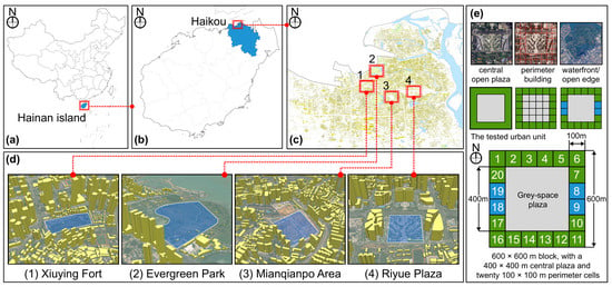
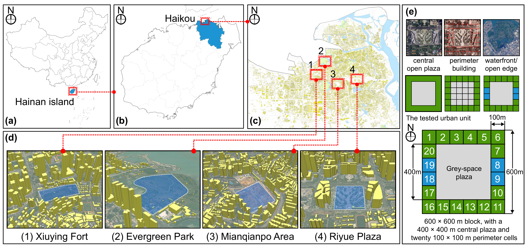
This study develops a reference-generated, surrogate-assisted multi-objective optimization framework for perimeter building morphology around a central grey-space plaza in Haikou, China. Its winter scenario addresses seasonal outdoor staying and pedestrian exposure in a hot-humid coastal setting. Figure 1a–d connects the regional location with four urban examples: Xiuying Fort, Evergreen Park, Mianqianpo Area and Riyue Plaza. Their observable central open spaces, flanking perimeter buildings and adjacent waterfront/open edges together inform the standardized experimental geometry in Figure 1e. The tested urban unit comprises a 600 m × 600 m block, a 400 m × 400 m central plaza and twenty 100 m × 100 m perimeter cells, numbered clockwise from the northwestern corner for reproducible layout comparison.
Figure 1.
Study location and experimental grey-space unit. (a–c) China, Hainan and Haikou; (d) four urban examples; (e) plaza–perimeter abstraction, dimensions and twenty clockwise slots. The central plaza measures 400 × 400 m.
All environmental variables were sampled at a pedestrian height of 1.6 m. This height was adopted as the human-scale exposure layer where solar access, wind sensation, visual openness and outdoor thermal stress are directly experienced. The winter solstice, 22 December, was used for direct-sun-hour calculation, while UTCI was computed for 12:00 on the coldest day of the typical meteorological year. This setting allows the method to focus on long-stay, slow-walking and leisure-oriented winter plaza use, for which solar availability and excessive wind cooling can jointly influence perceived comfort [1,3].
2.2. Haikou Morphological Survey and Prototype Abstraction
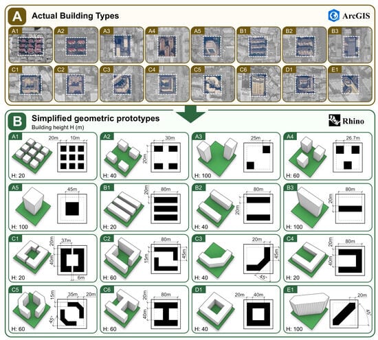
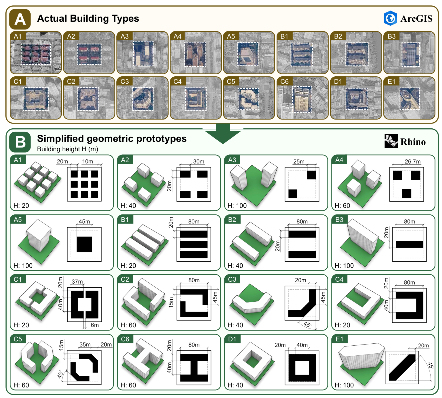
The building prototype library was derived from a typological reading of recurrent building morphologies in Haikou’s urban fabric. Figure 2A,B pairs actual building types with simplified three-dimensional geometry and footprint dimensions. The abstraction retains footprint subdivision, tower-bar combinations, courtyard-like enclosure, slab continuity, central voids, diagonal massing and compact block patterns. Sixteen prototypes, A1–A5, B1–B3, C1–C6, D1 and E1, form the controlled library. Their geometric heights are shown in Figure 2B across 20 m, 40 m, 60 m and 100 m categories, representing contrasting height conditions in the experimental perimeter. These correspondences preserve recognizable local typologies.
Figure 2.
Sixteen Haikou-derived building morphology prototypes. (A) Actual building types; (B) simplified prototypes, footprint dimensions and geometric heights.
The abstraction follows a prototype-based urban design logic. Morphological complexity is retained through plan configuration and height category, while constructional details, facade treatments and material differences are suppressed to isolate layout effects. This approach is consistent with recent performance-based block studies that identify representative urban typologies before conducting environmental simulation or optimization [5,43]. Each prototype is placed at the centre of its 100 m × 100 m cell, and rotation is prohibited for all algorithms. The decision problem is therefore a constrained permutation problem, in which the optimizer changes cell assignment while preserving the orientation and internal geometry of each prototype.
Four perimeter cells are encoded as WATER to retain their blue-space land-use identity. In the simulations, they are non-building geometric openings. Their interpreted effects arise from changes in solar obstruction, airflow passage and visible space; evaporation, humidity-source terms and water-surface heat exchange are outside this geometric representation [44,45].
2.3. Reference Morphology Generator for the Layout
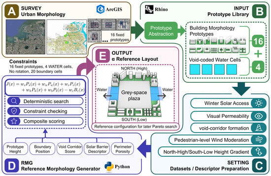
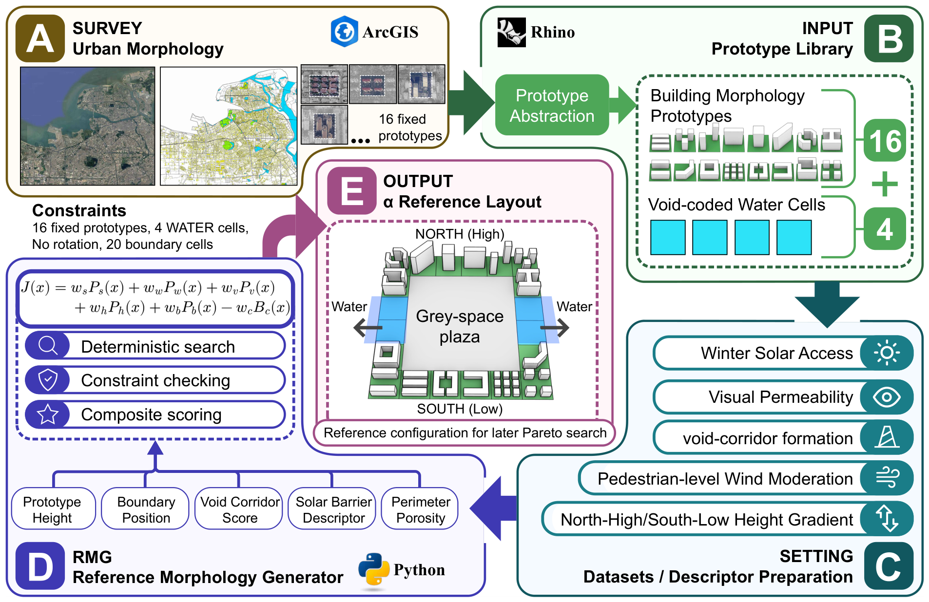
The layout was generated through a deterministic Reference Morphology Generator (RMG), which translates literature-informed climatic and perceptual rules into a reproducible perimeter arrangement (Figure 3A–E). The generator integrates winter solar access, pedestrian-level wind moderation, visual permeability, void-corridor formation and north–south height gradient. The northern sector receives greater tolerance for tall prototypes because winter solar shadows can extend away from the central plaza, while the southern sector receives a low-height preference to protect winter direct solar access. Lateral middle zones receive higher void suitability scores to encode paired east–west openings. These rules define a reference preference examined through four-objective comparisons across the candidate design space.
Figure 3.
Reference morphology generator for . Arrows indicate the direction of information flow, and colours distinguish the functional modules (A–E). The ellipsis in panel A denotes a selective display of the survey images; the complete set is presented in Figure 2.
For a candidate layout x, the RMG minimizes a composite penalty:
where penalizes south-side solar obstruction, penalizes excessive wind blockage or exposure, penalizes visual closure, penalizes height-gradient disorder, penalizes uneven boundary concentration, and rewards paired middle void-corridor formation. The RMG is deterministic under a fixed prototype library and rule-weight vector, so the layout can be regenerated without subjective manual adjustment. The resulting layout is then used as a reference configuration and reference vector in later optimization, in line with recent work on morphology-performance optimization and ventilation-corridor assessment [14,46].
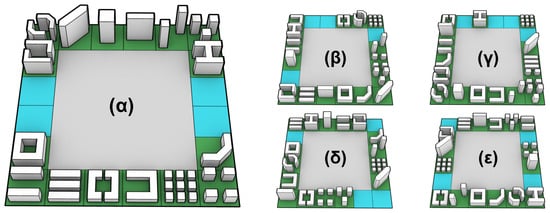
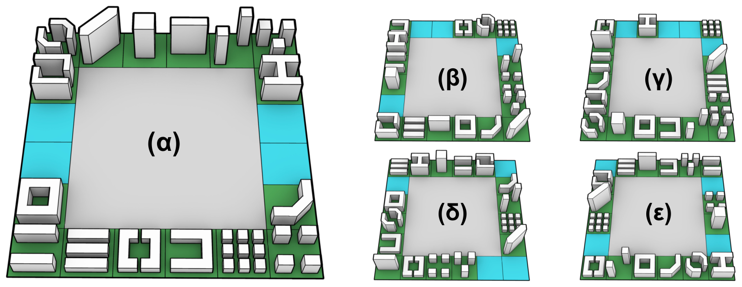
The reference layout and four comparison layouts, –, form the high-fidelity simulation set (Figure 4). Their perimeter sequences are listed in Table A1; every layout retains the same sixteen prototypes, four void cells and fixed prototype orientations.
Figure 4.
Five layouts used for high-fidelity simulation.
2.4. High-Fidelity Simulation and Matrix Reconstruction
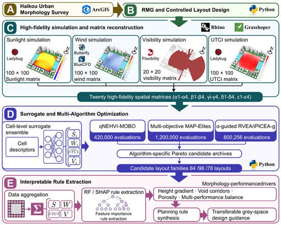
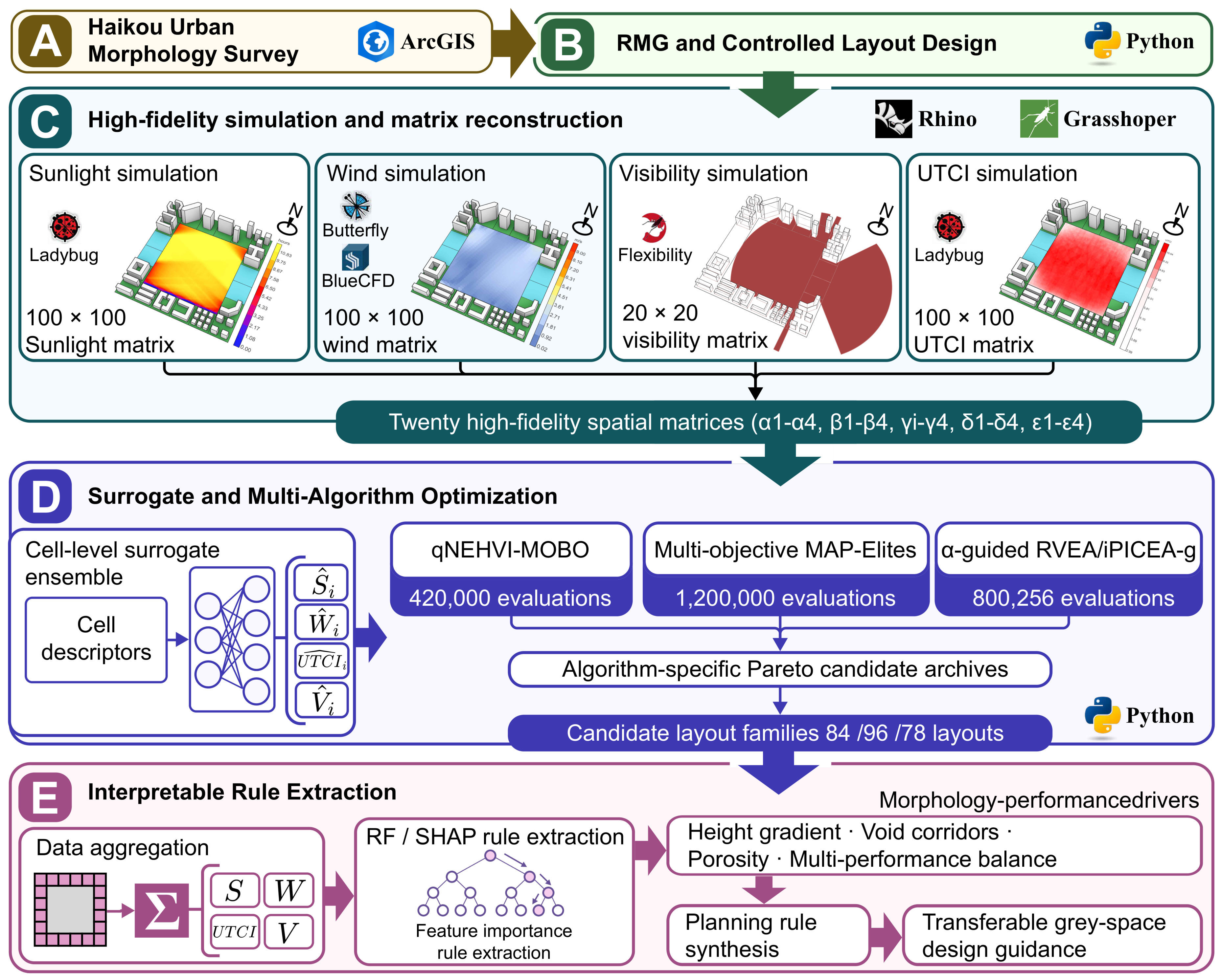
The workflow in Figure 5 uses Rhino/Grasshopper to maintain common geometry, parameter control and spatial indexing across the four assessments (Table 1). This integration preserves identical building arrangements when transferring geometry between environmental tasks. Ladybug Tools supports solar and UTCI-related radiation processing; Flexibility computes visibility. Butterfly prepares and runs the OpenFOAM CFD case through BlueCFD for the wind calculation. Rhino/Grasshopper is therefore the modeling and workflow interface, while the environmental computations are performed by the associated components and solver. Published Ladybug applications inform this tool selection [47,48].
Figure 5.
Overall methodological framework.
Table 1.
Main modeling configuration.
The weather input was the Haikou typical-meteorological-year EPW obtained from the EnergyPlus weather-data repository and imported through Ladybug. The EPW supplied location information and hourly meteorological variables; Ladybug served as the importer and processing interface. The five layouts used the same weather source and evaluation settings. The selected 12:00 cold-day record supplied the UTCI weather inputs, representing a typical-year comparison rather than contemporaneous on-site observations.
Direct sun hours were calculated on 22 December using a 100 × 100 grid over the central grey-space plaza. Pedestrian wind speed was simulated under the representative ENE incoming wind condition, with the buildings treated as solid obstacles in a steady incompressible RANS k- setting. Visibility was computed using 20 × 20 observation points; from each point, 400 radial rays were cast within a 200 m visual radius, and the visible-area ratio was obtained by dividing the visible polygon area by the theoretical circular area. Visibility is reported as a dimensionless ratio from 0 to 1; multiplying by 100 gives a percentage. This isovist-based treatment follows the geometric logic of visible-space measurement and visibility graph analysis [49,50]. UTCI was calculated at 12:00 on the coldest day using air temperature, humidity, wind speed and mean radiant temperature.
The five layouts shown in Figure 4, , , , and , produced twenty high-fidelity spatial matrices. Sunlight, wind speed and UTCI each contain 10,000 grid values per layout; visibility contains 400 values per layout. Values were reconstructed from the southwest corner, increasing northward within the same column, then moving eastward to the next column. This column-major ordering maintains a consistent geographic coordinate system for heatmaps, surrogate features and later spatial aggregation.
2.5. Objective Formulation and Cell-Level Surrogate Model
The optimization problem was formulated as a four-objective, constrained permutation search. Each layout is represented as:
Each building prototype appears exactly once, four cells are WATER, and rotation is fixed:
For each candidate layout, four objectives summarize the predicted spatial fields. The 2 h sunlight threshold and 0.5–2.5 m/s wind band are fixed comparative screening criteria for winter outdoor staying, not locally calibrated acceptance limits. The 9–26 °C UTCI band follows the no-thermal-stress classification [51], with regional interpretation informed by hot-humid calibration research [8]. Table A2 retains these definitions. The objectives describe complementary aspects of one winter planning scenario: solstice-day solar duration, the representative ENE wind field, geometric visibility and the selected cold-day noon UTCI. They remain separate Pareto objectives rather than a time-synchronous exposure index. Supplementary Table S1 reports threshold perturbations calculated from the existing baseline matrices, making the dependence on the screening cut-offs explicit.
A cell-level surrogate ensemble mapped spatial coordinates, directional distances, prototype height, density, opacity, void adjacency and sectoral morphology to plaza performance. Three members per metric supplied ensemble means and dispersion for uncertainty-aware scoring. Ensemble dispersion is a model-disagreement measure and is not a calibrated prediction interval. Original simulations retained their full matrices; candidate scoring used 25 × 25 grids for sunlight, wind and UTCI, and 20 × 20 for visibility. Geometric heights follow Figure 2B; reported search descriptors retain their archived feature encoding. This combination supports efficient reuse of spatial simulations, consistent with surrogate-assisted environmental design approaches [32,52]. Candidate objective scores, physical means and threshold shares are reported separately throughout the analysis. Height features are normalized; objective scores are dimensionless comparative quantities and are not interchangeable with the threshold shares in Table A2.
We assessed surrogate transferability through five-fold leave-one-layout-out reanalysis of the existing simulations. In each fold, all points from one layout were withheld, and the three-member model for each metric was refitted using only the other four layouts. Architecture, descriptors, 160 training epochs and the archived hyperparameters remained fixed. Feature and response normalization and output bounds were estimated exclusively from the training layouts; no held-out response informed fitting or model selection. Predictions were evaluated at the withheld layout’s native points using MAE, RMSE, and threshold-share error. Supplementary Table S2 reports all twenty layout-metric tests, together with an untrained spatial-mean comparator. This reanalysis does not alter the optimization archives.
To separate sampling effects from surrogate error, we resampled each existing baseline field at the cell-centred scoring positions by bilinear interpolation. Native and resampled means and threshold shares were compared without solving a new environmental model. Four-by-four block averaging and all sixteen stride-four offsets provided supplementary aggregation checks. Visibility retained its original grid throughout (Supplementary Table S3).
2.6. Algorithm I: qNEHVI-MOBO for Pareto-Efficient Candidate Discovery
The first optimizer is a discrete-permutation adaptation of q-noisy expected hypervolume improvement multi-objective Bayesian optimization, hereafter qNEHVI-MOBO. qNEHVI is designed to improve Pareto hypervolume under uncertainty and noisy objective estimates, making it suitable for surrogate-guided environmental design where objective values are predicted from ensemble models [36,37]. In this study, candidate layouts are generated through constrained swap, sector exchange and void-relocation operators, then scored in batches by the surrogate ensemble.
For a candidate batch , the hypervolume-improvement principle can be written schematically as:
where is the dominated hypervolume and is the current Pareto archive. The implementation uses batch screening, uncertainty penalization and archive-based non-dominated filtering. A total of 420,000 candidate evaluations were performed, with a target archive of 84 Pareto layouts.
2.7. Algorithm II: Multi-Objective MAP-Elites for Morphology-Performance Illumination
The second optimizer is Multi-objective MAP-Elites. It was selected because the research objective is not limited to finding a single best arrangement; it also aims to illuminate which combinations of height gradient, void placement and boundary porosity produce high-performance grey-space conditions. MAP-Elites divides an interpretable feature space into cells and stores the best-performing elite for each occupied cell, thereby creating a morphology-performance atlas [53].
The descriptor vector is:
where is north–south height gradient, and are northern and southern high/low-rise ratios, is middle void-corridor strength, is height entropy and is perimeter porosity. The archive update rule is:
where is the multi-objective quality score derived from dominance rank, diversity and uncertainty. The algorithm performed 1,200,000 candidate evaluations and produced 96 Pareto layouts.
2.8. Algorithm III: -Guided RVEA/iPICEA-g for Reference-Oriented Search
The third optimizer combines reference-vector-guided evolutionary search with preference-inspired co-evolutionary goal vectors. RVEA decomposes a many-objective problem through reference vectors and uses angular penalized distance to balance convergence and diversity [54]. PICEA-g and its interactive extensions co-evolve candidate solutions and goal vectors, allowing a preferred region of the Pareto front to be explored without collapsing the search into a single weighted-sum solution [40,55].
The layout provides the initial reference direction in the normalized objective space:
Candidate layouts are selected by angular association to reference vectors and by an -proximity term:
The search used a population of 768, 1042 generations and 220 reference vectors, corresponding to 800,256 candidate evaluations. The final archive contains 78 -guided Pareto layouts, preserving both reference consistency and morphological diversity.
2.9. Random Forest and SHAP-Based Post-Hoc Rule Extraction
Random Forest classified surrogate-derived Pareto membership and regressed the four search objectives using thirty morphology descriptors, including height gradients, solar-barrier proxies, void placement and reference scores [56]. Completed-run diagnostics and permutation importance describe this fitted model. SHAP attribution was computed using a separate, controlled-background reconstruction with 258 archived positive layouts and identical classifier hyperparameters. For integrated analysis, we pooled the algorithm-specific archives, retained the 224 four-objective non-dominated candidates under the common maximization convention and examined their morphology-performance associations within this selected design set.
SHAP supplies additive feature attribution [57], complementing interpretable urban morphology modeling [41,58]. Six eight-variable matrices, with 224 layouts per panel, summarize Pearson correlations, marginal distributions and pairwise scatter patterns; two-sided tests use Benjamini–Hochberg correction within each panel’s 28 comparisons. Correlation directions complement RF importance without representing intervention effects. Together, the workflow in Figure 5 links spatial simulation, complementary Pareto search and evidence-based planning interpretation, with model-specific diagnostics distinguished from candidate-set correlations.
3. Results
3.1. Computational Completion and Integrity of the Optimization Run
The computing environment used Python 3.11.9 and PyTorch 2.5.1 with CUDA 12.1 acceleration for parallelized sampling, archive updating and Random Forest post-processing. The computational workflow included surrogate training, three independent optimization searches, Pareto archive generation, PNG/SVG visualization, heatmap rendering, two-dimensional and three-dimensional scatter plotting, and RF–SHAP interpretation.
Twelve surrogate networks were fitted, comprising three ensemble members for each environmental variable. Each member used 160 epochs. Final training losses ranged from 0.0164–0.0168 for sunlight, 0.0262–0.0263 for wind and 0.0204–0.0225 for visibility, with UTCI losses around 0.0203. These values describe fitting; the additional whole-layout tests provide a separate assessment of transfer to an unseen arrangement. Pooled out-of-fold values were −0.007, −0.176, 0.358, −0.132 for sunlight, wind, visibility and UTCI, respectively; the corresponding RMSE values were 2.030, 0.819, 0.058, 0.623, in hours, m/s, ratio units and °C. Performance varied substantially by withheld layout (Supplementary Table S2). The negative pooled values for sunlight, wind and UTCI indicate limited transfer accuracy for unseen arrangements. These held-out results assess surrogate prediction against existing simulation fields. The optimized candidates were not independently simulated; their Pareto scores and coverage indicators remain predictions from the original full-data surrogate.
The subsequent optimization stage performed 2,420,256 surrogate candidate evaluations in total (Table 2). This total counts evaluations and does not establish the number of distinct layouts. Algorithm I, qNEHVI-MOBO, evaluated 420,000 candidates; Algorithm II, Multi-objective MAP-Elites, evaluated 1,200,000 candidates; and Algorithm III, -guided RVEA/iPICEA-g, evaluated 800,256 candidates through 768 individuals over 1042 generations. All generated layouts preserved the fixed prototype library, the four void-coded water cells and the non-rotation constraint. The final archives contained 84, 96 and 78 algorithm-specific Pareto candidate layouts, respectively. The three searches provide complementary candidate sets for examining performance, morphological diversity and reference-oriented preferences. Their unequal evaluation budgets do not support a direct comparison of computational efficiency.
Table 2.
Computational scale and algorithm settings.
3.2. Baseline Performance of the Five High-Fidelity Layouts
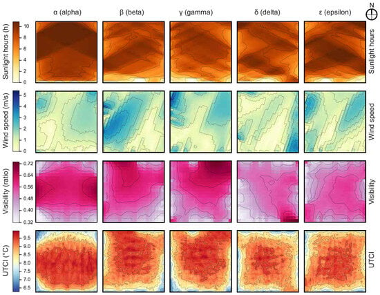
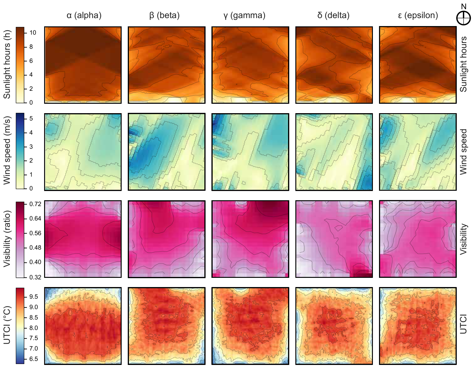
The five high-fidelity layouts establish the physical baseline for the surrogate-driven candidate space. Figure 6 arranges four performance rows against five layout columns, using common within-metric color scales to reveal spatial heterogeneity at pedestrian height. The layout produced the highest mean winter direct sun duration, reaching 9.356 h on 22 December, with 98.54% of plaza cells receiving at least 2 h (Table 3). Its relatively continuous high-sunlight field demonstrates how perimeter arrangement can preserve winter exposure across the plaza, alongside localized edge effects in the other configurations.
Figure 6.
High-fidelity baseline heatmap matrix of the five layouts. Baseline statistics are reported in Table 3.
Table 3.
Baseline high-fidelity statistics for –. Threshold shares follow the screening criteria in Table A2. Visibility means are dimensionless ratios.
The layout also showed the highest mean UTCI among the five baseline configurations, with a mean value of 9.017 °C and a UTCI comfort share of 65.25% within the adopted no-thermal-stress range. This result is important because the average UTCI values of the five high-fidelity cases were located close to the lower comfort boundary. Small morphological changes therefore generated meaningful shifts in the comfort share. The layout, by comparison, showed the lowest UTCI mean at 8.735 °C and the lowest UTCI comfort share at 37.11%, revealing that some non-ideal perimeter arrangements can intensify cold-related thermal discomfort even when their average wind speed is not high.
The wind field presented a more nuanced pattern. The layout had a mean wind speed of 1.190 m/s and a comfort share of 87.14%, while and also achieved high wind-comfort shares of 85.85% and 84.64%, respectively. The layout reached the highest mean wind speed, 1.673 m/s, but its wind-comfort share decreased to 70.51%, indicating that a stronger average wind field does not directly translate into better pedestrian comfort in a winter stay-oriented scenario. Visibility showed another localized trade-off: reached the highest mean visibility value, 0.554, slightly above at 0.553, whereas showed a much weaker visual openness pattern, with a mean visibility of 0.489 and only 52.25% of points above 0.5.
The baseline results establish as a productive reference for winter comfort-oriented grey-space planning, particularly for direct sun-hour availability and UTCI. Figure 6 also reveals distinct low-value patches and heterogeneous visibility patterns that layout means alone do not describe. The small visibility advantage of and the wind variation across – support retaining four performance dimensions. These complementary baseline patterns motivate the subsequent four-objective candidate comparisons, where alternative perimeter arrangements can prioritize solar access, visual openness or thermal comfort while maintaining the same experimental block geometry.
3.3. Pareto Distribution and Trade-Off Structure Across the Combined Archives
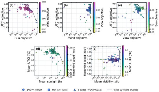
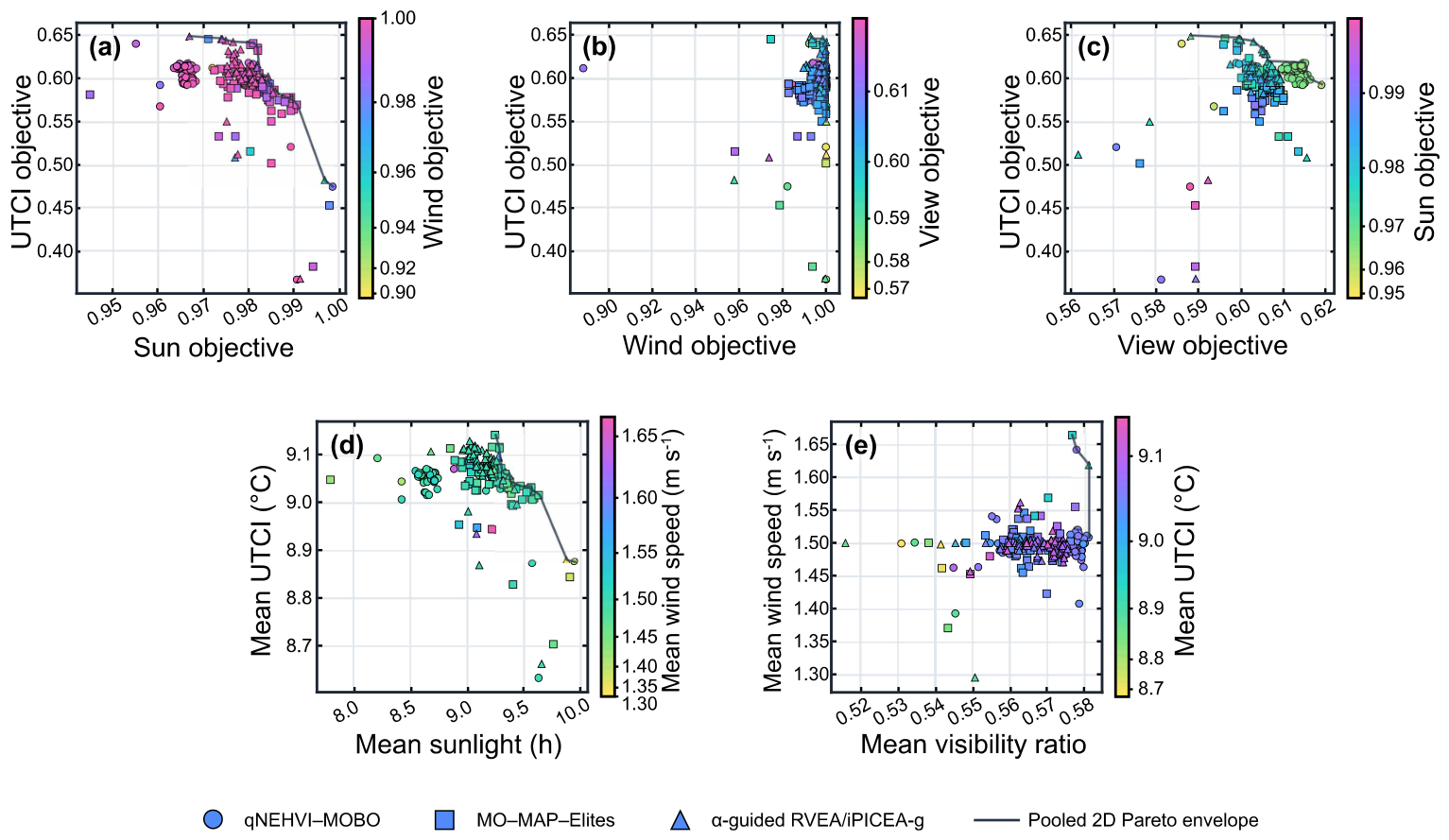
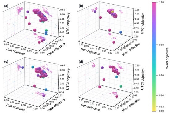
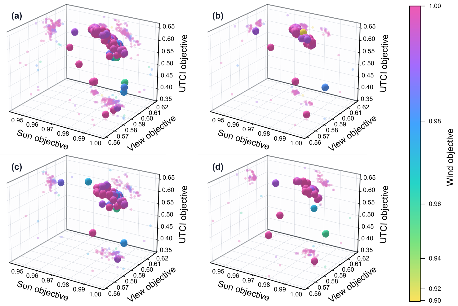
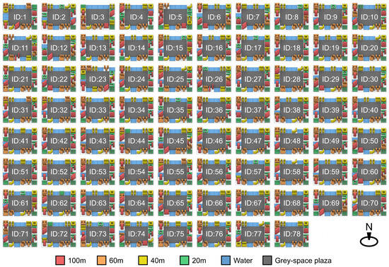
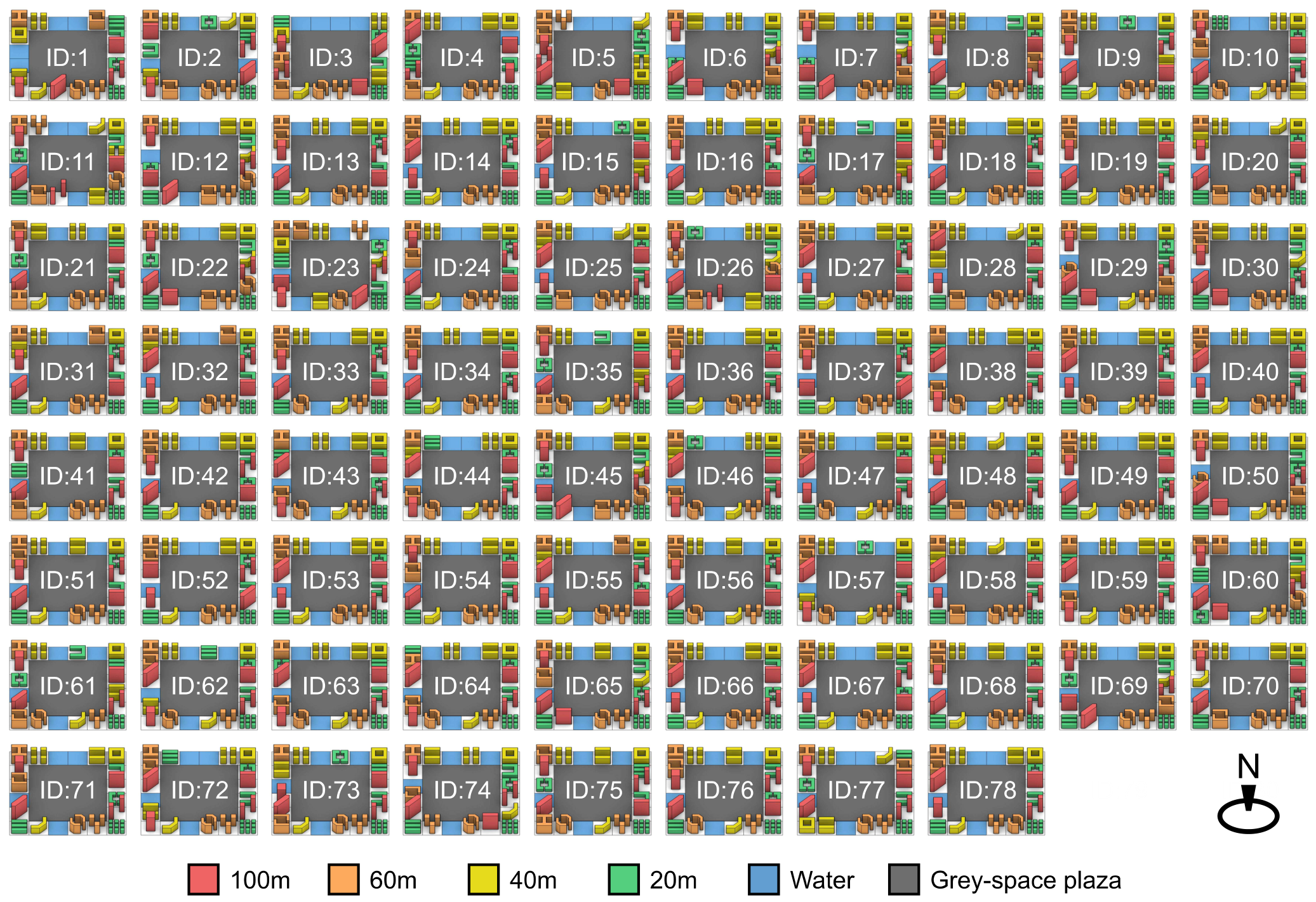
The three optimizers produced 258 algorithm-specific Pareto archive entries. Pooling the archives and rechecking the four normalized objectives retained 224 non-dominated candidates within the combined set. Figure 7 and Figure 8 summarize the two- and three-dimensional projections, respectively. Table 4 distinguishes the full algorithm-specific archives from the pooled non-dominated subset. Figure 8a displays this filtered set; Figure 8b–d displays the complete individual archives. The resulting collection samples complementary parts of the predicted trade-off surface and offers morphologically varied alternatives. This cross-archive comparison distinguishes each algorithm’s candidate family from the pooled selection.
Figure 7.
Pareto trade-offs: (a–c) sun, wind and view versus UTCI, colored by wind, view and sun, respectively; (d) mean sun-UTCI, colored by mean wind; (e) mean view-wind, colored by mean UTCI. Shapes denote algorithms; lines show 2D envelopes.
Figure 8.
Three-dimensional Pareto distribution plots. (a) The 224 pooled non-dominated candidates; (b–d) qNEHVI, MAP-Elites and RVEA/iPICEA-g archives.
Table 4.
Pareto archive statistics. Scores are means; best UTCI comfort is the maximum predicted comfort share. Pooled ND counts entries retained after cross-archive dominance filtering.
Across the 258 archive entries, the mean sunlight, wind, visibility and UTCI objectives were 0.977, 0.996, 0.606 and 0.595. All entries had predicted sunlight coverage of 1.000 at the 625 candidate-grid points above the threshold. The existing-field reanalysis helps explain this saturation: ’s sunlight coverage changed from 98.54% on the native grid to 100.00% at the coarse scoring positions. Across the five baselines, the largest absolute changes in sunlight, wind and UTCI threshold shares were 1.46, 1.34 and 1.11 percentage points, respectively (Supplementary Table S3). These values quantify sampling effects on the available fields, separately from errors in predicting new layouts.
The mean predicted wind-comfort share was 99.83% across the 258 archive entries, with individual shares ranging from 91.20% to 100.00%. Each share counts the points within –, and the archive mean gives equal weight to each entry. Most predicted mean speeds were close to . The wind objective additionally penalizes deviation from this target mean and speeds above . The sunlight and wind coverage figures describe surrogate-predicted candidate performance, not independently verified outcomes; threshold coverage and the continuous wind-objective score remain distinct.
Visibility and UTCI retained stronger trade-offs. The combined archive had a mean predicted visibility of 0.568 and a mean 10th-percentile visibility between 0.47 and 0.48. The highest candidate visibility means approached 0.581. Mean predicted UTCI comfort across the algorithm-specific archives was 68.81%, with the best entries exceeding 75%. These reported profiles support comparative layout screening alongside the held-out error estimates in Supplementary Table S2.
Figure 7a–c projects the candidate archives onto sunlight–UTCI, wind–UTCI and visibility–UTCI objective planes; marker shapes identify algorithms, whereas color represents another performance variable. Figure 7d,e instead compares predicted physical means, keeping wind speed distinct from wind comfort. Mean-based comparisons additionally retain the units of exposure. The distributions expose competing combinations of solar availability, visual openness and thermal response rather than a uniform improvement direction. Figure 8 uses common sunlight, visibility and UTCI axes, with wind objective encoded by color, to compare the pooled non-dominated set against each algorithm-specific archive. Together, these projections make the four-dimensional design trade-offs accessible without treating either a two-dimensional envelope or a concentrated point cloud as evidence of universal superiority.
3.4. qNEHVI-MOBO Archive: Predicted Performance and Layout Diversity
The qNEHVI-MOBO archive contains 84 internally non-dominated candidate layouts. Its performance profile combines strong view-objective performance with varied competing objective combinations. The mean normalized sun objective was 0.970, the mean wind objective was 0.996, the mean view objective was 0.609, and the mean UTCI objective was 0.602. Among the three algorithms, qNEHVI produced the highest mean view objective, and its maximum view objective reached 0.619. These statistics identify a candidate family with high predicted visual openness and competitive sunlight, wind and thermal-comfort scores across feasible perimeter configurations.
The qNEHVI archive also produced the highest individual sun-objective value among all three algorithms, reaching 0.999, with a predicted mean direct sun duration of 9.941 h. Several layouts had predicted full wind-comfort coverage and mean visibility above 0.57. The highest predicted UTCI-comfort share in the qNEHVI archive was 75.04%, with predicted wind-comfort coverage close to 1.0. The archive thus contains model-based alternatives with different combinations of solar access, wind moderation and thermal-comfort scores.
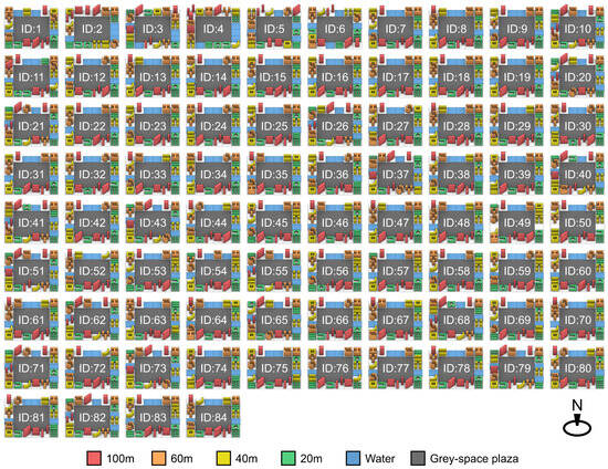
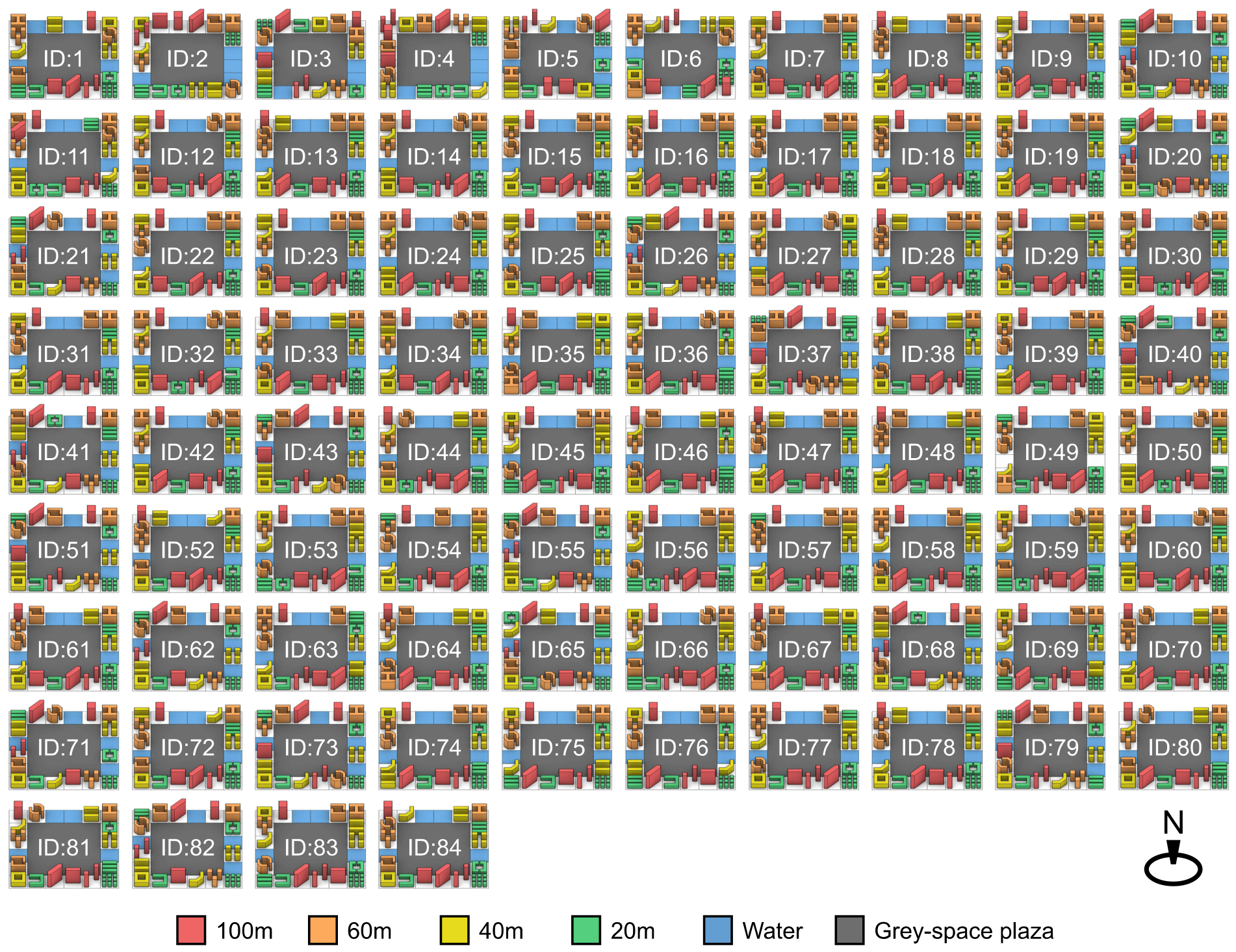
The qNEHVI archive combines a mean water-mid-corridor score of 0.500 with an east–west water symmetry of 0.929. Its average -reference score was 0.425, below the reference-guided archive. The archived normalized north–south height-gradient mean was −0.121, identifying a different height allocation from the average MAP-Elites and RVEA/iPICEA-g configurations. Figure 9 makes this variability explicit through prototype identifiers, height labels and four objective scores for every layout. Thus, qNEHVI contributes visually competitive alternatives that need not reproduce ’s arrangement with taller northern buildings, while maintaining the fixed prototype inventory and four void-coded cells. This distinction preserves genuine choice between solar–visual priorities.
Figure 9.
Complete qNEHVI-MOBO Pareto layout atlas. All 84 qNEHVI layouts.
For planning, the qNEHVI family offers alternatives emphasizing visibility alongside winter comfort. Each panel in Figure 9 links a solution identifier to its twenty slot assignments, objective scores, predicted plaza means and reference score. These annotations support direct comparison of perimeter openings and height allocations without assigning plaza-level performance to individual buildings.
3.5. MAP-Elites and -Guided RVEA/iPICEA-g Archives
The Multi-objective MAP-Elites archive contains 96 internally non-dominated layouts and has the largest archive among the three algorithms. Its main contribution lies in the morphology-performance atlas. The archive reached a mean sun objective of 0.982, the highest among the three algorithms, while maintaining a mean wind objective of 0.994 and a mean view objective of 0.605. The mean predicted direct sun duration was 9.276 h, and all archive members achieved full predicted coverage above the 2 h winter sun threshold. These predicted profiles support exploratory comparisons of winter solar-access alternatives within the Haikou case.
The MAP-Elites candidates showed the lowest mean ensemble uncertainty among the three algorithms, 0.119. The archived normalized north and south mean-height descriptors were 0.537 and 0.456, respectively, giving a positive mean north–south gradient. The north high-rise ratio averaged 0.330, while the south low-rise ratio averaged 0.458. These statistics characterize a solar-oriented family with relatively taller northern and lower southern interfaces. The uncertainty value describes ensemble dispersion for these candidates; its comparative role is to locate internally consistent predictions for further design inspection alongside the objective trade-offs, without changing the physical units or interpretation of the original simulation matrices.
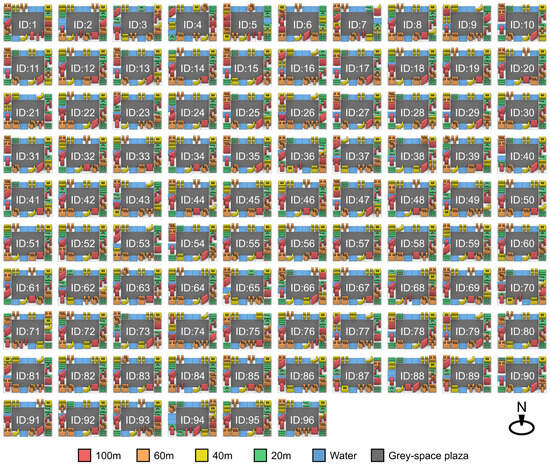
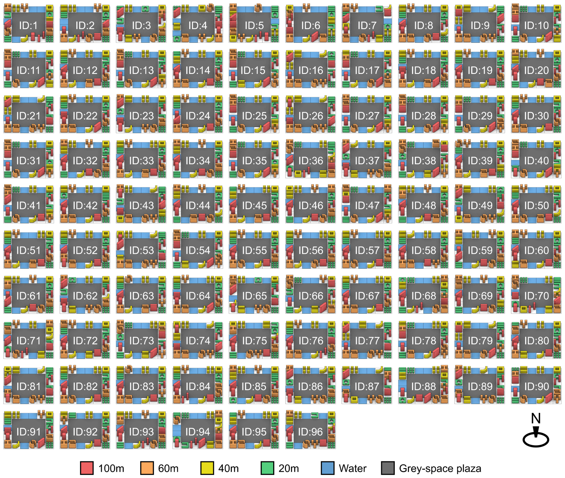
The MAP-Elites archive also identifies multiple void arrangements. Its mean water-mid-corridor score was 0.539, above qNEHVI, with substantial east–west symmetry. Figure 10 displays all 96 layouts as annotated slot diagrams, allowing the positions of low-rise, high-rise and WATER units to be inspected directly. Combined with the numerical archive, these diagrams translate quality-diversity search into an accessible set of planning alternatives. The differences concern the organization of a fixed inventory: each layout retains four void cells, while their lateral allocation and relationships with surrounding prototypes vary substantially.
Figure 10.
Complete multi-objective MAP-Elites Pareto layout atlas. All 96 MAP-Elites layouts.
The -guided RVEA/iPICEA-g archive contains 78 internally non-dominated layouts and shows the strongest reference-oriented behavior. It produced a mean sun objective of 0.980, a mean wind objective of 0.997, a mean view objective of 0.604, and a mean UTCI objective of 0.600. Its average -reference score was 0.520, the highest among the three archives, and 77 of its 78 layouts remained non-dominated within the pooled archives. This indicates that the -guided search did not merely reproduce the reference layout; it generated a compact and highly competitive set of candidate morphologies around the most promising region of the objective space.
The RVEA/iPICEA-g archive had the highest predicted maximum UTCI objective, 0.648, and the highest predicted individual UTCI-comfort share, 75.52%. Its average predicted wind-comfort share reached 99.96%, and its mean water-mid-corridor score was 0.622, the highest of the three algorithms. Figure 11 identifies the corresponding arrangements and their individual objective trade-offs. These outcomes establish a strong reference-oriented candidate family, while the detailed slot annotations retain alternatives within that family. The results support combining reference guidance with objective-specific evaluation during early-stage design development, rather than assuming that increasing reference similarity improves every performance measure.
Figure 11.
Complete -guided RVEA/iPICEA-g Pareto layout atlas. All 78 reference-guided layouts.
3.6. Integrated Interpretation of High-Performing and Low-Performing Patterns
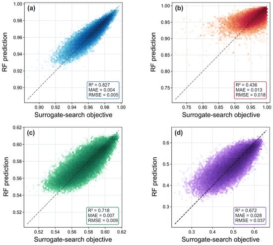
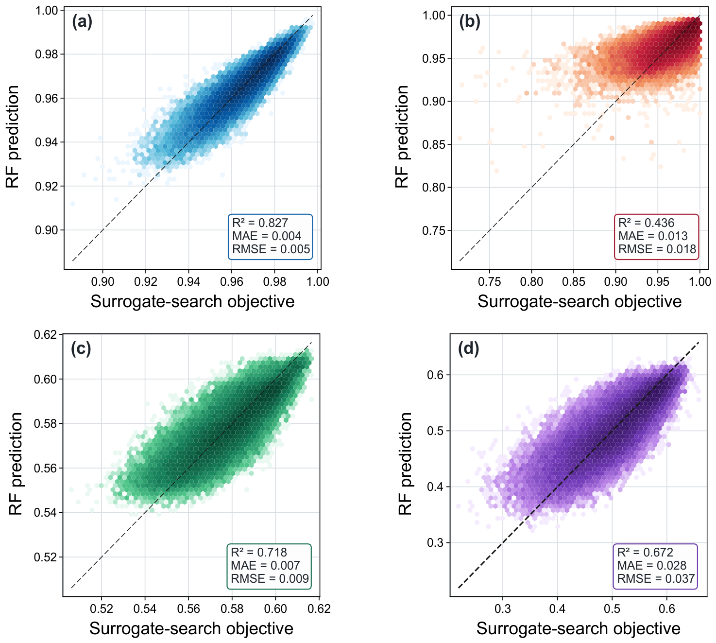
The Random Forest (RF) stage summarizes morphology–performance relationships in the surrogate-search records. Classification achieved an accuracy of 0.973 and ROC–AUC of 0.961, with F1 = 0.564 and average precision = 0.526 (Table 5). The labeled classification subset contained 7866 training and 2622 test records, drawn from a sampled history of 300,000 records with 228 Pareto positives. Figure 12a–d compares RF predictions with the surrogate-search objective values for sunlight, wind, visibility and UTCI, respectively, using 48,400 test pairs per objective. The corresponding regression values were 0.827, 0.436, 0.718 and 0.672. Sunlight showed the strongest fit, followed by visibility and UTCI, whereas wind showed the weakest fit. These diagnostics assess how well the RF models approximate surrogate-search objective values; they do not independently validate the environmental simulations or surrogate predictions. All test pairs are included in each panel without subsampling.
Table 5.
RF diagnostics against surrogate-search targets and leading descriptors. These diagnostics do not validate the environmental surrogate against independent simulations or measurements.
Figure 12.
RF regression diagnostics against surrogate-search objective values for (a) sunlight, (b) wind, (c) visibility and (d) UTCI. Each panel includes 48,400 test pairs. Dashed lines indicate equality between RF predictions and surrogate-search objective values.
Table A3 summarizes the top-ten RF feature-importance descriptors for classification and objective regression, together with the archived permutation importance scores. North solar barrier leads the classifier Gini ranking, followed by east mean height, -reference score, west–east height gradient and south solar barrier. Permutation importance likewise identifies north solar barrier and -reference score as the leading discriminators. For objective regression, west void ratio, water-mid-corridor score and west water share rank above the northern and southern solar-barrier descriptors. These rankings indicate that boundary-height organization and directional void allocation contribute to the fitted RF models. The importance values describe model-specific associations; they do not establish causal effects or indicate the direction of each descriptor’s relationship with performance.
Within the surrogate-generated Haikou archive, different predicted performance preferences accompany distinct morphological tendencies. Solar-oriented candidates emphasize lower southern obstruction and favorable directional height allocation; visually competitive alternatives retain different height patterns and side openings. Thermal-comfort selection then balances those geometric opportunities against wind moderation and the predicted UTCI distribution. This distinction preserves the practical value of the three algorithms: their shared four-objective formulation yields different usable configurations, each documented by a complete slot sequence and performance vector. Candidate selection therefore draws on simultaneous comparisons rather than imposing one height gradient or void arrangement on every objective and every layout.
The weaker baseline configurations sharpen this interpretation. In , low visibility and a UTCI comfort share of 37.11% coincide, whereas combines greater winter sunlight with 65.25% UTCI comfort. Within the optimized archives, the best predicted UTCI share reaches 75.52%, identifying a promising candidate for re-simulation under the same plaza scenario. These comparisons identify useful and less favorable performance combinations without discarding the spatial information in lower-performing layouts. Their contrasting baseline fields help designers recognize exposure patterns and boundary configurations that warrant attention when selecting among the documented candidate families.
The evidence base combines twenty high-fidelity matrices, more than 2.42 million candidate evaluations, 258 algorithm-specific layouts, 224 pooled non-dominated candidates and RF-based interpretation. It connects pedestrian-scale spatial fields with an extensive configuration archive and traceable solution identifiers. The practical result is a set of documented model-based alternatives for exploring solar, wind, visibility and UTCI trade-offs while the building inventory remains fixed. This makes the framework useful for early-stage comparison, when changing the placement of a prototype or an opening remains feasible and its implications need to be assessed across several environmental objectives simultaneously.
4. Discussion
4.1. Morphological Logic of Winter Solar Access and Pedestrian Thermal Gain
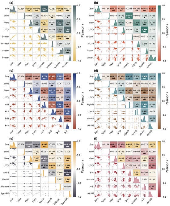
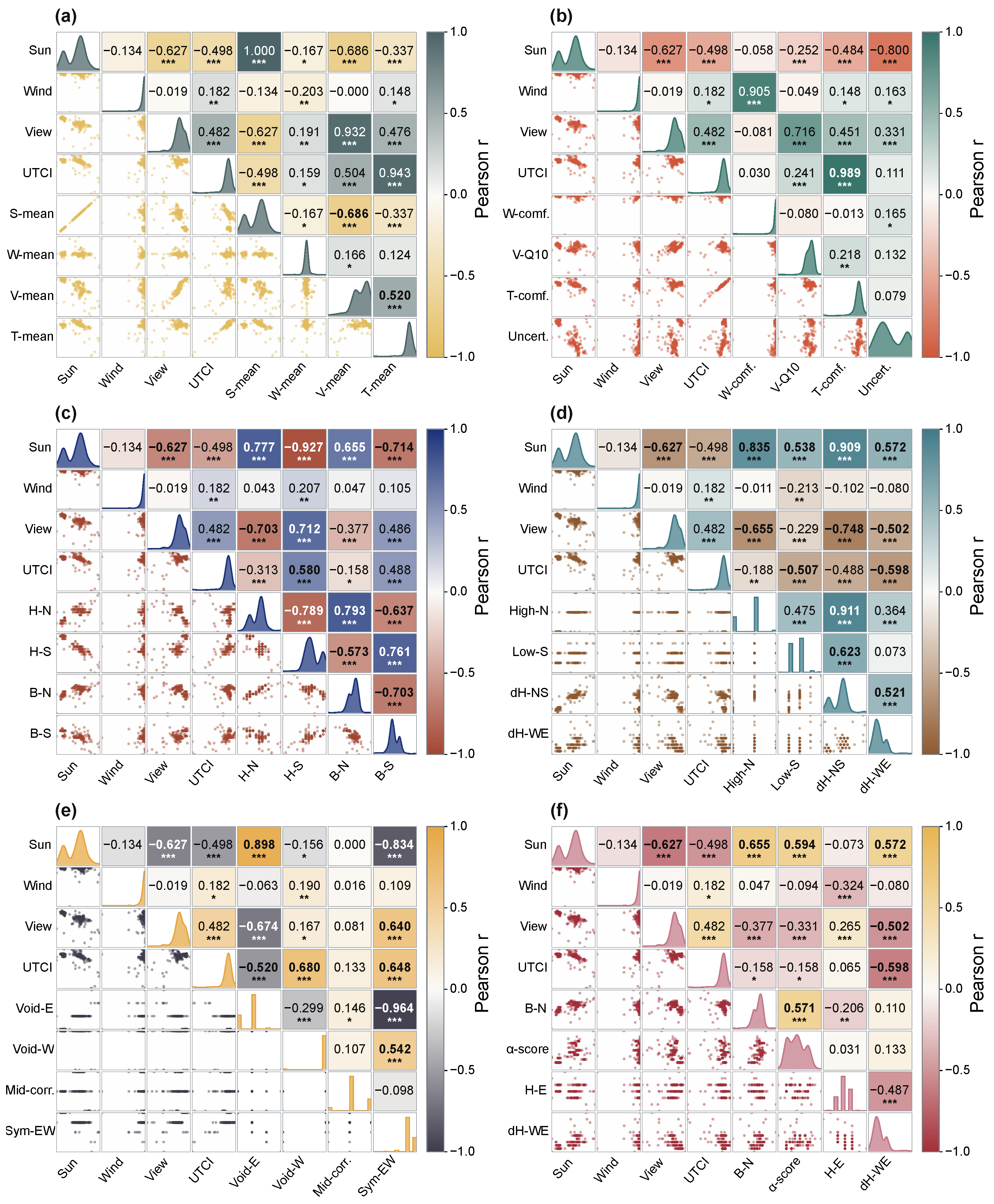
Seasonal morphology studies establish that winter and summer require different exposure strategies [59]. Our study extends this reasoning into a directional, four-performance design analysis. Within the 224 pooled non-dominated Haikou candidates, northern mean height correlates positively with the predicted sunlight objective (), while southern mean height correlates negatively (r = −0.927; Figure 13c). The north–south height gradient provides an especially strong solar signal (; Figure 13d). However, its association with the UTCI objective is negative (). Within this candidate set, the contrasting associations distinguish solar-oriented predictions from different thermal trade-offs, providing hypotheses for screening height and opening combinations. The reported significant correlations satisfy the panel-wise multiple-testing criterion. These associations describe the selected archive and do not establish causal effects.
Figure 13.
Archive-specific morphology–performance correlations across 224 surrogate-evaluated Haikou candidates: (a) performance; (b) comfort/uncertainty; (c) solar-height control; (d) height gradients; (e) void organization; (f) selected descriptors. Diagonals show distributions; lower/upper triangles show scatterplots/Pearson’s (r). Panel-wise BH-adjusted significance: * (q < 0.05), ** (q < 0.01), *** (q < 0.001). Uncertainty denotes ensemble dispersion.
Our best candidate reaches 75.52% predicted UTCI comfort, compared with 65.25% in the high-fidelity baseline. The difference between these two reported values is:
Whole-layout validation yielded negative pooled for sunlight (), wind () and UTCI (), indicating limited transfer accuracy for unseen arrangements. Equation (9) compares a surrogate-estimated candidate share with the simulated baseline; its 10.27-percentage-point difference is not an independently verified improvement. The archive remains a documented set of exploratory model-based alternatives.
4.2. Void-Coded Water Cells as Geometric Regulators of Wind and Visual Permeability
With four void cells fixed, Figure 13e describes allocation-related tendencies within the surrogate-generated Haikou archive. Figure 13e shows that western void ratio correlates with the UTCI objective at , and east–west void symmetry at . Eastern void ratio instead correlates strongly with sunlight (). The directional pattern differentiates predicted environmental priorities within this archive at fixed void quantity.
High-rise layout research demonstrates the importance of spatial arrangement for vertical ventilation [7]. Our framework further advances the planning application by evaluating openness alongside solar access, visibility and thermal comfort in the same candidate families. Average predicted wind-comfort coverage reaches 99.83%, while east–west void symmetry also correlates with visibility at . The mid-side corridor descriptor has a weaker linear UTCI association (), indicating that corridor geometry should be assessed together with side allocation and surrounding heights. Within the investigated Haikou archive, this distinction supports comparing opening locations against model-predicted objectives.
4.3. Visibility and UTCI as Co-Equal Grey-Space Performance Dimensions
Our integrated analysis brings the eye’s spatial reach into the same decision space as the body’s thermal exposure. Three-dimensional visibility measures describe observer-dependent built-form openness [60]; within the Haikou candidate archive, predicted visibility and UTCI objectives correlate positively (), whereas sunlight–visibility and sunlight–UTCI correlations are negative (r = −0.627 and −0.498; Figure 13a). These associations remain significant after panel-wise multiple-testing correction, identifying a coherent trade-off structure among the selected candidates.
Urban-square research links thermal experience to local environmental conditions [61]. Our study adds a spatially explicit selection framework in which visibility remains a co-equal objective throughout optimization. Figure 13b connects objective scores to their underlying comfort statistics: wind objective correlates with wind-comfort share at , and UTCI objective with UTCI-comfort share at . These relationships clarify what the scores reward; they are not independent accuracy tests. Their practical value is interpretability: a planner can relate a high-scoring alternative to recognizable exposure and openness conditions, then inspect its complete layout before committing to detailed architectural design in practice.
4.4. Algorithmic Value of Three Complementary Pareto Archives
The three searches performed 2,420,256 candidate evaluations and retained 84, 96 and 78 layouts. Cross-archive filtering preserved 224 entries: 78 from qNEHVI, 69 from MAP-Elites and 77 from the reference-guided search. Under their respective budgets, these archives emphasize different objectives: qNEHVI has the highest mean visibility score, MAP-Elites the highest mean sunlight score, and RVEA/iPICEA-g the highest predicted UTCI-comfort share. These are descriptive properties of complementary candidate collections, not an equal-budget ranking of optimizer efficiency.
Evolutionary urban design and metaheuristic building optimization already address competing objectives [62,63]. Our contribution is a shared, constraint-preserving interface that connects local building prototypes to four spatial performance fields and retains traceable alternatives for planning selection. The established search principles serve different exploration roles within that interface. Within the generated Haikou archive, Figure 13f shows reference similarity correlating positively with predicted sunlight () but negatively with predicted UTCI (r = -0.158). Coupling these directional associations with RF interpretation makes the candidate families more usable than an unexplained list of high-scoring layouts.
The four-objective archive explicitly retains these complementary alternatives:
Here, non-dominance refers to the pooled candidate set, while morphological variety remains available for subsequent preference-based planning selection.
4.5. Transferability, Interpretation and Practical Planning Value
RF–SHAP studies interpret nonlinear urban environmental relationships [42]. Our analysis links that interpretive approach to complete, selectable perimeter layouts. The classifier’s ROC–AUC of 0.961 and sunlight-regression of 0.827 quantify useful discrimination and target approximation within the surrogate-search records. North solar barrier leads classification importance, while western void allocation and mid-side corridor structure lead objective regression. Figure 13f supplies association directions within the generated candidate archive. Because RF learns surrogate-generated targets, its rankings explain the modeled search records; they neither independently establish surrogate reliability nor demonstrate physical effects of individual descriptors. Combining these rankings with archive-specific associations supports traceable exploration of candidate differences.
The planning value lies in organizing solar-oriented, visually open and thermally favorable predictions into inspectable Haikou layout alternatives. Our framework preserves site geometry, prototype inventory and four void cells across these comparisons, making arrangement the central design decision. Table 6 consolidates the directional associations into selection guidance. The present predictions support early-stage screening; site-specific simulation or field measurements can examine proposals with vegetation, materials and actual water-energy exchange. This progression gives the study a clear practical role: locating promising configurations while leaving architectural development room to respond.
Table 6.
Archive-specific associations with surrogate-predicted objectives and exploratory selection implications for the Haikou case ().
5. Conclusions and Planning Implications
5.1. Main Findings
This study developed and completed a reference-generated, surrogate-assisted multi-objective framework for optimizing perimeter building morphologies around a winter grey-space plaza in Haikou. It combines 16 local prototypes, four void-coded cells, pedestrian-height sunlight, wind, visibility and UTCI matrices, and three complementary search algorithms. The resulting 84, 96 and 78 algorithm-specific layouts yielded 224 non-dominated alternatives after pooling. Predicted archive indicators include full coverage above the 2 h sunlight threshold at the candidate-grid points, 99.83% average wind-comfort coverage and 75.52% maximum UTCI-comfort coverage; these optimized layouts were not independently verified by high-fidelity simulation. Within the Haikou archive, height allocation and void distribution accompany different predicted solar, thermal and visual trade-offs. RF interpretation connects these model-generated patterns to identifiable descriptors. The framework therefore offers a reproducible route from early massing alternatives to quantitatively informed, preference-sensitive grey-space planning decisions. Each candidate retains documented arrangements and objective values.
5.2. Planning Implications for Hot-Humid Coastal Grey-Space Plazas
The Haikou candidate archive suggests exploratory configurations rather than generally applicable design prescriptions.Within this archive, lower southern interfaces and taller northern sectors accompany higher predicted solar access, while thermal objectives exhibit different trade-offs.Western void allocation and east–west symmetry identify further thermal and visual tendencies in the generated records; the mid-side corridor is interpreted together with surrounding heights. These relationships organize candidate inspection according to staying, walking and visual-openness priorities. The practical contribution is a traceable comparison of arrangements under fixed site geometry, prototype inventory and climate inputs. It supports selecting configurations for further evaluation without assuming that their predicted performance or ordering will transfer unchanged to other settings.
5.3. Limitations and Future Work
The framework addresses a fixed-inventory, winter perimeter-plaza problem. The added whole-layout reanalysis uses all five existing simulations and shows target- and layout-dependent prediction errors, including negative in several held-out tests. The archived percentages and the comparison in Equation (9) therefore remain screening estimates. Grid resampling quantifies aggregation sensitivity on the available fields; it does not measure physical error for unmodeled arrangements. The transferable contribution is the reproducible sequence of prototype abstraction, spatial assessment, complementary search and interpretable selection. Predicted performance indicators and archive-specific tendencies remain conditional on the Haikou geometry, fixed orientations and prescribed climate settings.
The analysis does not establish annual or age-specific comfort. Water cells represent geometric openings, and building-energy savings were not calculated. Extending the method to other climates or detailed designs would require corresponding weather, vegetation, surface and water-energy inputs. The present study provides a documented starting point for those applications without asserting universal configurations or equal-budget algorithmic superiority.
Supplementary Materials
The following supporting information can be downloaded at https://www.mdpi.com/article/10.3390/buildings16214447/s1, Table S1: Threshold sensitivity; Table S2: Whole-layout transfer assessment; Table S3: Sampling-resolution sensitivity. All tables are included in the accompanying document, Supplementary Material: Tables S1–S3.
Author Contributions
Conceptualization, P.S.; methodology, P.S. and J.W.; software, J.W.; validation, J.W.; formal analysis, P.S.; investigation, P.S.; resources, P.S.; data curation, P.S.; writing—original draft preparation, P.S. and J.W.; writing—review and editing, X.W.; visualization, P.S. and J.W.; supervision, X.W.; project administration, X.W.; funding acquisition, X.W. All authors have read and agreed to the published version of the manuscript.
Funding
This work was supported by the National Social Science Fund of China (Grant No. 22BXW084).
Data Availability Statement
The supplementary analysis results are provided in Tables S1–S3 of the Supplementary Materials. The raw data supporting the conclusions of this article will be made available by the authors on request.
Acknowledgments
The authors are grateful for the financial support for this research.
Conflicts of Interest
The authors declare no conflicts of interest.
Appendix A
Table A1.
Boundary sequences of the five baseline layouts.
Table A2.
Objective definitions and threshold statistics.
Table A3.
Top-10 RF feature-importance descriptors.
References
- Abd Elraouf, R.; Elmokadem, A.; Megahed, N.; Eleinen, O.A.; Eltarabily, S. The impact of urban geometry on outdoor thermal comfort in a hot-humid climate. Build. Environ. 2022, 225, 109632. [Google Scholar] [CrossRef] [Scilit]
- Xia, B.; Li, Z. Optimization of residential urban-block morphology based on its synthetic effects on indoor and outdoor natural lighting environments. Sustain. Cities Soc. 2023, 97, 104698. [Google Scholar] [CrossRef] [Scilit]
- Jia, S.; Wang, Y.; Wong, N.H.; Weng, Q. A hybrid framework for assessing outdoor thermal comfort in large-scale urban environments. Landsc. Urban Plan. 2025, 256, 105281. [Google Scholar] [CrossRef] [Scilit]
- Wang, M.; Dong, Y.; Liao, W.; Pan, B.; Li, S.; Duan, J.; Xu, S. Impact of residential morphology on outdoor thermal comfort and building energy consumption in winter and summer: A case study. Urban Clim. 2025, 61, 102479. [Google Scholar] [CrossRef] [Scilit]
- Xu, S.; Wang, S.; Li, G.; Zhou, H.; Meng, C.; Qin, Y.; He, B.J. Performance-based design of residential blocks for the co-benefits of building energy efficiency and outdoor thermal comfort improvement. Build. Environ. 2024, 264, 111926. [Google Scholar] [CrossRef] [Scilit]
- Feng, W.; Chen, J.; Yang, Y.; Gao, W.; Xing, H.; Yu, S. Multi-objective optimization of morphology for high-rise residential cluster with the regards to energy use and microclimate. Energy Build. 2024, 319, 114534. [Google Scholar] [CrossRef] [Scilit]
- Song, D.; Lu, M.; Xing, J. Impact of spatial layout on vertical wind conditions and comfort levels in high-rise residential buildings in Shenzhen. Urban Clim. 2024, 55, 101949. [Google Scholar] [CrossRef] [Scilit]
- Chen, W.A.; Fang, P.L.; Hwang, R.L. Calibrating the UTCI scale for hot and humid climates through comprehensive year-round field surveys to improve the adaptability. Urban Clim. 2025, 59, 102267. [Google Scholar] [CrossRef] [Scilit]
- Rostami, E.; Nasrollahi, N. The impact of urban morphology on sunlight availability at urban and neighborhood scales: A systematic review. Sustain. Cities Soc. 2025, 121, 106194. [Google Scholar] [CrossRef] [Scilit]
- Liu, B.; Liu, Y.; Cho, S.; Chow, D.H.C. Urban morphology indicators and solar radiation acquisition: 2011–2022 review. Renew. Sustain. Energy Rev. 2024, 199, 114548. [Google Scholar] [CrossRef] [Scilit]
- Liu, K.; Xu, X.; Huang, W.; Zhang, R.; Kong, L.; Wang, X. A multi-objective optimization framework for designing urban block forms considering daylight, energy consumption, and photovoltaic energy potential. Build. Environ. 2023, 242, 110585. [Google Scholar] [CrossRef] [Scilit]
- Rostami, E.; Nasrollahi, N.; Khodakarami, J. A comprehensive study of how urban morphological parameters impact the solar potential, energy consumption and daylight autonomy in canyons and buildings. Energy Build. 2024, 305, 113904. [Google Scholar] [CrossRef] [Scilit]
- Nasrollahi, N.; Rostami, E. The impacts of urban canyons morphology on daylight availability and energy consumption of buildings in a hot-summer Mediterranean climate. Sol. Energy 2023, 266, 112181. [Google Scholar] [CrossRef] [Scilit]
- Li, Q.; Zheng, J.; Yuan, S.; Zhang, L.; Dong, R.; Fu, H. RAV model: Study on urban refined climate environment assessment and ventilation corridors construction. Build. Environ. 2024, 248, 111080. [Google Scholar] [CrossRef] [Scilit]
- Xie, P.; Li, Q.; Yu, B.; Lu, Y. A new morphology-based approach for urban ventilation corridor analysis inspired by the lattice Boltzmann method. Sustain. Cities Soc. 2025, 130, 106668. [Google Scholar] [CrossRef] [Scilit]
- He, Y.; Liu, Z.; Ng, E. Parametrization of irregularity of urban morphologies for designing better pedestrian wind environment in high-density cities–A wind tunnel study. Build. Environ. 2022, 226, 109692. [Google Scholar] [CrossRef] [Scilit]
- Zhang, X.; Gao, Y.; Tao, Q.; Min, Y.; Fan, J. Improving the pedestrian-level wind comfort by lift-up factors of panel residence complex: Field-measurement and CFD simulation. Build. Environ. 2023, 229, 109947. [Google Scholar] [CrossRef] [Scilit]
- Sheng, S.; Wang, Y. Configuration characteristics of green-blue spaces for efficient cooling in urban environments. Sustain. Cities Soc. 2024, 100, 105040. [Google Scholar] [CrossRef] [Scilit]
- Das, M.; Das, A.; Saha, P.; Paul, S. Impact of spatial configuration of urban blue spaces in mitigating temperature during summer: A remote sensing and field-based observation. Sustain. Cities Soc. 2025, 127, 106418. [Google Scholar] [CrossRef] [Scilit]
- Fricke, L.; Legg, R.; Kabisch, N. Impact of blue spaces on the urban microclimate in different climate zones, daytimes and seasons–A systematic review. Urban For. Urban Green. 2024, 101, 128528. [Google Scholar] [CrossRef] [Scilit]
- Yang, M.; Ye, P.; He, J. Green and blue infrastructure for urban cooling: Multi-scale mechanisms, Spatial optimization, and methodological integration. Sustain. Cities Soc. 2025, 129, 106501. [Google Scholar] [CrossRef] [Scilit]
- Inglis, N.C.; Vukomanovic, J.; Costanza, J.; Singh, K.K. From viewsheds to viewscapes: Trends in landscape visibility and visual quality research. Landsc. Urban Plan. 2022, 224, 104424. [Google Scholar] [CrossRef] [Scilit]
- Cheng, H.; Rui, Q.; Yu, K.; Shan, L.; Chen, Y.; Ding, G.; Liu, J. 3D visibility analysis of urban parks using LIDAR for enhanced accuracy. J. Environ. Manag. 2025, 389, 126226. [Google Scholar] [CrossRef] [Scilit]
- Chiang, Y.C.; Liu, H.H.; Li, D.; Ho, L.C. Quantification through deep learning of sky view factor and greenery on urban streets during hot and cool seasons. Landsc. Urban Plan. 2023, 232, 104679. [Google Scholar] [CrossRef] [Scilit]
- Liu, Y.; Yu, Z.; Song, Y.; Yu, X.; Zhang, J.; Song, D. Psychological influence of sky view factor and green view index on daytime thermal comfort of pedestrians in Shanghai. Urban Clim. 2024, 56, 102014. [Google Scholar] [CrossRef] [Scilit]
- Wróżyński, R.; Pyszny, K.; Wróżyńska, M. Reaching beyond GIS for comprehensive 3D visibility analysis. Landsc. Urban Plan. 2024, 247, 105074. [Google Scholar] [CrossRef] [Scilit]
- Qi, L.; Hu, Y.; Bu, R.; Xiong, Z.; Li, B.; Zhang, C.; Liu, H.; Li, C. Spatial-temporal patterns and influencing factors of the Building Green View Index: A new approach for quantifying 3D urban greenery visibility. Sustain. Cities Soc. 2024, 111, 105518. [Google Scholar] [CrossRef] [Scilit]
- Liang, X.; Zhao, T.; Biljecki, F. Revealing spatio-temporal evolution of urban visual environments with street view imagery. Landsc. Urban Plan. 2023, 237, 104802. [Google Scholar] [CrossRef] [Scilit]
- Zhan, Z.; Jia, L.; Wang, P.; Huang, L. Impact of building morphology on outdoor thermal comfort in summer afternoons: A case study in Nanjing, China. Urban Clim. 2024, 56, 102064. [Google Scholar] [CrossRef] [Scilit]
- Mahdavinejad, M.; Shaeri, J.; Nezami, A.; Goharian, A. Comparing universal thermal climate index (UTCI) with selected thermal indices to evaluate outdoor thermal comfort in traditional courtyards with BWh climate. Urban Clim. 2024, 54, 101839. [Google Scholar] [CrossRef] [Scilit]
- Zhang, T.; Fu, X.; Qi, F.; Shen, Y.; Xu, P.; Tao, Y.; Liu, T.; Song, Y. Optimizing pedestrian thermal comfort in urban street canyons for summer and winter: Tree planting or low-albedo pavements? Sustain. Cities Soc. 2025, 120, 106143. [Google Scholar] [CrossRef] [Scilit]
- Cruz, A.; Caldas, L.; Mendes, V.; Mendes, J.; Bastos, L. Multi-objective optimization based on surrogate models for sustainable building design: A systematic literature review. Build. Environ. 2024, 266, 112147. [Google Scholar] [CrossRef] [Scilit]
- Wu, Y.; Quan, S.J. A review of surrogate-assisted design optimization for improving urban wind environment. Build. Environ. 2024, 253, 111157. [Google Scholar] [CrossRef] [Scilit]
- Elwy, I.; Hagishima, A. The artificial intelligence reformation of sustainable building design approach: A systematic review on building design optimization methods using surrogate models. Energy Build. 2024, 323, 114769. [Google Scholar] [CrossRef] [Scilit]
- Zhao, Z.; Li, H.; Wang, S. Surrogate-assisted coordinated design optimization of building and microclimate considering their mutual impacts. Appl. Energy 2025, 383, 125374. [Google Scholar] [CrossRef] [Scilit]
- Daulton, S.; Balandat, M.; Bakshy, E. Parallel Bayesian Optimization of Multiple Noisy Objectives with Expected Hypervolume Improvement. In Proceedings of the Advances in Neural Information Processing Systems; Curran Associates, Inc.: Red Hook, NY, USA, 2021; Volume 34, pp. 2187–2200. Available online: https://dl.acm.org/doi/10.5555/3540261.3540429 (accessed on 1 October 2026).
- Zhang, J.; Sugisawa, N.; Felton, K.C.; Fuse, S.; Lapkin, A.A. Multi-objective Bayesian optimisation using q-noisy expected hypervolume improvement (q NEHVI) for the Schotten–Baumann reaction. React. Chem. Eng. 2024, 9, 706–712. [Google Scholar] [CrossRef] [Scilit]
- Brevault, L.; Balesdent, M. Bayesian Quality-Diversity approaches for constrained optimization problems with mixed continuous, discrete and categorical variables. Eng. Appl. Artif. Intell. 2024, 133, 108118. [Google Scholar] [CrossRef] [Scilit]
- Pan, J.S.; Zhang, A.N.; Chu, S.C.; Zhao, J.; Snášel, V. An activity level based surrogate-assisted evolutionary algorithm for many-objective optimization. Appl. Soft Comput. 2024, 164, 111967. [Google Scholar] [CrossRef] [Scilit]
- Wang, R.; Ma, W.; Tan, M.; Wu, G.; Wang, L.; Gong, D.; Xiong, J. Preference-inspired coevolutionary algorithm with active diversity strategy for multi-objective multi-modal optimization. Inf. Sci. 2021, 546, 1148–1165. [Google Scholar] [CrossRef] [Scilit]
- Zhu, S.; Yan, Y.; Zhao, B.; Wang, H. Assessing the impact of adjacent urban morphology on street temperature: A multisource analysis using random forest and SHAP. Build. Environ. 2025, 267, 112326. [Google Scholar] [CrossRef] [Scilit]
- Hong, T.; Yim, S.H.; Heo, Y. Interpreting complex relationships between urban and meteorological factors and street-level urban heat islands: Application of random forest and SHAP method. Sustain. Cities Soc. 2025, 126, 106353. [Google Scholar] [CrossRef] [Scilit]
- Xie, M.; Wang, M.; Zhong, H.; Li, X.; Li, B.; Mendis, T.; Xu, S. The impact of urban morphology on the building energy consumption and solar energy generation potential of university dormitory blocks. Sustain. Cities Soc. 2023, 96, 104644. [Google Scholar] [CrossRef] [Scilit]
- Chew, L.W.; Norford, L.K. Pedestrian-level wind speed enhancement with void decks in three-dimensional urban street canyons. Build. Environ. 2019, 155, 399–407. [Google Scholar] [CrossRef] [Scilit]
- Ampatzidis, P.; Kershaw, T. A review of the impact of blue space on the urban microclimate. Sci. Total Environ. 2020, 730, 139068. [Google Scholar] [CrossRef] [Scilit] [PubMed]
- Yang, Z.; Peng, J.; Jiang, S.; Yu, X.; Hu, T. Optimizing building spatial morphology to alleviate human thermal stress. Sustain. Cities Soc. 2024, 106, 105386. [Google Scholar] [CrossRef] [Scilit]
- Sadeghipour Roudsari, M.; Pak, M.; VIOLA, A. Ladybug: A parametric environmental plugin for grasshopper to help designers create an environmentally-conscious design. In Proceedings of the Building Simulation 2013, IBPSA, Chambéry, France, 25–28 August 2013; Volume 13, pp. 3128–3135. [Google Scholar]
- Nicholson, S.; Nikolopoulou, M.; Watkins, R.; Löve, M.; Ratti, C. Data driven design for urban street shading: Validation and application of ladybug tools as a design tool for outdoor thermal comfort. Urban Clim. 2024, 56, 102041. [Google Scholar] [CrossRef] [Scilit]
- Benedikt, M.L. To take hold of space: Isovists and isovist fields. Environ. Plan. B Plan. Des. 1979, 6, 47–65. [Google Scholar] [CrossRef] [Scilit]
- Turner, A.; Doxa, M.; O’sullivan, D.; Penn, A. From isovists to visibility graphs: A methodology for the analysis of architectural space. Environ. Plan. B Plan. Des. 2001, 28, 103–121. [Google Scholar] [CrossRef] [Scilit]
- Climate-ADAPT. High UTCI Days: Universal Thermal Climate Index Categories; Climate-ADAPT: Copenhagen, Denmark, 2025. [Google Scholar]
- Briegel, F.; Wehrle, J.; Schindler, D.; Christen, A. High-resolution multi-scaling of outdoor human thermal comfort and its intra-urban variability based on machine learning. Geosci. Model Dev. 2024, 17, 1667–1688. [Google Scholar] [CrossRef] [Scilit]
- Mouret, J.; Clune, J. Illuminating search spaces by mapping elites. arXiv 2015, arXiv:1504.04909. [Google Scholar] [CrossRef] [Scilit]
- Cheng, R.; Jin, Y.; Olhofer, M.; Sendhoff, B. A reference vector guided evolutionary algorithm for many-objective optimization. IEEE Trans. Evol. Comput. 2016, 20, 773–791. [Google Scholar] [CrossRef] [Scilit]
- Wang, R.; Purshouse, R.C.; Fleming, P.J. Preference-Inspired Coevolutionary Algorithms for Many-Objective Optimization. IEEE Trans. Evol. Comput. 2013, 17, 474–494. [Google Scholar] [CrossRef] [Scilit]
- Breiman, L. Random forests. Mach. Learn. 2001, 45, 5–32. [Google Scholar] [CrossRef] [Scilit]
- Lundberg, S.M.; Lee, S.I. A unified approach to interpreting model predictions. Adv. Neural Inf. Process. Syst. 2017, 30, 4765–4774. [Google Scholar]
- Liu, Y.; Li, G. Inequities in thermal comfort and urban blue-green spaces cooling: An explainable machine learning study across residents of different socioeconomic statuses in Hangzhou, China. Sustain. Cities Soc. 2025, 127, 106427. [Google Scholar] [CrossRef] [Scilit]
- Liu, Z.; Xu, Q.; Jin, H. The influence of urban residential block morphology on seasonal outdoor thermal comfort in severely cold regions: A case study of Harbin, China. Front. Archit. Res. 2026, 15, 1302–1325. [Google Scholar] [CrossRef] [Scilit]
- Giseop, K.; Ayoung, K.; Youngchul, K. A new 3D space syntax metric based on 3D isovist capture in urban space using remote sensing technology. Comput. Environ. Urban Syst. 2019, 74, 74–87. [Google Scholar] [CrossRef] [Scilit]
- Manavvi, S.; Rajasekar, E. Assessing thermal comfort in urban squares in humid subtropical climate: A structural equation modelling approach. Build. Environ. 2023, 229, 109931. [Google Scholar] [CrossRef] [Scilit]
- Castrejon-Esparza, N.; González-Trevizo, M.; Martínez-Torres, K.; Santamouris, M. Optimizing urban morphology: Evolutionary design and multi-objective optimization of thermal comfort and energy performance-based city forms for microclimate adaptation. Energy Build. 2025, 342, 115750. [Google Scholar] [CrossRef] [Scilit]
- Karbasforoushha, M.A.; Khajehzadeh, M.; Jearsiripongkul, T.; Keawsawasvong, S.; Eslami, M. A comprehensive review of building energy optimization using metaheuristic algorithms. J. Build. Eng. 2024, 98, 111377. [Google Scholar] [CrossRef] [Scilit]

Disclaimer/Publisher’s Note: The statements, opinions and data contained in all publications are solely those of the individual author(s) and contributor(s) and not of MDPI and/or the editor(s). MDPI and/or the editor(s) disclaim responsibility for any injury to people or property resulting from any ideas, methods, instructions or products referred to in the content. |
© 2026 by the authors. Licensee MDPI, Basel, Switzerland. This article is an open access article distributed under the terms and conditions of the Creative Commons Attribution (CC BY) license.