


Abstract
Digital-twin technology promises real-time virtual representations of the built environment, yet accurate 3D documentation—its foundational layer—remains underdeveloped for architectural heritage in Ecuador, where 170,000 inventoried assets face seismic exposure and limited institutional capacity. This study examines scan-to-BIM and 3D documentation practices underpinning digital-twin creation for Ecuadorian built heritage (2015–2025) and proposes the C1–C5 matrix as a diagnostic tool for digital-twin readiness. Here, 3D documentation precedes the digital twin, not the reverse. A qualitative-descriptive design combined structured searches of international and regional databases and 38 Ecuadorian university repositories with a comparative analysis of eighteen indexed cases—including scan-to-BIM and HBIM workflows—coded via the C1–C5 matrix and validated by a five-member expert panel. Results identify three stages—exploratory (2015–2018), consolidation (2019–2022), and diversification (2023–2025)—with SfM photogrammetry and hybrid methods each representing 27.8% of cases, and geographic concentration in Azuay and Loja (66.7%). A structural gap persists between academic production and indexed dissemination: only 12–15% of relevant theses reach indexed publication. The study concludes with guidelines—shared equipment networks, interuniversity training, and open-source migration—to strengthen digital-twin documentation foundations in comparable Latin American contexts.
1. Introduction
Digital-twin technology—a virtual representation of a physical asset, linked to it through real-time or periodically updated data, that supports monitoring, simulation, and decision-making across its life cycle—is reshaping construction, engineering, and facilities management by extending the value of built assets beyond design and construction into long-term operation. Realizing this promise for any asset, however, depends on a foundational layer that is frequently underestimated. This layer is an accurate, interoperable, and semantically structured 3D model from which the digital twin is built.
This foundational layer, however, is not itself a digital twin. A static point cloud or an HBIM model documents an asset’s geometry and semantic structure at a single point in time; it becomes a true digital twin only once integrated with IoT sensor networks and structural health monitoring (SHM) systems capable of continuous data acquisition and real-time communication. This distinction between a static documentation layer and a dynamically monitored digital twin frames the scope of this study, which examines the former as the necessary precursor to, rather than the equivalent of, the latter.
For architectural heritage, establishing this foundational layer is both more difficult and more urgent than for new construction, and it is inseparable from the documentation and conservation of heritage recognized as an ethical commitment under the Venice Charter [1], the ICOMOS framework [2], and the UNESCO World Heritage Convention [3].
Ecuador illustrates this tension with particular intensity: the historic centers of Quito (inscribed 1978) and Cuenca (inscribed 1999) concentrate most institutional attention [4], while more than 170,000 inventoried immovable heritage assets [5] remain distributed across a territory marked by high seismic activity—exemplified by the 2016 Pedernales earthquake (Mw 7.8), which destroyed vernacular coastal heritage within minutes [6]—unregulated urban transformation, and limited technical capacity in smaller municipalities [7].
Structure-from-Motion (SfM) photogrammetry, terrestrial laser scanning (TLS), and Heritage Building Information Modeling (HBIM) constitute the technological pipeline through which physical heritage assets are converted into the geometric and semantic models that digital-twin applications require [8]. SfM reconstructs three-dimensional geometry from image sequences with millimetric-to-centimetric accuracy and has proven effective for documenting complex ornamental elements [9] and for connecting photogrammetric survey to seismic-risk assessment in vernacular construction, including in the neighboring Argentine context [10]. TLS delivers sub-millimetric point clouds [11], and hybrid TLS–SfM workflows—shown to be complementary across horizontal and vertical coordinate accuracy in comparative studies at Magoksa Temple, Korea [12], and validated for metric accuracy assessment at Pozzoveggiani Church, Italy [13]—represent the current paradigm for high-fidelity capture [14]. Scan-to-BIM workflows then convert these point clouds into interoperable [15], semantically structured HBIM models [16]—the direct precursor of a heritage digital twin—while immersive AR/VR technologies extend public access to the resulting models [17].
Ecuadorian architectural heritage spans four constructive traditions—colonial (16th–18th centuries), republican (1850–1950), historically under-documented vernacular architecture [18], and modern/contemporary expressions (1930–1990)—all threatened simultaneously by seismic vulnerability, material deterioration, and the erosion of traditional construction knowledge [5]. Yet Ecuadorian cases are largely absent from the international construction-management and digital-twin literature, suggesting that the documentation foundations required for heritage digital twins remain underexamined precisely where the asset risk is highest.
This study addresses that gap with a twofold contribution. First, it develops the C1–C5 matrix, a multidimensional framework for the comparative technical assessment of heritage-digitization projects—covering context, technology, methodology, outputs, and scientific validation—designed to benchmark digital-twin readiness across resource-constrained settings beyond Ecuador. Second, it applies the matrix to eighteen scientifically documented Ecuadorian cases (2015–2025), several of which build scan-to-BIM and HBIM models directly analogous to established digital-twin creation workflows, to characterize technological trajectories, accuracy benchmarks, and institutional collaboration patterns, and to identify actionable guidelines—equipment-sharing networks, open-source workflow migration, and interuniversity graduate training—for practitioners and institutions building toward digital-twin adoption with limited resources. The findings additionally speak to Sustainable Development Goals 11 (Sustainable Cities and Communities) and 4 (Quality Education) by linking digital-heritage practice to institutional capacity-building.
2. Materials and Methods
2.1. Research Approach and Design
This research adopts an exploratory qualitative-descriptive approach that combines a structured literature review with the comparative analysis of multiple case studies. The multiple-case study is the main methodological strategy [19], as it enables the detailed examination of concrete cases and the identification of common patterns through systematic comparison. It should be clarified that, although the article originally used the term “Structured Literature Review” in its subtitle, the applied method is more accurately described as a structured literature review combined with multiple-case analysis. The bibliographic search follows systematic principles, but the main analytical contribution derives from comparative case study analysis rather than from a canonical SLR protocol such as PRISMA or Cochrane. This distinction is maintained explicitly throughout the study.
2.2. Search Strategy and Case Selection
The bibliographic search was carried out between January 2025 and March 2026 in international databases (Scopus, Web of Science, ScienceDirect) and regional databases (SciELO, Redalyc, Dialnet). The search strategy was implemented in two phases: first, an international phase restricted to article titles and without the descriptor “Ecuador”, intended to map the global state of the art in digital heritage documentation; and second, a phase that incorporated “Ecuador” as a geographic filter. Initial literature identification was supported by SciSpace and Consensus as assisted bibliographic discovery tools, followed by manual verification of each record against its source database before inclusion in title/abstract screening. Search descriptors included digital heritage, photogrammetry, augmented reality, 3D modeling, virtual tour, and heritage documentation, in both Spanish and English, for the period 2015–2025. Undergraduate and graduate theses were included in the national characterization; capstone projects without a formal research component were excluded.
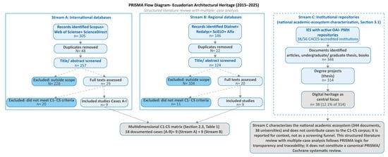
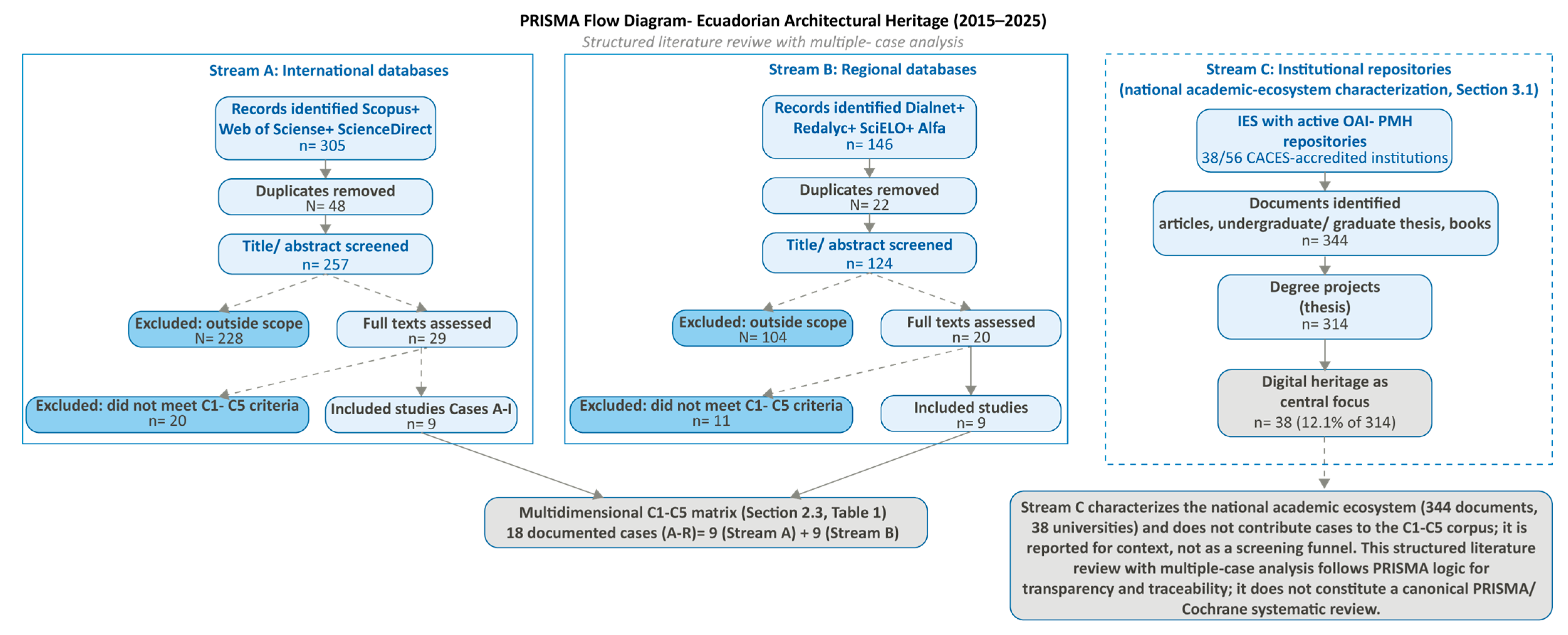
The search of institutional repositories covered Ecuadorian universities and polytechnic schools with architecture programs or disciplines related to ICT and heritage. Of the 63 higher education institutions registered in Ecuador, 59 are duly accredited by CACES, Ecuador’s Council for Quality Assurance in Higher Education [20]. The work team analyzed all 59 accredited universities and polytechnic schools with degree projects and indexed academic research related to ICT; of these, 21 institutions were excluded because they lacked at least two of the following criteria: (a) an active faculty or program in design, art, or architecture; (b) a digital repository indexed in Ecuador’s open-access network; and (c) academic output containing the search keywords. This yielded 38 institutions included in the analysis. Among the 21 excluded institutions, two had repositories with inactive OAI-PMH protocols during the capture period, which may have resulted in the exclusion of some relevant works from those repositories (See Figure 1).
Figure 1.
Prisma Flow Diagram.
For the Ecuadorian architectural heritage (2015–2025), a structured literature review was made with multiple-case analysis (Stream A: international databases; Stream B: regional databases; Stream C: institutional repositories characterizing the national academic ecosystem, which is reported for context and does not contribute cases to the C1–C5 corpus).
Four criteria were applied for case selection: (1) scientific validation through indexed publication or peer-reviewed conference proceedings; (2) documentary accessibility for detailed methodological analysis; (3) typological representativeness across different heritage types and technologies; and (4) geographic distribution across Ecuadorian cities and territories. Criterion (4) was applied as a descriptive verification dimension rather than as an exclusion filter: no scientifically validated case identified through the search process (Streams A–B) was excluded on account of its province, and the eighteen cases correspond to the entirety of the indexed literature meeting criteria 1–3; their geographic distribution reflects the actual territorial pattern of scientifically validated production rather than a researcher-imposed quota. The multidimensional C1–C5 matrix was designed by the corresponding author based on the valuation and selection criteria for immovable heritage established in the INPC “Instructivo para fichas de registro e inventario: Bienes inmuebles” [21], adapted to the specific requirements of digital documentation projects. Its validation was conducted through a three-session protocol with a panel of five evaluators: the three authors of the study, one specialist in historical documentation of built heritage, and one expert in geomatics and photogrammetry applied to heritage. The first session, held on 23 April 2025, consisted of a collective discussion of the identified corpus, the establishment of inclusion and exclusion criteria, and verification of the relevance of the eighteen selected cases. The second session, held on 22 May 2025, piloted the matrix on two selected cases, allowing the criteria to be calibrated and the operational definitions of each variable to be refined. The third session, held on 10 June 2025, distributed the eighteen cases among the five evaluators (three to four cases per person) and applied the complete matrix in real time, with joint discussion of each criterion until consensus was reached. This expert-consensus validation protocol ensures the coherence of the coding process and anchors the C1–C5 criteria in complementary disciplinary perspectives.
Regarding the use of generative artificial intelligence (GenAI) in this study: SciSpace (Basic 101 plan) was used during the bibliographic identification phase as an assisted literature-discovery tool, with every record subsequently verified manually against its original source database prior to title/abstract screening (see Section 2.2). Claude Sonnet 5 (medium effort, Anthropic) was used to assist in the conceptual design of the PRISMA flow diagram and for correction of writing style throughout the manuscript; it was not used for data collection, coding of the C1–C5 matrix, statistical analysis, or interpretation of results, which remain the exclusive work of the authors. All GenAI-assisted output was reviewed and edited by the authors, who take full responsibility for the content of this publication.
2.3. Analytical Framework: The Multidimensional C1–C5 Matrix
The comparative analysis of the cases required an analytical framework capable of describing projects of highly diverse nature in a uniform manner. A multidimensional C1–C5 matrix, informed by the INPC heritage valuation and selection criteria [21] (see Section 2.2), was therefore developed to organize the relevant variables into five complementary categories:
Context variable (C1): locates each project in the space, time, and institutional setting that produced it: city, region, or province; duration; responsible institution and collaborations; and type of heritage documented, including modern, vernacular, republican, colonial, urban, or archaeological heritage.
Technological variable (C2): records the technologies used, such as terrestrial laser scanning, hybrid methods, 360-degree virtual tours, SfM photogrammetry, augmented reality, and virtual reality, as well as the instruments and software used, and the technical accuracy achieved.
Methodological variable (C3): describes the general orientation of the project, whether pure digital documentation or documentation directed toward a specific purpose such as conservation, cultural tourism, risk management, or heritage education; the workflow followed; and the methods used to validate results.
Outputs and results variable (C4): identifies what was produced, including textured 3D models, dense point clouds, interactive virtual tours, web platforms, and high-resolution orthophotos, as well as their degree of accessibility and additional derived applications.
Scientific validation and impact variable (C5): assesses the level of scientific validation achieved, such as presentation at a peer-reviewed conference or publication in an indexed journal; observed impact, including incorporation into educational programs, institutional adoption, or media presence; and identifiable methodological contributions.
3. Results
3.1. Characterization of the National Academic Ecosystem
Of the 59 higher education institutions accredited by CACES [20], 38 were included in the analysis (see Section 2.2). The systematic search identified 344 documents, of which 314 degree projects correspond to the sum of undergraduate (264) and postgraduate (50) thesis; whose count and typological classification were conducted independently by two researchers using Excel tables, with differences resolved by consensus (see Table 1).
Table 1.
Typology of the reviewed corpus (38 Ecuadorian universities, 2015–2025).
Of the 314 degree projects identified, only 38 (12.1%) address digital documentation of heritage as a central topic. The nine directly related scientific articles correspond to Cases A–I, while Cases J–R come from the extended search in regional databases. Scientific outputs represent only 12–15% of total academic production, a persistent gap that constitutes one of the five structural challenges identified in Section 3.
3.2. Description of the Eighteen Documented Cases
Table 2 presents the complete C1–C5 comparative matrix. Chronologically, the corpus shows three stages. The exploratory stage (2015–2018) is exemplified by Case A (Todos Santos archaeological site, Cuenca), which used 350 low-cost photographs (70% overlap) in Agisoft PhotoScan to reach ±15 cm accuracy in ~100 h, demonstrating that non-invasive multicultural-site documentation is feasible without large budgets [22]. The consolidation stage (2019–2022) introduced GIS integration for municipal management (Case C) [23], rigorous cost–time–accuracy comparison across three techniques (Case B) [24], mobile AR for religious heritage with 88–92% user satisfaction (Case D) [25], an immersive AR/VR museum showing a 65% gain in cultural-knowledge retention among students (Case E) [26], and BIM-based restoration and documentation protocols (Case Q and R) [27,28]. The diversification stage (2023–2025) integrates TLS, multispectral imaging, and infrared thermography (Case G, Quillusara monument), achieving ±2 mm accuracy—the highest recorded in the corpus [29]—and extends HBIM to religious (Case J) [30] and underground (Case K) [31] typologies.
Table 2.
Eighteen scientifically documented cases of digital heritage documentation in Ecuador (2015–2025).
Case A: Digital photogrammetry for the 3D survey of the Todos Santos archaeological site, Cuenca (2018); between 2015 and 2018, Universidad Politécnica Salesiana, the Municipal Museum, and the INPC carried out the first systematic effort to digitally document Ecuadorian heritage at the Todos Santos site, where Inca, Cañari, and Spanish cultural remains overlap. Using accessible photographic devices and Agisoft PhotoScan, 350 photographs with 70% overlap produced a textured 3D model with ±15 cm geometric accuracy in approximately 100 h of work [22]. The project demonstrated that non-invasive documentation of multicultural sites is feasible without large budgets.
Case B: Documentation of modern architecture through 3D digital techniques: catalog (2020); Preti Ochoa, Tituana, and Heras Barros comparatively evaluated three techniques in the El Ejido neighborhood of Cuenca, recognized as cultural heritage of the state in 2011, in collaboration with Universidad Nacional de La Plata. They applied TLS laser scanning (±19 mm), aerial and terrestrial drone photogrammetry using Agisoft Metashape, and rectified photography using OnSite Photo [24]. Reference [40] is the preliminary conference version of this same study, presented at the 27th CIPA International Symposium (2019) prior to its extended journal publication; both references describe the same fieldwork and results and are cited jointly for publication-history traceability. The resulting catalog combines 2D drawings, textured 3D models, and physical prints with an explicit assessment of the costs, time requirements, and limitations of each technology.
Case C: 2D and 3D photogrammetric recording model for the built heritage of Cuenca (2020); Ref. [23] connected digital photogrammetry with GIS to integrate heritage records into a searchable geospatial platform. The workflow combined aerial and terrestrial capture, processing in Agisoft Metashape and Photomodeler, and integration of 2D/3D products in ArcGIS 10.3 alongside municipal cadastral information, generating a model scalable to the management of an entire historic center.
Case D: Photogrammetry and AR to promote the religious heritage of San Pedro Cathedral, Guayaquil (2020); Ref. [25] photogrammetrically documented the facade of San Pedro Cathedral using 280 photographs with 75% overlap in Agisoft Metashape. They optimized the model for mobile devices, reducing it from 2.5 million to 150,000 polygons, and integrated it into an AR application developed in Unity 3D with the Vuforia SDK. User validation reported 92% satisfaction with the interface and an 88% perceived improvement in the visitor experience.
Case E: Interactive digital museums—IntiKilla Virtual Museum (2022); The IDSA Research Center at UNACH digitized 45 ceramic objects from three ancestral cultures, Upano, Valdivia, and Puruhá, in 3D at submillimetric resolution, and developed the IntiKilla Virtual Museum: an immersive environment in Unity 3D with AR modules activated through QR codes [26]. A survey of 200 secondary-school students recorded a 65% increase in the retention of cultural knowledge compared with a traditional museum visit.
Case F: Preservation of the Loja Governorate Building through collection, reconstruction, and virtual tour (2024); documented the nineteenth-century republican Governorate Building in Loja in three phases: compilation of historical archives, drone-based survey and 2D planimetry, and modeling in Revit/AutoCAD with a 360-degree virtual tour in Panoraven. The hypothetical reconstruction of the original design made it possible to quantify a 65% degree of preserved authenticity, establishing an objective baseline for prioritizing conservation interventions [32].
Case G: New tools for heritage virtualization—Quillusara Monument (2024); The megalithic monument of Quillusara in Célica, Loja, was documented through a UTPL-UPM-UAM-UCM interinstitutional alliance using four complementary techniques: photogrammetry under controlled dawn lighting, 3D laser scanning, raking-light photography, and infrared thermography [29]. The non-invasive protocol achieved ±2 mm accuracy, the highest recorded in the Ecuadorian corpus, and generated 3D-printed replicas that enable research without returning to the original site.
Case H: Loja Central Square: historical, heritage, and digital vision (2025); UTPL and UPM documented Loja Central Square through documentary analysis of its urban transformations, spatial analysis based on Louis Kahn’s principles, and modeling in Kuula as an interactive virtual tour. Validation with 42 participants showed that 95% were willing to recommend the tour, 100% gave a positive evaluation of informational clarity, and 100% recognized the faithful resemblance to the original square [33].
Case I: Heritage houses in Loja—digital technical documentation (2025); UTPL and UPM documented the Valdivieso house in Loja, built in 1840, a two-story rammed-earth structure registered by the INPC that now preserves less than half of its original fabric after successive subdivisions [34]. Through a sequence of research, digitization, and virtual dissemination, the original state was hypothetically reconstructed, and an updatable database was generated for future restoration work.
Case J: Digital documentation of Balbanera Church, Colta (2024); Balbanera Church, the oldest church in Ecuador (1534), was documented by a research team using 3D laser scanning and HBIM [30]. The methodology comprised planning, in situ laser-scanner survey, data processing, and HBIM model generation. The results include the church model, quantification of construction materials, and architectural drawings in plan and elevation.
Case K: Geospatial documentation of the Sicalpa Viejo Catacombs, Colta (2024); the same research group documented the underground heritage constructions of Sicalpa Viejo using geospatial technologies [31]. This case is methodologically significant because it addresses a typology not previously represented in the Ecuadorian corpus, demonstrating the adaptability of 3D geospatial documentation to non-conventional architectural contexts.
Case L: Geomatics documentation for monitoring rural heritage—Nabón, Azuay (2021); the Nabón project, led by Collado et al., is the only case in the corpus that explicitly integrates community participation, through a mapathon, with formal geomatics documentation. It combines RPAS/SfM, TLS, and GIS in a geoportal accessible to municipal decision-makers and uses the open-source Arches platform. The project addresses a rural context in a historically peripheral province, demonstrating that documentation with international standards is achievable outside major urban centers when adequate interinstitutional cooperation exists [35].
Case M: Urban heritage monitoring with TLS and image processing—Cuenca (2019); Verónica Heras and coauthors developed a methodology for urban-scale heritage monitoring in the historic center of Cuenca by combining TLS, aerial photogrammetry, orthomosaics, and digital terrain models [36]. The results showed that this combination improves heritage conservation outcomes using comparatively lower economic resources, a finding directly relevant to the Ecuadorian institutional context.
Case N: 3D reconstruction of El Barranco—Cuenca (2017); Montero, Sardi, and Hermida validated a methodology to identify architectural and urban alterations in El Barranco, Cuenca, by combining aerial and terrestrial photogrammetry (DJI Phantom 4 drone, Nikon D5300, GoPro Hero 3, iPhone 7) with LIDAR. Data were collected in two phases separated by four months in order to detect changes. LIDAR produced the most accurate results, while the DJI Phantom 4 offered the best cost-quality ratio [37]. Two cases of architectural alteration were detected, validating the methodology for monitoring.
Case O: UAV aerial photogrammetry—La Esperanza Complex (2023); this case documents the La Esperanza archaeological complex, located in the Morona Santiago canton on both sides of the Upano River in the Ecuadorian Amazon, using UAV-based SfM photogrammetry [38]. The project is significant because it represents the first case in the corpus located in Amazonian territory and because it continues the trajectory of SfM universalization identified in the corpus.
Case P: Drones in urban heritage spaces—Cuenca (2017); applied UAV-based SfM photogrammetry to public heritage spaces and built heritage in Cuenca. The case helped establish an early baseline for drone-based documentation of urban heritage in Ecuador [39], preceding the more institutionally integrated cases of the consolidation phase (2019–2022).
Case Q: BIM management methodology for heritage restoration—Cuenca (2022); researchers led by Sagbaicela et al. proposed a BIM management methodology adapted to architectural restoration projects in the historic center of Cuenca, incorporating the seven BIM dimensions. It is categorized as a methodological contribution: it does not document an explicit 3D survey in the available source, but the proposed BIM framework structures the integration of 3D data produced by other means [27].
Case R: HBIM documentation—Isla Bejucal Hacienda, Babahoyo, Los Ríos (2022); Isla Bejucal Hacienda, documented by Guamán Arpi and Aguirre Ullauri through HBIM methodology, is the only case in the corpus located in the coastal region outside Guayaquil. It is significant because it extends geographic coverage to Los Ríos, representing the first rural coastal case, and because it represents an emerging line of documentation for hacienda typologies that are particularly vulnerable in Ecuador’s coastal lowlands [28].
3.3. Technological Distribution (n = 18)
Table 3 presents the recalculated technological statistics for the extended corpus of 18 cases. Given the qualitative multiple-case design (n = 18), the percentages reported below describe the composition of the documented corpus rather than statistically representative population estimates; each case corresponds to 5.6 percentage points, and figures should be interpreted accordingly.
Table 3.
Technological distribution—18 Ecuadorian cases (2015–2025).
The most significant finding of the extended analysis is that SfM photogrammetry as a single primary technology accounts for 27.8% of the cases (5/18). Hybrid methods also reach 27.8%, emerging with the same prevalence. The combined HBIM/BIM categories (16.7%) confirm that the field has begun to develop institutional frameworks alongside field-capture techniques.
Of the cases studied, 6 cases represent the most commonly used technology in TLS: B, G, J, K, L, and M, accounting for 33.3% (6/18) of the cases in which this technology is used.
3.4. Geographic Distribution
Table 4 aggregates the C1 (context) variable by province to assess how digitization capacity is distributed across Ecuadorian territory.
Table 4.
Geographic distribution of the 18 cases by province.
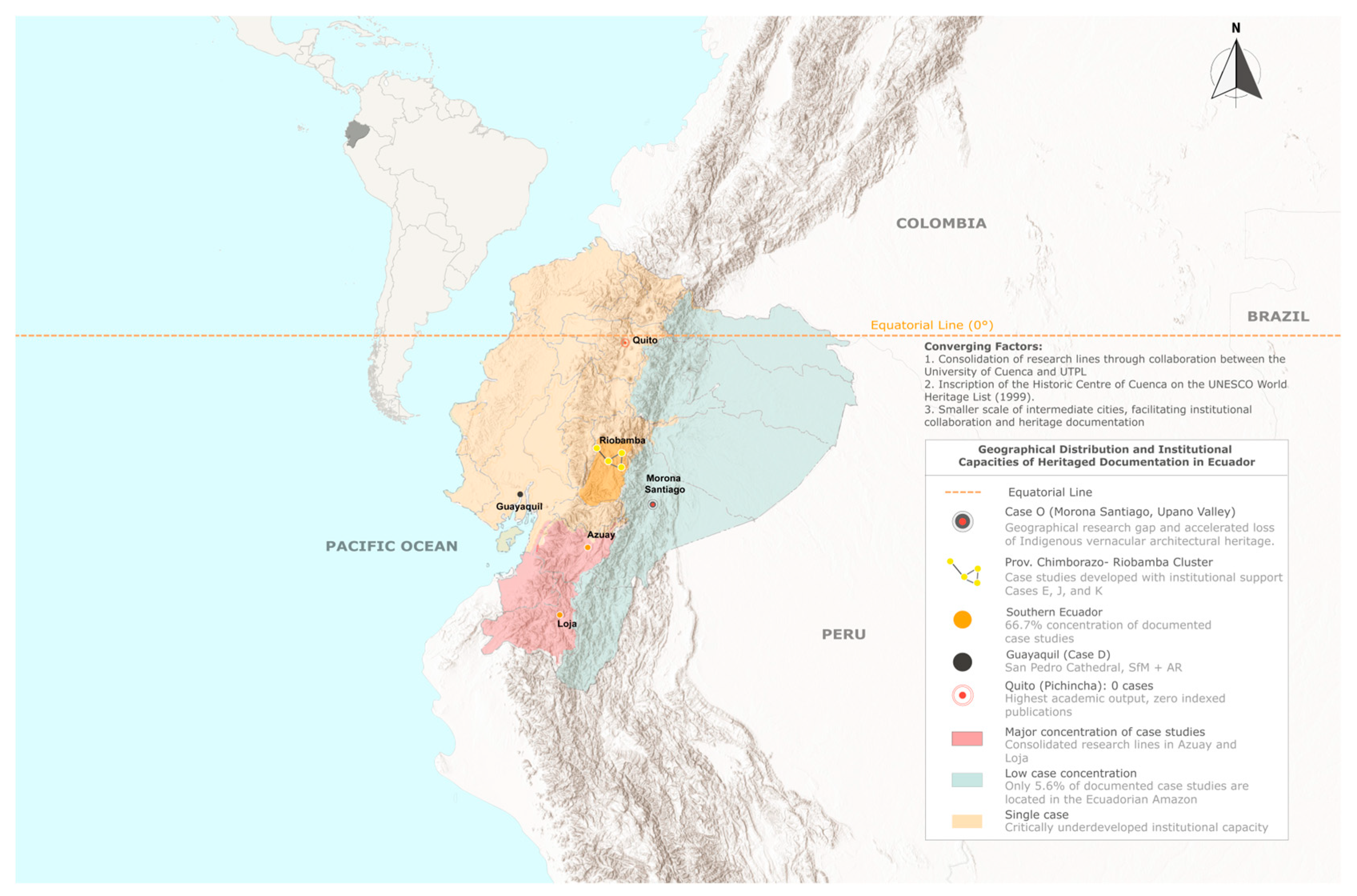
The concentration in the southern zone is dominant, accounting for 66.7% of cases (12/18), a pattern that this expanded corpus allows us to nuance in greater detail. Chimborazo accounts for 16.7% (3/18), which already constitutes a recognizable line of research within the field.
The most striking geographic finding is Pichincha: 0% of published and indexed cases on this topic. This figure is surprising given that the province is home to a historic center declared a UNESCO World Heritage Site in 1978, considered the best-preserved in Latin America, and given that it produces a considerable volume of non-indexed research—46 undergraduate theses and 5 graduate theses on digital technologies in cultural contexts. This absence, then, cannot be explained by a lack of resources or heritage significance: the scholarship exists, but it does not flow into indexed channels.
It is worth noting that the only Scopus-indexed work that comes close to this topic, “Digital Museums as Pedagogical Mediators in the Pandemic Crisis” [41], comes from the fields of computer science and human-computer interaction and addresses virtual museums as a pedagogical resource during the pandemic, with no relation to built heritage.
This absence reveals the central paradox of the corpus: the province with the highest density of monumental heritage and the highest academic output in the country has not produced, in ten years, a single indexed study on the digital documentation of its own heritage.
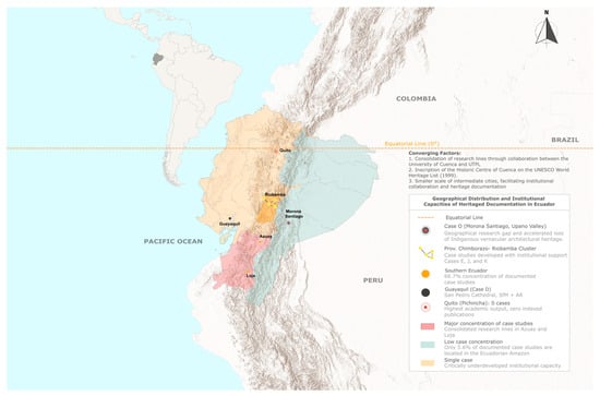
The Ecuadorian Amazon, for its part, contributes its first documented case in the Ecuadorian Amazon, for its part, contributes its first documented case in the corpus (Case O, Morona Santiago), although its representation remains marginal: 5.6% (1/18) (See Figure 2).
Figure 2.
Geographic distribution of indexed digital-heritage case studies and institutional research capacity across Ecuador (2015–2025).
3.5. Geometric Accuracy and Institutional Collaborations
Table 5 consolidates the geometric accuracy reported for each case, providing the empirical benchmarks referenced throughout this assessment and, where TLS-based scan-to-BIM is used, the precision baseline against which digital-twin geometric fidelity can later be evaluated.
Table 5.
Geometric accuracy and texture resolution by case study.
3.6. Technical and Institutional Barriers
Beyond the case-by-case comparison in Table 2, cross-case synthesis of the C1–C5 matrix surfaces five recurring barriers that constrain the transition from individual documentation projects to institutionalized, digital-twin-ready practice. Table 6 summarizes each barrier with its supporting evidence from the corpus and the corresponding practice implication, providing the direct evidentiary basis for the recommendations developed in Section 4.2.
Table 6.
Cross-case barriers to consolidation of digital heritage practice.
Taken together, these five barriers indicate that the field’s principal constraint is institutional capacity and coordination rather than the availability of proven digitization methods—a distinction that directly informs the recommendations in Section 4.2.
4. Discussion
4.1. Chronological Evolution (2015–2025)
The analysis of the eighteen indexed cases reveals a clear evolutionary trajectory in three phases. The exploratory phase (2015–2018) involved pioneering projects that sought to demonstrate the technical feasibility of digital photogrammetry under local conditions. The Todos Santos archaeological site [22] exemplifies this period: the methodology centered on democratizing access to technology through accessible devices and low-cost software, opening pathways for later, more sophisticated implementations.
During the consolidation phase (2019–2022), projects of greater complexity emerged, with an emphasis on practical applications. The photogrammetric model of Cuenca [23] introduced GIS integration for municipal management; the modern architecture catalog [24] described rigorous cost-time-accuracy criteria; the AR application for San Pedro Cathedral [25] demonstrated technical and economic feasibility; and the IntiKilla virtual museum [26] integrated tangible and intangible heritage with measurable educational impact, and the Nabón rural-heritage monitoring project [35] extended geomatics documentation to a community-participation context, demonstrating that internationally standard documentation is achievable outside major urban centers.
The diversification phase (2023–2025) shows a richer methodological diversity. The Quillusara Monument project [29] integrates TLS, multispectral photography, infrared thermography, and SfM, achieving ±2 mm accuracy, the most sophisticated application documented in Ecuador. Cases J (Balbanera) and K (Sicalpa) extend this sophistication to religious, underground, and rural vernacular typologies, respectively.
Compared to the European context, where digital heritage technologies began to take hold in the early 2000s, Ecuador lags behind by approximately 18–22 years. This estimate reflects the authors’ interpretive judgment based on the chronological patterns identified in this corpus, rather than a formal cross-country comparison. This temporal gap is largely explained by the structural challenges identified in this study: the prohibitive cost of specialized equipment and the absence of specialized graduate programs in the country. Formal international cooperation, defined here as explicit institutional coauthorship, is present in 22.2% of the eighteen cases, all with UTPL as the base institution, and predominantly with Spanish universities (UPM, UCM, UAM). This cooperation has acted as the principal accelerating mechanism in the country’s technological trajectory.
4.2. Practice and Policy Recommendations for Digital-Twin Readiness
For practitioners and institutions operating with limited resources, five actionable directions follow directly from Table 6, each also constituting a concrete step toward digital-twin readiness: (i) institutional publication-support funds paired with technical-writing training in graduate curricula, so that proven scan-to-BIM workflows become visible and replicable rather than remaining locked in unpublished theses; (ii) migration toward open-source processing ecosystems combined with formalized regional equipment-lending agreements, following the Nabón model, which demonstrates that shared access to TLS and RPAS equipment can substitute for institutional ownership as a route to scan-to-BIM capability; (iii) an interuniversity graduate curriculum in digital heritage documentation, leveraging existing UTPL–Universidad de Cuenca–Spanish university networks and extended to cover scan-to-BIM and HBIM workflows specifically; (iv) framework agreements linking university research with INPC and municipal heritage management, following the Nabón and Cuenca precedents, so that the resulting documentation models feed directly into the asset-management systems a digital twin is meant to serve; and (v) a national digital-heritage repository under INPC leadership, providing the persistent, interoperable data infrastructure that digital-twin platforms require, for which the multi-institutional Qhapaq Ñan Ecuador initiative provides a workable precedent [42].
4.3. Implemented Technologies and Methodological Strategies
SfM photogrammetry remains the technological axis of heritage documentation in Ecuador. Its centimeter-level accuracy (±8–15 cm) is sufficient for most documentation objectives, particularly when rigorous capture protocols are used. TLS, present in six of the eighteen cases (33.3%: Cases B, G, J, K, L, and M, per Table 5), offers submillimetric accuracy essential for structural analyses and detailed documentation of pathologies. Immersive technologies, including AR (Case D) and 360-degree virtual tours (Case H), confirm the social impact achievable when they are designed according to ISO 9241-210 [43] principles, with positive user-survey ratings ranging from 88% to 100%. Cases E and F report complementary but methodologically distinct impact metrics—a 65% increase in cultural-knowledge retention (Case E) and a 65% degree of preserved authenticity established through hypothetical reconstruction (Case F)—that are not directly comparable to the user-survey ratings reported for Cases D and H.
Three methodological trends coexist in the Ecuadorian corpus. First is open access to technology through affordable equipment: the Todos Santos (2018), San Pedro Cathedral (2020), and Virtual Museums (2022) projects used common cameras and low-cost software. Second is the integration of multiple scales, from the urban scale to the architectural detail, applying the [44] principle of aligning levels of documentation detail with specific conservation objectives. Third is the integration of diverse technologies: the Quillusara project (2024) combines infrared thermography, laser scanning, multispectral photography, and photogrammetry, consistent with [45] argument that no single technique outperforms all others.
4.4. Study Limitations
Six limitations delimit the scope of this study. First, the corpus is restricted: of the 344 documents identified, only eighteen meet the inclusion criteria. This restriction is due to strict scientific criteria, not to search problems. Second, geographic bias is present: 66.7% of the cases are concentrated in the southern region. This concentration is not an artifact of the selection criteria: all eighteen cases correspond to the full population of scientifically validated literature identified through the search (Section 2.2), and criterion 4 served only to characterize this distribution, not to cap or exclude cases from other provinces. The clearest evidence against a selection-driven artifact is Pichincha: despite hosting the Quito UNESCO-listed historic center (1978) and concentrating the country’s largest volume of non-indexed academic production on the topic (46 undergraduate and 5 graduate theses, (Section 3.4), it contributes zero cases to the indexed corpus. This indicates that the observed concentration reflects a genuine disparity in indexed, scientifically validated output—plausibly linked to institutional factors present in Azuay and Loja, such as UNESCO/INPC heritage recognition and sustained international academic cooperation (22.2% of cases, Section 4.1)—rather than to the case-selection process itself. Third, the temporal observation period, 2015–2025, excludes earlier years in which indexed publications were extremely scarce. Fourth, two institutions had repositories with inactive OAI-PMH protocols during the capture period, which may have excluded some relevant works. Fifth, the evaluation of AR applications and virtual tours was based on available technical documentation rather than direct review of digital files. This limitation mainly affects Cases F and H, whose immersive products could not be verified in an execution environment. Sixth, of the 18 case studies selected for analysis in this research, 10 did not report key technical details, such as measurement accuracy, tolerance relative to their spatial environment, or the texture resolutions used in their models, which can be interpreted as a limitation in the technical documentation available for the creation of high-fidelity digital-twins models.
5. Conclusions
This comparative technical assessment of eighteen Ecuadorian digital-heritage cases (2015–2025) documents a young but rapidly maturing documentation pipeline: from early exploratory SfM photogrammetry to hybrid workflows integrating TLS, scan-to-BIM, multispectral imaging, and immersive technologies—the foundational layer on which heritage digital twins depend. Geographic concentration in the south persists (66.7%), the dissemination gap remains at 12–15%, and the Ecuadorian Amazon enters the indexed corpus for the first time (Case O), though its representation remains minimal. The most significant dissemination finding is the absence of Pichincha—home to Quito’s UNESCO-listed historic center—from the indexed corpus, indicating that the principal barrier to digital-twin-ready documentation is institutional and communicational rather than technical.
Four contributions emerge from this work: the C1–C5 matrix itself, a diagnostic tool validated by a five-member expert panel and designed to benchmark digital-twin readiness in resource-constrained contexts beyond Ecuador; the first systematic mapping of the Ecuadorian academic ecosystem in this domain (344 documents, 38 universities); a comparative analysis establishing and structurally explaining an 18–22-year lag relative to international references; and evidence-based guidelines—open-source migration, interuniversity training, and a national digital repository—that translate the diagnosis into actionable practice for institutions building toward digital-twin adoption.
As established in the introduction, a digital twin requires more than static point clouds or HBIM models—the predominant methodologies within the Ecuadorian context. Rather, it must be constituted as a complete architecture comprising IoT sensor networks and structural health monitoring (SHM) systems for the object of study, together with reliable data acquisition, real-time communication, and integration protocols, as previously stated. This would allow BIM/HBIM models to be continuously updated through operational and structural data, opening the possibility for these systems to evolve from static digital representations into dynamic, continuously monitored digital twins.
Future research priorities include systematic documentation of Amazonian Indigenous vernacular heritage, empirical validation of the long-term sustainability of generated digital products, integration of real-time sensor data into the HBIM models already produced by Cases J and R to close the gap toward operational digital twins, and development of user-centered evaluation frameworks specific to the Ecuadorian and comparable Latin American contexts.
Author Contributions
Conceptualization, M.J.D.C.; Methodology, M.J.D.C.; Investigation, C.S.R.N. and C.N.J.F.; Data curation, M.J.D.C., C.S.R.N. and C.N.J.F.; Formal analysis, M.J.D.C., C.S.R.N. and C.N.J.F.; Visualization, M.J.D.C., C.S.R.N. and C.N.J.F.; Project administration, M.J.D.C.; Supervision, M.J.D.C.; Validation, M.J.D.C.; Writing—original draft, M.J.D.C., C.S.R.N. and C.N.J.F.; Writing—review and editing, M.J.D.C. All authors have read and agreed to the published version of the manuscript.
Funding
This research received no external funding. It was supported by the authors’ own resources.
Institutional Review Board Statement
Not applicable. This study did not involve patients or the collection of personal, clinical, or identifiable data from human subjects. The five-member expert panel described in Section 2.2 participated in a technical validation exercise (calibration and application of the C1–C5 analytical matrix to previously published, publicly available case studies) and did not constitute a research intervention on human participants; no personal or sensitive data were collected from the panelists themselves. Ethical approval was therefore not sought, in line with institutional practice for non-interventional technical/methodological consultation exercises of this kind.
Informed Consent Statement
Not applicable, as no identifiable personal data from human participants are reported in this study. The three external members of the expert panel (beyond the authors) participated voluntarily in the matrix-validation sessions described in Section 2.2 and agreed to be acknowledged for this contribution; no other consent was required as no individual-level data about them is disclosed.
Data Availability Statement
The data supporting the comparative analysis of the C1–C5 multidimensional matrix applied to the eighteen indexed cases are derived entirely from publicly available scientific publications listed in the References section. The systematic review of the institutional repositories of the 38 universities was conducted in accordance with the open-access protocols described in Section 3. The disaggregated coding matrices and the operationalized C1–C5 criteria are available from the corresponding author upon reasonable request.
Acknowledgments
The authors thank Universidad Técnica Particular de Loja for providing the workspace and tools necessary to verify the information, and Universidad Politécnica de Madrid for access to its digital library, which supported the literature review underlying this study. During the preparation of this manuscript, the authors used SciSpace (Basic 101 plan) as a scientific literature search and verification tool during the bibliographic identification phase, with subsequent manual verification of each record against its original database prior to title/abstract screening. For manuscript verification and editing, the authors used Claude Sonnet 5 (medium effort, Anthropic) for the conceptual design of the PRISMA flow diagram and for correction of writing style throughout the article. The authors have reviewed and edited all AI-assisted output and take full responsibility for the content of this publication. The research design, the selection and analysis of the eighteen case studies, the C1–C5 analytical matrix, and the interpretation of results and conclusions remain the exclusive intellectual contribution of the authors.
Conflicts of Interest
The authors declare no conflicts of interest.
References
- ICOMOS (Ed.) Carta internacional sobre la conservación y la restauración de monumentos y sitios (Carta de Venecia 1964). In Proceedings of the II Congreso Internacional de Arquitectos Y Técnicos de Monumentos Históricos; International Council on Monuments and Sites: Venecia, Italy, 1964; pp. 1–4. Available online: https://www.icomos.org/images/DOCUMENTS/Charters/venice_e.pdf (accessed on 6 November 2025).
- ICOMOS. World Report 2000 on Monuments and Sites in Danger. Available online: https://www.icomos.org/public/risk/world_report/2000/trends_eng.htm (accessed on 5 August 2026).
- UNESCO. Convención sobre la Protección del Patrimonio Mundial Cultural y Natural de 1972. Available online: https://patrimoniomundial.cultura.pe/patrimoniomundial/laconvencionde1972 (accessed on 9 July 2025).
- Cabrera Hanna, J.S. El Centro Histórico de Quito en la planificación urbana (1942–1992). Discursos patrimoniales, cambios espaciales y desplazamientos socioculturales. Territorios 2017, 36, 189–215. [Google Scholar] [CrossRef] [Scilit]
- Instituto Nacional de Patrimonio Cultural. Sistema de Información del Patrimonio Cultural del Ecuador (SIPCE); INPC: Quito, Ecuador, 2025; Available online: https://www.patrimoniocultural.gob.ec/sistema-de-informacion-del-patrimonio-cultural-ecuatoriano-sipce/ (accessed on 20 February 2025).
- Sánchez Cortez, J.L.; Tasiguano, M.S. Earthquake of April 16, 2016, in Ecuador: A general vision of the events and lessons learned. Rev. Estud. Latinoam. Reducc. Riesgo Desastres 2024, 8, 83–98. [Google Scholar] [CrossRef] [Scilit]
- Jiménez Pacheco, J.; Cabrera Cajamarca, J.; Sánchez Beltrán, J.; Avilés Tenorio, F. View of Seismic vulnerability of the built heritage of the Historic Center of the City of Cuenca: General guidelines and progress of the project. Maskana 2018, 9, 59–78. [Google Scholar] [CrossRef] [Scilit]
- Rodríguez Miranda, Á.; Pérez Vidiella, P.; Martínez Lázaro, R.; Valle Melón, J.M. Reutilización de pares fotogramétricos de elementos arquitectónicos para la obtención de modelos 3D y ortofotografías a partir de técnicas SFM. Arqueol. Arquit. 2015, 12, e024. [Google Scholar] [CrossRef] [Scilit]
- Lerma, J.L.; Navarro, S.; Cabrelles, M.; Villaverde, V. Terrestrial laser scanning and close range photogrammetry for 3D archaeological documentation: The Upper Palaeolithic Cave of Parpalló as a case study. J. Archaeol. Sci. 2010, 37, 499–507. [Google Scholar] [CrossRef] [Scilit]
- Prieto Olavarría, C.; Chiavazza, H.; Lo Vecchio Repetto, A.; Gandulfo, G. Photogrammetry of architectural heritage amid climate change and seismic risk: Adobe, rock, and brick structures in the Andes Mountain Range and plains of Mendoza, Argentina. Digit. Appl. Archaeol. Cult. Herit. 2026, 40, e00482. [Google Scholar] [CrossRef] [Scilit]
- Staiger, R. Terrestrial Laser Scanning Technology, Systems and Applications. In TS12 Positioning and Measurement Technologies and Practices, Proceedings of the 2nd FIG Regional Conference, Marrakech, Morocco, 2–5 December 2003; International Federation of Surveyors: Copenhagen, Denmark, 2003; pp. 1–10. [Google Scholar]
- Hoon, Y.J.; Hong, S. Three-dimensional digital documentation of cultural heritage site based on the convergence of terrestrial laser scanning and unmanned aerial vehicle photogrammetry. ISPRS Int. J. Geoinf. 2019, 8, 53. [Google Scholar] [CrossRef] [Scilit]
- Guarnieri, A.; Vettore, A.; Remondino, F. Photogrammetry and Ground-based Laser Scanning: Assessment of Metric Accuracy of the 3D Model of Pozzoveggiani Church. In Proceedings of the FIG Working Week; 04.01—Contribución a las actas de la conferencia; International Federation of Surveyors: Copenhagen, Denmark, 2004; pp. 1–15. Available online: https://www.isprs.org/proceedings/xxxvi/part5/paper/1216_dresden06.pdf (accessed on 26 June 2026).
- Heritage, G.L.; Large, A.R.G. (Eds.) Laser Scanning for the Environmental Sciences; Wiley: Chichester, UK, 2009. [Google Scholar]
- Murphy, M.; McGovern, E.; Pavia, S. Historic Building Information Modelling—Adding intelligence to laser and image based surveys of European classical architecture. ISPRS J. Photogramm. Remote Sens. 2013, 76, 89–102. [Google Scholar] [CrossRef] [Scilit]
- Nieto Julián, J.E.; Farratell, J.; Bouzas Cavada, M.; Moyano, J. Collaborative Workflow in an HBIM Project for the Restoration and Conservation of Cultural Heritage. Int. J. Archit. Herit. 2022, 17, 1813–1832. [Google Scholar] [CrossRef] [Scilit]
- Lee, J.; Jung, T.; Tom Dieck, M.C.; García-Milon, A.; Kim, C.S. Affordance, digital media literacy, and emotions in virtual cultural heritage tourism experiences. J. Vacat. Mark. 2025, 31, 1056–1073. [Google Scholar] [CrossRef] [Scilit]
- Chaos Yeras, M.T. La arquitectura vernácula como importante manifestación de la cultura. Arquit. Del Sur 2015, 33, 62–73. Available online: https://revistas.ubiobio.cl/index.php/AS/article/view/1342 (accessed on 9 November 2025).
- Yin, R.K. Case Study Research and Applications: Design and Methods, 6th ed.; SAGE Publications: Thousand Oaks, CA, USA, 2018; Volume 11, Available online: https://ebooks.umu.ac.ug/librarian/books-file/Case%20Study%20Research%20and%20Applications.pdf (accessed on 26 June 2026).
- CASES. CACES. Available online: https://www.caces.gob.ec/listado-de-universidades-y-escuelas-politecnica/ (accessed on 31 August 2026).
- Instituto Nacional de Patrimonio Cultural. Instructivo Para Fichas de Registro e Inventario: Bienes Inmuebles; Instituto Nacional de Patrimonio Cultural: Quito, Ecuador, 2011; Available online: http://downloads.arqueo-ecuatoriana.ec/ayhpwxgv/noticias/publicaciones/INPC-X-InstructivoParaFichasDeRegistroInventarioBienesMuebles.pdf (accessed on 14 May 2026).
- Aparicio Resco, P.; Espinoza- Figueroa, F.; Aguirre Ullauri, M.D.C.; Mejía Coronel, P.; Matovelle Jara, C. Digital photogrammetry for the 3D model of the archeological site of Todos Santos, Cuenca (Ecuador). Estoa 2018, 7, 31–54. [Google Scholar] [CrossRef] [Scilit]
- Ochoa Arias, P.; Delgado Pinos, O.A. Modelo de registro fotogramétrico 2D y 3D del patrimonio edificado de Cuenca. Universitas 2020, 33, 163–180. [Google Scholar] [CrossRef] [Scilit]
- Preti Ochoa, S.P.; Tituana, K.B.T.; Heras Barros, V.C. Documentación para Arquitectura Moderna Mediante Técnicas Digitales Tridimensionales: Catálogo. DAYA Diseño Arte Y Arquit. 2020, 1, 273–285. [Google Scholar] [CrossRef] [Scilit]
- Llerena Izquierdo, J.L.; Gonzabay, L.C. Photogrammetry and Augmented Reality to Promote the Religious Cultural Heritage of San Pedro Cathedral in Guayaquil, Ecuador. In Applied Technologies; Communications in Computer and Information Science, CCIS; Botto-Tobar, M., Vizuete, M.Z., Torres-Carrión, P., León, S.M., Vásquez, G.P., Durakovic, B., Eds.; Springer: Berlin/Heidelberg, Germany, 2020; Volume 1194, pp. 593–606. [Google Scholar] [CrossRef] [Scilit]
- Radicelli García, C.; Pomboza Floril, M. Interactive digital museums, a new way of generate and transmite knowledge. DYNA 2022, 89, 83–90. [Google Scholar] [CrossRef] [Scilit]
- Sagbaicela, C.; Campoverde, J.D.Q.; Toledo, J.T. BIM management methodology for the documentation of architectural restoration projects: Case study of Cuenca-Ecuador. AIP Conf. Proc. 2022, 2574, 090004. [Google Scholar] [CrossRef] [Scilit]
- Guamán Arpi, M.L.; Aguirre Ullauri, M.d.C. La metodología HBIM en el estudio de inmuebles patrimoniales, Caso Hacienda Isla Bejucal, Baba, Ecuador. AlfaPublicaciones 2022, 4, 103–124. [Google Scholar] [CrossRef] [Scilit]
- Lorenzo Cueva, C.; Delgado Cruz, M.J.; Toledo Álvarez, H.S.; Sanz González, S. Nuevas herramientas para la representación y virtualización del Patrimonio Arquitectónico y Arqueológico. Cuad. Cent. Estud. Diseño Comun. 2024, 213, 91–101. [Google Scholar] [CrossRef] [Scilit]
- Velastegui Cáceres, L.A.; Guevara Bonifaz, B.; Velastegui Cáceres, J.; Carretero Poblete, P.A.; Espinoza Figueroa, E. Digital Documentation of Built Heritage: 3D Point Cloud Modeling of the Balbanera Church, Ecuador. Arqueol. Iberoam. 2024, 53, 83–94. [Google Scholar] [CrossRef]
- Velastegui Cáceres, L.A.; Guevara Bonifaz, B.; Velastegui Cáceres, J.V.; Carretero Poblete, P.A. Geospatial Technologies for 3D Digital Documentation of Underground Heritage Constructions: Catacombs from Sicalpa Viejo, Ecuador. Arqueol. Iberoam. 2024, 53, 104–111. [Google Scholar] [CrossRef]
- Arévalo Valdivieso, S.C.; Delgado Cruz, M.J. Preservación del edificio de la Gobernación de Loja (Ecuador) mediante la recopilación, reconstrucción y recorrido virtual. In Proceedings of the Convención Internacional de la Arquitectura Técnica, Ibiza, España, 25–26 April 2024; Available online: https://goo.su/EcBSPH (accessed on 19 April 2026).
- Puglla Tamayo, F.E.P.; Delgado Cruz, M.J. The central square of Loja-Ecuador a historical, patrimonial and digital vision. In Proceedings of the 10th Euro-American Congress on Construction Pathology, Rehabilitation Technology and Heritage Management, REHABEND, Gijon, Spain, 7–10 May 2025; pp. 2349–2365. Available online: https://www.scopus.com/pages/publications/85202604739 (accessed on 3 March 2026).
- Malla Lozano, J.A.M.; Delgado Cruz, M.J. New technologies as tools for documentation and dissemination of heritage homes, Loja- Ecuador. In Proceedings of the REHABEND: 10th Euro-American Congress on Construction Pathology, Rehabilitation Technology and Heritage Management; University of Cantabria—Building Technology R&D Group: Gijon, Spain, 2025; pp. 2366–2379. Available online: https://www.scopus.com/pages/publications/85202641988 (accessed on 1 October 2025).
- Collado, A.; Heras, V.; Rodas, P.; Delgado, A.; Carrión, C.; Mora-Navarro, G.; Lerma, J.L. Geomatics Documentation Techniques as Monitoring Tools for Rural Built Heritage in Nabón (Ecuador). In Proceedings of the ISPRS Annals of the Photogrammetry, Remote Sensing and Spatial Information Sciences; Copernicus GmbH: Göttingen, Germany, 2021; pp. 65–72. [Google Scholar] [CrossRef] [Scilit]
- Heras, V.; Sinchi, E.; Briones, J.; Lupercio, L. Urban heritage monitoring, using image processing techniques and data collection with terrestrial laser scanner (tls), case study cuenca-Ecuador. In Proceedings of the ISPRS Annals of the Photogrammetry, Remote Sensing and Spatial Information Sciences; Copernicus GmbH: Göttingen, Germany, 2019; pp. 609–613. [Google Scholar] [CrossRef] [Scilit]
- Montero, O.; Sardi, J.; Hermida, M.-A. Posibilidades de la reconstrucción tridimensional de zonas patrimoniales en base a fotogrametría y escáner LIDAR. El Barranco de la ciudad de Cuenca como caso de estudio. Rev. Maskana 2017, 8, 83–98. [Google Scholar] [CrossRef] [Scilit]
- Orejuela Palacios, F.I. Fotogrametría aérea con UAV como herramienta para la conservación de sitios arqueológicos. Caso de estudio: Complejo La Esperanza. Antropol. Cuad. Investig. 2023, 28, 59–70. [Google Scholar] [CrossRef] [Scilit]
- Pacheco Prado, D. Drone in urban spaces: Study case in parks, gardens and built heritage of Cuenca. Estoa 2017, 6, 159–168. [Google Scholar] [CrossRef] [Scilit]
- Preti, P.; Tituana, K.; Carvallo, J.; Heras, V. Digital Heritage Documentation of Modern Architecture in Cuenca—Ecuador. Int. Arch. Photogramm. Remote Sens. Spat. Inf. Sci. 2019, XLII-2/W15, 937–943. [Google Scholar] [CrossRef] [Scilit]
- Palacios, D.; Jadán-Guerrero, J.; Ramos-Galarza, C. Digital museums as pedagogical mediators in the pandemic crisis. In Proceedings of the International Conference on Human-Computer Interaction; Springer Science and Business Media Deutschland GmbH: Berlin/Heidelberg, Germany, 2021; pp. 122–131. [Google Scholar] [CrossRef] [Scilit]
- Qhapaq Ñan, Promoviendo el Turismo Patrimonial Comunitario|Programa De Las Naciones Unidas Para El Desarrollo. Available online: https://www.undp.org/es/ecuador/proyectos/qhapaq-nan-promoviendo-el-turismo-patrimonial-comunitario (accessed on 6 August 2026).
- ISO 9241-210:2019; Ergonomics of Human-System Interaction—Part 210: Human-Centred Design for Interactive Systems. International Organization for Standardization: Geneva, Switzerland, 2019. Available online: https://www.iso.org/standard/77520.html (accessed on 7 September 2026).
- Letellier, R.; Schmid, W.; LeBlanc, F. Recording, Documentation, and Information Management for the Conservation of Heritage Places; The Getty Conservation Institute: Los Angeles, CA, USA, 2007. [Google Scholar]
- Remondino, F.; Efstratios, S. 3D Recording, Documentation and Management of Cultural Heritage; Whittles Publishing: Scotland, UK, 2016. [Google Scholar]

Disclaimer/Publisher’s Note: The statements, opinions and data contained in all publications are solely those of the individual author(s) and contributor(s) and not of MDPI and/or the editor(s). MDPI and/or the editor(s) disclaim responsibility for any injury to people or property resulting from any ideas, methods, instructions or products referred to in the content. |
© 2026 by the authors. Licensee MDPI, Basel, Switzerland. This article is an open access article distributed under the terms and conditions of the Creative Commons Attribution (CC BY) license.