


Abstract
Rapid urbanisation across the Global South has intensified contestation over sidewalk space, where formal planning collides with informal livelihoods. Street vending, central to the urban economy, is routinely framed as disorder and met with exclusionary interventions that overlook its socio-spatial logic. This paper asks who holds the right to the sidewalk in intermediary cities, and how planning can move from displacement toward negotiated coexistence. Using Ben Guerir, Morocco, as a case, the study integrates Space Syntax (global integration Rn, ArcGIS Pro), 60 h of behavioural mapping across 18 sessions recording 158 vendors in three daily time-bands, and a stratified perception survey (n = 120: 60 pedestrians, 30 vendors, 30 shopkeepers). Vending concentrates in the most integrated segments of the urban grid, follows pedestrian rhythms across the day, and persists despite the formal Souk Al Karama market, which remains underutilised due to its spatial isolation. The contribution is threefold: (i) extending Space Syntax and Right to the City scholarship to an under-studied intermediary-city context; (ii) showing empirically that informal vending is a spatially rational adaptation to urban accessibility, not encroachment; and (iii) translating findings into operational principles for inclusive sidewalk governance, advancing Sustainable Development Goals 8 and 11.
1. Introduction
Urbanization across the Global South has intensified contestation over public space, particularly on sidewalks where formal planning and informal economic demands frequently collide. Although street vending plays a pivotal role in urban livelihoods, it is routinely construed as spatial disorder. Municipal authorities often pursue exclusionary measures, such as clearance and relocation, that fail to generate long-lasting results [1,2]. Vendors frequently return to high-traffic areas, exposing the shortcomings of top-down solutions that overlook the spatial processes of informal economies [3,4]. Recent research notes that urban change in fast-growing African intermediary cities is increasingly marked by a hybridization between formal and informal regimes [5,6], in which informal vending is intrinsically tied to patterns of walking and accessibility [7]. In Morocco, and particularly in rapidly urbanizing intermediary cities like Ben Guerir, these conflicts are sharpened by state-led modernization plans that prioritize formal urban growth, turning sidewalks into daily sites of negotiation over the right to the city and spatial justice [8,9,10].
Despite growing recognition that informality operates as an organizing socio-spatial logic rather than a deviation from planning norms [11,12], critical knowledge gaps remain. First, most of the literature examines informality through regulatory or socio-economic lenses, paying little attention to its precise spatial organization within urban systems. Second, empirical studies often rely on aggregate data or policy analysis, lacking the human-focused approaches that would capture the temporal and behavioural intricacies of informal practices [13,14]. Third, few studies have managed to integrate spatial analysis, behavioural observation, and perception-based inquiry into a single coherent framework [15]. As a result, formal planning responses tend to overlook these socio-spatial dynamics, producing interventions that deepen spatial conflict rather than resolve it.
To address these gaps and move beyond exclusionary policies, this paper develops an analytical framework for assessing equitable access to the sidewalk in fast-changing intermediary cities. Focusing on the contested corridors of Ben Guerir, Morocco, the research employs a mixed-methods approach combining structural Space Syntax analysis, behavioural mapping, and a structured perception survey (n = 120). By triangulating spatial form, human activity, and stakeholder perception, the study examines how urban spatial structure, behavioural patterns, and social attitudes toward informal street vending interact. The framework ultimately offers empirical pathways for shifting urban governance from reactive displacement toward inclusive, negotiated coexistence. To fulfill this objective, the study will have the following objectives:
- To investigate the spatial distribution of street vending activities in terms of spatial configuration measurements;
- To study the behavioural profiles and professional adaptation patterns of street vendors by observation;
- To determine the opinion of the population on the informal vending and sidewalk availability;
- To suggest context sensitive planning strategies that promote inclusive and fair management of the public spaces.
The research questions this study will deal with are the following:
- Where are street vendors concentrated within the urban grid, and what spatial factors determine these patterns?
- What is the role of spatial arrangement in the distribution and persistence of the informal vending activities?
- What is the perception of the various user groups regarding street vending in terms of accessibility, order and equity?
- What is fair sidewalk utilisation in the rapidly changing intermediate cities?
This research addresses the literature gap in three respects. Theoretically, it brings together debates on informality and spatial justice by combining the Right to the City approach with contemporary perspectives on informal urbanism [8,9]. Methodically, it constructs a mix-methodology approach that integrates mixed data regarding spatial analysis, behavioural mapping, and perception-based data, that uses the human-centred approach of analysis [14,16]. In practice, it offers insights that are relevant in policy making by urban planners, who want to achieve mobility, economic vitality, and equity in disputed public spaces.
Framed in these terms, the paper contributes directly to current debates in land-use planning and sidewalk governance. Sidewalks are land: they are publicly owned, formally designated, and actively contested terrain whose allocation among pedestrians, vendors, and motorised traffic is a land-use decision in everything but name. In intermediary cities of the Global South, where state-led urbanisation is producing new street networks faster than municipalities can govern them, the question of who has standing to use the sidewalk is also a question of how planned land is converted into lived public space. By coupling configurational analysis of the planned street network with behavioural and perceptual evidence of how that network is actually used, the study offers a transferable, evidence-based approach to integrating informal economic activity into formal land-use frameworks rather than displacing it. The framework developed here is intended for planners, municipal governments and researchers concerned with equitable urban land governance in rapidly transforming cities.
The organization of the paper is as follows: The second section establishes the theoretical framework; the third section provides a description of the mixed methodology; the fourth section describes the empirical results; the fifth section presents a discussion of these findings through the lens of spatial justice; and the final section provides recommendations for policy and conclusion.
2. Literature Review & Theoretical Framework
The literature review for this research project develops the theoretical basis for the study through integration of three interconnected bodies of literature. This first body of literature is a normative analysis of spatially just cities and employs the Right to the City framework. The second body of literature consists of contemporary views on informal urbanism which provide an insight into the spatial rationalities of street vendors, within contemporary urban contexts. Finally, this review will evaluate advances in urban analytics and reveal significant methodological weaknesses in projects currently being conducted, thereby supporting the need for implementation of a human-centered mixed methods approach.
2.1. Right to the City and Public Space Justice
The concept of the Right to the City that was first developed by Lefebvre [8] offers a theoretical basis of critique regarding the politics of urban space. That right was the right of a person and to recreate the urban space, but more generally, the right of the community to reform the urban space in relation to the social needs, and not according to the capitalist demands. This view opposes the major planning paradigms that exhibit greater interest in order, efficiency, and exchange value as opposed to lived experience and social use [17].
Seen through this lens, hybrid spaces such as sidewalks, where mobility, commerce, and property rights intersect, become sites of particular contestation and multifunctional urban life [18].
Later scholars have extended Lefebvre’s framework to study the socio-political dimensions of urban governance. Harvey [10] redefines the Right to the City as a democratisation process of the urban processes, with the exclusion groups being involved in urban futures. Equally, Mitchell [9] underlines the role of the public spaces as arenas of conflict, where the access is actively negotiated all the time, and is frequently disputed with the help of the regulatory practices disenfranchising the vulnerable populations. In this regard, sidewalks develop into significant places of contention. They are not neutral infrastructures and, instead, socially produced spaces of numbers of competing claims, such as mobility, commerce, and control. The practice of informal street vendors specifically is a challenge to spatial elite orders because they insist on being located in high-profile and reachable places. Their operations depict the conflict between abstract space, which is regulated and planned in nature, and lived space, which is characterized by daily routine and social relationships [19]. Their interpretation would, thus, entail placing sidewalk dynamics in the context of more general discussions on spatial justice and the right to urban participation.
These debates on the right to the city, abstract versus lived space, and the contested status of the sidewalk provide the conceptual ground on which this study builds. Translating them into an analytical object, however, requires a construct that can be observed and measured rather than only theorised. Building on this theoretical grounding, the present study therefore draws on these debates to develop a working notion of “equitable access” to the sidewalk, understood as the extent to which different user groups can make use of public space in ways that reflect both spatial opportunity and social legitimacy. To render this notion empirically tractable, equitable access is approached through a tripartite set of indicators that broadly correspond to the three components of our mixed-methods framework: (1) Potential Accessibility and Movement, approached through Space Syntax, which offers an indication of the structural capacity of the street network to support pedestrian footfall and associated economic opportunities; (2) Spatio-Temporal Coexistence, examined through behavioural mapping, which provides an empirical reading of how shared use unfolds on the ground (for example, periods of congestion as opposed to more harmonious shared usage); and (3) Perceived Fairness and Socio-Economic Legitimacy, explored through the stakeholder survey, which seeks to capture how vendors, pedestrians and shop owners experience and negotiate competing spatial claims.
2.2. Informal Urbanism and Street Vending
Informal urbanism has increasingly been recognized as a fundamental component of urban systems in the Global South, rather than a deviation from formal planning norms. Roy [11] argues that informality should be understood as an organizing logic of urbanization, embedded within governance structures, rather than existing outside them. Recent views also highlight the idea that informal practices play the active role of forming the spatial nature of cities, and give rise to adaptive and spontaneous urban forms [20]. Newer theoretical imaginations have placed informality as an inherent and substantive state of urbanity itself, and not an exemption of formal systems [21]. This perspective shifts the analytical focus from illegality to the socio-economic processes that produce and sustain informal practices.
Within this broader understanding of informality, street vending offers a particularly well-documented case. It has long been recorded as part of the daily negotiation of the street under conditions of rapid urbanisation [22]. Street vending exemplifies this dynamic, functioning as both a livelihood strategy and a spatial practice. Kamalipour and Peimani [12] conceptualize informal street vending as an adaptive and context-sensitive response to urban conditions, emphasizing its role in shaping public space through everyday interactions. Similarly, Roever [4] highlights the economic and social significance of street vending, noting its contribution to employment, accessibility, and urban vitality. In African cities, the importance of street vending is particularly pronounced. Studies by Addi et al. [23] and Takyi et al. [24] demonstrate that informal economies are deeply embedded in urban life, providing essential income opportunities, while also reflecting broader governance challenges. These studies underscore the limitations of regulatory approaches that seek to eliminate or marginalize informal activities, without addressing their structural drivers.
Within the specific context of Morocco and the wider MENA region, street vending is deeply embedded in urban culture and daily consumption patterns. Yet municipal pavement governance has historically oscillated between tolerance and strict exclusionary tactics. Recent market formalization and relocation policies illustrate this tension well. Initiatives such as the enclosed commercial complexes built in Salé, including Souk Assalihine, or the peripheral relocations carried out in Casablanca and Marrakech, have yielded mixed results. Some structured markets do succeed in providing stable trading environments, but many relocation efforts fall short because they sever vendors from the pedestrian flows and social networks on which their economic survival depends. This pattern underscores the need for context-sensitive regulation of public space, one that recognises the spatial and cultural logic specific to North African cities.
Rather than viewing street vending as a problem to be solved, contemporary scholarship increasingly frames it as a form of urban resilience and adaptability. This perspective calls for planning approaches that recognize informality as an integral component of urban systems, requiring integration rather than exclusion. Such views are supported by more broad theoretical syntheses that theorise informal economy as inherent in the social–economic systems, and not maintaining additional relations to them [25].
2.3. The Spatial Logic of Informality
A growing body of literature challenges the traditional view that informal activities occur randomly or chaotically, suggesting instead that street vending behaviour tends to follow a discernible spatial logic. Street vendors position themselves in strategic locations to maximize visibility, access, and customer traffic, while minimizing regulatory risk [11,12]. Such a practice demonstrates high level of awareness of the dynamics of cities, and indicates the rationality of informal practices.
Building on this idea of a spatial logic, Dovey et al. [7] conceptualise street vending as an assemblage that is dynamic and relational. Vending activity within this context is perceived as transient relationships between people, goods, and spaces that engage the formal city structure. The trend can be compared to the wider studies of the African urban operations, where informality is dominant in the development of the space and economic processes [5,6]. This view rests the emphasis on unchanging encroachment to the dynamic integration, with informal practices being considered in the wider context of the rest of the city. Spatial movements of the vending are closely connected with the rhythms of mobility and movement. The vendors tend to be on the locations with great traffic like in the intersections, transportation hubs, and business streets, where economic prospects are the best. Such patterns imply not only that the informal activities are socially embedded, but also spatially organized, and react to the existing structure of the urban grid [7,14]. Recognising this spatial logic can be valuable in formulating effective planning strategies. Instead of trying to use informal activities as an element to negate, planners should be able to identify under which conditions such informal activities will be attracted and maintained, so that they can implement more context-specific interventions. Such findings reinforce the view that informal practices are not only spatially adaptive, but are also deeply embedded in the broader rhythms of urban mobility and movement [7,14].
2.4. Spatial Suitability and Urban Analytics
Spatial suitability refers to the capacity of specific urban sites to accommodate particular activities, determined by factors such as accessibility, visibility, and spatial openness. Applied to street vending, this concept provides a useful analytical lens for understanding the uneven distribution of informal economic activities within the urban fabric. The relationship between human behavior and spatial configuration has also been emerging, alongside some recent developments in the field of urban analytics, which has now made it possible to measure these aspects more accurately. In this analysis, the space syntax theory is a key constituent, because it offers the instruments to measure urban spaces, connectivity and integration. Recent methodological advances have further strengthened the connection between Space Syntax and spatial interaction modelling, extending its predictive capacity for pedestrian movement and activity distribution across urban networks [26]. Its use in a variety of settings, including the analysis of spatial cognition and wayfinding within complex buildings [27], is characteristic of the strength of space syntax in determining the forms of spatial behaviour and social interaction [28,29]. Such measures as integration and choice values can be used to forecast the tendencies in the movement of pedestrians, and define the regions that have high possibilities of social and economic active life. The connection between urban structure and informal activity has been supported by studies, in which Zhang and Shao [15] show that street vending is most likely to be clustered in areas that have high geographical accessibility. In the same vein, pedestrian flow patterns play a key role in determining the spatial allocation of informal economic activities. It is demonstrated that informal economies are closely connected to the rhythm of urban life [14]; according to spatial and temporal differences in mobility, the density of vendor is strongly interrelated.
Taken together, these studies highlight the weaknesses of planning methods that disregard the role of spatial configuration. New methods of analysis also include machine learning models to chart the development and use of space syntax studies, which indicate the increasing methodological significance of this study [30]. The spatial analytics, when integrated into the decision-making processes, also allow planners to have a more accurate grasp of the location of likely emergence of informal activities, and devise interventions that would not risk disrupting the current urban flows.
2.5. Methodological Gap: From Big Data to Human-Centered Approaches
Despite advances in urban analytics, significant methodological gaps remain in the study of informal urbanism. The “smart city” paradigm has emphasized the use of big data, automated sensing, and algorithmic analysis to monitor and manage urban systems [31]. Nevertheless, digital governance and current open data models do not always have sufficient means to capture informal urban practices, which inhibits their capacities to reflect on the multifaceted socio-spatial processes [32]. While these technologies offer valuable insights, they often fail to capture the complexity of informal practices, which are fluid, context-dependent, and socially embedded.
One key limitation of big data approaches is their inability to account for qualitative aspects of urban life, such as social interactions, behavioral adaptations, and perceptions of space. Nathvani et al. [14] demonstrate that, while image-based analysis can identify the presence of vendors, it cannot fully explain the underlying motivations and dynamics of their activities. Similarly, concerns have been raised regarding the ethical implications of surveillance technologies, particularly in contexts where informal actors are already vulnerable to exclusion and regulation [31]. To address these limitations, there is a growing need for human-centered methodologies that prioritize direct observation and contextual understanding. Behavioural mapping, as developed by Gehl and Svarre [16] and grounded in Gehl’s human-scale approach to observing urban life [33], provides a valuable tool for capturing the spatial and temporal dynamics of urban activities. By recording how people use space in real time, this approach generates “thick data” that complements quantitative analysis, and reveals patterns that might otherwise remain hidden.
Integrating behavioural mapping with spatial analytics and perception-based surveys offers a more comprehensive approach to studying informal urbanism. This mixed-methods framework enables researchers to combine the strengths of quantitative and qualitative methods, providing a richer and more nuanced understanding of urban space.
2.6. Synthesis and Research Gaps
The reviewed literature highlights a critical shift in the understanding of informal urbanism from viewing it as a problem of disorder, to recognizing it as a structured and adaptive component of urban systems. The Right to the City framework emphasizes the normative dimension of spatial justice, while studies on informal urbanism and spatial logic reveal the rational and context-sensitive nature of street vending. At the same time, advances in spatial analytics provide tools for understanding the relationship between urban form and human behavior.
However, a key gap remains in integrating these perspectives within a unified analytical framework. Existing approaches often isolate theoretical, spatial, and methodological dimensions, limiting their ability to fully capture the complexity of sidewalk dynamics. This study addresses this gap by combining insights from spatial theory, informal urbanism, and human-centered methodologies to develop a comprehensive framework for assessing equitable access to public space. In doing so, it seeks to bridge the divide between abstract planning concepts and the lived realities of urban life, providing a foundation for more inclusive and effective urban governance.
3. Methodology
This section outlines the methodological approach employed to study sidewalk dynamics (street vending) in Ben Guerir, in order to translate the theoretical framework into an empirical investigation. It provides a detailed description of the mixed-methods research design, which is the basis for conducting the analysis. It then explains the research site (the urban context of the study area), and describes in detail the data collection and analytical procedures. These three procedures provide a rigorous, multi-faceted means of assessing informal street vending.
3.1. Research Design
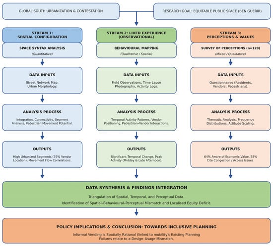
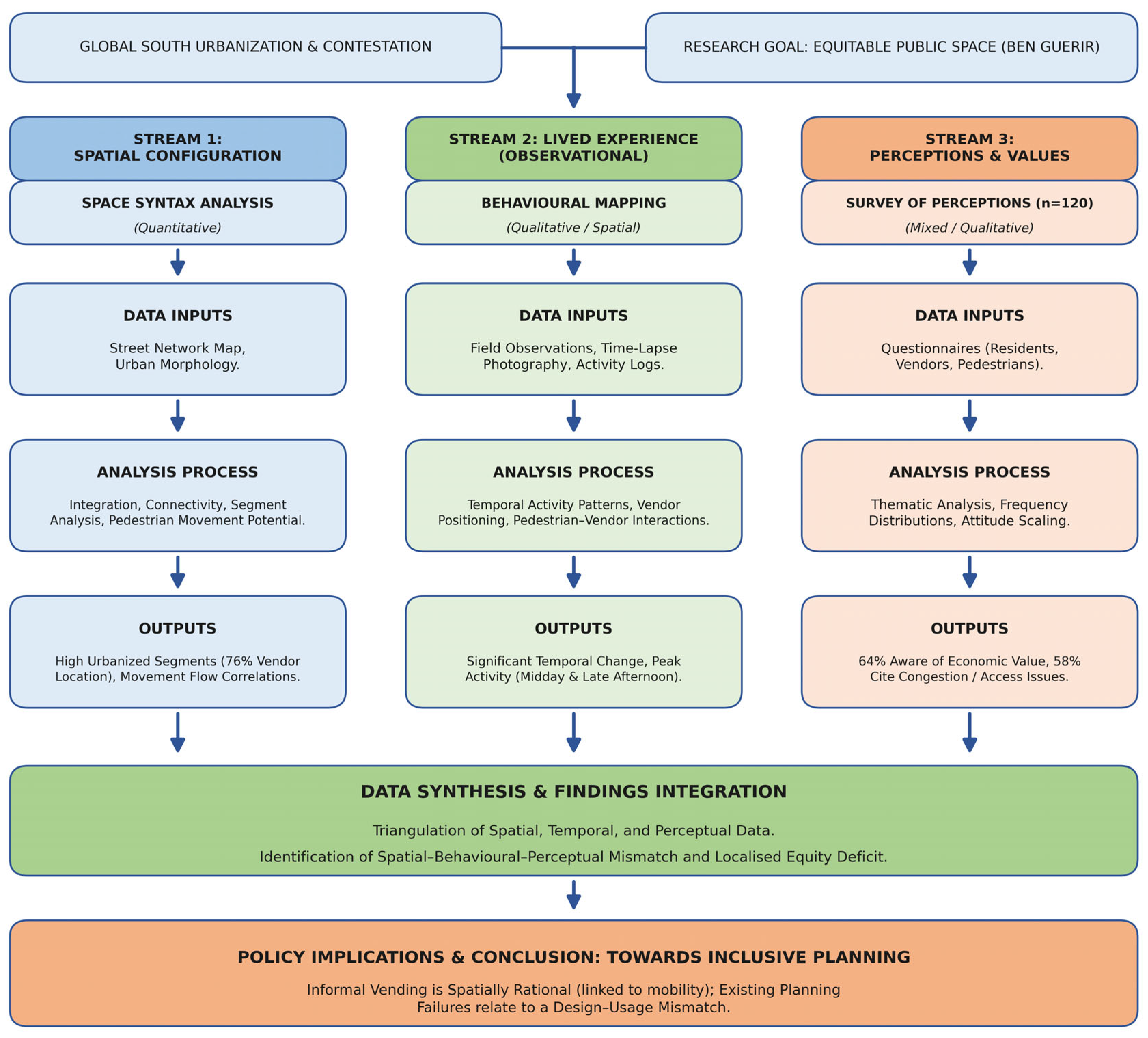
This study adopts a convergent parallel mixed-methods research design to examine equitable sidewalk use in Ben Guerir, Morocco. The design combines three complementary methods, each chosen because it addresses a distinct layer of the research problem that no single approach can capture in isolation. Space Syntax analysis is used to characterise the configurational properties of the street network and identify where pedestrian movement is structurally concentrated; behavioural mapping is used to record where and when sidewalk activity actually occurs on the ground, and a perception survey is used to surface how the three principal stakeholder groups (pedestrians, vendors, and adjacent shopkeepers) interpret access, congestion, and equity. Together they connect the configurational, behavioural, and perceptual dimensions of sidewalk use, allowing structural explanations to be triangulated against lived experience and stated meaning [11,12]. This integrative logic is widely advocated for the study of informal urbanism, where spatial structure, observed behaviour, and contested perceptions are mutually constitutive [14,16,34]. Triangulating across the three datasets strengthens both reliability and interpretive validity: convergence across methods increases confidence in findings, and divergence flags where structural opportunity and lived experience pull in different directions. Figure 1 illustrates the overall mixed-methods framework applied in this study.
Figure 1.
Mixed-methods research framework. The diagram illustrates the integration of Space Syntax (ArcGIS Pro v3.1), behavioural mapping, and perception surveys through data triangulation to analyze informal street vending in Ben Guerir. Source: Authors’ elaboration (2026).
3.2. Study Area
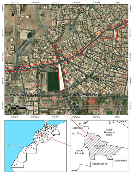
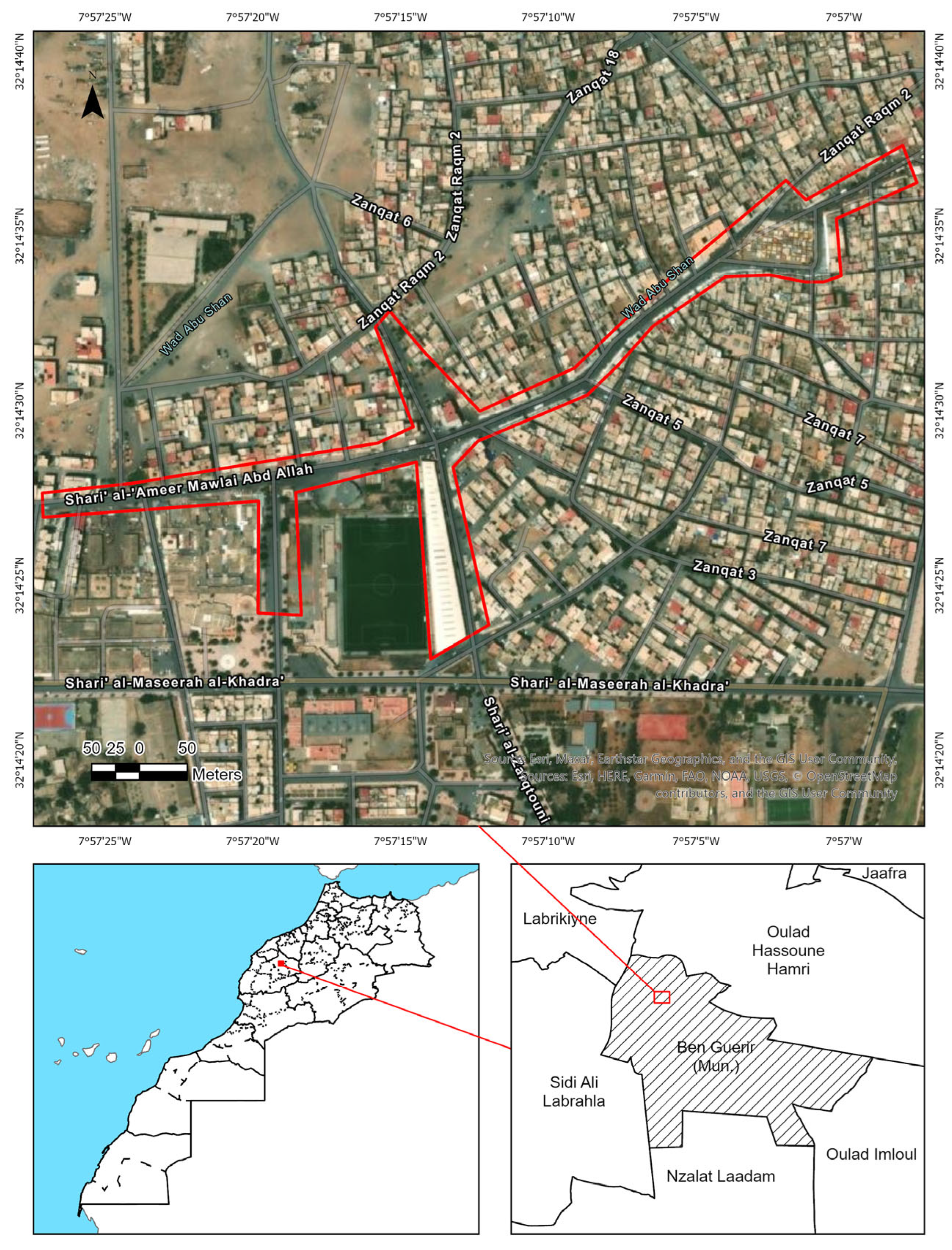
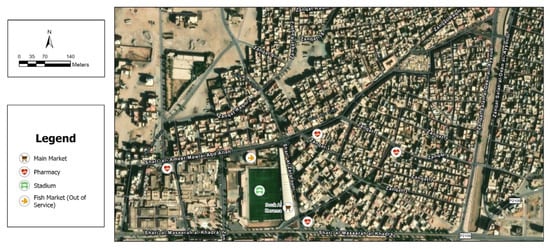
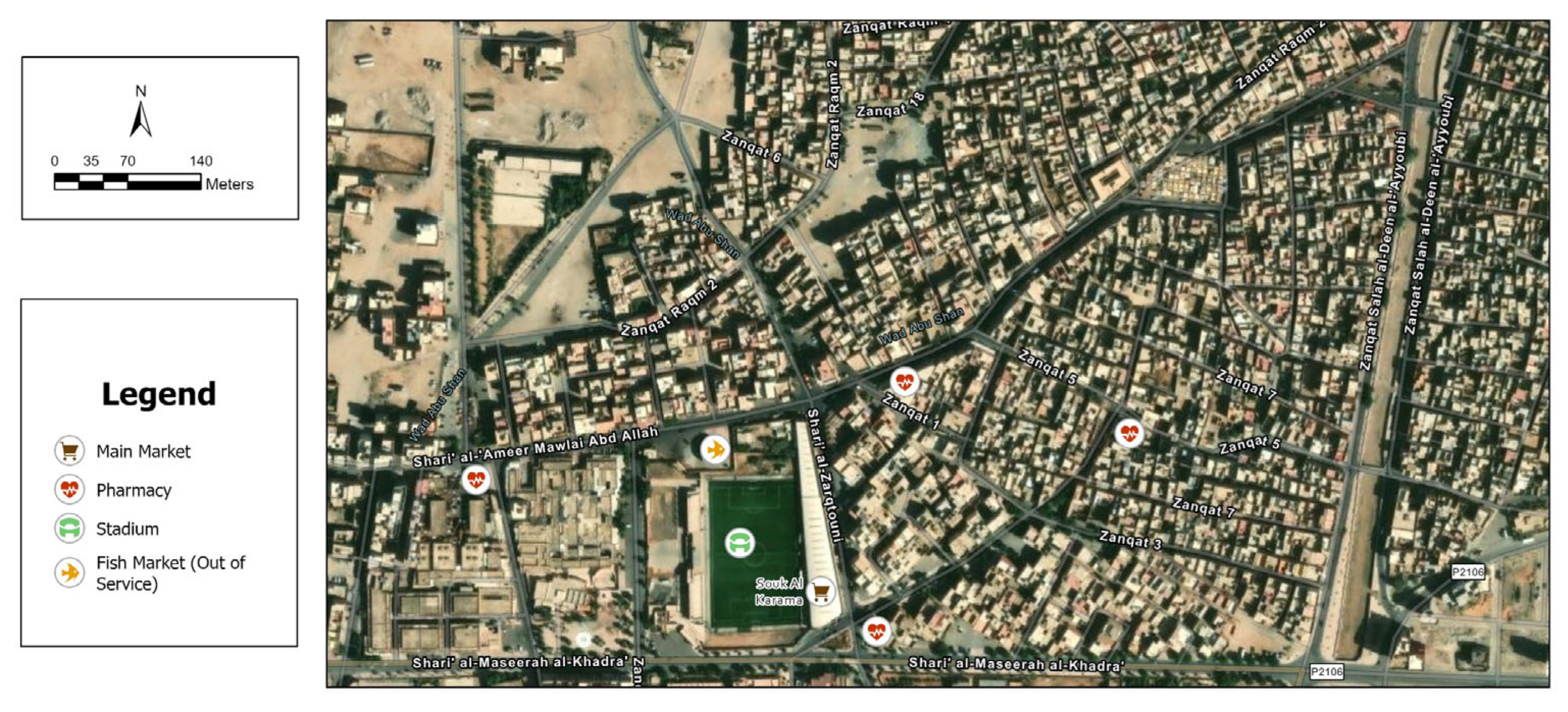
The study was conducted in Ben Guerir, Morocco, a rapidly transforming intermediary city shaped by major state-led development initiatives, including the establishment of Mohammed VI Polytechnic University (UM6P). The research focuses on Boulevard Moulay Abdallah (32.241360 N, 7.954120 W), the principal commercial corridor of the town and a high-footfall pedestrian environment with a dense concentration of informal street vendors. Crucially, the same corridor also hosts the formal Souk Al Karama market, a purpose-built facility constructed as a municipal relocation policy intended to absorb street vendors off the sidewalk and into a designated trading space. The juxtaposition of two co-located but functionally divergent spaces (a vibrant informal sidewalk economy and a chronically underutilised formal market) makes Boulevard Moulay Abdallah a uniquely diagnostic case for examining the relationship between spatial configuration and informal economic activity. Souk Al Karama is therefore treated not as an incidental feature of the site but as a central analytical anchor of the research design: it allows the study to test, within a single corridor, whether informal vending follows configurational logic and whether formal infrastructure displaced from that logic can attract activity. Figure 2 and Figure 3 illustrates this contrast, showing that the principal vending stretch of Boulevard Moulay Abdallah is closely aligned with the most convenient pedestrian paths, whereas the purpose-built Souk Al Karama is set back from the main movement course.
Figure 2.
Spatial context of the study area in Ben Guerir, Morocco. The red outline indicates the high-density informal vending corridor along Boulevard Moulay Abdallah, while the white footprint highlights the formal Souk Al Karama market located adjacent to the Municipal Stadium. Source: Authors’ elaboration based on field survey and GIS analysis.
Figure 3.
Urban infrastructure map illustrating the spatial mismatch between formal infrastructure vacancy and informal vending activity along Boulevard Moulay Abdallah. Source: Authors’ elaboration based on field survey and GIS mapping (2026).
3.3. Data Collection Methods
As illustrated in the methodological framework (Figure 1), the data collection process was operationalized through three distinct methods.
3.3.1. Spatial Analysis (Space Syntax)
To analyse the configurational properties of the study area, Space Syntax analysis was conducted using ArcGIS Pro (v3.1) following established axial- and segment-map procedures [35,36]. The street network was digitised from a combination of OpenStreetMap base data and high-resolution satellite imagery, and then field-verified during the observation period to capture lanes and pedestrian connections omitted from public datasets. The network was cleaned to remove disconnected segments and dangling lines, and converted into an axial representation, from which a segment map was generated. From the segment map we computed global integration (Rn) and choice (betweenness) as standard measures of spatial accessibility and movement potential within the urban grid. Global integration at the full radius (Rn) was selected as the primary measure because the research question concerns urban-scale centrality and its relationship to vending location; intermediate radii (R3 to R9), which capture neighbourhood-scale movement, were computed in parallel as a robustness check and yielded a consistent ranking of the principal corridors. To define discrete accessibility classes, the continuous segment-level integration (Rn) values were grouped into three zones reflecting the observed distribution of integration along the corridor: a High-integration zone (Rn ≥ 1.42), corresponding to the well-connected central corridor; a Low-integration zone (Rn ≤ 1.12), corresponding to the peripheral sections adjacent to the Souk Al Karama complex; and a Medium-integration zone spanning the intermediate values (1.12 < Rn < 1.42). These thresholds were derived from the integration values themselves, independently of vendor locations, so that the zones reflect the configurational structure of the street network rather than observed activity. The 158 vendor point locations recorded during behavioural mapping were then overlaid on the classified integration map and cross-tabulated against the three zones to test for spatial coincidence. Separately, the distribution of vendor points was visualised as a kernel-density (heat map) surface to illustrate observed clustering; this density surface is descriptive only and was not used to define the integration zones.
3.3.2. Behavioural Mapping
Systematic in situ observations were used to conduct behavioural mapping along Boulevard Moulay Abdallah, a method widely adopted in urban studies to examine spatial occupancy and interaction in public space [16,37]. Observations were conducted by two trained observers across three daily time periods (morning 08:00 to 10:00, midday 12:00 to 14:00, and late afternoon 16:00 to 18:00) on six non-consecutive weekdays during the field period, yielding 18 time-bounded observation sessions. During each session the observers walked a fixed transect at a steady pace and recorded vendor locations on a printed base map, supplemented by time-stamped photographs and a structured observation sheet adapted from Gehl and Svarre [16]. Recorded categories included: vendor count and location, vendor mobility (fixed stall, semi-fixed cart, or ambulant), grouping behaviour, primary user activity (vending, walking, stationary, socialising), and degree of sidewalk obstruction. Across all sessions, 158 distinct vendor instances were recorded. To assess inter-observer reliability, the two observers independently mapped the same 200 m segment during three sessions; agreement on vendor counts and mobility categories was 92% and 88% respectively, judged acceptable for descriptive spatial analysis. Repeat sampling across days and time-bands further limited the influence of single-day variation and observer drift.
3.3.3. Perception Survey
The survey on perception was organized to define the attitudes of the users towards informal vending and access to the sidewalks. The survey was conducted on three groups in the study area through a purposive sampling method.
- Pedestrians;
- Street vendors;
- Nearby shop owners.
The survey was administered face-to-face along Boulevard Moulay Abdallah during the same field period as the behavioural mapping. The total sample comprised 120 participants (n = 120), distributed across the three stakeholder groups as follows: 60 pedestrians (50%), 30 street vendors (25%), and 30 nearby shopkeepers (25%). The quota was set to give analytical weight to vendors and shopkeepers, who are the primary contestants in disputes over sidewalk space, while ensuring sufficient representation of the broader pedestrian public. Within each stratum, participants were recruited through purposive on-street sampling, alternating between the northern, central, and southern segments of the corridor and between the three daily time-bands to capture variation across both space and time of day. Sample size was determined as appropriate for an exploratory mixed-methods case study aimed at descriptive triangulation rather than population-level inference, and is consistent with comparable studies of informal vending in intermediary cities [12]. The questionnaire combined closed-ended and open-ended items addressing access, congestion, safety, perceived economic value, and equity in the use of public space. Participation was voluntary and anonymous; verbal informed consent was obtained from each respondent in the language of their choice (Arabic, French or English) prior to administration, and respondents were free to withdraw at any point. No personally identifying information was recorded, and all survey responses were stored on a password-protected device accessible only to the research team. Under the policy on human-subjects research at Université Mohammed VI Polytechnique (UM6P), anonymous on-street perception surveys of this kind do not require formal ethics committee approval; the protocol nonetheless followed the institution’s general guidance on ethical research with human participants.
3.4. Data Analysis
The analysis of the data occurred by combining the results of the spatial, observational, and survey data. The output of Space Syntax was put in comparison to the patterns of distribution of vendors, which were already determined. There was descriptive analysis of behavioural mapping data, in which spatial clustering and time variations were observed. The analysis of the responses to the survey was performed statistically, with the help of frequency distributions and cross tabulations in the case of necessity. Mapping results involved superimposition of vendor points on integration maps and time-based activity figures describing day-to-day activity rhythms of the sidewalks. This triangulation strategy was intended to strengthen the reliability and interpretive validity of the findings.
4. Results
This section presents the empirical findings from the research, using a mixed-methods approach. The first part outlines the spatial characteristics of the study area, mapping the key locations where vendors have access and are therefore able to operate. The second part examines how vendors behave in these public spaces, and what effects time and place have upon their behaviours. The final part presents the results of an opinion survey regarding how pedestrians and other users perceive the vendors, as well as how vendors view themselves with regard to credibility and physical safety. Together, the results of these three analytical streams help to illustrate the complexity of the socio-spatial dynamics associated with informal vending in Ben Guerir.
4.1. Spatial Configuration Findings
A spatial syntax analysis also indicated a distinct separation between the different spaces along the study corridor. The values of global integration along Boulevard Moulay Abdallah were greatest in the middle of the corridor (Rn range: 1.42–1.68), indicating a well-connected urban grid pattern. Conversely, the integration values were significantly lower along the periphery sections, especially in the sections adjacent to the Souk Al Karama complex (Rn range: 0.87–1.12).
The analysis of the overlapping of actual spatial results with locations where the vendors are located has shown that the informal economy is highly correlated to levels of access. Overlaying the 158 identified vendor locations on the integration zones (defined above from Rn thresholds, independently of vendor positions) shows that 120 vendors (76%) fell within the High-integration zone (Rn ≥ 1.42), while the remaining 38 vendors (24%) were located in the Medium- and Low-integration zones combined. Because the zones were derived from the configurational structure of the network rather than from vendor density, this concentration is more plausibly read as an association between spatial accessibility and vending activity than as an artefact of how the zones were drawn. The results of this study are consistent with previous studies of urban areas that indicate spatial accessibility and pedestrian mobility are two of the most significant factors that will determine where activities will take place in an urban area [7,14].
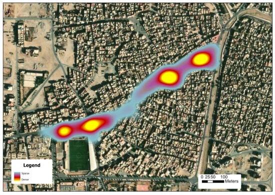
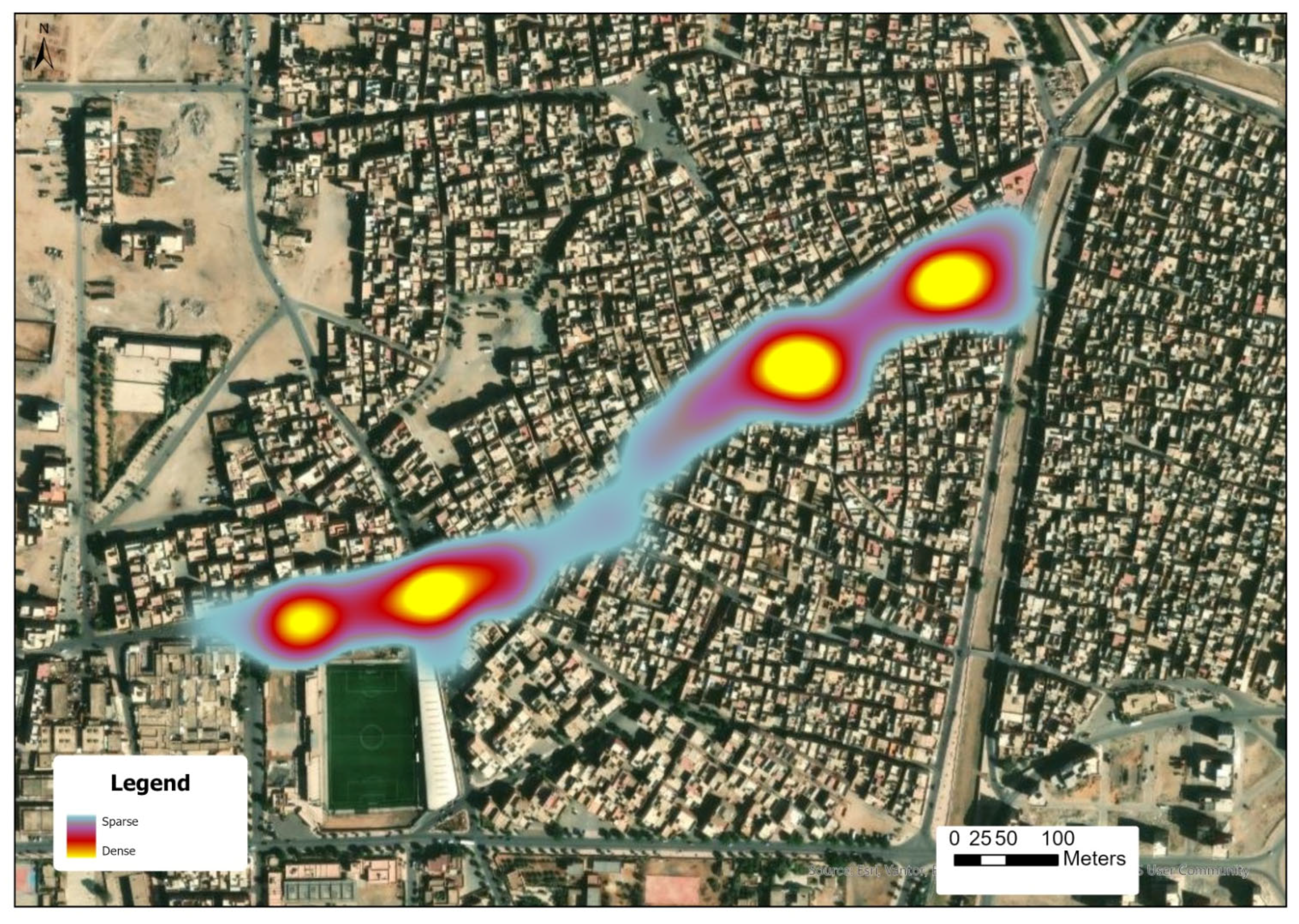
To gain more insight into the spatial arrangement of street vendors, a heat-map was created to illustrate the trends in vendor density across the study area (Figure 4). As indicated by Figure 4, the locations of vendor activity are concentrated or clustered in certain areas along Boulevard Moulay Abdallah and have created distinct spatial patterns based on pedestrian foot traffic density. Clusters of vendors are more prevalent at different types of intersections and transition areas, where there are two higher degrees of spatial permeability and visibility as well as greater numbers of pedestrians passing through along the same route. Taken together, these results suggest that the spatial distribution of vendors is unlikely to be random, appearing instead to be associated with pedestrian ease of access and broader trends in pedestrian flow.
Figure 4.
Heat map illustrating the spatial distribution of street vendor density (n = 158) along Boulevard Moulay Abdallah. High-density clusters (yellow-red) are concentrated at major intersections and commercial frontages. Source: Authors’ elaboration based on field survey and GIS analysis.
4.2. Behavioural Mapping Results
Having established where the urban grid concentrates structural accessibility, the behavioural mapping turns to how that potential is taken up in practice over the course of the day. Spatial clustering patterns of vending were identifiable within the behavioural mapping; in particular, vendor clustering occurred at intersections and commercial frontages. The slowing down of pedestrian flows at these locations created greater opportunity for interaction between pedestrians and vendors. Throughout all observation periods, vending was the most frequently observed stationary activity (58%), followed by informal social interactions (23%), and resting activities (19%) respectively. Vendors commonly adapted their spatial behaviour according to changes in pedestrian traffic and environmental factors, thus changing their position(s).
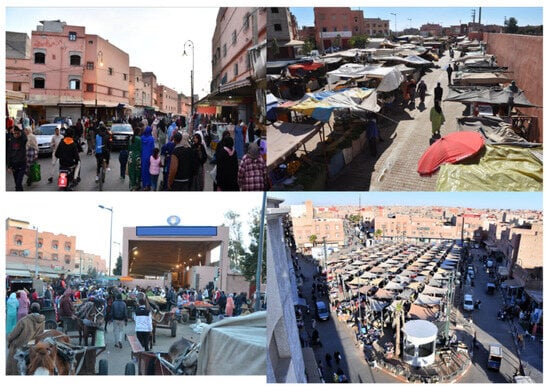
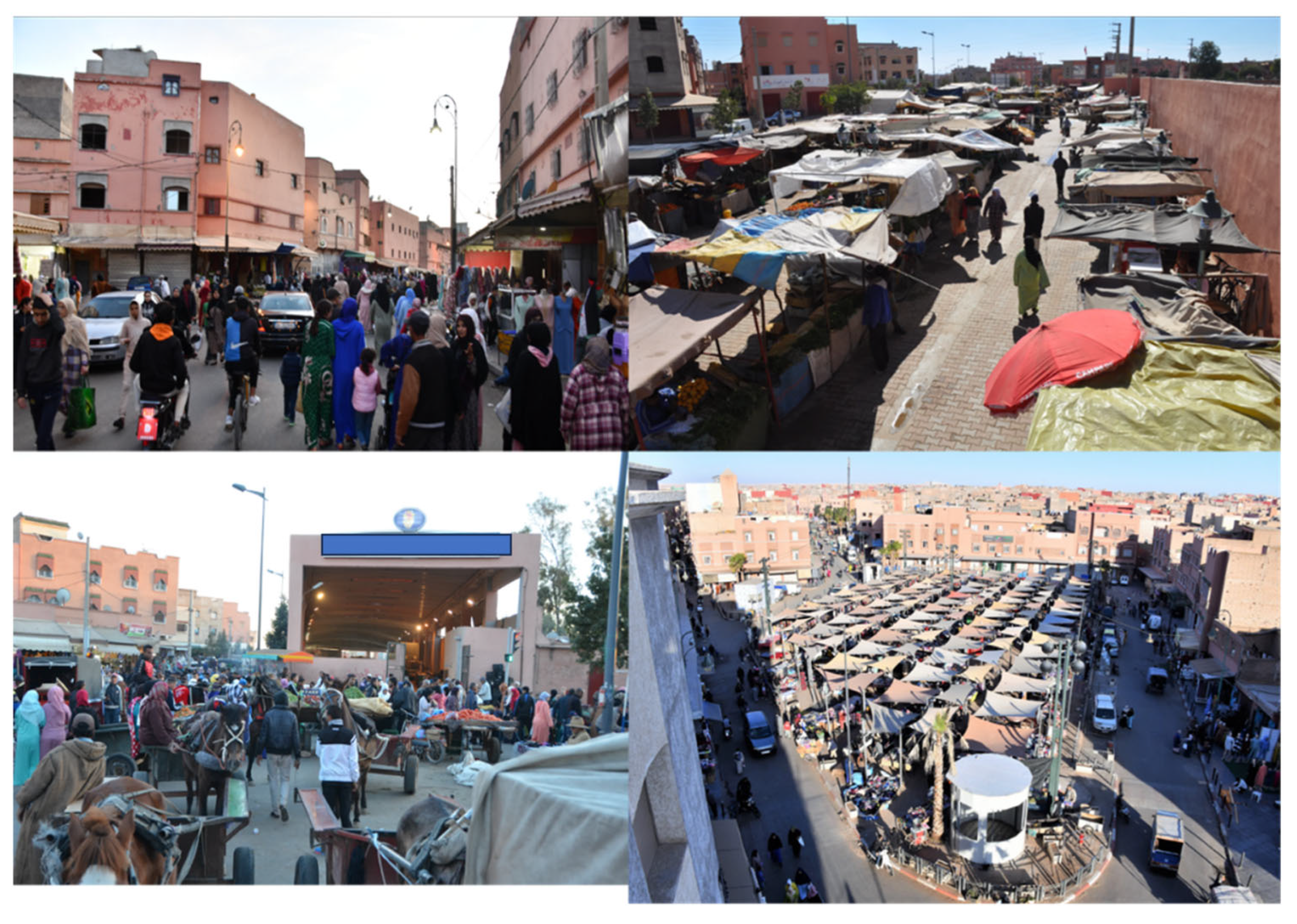
The analysis by time period revealed marked variation in activity levels, which is presented in Table 1. The greatest density of vendors occurred in both the midday and late afternoon. Specifically, from the 158 vendors recorded, 61 (39%) were observed in the midday time frame, compared to 54 (34%) in the late afternoon time frame and 43 (27%) during the morning readings. The informal vendors are primarily located at intersections and commercial frontages, areas where individuals are more likely to walk slowly and engage with each other, versus outside of these areas where the formal infrastructure is typically underused, as shown in Figure 5.
Table 1.
Temporal Distribution of Vendor Activity.
Figure 5.
Contrasting spatial dynamics of formal and informal commercial activities. Top and bottom-right: high-density informal vending activities occupying intersections and sidewalks; bottom-left: the formal Souk Al Karama market showing limited commercial activity. Source: Authors’ field photographs (2024).
4.3. Survey Findings
Building on the spatial and behavioural results, the perception survey assessed how the three stakeholder groups evaluate informal vending, congestion, and access. The responses reveal a range of attitudes rather than a single shared view. According to the survey data in Table 2, of 120 respondents—77 or 64% said they believed the informal street trade has economic importance. However, respondents also had considerable concern about accessibility and congestion when using the sidewalk. About 69 or 58% had problems navigating very congested sidewalks. Respondents could express more than one opinion; therefore, some opinions overlap.
Table 2.
Survey Perceptions of Informal Street Vending.
There were varying types of perception from each group of users. Pedestrians reported more concerns related to congestion than other users did, while owners of shops immediately adjacent to informally vending businesses reported less congestion and greater issues surrounding competition for space with the informal vendors. The vendors themselves were mostly supportive of regulations that promote co-existence between vendors and the other users of the sidewalk.
5. Discussion
5.1. Rethinking “Encroachment”: Vendors as Spatially Rational Actors
This section examines the empirical results through the theoretical frames of spatial justice and informal urbanism established previously. Section 5.1 reviews street vending as a context-sensitive use of space and revisits conventional readings of urban encroachment; Section 5.2 examines competing claims to the sidewalk; Section 5.3 turns to the formal planning challenges illustrated by Souk Al Karama; and Section 5.4 and Section 5.5 address policy implications and the limitations of the study.
Before turning to the Ben Guerir results in detail, it is useful to situate them within a broader body of Space Syntax scholarship that has been used to decode urban dynamics across very different geographical contexts. Our findings on the relationship between spatial configuration, pedestrian flows, and informal vending engage directly with this literature that has been used to decode urban dynamics across very different geographical contexts. Two comparative cases are particularly instructive for the present study. In the North African context of Cairo, Abusaada and Elshater [38] demonstrate that street connectivity and configurational legibility directly shape pedestrian walkability and public health, and that the removal of visual and physical obstructions from highly integrated corridors encourages active mobility and reduces spatial stress. Read against Ben Guerir, their Cairo analysis suggests that the high-integration corridor along Boulevard Moulay Abdallah is not simply attractive to vendors; it is also where pedestrian wellbeing is most at stake, which raises the political and design question of how a single corridor accommodates competing claims from walkers, vendors, and shopkeepers. In a very different setting, Saygi [39] uses Space Syntax and isovist analysis on the historical fabric of Edo/Tokyo to show how geometric configuration sustains a functional contrast between highly visible commercial arteries and visually segregated, community-driven backstreets, with informal social interaction and small-scale exchange concentrating in the configurationally connected but visually negotiated spaces between them. The relevance for Ben Guerir is twofold: first, the persistence of vending on the most integrated edges of the grid mirrors the long-run pattern Saygi documents, in which configuration, rather than formal designation, anchors everyday economic life; second, it suggests that the underutilisation of the formally designated Souk Al Karama, located off the principal axes of movement, is not a Ben Guerir-specific anomaly but a predictable outcome when relocation policy ignores the configurational logic both cases identify. Taken together, Abusaada and Elshater [38] and Saygi [39] provide the comparative scaffolding within which our findings should be read: informal street vendors do not occupy space randomly; they decode and leverage the topological advantages of the urban grid in ways that planning instruments may do better to engage with rather than override.
The results invite a reconsideration of mainstream planning discourses that view street vending primarily as spatial disorder or intrusion. They point to a discernible relationship between spatial accessibility and vendor distribution. Table 3 indicates that 76 percent of the vendors (n = 120 of 158) were located in the most integrated areas on the urban grid, especially at intersections and transitional areas involving heavy foot traffic. This distribution is consistent with the argument that informal vending tends to follow a discernible spatial logic rather than occurring randomly [7,11].
Table 3.
Distribution of Vendors by Spatial Integration Level.
This interpretation is further supported by behavioural mapping. The volatility of the variable vending concentrations in response to temporal changes in pedestrian flow is, on the one hand, demonstrated by the fact that vending is more denser during high activity times (39% of the day during midday and 34% of the day during late afternoon) (Table 1). Such adaptive action is indicative of changes in relation to mobility and economic prospects, and fits the description of informal urbanism to be flexible and sensitive to its surroundings [12,40]. Restructuring vending as a logical activity of space moves the analytical emphasis of enforcement to the interpretation of what repeatedly happens to informal economies: what socially and spatially provides support. This is in line with the new theoretical insights, which place informality as a socially embedded and rational aspect of city systems, as opposed to a peripheral deviance [21,25].
Beyond simply showing that street vending is not randomly distributed, the findings suggest that informal practices are a way for people to turn urban accessibility into real economic opportunities. The tendency of vendors to cluster in the most accessible parts of the city means they are constantly adapting to where people move, making the most of busy areas to support their livelihoods.
In this way, street vending reveals how city centers really work, highlighting the gap between where planners think people will go and where people actually spend their time. This view builds on recent studies by showing that informality not only adapts to the city, but also makes clear how urban spaces are truly used day-to-day [7].
5.2. The Right to the Sidewalk: A Spatial Justice Perspective
The results of the empirical investigation also give an understanding of the conflicts over the space of sidewalks through the lens of spatial justice. The results of the survey show that 64 percent of participants are aware of the economic importance of street vending, with 58 percent of the respondents citing issues that concern congestion and accessibility (Table 2). This duality reveals the state of simultaneous tolerance and tension in the use of a public space, indicating the element of negotiability of sidewalks as a common urban environment. Theoretically, the findings are consistent with the ideas of Right to the City proposed by Lefebvre [8] and the focus of Mitchell [9] on the idea of the public space as a negotiating place. The information indicates that informal vendors are no peripheral participants, but they are also involved in the formation of urban space, trying to establish themselves in the most accessible and economically relevant areas. Meanwhile, the mentioned issues concerning congestion mean that there should be some governance strategies that incorporate several claims on the space. Read in this light, fair use of the sidewalk is arguably better approached as a matter of negotiated coexistence than through an exclusionary paradigm.
Sidewalks can be made more accessible by implementing spatial justice through appropriate design and governance interventions that enhance their use. The presence of many vendors in areas that are located on the urban grid was used to develop a new understanding of how to make those areas pedestrian-friendly and support informal economic activity. For example, through the reorganization of specific, highly utilized areas of the grid to establish separate areas for pedestrians and vendors, conflicts can be reduced, while still allowing the area to serve as an economic area.
Temporal patterns identified through this study (e.g., peak activity is most concentrated at midday and late afternoon) also indicate that time-based management systems will become increasingly important. By utilizing time-allocated use of space with respect to peak activity times (i.e., flexible/cyclic use of space), circulation and economic efficiency could be improved without requiring permanent spatial separation.
Recent international planning frameworks advocate for inclusive and people-centred urban design; two examples include the New Urban Agenda [41], which explores how public spaces can act as drivers of equity and economic inclusion, and the Global Public Space Toolkit from UN-Habitat [42] recommending that streets are designed with multiple functions to accommodate diverse and competing needs. From this perspective, the management of sidewalk space moves away from being controlled as exclusionary, towards adaptive configurations that reflect the ever-changing and negotiated nature of urban experience.
5.3. The Failure of Formal Planning: Explaining the Underutilization of Souk Al Karama
The example of Souk Al Karama provides a central empirical baseline for understanding the failure of conventional relocation policies. By directly comparing the indoor formal market to the contested outdoor sidewalks, we see sharp configurational and behavioural disparities emerge. The spatial analysis reveals that the integration values of the isolated grid surrounding the formal market are significantly lower (Rn range: 0.87–1.12) than those of the highly integrated main commercial corridors (Rn range: 1.42–1.68). This mathematical deficit in pedestrian potential correlates directly with our behavioural mapping and occupancy indicators: the formal market attracted a mere 8% of the observed vendors, whereas 76% clustered organically along the highly integrated main axes. This comparison shows that Souk Al Karama’s underutilization is not merely an administrative issue, but a structural disconnect between formal urban design and the socio-spatial logic of informal economies.
The lack of congruity between projected urban infrastructure and the real flows in the city can be used to clarify why the Souk Al Karama is underutilized. Although the market is aimed at being a relocation solution, it is unable to draw the number of pedestrians to facilitate economic activities among the vendors. The same consequences have been reported in other situations where the relocation plans failed to put into consideration the spatial dynamics [1,3]. The results of the analysis indicate that the impact of non-compliance with the regulations cannot be assumed as mere planning failures, but it is a more fundamental lack of connection between official design and lived in spatial cultures. This contradiction is also strengthened using visual evidence. The result of the space between the ideal planning space and actual urban space is the vibrant informal vending landscape in sharp contrast with the low activity levels found at the Souk Al Karama facility, as depicted in Figure 4.
These findings highlight how relocation-based planning approaches, disconnected from the spatial logic of urban systems, tend to limit opportunities for businesses to thrive, as evidenced by Souk Al Karama. Underutilization of the formal marketplace is only one example of this. Additionally, it can also be attributed to an economic and spatial disconnect (that is the “configurational dynamics”) between the spatial planning ‘interventions’ that have occurred and how pedestrian traffic flows through an area (and thus affects how businesses will operate).
The disconnection between abstract spaces (made through regulations or designs) versus lived or experienced spaces (produced through day-to-day practice) is an evident example of a failure to plan properly. Additionally, moving strategies which prioritize formal order at the expense of accessibility will displace, rather than reorganize, informal economies from their original location due to a lack of access to the new location (between new and old infrastructures). Therefore, once again, informal activities will tend to return to areas that support high-intensity traffic, and will not benefit from any form of programmed infrastructure, because programmed infrastructure will not have been integrated with the transport system.
The multitude of studies supporting these findings align with the increasing literature, which believes that informalities should not be addressed by displacing them spatially, but rather integrating them into the already established urban dynamics [7,11]. Souk Al Karama’s case exemplifies how planning interventions that do not incorporate the spatial conditions of access and visibility are unlikely to yield lasting success, however carefully they may be formally or institutionally designed.
5.4. Toward Inclusive Planning: Coexistence Strategies and Policy Implications
The added value of this study goes beyond the expected conclusion that vendors cluster in pedestrian-rich locations. By triangulating spatial, behavioural, and perceptual evidence, it offers a diagnostic tool that changes how urban planning decisions are made. Rather than relying on abstract zoning to dictate where formal markets should be built, an approach that often leaves vacant infrastructures like Souk Al Karama, planners can now treat configurational accessibility (Space Syntax) as an empirical guide for site selection. Integrating behavioural rhythms further allows authorities to calibrate temporal regulations, such as flexible vending hours, rather than impose blanket evictions, while perceptual data establishes social tolerance thresholds for street design. This multipronged approach ultimately shifts the planning paradigm from reactive spatial exclusion to proactive, evidence-based socio-spatial coexistence. The high concentration of vendors in high-integration areas (76%) suggests that these zones are structurally well placed in case of economic activity, and must be taken into consideration when developing interventions. Meanwhile, regarding the results of the survey, 58 per cent worry about congestion, indicating the significance of spatial conflict management to ensure access. The inclusivity planning strategies must hence be based on organizing, and not eradicating, the vending activities. Planning solutions, including special vending areas in high-traffic zones, better sidewalk patterns, and flexible infrastructure, can be used to enhance movement as well as trade. Moreover, the detected temporal changes in the activity of vending indicate that the changes in the flexibility of enforcing the temporary policies can be more effective than the enforcing strategies that are fixed in time. Those results align with the recent demands to diversify and make more responsive urban governmental structures that acknowledge the systems nature of informality in the rapidly changing urban environment [6,34].
Finally, more responsive and evidence-based urban governance can be based on the combination of spatial analysis, behavioural data, and user perceptions. Through harmonizing spatial planning approaches with established societal spatial patterns and mind-sets, cities can be brought to achieve a more just and sustainable system of managing the urban space.
To move beyond the descriptive register and operationalise these contributions for practitioners, the empirical findings of the study are distilled in Table 4 into five design and policy principles for inclusive sidewalk governance in intermediary cities. Each principle pairs a finding from the Ben Guerir case with a corresponding planning action and the evidence base supporting it. Taken together, the five principles are intended as a transferable framework for intermediary cities across the Global South where state-led urbanisation is producing similar mismatches between formal infrastructure and lived sidewalk practice.
Table 4.
Five design and policy principles for inclusive sidewalk governance in intermediary cities, derived from the Ben Guerir case.
According to the research we conducted, in order to make meaningful progress on SDG 11-Sustainable Cities and Communities, urban planners would benefit from placing comparable importance on providing formal infrastructure and on addressing spatial inequalities present within the municipalities, so that residents are better able to access public space in an equitable way. Greater attention should be paid to closing the socio-spatial gap between rigid formal planning processes and the actual lived experience of informal street vendors. Additionally, informal economies are closely linked to the urban spatial arrangement; therefore, advancing spatial justice is likely to require holistic, multi-sectoral governance, not simply relocating people spatially.
5.5. Limitations and Scope of Interpretation
Despite the high levels of spatial dependence connecting accessibility to the presence of vendors, care should be taken when interpreting the results. First, even though the spatial configuration of an intermediary city could be used to predict vendor presence, the presence of vendors should not be interpreted as being caused by spatial configuration alone. Regulation and social networks can also affect street vending [4]. Second, the results of this research are dependent on the conditions of each intermediary city; the same pattern may not be found in other metropolitan areas or informal settings.
Methodologically, differences in each stream of analysis constrain our analysis in terms of the tools available to us. For example, spatial analysis requires street network data, which does not account for micro-scale (i.e., small-size) urban design features such as the layout of the sidewalks as well as the quality of the environment [16]. Behavioural observations were also conducted during a specific period of time, therefore missing out on any changes that may occur in business activity seasonally. Lastly, survey responses may be subject to bias by the individual completing it due to instability in regard to regulation and our vulnerability level regarding street vending activities.
Triangulating spatial, observational, and perceptual data offsets individual drawbacks and collectively demonstrates a regularly occurring phenomenon in that informal vending in Ben Guerir arises as a rational response to difficulties of accessibility and economic necessity. The evidence assembled here suggests that space, time and perception are interconnected dimensions of how informal activities are arranged and how sidewalks are contested. These interconnections point to the value of moving beyond planning paradigms that conceive of formal and informal sectors in strictly dichotomous terms.
6. Conclusions
This study set out to examine whether informal street vending in Ben Guerir is better characterised as spatial disorder or as a structured, context-sensitive response to urban form. Evidence from the three analytical strands points more clearly toward the latter interpretation. Space Syntax analysis indicates that, in the case examined, vendor distribution is closely aligned with the highest-accessibility corridors in the urban grid rather than randomly scattered across the street network. Behavioural mapping suggests that this alignment is dynamic, shifting with fluctuations in pedestrian traffic over the course of the day. Survey data reveal that the majority of users simultaneously recognise the economic value of vending, while expressing legitimate concerns about congestion, a tension that points to the need for negotiated governance rather than exclusionary enforcement. Taken together, these findings invite a reframing of the sidewalk: less as a site of disorder to be cleared, and more as a contested commons where competing urban claims may benefit from inclusive, evidence-based management. The persistent underutilisation of Souk Al Karama further suggests that planning interventions disconnected from the spatial logic of pedestrian flows are likely to struggle to attract sustained use, irrespective of their formal design intent.
By operationalising the Right to the City framework within a quantifiable spatial context, this study advances informal urbanism theory beyond normative critique. It demonstrates empirically how spatial appropriation is enacted through everyday practice, and lends support to the argument that informality is better understood as an embedded feature of urban systems than as a peripheral or transient condition. These findings argue for repositioning informality within spatial justice discourse: less as a problem to be regulated away, and more as an organizing logic that planning would benefit from engaging with on its own terms.
At the policy level, the evidence points to three actionable directions. First, designated vending zones should be established within high-integration corridors where informal activity already concentrates organically, rather than in peripheral sites that lack pedestrian connectivity. Second, regulatory frameworks should be temporally flexible, calibrated to the peak activity periods identified through behavioural observation, rather than applied as fixed, time-insensitive restrictions. Third, modular and adaptable street infrastructure should be introduced to improve spatial organization, without displacing livelihoods or disrupting existing pedestrian flows. Together, these strategies offer a coexistence-based alternative to enforcement-driven approaches, grounded in the actual spatial and temporal rhythms of urban life.
Future research should extend this framework through longitudinal studies capable of tracking how informal vending patterns evolve under different policy conditions. Comparative analysis across Moroccan intermediary cities and broader African urban contexts would strengthen the generalisability of the findings. Expanding the analytical scope to include economic performance indicators and environmental quality measures would deepen understanding of how informal urban systems interact with formal planning outcomes. Finally, integrating emerging geospatial technologies, including real-time pedestrian sensing and machine learning-based activity mapping, with the human-centred observational methods applied here represents a promising avenue for developing more responsive and context-sensitive urban analytics.
Author Contributions
Conceptualization, O.K.; methodology, O.K. and A.L.; formal analysis, A.L.; investigation, O.K.; data curation, O.K. and A.L.; writing—original draft preparation, O.K.; writing—review and editing, J.C., A.L., R.A., M.A.S.A., S.A.E.A. and M.B.; visualization, A.L.; validation, A.L., R.A., M.A.S.A., S.A.E.A. and M.B.; supervision, J.C. All authors have read and agreed to the published version of the manuscript.
Funding
This research received no external funding.
Data Availability Statement
The data presented in this study are available on request from the corresponding author due to privacy restrictions, as the survey responses and vendor location data contain potentially identifying information.
Conflicts of Interest
The authors declare no conflict of interest.
References
- Swanson, K. Revanchist urbanism heads south: The regulation of indigenous beggars and street vendors in Ecuador. Antipode 2007, 39, 708–728. [Google Scholar] [CrossRef] [Scilit]
- Smith, N. After Tompkins Square Park: Degentrification and the Revanchist City. In Re-Presenting the City; King, A.D., Ed.; Palgrave: London, UK, 1996. [Google Scholar] [CrossRef] [Scilit]
- Winter, B.C. Reappropriating Public Space in Nanchang, China: A Study of Informal Street Vendors; University of South Florida: Tampa, FL, USA, 2017. [Google Scholar]
- Roever, S. Street vendors and regulations. In The Informal Economy Revisited; Routledge: Abingdon, UK, 2020; pp. 173–178. [Google Scholar]
- Kemajou, A.; Konou, A.A.; Jaligot, R.; Chenal, J. Analyzing four decades of literature on urban planning studies in Africa (1980–2020). Afr. Geogr. Rev. 2021, 40, 425–443. [Google Scholar] [CrossRef] [Scilit]
- Ablo, A.D. Private cities, land, and the transformation of Africa’s urban fringe. Urban Geogr. 2024, 45, 1214–1235. [Google Scholar] [CrossRef] [Scilit]
- Dovey, K.; Recio, R.B.; Pafka, E. The spatial logic of informal street vending in Manila: An assemblage approach. Space Polity 2022, 26, 192–215. [Google Scholar] [CrossRef] [Scilit]
- Lefebvre, H. Le Droit à la Ville; Anthropos: Paris, France, 1968. [Google Scholar]
- Mitchell, D. The Right to the City: Social Justice and the Fight for Public Space; Guilford Press: New York, NY, USA, 2003. [Google Scholar]
- Harvey, D. The right to the city. New Left Rev. 2008, 53, 23–40. [Google Scholar] [CrossRef] [Scilit]
- Roy, A. Urban informality: Toward an epistemology of planning. J. Am. Plan. Assoc. 2005, 71, 147–158. [Google Scholar] [CrossRef] [Scilit]
- Peimani, N.; Kamalipour, H. Informal Street vending: A systematic review. Land 2022, 11, 829. [Google Scholar] [CrossRef] [Scilit]
- Jacob, A.A. Influence of Urban Street Vending on Pedestrian Experience and Behaviour: A Systematic Quantitative Review. J. Contemp. Urban Aff. 2023, 7, 139–163. [Google Scholar] [CrossRef] [Scilit]
- Nathvani, R.; Clark, S.N.; Muller, E.; Alli, A.S.; Bennett, J.E.; Nimo, J.; Moses, J.B.; Baah, S.; Metzler, A.B.; Brauer, M.; et al. Characterisation of urban environment and activity across space and time using street images and deep learning in Accra. Sci. Rep. 2022, 12, 20470. [Google Scholar] [CrossRef] [Scilit] [PubMed]
- Zhang, X.; Shao, J. Evaluation of the suitability of street vending planning in urban public space in the post-COVID-19 era. Land 2024, 13, 489. [Google Scholar] [CrossRef] [Scilit]
- Gehl, J.; Svarre, B. Public Space, Public Life: An Interaction. In How to Study Public Life; Island Press: Washington, DC, USA, 2013. [Google Scholar] [CrossRef] [Scilit] [PubMed]
- Cross, J. Street vendors, and postmodernity: Conflict and compromise in the global economy. Int. J. Sociol. Soc. Policy 2000, 20, 29–51. [Google Scholar] [CrossRef] [Scilit]
- Kim, A.M. The mixed-use sidewalk: Vending and property rights in public space. J. Am. Plan. Assoc. 2012, 78, 225–238. [Google Scholar] [CrossRef] [Scilit]
- Lefebvre, H. The Production of Space; Nicholson-Smith, D., Translator; Blackwell: Oxford, UK, 1991. [Google Scholar]
- Lehmann, S. The unplanned city: Public space and the spatial character of urban informality. Emerald Open Res. 2023, 1, 5. [Google Scholar] [CrossRef] [Scilit]
- Dovey, K. Informality as the Ur-Form of Urbanity: Keeping the Ur- in Urban Studies. Int. J. Urban Reg. Res. 2025, 49, 39–51. [Google Scholar] [CrossRef] [Scilit]
- Anjaria, J.S. Street Hawkers and Public Space in Mumbai. Econ. Political Wkly. 2006, 41, 2140–2146. [Google Scholar]
- Addi, B.; Amoako, C.; Takyi, S.A.; Azunre, G.A.; Amponsah, O. Exploring the street economy in African cities: A review of practices, regulatory policies, and challenges of urban governance in Ghana. J. Urban Aff. 2024, 48, 515–534. [Google Scholar] [CrossRef] [Scilit]
- Takyi, S.A.; Ayoo, W.A.; Amponsah, O.; Liwur, S.B.; Mensah, H. Making a living out of illegality: Effects of street vending on the livelihoods of street vendors in the central business district of Accra. SN Soc. Sci. 2023, 3, 106. [Google Scholar] [CrossRef] [Scilit]
- Dell’Anno, R. Theories and definitions of the informal economy: A survey. J. Econ. Surv. 2022, 36, 1610–1643. [Google Scholar] [CrossRef] [Scilit]
- Batty, M. Integrating space syntax with spatial interaction. Urban Info 2022, 1, 4. [Google Scholar] [CrossRef] [Scilit]
- Youssef, K.A.; Youssef, A.M.A. Promoting spatial cognition in hospital buildings using space syntax analyses. J. Eng. Appl. Sci. 2022, 69, 101. [Google Scholar] [CrossRef] [Scilit]
- El-Darwish, I.I. Enhancing outdoor campus design by utilizing space syntax theory for social interaction locations. Ain Shams Eng. J. 2022, 13, 101524. [Google Scholar] [CrossRef] [Scilit]
- Yatmo, Y.A. Street vendors as ‘out of place’ urban elements. J. Urban Des. 2008, 13, 387–402. [Google Scholar] [CrossRef] [Scilit]
- Mohamed, A.A. Using BERTopic modelling to map the evolution of space syntax research. Land Use Policy 2025, 157, 107639. [Google Scholar] [CrossRef] [Scilit]
- Kitchin, R. The real-time city? Big data and smart urbanism. GeoJournal 2014, 79, 1–14. [Google Scholar] [CrossRef] [Scilit]
- Lnenicka, M.; Saxena, S. Re-defining open government data standards for smart cities’ websites: A case study of selected cities. Digit. Policy Regul. Gov. 2021, 23, 398–411. [Google Scholar] [CrossRef] [Scilit]
- Gehl, J. Cities for People; Island press: Washington, DC, USA, 2013. [Google Scholar]
- Banks, N.; Lombard, M.; Mitlin, D. Urban informality as a site of critical analysis. J. Dev. Stud. 2020, 56, 223–238. [Google Scholar] [CrossRef] [Scilit]
- Hillier, B.; Hanson, J. The Social Logic of Space; Cambridge University Press: Cambridge, UK, 1984. [Google Scholar] [CrossRef] [Scilit]
- Turner, A. From axial to road-centre lines: A new representation for space syntax and a new model of route choice for transport network analysis. Environ. Plan. B Plan. Des. 2007, 34, 539–555. [Google Scholar] [CrossRef] [Scilit]
- Marušić, B. Analysis of patterns of spatial occupancy in urban open space using behaviour maps and GIS. Urban Des. Int. 2011, 16, 36–50. [Google Scholar] [CrossRef] [Scilit]
- Abusaada, H.; Elshater, A. Revisiting urban street planning and design factors to promote walking as a physical activity for middle-class individuals with metabolic syndrome in Cairo, Egypt. Int. J. Environ. Res. Public Health 2024, 21, 402. [Google Scholar] [CrossRef] [Scilit] [PubMed]
- Saygi, G. Tracing the lost streets: A spatial mapping of Tokyo at the turn of the eighteenth century. J. Cult. Herit. Manag. Sustain. Dev. 2026, 16, 294–311. [Google Scholar]
- Piazzoni, F. Material agencies of survival: Street vending on a Roman bridge. Cities 2022, 123, 103412. [Google Scholar] [CrossRef] [Scilit]
- UN Habitat. New Urban Agenda; United Nations: New York, NY, USA, 2016. [Google Scholar]
- UN Habitat. Global Public Space Toolkit from Global Principles to Local Policies and Practice; United Nations Human Settlements Programme (UN-Habitat): Nairobi, Kenya, 2015. [Google Scholar]

Disclaimer/Publisher’s Note: The statements, opinions and data contained in all publications are solely those of the individual author(s) and contributor(s) and not of MDPI and/or the editor(s). MDPI and/or the editor(s) disclaim responsibility for any injury to people or property resulting from any ideas, methods, instructions or products referred to in the content. |
© 2026 by the authors. Licensee MDPI, Basel, Switzerland. This article is an open access article distributed under the terms and conditions of the Creative Commons Attribution (CC BY) license.