


Abstract
As an important part of territorial ecological restoration, existing research on mine ecological restoration largely focuses on individual mine restoration projects from an engineering perspective or the identification of restoration priorities from a purely ecological viewpoint. There is little consideration of integrated decision-making for mine ecological restoration at a whole-area spatial scale, and a spatial prioritization framework that simultaneously integrates ecological, habitat, and health-support dimensions remains absent. This study introduces a One Health framework, taking 169 mining brownfields in Longhu Town, Jinjiang City, Fujian Province as the study objects. Based on a whole-area spatial scale, ArcGIS (10.8) spatial analysis was conducted to construct a three-dimensional evaluation framework of environment, species, and health support from the three dimensions of ecological sensitivity and landscape visual sensitivity, bird habitat suitability, and the spatial provision of health facilities. The Analytic Hierarchy Process (AHP) was then combined to identify ecological restoration priorities and reuse zones, further exploring strategic guidance for the ecological restoration and reuse of mining brownfields oriented toward a One Health framework at the whole-area spatial scale. The results show that the 169 mine brownfields are concentrated around stone processing areas. Among them, 21 sites are prioritized for environmental restoration, 67 for bird habitat suitability improvement, and 93 for enhancing health facility provision; these are ultimately classified into three comprehensive restoration zones. This study can provide decision support for the differentiated restoration, reuse zoning, and spatial governance of mine brownfields within a whole-area spatial planning system.
1. Introduction
Brownfields are diverse in type, numerous, and widely distributed. Among them, areas created by mining activities that are now abandoned and have undergone varying degrees of disturbance and degradation are commonly referred to as mining brownfields [1,2,3,4]. Most mining brownfields have experienced prolonged, high-intensity resource extraction, which has persistently affected their ecological baseline, surface morphology, and spatial functions. They generally face compounded problems, including ecological degradation, landscape fragmentation, functional disconnection, and inadequate public services [5,6,7]. At the same time, mining brownfields often retain distinctive mining remnants, unique site configurations, and strong place identity. They therefore not only require ecological remediation but also possess potential for landscape transformation, spatial renewal, and land reuse [8,9,10]. In rapidly urbanizing regions, restored mining brownfields can be further converted into ecological parks, public open spaces, or other multifunctional spaces, thereby serving as important vehicles for land-use intensification and spatial optimization [9,10,11].
Existing research on the ecological restoration and reuse of mining brownfields concentrates on three main areas. First, pollution remediation and ecological recovery studies focus on soil and groundwater treatment, land reclamation, vegetation reconstruction, and mining ecosystem restoration [12,13,14]. Second, landscape reuse and industrial heritage renewal research emphasizes the conservation and transformation of mining remnants, industrial landscapes, and their spatial-cultural values. Concepts such as landscape urbanism, urban wildscapes, and brownfield greening have provided new spatial design perspectives for mining brownfield reuse [15,16]. Third, land redevelopment and spatial governance studies are beginning to examine the functional restructuring of brownfields within regional transformation and land governance from the perspectives of urban renewal, land readjustment, redevelopment suitability assessment, and integrated decision-making [17,18,19,20]. Studies have shown that brownfield redevelopment involves not only site contamination remediation and use conversion but is also closely related to ecosystem service enhancement, regional renewal, and the coordination of socioeconomic benefits [19,20,21,22]. Incorporating mining brownfields into green infrastructure networks, ecological restoration priority area identification, and regional land governance frameworks has gradually become an important research direction [23]. Relevant studies have offered useful explorations for brownfield identification, redevelopment assessment, and restoration priority area delineation from perspectives such as synergistic analysis of urban complex ecosystems and green infrastructure network connectivity [17,18].
Nevertheless, current mining brownfield research still has notable shortcomings in supporting differentiated restoration and reuse decisions. First, existing studies often target single objectives such as pollution control, ecological restoration, or landscape renewal, lacking an integrated assessment that combines ecological, habitat, and health-support needs within a unified framework [23,24]. Second, from the perspective of spatial scale, as an important component of territorial ecological restoration, most related studies focus on individual mine restoration projects from an engineering perspective or on restoration prioritization from a purely ecological viewpoint, and rarely reflect an integrated decision-making approach for mine ecological restoration at a whole-area spatial scale [13]. Third, although researchers increasingly recognize the connections between brownfields and green infrastructure, ecosystem services, and urban renewal, there remains no spatial prioritization framework that can simultaneously identify environmental restoration conditions, habitat support capacity, and health-support conditions, making it difficult to inform priority identification and differentiated reuse zoning [23,24]. Finally, the reuse of mining brownfields usually involves multi-objective trade-offs among ecological restoration, public service supplementation, landscape renewal, and construction development, yet existing studies provide insufficient clear spatial decision-making evidence [17,18]. Overall, current research on the differentiated restoration and reuse of mining brownfields still falls short in terms of whole-area spatial scale considerations, cross-dimensional comprehensive assessment, spatial priority identification, and zoning decision support.
In recent years, the “One Health” concept has provided a transdisciplinary perspective for understanding the interconnections among humans, other organisms, and the environment they share [24,25]. Jointly promoted by the World Health Organization, the Food and Agriculture Organization, the World Organization for Animal Health, and the United Nations Environment Programme, the concept emphasizes the interdependence of human, species, and environmental health and advocates for cross-disciplinary and cross-sectoral collaboration to address complex health and environmental issues [24,25,26]. Research has shown that in the context of urban stock land transformation, the value of One Health lies not in simply listing humans, organisms, and the environment as separate dimensions but in providing an integrative framework for the synergistic identification and coordinated governance of multiple effects [24,27,28]. For mining brownfields, restoration and reuse are linked not only to ecological and environmental improvement but also to the recovery of habitat support capacity and the optimization of health-support conditions, thus exhibiting a typical multi-objective coupling character. Approaching from a single perspective—pollution control, ecological restoration, or landscape renewal—cannot fully capture the restoration needs and spatial variations in mining brownfields under multi-dimensional governance objectives. Therefore, introducing One Health as an integrative lens into mining brownfield research can help identify multiple governance demands, including environmental restoration, habitat support, and health support, within a unified framework, and provide theoretical support for restoration priority differentiation and reuse zoning [24,25,26,29,30].
Longhu Town, Jinjiang City, Fujian Province, is a typical rapidly urbanizing coastal area. During the development of the stone industry, a large number and diverse types of mining brownfields were generated and left behind. The area simultaneously faces multiple practical challenges, including constricted ecological space, uneven public service provision, and rising demand for land reuse [31,32,33]. The 169 existing mining brownfields in Longhu Town are mostly abandoned building stone quarries [32]. The local authorities have long been committed to mine restoration through ecological greening and landform rehabilitation at individual sites from engineering and purely ecological perspectives, yet these efforts have struggled to resolve the coexistence of abandoned mines, rapid urban expansion, and growing ecological and public service needs [32,33]. For such areas, determining restoration sequence based solely on individual mines and a single ecological dimension can hardly address the compound governance demands that place equal emphasis on ecological restoration, habitat improvement, and health support. Thus, Longhu Town offers a representative case for identifying restoration priority areas and differentiated reuse zones for mining brownfields under multi-dimensional governance objectives at a whole-area spatial scale. On this basis, this study introduces a One Health framework, takes the mining brownfields in Longhu Town as the research objects, constructs a three-dimensional evaluation framework of environmental restoration, habitat support, and health support at a whole-area spatial scale, identifies restoration priority areas, and formulates differentiated reuse zones. The paper addresses the following three questions: (1) What spatial differentiation characteristics do the governance demands of mining brownfields exhibit across the three dimensions of environmental restoration, habitat support, and health support at a whole-area scale? (2) Do the priority areas identified under different dimensions overlap or misalign spatially? (3) Based on the integrated multi-dimensional evaluation results, how can a zoning decision oriented toward differentiated restoration and land reuse be developed at a whole-area scale? This study, on the one hand, builds a comprehensive evaluation framework that integrates environmental restoration, habitat support, and health support at a whole-area scale; on the other hand, it identifies spatial priority areas under different restoration demands within a whole-area spatial planning system at the case scale, forming a decision-support pathway for differentiated governance and reuse zoning [18,20,23].
2. Materials and Methods
2.1. Study Areas
Jinjiang City is located on the southeastern coast of Fujian Province, China, bordering the Taiwan Strait to the east. The terrain generally slopes from northwest to southeast and is dominated by low hills and plains, with the city surrounded by the sea on three sides. Longhu Town lies in the southeastern part of Jinjiang (Figure 1), covering an administrative area of 6304.05 ha and encompassing 42 administrative villages. It is one of the areas in Jinjiang with rapid township industrial development and concentrated construction activities [31]. Since the 1980s, Longhu Town has built a vibrant local industrial base centered on building-facing stone processing. From 2013 onward, driven by environmental pollution control requirements and operating losses, local stone processing enterprises gradually transformed, and the associated quarries were successively closed [32]. Longhu Town has 169 existing abandoned mining sites, which are located in the coastal zone of the subtropical hilly region as classified by China’s ecological restoration zoning for abandoned mines [4]. These sites are predominantly remnants of building stone extraction, consisting mainly of exposed bedrock areas formed by mining and later burial sites created by sand and soil accumulation and construction waste disposal [34]. They are characterized by minimal industrial pollution, small individual areas but large quantities, clustered distribution, and severe damage to vegetation, topography, and landform (Figure 2). Because such mining sites generally do not cause pollution to surrounding areas, the focus of their ecological governance lies in restoration and reuse, making them particularly suitable for green infrastructure-oriented transformation and reuse of mining brownfields [13,23]. With rapid regional economic development and continuous urban expansion, ecological space in Longhu Town has been increasingly squeezed (Figure 3, Table 1). In terms of land-use structure, construction land covers 2858.31 ha, accounting for 45.33% of the total area—substantially higher than forest land and water-source wetlands—indicating a high intensity of land development. Cultivated land covers 1810.35 ha (28.72%), while forest land and water-source wetlands cover 959.94 ha (15.23%) and 548.28 ha (8.70%), respectively (Table 1). This land-use pattern, dominated by construction land and cultivated land, further highlights the practical need to advance ecological restoration, supplement public services, and reuse stock land in parallel in Longhu Town. For years, the local authorities have primarily carried out ecological greening and landform rehabilitation at individual mining sites from a single ecological dimension. This approach can no longer meet the multi-objective balancing demands among ecological restoration, public service supplementation, landscape renewal, and construction development in the practical governance of Longhu Town.
Figure 1.
Location of Longhu Town.
Figure 2.
Representative Mining Brownfield Types.
Figure 3.
Current land use of Longhu Town.
Table 1.
Land-use types.
2.2. Data Sources
The data used in this study mainly include topography, vegetation, land use, mining brownfield boundaries, road networks, residential locations, administrative boundaries, and health facility points of interest (POI). All datasets are from 2024. To ensure consistency across multiple data sources in spatial analysis, all data were processed in ArcGIS (10.8) using unified coordinate transformation, format conversion, clipping, and spatial alignment. Raster data were resampled to a uniform resolution of 30 m × 30 m and clipped to the administrative boundary of Longhu Town. Vector data underwent coordinate system transformation and topology checks to meet the requirements of subsequent overlay analysis, distance analysis, and zoning identification. The digital elevation model (DEM) was obtained from the Geospatial Data Cloud of the Chinese Academy of Sciences, with a spatial resolution of 30 m, and was used to derive terrain factors such as elevation, slope, and aspect. Vegetation data were sourced from the National Ecological Science Data Center, also at a 30 m resolution, and were primarily used to calculate the normalized difference vegetation index (NDVI) and vegetation coverage. Data on mining brownfield patches, road networks, building addresses, land use, the administrative boundary of Longhu Town, and health facility POIs were provided by the Jinjiang Municipal Bureau of Natural Resources. Specifically, the mining brownfield patches were used to identify the study objects and carry out priority overlay analysis. Road network and building address data were mainly employed in landscape visual sensitivity assessment, bird habitat suitability analysis, and health facility spatial analysis. Land-use data were applied in ecological sensitivity assessment, bird food source identification, and landscape conspicuousness classification. Health facility POI data were used to evaluate the health-support dimension (Table 2).
Table 2.
Data sources and preprocessing.
Additionally, a full-coverage field survey and interview investigation were conducted for the 169 mining brownfields in Longhu Town from January 2023 to December 2024. Following the research framework (Figure 4), the environmental restoration dimension focused on investigating the topography, landform, vegetation, land use, and pollution levels of the mining brownfields and their surrounding areas (Figure 2). The habitat support dimension concentrated on surveying animal species and habitat conditions, hydrological conditions, roads, residential area distribution, and vegetation coverage. The health-support dimension focused on examining the distribution of basic service facilities that support residents’ daily lives and public service provision. Interviews were conducted at the village level to investigate residents’ needs for health facilities. Through the identification and digitization of field photographs, the boundaries, topography and landform, vegetation coverage of the mining brownfields, the extent of surrounding built-up areas, and the distribution of health infrastructure were verified and corrected in ArcGIS.
Figure 4.
Research technical route.
2.3. Methods
As an important component of territorial ecological restoration, current mining ecological restoration lacks an integrated decision-making approach at a whole-area spatial scale and a spatial prioritization framework that can simultaneously integrate ecological, habitat, and health-support dimensions [13,23]; this has been elaborated in the Section 1. Accordingly, this study introduces a One Health framework. Anchored in the current development needs of Longhu Town and the characteristics of its mining brownfields, ArcGIS spatial analysis was performed at a whole-area spatial scale to construct a three-dimensional evaluation framework encompassing environment, species, and health support from the dimensions of ecological sensitivity and landscape visual sensitivity, bird habitat suitability, and the spatial provision of health facilities. This framework aims to identify restoration priority areas and formulate differentiated reuse zones for mining brownfields, and further explore strategic guidance for the ecological restoration and reuse of mining brownfields oriented toward a One Health framework at a whole-area spatial scale (Figure 4). Specifically, spatial priority areas for environmental restoration, habitat support, and health support are first identified at the study area scale. Second, the mining brownfield patches are spatially overlaid with the evaluation results of each dimension to pinpoint priority restoration targets under different governance objectives. Finally, the Analytic Hierarchy Process (AHP) is employed to integrate the three dimensions, yielding comprehensive priority zoning and reuse schemes for mining brownfields (Figure 4). This study can provide decision support for the differentiated restoration, reuse zoning, and spatial governance of mining brownfields within a whole-area spatial planning system.
It should be noted that this study focuses on an integrated decision-making approach for mine ecological restoration at a whole-area spatial scale. The proposed framework prioritizes the restoration needs of the study area as a whole, particularly those of the surrounding areas of the mining brownfields, rather than the restoration preferences of individual brownfield sites; this serves as the basis for constructing the research framework and selecting the indicators. Furthermore, as elaborated in Section 2.1, the current development needs of Longhu Town and the characteristics of its mining brownfields have been detailed. Therefore, this study does not directly measure the complete state of “environmental health,” “species health,” and “human health.” Instead, guided by the study area’s demand for green infrastructure, it characterizes the governance demands and transformation potential of mining brownfields at a whole-area spatial scale through environmental restoration conditions, habitat support capacity based on bird habitat suitability, and the spatial provision of health facilities, respectively.
2.3.1. Prioritizing Ecological Restoration of Mining Brownfields at a Whole-Area Spatial Scale Based on the Environmental Restoration Dimension
The environmental restoration dimension is mainly used to identify, at a whole-area spatial scale, the restoration needs of the study area for mining brownfields in terms of ecological vulnerability and landscape exposure characteristics. This study incorporates both ecological sensitivity and landscape visual sensitivity into the environmental restoration dimension to comprehensively characterize the spatial differences in the study area’s restoration needs for mining brownfields regarding ecological stability, landscape exposure, and environmental governance pressure.
- (1)
- Ecological sensitivity assessment
Ecological sensitivity refers to the degree to which an ecosystem responds to external disturbances and the difficulty of its natural recovery. It reflects the impact of resource exploitation on Longhu Town’s ecosystems and their ecological vulnerability, and is used to assess the study area’s restoration needs for mining brownfields in terms of ecological stability [35]. Given that Longhu Town is underlain by low mountains, hills, and red soil platforms, dominated by bedrock coasts interspersed with headlands and bays, and has long been subjected to the dual disturbances of mining and urban construction [33], it is a typical area where natural evolution and human intervention are highly coupled. It is therefore necessary to comprehensively identify its ecological sensitivity characteristics from topography, vegetation, and land use. Accordingly, five factors elevation, slope, aspect, NDVI, and land-use type were selected for the ecological sensitivity assessment [36]. Based on the geomorphological features of the study area and existing research [37,38], elevation was graded as <50 m, 50~100 m, 100~150 m, 150~200 m, and >200 m to reflect topographic differences from coastal lowlands to hilly mining areas. Slope was graded as 0°~5°, 5°~10°, 10°~15°, 15°~20°, and >20° to represent surface erosion risk and sensitivity to soil and water loss. Aspect was classified according to differences in light and moisture conditions across orientations to reflect variations in vegetation growth environments under the coastal climatic background. Land-use types were ranked by ecological resistance and intensity of human disturbance. NDVI was graded as 0~0.2, 0.2~0.4, 0.4~0.6, 0.6~0.8, and >0.8, corresponding to different levels of vegetation coverage and ecological vitality. Factor weights were determined using the Analytic Hierarchy Process (AHP). A pairwise comparison matrix was constructed with ecological sensitivity as the target layer and elevation, aspect, slope, NDVI, and land use as the criterion layer. Six experts in landscape architecture and four local technicians were invited to make pairwise comparisons and assign values according to the scale method (Table 3). The weights were then calculated, and a consistency check was performed using Python (3.14.0). The results showed a consistency ratio (CR) of 0.0762 (<0.1), indicating that the matrix passed the consistency check and the weight results had acceptable reliability. The five factors were assigned raster values according to their weights and overlaid through weighted summation in ArcGIS to generate the ecological sensitivity index for the study area. Finally, the ecological sensitivity index was classified from low to high into Grades I to V using the natural breaks method in ArcGIS.
Table 3.
Classification and weight of ecological sensitivity assessment factors.
- (2)
- Landscape visual sensitivity assessment
Landscape visual sensitivity refers to the degree to which a landscape is observed, recognized, and noticed, comprehensively reflecting its visibility, legibility, clarity, and conspicuousness [39]. It is also an important indicator of landscape exposure characteristics and potential visual impacts [40]. In Longhu Town, the mining brownfields are mostly characterized by exposed bedrock, pronounced topographic relief, and high exposure in the coastal landscape, which gives them strong visual perceptibility. Given that such mining brownfields generally cause no pollution to surrounding areas and can potentially be transformed, following a green infrastructure-oriented approach, into green open spaces or landscape resources to supplement the regional ecological and public space system [13,23], this study selected five factors—relative slope, viewshed, visibility frequency, relative distance to roads, and conspicuousness—to conduct a landscape visual sensitivity assessment, so as to identify spatial differences in the study area’s restoration needs for mining brownfields in terms of landscape exposure, visual attraction, and potential visual governance pressure [41,42,43]. For the grading criteria, each factor is assigned values corresponding to visual sensitivity levels from low to high. Relative slope is graded according to slope gradient [41,42,43] to reflect differences in visual impact caused by topographical undulation. Viewshed is assigned a binary value based on visibility [41,42,43] and then incorporated into the weighted overlay in the comprehensive evaluation. Visibility frequency is graded according to the degree of landscape exposure along observation routes [41,42,43]. Relative distance to roads is graded along a visual perception gradient from far to near [41,42,43]. Conspicuousness is classified based on the visual distinctiveness of different surface types [41,42,43] (Table 4). Factor weights were determined using the Analytic Hierarchy Process (AHP). A pairwise comparison matrix was constructed with landscape visual sensitivity as the target layer and relative slope, viewshed, visibility frequency, relative distance to roads, and conspicuousness as the criterion layer. Ten experts in landscape architecture were invited to make pairwise comparisons and assign values according to the scale method (Table 4). The weights were calculated, and a consistency check was performed using Python. The results showed a consistency ratio (CR) of 0.0798 (<0.1), indicating that the matrix passed the consistency check and the weight results had acceptable reliability. The five factors were standardized, assigned raster values according to their weights, and overlaid through weighted summation in ArcGIS to generate the landscape visual sensitivity index for the study area. Finally, the natural breaks method was used to classify the index from low to high into Grades I to V.
Table 4.
Classification of landscape visual sensitivity assessment factors.
- (3)
- Comprehensive evaluation of the environmental restoration
The graded raster data of ecological sensitivity and landscape visual sensitivity were loaded into ArcGIS. After assigning corresponding weights to the two indicators based on expert questionnaire results, the weighted overlay method was applied to generate the composite index of the environmental restoration dimension for the study area. The natural breaks method in ArcGIS [41,42,43] was then used to classify the composite index into Grades I to V, thereby characterizing the spatial differentiation of the study area’s restoration needs for mining brownfields from low to high in the environmental restoration dimension.
- (4)
- Prioritizing ecological restoration of mining brownfields at a whole-area spatial scale based on the environmental restoration dimension
The mining brownfield patches were spatially overlaid with the comprehensive evaluation results of the environmental restoration dimension in ArcGIS. The 169 mining brownfields were assigned priorities based on the environmental restoration dimension grade of the grid cells they occupy, and were classified into different levels of environmental restoration priority zones. This step further translates the environmental restoration conditions at the study area scale down to individual mining brownfields, reflecting the environmental governance pressure on mining brownfields under the dual constraints of ecological vulnerability and landscape exposure in the study area at a whole-area spatial scale, and provides data support for the subsequent comprehensive priority evaluation and differentiated reuse zoning.
2.3.2. Prioritizing Ecological Restoration of Mining Brownfields at a Whole-Area Spatial Scale Based on the Habitat Support Dimension Using Bird Habitat Suitability
The habitat support dimension primarily identifies the restoration needs of the study area for mining brownfields in terms of species habitat support capacity at a whole-area spatial scale. A habitat is a living environment that provides the biotic and abiotic requirements for the complete life activities of a species [44], and habitat suitability assessment can relatively intuitively reflect a region’s capacity to support the survival, foraging, and reproduction of target species [45]. Longhu Town has a relatively small whole-area spatial scale and a high degree of urbanization; its ecological and environmental conditions cannot easily sustain complex habitats, making it difficult to simultaneously characterize the habitat requirements of all species. Meanwhile, bird observation data provided by the China Bird Report Center and the forestry and landscaping authorities of Jinjiang City indicate that certain bird species have become representative of the local habitat support capacity. For these reasons, bird habitat suitability was selected as a proxy indicator for assessing the restoration needs of the study area for mining brownfields in terms of habitat support conditions [16,46,47].
- (1)
- Bird habitat suitability assessment in the study area
Eight factors—bird-suitability elevation, bird-suitability aspect, bird-suitability slope, distance to water, vegetation coverage (FVC), food source, distance to roads, and distance to residential areas—were selected to evaluate bird habitat suitability [48,49,50]. Among them, bird-suitability elevation, aspect, and slope reflect the topographical conditions for nesting and activities of the target bird species. Distance to water represents the supportive role of water bodies in providing drinking water, foraging, and local microclimate regulation, serving as an important natural factor for habitat quality [51]. FVC indicates the degree of regional vegetation luxuriance and ecosystem stability; generally, higher vegetation coverage is more favorable for the habitation and nesting of target birds [52]. Food source is categorized based on the differences in food resources provided by different land-use types [49]. Distance to roads and distance to residential areas are used to characterize the potential intensity of human disturbance on bird habitats [46]. Based on the species, frequency, and stability of bird occurrences within Longhu Town provided by the China Bird Report Center and the forestry and landscaping authorities of Jinjiang City, the Light-vented Bulbul (Pycnonotus sinensis), Eurasian Tree Sparrow (Passer montanus), and Grey Heron (Ardea cinerea) were selected as target indicator bird species for habitat restoration in the study area. For the grading criteria, bird-suitability elevation was graded according to the suitable elevation range for the target species within the study area [48,49,50]. Bird-suitability slope was graded based on surface flatness and its influence on nesting and activities [48,49,50]. Bird-suitability aspect was classified by differences in light and moisture conditions [48,49,50]. Distance to water was graded according to the target species’ dependence on water bodies and the extent of the study area [51]. FVC, derived from NDVI, was graded using the natural breaks method [52]. Food source was ranked according to the likelihood of different land-use types providing food resources for the target birds [49]. Distance to roads and distance to residential areas were graded based on the sensitivity of the target species to disturbances from roads and human activities [46] (Table 5). Factor weights were determined using the Analytic Hierarchy Process (AHP). A pairwise comparison matrix was constructed with bird habitat suitability as the target layer, and bird-suitability elevation, bird-suitability aspect, bird-suitability slope, food source, FVC, distance to water, distance to roads, and distance to residential areas as the criterion layer. Four experts in landscape architecture, four local technicians, and two members of birdwatching organizations in Fujian Province were invited to make pairwise comparisons and assign values according to the scale method (Table 5). The weights were then calculated, and a consistency check was performed using Python. The results showed a consistency ratio (CR) of 0.0866 (<0.1), indicating that the matrix passed the consistency check and the weight results had acceptable reliability (Table 5). The eight factors—bird-suitability elevation, bird-suitability aspect, bird-suitability slope, food source, FVC, distance to water, distance to roads, and distance to residential areas—were assigned raster values according to their weights and overlaid through weighted summation in ArcGIS to generate the bird habitat suitability index for the study area. Finally, the ecological sensitivity index was classified from low to high into Grades I to V using the natural breaks method in ArcGIS.
Table 5.
Classification and weights of bird habitat suitability assessment factors.
- (2)
- Prioritizing ecological restoration of mining brownfields at a whole-area spatial scale based on the habitat support dimension using bird habitat suitability
The mining brownfield patches were spatially overlaid with the bird habitat suitability assessment results in ArcGIS. Based on the bird habitat suitability grade of the grid cells they occupy, the 169 mining brownfields were assigned priorities and classified into different levels of priority zones for habitat support restoration. This step translates the habitat support conditions from the study area scale down to individual mining brownfields, providing a basis for subsequent comprehensive priority identification and differentiated reuse zoning at a whole-area spatial scale.
2.3.3. Prioritizing Ecological Restoration of Mining Brownfields at a Whole-Area Spatial Scale Based on the Health-Support Dimension
The health-support dimension is mainly used to identify, at a whole-area spatial scale, spatial differences in the study area’s restoration needs for mining brownfields in terms of supporting residents’ daily lives, public service provision, and health-support environments. Meanwhile, as elaborated in Section 2.1 regarding the current development needs of Longhu Town and the characteristics of its mining brownfields, the selection and evaluation of indicators for the health-support dimension are guided by the study area’s demand for green infrastructure. Moreover, given the considerable difficulty of directly measuring residents’ health status at a whole-area spatial scale, the spatial provision of health facilities is adopted as a suitable proxy indicator for this dimension. By analyzing the spatial distribution characteristics of health facilities in the study area, it is possible to identify areas with weak health-support conditions at a whole-area scale, assess the demand for converting mining brownfields into green health facilities or the adequacy of existing green health facilities in surrounding areas, and further determine priority restoration targets for mining brownfields under the health-support dimension.
- (1)
- Spatial distribution analysis of health facilities in the study area
To characterize the study area’s restoration needs for mining brownfields in terms of health-support conditions, this study selected six categories of health facility POI data closely related to residents’ daily lives and public services for spatial distribution analysis: commercial services, parks and landscapes, environmental sanitation, education–culture and sports facilities, social welfare facilities, and medical services [53,54,55]. Together, these facilities constitute an important component of the health-support environment in the study area and can, to a certain extent, reflect spatial differences in public service provision and health-support conditions at a whole-area spatial scale. Accordingly, kernel density estimation was performed for each of the six categories using ArcGIS to identify their spatial agglomeration characteristics and distribution hotspots, providing a basis for the subsequent comprehensive evaluation.
- (2)
- Comprehensive evaluation of the health-support dimension based on the MaxEnt model
Building on the kernel density analysis of each category of health facilities, the MaxEnt model was further applied in combination with environmental variables to comprehensively evaluate the health-support conditions in the study area. MaxEnt (Maximum Entropy Model) is a machine learning method based on the maximum entropy principle. It can estimate the potential spatial distribution probability of a target subject within a study area by using the relationship between occurrence point data and environmental variables [56,57]. In this study, health facility POIs were used as occurrence data and combined with environmental variables to construct a MaxEnt model, which was employed to characterize the spatial agglomeration tendency of health facilities and the comprehensive differences in overall health-support needs at a whole-area spatial scale [58,59].
Specifically, let the occurrence points of health facilities in the study area be X, and the set of environmental variables be Y. The MaxEnt model estimates the target distribution by maximizing the conditional entropy while satisfying the sample constraints. Its expression is given by Formula (1).
Here, p(X, Y) denotes the conditional probability of a health facility occurring at spatial location x given the environmental variable Y, and H(X∣Y) is the relationship between health facility occurrence points and environmental variables. The objective of MaxEnt is to maximize the conditional entropy while meeting the constraints of training sample characteristics, as expressed in Formula (2), where X* represents the optimal probability distribution under the given constraints. This process, by constructing feature functions and environmental constraints, enables the model to estimate the spatial distribution probability of health-support conditions in the study area based on the known relationship between health facility occurrence points and environmental variables.
In this study, all categories of health facility POIs were input into the MaxEnt model together with the environmental variables, with the training set and test set comprising 781 and 260 occurrences, respectively. The model’s fitting performance was tested using the area under the receiver operating characteristic curve (AUC). The result showed an AUC of 0.844, indicating that the model has good explanatory ability and predictive performance. Based on the MaxEnt output, a spatial distribution probability map of the health-support needs in the study area was obtained, and the natural breaks method in ArcGIS was used to classify it from low to high into Grades I to V, thereby characterizing the spatial differentiation of health-support needs across the study area.
- (3)
- Prioritizing ecological restoration of mining brownfields at a whole-area spatial scale based on the health-support dimension
Based on the comprehensive evaluation of the health-support needs in the study area, a spatial overlay analysis was conducted between the mining brownfield patches and the health-support dimension evaluation results. Based on the health-support dimension grade of the grid cells they occupy, mining brownfield sites located in areas with weak health-support conditions that hold value for priority restoration and reuse were identified. This step aims to translate the health-support conditions at the study area scale down to individual mining brownfields, providing a basis for subsequent comprehensive priority identification and differentiated reuse zoning at a whole-area spatial scale.
2.3.4. Comprehensive Prioritization of Ecological Restoration for Mining Brownfields at a Whole-Area Spatial Scale Within a One Health Framework
Building on the identification of spatial priority areas for the environmental restoration, habitat support, and health-support dimensions, the Analytic Hierarchy Process (AHP) [25] was further introduced to integrate the three dimensions. This step aims to coordinate multi-dimensional governance needs from the integrative perspective of One Health at a whole-area spatial scale and to identify composite priority areas that single-dimension evaluations cannot fully reveal. A judgment matrix was constructed with the comprehensive evaluation of One Health needs as the target layer and environmental restoration, habitat support, and health support as the criterion layer. Ten experts in landscape architecture were invited to judge the relative importance of each pair of indicators. Factor weights were then calculated, and a consistency check was performed in Python. The calculated consistency ratio (CR) of the judgment matrix was 0.0706 (<0.1), indicating that both individual factors and the overall matrix passed the consistency check. Using the appropriate weights of the three dimensions (Table 6), a multi-factor raster overlay analysis was carried out in ArcGIS, and the natural breaks method in ArcGIS was applied to classify the comprehensive evaluation of One Health needs of the study area into three levels from low to high. The spatial data of mining brownfields were then overlaid with the One Health needs evaluation results through spatial vector overlay analysis to identify ecological restoration priorities based on the comprehensive evaluation grade of the grid cells they occupy, thereby exploring priority identification and reuse zoning for mining brownfields oriented toward One Health needs at a whole-area spatial scale [26].
Table 6.
Indicators of the three One Health dimensions.
3. Results
3.1. Spatial Distribution Analysis of Mining Brownfields in the Study Area
As shown in (Figure 5), there are 169 mining brownfields in Longhu Town, covering a total area of approximately 108.07 ha. They are spatially concentrated mainly in Xinjie, Sukeng, Hongxi, Wucuo, Shigui, and Nanxun villages. Field surveys indicate that stone processing enterprises were densely distributed around these areas, and nearby quarrying was historically adopted to obtain raw stone materials. Consequently, a large number of leftover mining brownfields were formed after industrial transformation and mine closures. The existing mining brownfields primarily consist of pits, sand storage yards, abandoned machinery, abandoned buildings, and abandoned roads, exhibiting a clustered, multi-type distribution pattern (Figure 3).
Figure 5.
Spatial distribution of mining brownfields in Longhu Town.
3.2. Prioritizing Ecological Restoration of Mining Brownfields at a Whole-Area Spatial Scale Based on the Environmental Restoration Dimension
Based on Figure 6 and Table 7, the areas with high ecological sensitivity (Grades IV~V) cover 407.35 ha, accounting for 7% of the study area, while those with high landscape visual sensitivity (Grades IV~V) cover 560.94 ha, accounting for 9%. Overall, the proportion of high-grade environmental restoration priority areas is relatively low, indicating that the environmental restoration conditions in Longhu Town are relatively weak. On this basis, by integrating the comprehensive evaluation results of ecological sensitivity and landscape visual sensitivity, the 169 mining brownfields were classified into three environmental restoration priority zones: Grade I, Grade II, and Grade III (Figure 7, Table 8). Among them, 21 mining brownfields fall into the Grade I zone, covering an area of 11.42 ha (10.57% of the total mining brownfield area); 89 sites fall into the Grade II zone, covering 54.46 ha (50.39%); and 59 sites fall into the Grade III zone, covering 42.19 ha (39.04%).
Figure 6.
(a) Ecological sensitivity; (b) Landscape visual sensitivity assessment.
Table 7.
Ecological sensitivity and landscape visual sensitivity assessment of Longhu Town.
Figure 7.
Prioritizing ecological restoration of mining brownfields in Longhu Town at a whole-area spatial scale based on the Environmental restoration dimension (ecological sensitivity and landscape visual sensitivity).
Table 8.
Prioritizing ecological restoration of mining brownfields at a whole-area spatial scale based on the Environmental restoration dimension (ecological sensitivity and landscape visual sensitivity).
In terms of zonal characteristics, the Grade I zone corresponds to areas with both low ecological sensitivity and low landscape visual sensitivity, where environmental restoration conditions are the weakest, and the need for environmental governance is the highest. The Grade II zone is characterized by medium levels of ecological and landscape visual sensitivity, with moderate restoration conditions. The Grade III zone is dominated by relatively high sensitivity levels, indicating relatively better restoration conditions. Overall, the priority targets for environmental restoration are mainly concentrated in the 21 mining brownfields within the Grade I zone, covering a total area of 11.42 ha (Figure 7, Table 8).
3.3. Prioritizing Ecological Restoration of Mining Brownfields at a Whole-Area Spatial Scale Based on the Habitat Support Dimension Using Bird Habitat Suitability
Based on the bird habitat suitability assessment results for Longhu Town, the 169 mining brownfields were classified into five habitat support priority zones (Grades I~V) (Figure 8, Table 9). Among them, 10 mining brownfields fall into the Grade I zone, covering an area of 8.11 ha (7.50% of the total mining brownfield area); 22 sites fall into the Grade II zone, covering 12.25 ha (11.33%); 35 sites fall into the Grade III zone, covering 28.42 ha (26.30%); 74 sites fall into the Grade IV zone, covering 46.55 ha (43.08%); and 28 sites fall into the Grade V zone, covering 12.74 ha (11.79%). Overall, the Grade I–III zones correspond to areas with lower bird habitat suitability, which are mainly distributed around residential areas and transportation land with insufficient food sources, low vegetation coverage, and strong human disturbance. In contrast, the Grade IV–V zones are primarily located in areas with relatively gentle terrain, higher vegetation coverage, and greater distances from residential areas and roads, where habitat support conditions are relatively favorable. In summary, the 67 mining brownfields within the Grade I–III zones, covering a total area of 48.78 ha (45.13% of the total mining brownfield area), represent the priority restoration targets under the habitat support dimension at a whole-area spatial scale (Figure 8, Table 9).
Figure 8.
Prioritizing ecological restoration of mining brownfields in Longhu Town at a whole-area spatial scale based on the habitat support dimension using bird habitat suitability.
Table 9.
Prioritizing ecological restoration of mining brownfields at a whole-area spatial scale based on the habitat support dimension using bird habitat suitability.
3.4. Prioritizing Ecological Restoration of Mining Brownfields at a Whole-Area Spatial Scale Based on the Health-Support Dimension
Based on the comprehensive evaluation results of health-support conditions in Longhu Town at a whole-area spatial scale, the 169 mining brownfields were classified into five health-support priority zones (Grades I~V) (Figure 9, Table 10). Among them, 93 mining brownfields fall into the Grade I zone, covering an area of 55.34 ha (51.21% of the total mining brownfield area); 33 sites fall into the Grade II zone, covering 25.73 ha (23.81%); 20 sites fall into the Grade III zone, covering 13.04 ha (12.06%); 18 sites fall into the Grade IV zone, covering 12.11 ha (11.21%); and 5 sites fall into the Grade V zone, covering 1.85 ha (1.71%).
Figure 9.
Prioritizing ecological restoration of mining brownfields in Longhu Town at a whole-area spatial scale based on the health-support dimension.
Table 10.
Prioritizing ecological restoration of mining brownfields in Longhu Town at a whole-area spatial scale based on the health-support dimension.
Spatially, the Grade I and Grade II zones together cover 73% of the total study area, indicating that health-support conditions are relatively weak across most of the study area, with a low density and unbalanced mix of health facility types. In the Grade III zone, the distribution of health facilities improves, but the overall composition is still dominated by commercial services, with relatively limited provision of public service facilities. The Grade IV and V zones exhibit relatively better health-support conditions, yet they still show deficiencies in parks and landscapes as well as science–education–culture–sports facilities. Overall, the 126 mining brownfields within the Grade I and Grade II zones, covering a total area of 81.07 ha (75.02% of the total mining brownfield area), represent the main priority restoration targets under the health-support dimension at a whole-area spatial scale (Figure 9, Table 10).
3.5. Comprehensive Prioritization of Mining Brownfields at a Whole-Area Spatial Scale Within a One Health Framework
Based on the comprehensive evaluation results within the One Health framework at a whole-area spatial scale, the 169 mining brownfields were classified into three comprehensive priority zones: the mining brownfield ecological restoration zone, the mining brownfield ecological restoration and development zone, and the mining brownfield development and construction zone. Representative brownfields from different priority zones were selected, and their field satellite images were compared with the model results to validate and establish connections (Figure 10 and Figure 11, Table 11). The mining brownfield ecological restoration zone covers an area of 2560.05 ha, accounting for 41% of the total study area. A total of 50 mining brownfields fall within this zone, covering 22.75 ha (21.05% of the total mining brownfield area). This zone is characterized by low environmental restoration dimension grades, relatively poor habitat support conditions, and insufficient health-support conditions, making it the area with the most pronounced overlap of multi-dimensional governance demands. The mining brownfield ecological restoration and development zone covers 2659.84 ha, accounting for 42% of the study area, with 63 mining brownfields totaling 49.06 ha (45.40%). In this zone, environmental restoration conditions are generally weak, but habitat support and health-support conditions exhibit considerable spatial variability. The mining brownfield development and construction zone covers 1084.16 ha, representing 17% of the study area, and contains 56 mining brownfields with an area of 36.26 ha (33.55%). Compared with the other two zones, the environmental restoration, habitat support, and health-support conditions here are relatively favorable overall, resulting in a relatively lower comprehensive priority.
Figure 10.
Prioritizing ecological restoration of mining brownfields in Longhu Town at a whole-area spatial scale within a One Health framework.
Figure 11.
Validation of the comprehensive evaluation results within the One Health framework against the current status of representative mining brownfields.
Table 11.
Comprehensive prioritization of ecological restoration for mining brownfields at a whole-area spatial scale within a One Health framework.
Overall, the comprehensive prioritization results for the ecological restoration of mining brownfields within the One Health framework at a whole-area spatial scale can simultaneously capture the superimposed characteristics of mining brownfields across the three governance objectives of environmental restoration, habitat support, and health support at this scale. Among them, the ecological restoration zone corresponds to the most prominent comprehensive priority targets with the greatest multi-dimensional governance needs; the ecological restoration and development zone exhibits strong spatial heterogeneity; and the development and construction zone, with relatively better comprehensive conditions, can serve as a potential development area in subsequent reuse zoning.
4. Discussion
4.1. Spatial Differentiation of Restoration Priorities at a Whole-Area Spatial Scale
The spatial differentiation of restoration priorities for mining brownfields in Longhu Town is essentially the combined outcome of historical industrial patterns, coastal settlement expansion, transportation network organization, and ecological space evolution. From the perspective of the environmental restoration dimension at a whole-area spatial scale, the formation, spatial distribution, and residual types of mining brownfields are clearly influenced by the historical layout of stone processing enterprises and the practice of nearby quarrying, resulting in a concentration of multiple types—such as pits, sand storage yards, abandoned machinery sites, and abandoned roads—in certain villages. Environmental restoration priority areas largely correspond to zones with high ecological sensitivity and strong landscape visual exposure, indicating that the environmental restoration needs of mining brownfields are constrained not only by ecological vulnerability but also closely related to landscape visibility and visual disturbance intensity [41,42,43,44,45,46].
From the perspective of the habitat support dimension at a whole-area spatial scale, the differences in restoration needs of mining brownfields are mainly influenced by the distribution of food sources, vegetation coverage, water accessibility, and disturbance from roads and residential areas. Previous studies have shown that roads and other infrastructure can significantly disturb bird and mammal populations, while high vegetation coverage and low human disturbance generally favor the maintenance of habitat suitability and landscape connectivity [37,47,48,49,50]. In our results, habitat support priority areas are more distributed in zones with low vegetation coverage, insufficient food sources, and strong human disturbance, whereas areas with gentler terrain, higher vegetation coverage, and greater distance from residential areas and transportation land exhibit higher bird habitat suitability. This indicates that at a whole-area spatial scale, the spatial variation in mining brownfields in the habitat support dimension essentially reflects the combined effect of natural habitat conditions and human disturbance intensity. From the health-support dimension, restoration needs of mining brownfields are mainly related to the density and typological mix of health facility distribution. Prior research has noted that converting brownfields or vacant land into green infrastructure and public open space is linked not only to ecological function recovery but also to supporting residents’ activities, supplementing community services, and improving health-support environments [36,43,44,45,46,47,48,49,50,51,52,53,54,55]. In the study area, zones with weak health-support conditions mostly correspond to spatial units where commercial service facilities are relatively concentrated, but parks and landscapes, science–education–culture–sports, social welfare, and medical service facilities are insufficiently provided. This indicates that the main problem with health-support conditions in Longhu Town is not merely an insufficient total quantity of facilities, but rather an imbalance in the configuration of different facility types. This imbalance suggests that the reuse of mining brownfields within the health-support dimension not only holds significance for supplementing public service space but also has the potential to improve the spatial equity of the health-support environment.
Overall, at a whole-area spatial scale, the priority restoration patterns of mining brownfields under the three dimensions of environmental restoration, habitat support, and health support exhibit both local overlap and obvious spatial misalignment, indicating that the restoration needs of mining brownfields have significant multidimensional heterogeneity. In other words, the same mining brownfield may have high restoration urgency in one dimension but relatively low governance pressure in another. This multidimensional difference is precisely the key feature that single-dimension evaluations cannot fully reveal but that a comprehensive framework can further identify and explain [5,13,14,37].
4.2. What Does the Integrated Framework Add at a Whole-Area Spatial Scale?
Existing research on mining brownfield reuse has largely proceeded from single or dual perspectives, such as pollution remediation, ecological restoration, or ecological–social benefits [12,13,14,15,16,17,18,19,20]. Although related studies have begun to address the synergies among ecosystem services, social benefits, and economic returns in brownfield redevelopment, most still construct evaluation systems around specific objectives and thus struggle to systematically respond to priority ranking and differentiated zoning under multiple coexisting goals. Research in Wuhu has pointed out that traditional brownfield redevelopment assessments tend to favor single paradigms from either the natural sciences or economics, and that integrating social, ecological, and geospatial characteristics remains a key challenge in comprehensive brownfield decision-making [16]. From the perspective of spatial scale, some scholars have attempted to determine priority investment areas for maximizing the combined ecological and social benefits of mines, as well as other zones, based on the ecological baseline under a comprehensive ecological security pattern at the municipal scale and the social development demands in territorial spatial planning, and have proposed different restoration strategies for different areas [13]. However, as an important component of territorial ecological restoration, existing research on mine ecological restoration still lacks a spatial prioritization framework that can simultaneously integrate ecological, habitat, and health-support dimensions at a whole-area spatial scale, as well as an integrated decision-making approach for reuse [13,23].
In contrast, this study introduces the One Health framework, incorporating environmental restoration, habitat support, and health support into a unified analytical logic, and constructs a comprehensive evaluation framework for the differentiated governance of mining brownfields at a whole-area spatial scale. At this scale, the value of One Health in research on urban stock land and green infrastructure lies not in simply listing humans, organisms, and the environment as separate dimensions, but in providing an integrative framework for the synergistic identification and coordinated governance of multiple effects [16,17,24,25]. The main incremental value of this framework is manifested in three respects. First, it breaks through the traditional single ecological restoration perspective, treating mining brownfields as composite spatial units that simultaneously carry functions of ecological and environmental improvement, habitat recovery, and health support, thereby expanding the dimensions through which the transformation value of mining brownfields can be identified. Second, it can identify priority areas where multidimensional pressures overlap—that is, mining brownfield spatial units that simultaneously face weak environmental restoration conditions, insufficient habitat support, and inadequate health-support conditions—a feature that single-dimension evaluations cannot fully reveal. Third, it can not only determine the priority restoration targets and their ranking at a macro scale, but also, through the combinatorial relationships of the evaluation results across dimensions, further identify the dominant governance demands of different zones, providing a more holistic decision-making basis for differentiated restoration and reuse zoning at a whole-area spatial scale [24,33,36,44].
The results demonstrate that the comprehensive prioritization under the One Health framework at a whole-area spatial scale can relatively clearly distinguish three types of zones: the mining brownfield ecological restoration zone, the ecological restoration and development zone, and the development and construction zone. Compared with single-dimension evaluations, the comprehensive framework better reflects the overall spatial composite attributes of mining brownfields under multiple governance demands and is more suitable for supporting a hierarchical, whole-area spatial governance pathway such as “restoration priority—balanced restoration and development—development orientation” [37].
4.3. Strategic Guidance for the Ecological Restoration and Reuse of Mining Brownfields Oriented Toward a One Health Framework at a Whole-Area Spatial Scale
The results show that, at a whole-area spatial scale, different comprehensive priority zones correspond to different reuse pathways for mining brownfields. For the mining brownfield ecological restoration zone, its main feature is the superposition of governance pressures from environmental restoration, habitat support, and health support; therefore, it is more suitable to prioritize governance strategies led by environmental restoration and ecological reconstruction. In this zone, measures such as land reclamation, vegetation restoration, and landscape rehabilitation can be prioritized to improve basic ecological conditions, creating the preconditions for subsequent habitat support enhancement and the incorporation of health-support functions (Figure 11). Previous studies have indicated that the greening and ecological restoration of mining brownfields can not only improve environmental quality but also lay the foundation for the subsequent optimization of green infrastructure networks and the enhancement of ecosystem services [23].
For the mining brownfield ecological restoration and development zone, the comprehensive priority is intermediate, yet it exhibits strong spatial variation in habitat support and health support, indicating that a uniform governance model is inappropriate for such areas. Instead, a gradualist pathway that balances restoration and development is more suitable. On the one hand, priority should be given to improving mining brownfields with weaker environmental restoration conditions, reducing ecological vulnerability and landscape exposure pressure; on the other hand, depending on the differences in habitat support and health-support dimensions of specific sites, public service facilities or open space functions can be moderately embedded, thereby achieving a dynamic balance between restoration and utilization (Figure 11). Existing studies have also pointed out that if brownfield redevelopment emphasizes only a single benefit target, the synergistic relationship between ecological and social subsystems is easily overlooked, and comprehensive evaluation is more conducive to forming zoned and gradual governance pathways [13,14].
For the mining brownfield development and construction zone, given its relatively low environmental restoration pressure and habitat support constraints, a reuse model oriented toward supplementing health-support facilities and optimizing public open spaces can be prioritized. For example, some mining brownfields could be transformed into community gardens, small parks, or public activity spaces based on surrounding built environment conditions, thereby improving the level of public service provision and spatial utilization efficiency (Figure 11). Relevant studies have shown that converting urban vacant land or brownfields into green infrastructure and public spaces helps to supplement scarce ecological space in high-density areas and improve the environment for residents’ activity support and health support [23].
From the perspective of spatial governance, the three types of comprehensive priority zones delineated in this study provide a “zonal guidance—category-specific policy” approach for mining brownfield governance at a whole-area spatial scale. Compared with homogenized and uniform governance approaches, this differentiated pathway is more conducive to improving the efficiency of resource allocation and enhancing the synergy between mining brownfield reuse and regional spatial structure optimization [14].
4.4. Limitations and Future Research
This study has several limitations. First, the habitat support dimension mainly uses bird habitat suitability as a proxy indicator and cannot yet comprehensively cover the habitat requirements of other taxa. Future research could therefore introduce additional indicator species or multi-taxa habitat metrics to improve the completeness of the habitat support evaluation. Second, the health-support dimension is primarily characterized by the spatial provision of health facilities, without directly incorporating data on residents’ health outcomes, behavioral activities, or health perceptions. Existing studies on One Health and urban vacant land also suggest that, although human health, biological health, and environmental health can be discussed together within a unified framework, they often need to be progressively addressed through different proxy indicators at the empirical level. Accordingly, future work could incorporate questionnaire surveys, activity trajectories, and social statistics to more deeply characterize the relationship between mining brownfield reuse and health support. Future research could incorporate questionnaire surveys, activity trajectories, and social statistics to more deeply characterize the relationship between mining brownfield reuse and health support.
Third, the indicator weights and classification thresholds in the comprehensive evaluation retain a degree of subjectivity. Although the AHP and consistency check improved the standardization of the weighting process, different expert backgrounds and evaluation scales may still influence the results. Subsequent studies could further explore the introduction of the entropy method, machine learning, or multi-model comparison to enhance the robustness of the evaluation outcomes. Finally, this paper has not yet incorporated pollution remediation costs, economic feasibility of restoration, and engineering implementation conditions into the comprehensive evaluation system. Existing brownfield redevelopment research has already pointed out that, in addition to ecological and social factors, pollution remediation, market potential, stakeholder preferences, and economic costs are also important constraints on brownfield reuse [13,14,32]. Therefore, it is necessary for future research to further integrate pollution remediation and economic constraint factors into the comprehensive evaluation framework to improve the applicability and implementability of the findings. It should be noted that this study primarily considers the ecological restoration and reuse of mining brownfields from a macro perspective at a whole-area spatial scale, and the proposed framework prioritizes restoring the surrounding territory instead of the preferences or restoration needs of individual brownfield sites. Given the inherently complex realities of mine ecological restoration across different regions, variations in mine types and site-specific governance conditions may involve different restoration issues and priorities. Therefore, when applying the methodology developed in this study, it is essential to integrate the actual conditions of individual mining sites, thereby exploring diverse approaches and practices for mine ecological restoration in different regional contexts.
5. Conclusions
Taking Longhu Town, Jinjiang City, Fujian Province as the study area and working at a whole-area spatial scale, this study introduces the One Health framework to construct a three-dimensional comprehensive evaluation system encompassing environmental restoration, habitat support, and health support, and carries out ecological restoration priority identification and reuse zoning for 169 mining brownfields. The results show that the mining brownfields in Longhu Town exhibit clear spatial clustering, mainly distributed around villages with concentrated stone processing activities. The priority restoration patterns under the three dimensions—environmental restoration, habitat support, and health support—differ significantly, indicating that the restoration needs of mining brownfields are characterized by pronounced multidimensional heterogeneity, which is difficult for a single evaluation perspective to fully capture in terms of comprehensive governance priorities. Based on the three-dimensional comprehensive evaluation results, the mining brownfields in the study area can be further classified into three comprehensive priority zones: an ecological restoration zone, an ecological restoration and development zone, and a development and construction zone, corresponding to differentiated restoration and reuse pathways. Overall, by incorporating environmental restoration, habitat support, and health support into a unified analytical logic within the One Health framework, this study constructs a three-dimensional comprehensive evaluation system for mining brownfield governance at a whole-area spatial scale, realizes the linkage between single-dimension priority identification and comprehensive priority zoning, and further reveals the dominant governance demands of different comprehensive zones. In doing so, One Health is not only transformed into an operable analytical framework for the spatial governance of mining brownfields, but also provides a decision-making basis for differentiated restoration, reuse zoning, and spatial governance of mining brownfields at a whole-area spatial scale, and offers new analytical insights for the optimal utilization of existing mining spaces in rapidly urbanizing regions.
Author Contributions
Conceptualization, Q.C., Y.Z. and S.L.; methodology, Q.C., Y.Z. and Q.L.; software, Q.C. and R.X.; validation, Q.C., Y.Z. and Q.L.; formal analysis, Q.C. and Y.Z.; investigation, Q.C., R.X. and R.Z.; resources, Q.C., Y.Z. and S.L.; data curation, Q.C. and Q.L.; writing—original draft preparation, Q.C. and Y.Z.; writing—review and editing, Q.C., Y.Z. and Q.L.; visualization, Q.C.; supervision, Y.Z., S.L. and Q.L.; project administration, Y.Z. and S.L.; funding acquisition, Y.Z. and S.L. All authors have read and agreed to the published version of the manuscript.
Funding
This research was funded by the Fujian Provincial Social Science Fund, General Project (FJ2025B229).
Data Availability Statement
The datasets used in this study are available from multiple sources. Publicly accessible datasets include the digital elevation model (DEM), obtained from the Geospatial Data Cloud of the Chinese Academy of Sciences (https://www.gscloud.cn), and vegetation-related datasets, including NDVI and vegetation coverage, obtained from the National Ecological Science Data Center (http://www.nesdc.org.cn). Other datasets, including mining brownfield patches, road networks, building location/address-related spatial data, land-use data, the administrative boundary of Longhu Town, and health facility POIs, were provided by the Jinjiang Municipal Bureau of Natural Resources under a data-use agreement. These restricted third-party datasets are not publicly available due to licensing and confidentiality restrictions. Access to these data requires permission from the Jinjiang Municipal Bureau of Natural Resources; reasonable requests may be directed to the corresponding author, who can facilitate the request where appropriate. De-identified field survey and interview data for the 169 mining brownfields are available from the corresponding author upon reasonable request.
Conflicts of Interest
The authors declare no conflicts of interest.
References
- Zheng, X. Multidimensional Brownfields. World Archit. 2021, 4, 26–30+129. [Google Scholar] [CrossRef]
- Fu, Q.; Zhu, J.; Zheng, X.; Li, Z.; Chen, M.; He, W. “Target–Classification–Modification” Method for Spatial Identification of Brownfields: A Case Study of Tangshan City, China. Land 2025, 14, 1213. [Google Scholar] [CrossRef] [Scilit]
- Henrieta, P.; Tomáš, B.; Mário, M. Management of Mining Brownfields for Support of Regional Tourism. Sustainability 2024, 16, 7986. [Google Scholar] [CrossRef] [Scilit]
- Zhang, J.; Fu, X. Study on Ecological Restoration of Abandoned Mines in China. Acta Ecol. Sin. 2020, 40, 7921–7930. [Google Scholar] [CrossRef] [Scilit]
- Jian, X.; Sheng, G. A Chinese Perspective: Current Status and Trends of the Brownfield Remediation Industry in China. In Brownfield Remediation & Redevelopment; AECOM Inc.; China Environmental Science Press: Beijing, China, 2013; Volume 6, pp. 32–35. [Google Scholar]
- Abdulmannan, R.; Jeff, S.; Filip, M.G. An Overview of Soil Pollution and Remediation Strategies in Coal Mining Regions. Minerals 2023, 13, 1064. [Google Scholar] [CrossRef] [Scilit]
- Fu, Z.Y.; Ma, Y.D.; Luo, M.; Lu, Z.H. Research Progress on the Theory and Technology of Ecological Protection and Restoration Abroad. Acta Ecol. Sin. 2019, 39, 9008–9021. [Google Scholar] [CrossRef] [Scilit]
- Jon, B.B. The Emergence of Landscape Urbanism: A Chronological Criticism Essay. Land 2018, 7, 147. [Google Scholar] [CrossRef] [Scilit]
- Thomas, P.; Special, I. Special Issue: Landscape Urbanism and Green Infrastructure. Land 2019, 8, 112. [Google Scholar] [CrossRef] [Scilit]
- Jorgensen, A.; Keenan, R. Urban Wildscapes; Routledge: London, UK; New York, NY, USA, 2012; pp. 123–140. [Google Scholar]
- Wang, H.; Jiang, H.Y.; Xiao, R.B.; Li, Z.S. Overseas Experience of Brownfield Renovation and Redevelopment. Planners 2017, 33, 19–24. [Google Scholar]
- Li, J.Z.; Zhang, J.D. Discussion on the Work of Mine Geo-environmental Investigation of China. Hydrogeol. Eng. Geol. 2018, 45, 169–172. [Google Scholar] [CrossRef]
- Cheng, K.X.; Wang, Z.F.; Tang, Y.C. Spatial Priority and Strategy of Ecological Restoration Under the Territorial Spatial Scale: A Case Study of Mine Land. Landsc. Archit. 2021, 28, 10–15. [Google Scholar] [CrossRef]
- Werner, T.T.; Bach, P.M.; Yellishetty, M.; Fatemeh, A.; Stuart, W.; Alec, M.; Matthew, R.; Andrew, S.; Philippa, S.; You, T.; et al. A Geospatial Database for Effective Mine Rehabilitation in Australia. Minerals 2020, 10, 745–766. [Google Scholar] [CrossRef] [Scilit]
- Hollander, J.B.; Kirkwood, N.G.; Gold, J.L. Principles of Brownfield Regeneration: Cleanup, Design, and Reuse of Derelict Land; Island Press: Washington, DC, USA, 2010; pp. 113–115. [Google Scholar]
- Wu, X.K.; Gao, F. Study on Ecological Restoration Strategy of Urban Brownfield Landscape Regeneration: Taking Taishantou Area of Wuwei County in Wuhu City of Anhui Province as an Example. J. Shenyang Jianzhu Univ. (Soc. Sci.) 2022, 24, 14–21. [Google Scholar] [CrossRef]
- Wang, Z.; Chen, X.; Huang, N.; Yi, Y.; Li, W.; Yuan, W. Spatial Identification and Redevelopment Evaluation of Brownfields in the Perspective of Urban Complex Ecosystems: A Case of Wuhu City, China. Int. J. Environ. Res. Public Health 2022, 19, 478. [Google Scholar] [CrossRef] [Scilit] [PubMed]
- Hou, W.; Zhai, L.; Feng, S.; Walz, U. Restoration Priority Assessment of Coal Mining Brownfields from the Perspective of Enhancing the Connectivity of Green Infrastructure Networks. J. Environ. Manag. 2021, 277, 111289. [Google Scholar] [CrossRef] [Scilit] [PubMed]
- Green, T.L. Evaluating Predictors for Brownfield Redevelopment. Land Use Policy 2018, 73, 299–319. [Google Scholar] [CrossRef] [Scilit]
- Pizzol, L.; Zabeo, A.; Klusáček, P.; Giubilato, E.; Critto, A.; Bohumil, F.; Standa, M.; Kunc, J.; Osman, R.; Bartke, S. Timbre Brownfield Prioritization Tool to Support Effective Brownfield Regeneration. J. Environ. Manag. 2016, 166, 178–192. [Google Scholar] [CrossRef] [Scilit] [PubMed]
- Valck, D.J.; Beames, A.; Liekens, I.; Bettens, M.; Seuntjens, P.; Broekx, S. Valuing Urban Ecosystem Services in Sustainable Brownfield Redevelopment. Ecosyst. Serv. 2019, 35, 139–149. [Google Scholar] [CrossRef] [Scilit]
- Mathey, J.; Rößler, S.; Banse, J.; Lehmann, I.; Bräuer, A. Brownfields as an Element of Green Infrastructure for Implementing Ecosystem Services into Urban Areas. J. Urban Plan. Dev. 2015, 141, A4015001. [Google Scholar] [CrossRef] [Scilit]
- Zhang, X.; Xu, M. Research on Green Infrastructure-Oriented Urban Vacant Land Transformation from the Perspective of One Health. Landsc. Archit. 2024, 31, 87–94. [Google Scholar] [CrossRef] [Scilit]
- Castaneda, N.R.; Pineda, P.M.; Gulsrud, N.M.; Cooper, C.; Maiead, O.D.; Marcus, C. Exploring the restorative capacity of urban green spaces and their biodiversity through an adapted One Health approach: A scoping review. Urban For. Urban Green. 2024, 100, 128489. [Google Scholar] [CrossRef] [Scilit]
- Li, X.; Zhang, Y.L.; Mu, H.K.; Zhang, R. Vision and Mission: Landscape Architecture in Response to Public Health. Landsc. Archit. 2020, 27, 91–94. [Google Scholar] [CrossRef]
- Li, X.; Zhang, Y. A New Approach in Urban Green Development for the New Era—Strategies for Building Park Cities. Chin. Landsc. Archit. 2018, 34, 38–43. [Google Scholar]
- Hong, X.-C.; Zhang, D.-Y.; Hu, F.-B.; Guo, L.-H.; Liu, J.; Guo, H. Does urban green space form influence the spatial pattern of noise complaints? Sustain. Cities Soc. 2025, 130, 106506. [Google Scholar] [CrossRef] [Scilit]
- Chu, S.; Wang, Y.; Liu, J.; Hong, X.-C. Pandemic-induced shifts in urban noise perception: A spatial-temporal analysis in a Chinese megacity. J. Environ. Manag. 2025, 391, 126584. [Google Scholar] [CrossRef] [Scilit] [PubMed]
- Chu, S.; Xu, W.; Zhang, D.; Lin, J.; Liu, J.; Liu, S.; Hong, X.-C. Urban Blue-Green Spaces and tranquility: A comprehensive review of noise reduction and sensory perception integration. J. Asian Archit. Build. Eng. 2026, 25, 2455–2476. [Google Scholar] [CrossRef] [Scilit]
- Lu, P.; Zhan, K.Y.; Xu, W.Z.; Ren, W.; Liu, J.; Hong, X.-C. Potential impacts of socio-economic changes on urban acoustic environment: Evidence from 20 cities in Southern China. Environ. Dev. Sustain. 2025, 7, 1–30. [Google Scholar] [CrossRef] [Scilit]
- Longhu Town People’s Government, China. Introduction and Characteristics of Longhu Town. 2021. Available online: https://www.jinjiang.gov.cn/xxgk/zfxxgkzl/zjdgk/16/zfxxgkml/202103/t20210325_2530142.htm (accessed on 22 April 2026).
- Longhu Town People’s Government, China. Notice of the Longhu Town People’s Government on Issuing the Work Plan for Further Deepening the Comprehensive Rectification of the Recurrence of Architectural Decorative Stone Processing Enterprises in Longhu Town. 2018. Available online: https://www.jinjiang.gov.cn/xxgk/zfxxgkzl/zjdgk/16/zfxxgkml/201806/t20180615_1530478.htm (accessed on 22 April 2026).
- Quanzhou Jinjiang Municipal People’s Government, China. Geographical Environment. 2023. Available online: https://www.jinjiang.gov.cn/yxjj/gkjj/dlhj/201002/t20100220_2466842.htm (accessed on 22 April 2026).
- Chen, J.; Li, R.; Yu, L. The Way of the Survey and Assessment of Copper Tailings Resources and Their Application. J. Nat. Resour. 2012, 27, 1373–1381. [Google Scholar]
- Lu, M.; Mu, H.G.; Tan, L.; Yi, Z.K.; Wang, H.; Li, W.Y.; Kong, Y.F. Ecological Sensitivity Evaluation of Jixi National Wetland Park Based on GIS. Period. Ocean Univ. China 2022, 52, 95–103. [Google Scholar] [CrossRef]
- Huang, F.M.; Yang, G.Z.; Su, C.X.; Liu, B.C.; Li, Y.J.; Peng, B. Ecological Sensitivity Assessment Based on GIS and Analytic Hierarchy Process: A Case Study of Longnan County in Jiangxi Province. J. Nanchang Univ. (Nat. Sci. Ed.) 2019, 43, 599–605. [Google Scholar] [CrossRef]
- Zhao, X.G.; Hu, Y.C.; Wang, W.H.; Hu, Y.Q. Changes in the Ecological Environment of Wuhai City and Driving Factors. J. Zhejiang A F Univ. 2019, 36, 990–998. [Google Scholar]
- Liu, C.; Li, Y.S.; Xie, J.L.; Tan, Q.L. Analysis on the Ecological Sensitivity of Suburban Areas Based on GIS Technology. J. Geomat. 2019, 44, 108–110. [Google Scholar] [CrossRef]
- Frank, S.; Furst, C.; Koschke, L.; Witt, A.; Makeschin, F. Assessment of landscape aesthetics—Validation of a landscape metrics-based assessment by visual estimation of the scenic beauty. Ecol. Indic. 2013, 32, 222–231. [Google Scholar] [CrossRef] [Scilit]
- Li, J.Y.; Hu, Y.M.; Yan, H.W.; Tang, Q.; Zhu, Y.; Liu, Z.H. Evaluation of Eco-tourism Suitability in Qipan Mountain Based on Landscape Visual Sensitivity. J. Northwest For. Univ. 2010, 25, 194–198. [Google Scholar]
- Robert, S. Assessing the visual landscape potential of coastal territories for spatial planning. A case study in the French Mediterranean. Land Use Policy 2018, 72, 138–151. [Google Scholar] [CrossRef] [Scilit]
- Wang, S.; Cheng, L.L.; Qiu, W.; Huang, S.; Ji, C.Y.; Dong, J.W.; Zheng, Y. Accessibility of Park Green Space in Jin’an District, Fuzhou Based on Multi-source Data. J. Northwest For. Univ. 2023, 38, 257–265. [Google Scholar] [CrossRef]
- Zheng, Y.; Lan, S.; Chen, W.Y.; Chen, X.; Xu, X.; Chen, Y.; Dong, J. Visual sensitivity versus ecological sensitivity: An application of GIS in urban forest park planning. Urban For. Urban Green. 2019, 41, 139–149. [Google Scholar] [CrossRef] [Scilit]
- Zube, E.; Sell, J.L.; Taylor, J.G. Landscape perception: Research, application and theory. Landsc. Plan. 1982, 9, 1–33. [Google Scholar] [CrossRef] [Scilit]
- Qin, H.; Zhong, Z.F.; Tian, Y.; Lü, Z.H.; La, M.K.; Xiao, Q.L.; Lu, Y. Analysis of Habitat Suitability for Different Ecological Types of Birds in Qidong City. Environ. Ecol. 2025, 7, 82–88. [Google Scholar] [CrossRef]
- Marselle, M.R.; Lindley, S.J.; Cook, P.A.; Bonn, A. Biodiversity and Health in the Urban Environment. Curr. Environ. Health Rep. 2021, 8, 146–156. [Google Scholar] [CrossRef] [Scilit] [PubMed]
- Fisher, J.C.; Bicknell, J.E.; Irvine, K.N.; Hayes, W.M.; Fernandes, D.; Mistry, J.; Davies, Z.G. Bird diversity and psychological well-being: A comparison of green and coastal blue space in a neotropical city. Sci. Total Environ. 2021, 793, 148653. [Google Scholar] [CrossRef] [Scilit] [PubMed]
- Hostetler, M.; Holling, C.S. Detecting the Scales at which Birds Respond to Structure in Urban Landscapes. Urban Ecosyst. 2000, 4, 25–54. [Google Scholar] [CrossRef] [Scilit]
- Yan, J.L.; Dong, Y.X.; Ye, K.M.; Suo, J.B.; Yan, N.; Han, L.; Lin, C.S. Planning and Design of Country Park Based on Bird Habitat Construction: A Case Study of East District of Longquan Lake Park in Shijiazhuang of northern China. J. Beijing For. Univ. 2019, 41, 153–166. [Google Scholar]
- Liu, X.; Zhang, W.H.; Li, Y.H.; Gao, P.J.; Li, L.; Wang, T. Study on Bird Habitat Construction in Wetland Parks: A Case Study of Beijing Liulihe Wetland Park. Acta Ecol. Sin. 2018, 38, 4404–4411. [Google Scholar] [CrossRef] [Scilit]
- Wang, Z.R.; Liao, W.M.; Sun, Z.Y.; Huang, X.F.; Wang, L.F.; Wang, Y.R. Analysis of the Structure and Diversity of Urban Bird Community in Nanchang City. Acta Agric. Univ. Jiangxiensis 2011, 33, 796–800. [Google Scholar] [CrossRef]
- Xu, H.T.; Zhang, M.Y.; Cui, L.J.; Wang, H.N.; Wei, Y.Y.; Yang, S.; Guo, Z.L.; Ma, M.Y. Wetland Landscape Design for Waterbird Habitat Restoration in Parks of Beijing. Wetl. Sci. 2018, 16, 33–37. [Google Scholar] [CrossRef]
- Wei, W.; Yao, N. “Comprehensive Health” Spaces and Facilities: Connotations, Classification, and Research Framework. Urban Probl. 2023, 02, 26–37. [Google Scholar] [CrossRef]
- Chen, J.Y.; Song, Y.Y.; Li, Z.M.; Hou, C.Y.; Wang, Z.Y.; Zheng, Y.X.; Lang, Q.T. Spatial Allocation Characteristics and Optimization Decisions of Elderly Care Service Facilities in Xi’an City Based on Multi-source Data. J. Shaanxi Norm. Univ. (Nat. Sci. Ed.) 2025, 53, 84–101+2. [Google Scholar] [CrossRef]
- Hui, L.; Xiao, Z.; Dian, Z.; Zhuo, S. Evaluation of Healthy Community Vitality and Planning Optimization Based on Public Sports Behavior. Urban Archit. 2025, 22, 31–34. [Google Scholar] [CrossRef]
- Shi, X.; Lyu, W.; Ding, W.; Wang, Y.; Yang, Y.; Wang, L. Mapping the Spatial Distribution of Photovoltaic Power Plants in Northwest China Using Remote Sensing and Machine Learning. Sustainability 2026, 18, 820. [Google Scholar] [CrossRef] [Scilit]
- Sherrouse, B.C.; Semmens, D. Social Values for Ecosystem Services, Version 3.0 (SolVES 3.0): Documentation and User Manual; Open-File Report 2015-1008; U.S. Geological Survey: Reston, VA, USA, 2015; pp. 65–126. [CrossRef] [Scilit]
- Phillips, S.J.; Anderson, R.P.; Schapire, R.E. Maximum Entropy Modeling of Species Geographic Distributions. Ecol. Model. 2006, 190, 231–259. [Google Scholar] [CrossRef] [Scilit]
- Phillips, S.J.; Dudik, M. Modeling of Species Distributions with Maxent: New Extensions and a Comprehensive Evaluation. Ecography 2008, 31, 161–175. [Google Scholar] [CrossRef] [Scilit]
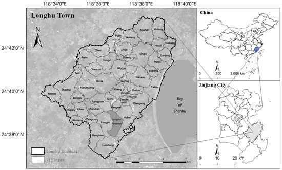
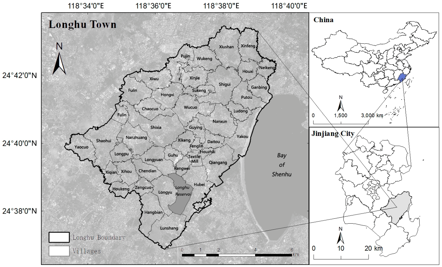
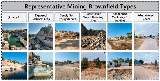
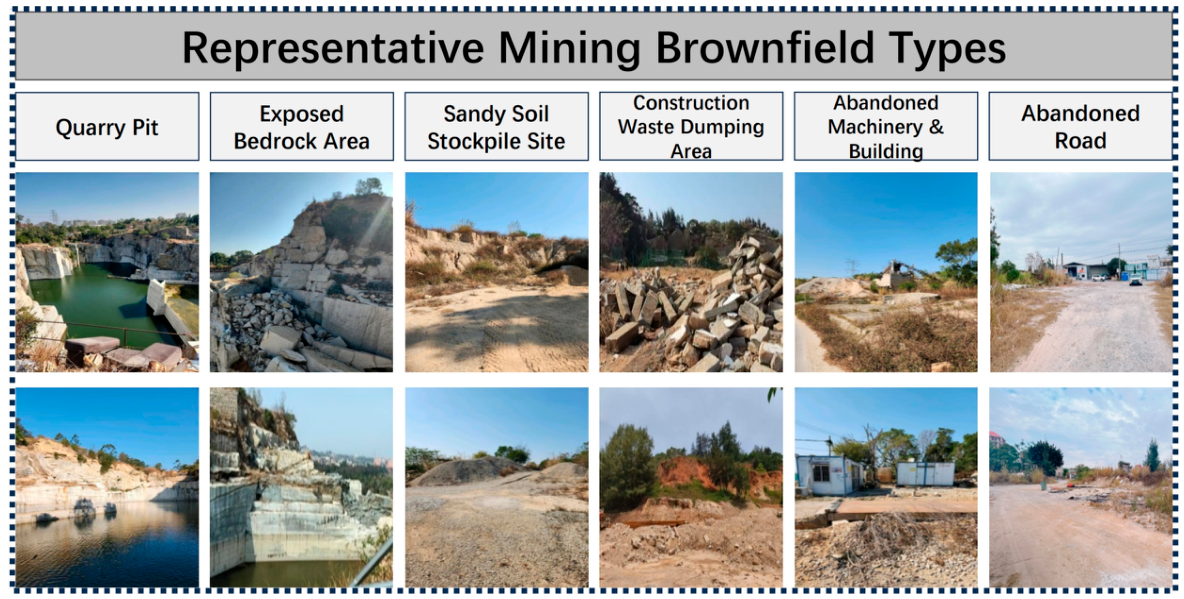
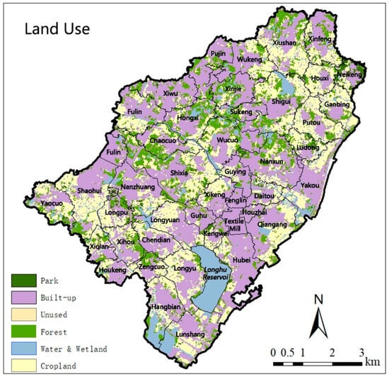
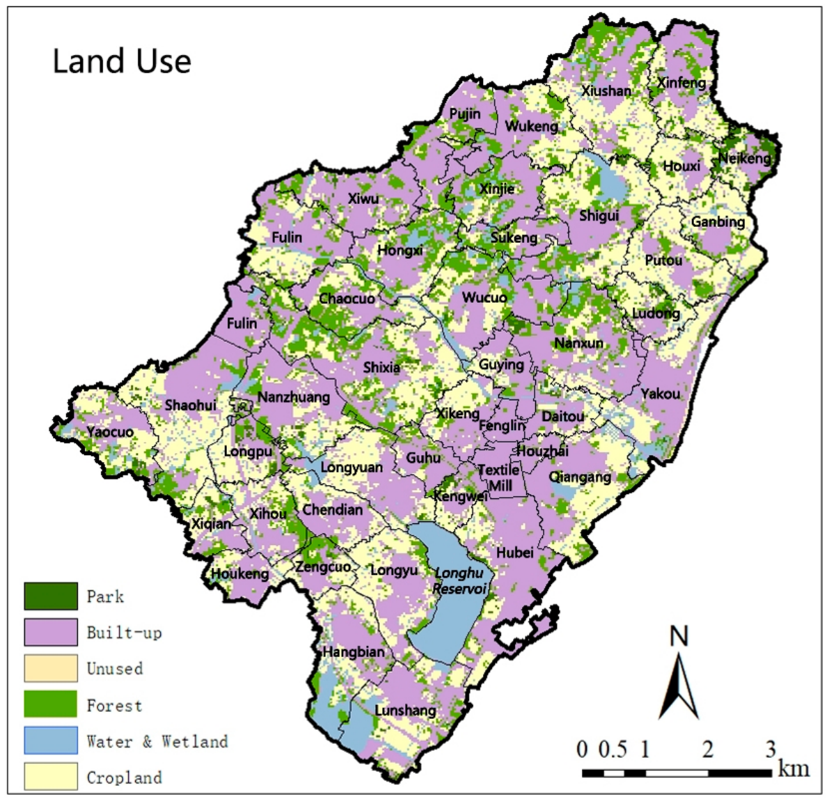
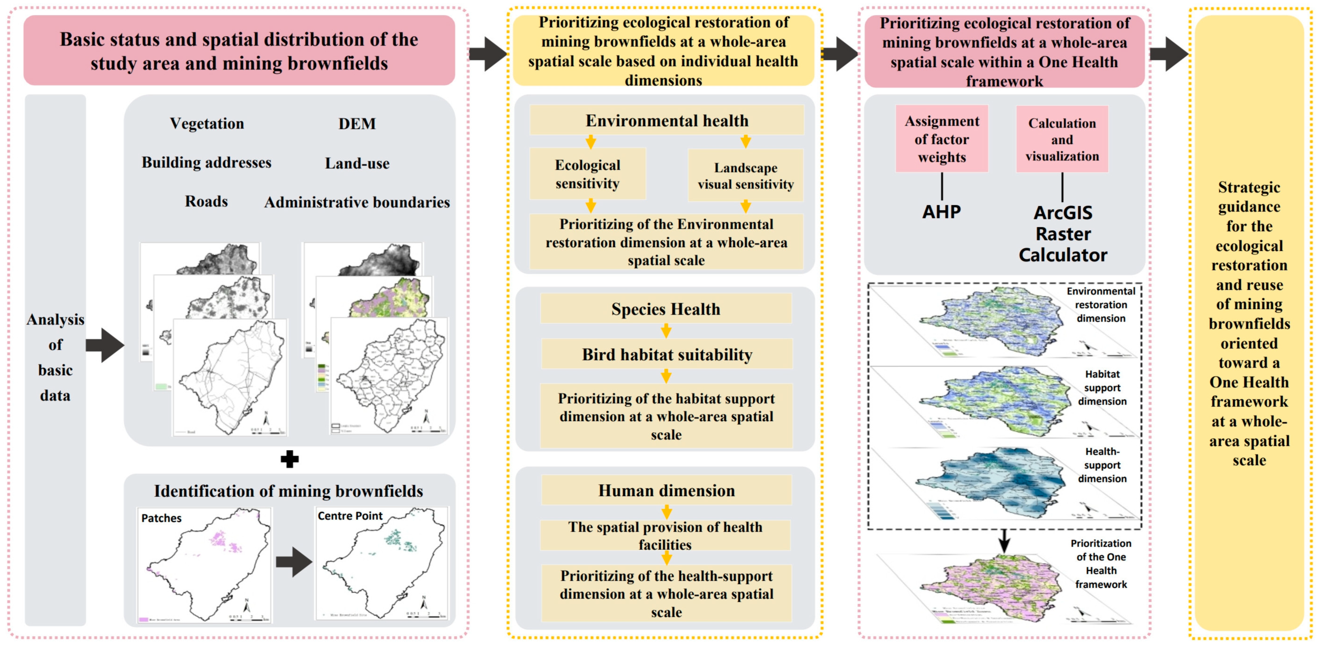
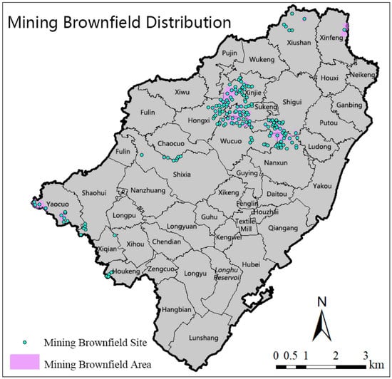
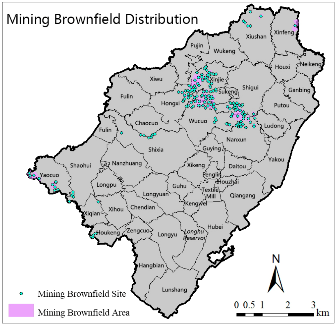
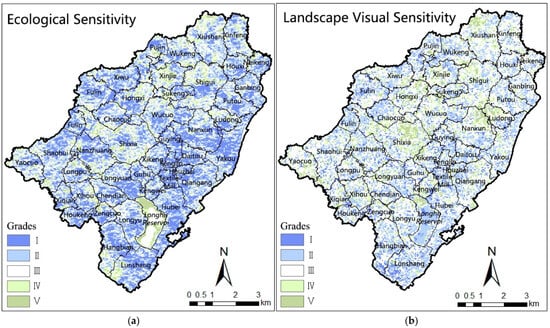
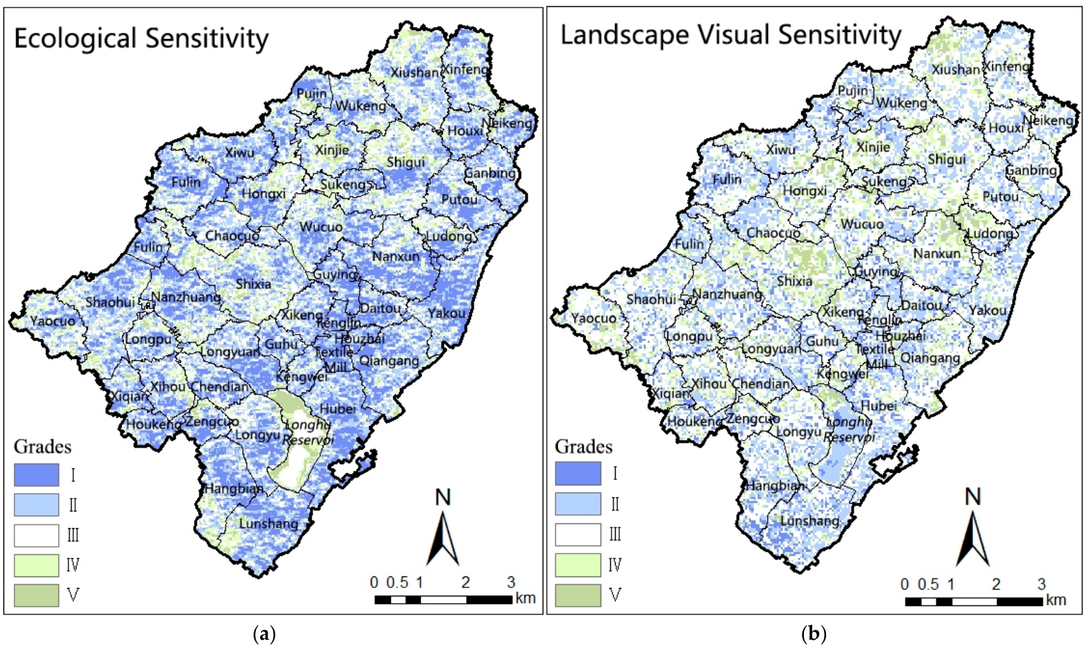
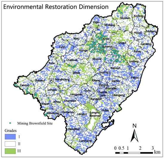
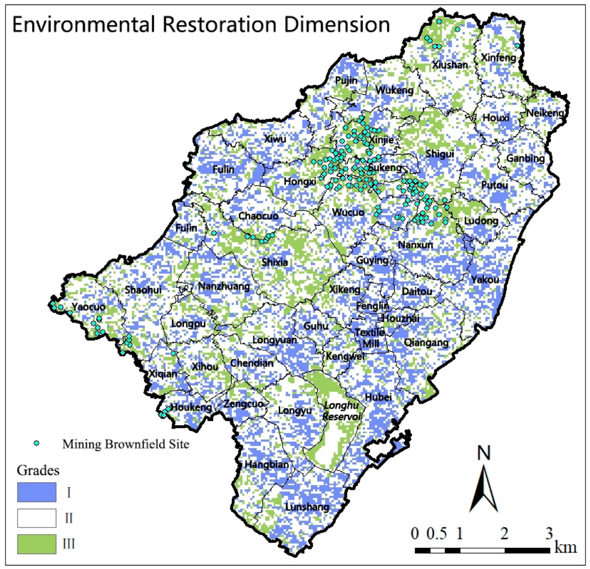
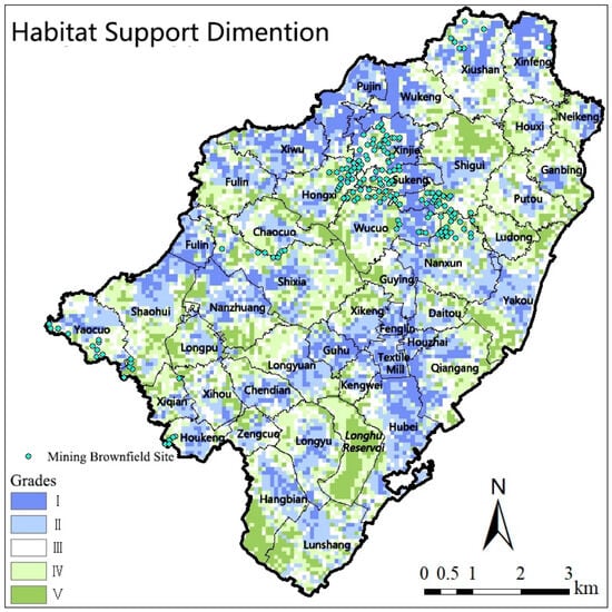
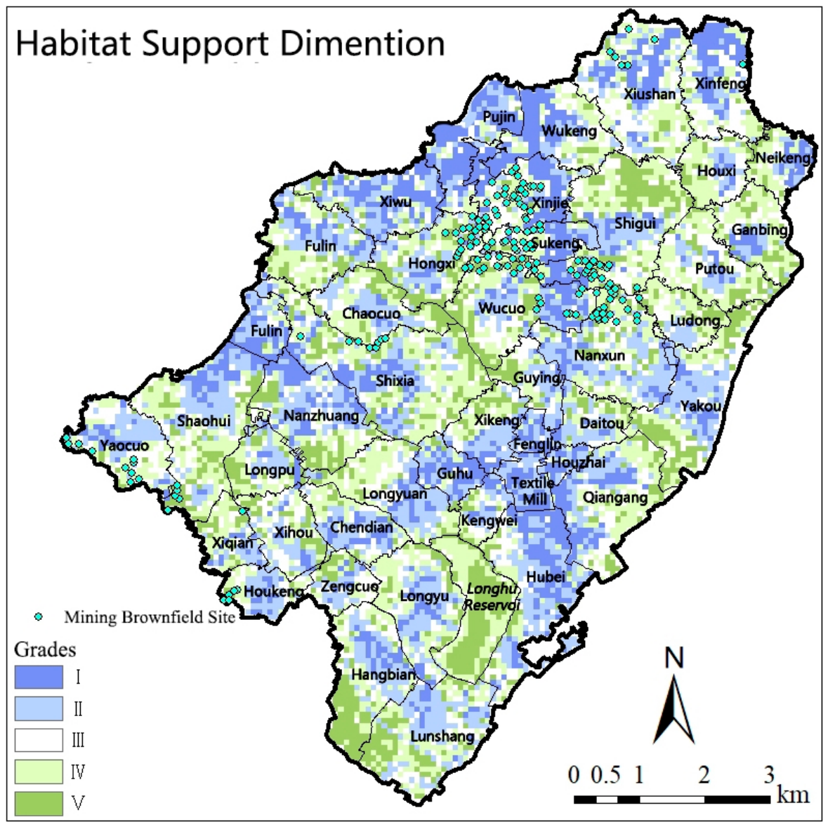
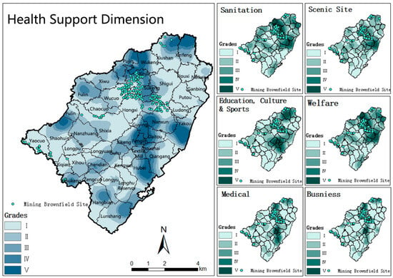
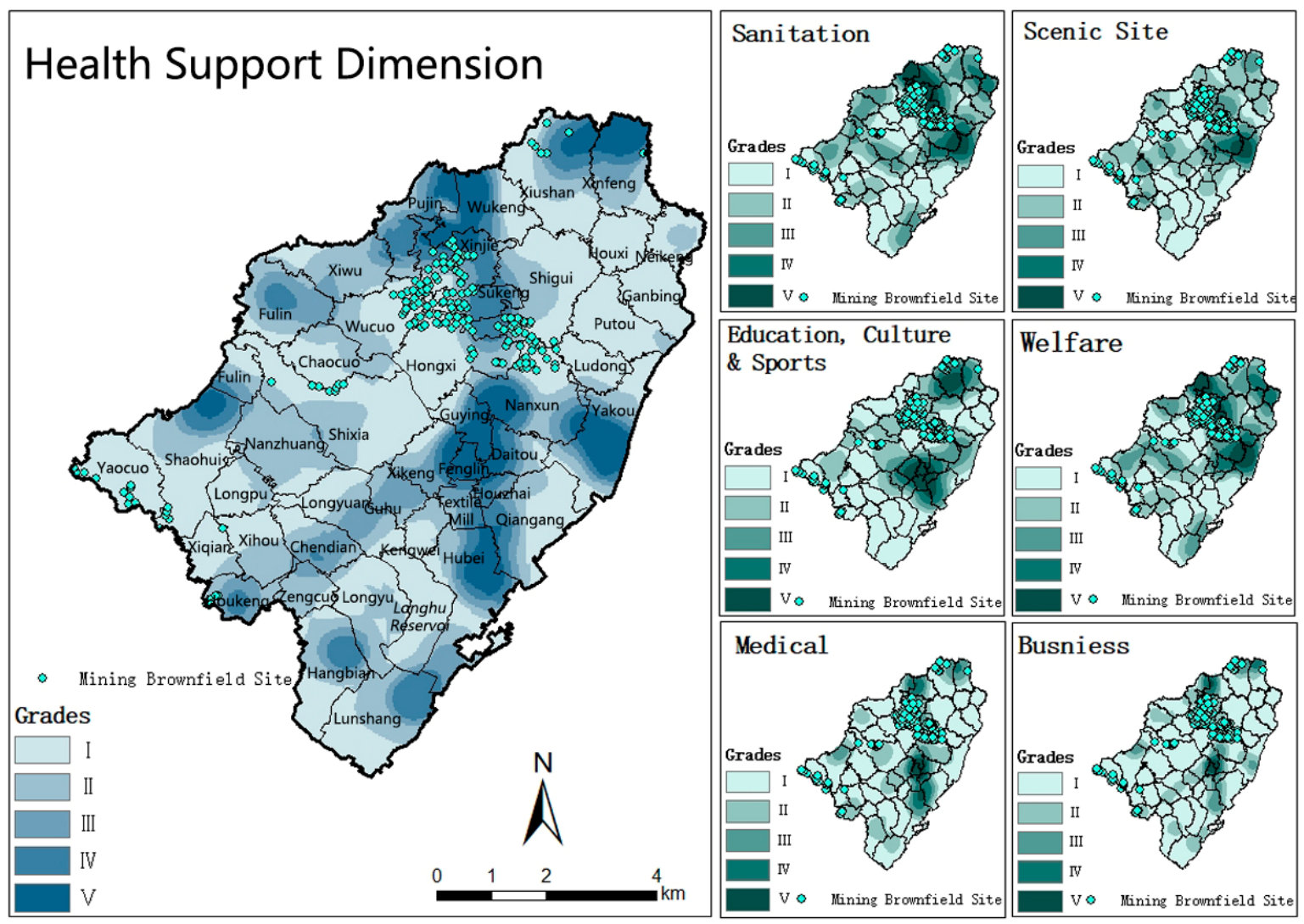
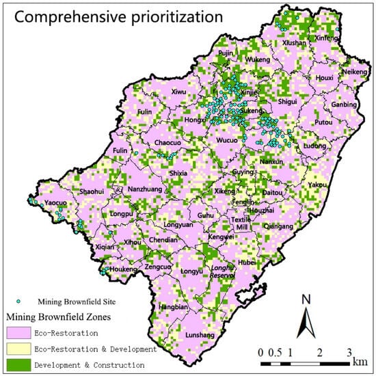
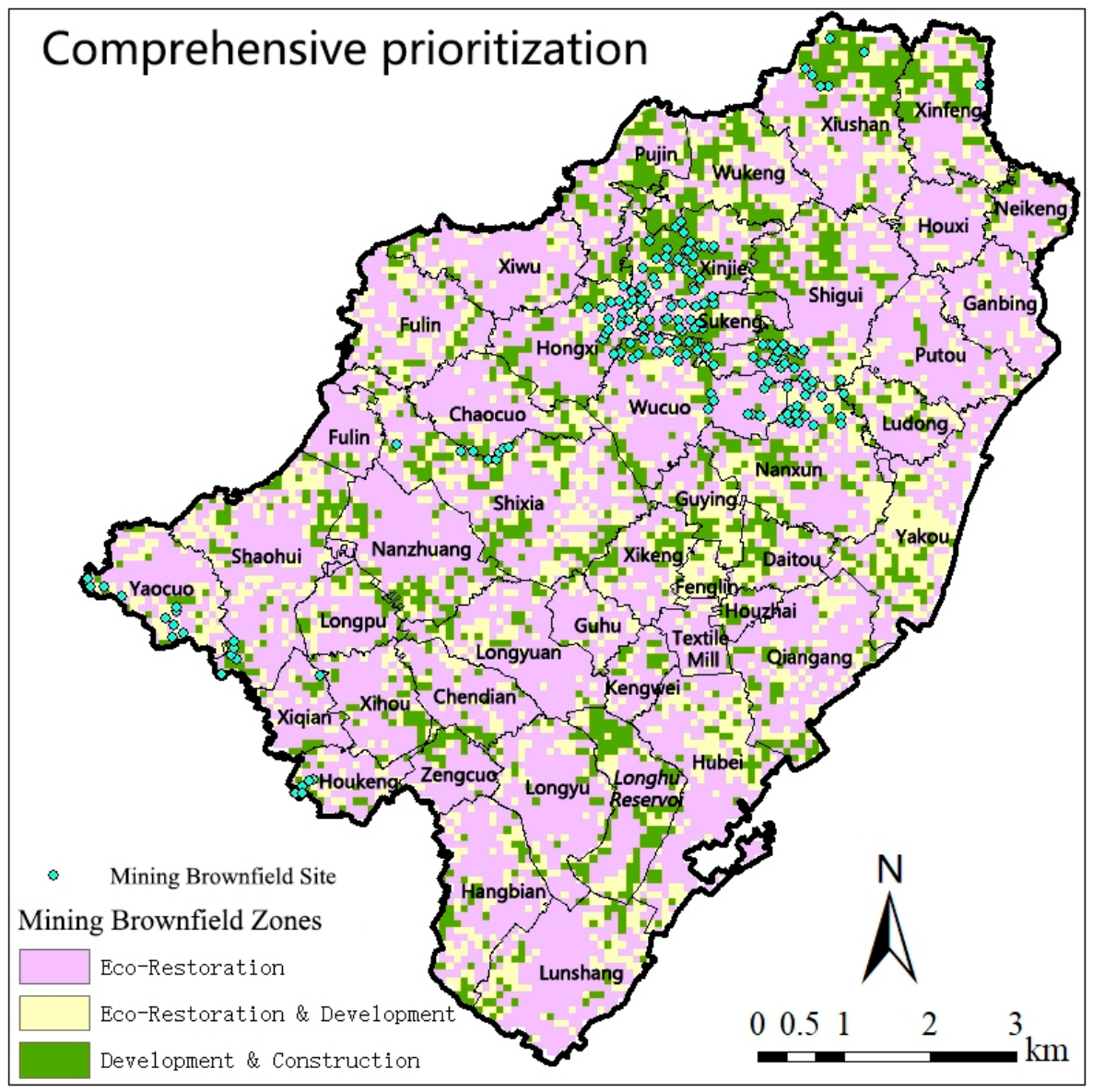
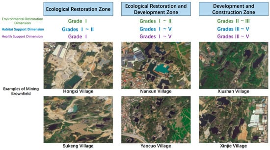
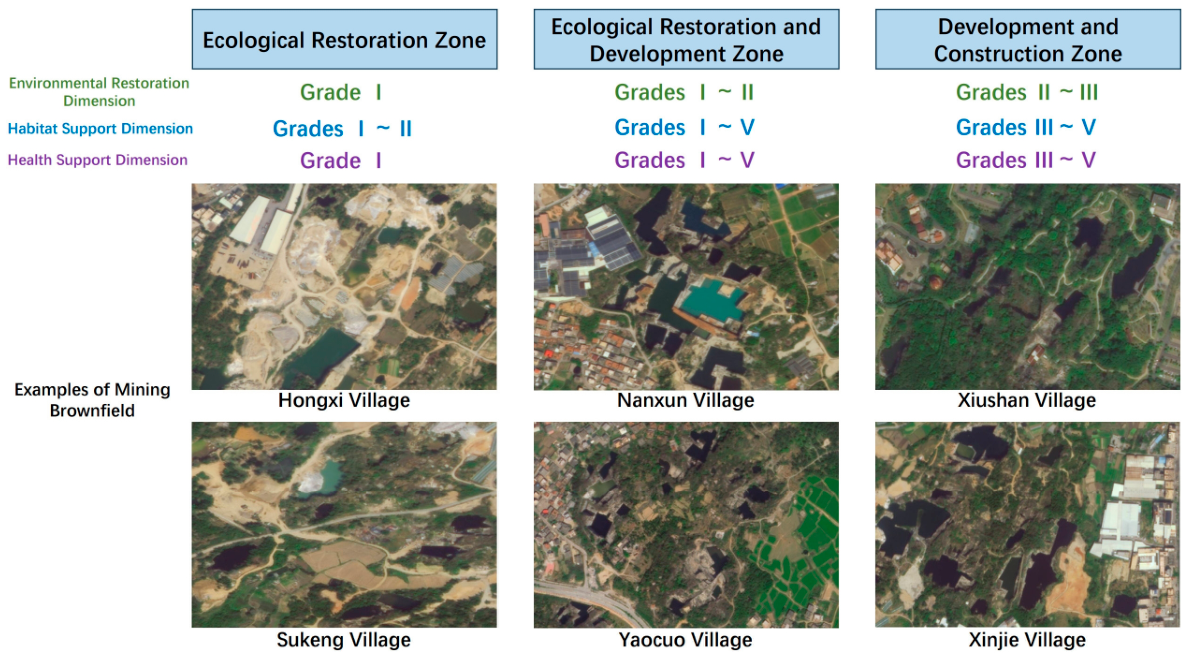

Disclaimer/Publisher’s Note: The statements, opinions and data contained in all publications are solely those of the individual author(s) and contributor(s) and not of MDPI and/or the editor(s). MDPI and/or the editor(s) disclaim responsibility for any injury to people or property resulting from any ideas, methods, instructions or products referred to in the content. |
© 2026 by the authors. Licensee MDPI, Basel, Switzerland. This article is an open access article distributed under the terms and conditions of the Creative Commons Attribution (CC BY) license.