


Abstract
The forest within the Ben En National Park has a diverse flora, which, although protected, remains subject to degradation. The analysis and management strategies for forest degradation within this park were conducted using a phytogeographical approach supplemented by satellite imagery and a SWOT analysis. As a result, the area is characterized by nine distinct vegetation types comprising 1417 vascular plant species (from 902 genera and 196 families). These species belong to endemics from Northern, Central, and all of Vietnam, as well as 16 other phytogeographical elements. Tropical Asian and South China elements dominate the community structure in evergreen broad-leaved closed forests on both limestone and non-limestone mountains. Forest degradation is evident in changes to both floristic composition and vegetation structure. Floristic composition shows a trend of decreasing native elements while simultaneously increasing non-native or introduced elements. This “anthropogenic tropicalization” leads to a declining chain of ecological function from palaeotropical to introduced elements, resulting in biological invasion. For instance, the invasive species, Mimosa pigra, currently occupies about 442 ha in the semi-submerged zone of the Song Muc reservoir, indicating a loss of ecological function and a likely hydrological pathway for further spread. As a consequence of “anthropogenic tropicalization”, the vegetation is fragmented and gradually altered from a natural system to an anthropogenic one through a regressive succession from primary forest to bare land/invaded area. Based on the SWOT analysis, four management actions were proposed: 1—Establish a “sustainable native forest” program and “invasive species control” in the Song Muc reservoir; 2—Launch a “green livelihoods for the buffer zone” initiative; 3—Implement a “Smart forest monitoring” system; and 4—Forge an “ecotourism-conservation-community” alliance.
1. Introduction
Forests are one of the most complex and dynamic ecosystems, playing a crucial role in maintaining ecological balance and global climate stability. Beyond providing timber, medicinal herbs, and food, forests serve as a vital bastion for biodiversity conservation and natural disaster mitigation (such as droughts, floods, and landslides). Furthermore, they act as a massive carbon sink and a natural shield that mitigates the impacts of climate change [1]. Although recognized as an irreplaceable ecological pillar, forests are facing a severe rate of decline unprecedented in modern history. Between 2000 and 2018, more than 386 million ha of natural forest were lost, with the majority concentrated in tropical regions—which are considered the planet’s “gene banks” [2]. This crisis is not limited to the reduction of forest area; the quality and structure of vegetation are also being disrupted, significantly weakening the ecological functions of this vital system [3].
In the evolution of science and technology, the assessment and management of forest degradation have been approached from diverse perspectives, reflecting the interdisciplinary nature of modern forestry science. Ecologists typically focus on species composition and community structure, using diversity indices—such as Shannon’s Index—to quantify the biological complexity of the forest [4,5]. However, these methods have certain limitations as they do not allow for spatial generalization and make it difficult to assess trends of temporal change. In contrast, the integration of remote sensing technology and Geographic Information Systems (GIS) enables comprehensive observation, facilitating the detection and quantification of spatiotemporal changes in forest cover [6]. Nevertheless, analyses based solely on satellite imagery often lack biological depth, leaving gaps in the interpretation of the underlying ecological mechanisms and causes of degradation. Consequently, recent studies have increasingly sought to integrate biological, spatial, and managerial approaches to ensure both rigorous quantification and true reflection of socio-ecological dynamics [7,8,9].
While these integrated efforts are being vigorously implemented in South America and Africa, Southeast Asia—especially Vietnam—still lacks such comprehensive studies. As a region of high biodiversity and a notorious hotspot for deforestation, Southeast Asia has experienced severe forest loss. Total forest area declined from 268 million hectares in 1990 to 236 million hectares in 2010, corresponding to annual deforestation rates of 0.67% and 0.59% during the 1990–2000 and 2000–2010 periods, respectively [10]. Compared to other tropical regions, Southeast Asia faces a disproportionately high deforestation rate and could lose three-quarters of its primary forests by 2100, risking the loss of 42% of its biodiversity [11]. The primary driver of this decline is the conversion of forests to industrial crops, especially oil palm, rather than just logging [10,12]. Although fauna can survive in logged forest areas, the conversion to agriculture causes severe biodiversity loss [12]. Other notable threats include the spread of invasive alien plants [13,14]. While international studies have clearly demonstrated the negative impacts of invasive species on ecosystem services, in Vietnam, research remains fragmented and is rarely integrated with spatial analysis or forest management, particularly within national parks [15].
Since the beginning of the 21st century, Vietnam’s forest area has tended to increase thanks to large-scale afforestation programs; however, this does not mean that forest quality has improved. Recent statistics show that species-rich natural forests (special-use forests) account for less than 20% of the country’s total forested area [16]. Although efforts to monitor forest dynamics using Landsat or Sentinel data have been initiated, most studies remain limited to area-based statistics, lacking integration with field surveys and ecological analysis. Meanwhile, the invasion of alien species in wetlands and lakeside areas is increasingly prevalent, notably Mimosa pigra—a species documented as spreading across numerous national parks, including those in Central Vietnam [15]. This research gap underscores an urgent need for integrated studies—where remote sensing technology is utilized not only to “count trees” but also to provide deeper insights into the spatial patterns e and mechanisms of forest degradation.
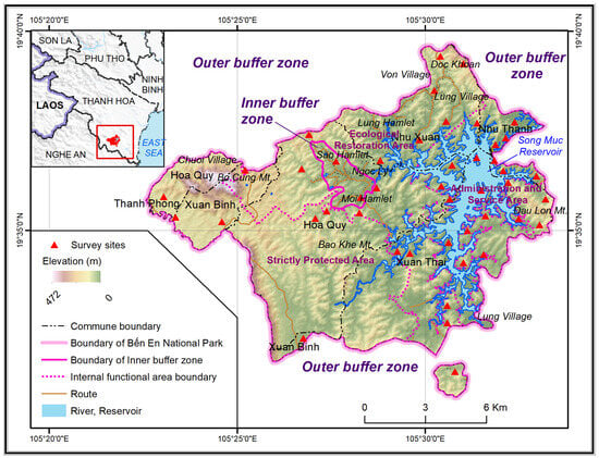
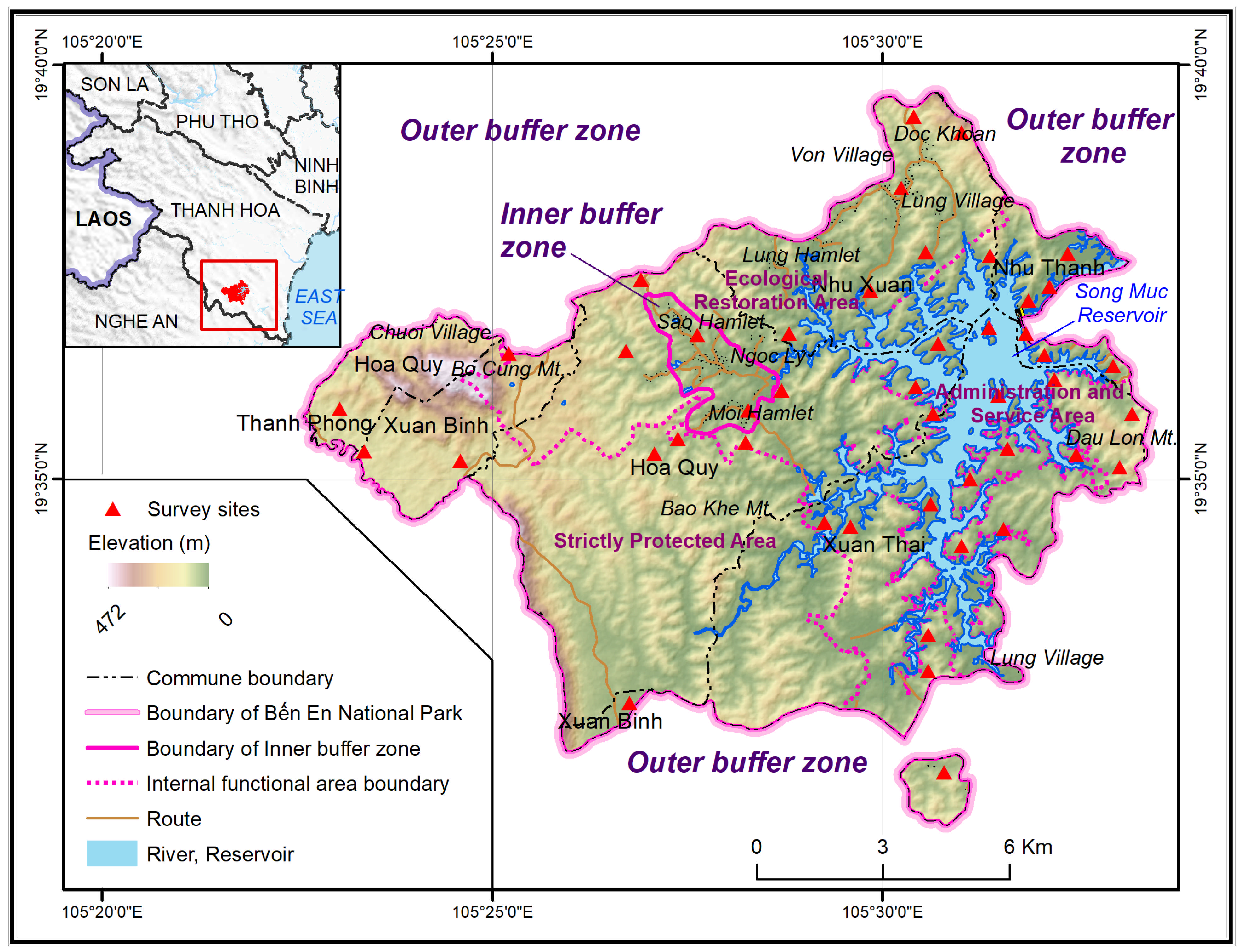
In this context, the Ben En National Park (BENP) in Thanh Hoa province, situated within the region of North Central Vietnam (NCVN), serves as a typical example of the above challenges (Figure 1). Covering 14,300 ha, this special-use forest spans the hilly terrain surrounding the Song Muc reservoir (Ben May Lake)—a major freshwater body in the region. Although BENP was established through the conversion of the former Ben En Forestry Farm, it remains a convergence point for unique geographical features characteristic of the Northern Truong Son floristic region. Unlike many national parks formed from isolated primary forest areas, BENP was established on forest land recovering from commercial logging and agroforestry practices. This historical legacy has given rise to a distinctive transitional ecosystem, reflecting a complex mosaic of natural forests, regenerating secondary forests, and human settlements. The flora of BENP comprises 1417 vascular plant species, of which 57 species are listed in the IUCN Red List (2013) and 46 in the Red Data Book of Vietnam (2007), following supplementary surveys in 2012–2013 that expanded upon earlier records [17,18,19]. These species are distributed across tropical evergreen forests on both terrestrial and limestone substrates, encompassing various successional stages: from slightly to heavily disturbed forests, shrublands, agricultural plots, forest plantations, and mixed bamboo-timber stands. However, the proliferation of invasive species around Song Muc reservoir, coupled with firewood exploitation, encroaching agriculture, and spontaneous tourism, has significantly altered the natural forest structure and habitats. While previous investigations focused on the conservation of high-value species—such as Erythrophleum fordii, Hopea hainanensis, Cinnamomum balansae, Melientha suavis, and Annamocarya sinensis—research on invasive species has remained sidelined. This gap presents not only a scientific deficiency but also a critical management challenge. Furthermore, the long-standing presence of local communities within the core and buffer zones underscores the complex social-ecological nature of BENP. These residents maintain a traditional livelihood, creating a microcosm of the tension between resource conservation and community development, a pressing issue for most national parks in Vietnam today. Consequently, this study adopts an interdisciplinary approach—integrating biological analysis, geospatial technology, and management assessment—to elucidate the plant diversity and the drivers of forest degradation in BENP. The specific objectives are to: (i) characterize the geographical elements of the flora, (ii) identify invasive species and assess their impacts, (iii) generate a vegetation map using Sentinel-2 data validated by field surveys, and (iv) propose context-specific management and conservation solutions. By doing so, this research not only provides empirical evidence on floristic characteristics and the degradation process in the NCVN but also establishes an applied framework for forest monitoring. This integrated approach, combining spatial observation with local ecological insight, aims to bridge existing research gaps and inform sustainable forest management amidst climate change and intensifying development pressure.
Figure 1.
Study area with survey sites.
2. Data and Research Methods
The study was conducted using a combination of traditional methods in phytogeography and modern technologies from earth sciences to ensure reliability and comprehensiveness in assessing floral characteristics and forest degradation in BENP. The chosen method follows an interdisciplinary research logic, ensuring both biological depth and expanding the ability to generalize spatially through remote sensing and GIS technology.
First, the existing literature and data, including scientific works, forest resource survey reports, and statistical data from the BENP Management Board, were synthesized and critically reviewed. This process, conducted in a selective-critical manner, involved not only collecting data but also cross-checking the consistency between sources and identifying remaining gaps or outdated information. This approach helps ensure that the baseline data accurately reflects the current state of the forest and allows for comparison with previous results.
Regarding spatial analysis, the primary objective was to generate a detailed vegetation map delineating nine distinct vegetation types of BENP’s ecosystem. The initial classification was performed through on-screen visual interpretation of Sentinel-2 satellite imagery (dated 4 May 2025) at a 10-m spatial resolution. Interpretation keys—including tone, color, size, shape, texture, pattern, shadow, and site—were analyzed in conjunction with habitat, landform, soil, and bedrock data to accurately identify specific vegetation types, deliberately avoiding generalized and less ecologically precise land-cover categories. To evaluate the reliability of this mapping without statistical bias, an independent point-to-point ground-truthing assessment was conducted via a field survey at 45 locations in May 2025. These points were distributed along transects representative of diverse landforms, altitudes, and forest successional stages. Each survey point was georeferenced using a high-precision GPS device, with associated ecological data recorded, including canopy structure, dominant species groups, soil substrate, slope, aspect, and evidence of anthropogenic intervention. Notably, occurrences of invasive alien species were meticulously documented, noting their exact coordinates, density, and occupied biotope. This spatial dataset provides a rigorous scientific foundation for evaluating ecological threats within the subsequent management framework. Crucially, none of these 45 field-surveyed sites were utilized for initial map calibration; they were strictly reserved for post-classification independent validation. Compared to automated classification methods, visual image interpretation offers a distinct advantage due to the highly heterogeneous boundaries between vegetation types in BENP. Experienced interpretation specialists were able to mitigate errors stemming from spectral confusion and terrain shadows—common pitfalls in automated algorithms. By directly overlaying the 45 independent GPS coordinates onto the laboratory-classified map, a spatial agreement of 85.8% was confirmed between the visually interpreted boundaries and actual field observations. This direct verification validates the current distribution of natural forests, regenerating areas, and invaded zones without relying solely on traditional pixel-based metrics.
Furthermore, a historical-comparative approach was employed to address the complexities of ecosystem degradation and biological invasion without conflating different timescales. To establish an ecological baseline and assess the inherent vulnerability of the BENP ecosystem, a comprehensive phytogeographic analysis was synthesized from historical botanical records and legacy inventory data. Species were categorized into 19 phytogeographic elements and compared against the broader North Central Vietnam (NCVN) and Cuc Phuong National Park (CPNP) regions. Rather than being used to calculate continuous spatial degradation rates, this quantitative floristic baseline serves to demonstrate the deep-rooted ecological vulnerability of the park. Specifically, this robust baseline provides the scientific justification for identifying “Invasive Alien Species” as a primary Threat (T) within the subsequent SWOT matrix.
In parallel with the spatial analyses, the research utilized the SWOT (Strengths, Weaknesses, Opportunities, Threats) framework to comprehensively evaluate the internal and external factors that influence the management and conservation of forest resources. The application of SWOT analysis not only helps to identify the strengths and weaknesses of the Ben En ecosystem but also clarifies development opportunities and potential threats from climate change and population pressure. The input factors for the SWOT matrix resulted from the analyses of field surveys, management documents, and interviews with local authorities and people. In-depth interviews were conducted in the field in November 2024 and May 2025. Using a purposive sampling technique, a total of 18 participants, including 8 staff and 10 local residents, were selected to ensure diverse perspectives on forest management. The staff was sampled from the Dien Ngoc, Xuan Dam, Song Chang, and Xuan Bai forest ranger stations, the Thung Sen checkpoint, the Scientific Management Department, the Forest Environment Protection Center, and the Tourism Service Center- all under the BENP Management Board; local residents involved in afforestation within the buffer zone. The interviews were semi-structured, utilizing open-ended questions focused on current conservation practices, livelihood challenges, and perceived environmental risks. To synthesize the qualitative data, interview transcripts and field notes were subjected to thematic analysis. Responses were coded into recurring themes (e.g., funding constraints, policy support, and ecological richness), which were then categorized into SWOT quadrants based on their origin (internal vs. external) and impact (helpful vs. harmful). For instance, internal issues such as low income and forest resource dependency were identified as Weaknesses, while external pressures such as invasive species were classified as Threats. This systematic approach bridges the gap between scientific data and management practice, enabling the derived SWOT elements to serve as a robust foundation for formulating TOWS matrix strategies (S-O, W-O, S-T, and W-T) rather than relying on conventional qualitative assessments.
The entire research process was conducted within an interdisciplinary framework—combining phytogeography, remote sensing technology, and resource management—to ensure that the results are not only descriptive but also serve policy planning. The combination of detailed field surveys and satellite data analysis helps minimize errors and enhances the ability to detect early signs of forest degradation. From there, the research results can serve as a scientific tool to support forest planning and conservation in other special-use areas of Vietnam.
3. Results and Discussion
Each flora encompasses numerous species originating from diverse geographical regions due to their phylogenetic history. Phytogeographically, BENP is situated in the North Indochinese Province [20], belonging to the Indochinese Region, Indomalesian Subkingdom, Paleotropical Kingdom [21,22]. An analysis of the flora in BENP shows a distinct diversity and convergence of ecogeographical elements. A total of 1417 species of vascular plants were recorded, belonging to 902 genera, 196 families, and 6 different phyla (BENP, 2014) [17]. Based on the classification framework of phytogeographical elements by Pócs (1965) and Le et al. (2025) [23,24], 19 geographical elements were identified for 1325 species (93.46% of the total) in BENP (Table 1). These element percentages not only show a harmonious combination of native and modern migrant species, reflecting the transitional nature between the two major phytogeographical areas—Northern Vietnam and Central Vietnam—but also highlight the unique diversity of BENP, particularly in the face of degradation pressures affecting tropical forests across NCVN.
Table 1.
Phytogeographical elements of the flora of BENP, NCVN, and CPNP.
Compared to Cuc Phuong National Park (CPNP), situated approximately 100 km north of BENP, and NCVN, the larger area of North Indochinese floristic Province, encompassing both CPNP and BENP, the total proportion of endemism in BENP (5.8%) is significantly lower than the average of the NCVN (12.66%) and Cuc Phuong National Park (CPNP) (17.33%). However, in BENP, the relative equality in both proportions and number of Northern Vietnam endemic elements (23 species, 1.63%) and Central Vietnam endemic elements (22 species, 1.55%) reflects a strong interchange between the Northern Vietnam and Central Vietnam flora. In CPNP, the proportion of Northern Vietnam endemism (215 species, 11.06%) is 2.8 times higher than the Central Vietnam (78 species, 4.01%) whereas in NCVN, the proportion of Northern Vietnam endemism (51 species, 1.9%) is much lower than the Central Vietnam (195 species, 7.26%), all reflects the suitability of Ben En’s geographical position: located on the northern edge of the Truong Son range, subject to the dual impact of the Northeast climate (cold dry season) and the Southwest monsoon (hot wet season). This simultaneously underscores BENP’s role as a biological bridge between the Northern Vietnam and Central Vietnam dispersal centers. Phytogeographically, this is a very typical characteristic of the Northern Truong Son transition zone—the area where the boundary between the South China–North Vietnam flora and the Indochina-Malaysia floras converges. Phytogeographically, this is a very typical characteristic of the Northern Truong Son transition zone—the converging area of South China, North Vietnam, and Indochina-Malaysia floras—a core criterion for defining “globally valuable conservation forests” [3] because in any regional flora, the conservation of genetic resources must prioritize the protection of endemic species. Meanwhile, the proportion of Vietnamese endemic elements in BENP reaches 2.61%, lower than the average for the NCVN (3.5%) but higher than that of CPNP (2.26%), further emphasizing the intermediate and dynamic nature of the BENP flora, showing that BENP is a region reflecting the essence of Vietnamization. This proportion also demonstrates the biological frontiers expansion of indigenous species, serving as evidence for the south-to-north (NCVN-BENP-CPNP) dispersal of Vietnamese endemics. Furthermore, it is a typical model for maintaining and restoring native species amid increasing habitat change and human impacts.
Despite its small area, Ben En still maintains a multi-layered and multi-originated structure—an important factor for stabilizing the ecosystem under rapidly changing climatic conditions. However, when considering the relationship between the rate of endemic species and palaeotropical elements versus the rate of introduced species (10.58%), which is higher than the NCVN (6.29%) and Vietnam (4.41%), it shows that the infiltration of alien elements into the BENP is relatively high. This suggests that the Ben En forest is currently in a transitional phase, where native biodiversity coexists with modern biological invasions. This contrast is an expression of “ecological duality”, where a vegetation type simultaneously plays two roles: acting as a native gene pool and serving as a sensitive spot vulnerable to environmental disturbances.
Among the 19 identified geographical elements, the Tropical Asian element group (368 species, 25.97%) and South China (206 species, 14.53%) are dominant, containing the most abundant and diverse number of species. This dominance clearly shows the influence of the humid tropical monsoon climate and provides evidence of the close phytogeographical link between BENP and the South China–Indochina flora, which is considered an ancient evolutionary center of Asian flora [26]. Areas with a high proportion of tropical elements often exhibit high biological stability, as evolutionary processes occur in a stable tropical environment with little climatic disturbance [3]. Moreover, the dominance of the Tropical Asian element explains why the vegetation in Ben En is a primarily evergreen closed forest with a multi-layered structure, high canopy density, and possesses many large timber species, characteristic for low-lying humid tropical forest communities. Adjacent elements, including Indochina (5.92%), India (5.29%), Malaysia–Indonesia (5.50%), and palaeotropical (5.57%), suggest a history of Eastward and Northward floristic dispersals in the region. They not only contribute to the rich vegetation structure, but their relatively even proportions suggest a long history of floristic dispersal routes and their interaction, thus precluding the absolute dominance of any single route. This is distinct from other national parks, where a single floristic element is often dominant, for instance, the Malesian element in Central Vietnam or the Himalayan element in the high mountains of Northwestern Vietnam. The NCVN is an important biogeographical transition zone, where two main dispersal routes converge, creating a complex ecological interface between the South China–East Asia and Malaysia–Sunda biological systems [26,27]. This convergence explains why the Tropical Asian (25.97%) and South China (14.53%) elements always dominate the spectrum of the geographical elements in BENP, while the Malesia–Indonesia (5.50%) and Indochina (5.92%) elements appear at a medium level.
However, unlike CPNP and the entire NCVN regarding the proportion of Asian elements, South China elements, palaeotropical elements, and introduced elements, Ben En has neither reached a state of ecological equilibrium nor preserved its palaeobotanical features. Notably, the high Tropical Asian element reflects the process of tropicalization of the flora—a characteristic of secondary forests following logging. Conversely, the palaeotropical element remains at only 5.57%, indicating that ancient-origin species belonging to the Dipterocarpaceae are gradually becoming isolated within the community, thereby losing their structurally dominant role. This evidence further confirms the evolutionary degradation in BENP, where the forest, although still having a green canopy, has declined in genetic quality. Meanwhile, the significant presence of introduced elements—150 species (10.58%), including four invasive species (Eupatorium odoratum, Lantana camara, Mimosa diplotricha, and Mimosa pigra), and three potentially invasive species (Sphagneticola trilobata, Ageratum conyzoides, and Leucaena leucocephala) is a warning sign of increasing ecological pressure, which not only alters the structure of the native community but also severely hinders the process of natural recovery. This is a common trend in tropical forests affected by tourism and population expansion [28]. Based on the studied invasion mechanism of tropical shrubs [28,29], the invasion in BENP is in the third stage of the “mature invasion” process, where the invasive population reaches the capacity for independent regeneration and spreads along water currents. Field observations confirm this, indicating that the species occupies up to 442 ha, grows rapidly and densely in the semi-submerged areas along the banks of Song Muc reservoir. This widespread growth is harming the ecosystem and threatening high-conservation-value native species. The expansion of Mimosa pigra has degraded the habitat of waterbirds, herbivores, and aquatic animals, while simultaneously disrupting the natural nutrient cycle. The pure stands of Mimosa pigra that can cause a “loss of ecological function” [29] are quite clearly demonstrated at BENP through the narrowing of the semi-submerged area. Moreover, as the Song Muc Reservoir is the water source for over 12,000 ha of agricultural land, downstream dispersal of seeds poses a significant threat. This process risks extending the invasion to lower reaches, leading to land degradation and presenting a serious threat to local ecological security. Biogeographically, the simultaneous presence of Tropical Asian–South China—modern introduced elements in the BENP is considered an initial manifestation of the tropical homogenization process. This is a warning sign for the decline in the evolutionary function of the forest vegetation. When alien species displace endemic groups, the natural adaptation chain is interrupted, weakening the self-recovery ability and generating new genetic variation.
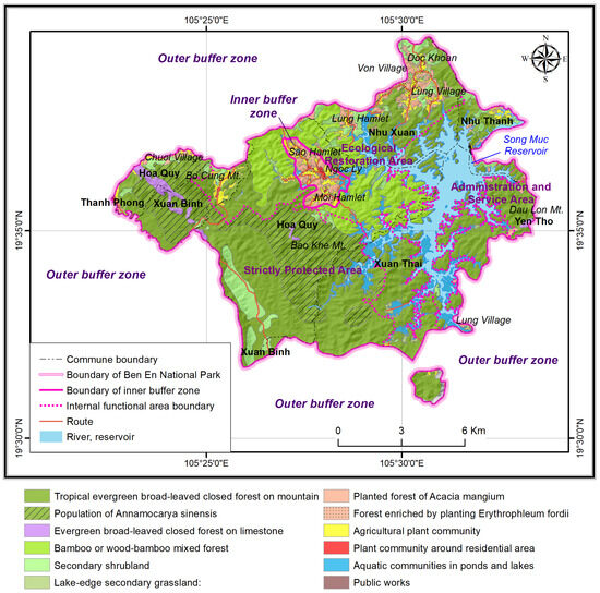
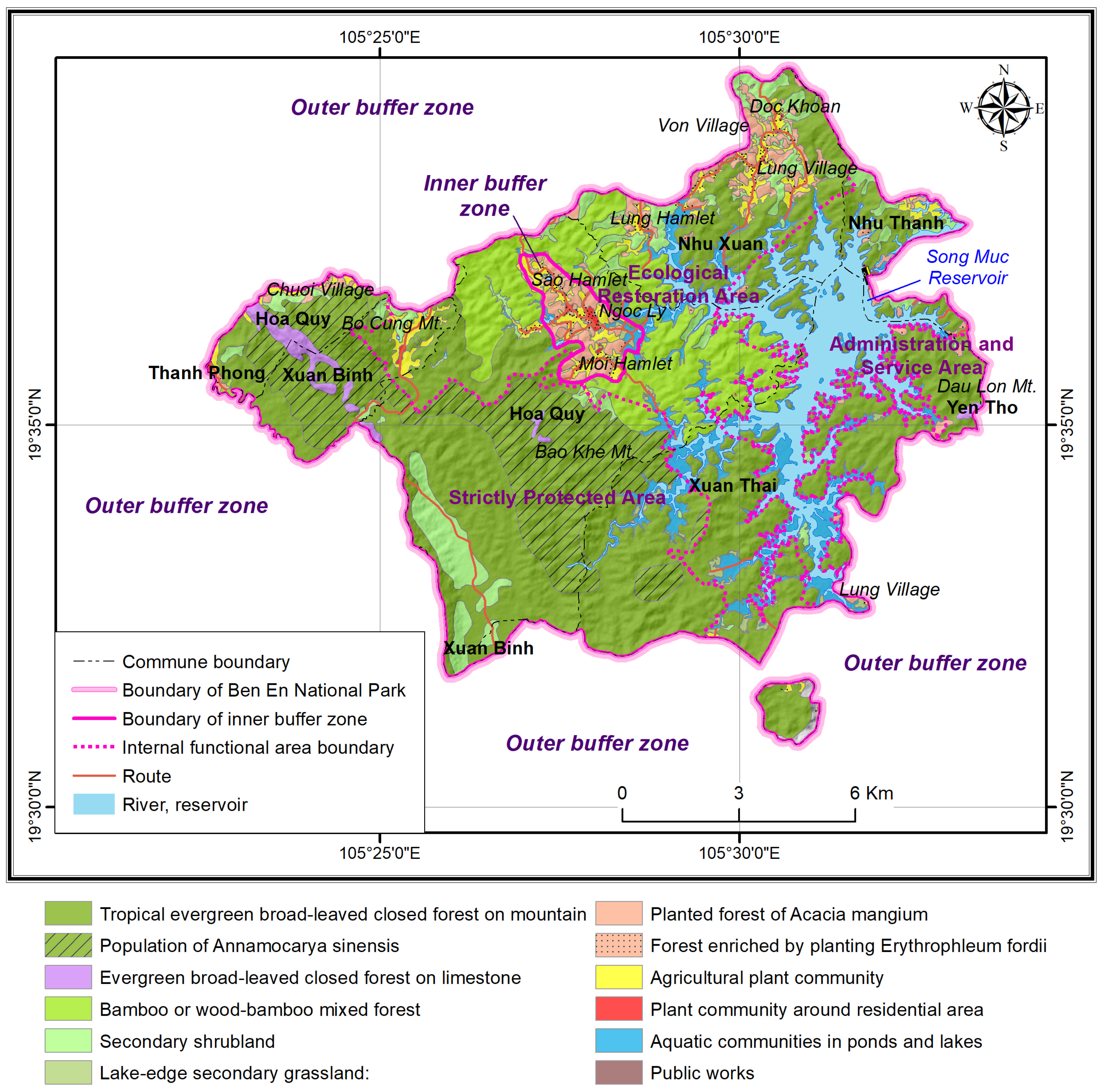
Satellite imagery data combined with field surveys allowed for the identification of 09 vegetation types, reflecting the spatial structure and ecological status of the entire area (Figure 2). This structure clearly demonstrates ecogeographical stratification and simultaneously reflects the process of spatial biological change in the area. The vegetation of BENP, characterized by the distribution of its phytogeographical elements (Table 1), is differentiated by altitude, topography, and the degree of human intervention.
Figure 2.
Vegetation of Ben En National Park.
Firstly, the two types of closed evergreen broad-leaved forest, found on both non-limestone and limestone mountains, occupy the largest area and are distributed across Nui Dam—Song Chang, Dien Ngoc, Xuan Binh, Xuan Thai, Hoa Quy. These are rugged, difficult-to-access areas, which means most remain relatively undisturbed except for those near residential areas that are easily exploited. The vegetation structure consists of four layers: canopy, sub-canopy, shrub, and herb/grass layer, dominated by species with Tropical Asian and South China phytogeographical elements. These elements represent the long-standing native character of the flora, corresponding to large, old-growth timber species such as Chukrasia tabularis, Peltophorum tonkinensis, Erythrophloeum fordii, Saraca indica, Aphanamixis grandiflora, Actinodaphne pilosa, Cinnamomum iners, Pterospermum truncatolobatum, Cinnamomum balansae, Caryodanophsis tonkinensis, Aglaia spectabilis, Saraca dives, Pavieasia anamensis, Castanopsis annamensis, and Aglaia silvestris. The dominance of these elements indicates that this is the remaining part of the primitive community, the “biological nucleus” of the entire region, which is consistent with the characteristics of evergreen closed forests in NCVN.
Next is the closed forest, dominated by a population of Annamocarya sinensis with a density of 1.29 trees/km2. This population is distributed largely along valleys or on limestone mountains, and more sparsely on the slopes and peaks of non-limestone mountains in the Duc Luong–Song Chang, and Dien Ngoc areas—all of which fall within the strict protection area [30,31]. It is accompanied by fast-growing heliophytes such as Macaranga denticulata, Lagerstroemia calyculata, Saraca dives, Erythrophloeum fordii, Caryodaphnopsis tonkinensis, etc.
Following this are the bamboo or mixed wood-bamboo forests, distributed across recovering and regenerating forest states within the ecological restoration area. In these forests, Indochinese, Indian, and Malesian–Indonesian floral elements appear with higher frequency, reflecting the process of secondary dispersal from neighboring areas. The common bamboo species include Neohouzeaua dulloa, Bambusa flexuosa, Bambusa spinosa, Indosasa sinica, and Dendrocalamus membranaceus. In many places, bamboo grows intermixed with broadleaf woody trees such as Pterospermum heterophyllum, Machilus bonii, Crape myrtle (Lagerstroemia calyculata), Saraca dives, and Mallotus paniculatus. The herbaceous layer is primarily composed of species belonging to the families of Zingiberaceae, Asteraceae, Poaceae, Rubiaceae, Euphorbiaceae, Acanthaceae, and Araceae. This provides evidence of the natural regeneration following exploitation, but also simultaneously indicates a shift in ecological structure: from a community dominated by long-lived native species to a temporary community of secondary species.
Monocultures of Acacia auriculiformis, Acacia mangium, Canarium tonkinensis, Cassia siamea, and Eucalyptus camaldulensis are mainly planted in the buffer zone and secondary shrublands. In these areas, the proportion of palaeotropical and native elements decreases sharply, replaced by introduced migrant elements. Invasive alien species such as Eupatorium odoratum, Lantana camara, and Mimosa diplotricha are concentrated in planted forests along transportation routes and in semi-inundated areas.
This correlation accurately reflects the dispersal pattern of invasive species in open habitats with low canopy cover and high disturbance frequency [28]. Specifically, the semi-submerged area of the Song Muc reservoir has recorded the strong expansion of Mimosa pigra, which has outcompeted native species such as Cyperus malaccensis, Axonopus compressus, and Imperata cylindrica. This displacement represents a process of ecological function loss, as the grass-shrub layer becomes homogenized, reducing its capacity for water and nutrient regulation [29]. Additionally, BENP is planting native species such as Erythrophleum fordii and Annamocarya sinensis in order to enrich the forest, improve forest quality, achieve in-situ conservation for reducing the risk of extinction, increase forest canopy cover, effectively promote the forest’s protective functions, enhance the efficiency of nature conservation efforts, and improve the ecological environment.
The nine vegetation types with their phytogeographical element structure in BENP reflect a retrograde succession, gradually shifting from a natural system to an anthropogenic one: primary forest → recovering forest → shrubland → bare land/invaded area. Simultaneously, the relationship between the distribution of vegetation types, their geographical elements, and the alien species clearly shows a pattern: a gradual decrease in ancient and native elements (Palaeotropical, Indochinese, South Chinese), accompanied by an increase in introduced elements and the fragmentation of vegetation types. This trend indicates a process of biotic homogenization [32], where specialized native biodiversity is replaced by widespread, generalist, or invasive species. This process not only leads to the loss of BENP’s floristic uniqueness but also reduces the ecosystem’s resilience to climate change. This shift could be characterized as a form of “evolutionary degradation”, where native species are gradually replaced by eurytopic species, leading to a simplification of the vegetative structure and function. Moreover, this transformation may correspond to a declining chain of ecological function: palaeotropical element → transitional element → introduced element → biological invasion. This trend is a deep manifestation of the process of forest degradation, starting with changes in species composition, extending to changes in vegetation structure, and then leading to ecological imbalance at the ecotype level. This raises a critical question: “Does the risk of forest degradation in BENP originate from the internal transformation within the flora’s structure—specially, the change in the origin and function of species groups—or is it solely due to the loss of forest area?”. This issue is more than purely theoretical; it carries profound practical significance, as it reflects the fundamental link between phytogeographical characteristics and the dynamics of forest degradation. Correctly identifying this mechanism helps shift the focus of conservation efforts from merely “protecting the area” to “maintaining the ecological-evolutionary process” of the vegetation.
SWOT analysis was employed to decode the complex relationship between BENP’s intrinsic value (phytogeographical and managerial factors) and external impacts (economic, social, climate change, and tourism) (Figure 3). Findings reveal that BENP is transitioning from traditional conservation toward modern adaptive management, demonstrating a clear interplay between biological strengths, social challenges, and technological opportunities. This evidence suggests a new management model based on three pillars: 1—Restoration of native species as the core strategy to reinstate the forest’s natural structure; 2—Flexible buffer zone management to mitigate human pressure on the core zone; and 3—Integration of geospatial information technology and AI for continuous, objective, and timely forest change monitoring of forest dynamics. This multi-layered strategic approach is specifically tailored to the local context and the BENP’s existing management framework.
Figure 3.
Strategic action framework for reducing forest degradation at BENP.
First and foremost, the management, protection, and restoration of natural forests are identified as top priorities. It is necessary to fully preserve the evergreen closed forest and those areas least impacted within the strict protection area—especially where endemic and rare species such as Annamocarya sinensis and Erythrophleum fordii are concentrated. In regenerating forest areas, it is necessary to combine natural regeneration enclosure with enrichment planting using native species. Concurrently, conservation models for valuable medicinal and rare woody species must be deployed to restore these critical plant resources. Furthermore, the application of geospatial technology and AI in monitoring forest dynamics will facilitate the tracking of changes in forest area, structure, and quality in a continuous, accurate, and transparent manner.
In parallel, it is necessary to control and prevent the spread of invasive alien species, especially Mimosa pigra, which currently occupies approximately 442 ha within the semi-submerged zone of the Song Muc reservoir. This strategy involves periodic mechanical removal, collecting biomass, and replacing it with flood-tolerant native species such as Cyperus malaccensis, Axonopus compressus, or Panicum repens. These activities must be integrated into a tripartite coordination mechanism between the Park Management Board, local authorities, and the residential community. This collaboration aims to develop a long-term control plan for biological invasions according to international standards [33].
Another key solution is to develop sustainable livelihoods for the buffer zone communities. In practice, many residents in the core zone remain dependent on the exploitation of bamboo shoots, firewood, and non-timber forest products. Therefore, transitioning to agroforestry models—such as the cultivation of native medicinal plants (Ardisia silvestris, Morinda officinalis, Jasminum subtriplinerve, Amomum xanthioides, Fibraurea tinctoria), and beekeeping under the forest canopy—will simultaneously increase income and reduce pressure on resource extraction. It is essential to link these models with green credit programs, payment for forest environmental services, and private sector partnerships to establish a sustainable “livelihood-conservation” value chain.
As tourism becomes a pivotal driver of development, the sustainable management of ecotourism activities has become an urgent requirement. The Song Muc Reservoir—spanning over 2000 ha—along with its botanical islands and waterways, offers immense potential but also carries hidden risks of ecological degradation. Consequently, it is necessary to determine the carrying capacity for each route and destination. This must be paired with the development of eco-friendly operating procedures, waste management protocols, invasive species controls, and environmental education training for local guides. When properly organized, community-based ecotourism in villages like Lung (Xuan Thai) and Von (Nhu Xuan) can serve as an effective tool for both socio-economic growth and fostering conservation awareness among local residents.
Furthermore, strengthening community management capacity and formalizing forest protection conventions is essential. Each village in the buffer zone should establish and implement a Community Convention for Special-Use Forest Development, drafted with local participation and officially sanctioned by authorities. In parallel, regular programs must be implemented to provide education and training on biodiversity, forest fire prevention, and the sustainable harvesting of medicinal plants and non-timber forest products. By doing so, local residents will not only recognize the economic incentives but also develop a clear understanding of their environmental responsibilities and the potential consequences of resource exploitation.
Finally, the establishment of a Smart Forest Monitoring System is essential. This system should integrate multi-source data—including remote sensing (Sentinel-2, UAV), vegetation indices such as NDVI and EVI, field survey, and community-sourced reports to develop a robust framework of early warning indicators for forest degradation. The annual publication of the “Ben En Forest Bulletin” will provide a transparent reporting mechanism, empowering stakeholders to engage in active monitoring and facilitating evidence-based management decisions.
Overall, these solutions form an integrated action framework, built upon three interconnected pillars: ecological restoration, livelihood development, and evidence-based management. Rather than merely offering short-term fixes, this approach aims to establish a long-term socio-ecological equilibrium for BENP. In this model, forest conservation is redefined as a continuous bio-human process, shifting the focus from simply maintaining existing forest cover to preserving the park’s functional and phytogeographical identity.
4. Conclusions
The flora of Ben En National Park is diverse, comprising 1417 vascular plant species distributed across nine distinct vegetation types. This assemblage includes endemics from Northern, Central, and all of Vietnam, as well as 16 other phytogeographical elements. Although protected, the park’s forests face ongoing degradation, evidenced by shifts in both their floristic composition and structural integrity. This degradation manifests as “anthropogenic tropicalization”, a process initiated by the coexistence of native and introduced species, which evolves as native elements decline and non-native elements proliferate. This phenomenon triggers a cascading loss of ecological function, transitioning from palaeotropical elements, through transitional elements, and ultimately to introduced elements, often culminating in biological invasion. Consequently, the vegetation becomes fragmented, transforming from a natural system into an anthropogenic one through a path of regressive succession: primary forest → recovering forest → shrubland → bare land/invaded area.
BENP is currently transitioning from traditional conservation toward modern adaptive management, demonstrating the dynamic interplay between biological strengths, social challenges, and technological opportunities. A SWOT analysis of the park reveals a foundation of significant Strengths, notably a primary forest nucleus harboring Erythrophleum fordii and Annamocarya sinensis communities alongside high overall biodiversity. However, weaknesses persist in the form of forest fragmentation and a high local dependence on forest resource extraction. Opportunities arise from favorable conservation policies, access to international climate and biodiversity funding, and a burgeoning ecotourism market. Conversely, Threats include the expansion of invasive species (notably Mimosa pigra), unregulated tourism, and the impact of climate change. To address these factors, four integrated strategic actions have been identified: 1—Establish a “sustainable native forest” program alongside dedicated “invasive species control” within the Song Muc Reservoir; 2—Launch a “green livelihoods for the buffer zone” initiative to reduce forest dependency; 3—Implement a “Smart forest monitoring” system leveraging real-time data for early warning; and 4—Forge an “ecotourism-conservation-community” alliance to ensure multi stakeholder participation.
Finally, BENP must transition its management paradigm from static ‘area conservation’ to the active ‘maintenance and conservation of phytogeographical function and identity.’ To effectively mitigate forest degradation, BENP must be viewed as a dynamic socio-ecological system. In this framework, phytogeographical knowledge serves not merely as a tool for taxonomic classification, but as a critical predictive instrument for the early detection and long-term monitoring of forest degradation.
Author Contributions
Conceptualization, T.V.T.T. and T.N.N.; methodology, T.V.T.T.; software, T.T.M.; validation, T.V.T.T., T.T.M., and T.N.N.; formal analysis, T.N.N. and T.V.T.T.; investigation, T.V.T.T. and T.T.M.; resources, T.V.T.T.; data curation, T.T.M.; writing—original draft preparation, T.V.T.T. and T.N.N.; writing—review and editing, T.N.N.; visualization, T.T.M.; supervision, T.N.N.; project administration, T.V.T.T.; funding acquisition, T.V.T.T. All authors have read and agreed to the published version of the manuscript.
Funding
This study was supported by the project with code VAST05.03/25-26.
Institutional Review Board Statement
This study does not require Institutional Review Board (IRB) approval because it is based on an anonymous survey and does not involve sensitive personal data or vulnerable populations.
Informed Consent Statement
All participants voluntarily participated in the survey and provided informed consent.
Data Availability Statement
The data supporting the findings of this study are available from the corresponding author upon reasonable request.
Acknowledgments
The authors would like to thank relevant individuals and institutions for their valuable support and constructive comments.
Conflicts of Interest
The authors declare no conflicts of interest.
References
- Costanza, R.; De Groot, R.; Sutton, P.; Van der Ploeg, S.; Anderson, S.J.; Kubiszewski, I.; Farber, S.; Turner, R.K. Changes in the Global Value of Ecosystem Services. Glob. Environ. Change 2014, 26, 152–158. [Google Scholar] [CrossRef] [Scilit]
- Curtis, P.G.; Christy, M.S.; Nancy, L.H.; Tyukavina, A.; Matthew, C.H. Classifying Drivers of Global Forest Loss. Science 2018, 361, 1108–1111. [Google Scholar] [CrossRef] [Scilit]
- Watson, J.E.M.; Evans, T.; Venter, O.; Williams, B.; Tulloch, A.; Stewart, C.; Thompson, I.; Ray, J.C.; Murray, K.; Salazar, A. The Exceptional Value of Intact Forest Ecosystems. Nat. Ecol. Evol. 2018, 2, 599–610. [Google Scholar] [CrossRef] [Scilit]
- Bacaro, G.; Ricotta, C.; Marignani, M.; Torri, D.; Chiarucci, A. Using Shannon’s recursivity to summarize forest structural diversity. For. Trees Livelihoods 2014, 23, 211–216. [Google Scholar] [CrossRef] [Scilit]
- Slik, J.W.F.; Franklin, J.; Arroyo-Rodríguez, V.; Field, R.; Aguilar, S.; Aguirre, N.; Ahumada, J.; Aiba, S.I.; Alves, L.F.; Anitha, K. Phylogenetic Classification of the World’s Tropical Forests. Proc. Natl. Acad. Sci. USA 2018, 115, 1837–1842. [Google Scholar] [CrossRef] [Scilit] [PubMed]
- Kennedy, R.E.; Yang, Z.; Cohen, W.B. Detecting Trends in Forest Disturbance and Recovery Using Yearly Landsat Time Series: 1. LandTrendr—Temporal Segmentation Algorithms. Remote Sens. Environ. 2010, 114, 2897–2910. [Google Scholar] [CrossRef] [Scilit]
- Chazdon, R.L.; Brancalion, P.H.S.; Lamb, D.; Laestadius, L.; Calmon, M.; Kumar, C. A Policy-driven Knowledge Agenda for Global Forest and Landscape Restoration. Conserv. Lett. 2017, 10, 125–132. [Google Scholar] [CrossRef] [Scilit]
- Etxano, I.; Garmendia, E.; Pascual, U.; Hoyos, D.; Díez, M.-Á.; Cadiñanos, J.A.; Lozano, P.J. A Participatory Integrated Assessment Approach for Natura 2000 Network Sites. Environ. Plan. Gov. Policy 2015, 33, 1207–1232. [Google Scholar] [CrossRef] [Scilit]
- Miteva, D.A.; Pattanayak, S.K.; Ferraro, P.J. Evaluation of Biodiversity Policy Instruments: What Works and What Doesn’t? Oxf. Rev. Econ. Policy 2012, 28, 69–92. [Google Scholar] [CrossRef] [Scilit]
- Stibig, H.J.; Achard, F.; Carboni, S.; Raši, R.; Miettinen, J. Change in Tropical Forest Cover of Southeast Asia from 1990 to 2010. Biogeosciences 2013, 10, 12625–12653. [Google Scholar] [CrossRef] [Scilit]
- Sodhi, N.S.; Koh, L.P.; Brook, B.W.; Ng, P.K. Southeast Asian Biodiversity: An Impending Disaster. Trends Ecol. Evol. 2004, 19, 654–660. [Google Scholar] [CrossRef] [Scilit]
- Wilcove, D.S.; Giam, X.; Edwards, D.P.; Fisher, B.; Koh, L.P. Navjot’s Nightmare Revisited: Logging, Agriculture, and Biodiversity in Southeast Asia. Trends Ecol. Evol. 2013, 28, 531–540. [Google Scholar] [CrossRef] [Scilit]
- Brondízio, E.S.; Settele, J.; Sandra, S.; Ngo, H.T. Global Assessment Report of the Intergovernmental Science-Policy Platform on Biodiversity and Ecosystem Services; IPBES: Bonn, Germany, 2019. [Google Scholar]
- Hughes, A.C. Understanding the Drivers of S Outheast A Sian Biodiversity Loss. Ecosphere 2017, 8, e01624. [Google Scholar] [CrossRef] [Scilit]
- Tan, D.T.; Pham, Q.T.; Dell, B. Invasive Plant Species in the National Parks of Vietnam. Forests 2012, 3, 997–1016. [Google Scholar] [CrossRef] [Scilit]
- MARD. Decision No. 816//QD-BNN-KL Dated 20/3/2024 Announcing the National Forest Status in 2023; Viet Nam Ministry of Agriculture and Rural Development: Hanoi, Vietnam, 2024. [Google Scholar]
- BENP. Checklist of Flora and Fauna in Ben En National Park; Ben En National Park Management Board: Thanh Hoa, Vietnam, 2014. [Google Scholar]
- Hoang, V.S.; Baas, P.; Keßler, P.J.A.; Slik, J.W.F.; Steege, H.T.; Raes, N. Human and Environmental Influences on Plant Diversity and Composition in Ben En National Park, Vietnam. J. Trop. For. Sci. 2011, 23, 328–337. [Google Scholar]
- Hoang, V.S. Uses and Conservation of Plant Diversity in Ben En National Park, Vietnam. Ben En National Park Management Board. 2009. Available online: https://hdl.handle.net/1887/13720 (accessed on 8 April 2009).
- Averyanov, L.V.; Loc, P.K.; Hiep, N.T.; Harder, D.K. Phytogeographic review of Vietnam and adjacent areas of Eastern Indochina. Komarovia 2003, 3, 1–83. [Google Scholar]
- Loidi, J.; Vynokurov, D. The biogeographical kingdoms and regions of the world. Mediterr. Bot. 2024, 45, e92333. [Google Scholar] [CrossRef] [Scilit]
- Takhtajan, A.L. Floristic Regions of the World; University of California Press: Berkeley, CA, USA; Los Angeles, CA, USA; London, UK, 1986; Volume xxii, 522p. [Google Scholar]
- Le, T.C.; Nguyen, H.T.; Nguyen, V.L.; Tran, T.T.V. Some Basic Characteristics of Vietnamese Flora; Natural Science and Technology Publishing house: Hanoi, Vietnam, 2025. [Google Scholar]
- Pócs, T. Prodome de La Bryoflore Du Vietnam. Az Egri Tanárk. Főisk. Tudományos Közleményei (Új Sor. 3. Köt.) Acta Acad. Paedagog. Agriensis 1965, 3, 453–495. [Google Scholar]
- Thu, N.B. Measures to Build Up Buffer Zone in Cuc Phuong National Park; Ben En National Park Management Board: Thanh Hoa, Vietnam, 1995. [Google Scholar]
- De Bruyn, M.; Björn, S.; Morley, R.J.; Hall, R.; Carvalho, G.R.; Cannon, C.H.; Van Den Bergh, G.; Meijaard, E.; Metcalfe, I.; Boitani, L. Borneo and Indochina Are Major Evolutionary Hotspots for Southeast Asian Biodiversity. Syst. Biol. 2014, 63, 879–901. [Google Scholar] [CrossRef] [Scilit]
- Luo, Y.; Li, S. Cave Stedocys Spitting Spiders Illuminate the History of the Himalayas and Southeast Asia. Ecography 2018, 41, 414–423. [Google Scholar] [CrossRef] [Scilit]
- Hiremath, A.J.; Sundaram, B. Invasive Plant Species in Indian Protected Areas: Conserving Biodiversity in Cultural Landscapes. In Plant Invasions in Protected Areas: Patterns, Problems and Challenges; Springer: New York, NY, USA, 2015; pp. 241–266. [Google Scholar]
- Richardson, D.M.; Rejmánek, M. Trees and Shrubs as Invasive Alien Species–a Global Review. Divers. Distrib. 2011, 17, 788–809. [Google Scholar] [CrossRef] [Scilit]
- BENP. Conservation and Development of the Annamocarya sinensis Leroy Species in Ben En National Park, Thanh Hoa Province; Ben En National Park Management Board: Thanh Hoa, Vietnam, 2023. [Google Scholar]
- Sy, N.Q. Some biological and ecological characteristics of the Annamocarya sinensis Leroy species in Ben En National Park, Thanh Hoa. Thanh Hoa J. Sci. Technol. 2023, 4, 26–33. [Google Scholar]
- Kramer, J.M.F.; Zwiener, V.P.; Müller, S.C. Biotic Homogenization and Differentiation of Plant Communities in Tropical and Subtropical Forests. Conserv. Biol. 2023, 37, e14025. [Google Scholar] [CrossRef] [Scilit] [PubMed]
- FAO. The State of the World’s Forests 2022: Forest Pathways for Green Recovery and Building Inclusive, Resilient and Sustainable Economies; Food and Agriculture Organization: Rome, Italy, 2022. [Google Scholar] [CrossRef] [Scilit]



Disclaimer/Publisher’s Note: The statements, opinions and data contained in all publications are solely those of the individual author(s) and contributor(s) and not of MDPI and/or the editor(s). MDPI and/or the editor(s) disclaim responsibility for any injury to people or property resulting from any ideas, methods, instructions or products referred to in the content. |
© 2026 by the authors. Licensee MDPI, Basel, Switzerland. This article is an open access article distributed under the terms and conditions of the Creative Commons Attribution (CC BY) license.