Next Issue
Volume 13, May
Previous Issue
Volume 13, March


Land, Volume 13, Issue 4 (April 2024) – 162 articles

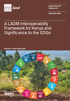
Cover Story (view full-size image): Many land rights in Kenya are undocumented. Land administration is implemented in a distributed environment, and land data are available in different systems. Thus, there is a need for data sharing. Guidelines are necessary in support for the development of a land data exchange and interoperability framework. With the ISO Framework for Enterprise Interoperability combined with the Land Administration Domain Model profile for Kenya, such an interoperability framework is developed. Four key issues are identified and modeled, and mapping them to the sustainable development goals helps in achieving those goals. Implementing and testing the LADM profile for Kenya is easy using GIS tools. With the LADM compliant database, a complete and accurate workflow is assured. Integration with external databases aids in improving efficiency and eliminating duplication. View this paper
  • Issues are regarded as officially published after their release is announced to the table of contents alert mailing list.
  • You may sign up for e-mail alerts to receive table of contents of newly released issues.
  • PDF is the official format for papers published in both, html and pdf forms. To view the papers in pdf format, click on the "PDF Full-text" link, and use the free Adobe Reader to open them.
Order results
Result details
Section
Select all
Export citation of selected articles as:
28 pages, 11064 KiB  
Article
Navigating Post-COVID-19 Social–Spatial Inequity: Unravelling the Nexus between Community Conditions, Social Perception, and Spatial Differentiation
by Minjun Zhao, Ning Liu, Jinliu Chen, Danqing Wang, Pengcheng Li, Di Yang and Pu Zhou
Land 2024, 13(4), 563; https://doi.org/10.3390/land13040563 - 22 Apr 2024
Viewed by 279
Abstract
The 2023 SDGs report underscores the prolonged disruption of COVID-19 on community living spaces, infrastructure, education, and income equality, exacerbating social and spatial inequality. Against the backdrop of the dual impact of significant events and the emergence of digital technologies, a coherent research [...] Read more.
The 2023 SDGs report underscores the prolonged disruption of COVID-19 on community living spaces, infrastructure, education, and income equality, exacerbating social and spatial inequality. Against the backdrop of the dual impact of significant events and the emergence of digital technologies, a coherent research trajectory is essential for characterizing social–spatial equity and understanding its influential factors within the urban planning discipline. While prior research emphasized spatial dimensions and mitigated spatial differentiation to ensure urban equity, the complexity of these interconnections necessitates a more comprehensive approach. This study adopts a holistic perspective, focusing on the “social–spatial” dynamics, utilizing social perception (sentiment maps) and spatial differentiation (housing prices index) pre- and post-pandemic to elucidate the interconnected and interactive nature of uneven development at the urban scale. It employs a multi-dimensional methodological framework integrating morphology analysis of housing conditions, GIS analysis of urban amenities, sentiment semantic analysis of public opinion, and multiscale geographically weighted regression (MGWR) analysis of correlation influential factors. Using Suzhou, China, as a pilot study, this research demonstrates how these integrated methods complement each other, exploring how community conditions and resource distribution collectively bolster resilience, thereby maintaining social–spatial equity amidst pandemic disruptions. The findings reveal that uneven resource distribution exacerbates post-pandemic social stratification and spatial differentiation. The proximity of well-maintained ecological environments, such as parks or scenic landmarks, generally exhibits consistency and positive effects on “social–spatial” measurement. Simultaneously, various spatial elements influencing housing prices and social perception show geographic heterogeneity, particularly in areas farther from the central regions of Xiangcheng and Wujiang districts. This study uncovers a bilateral mechanism between social perception and spatial differentiation, aiming to delve into the interdependent relationship between social–spatial equity and built environmental factors. Furthermore, it aspires to provide meaningful references and recommendations for urban planning and regeneration policy formulation in the digital era to sustain social–spatial equity. Full article
Show Figures

Figure 1

18 pages, 6982 KiB  
Article
Unveiling the Impact of Urbanization on Net Primary Productivity: Insights from the Yangtze River Delta Urban Agglomeration
by Jing Gao, Min Liu and Xiaoping Wang
Land 2024, 13(4), 562; https://doi.org/10.3390/land13040562 - 22 Apr 2024
Viewed by 310
Abstract
Urbanization has significantly altered the carbon cycle of the terrestrial environment, particularly in relation to net primary productivity (NPP). Gaining a more comprehensive comprehension of how NPP is affected by urbanization is crucial for obtaining fresh perspectives on sustainable urban landscape design and [...] Read more.
Urbanization has significantly altered the carbon cycle of the terrestrial environment, particularly in relation to net primary productivity (NPP). Gaining a more comprehensive comprehension of how NPP is affected by urbanization is crucial for obtaining fresh perspectives on sustainable urban landscape design and decision making. While there is a significant body of research examining the geographical and temporal patterns of NPP supply capacity, there are only a few studies that have investigated the spatial relationships between NPP and urbanization, particularly at the grid scale. This research investigated the temporal and geographical features and patterns of NPP and their impact mechanisms. In order to estimate NPP and the level of urbanization in the Yangtze River Delta Urban Agglomeration (YRDUA), we used a combination of different models and datasets. To evaluate the geographical correlations and dependence between NPP and urbanization, we utilized local bivariate autocorrelation methods and spatial regression models to describe and visualize these relationships. The findings revealed that there was a consistent negative relationship between NPP and urbanization on a global scale from 1990 to 2020. However, when examining the local scale, the geographical correlations could be classified into four distinct categories: areas with both low NPP and low urbanization, areas with high NPP and high urbanization, areas with low NPP and high urbanization, and areas with high NPP and low urbanization. Our analysis showed that spatial regression models are more suitable for quantifying the spatial relationship between NPP and urbanization due to their ability to include the impacts of spatial Moran’s I techniques. Due to the growing urbanization, the highest NPP value was recorded in 2005, followed by 2000, 2020, and 2010. Conversely, the smallest association was observed in 2015. Examining the geographical connection between NPP and urbanization offers theoretical and practical insights for urban planning that prioritizes human needs and promotes sustainable development. It also aids in the development of reasonable methods for organizing ecological functional systems. Full article
(This article belongs to the Special Issue Land-Based Greenhouse Gas Mitigation for Carbon Neutrality)
Show Figures

Figure 1

18 pages, 12403 KiB  
Article
Ecological Risk Assessment of Land Use Change in the Tarim River Basin, Xinjiang, China
by Yaqi Cheng, Xuyang Zhang and Wei Song
Land 2024, 13(4), 561; https://doi.org/10.3390/land13040561 - 22 Apr 2024
Viewed by 281
Abstract
In recent years, global climate change and human alterations to land use have led to a decrease in ecosystem services, making ecosystems more vulnerable. However, unlike the well-established risk assessment frameworks used in natural disaster research, the concept of ecological risks arising from [...] Read more.
In recent years, global climate change and human alterations to land use have led to a decrease in ecosystem services, making ecosystems more vulnerable. However, unlike the well-established risk assessment frameworks used in natural disaster research, the concept of ecological risks arising from changes in land use is still in its early stages, with its nuances and assessment methodologies yet to be clearly defined. This study proposes a new framework for assessing ecological risks resulting from changes in land use in the Tarim River Basin. The framework employs a coupled PLUS and Invest model to evaluate the ecological risks of land use change under three development scenarios projected for the Tarim River Basin in Xinjiang by 2035. The findings indicate that: (1) Between 2000 and 2020, the predominant land use types in the Tarim River Basin in Xinjiang were primarily unused land, followed by grassland and cropland. Conversely, grassland, water, and construction land were relatively less prevalent. During this period, the area of unused land and cultivated land increased, while grassland, forest land, and water exhibited a declining trend. Moving forward, under the three scenarios from 2020 to 2035, land use changes in the study area are characterized by the expansion of cropland and unused land, coupled with a significant decrease in grassland area, while other land categories demonstrate minor fluctuations. (2) From 2020 to 2035, across various scenarios, the total ecosystem service within the study area demonstrates an overall increasing trend in both the northern and southern marginal zones. Specifically, under the baseline scenario, the total amount of ecosystem services in the study area decreased by 15.247% compared to 2020. Similarly, under the economic development scenario, this decrease amounted to 13.358% compared to 2020. Conversely, under the ecological protection scenario, the decrease reached 19.852% compared to 2020. (3) The structure of ecological risk levels from 2020 to 2035, across multiple scenarios, demonstrates a consistent pattern, characterized by a predominant proportion of moderate risk. Conversely, other risk levels occupy relatively smaller proportions of the area. Full article
(This article belongs to the Special Issue Landscape Ecological Risk in Mountain Areas)
Show Figures

Figure 1

20 pages, 3730 KiB  
Article
Spatial Differentiation of Ecotourist Perceptions Based on the Random Forest Model: The Case of the Gansu Section of the Yellow River Basin
by Jing Yuan, Hang Gao, Yanlong Shen and Guoqiang Ma
Land 2024, 13(4), 560; https://doi.org/10.3390/land13040560 - 22 Apr 2024
Viewed by 319
Abstract
Ecotourism is vital for coordinating regional ecological protection with socio-economic development. The Gansu section of the Yellow River Basin is a typical ecologically fragile area in China, and it holds a distinctive position in ecological protection and high-quality development. This study explores spatial [...] Read more.
Ecotourism is vital for coordinating regional ecological protection with socio-economic development. The Gansu section of the Yellow River Basin is a typical ecologically fragile area in China, and it holds a distinctive position in ecological protection and high-quality development. This study explores spatial differentiation in ecotourist perceptions and their distinct effects on ecotourist satisfaction, revisitation, and recommendation. It uses four cities (Gannan, Linxia, Lanzhou, and Baiyin) in the Gansu section of the Yellow River (mainstream) as examples, employing a questionnaire survey to collect ecotourists’ perception data and applying a random forest model and one-way ANOVA for analysis. It was found that: (1) rich ecotourism potential exists in the Gansu section of the Yellow River Basin as an ecologically fragile area; (2) there is spatial differentiation in ecotourist perceptions, and among the four regions, Baiyin stands out for its nature and atmosphere perception, and Lanzhou excels in accessibility and service perception; (3) spatial disparities exist in the influencing factors of ecotourist satisfaction, revisitation, and recommendation. Ecotourists in districts with unique natural resources, such as Gannan and Baiyin, prioritize nature perception, whereas districts with abundant natural resources and an established foundation for ecotourism development, such as Linxia and Lanzhou, emphasize service and atmosphere perception. This study constructs a new research framework to explore spatial variations in ecotourists’ perceptions, assisting ecotourism destinations to meet the needs of ecotourists from the supply side, and presents distinctive strategies and recommendations for the development of ecotourism in similar ecologically fragile areas. Full article
Show Figures

Figure 1

13 pages, 10688 KiB  
Article
Policies and Regulations for Desertification Prevention and Control in Mongolia
by Yuan You, Na Zhou and Yongdong Wang
Land 2024, 13(4), 559; https://doi.org/10.3390/land13040559 - 22 Apr 2024
Viewed by 273
Abstract
Desertification is a transnational, cross-regional, and global eco-environmental problem that seriously restricts sustainable socioeconomic development. As Mongolia is a typical arid and semi-arid region, the evolution of desertification in the country is closely related to major global issues such as climate change, global [...] Read more.
Desertification is a transnational, cross-regional, and global eco-environmental problem that seriously restricts sustainable socioeconomic development. As Mongolia is a typical arid and semi-arid region, the evolution of desertification in the country is closely related to major global issues such as climate change, global carbon cycling, and biodiversity. In this article, we analyze the background, development process, limitations, and other aspects of Mongolia’s desertification prevention and control policies and regulations and conclude that Mongolia needs to formulate a “Desertification Prevention and Control Law.” In particular, it needs to clarify the responsibility subjects, beneficiaries, interest compensation subjects, and illegal punishment subjects for prevention and control, as well as the responsibilities and obligations of relevant legal subjects. The research results show that it is important to form a solution mechanism in legal research on the joint prevention and control of desertification between Mongolia and China. We propose a concept of best future practice, highlighting the urgent need to establish a framework for the joint prevention and control of desertification via a cooperative mechanism between Mongolia and China and for the two countries to jointly promote global cooperation in combating this important environmental issue. Full article
(This article belongs to the Section Land Environmental and Policy Impact Assessment)
Show Figures

Figure 1

18 pages, 3426 KiB  
Article
Challenges and Institutional Barriers to Forest and Landscape Restoration in the Chittagong Hill Tracts of Bangladesh
by Oliver Tirtho Sarkar and Sharif A. Mukul
Land 2024, 13(4), 558; https://doi.org/10.3390/land13040558 - 22 Apr 2024
Viewed by 401
Abstract
Preventing, halting, and reversing ecosystem degradation is now a global priority, partly due to the declaration of the United Nations (UN) Decade on Ecosystem Restoration by the UN General Assembly 2021–2030 on 1 March 2019. Apart from the most recent global target to [...] Read more.
Preventing, halting, and reversing ecosystem degradation is now a global priority, partly due to the declaration of the United Nations (UN) Decade on Ecosystem Restoration by the UN General Assembly 2021–2030 on 1 March 2019. Apart from the most recent global target to protect 30% of the natural planet by 2030 as part of the Kunming-Montreal Global Biodiversity Framework agreed during COP15, there are several other global goals and targets. The Government of Bangladesh (GoB) has also pledged to restore 0.75 million hectares of forests as part of the Bonn Challenge. The Chittagong Hill Tracts (CHT) of Bangladesh contain almost one-third of the country’s state-owned forests and are home to 12 ethnic communities, whose livelihoods are dependent on forests. Although once rich in biodiversity, the majority of the forests in the region are highly degraded due to faulty management, complex institutional arrangements, and land disputes with locals. The CHT, therefore, represent the most promising region for ecosystem restoration through forest and landscape restoration (FLR). Here, using the secondary literature, we examine the current institutional arrangements and drivers of deforestation and forest degradation in the CHT region and potential benefits and modalities to make FLR successful in the region. Based on our study, we suggest that institutional reform is essential for successful FLR in the CHT. We also discuss key interventions that are necessary to halt ecosystem degradation and to secure community participation in natural resources management in the region. Full article
(This article belongs to the Special Issue Institutions in Governance of Land Use: Mitigating Boom and Bust)
Show Figures

Figure 1

23 pages, 16274 KiB  
Article
Multi-Scenario Land Use Optimization Simulation and Ecosystem Service Value Estimation Based on Fine-Scale Land Survey Data
by Rui Shu, Zhanqi Wang, Na Guo, Ming Wei, Yebin Zou and Kun Hou
Land 2024, 13(4), 557; https://doi.org/10.3390/land13040557 - 22 Apr 2024
Viewed by 296
Abstract
Land optimization simulation and ecosystem service value (ESV) estimation can better serve land managers in decision-making. However, land survey data are seldom used in existing studies, and land optimization constraints fail to fully consider land planning control, and the optimization at the provincial [...] Read more.
Land optimization simulation and ecosystem service value (ESV) estimation can better serve land managers in decision-making. However, land survey data are seldom used in existing studies, and land optimization constraints fail to fully consider land planning control, and the optimization at the provincial scale is not fine enough, which leads to a disconnection between academic research and land management. We coupled ESV, gray multi-objective optimization (GMOP), and patch-generating land use simulation (PLUS) models based on authoritative data on land management to project land use and ESV change under natural development (ND), rapid economic development (RED), ecological land protection (ELP), and sustainable development (SD) scenarios in 2030. The results show that construction land expanded dramatically (by 97.96% from 2000 to 2020), which encroached on grassland and cropland. This trend will continue in the BAU scenario. Construction land, woodland, and cropland are the main types of land used for expansion, while grassland and unused land, which lack strict use control, are the main land outflow categories. From 2000 to 2030, the total amount of ESV increases steadily and slightly. The spatial distribution of ESV is significantly aggregated and the agglomeration is increasing. The policy direction and land planning are important reasons for land use changes. The land use scenarios we set up can play an important role in preventing the uncontrolled expansion of construction land, mitigating the phenomenon of ecological construction, i.e., “governance while destruction”, and promoting food security. This study provides a new approach for provincial large-scale land optimization and ESV estimation based on land survey data and provides technical support for achieving sustainable land development. Full article
Show Figures

Figure 1

20 pages, 1282 KiB  
Article
Promoting Green Transformations through Smart Engagement: An Assessment of 100 Citizen-Led Urban Greening Projects
by Eleni Oikonomaki, Ilektra Papadaki and Christina Kakderi
Land 2024, 13(4), 556; https://doi.org/10.3390/land13040556 - 22 Apr 2024
Viewed by 372
Abstract
In the face of challenges like heatwaves, flooding, other extreme events, as well as increasing pollution and declining quality of life in cities, there is a growing demand for the preservation and expansion of urban green spaces, often driven by citizen-led transformations. This [...] Read more.
In the face of challenges like heatwaves, flooding, other extreme events, as well as increasing pollution and declining quality of life in cities, there is a growing demand for the preservation and expansion of urban green spaces, often driven by citizen-led transformations. This paper examines 100 urban greening projects initiated or supported by citizens globally, categorizing them according to the type of greenery, the stakeholders involved, the mode of implementation, and the use of smart technologies incorporated. We notice variations in green endeavors based on the stakeholders orchestrating them; most of the entirely citizen-led initiatives being aimed at the creation of urban farms and food growing, demonstrating the pressing need to secure food and self-determination in communities. More than half of the assessed initiatives that managed to scale up and multiply had public authorities providing a framework or a type of support for their development or an NGO or other organization providing expertise and mobilizing citizens at various stages. In terms of technological use, we mostly found that websites and social media platforms ease participatory endeavors and knowledge sharing of best practices, accelerating scaling efforts, while there is low integration of more advanced digital technologies, which, if used, could enable real-time monitoring of green spaces, inform evidence-based decision-making, and streamline processes in scaling up green initiatives. Full article
Show Figures

Figure 1

19 pages, 11968 KiB  
Article
Validation of Remotely Sensed Land Surface Temperature at Lake Baikal’s Surroundings Using In Situ Observations
by Egor Dyukarev, Nadezhda Voropay, Oksana Vasilenko and Elena Rasputina
Land 2024, 13(4), 555; https://doi.org/10.3390/land13040555 - 21 Apr 2024
Viewed by 257
Abstract
The accuracy of Land Surface Temperature (LST) products retrieved from satellite data in mountainous-coastal areas is not well understood. This study presents an analysis of the spatial and temporal variability of the differences between the LST and in situ observed air and surface [...] Read more.
The accuracy of Land Surface Temperature (LST) products retrieved from satellite data in mountainous-coastal areas is not well understood. This study presents an analysis of the spatial and temporal variability of the differences between the LST and in situ observed air and surface temperatures (ISTs) for the southeastern slope of Lake Baikal’s surroundings. The IST was measured at 12 ground observation sites located on the southeastern macro-slope of the Primorskiy Ridge (Baikal, Russia) within an elevation range of 460–1656 m above sea level from 2009 to 2021. LST was estimated using 617 Landsat (7 and 8) images from 2009–2021, taking into account brightness temperature, surface emissivity and vegetation cover fraction. The comparison of the LST from satellite data and the IST from ground observation showed relatively high differences, which varied depending on the season and site type. A neural network was suggested and calibrated to improve the LST data. The corrected remote-sensed temperature was found to reproduce the IST very well, with mean differences of about 0.03 °C and linear correlation coefficients of 0.98 and 0.95 for the air and surface IST. Full article
(This article belongs to the Special Issue Digital Mapping for Ecological Land)
Show Figures

Figure 1

28 pages, 12365 KiB  
Article
How to Realize Synergistic Emission Reduction in Future Urban Agglomerations: Spatial Planning Approaches to Reducing Carbon Emissions from Land Use: A Case Study of the Beijing–Tianjin–Hebei Region
by Haoran Li, Yang Liu, Yixiao Li, Xiaoxi Li, Shuyi Yan and Xi Zheng
Land 2024, 13(4), 554; https://doi.org/10.3390/land13040554 - 21 Apr 2024
Viewed by 297
Abstract
Land use changes in rapidly urbanizing regions around the world constitute a principal anthropogenic element fueling the surge in carbon emissions. Here, land use patterns within the Beijing–Tianjin–Hebei (BTH) urban agglomeration under low-carbon development (LCD) scenarios were simulated. Additionally, social network analysis was [...] Read more.
Land use changes in rapidly urbanizing regions around the world constitute a principal anthropogenic element fueling the surge in carbon emissions. Here, land use patterns within the Beijing–Tianjin–Hebei (BTH) urban agglomeration under low-carbon development (LCD) scenarios were simulated. Additionally, social network analysis was employed to formulate carbon balance planning guidelines for various administrative regions. (1) In the ecological protection scenario, carbon emissions from land use were 643.42 × 10⁴ tons lower compared to the natural development scenario. Counties with high ecological support coefficients accounted for 22%, making them better suited for predicting outcomes related to low-carbon-oriented land use. (2) The spatial connections of carbon emissions in BTH were closely related, forming the three main carbon emission spatial linkage areas. (3) A carbon balance zoning plan for the BTH in 2035 under the LCD scenario was formulated. Furthermore, key areas for the implementation of carbon peak and carbon neutrality projects were delineated, and targeted measures for carbon reduction and sink increase were proposed. This study provides a new perspective for implementing territorial spatial planning in Chinese urban agglomerations and can aid the government in formulating a reasonable low-carbon-oriented regional planning policy. Full article
(This article belongs to the Section Land Planning and Landscape Architecture)
Show Figures

Figure 1

18 pages, 8984 KiB  
Article
Factors Influencing Ephemeral Gullies at the Regional Scale: Formation and Density
by Lei Ma, Chunmei Wang, Yuan Zhong, Guowei Pang, Lei Wang, Yongqing Long, Qinke Yang and Bingzhe Tang
Land 2024, 13(4), 553; https://doi.org/10.3390/land13040553 - 20 Apr 2024
Viewed by 315
Abstract
Ephemeral gully (EG) erosion is an important type of water erosion. Understanding the spatial distribution of EGs and other influencing factors at a regional scale is crucial for developing effective soil and water management strategies. Unfortunately, this area has not been sufficiently studied. [...] Read more.
Ephemeral gully (EG) erosion is an important type of water erosion. Understanding the spatial distribution of EGs and other influencing factors at a regional scale is crucial for developing effective soil and water management strategies. Unfortunately, this area has not been sufficiently studied. The present study visually interpreted the EGs based on Google Earth images in 137 small watersheds uniformly distributed in the Loess Plateau, compared them with measured results, and analyzed the factors influencing EG formation and density using GeoDetector. The results showed that visually interpreting EGs from Google Earth images was suitable for EG regional studies. Out of the 137 small watersheds, 33.6% had EG occurrence with an average density of 3.41 km/km2. Rainfall (R) and slope gradient (S) were the primary factors influencing the formation of EGs, while the area proportion of sloping farmland (APSF) and soil erodibility (K) were the main factors affecting EG density. The interaction of dual factors had a greater influence compared to single factors, with the interaction between S and Normalized Difference Vegetation Index (NDVI) having the greatest impact on EG formation and the interaction between K and NDVI on EG density. Although natural forces significantly influence whether EGs can form in a specific area, human activities greatly affect the density of the gullies that develop. This underscores the importance of proper land management in controlling gully erosion. These findings could provide theoretical support for EG prediction models and a scientific basis for soil and water loss control strategies at the regional scale. Full article
Show Figures

Figure 1

16 pages, 4340 KiB  
Article
Measuring Deprivation and Micro-Segregation in Greek Integrated Sustainable Urban Development Strategies: Time to Apply a Common Method?
by Nikos Karadimitriou and Stavros Spyrellis
Land 2024, 13(4), 552; https://doi.org/10.3390/land13040552 - 20 Apr 2024
Viewed by 288
Abstract
During the Programming Period 2014–2020, dozens of Greek cities drafted Integrated Territorial Investment programmes, based on Integrated Sustainable Urban Development Strategies (ITI SUDs). The Strategies justified the selection of intervention and activity areas using socio-economic analysis. The parameters of that analysis, as specified [...] Read more.
During the Programming Period 2014–2020, dozens of Greek cities drafted Integrated Territorial Investment programmes, based on Integrated Sustainable Urban Development Strategies (ITI SUDs). The Strategies justified the selection of intervention and activity areas using socio-economic analysis. The parameters of that analysis, as specified by the National Coordination Authority, reflected the socio-economic and functional parameters highlighted in the relevant EU regulations. This paper uses a recently published methodology in order to estimate and map deprivation in Greek cities with over 100,000 inhabitants, and compares the results with the activity areas identified in the ITI SUDs of those cities. The paper also makes an estimation of the potential for micro-segregation in deprived areas, in an effort to uncover the links between deprivation, built form and social composition at the micro-scale. The analysis shows that deprivation is comparatively more pronounced in Athens and Thessaloniki, and that the use of a common methodology to measuring deprivation, but with customized measurement scales, could support a more targeted allocation of urban policy resources. On the other hand, micro-segregation seems to be a factor worth exploring only in Athens and Thessaloniki, and not in Patra, Larissa, Volos and Heraklion, where the building stock in areas of deprivation is mostly low-rise. Full article
(This article belongs to the Special Issue Urban Micro-Segregation)
Show Figures

Figure 1

12 pages, 3034 KiB  
Article
Using Automated Machine Learning for Spatial Prediction—The Heshan Soil Subgroups Case Study
by Peng Liang, Cheng-Zhi Qin and A-Xing Zhu
Land 2024, 13(4), 551; https://doi.org/10.3390/land13040551 - 20 Apr 2024
Viewed by 314
Abstract
Recently, numerous spatial prediction methods with diverse characteristics have been developed. Selecting an appropriate spatial prediction method, along with its data preprocessing and parameter settings, presents a challenging task for many users, especially for non-experts. This paper addresses this challenge by exploring the [...] Read more.
Recently, numerous spatial prediction methods with diverse characteristics have been developed. Selecting an appropriate spatial prediction method, along with its data preprocessing and parameter settings, presents a challenging task for many users, especially for non-experts. This paper addresses this challenge by exploring the potential of automated machine learning method proposed in artificial intelligent domain to automatically determine the most suitable method among various machine learning methods. As a case study, the automated machine learning method was applied to predict the spatial distribution of soil subgroups in Heshan farm. A total of 110 soil samples and 10 terrain variables were utilized in the designed experiments. To evaluate the performance, the proposed method was compared to each machine learning method with default parameters values or parameters determined by expert knowledge. The results showed that the proposed method typically achieved higher accuracy scores than the two alternative methods. This suggests that automated machine learning performs effectively in scenarios where numerous machine learning methods are available and offers practical utility in reducing the dependence on users’ expertise in spatial prediction. However, a more robust automated framework should be developed to encompass a broader range of spatial prediction methods, such as spatial statistic methods, rather than only focusing on machine learning methods. Full article
Show Figures

Figure 1

26 pages, 4060 KiB  
Article
Impacts of Land Use Conversion on Soil Erosion in the Urban Agglomeration on the Northern Slopes of the Tianshan Mountains
by Ziqi Guo, Zhaojin Yan, Rong He, Hui Yang, Hui Ci and Ran Wang
Land 2024, 13(4), 550; https://doi.org/10.3390/land13040550 - 20 Apr 2024
Viewed by 492
Abstract
The serious problem of soil erosion not only has a profound impact on people’s lives but also results in a series of ecological and environmental challenges. To determine the impact of changes in land use type on soil erosion in the urban agglomeration [...] Read more.
The serious problem of soil erosion not only has a profound impact on people’s lives but also results in a series of ecological and environmental challenges. To determine the impact of changes in land use type on soil erosion in the urban agglomeration on the northern slopes of the Tianshan Mountains, this study commences by employing the InVEST-SDR (integrated valuation of ecosystem services and tradeoffs–sediment delivery ratio) model to calculate soil erosion levels spanning from 2000 to 2020. Subsequently, it forecasts land use and land cover (LULC) conditions for the year 2030 under three scenarios: Q1 (natural development), Q2 (ecological protection), and Q3 (economic priority). This projection is accomplished through the integration of a coupled Markov chain and multi-objective planning model (MOP) alongside patch-generating land use simulation (PLUS) models. Ultimately, based on these outcomes, the study predicts soil erosion levels for the year 2030. There has been a consistent decline in soil erosion from 2000 to 2020 with high-intensity erosion concentrated in the Tianshan Mountain region. Grasslands, glaciers, and permafrost are identified as the most erosion-prone land types in the study area, with forests exhibiting the highest capacity for soil retention. Converting from grassland and barren land to forest within the same area results in a substantial reduction in soil erosion, specifically by 27.3% and 46.3%, respectively. Furthermore, the transformation from barren land to grassland also leads to a noteworthy 19% decrease in soil erosion. Over the past two decades, the study area has witnessed a significant decline in the area of grasslands, with a notable shift towards barren and impervious surfaces due to economic development and mining activities. The three predicted scenarios depict significant expansion towards barren land, grassland, and impervious area, respectively. Soil erosion decreases under different shared socio-economic pathway (SSP) scenarios relative to 2020. There is an increase in soil erosion in the Q1 scenario and in the Q3 scenario, whereas the amount of soil erosion in the Q2 scenario exhibits a continued decrease when only the effect of land change on soil erosion is considered. Persistently rapid economic development can exacerbate soil erosion problems, underscoring the need to find a balance between economic growth and ecological conservation. As economic expansion slows down, greater emphasis should be placed on environmental protection to maintain ecological stability. Full article
Show Figures

Figure 1

22 pages, 3750 KiB  
Review
Research Progress in the Field of Peatlands in 1990–2022: A Systematic Analysis Based on Bibliometrics
by Jianzong Shi, Wenhao Liu, Ren Li, Xiaodong Wu, Tonghua Wu, Lin Zhao, Junjie Ma, Shenning Wang, Yao Xiao, Guojie Hu, Yongliang Jiao, Dong Wang, Xianhua Wei, Peiqing Lou and Yongping Qiao
Land 2024, 13(4), 549; https://doi.org/10.3390/land13040549 - 19 Apr 2024
Viewed by 412
Abstract
Peatlands are major natural carbon pool in terrestrial ecosystems globally and are essential to a variety of fields, including global ecology, hydrology, and ecosystem services. Under the context of climate change, the management and conservation of peatlands has become a topic of international [...] Read more.
Peatlands are major natural carbon pool in terrestrial ecosystems globally and are essential to a variety of fields, including global ecology, hydrology, and ecosystem services. Under the context of climate change, the management and conservation of peatlands has become a topic of international concern. Nevertheless, few studies have yet systematized the overall international dynamics of existing peatland research. In this study, based on an approach integrating bibliometrics and a literature review, we systematically analyzed peatland research from a literature perspective. Alongside traditional bibliometric analyses (e.g., number of publications, research impact, and hot areas), recent top keywords in peatland research were found, including ‘oil palm’, ‘tropical peatland’, ‘permafrost’, and so on. Furthermore, six hot topics of peatland research were identified: (1) peatland development and the impacts and degradations, (2) the history of peatland development and factors of formation, (3) chemical element contaminants in peatlands, (4) tropical peatlands, (5) peat adsorption and its humic acids, and (6) the influence of peatland conservation on the ecosystem. In addition, this review found that the adverse consequences of peatland degradation in the context of climate change merit greater attention, that peatland-mapping techniques suitable for all regions are lacking, that a unified global assessment of carbon stocks in peatlands urgently needs to be established, spanning all countries, and that a reliable system for assessing peatland-ecosystem services needs to be implemented expeditiously. In this study, we argued that enhanced integration in research will bridge knowledge gaps and facilitate the systematic synthesis of peatlands as complex systems, which is an imperative need. Full article
Show Figures

Figure 1

22 pages, 3965 KiB  
Article
Evolution Process of Urban Industrial Land Redevelopment in China: A Perspective of Original Land Users
by Fang He, Yuan Yi and Yuxuan Si
Land 2024, 13(4), 548; https://doi.org/10.3390/land13040548 - 19 Apr 2024
Viewed by 325
Abstract
The crucial role of urban industrial land redevelopment in sustainable urban renewal has garnered widespread attention. While some scholars have explored the interest game among stakeholders in industrial land redevelopment, they primarily focus on the government-led model. Moreover, there remains a research gap [...] Read more.
The crucial role of urban industrial land redevelopment in sustainable urban renewal has garnered widespread attention. While some scholars have explored the interest game among stakeholders in industrial land redevelopment, they primarily focus on the government-led model. Moreover, there remains a research gap concerning the impact of government intervention on the redevelopment of industrial land. This article utilizes evolutionary game theory to investigate the interest game between local governments and original land users in the model of urban industrial land redevelopment dominated by original land users. We establish evolutionary game models considering incentives and the combination of incentives and regulations, explore the interest balance strategy, and examine the impact of positive incentives and mandatory regulations on industrial land redevelopment. Furthermore, we employ a numerical simulation to unveil the impact of initial strategies and parameter adjustments on game strategy. The research results are as follows: (1) Under the original land user-led redevelopment model, only two evolutionary stability strategies exist: either the original land users implement industrial land redevelopment with positive responses from local governments, or neither party advances the process. (2) Government intervention is pivotal in facilitating the redevelopment of inefficient industrial land as economic subsidies and punitive measures motivate more participants to adopt proactive strategies. (3) The increase in government support positively correlates with the likelihood of industrial land redevelopment implementation by original land users. (4) The interests and costs of original land users emerge as crucial parameters influencing strategic decisions. This study enriches the understanding of the interests of core participants in industrial land redevelopment and provides valuable insights for sustainable urban renewal. Full article
Show Figures

Figure 1

22 pages, 26163 KiB  
Article
Spatiotemporal Analysis of Soil Quality Degradation and Emissions in the State of Iowa (USA)
by Elena A. Mikhailova, Hamdi A. Zurqani, Lili Lin, Zhenbang Hao, Christopher J. Post, Mark A. Schlautman and Gregory C. Post
Land 2024, 13(4), 547; https://doi.org/10.3390/land13040547 - 19 Apr 2024
Viewed by 239
Abstract
The concept of soil quality (SQ) is defined as the soil's capacity to function, which is commonly assessed at the field scale. Soil quality is composed of inherent (soil suitability) and dynamic (soil health, SH) SQ, which can also be analyzed using geospatial [...] Read more.
The concept of soil quality (SQ) is defined as the soil's capacity to function, which is commonly assessed at the field scale. Soil quality is composed of inherent (soil suitability) and dynamic (soil health, SH) SQ, which can also be analyzed using geospatial tools as a SQ continuum (SQC). This study proposes an innovative spatiotemporal analysis of SQ degradation and emissions from land developments using the state of Iowa (IA) in the United States of America (USA) as a case study. The SQ degradation was linked to anthropogenic soil (SD) and land degradation (LD) in the state. More than 88% of land in IA experienced anthropogenic LD primarily due to agriculture (93%). All six soil orders were subject to various degrees of anthropogenic LD: Entisols (75%), Inceptisols (94%), Histosols (59%), Alfisols (79%), Mollisols (93%), and Vertisols (98%). Soil and LD have primarily increased between 2001 and 2016. In addition to agricultural LD, there was also SD/LD caused by an increase in developments often through urbanization. All land developments in IA can be linked to damages to SQ, with 8385.9 km2 of developed area, causing midpoint total soil carbon (TSC) losses of 1.7 × 10¹¹ kg of C and an associated midpoint of social cost of carbon dioxide emissions (SC-CO2) of $28.8B (where B = billion = 109, USD). More recently developed land area (398.5 km2) between 2001 and 2016 likely caused the midpoint loss of 8.0 × 10⁹ kg of C and a corresponding midpoint of $1.3B in SC-CO2. New developments are often located near urban areas, for example, near the capital city of Des Moines, and other cities (Sioux City, Dubuque). Results of this study reveal several different kinds of SQ damage from developments: loss of potential for future C sequestration in soils, soil C loss, and “realized” soil C social costs (SC-CO2). The state of IA has very limited potential land (2.0% of the total state area) for nature-based solutions (NBS) to compensate for SD and LD. The results of this study can be used to support pending soil health-related legislation in IA and monitoring towards achieving the Sustainable Development Goals (SDGs) developed by the United Nations (UN) by providing a landscape-level perspective on LD to focus field-level initiatives to reduce soil loss and improve SQ. Future technological innovations will provide higher spatial and temporal remote sensing data that can be fused with field-level direct sensing to track SH and SQ changes. Full article
Show Figures

Figure 1

15 pages, 4533 KiB  
Article
Temporal Variation in Soil Resistance to Rill Erosion in Cropland of the Dry—Hot Valley Region, Southwest China
by Yi Wang, Xiaosong Qin, Yaping Kong, Dongdong Hou and Ping Ren
Land 2024, 13(4), 546; https://doi.org/10.3390/land13040546 - 19 Apr 2024
Viewed by 284
Abstract
In croplands, soil erosion resistance varies with both natural processes and human disturbances. To clarify the temporal variation in soil erosion resistance, nine cropland plots with three treatments (continuous fallow, fallow after tillage and tillage with corn) were established in the dry–hot valley [...] Read more.
In croplands, soil erosion resistance varies with both natural processes and human disturbances. To clarify the temporal variation in soil erosion resistance, nine cropland plots with three treatments (continuous fallow, fallow after tillage and tillage with corn) were established in the dry–hot valley region of China. A total of 144 field runoff simulation experiments were conducted from May to October to measure the soil detachment rate (Dc), rill erodibility (Kr) and critical shear stress (τc). The results revealed that the natural dry—wet alternation had little influence on the continuous-fallowed soil erosion resistance. On the other hand, the tillage disturbance that occurred in May sharply increased the Dc and Kr to 2.24 and 3 times that of the continuous-fallow treatment, respectively. Then, the erosion resistance could be enhanced with surface consolidation for the fallow-after-tillage treatment. However, after three months of fallow, the Kr was still 89.5% of the fresh tilled soil. In contrast, crop growth could significantly improve aggregate stability and reduce the Kr to 38.2% in August and even further to 23.7% in October compared to the fresh tilled soil. It could be concluded that crop growth is more efficient in enhancing erosion resistance than the mechanical effect. The above results would benefit from the accurate modeling of cropland soil erosion dynamics and guide agricultural management in dry–hot climate regions. Full article
(This article belongs to the Section Soil-Sediment-Water Systems)
Show Figures

Figure 1

20 pages, 3859 KiB  
Article
Insights from 30 Years of Land Use/Land Cover Transitions in Jakarta, Indonesia, via Intensity Analysis
by Faizal Rachman, Jinliang Huang, Xiongzhi Xue and Muh Aris Marfai
Land 2024, 13(4), 545; https://doi.org/10.3390/land13040545 - 19 Apr 2024
Viewed by 267
Abstract
Here, we assess land use/land cover (LULC) transitions over the last 30 years in Jakarta, Indonesia. Land cover maps were prepared for 1990, 1995, 2000, 2005, 2010, 2015, and 2020 using seven categories of Landsat satellite image: bare land, built-up, cropland, green area, [...] Read more.
Here, we assess land use/land cover (LULC) transitions over the last 30 years in Jakarta, Indonesia. Land cover maps were prepared for 1990, 1995, 2000, 2005, 2010, 2015, and 2020 using seven categories of Landsat satellite image: bare land, built-up, cropland, green area, mangrove, water body, and pond. LULC changes were assessed through intensity analyses at the interval and transition levels. LULC changes were initially rapid (1990–1995) and then more gradual (1995–2000, 2000–2005, and 2005–2010). Unlike in previous intervals, annual changes were uniformly distributed over time in 2010–2015 and 2015–2020. Driven by high population and economic growth, built-up land was identified as an active gainer in all intervals except 2010–2015. Alongside built-up areas, cropland was the main supplier of other categories, including bare land, pond, built-up, and green areas. The largest transition area occurred in pond and green areas during 2005–2010 and in built-up land during 2015–2020. High demand for built-up land was observed in land changes driven by high population growth triggered by economic necessity. Economic and population growth exhibited a positive correlation (R2 = 0.78, t = 9.996). This study elucidates spatiotemporal LULC transition patterns over 30 years in a rapidly growing city. Full article
Show Figures

Figure 1

3 pages, 149 KiB  
Editorial
Public Spaces: Socioeconomic Challenges
by Teresa de Noronha
Land 2024, 13(4), 544; https://doi.org/10.3390/land13040544 - 19 Apr 2024
Viewed by 279
Abstract
This Special Issue, entitled ‘Public Spaces: Socioeconomic Challenges’ considers the concept of general well-being from the point of view of collective achievements and/or external conditions that can favorably impact the individual when implemented within an urban structure [...] Full article
(This article belongs to the Special Issue Public Spaces: Socioeconomic Challenges)
21 pages, 9048 KiB  
Article
Trends, Drivers, and Land Use Strategies for Facility Agricultural Land during the Agricultural Modernization Process: Evidence from Huzhou City, China
by Yun Chen, Zhifeng Wang, Kaijiang You, Congmou Zhu, Ke Wang, Muye Gan and Jing Zhang
Land 2024, 13(4), 543; https://doi.org/10.3390/land13040543 - 18 Apr 2024
Viewed by 448
Abstract
Facility agriculture is an important initiative to adopt an all-encompassing approach to food and build a diversified food supply system. Understanding the evolution of facility agricultural land and the factors that drive it can contribute to the development of scientifically strategic agricultural planning [...] Read more.
Facility agriculture is an important initiative to adopt an all-encompassing approach to food and build a diversified food supply system. Understanding the evolution of facility agricultural land and the factors that drive it can contribute to the development of scientifically strategic agricultural planning and agricultural modernization. Therefore, this paper constructs a “situation-structure-behavior-value” theoretical framework; quantifies the relevant driving factors (physical, proximal, and socioeconomic) and their impacts on the development and layout of facility agriculture land by using a multivariate logistic regression model; and provides a strategy for optimizing land use. The results showed that the area of facility agriculture in Huzhou is rapidly expanding. Regarding drivers, facility agricultural land tends to be located in areas with higher slopes according to plot selection. Facility agriculture is more likely to develop in plots with convenient transportation and closer proximity to markets. At the economic level, economic efficiency, agricultural resource superiority, and policies significantly impact facility agriculture expansion. Finally, we propose three land use policy options to facilitate the sustainable development of facility agriculture. This study elucidates the underlying factors driving different types of facility agricultural land and offers methodological guidance for policy support, planning, control, and optimization strategies for facility agriculture. Full article
Show Figures

Figure 1

16 pages, 1091 KiB  
Article
Drinking Poison to Quench Thirst: Local Government Land Financial Dependence and Urban Innovation Quality
by Shiying Xu, Fuqiang Yang, Qian Yang, Binbin Chang and Kun Wang
Land 2024, 13(4), 542; https://doi.org/10.3390/land13040542 - 18 Apr 2024
Viewed by 347
Abstract
Many emerging markets rely on land financing, whereby land grants are used to raise funds for the government. In the short term, land financing eases the government’s fiscal deficit and boosts regional economic development. However, the long-term implications of such behaviour have not [...] Read more.
Many emerging markets rely on land financing, whereby land grants are used to raise funds for the government. In the short term, land financing eases the government’s fiscal deficit and boosts regional economic development. However, the long-term implications of such behaviour have not been adequately discussed. This study focuses on the relationship between local government land finance dependence (LGLFD) and urban innovation quality (UIQ). We find that LGLFD significantly inhibits the improvement of UIQ, and this inhibition occurs through three main channels: changing government spending preferences, reducing financial efficiency, and deteriorating the institutional environment. Our empirical study analyses 3662 samples from 264 Chinese cities from 2003 to 2016, confirming our research hypothesis. Further research finds that there is significant heterogeneity in the effect of LGLFD on UIQ. Based on these conclusions, some policy implications are proposed. Full article
Show Figures

Figure 1

13 pages, 2405 KiB  
Article
Importance of Soil Health for Coffea spp. Cultivation from a Cooperative Society in Puebla, Mexico
by Carol Meritxell Molina-Monteleón, Amparo Mauricio-Gutiérrez, Rosalía Castelán-Vega and José Victor Tamariz-Flores
Land 2024, 13(4), 541; https://doi.org/10.3390/land13040541 - 18 Apr 2024
Viewed by 494
Abstract
The cultivation systems of Coffea spp. in a cooperative society in Puebla, Mexico, include Rustic, Traditional Polyculture, Commercial Polyculture, Unshaded Monoculture and Shaded Monoculture. In this work, the properties of the soil were analyzed through physical, chemical and biological analyses to determine its [...] Read more.
The cultivation systems of Coffea spp. in a cooperative society in Puebla, Mexico, include Rustic, Traditional Polyculture, Commercial Polyculture, Unshaded Monoculture and Shaded Monoculture. In this work, the properties of the soil were analyzed through physical, chemical and biological analyses to determine its nutritional status. Composite sample analyses were conducted to determine physical, chemical and microbiological parameters (fungi, actinomycetes, mesophilic bacteria, nitrifying and denitrifying bacteria). Leaf nutrients were determined. Rustic was the cropping system with the highest amount of K in the soil and nutrient assimilation in the leaf (N, P, K and Fe) (p = 0.001); in addition, it had high populations of mesophilic bacteria, fungi and actinomycetes and very low nitrification and denitrification rates. The principal component analyses (PCA) (>3.25%) indicated that actinomycetes and K in soil favor the assimilation of Fe, K and P. This Coffea spp. cultivation system generated a lower impact on soil health than the rest of the systems and favored forest ecosystem conservation. Full article
(This article belongs to the Special Issue Soil Management for Soil Health)
Show Figures

Figure 1

25 pages, 8912 KiB  
Article
Urban Green–Blue Space Utilization and Public Perceptions Amid the COVID-19 Pandemic: Insights from Northwest China
by Yuliang Wang, Feifei Li, Dan Liu and Zilong Zhang
Land 2024, 13(4), 540; https://doi.org/10.3390/land13040540 - 18 Apr 2024
Viewed by 300
Abstract
The COVID-19 pandemic has reshaped our daily lives and the way we interact with urban green–blue spaces (UGBS), particularly in the economically challenged regions of Northwest China. Our study, utilizing surveys and social media, delves into the pandemic’s impact on UGBS engagement in [...] Read more.
The COVID-19 pandemic has reshaped our daily lives and the way we interact with urban green–blue spaces (UGBS), particularly in the economically challenged regions of Northwest China. Our study, utilizing surveys and social media, delves into the pandemic’s impact on UGBS engagement in this area, offering critical insights for urban planning amidst a global health crisis. We found a gender-balanced but preference-specific engagement in UGBS, with women and married couples in the Chengguan District of Lanzhou city showing affinity. Moreover, educational levels and proximity to academic institutions emerged as key factors influencing UGBS use, pointing to the importance of educational attainment in engagement diversity. Enhancing safety, creating child-friendly and leisure facilities for families, and designing vibrant spaces for socializing are vital, and placing UGBS near educational districts could also promote environmental awareness and scientific learning. Furthermore, the pandemic has reshaped public priorities, elevating the value of accessible, safe UGBS. This shift is evidenced by varied motivations for UGBS visits, with an emphasis on health, nature connectivity, and leisure. Women, older adults, and families, each with their distinct reasons, were drawn to UGBS for activities ranging from recreation to relaxation. Our findings advocate for the creation of multifunctional UGBS that cater to these varied interests, incorporating features such as air-purifying plants, scenic pathways, and zones for family activities, all underpinned by enhanced safety and accessibility. The study also highlights distinct transportation preferences among residents of Chengguan’s northern and southern parts, suggesting a tailored approach to urban infrastructure that accommodates pedestrian access and public transit use. To prevent overcrowding, adjusting facility hours and event timings based on peak visitation times is recommended. Moreover, improving walkways and public transport connectivity is essential not just for convenience but also for ensuring that these green spaces are equitable and financially accessible, fostering inclusive access to these essential urban areas. During the pandemic, social media revealed a growing search for spiritual fulfillment within UGBS, highlighting their importance in societal well-being and coping mechanisms. In response, there’s a compelling opportunity for UGBS to evolve by incorporating designated areas for spiritual relaxation, along with mental health support services. By actively monitoring social media feedback and trends, these spaces can adapt and refine their offerings, ensuring that they meet the community’s changing needs more effectively. Our study highlights the importance of tailoring UGBS to meet diverse community needs, especially during crises. It emphasizes creating multifunctional, accessible UGBS that reflect demographic trends, transportation habits, and public preferences, aiming to boost community resilience and well-being. Drawing from research conducted amidst a worldwide crisis, our study provides key recommendations for the future evolution of UGBS, urging the creation of inclusive environments that bolster the health and well-being of urban populations. Full article
Show Figures

Figure 1

21 pages, 7307 KiB  
Article
Local Perspectives on Agrosilvofishery in Peatlands: A Case Study of Perigi Village, South Sumatra, Indonesia
by Eunho Choi, Jaehui Jeong, Yustina Artati, Hyunyoung Yang, Dessy Adriani and A-Ram Yang
Land 2024, 13(4), 539; https://doi.org/10.3390/land13040539 - 18 Apr 2024
Viewed by 313
Abstract
As the need for sustainable use peatlands increases, the aim of this study is to identify ways to increase the application of agrosilvofishery as an alternative to the traditional sonor system. Herein, the researchers investigate the perception of peatland degradation and the willingness [...] Read more.
As the need for sustainable use peatlands increases, the aim of this study is to identify ways to increase the application of agrosilvofishery as an alternative to the traditional sonor system. Herein, the researchers investigate the perception of peatland degradation and the willingness to participate in agrosilvofishery among peatland residents. The researchers interviewed 228 households in Perigi Village, South Sumatra, Indonesia, and surveyed 137 peatland owners. Logistic regression analysis revealed a positive correlation between the willingness to participate in agrosilvofishery and household expenses, plans to improve peatland productivity, and knowledge regarding mixed farming in farmer and non-farmer groups. Willingness to provide labor for agrosilvofishery was positively correlated with household expenses and experience with farmer organizations. For both groups, the willingness to participate had a more substantial impact on the willingness to contribute to the agrosilvofishery financially than on the willingness to provide labor. It is imperative to consider various educational, institutional, research, and cultural factors that enable peatland agrosilvofisheries to contribute to the income and livelihood of the residents of Perigi Village. Institutional arrangements should be established, including initial capital support for restoration projects and a system involving the entire village community. This study can contribute to offering guidance for implementing agrosilvofisheries and enhance the practicality of field applications for peatland restoration. Full article
(This article belongs to the Special Issue Restoration of Tropical Peatlands: Science Policy and Practice)
Show Figures

Figure 1

24 pages, 10653 KiB  
Article
Leveraging Reed Bed Burnings as Indicators of Wetland Conversion in Modern Greece
by Cleo Maria Gaganis, Andreas Y. Troumbis and Themistoklis Kontos
Land 2024, 13(4), 538; https://doi.org/10.3390/land13040538 - 18 Apr 2024
Viewed by 445
Abstract
This study explores the historical occurrence of wetland ecosystems in Greece by using recurring Phragmites australis (common reed) burnings as an indicator. Phragmites australis, a plant closely associated with wetlands, provides excellent insights into wetland distribution. We establish a substantial association between [...] Read more.
This study explores the historical occurrence of wetland ecosystems in Greece by using recurring Phragmites australis (common reed) burnings as an indicator. Phragmites australis, a plant closely associated with wetlands, provides excellent insights into wetland distribution. We establish a substantial association between reed fires and historical wetland existence in Greece using geographical and statistical analysis, with these fires exhibiting remarkable constancy across time. Using Corine land-cover (CLC) data, we extend our analysis into land-use dynamics, demonstrating that places with the highest reed-bed-fire rates were originally wetlands, particularly those converted into permanent irrigated land and areas with complex agriculture patterns. We find spatial commonalities between reed fires and past wetland existence by analyzing fire occurrence across three main categories: reed fires, agricultural land fires, and grassland fires. Historical records of wetland conversion into agricultural land (or land reclamation works) in locations such as Yianitsa and Kopaida give context to our findings. Visualizations confirm the clustering of reed fires around these converted agricultural regions. In summary, our study offers a unique indicator based on Phragmites australis burnings that can be used to identify previous wetland-type ecosystems, with Mediterranean-wide implications. Despite data constraints, this study adds to the conversation about wetland preservation and sustainable land-use management. Full article
Show Figures

Figure 1

21 pages, 5722 KiB  
Article
How to Coordinate the Relationship between Urban Space Exploitation, Economic Development, and Ecological Environment: Evidence from Henan Province, China
by Xiaotong Xie, Kunlin Wu, Yingchao Li, Shanshan Guo and Xiaoshun Li
Land 2024, 13(4), 537; https://doi.org/10.3390/land13040537 - 17 Apr 2024
Viewed by 295
Abstract
With the rapid development of urbanization, China is facing problems, such as uncoordinated regional development, imbalanced land space development, and ecological environment pollution. This poses a huge threat to the sustainable development of China’s economy and society. Therefore, there is an urgent need [...] Read more.
With the rapid development of urbanization, China is facing problems, such as uncoordinated regional development, imbalanced land space development, and ecological environment pollution. This poses a huge threat to the sustainable development of China’s economy and society. Therefore, there is an urgent need to determine how to coordinate the relationship between the space exploitation, economic development, and ecological environment (SEE) of urban areas. In this study, taking the Henan Province as an example, long time-series data (2000–2020) were used, at a city scale. Then, we developed a logical framework to reveal the interrelationship and intrinsic mechanism between SEE. Next, we explored the spatiotemporal coupling characteristics of SEE using a linear weighting method and a coupling coordination analysis. We found that, from 2000 to 2020, the comprehensive level of SEE showed an obvious trend of change, and different cities have different coupling coordination degrees. However, the overall coupling coordination level is steadily developing and tending to improve. Furthermore, with the spatial autocorrelation method, we analyzed spatial correlation patterns and collaboration/trade-off relationships for SEE. Through the analysis, positive correlation types (HH, LL) cluster significantly and negative correlation types (HL, LH) have low clustering. Meanwhile, we found significant spatial differences in cooperation/trade-off relationships between different years. This research can serve as a reference and as methodological guidance for achieving coordination and sustainable development of the economy, space, and environment. Full article
(This article belongs to the Special Issue Environmental Sustainability Assessment of Land System)
Show Figures

Figure 1

32 pages, 26516 KiB  
Article
Integrating Heritage and Environment: Characterization of Cultural Landscape in Beijing Great Wall Heritage Area
by Ding He, Wenting Chen and Jie Zhang
Land 2024, 13(4), 536; https://doi.org/10.3390/land13040536 - 17 Apr 2024
Viewed by 291
Abstract
The Great Wall, as a globally important large-scale linear cultural heritage asset, is an example of the integration of architecture and landscape, demonstrating the interaction and feedback between heritage and the environment. In the context of advocating the holistic protection of cultural heritage [...] Read more.
The Great Wall, as a globally important large-scale linear cultural heritage asset, is an example of the integration of architecture and landscape, demonstrating the interaction and feedback between heritage and the environment. In the context of advocating the holistic protection of cultural heritage and surroundings, this study utilizes landscape character assessment (LCA) to identify the landscape character of the Great Wall heritage area. Taking the heritage area of the Great Wall in Beijing, China, as an example, principal component analysis (PCA), two-step clustering, and the eCognition software were used to identify and describe the landscape character types, and the interaction mechanism between heritage and the environment was further explored through the reclassification process. A total of 20 landscape character types and 201 landscape character areas were identified in the study area, and a deep coupling relationship between heritage and the environment and cultural landscape spatial patterns were found in the core heritage area. The heritage and environmental character of linear heritage areas should be integrated so as to protect, manage, and plan cultural heritage areas at the landscape level. This study identifies and describes the character of the coupling of heritage and the environment in the Great Wall area for the first time, expands the types and methods of landscape character assessment, and carries out the exploration to combine natural and cultural elements of large-scale linear cultural heritage areas. Full article
(This article belongs to the Section Land Planning and Landscape Architecture)
Show Figures

Figure 1

21 pages, 6313 KiB  
Article
Assessment of Uncertainties in Ecological Risk Based on the Prediction of Land Use Change and Ecosystem Service Evolution
by Chang You, Hongjiao Qu, Shidong Zhang and Luo Guo
Land 2024, 13(4), 535; https://doi.org/10.3390/land13040535 - 17 Apr 2024
Viewed by 361
Abstract
With the rapid progress in urbanization and economic development, the impact of land use change (LUC) on ecosystem services is becoming increasingly significant. However, the accuracy of ecological risk assessment faces challenges due to the presence of uncertainty factors. Using the PLUS model, [...] Read more.
With the rapid progress in urbanization and economic development, the impact of land use change (LUC) on ecosystem services is becoming increasingly significant. However, the accuracy of ecological risk assessment faces challenges due to the presence of uncertainty factors. Using the PLUS model, this study aims to simulate and predict land use changes (LUCs), focusing on the southern hilly regions in southeastern China as a case study, conducting an in-depth assessment of ecological risk uncertainty. Firstly, a spatiotemporal simulation of LUCs in the southern hilly region from 1990 to 2030 was conducted under multiple scenarios. Subsequently, differences in the spatial and temporal distribution of ecosystem service value (ESV) across different years and forecast scenarios in the southern hilly region were revealed, followed by a detailed analysis of the impact of LUCs on ESV. Finally, by calculating the Ecological Risk Index (ERI), the study systematically analyzed the evolution trend of ecological risk in the southern hilly region of China from 1990 to 2030. The main research findings are as follows: (1) the conversion proportions of different land use types vary significantly under different scenarios. Compared to 2020, under the 2030 National Development Scenarios (NDSs), there has been a slight decrease of around 3% in the total conversion area of farmland, forest, and grassland. However, under the Ecological Protection Scenario (EPS) and Urban Development Scenario (UDS) scenarios, there has been an increase in the area of forest and grassland, with a rise of approximately 1.5% in converted built-up land. (2) Western cities (e.g., Yueyang and Yiyang), central cities (e.g., Jiujiang), and northeastern cities (e.g., Suzhou) of China exhibit a relatively high ESV distribution, while ESV significantly decreased overall from 2010 to 2020. However, under the EPS and UDS, ESV shows a significant increasing trend, suggesting that these two scenarios may play a crucial role in ecosystem restoration. (3) The conversion of forest and water bodies to farmland has the most significant inhibitory effect on ESV, especially during the period from 1990 to 2000, providing substantial data support for relevant policy formulation. (4) From 1990 to 2030, ecological risk gradually increased in western, central, and southwestern cities of the southern hilly region, with the highest ecological risk values under the EPS scenario in northern cities (e.g., Chizhou and Tongling). Under the UDS scenario, there has been a significant decrease in ecological risk, providing valuable insights for future ecological conservation and sustainable development. However, a limitation lies in the need for further enhancement of the scenario’s simulation authenticity. This study offers a new perspective for understanding the impact of LUCs on ecosystem services and the uncertainty of ecological risks, providing crucial reference points for land resource management and the formulation of ecological conservation policies. Full article
(This article belongs to the Special Issue Ecological and Disaster Risk Assessment of Land Use Changes)
Show Figures

Figure 1

16 pages, 2360 KiB  
Article
Review of Urbanization-Associated Farmland Research in China: A Sustainability Perspective
by Qiqi Yang, Lijie Pu and Sihua Huang
Land 2024, 13(4), 534; https://doi.org/10.3390/land13040534 - 17 Apr 2024
Viewed by 366
Abstract
Farmland loss in drastically urbanizing landscapes has long been a research concern for resource management, landscape planning, and spatial governance, especially in the context of China. In recent years, the issue of urbanization-associated farmland loss (UAFL) seems to be increasingly recognized as relevant [...] Read more.
Farmland loss in drastically urbanizing landscapes has long been a research concern for resource management, landscape planning, and spatial governance, especially in the context of China. In recent years, the issue of urbanization-associated farmland loss (UAFL) seems to be increasingly recognized as relevant to sustainability. To date, however, existing studies have not yet comprehensively addressed the research gap between UAFL and sustainability. Here, we aim to help fill this knowledge gap by considering UAFL research as an example of the broader land/landscape-related literature, in a hope of informing future studies to better advance sustainability through land-related approaches. Specifically, we combined bibliometric analyses with code-based content analysis to reveal the knowledge base, thematic evolution, and historiographic paths of the literature on UAFL across China and the empirical case studies’ relevance to sustainability. Our main findings include: (1) the examined literature barely draws insights from sustainability science and sustainability only started to arise as a notable topic at around 2016; (2) over half of the empirical studies show awareness in advancing sustainability and interest in understanding the social-environmental drivers and processes underlying landscape dynamics, yet few demonstrate methodological transdisciplinarity; (3) those sustainability-relevant studies either frame UAFL as depletion of the farmland resource that may threat China’s food security and consequently hinder sustainable urbanization or frame UAFL as part of widespread landscape dynamics that affect the environmental outcome(s) or social–environmental tradeoffs of landscape multi-functions; and (4) existing empirical studies are disproportionately focused on 1991–2006, national, regional, and city scales, and some of China’s most developed areas. Our findings provide an overview of this specific research avenue on UAFL and, more importantly, point to the imperative for land/landscape scholars to break out of their disciplinary silos, especially in the natural sciences, to generate more actionable sustainability insights. Full article
Show Figures

Figure 1

Previous Issue
Next Issue
Back to TopTop