


Abstract
Water resources are of critical importance across all ecological, social, and economic realms. Accurate extraction of water bodies is of significance to estimate the spatial coverage of water resources and to mitigate water-related disasters. Single-modal remote sensing images are often insufficient for accurate water body extraction due to limitations in spectral information, weather conditions, and speckle noises. Furthermore, state-of-the-art deep learning models may be constrained by data extensibility, feature transferability, model scalability, and task producibility. This manuscript presents an integrated GeoAI framework that enhances foundation models for efficient water body extraction with multi-modal remote sensing images. The proposed framework consists of a data augmentation module tailored for optical and synthetic aperture radar (SAR) remote sensing images, as well as extraction modules augmented by three popular foundation models, namely SAM, SAMRS, and CROMA. Specifically, optical and SAR images are preprocessed and augmented independently, encoded through foundation model backbones, and subsequently decoded to generate water body segmentation masks under single-modal and multi-modal settings.
1. Introduction
Water is an essential source of life and strife that holds immense significance in various aspects of life and the natural world. Previous research has proved that water is vital for all forms of life on Earth, facilitating various biological processes and functions of ecosystems, and maintaining the Earth’s environmental balance [1,2]. Moreover, water bodies, such as rivers, lakes, and oceans, have served as major transportation routes for trade and commerce throughout human history. Besides the immense significance in various aspects of natural sustainability and social activities, water-caused disasters, such as flash floods and river/lake floods, could result in massive damage, including extensive infrastructure destruction, displacement of communities, and loss of lives.
The spatial coverage of water bodies is vital for understanding the volume of the available water resources and for estimating the level of disaster damage [3,4]. Traditional approaches for monitoring the spatial coverage of water bodies mainly rely on labor-intensive work, which are limited in effectiveness, health and safety, ongoing expenses, and always requires specific training and expertise skills. Geographical information science (GIS)-enhanced approaches have effectively dealt with extracting inaccessible water areas through spatial interpolation on the point-level sensor data [5]. The results of water area extraction are predicted based on point data distributed in the water bodies, which might be inaccurate and uncertain.
Remote sensing datasets enable extracting water bodies in a spatially seamless manner to ensure the long-term availability and conservation of water resources [6,7,8]. A great amount of the literature has reported on the efforts of implementing remote sensing techniques into water body extraction [9]. To date, optical remote sensing images and synthetic aperture radar (SAR) images are the main remote sensing data sources used for water body extraction [9,10,11]. However, neither can effectively support the accurate extraction of water bodies. Studies have proved that optical remote sensing images always fail to represent the land surface under cloud coverage and fog, or under rainfall and snowfall. Otherwise, SAR remote sensing images are often affected by inherently-generated speckle noise, making it difficult to discriminate the spatial characteristics of different land surfaces [12]. Therefore, it is efficient and productive to utilize multi-modal remote sensing data over vast water areas to conduct rapid and continuous monitoring on the changes of water bodies.
In this study, a foundation model refers to a large-scale deep learning model that is pretrained on massive and diverse datasets and can be efficiently adapted to downstream tasks through fine-tuning or prompt-based learning. Unlike task-specific models trained from scratch, foundation models exhibit strong generalization ability, feature transferability, and scalability, making them particularly suitable for multi-modal remote sensing applications where labeled data are limited.
Reference [8] presents a foundation model for land use/land cover classification through combining optical and SAR images. Their results proved that foundation models within multi-modal networks can outperform state-of-the-art multi-modal deep learning techniques. Given the semantic and spatial similarities between land classification and water body delineation, we hypothesize that these models can be effectively adapted to high resolution water segmentation, which is a more fine-grained and boundary-sensitive task. To test this hypothesis, we evaluated representative foundation models on benchmark water segmentation datasets.
This paper reports our efforts for developing a foundation model-enhanced framework for water body extraction with remote sensing images involving optical modal (optical) and radar modal (SAR) images. The specific objectives of this study are as follows:
- (1)
- To investigate the effectiveness of foundation models for water body extraction from optical and SAR remote sensing images.
- (2)
- To evaluate the performance differences between general vision foundation models and remote sensing-oriented foundation models.
- (3)
- To assess the advantages of multi-modal optical–SAR data fusion for water body segmentation under varying imaging conditions.
2. Related Works
2.1. Challenges of Single-Modal Remote Sensing Data for Water Body Extraction
Although optical and SAR remote sensing, respectively, can effectively employ the spatial details and waveband information to identify specific land cover, they have to deal with a variety of challenges in water body extraction.
Optical remote sensing images include a variety of imagery modal data involving high spatial resolution images, multispectral images, and hyperspectral images [13]. Images with high spatial resolution can visualize more spatial details of land cover, and images with high spectral resolution can represent the characteristics of landscape and object. Since spatial resolution and spectral resolution cannot remain high degree, high spatial resolution images always hold three or four wavebands within higher than 5 m in spatial resolution. With the development of modern Earth observation satellites, very high resolution optical remote sensing images with spatial resolutions finer than 10 m, and even sub-meter resolution, have become widely available. The spatial resolution of hyperspectral images is similar to those of multispectral images; however, they always hold hundreds of wavebands, each of which cover a very short spectral interval. Table 1 lists the commonly-used optical remote sensing images for water body extraction in the literature.
Table 1.
Optical remote sensing images used by the literature.
Optical remote sensing cannot extract water bodies in the cases of natural flood monitoring and urban drowned area monitoring, which are covered by clouds. Moreover, optical remote sensing images taken at different times might vary in radiometric information. Although radiometric correction can compensate for variations caused by atmospheric effects, it still cannot effectively reconstruct uncertain land surfaces covered by clouds. Last but not least, the water areas might be visually mixed with other land covers due to similar colors and textures.
SAR focuses on utilizing radar signals to generate high-resolution images of the Earth’s surface. In comparison to optical remote sensing images, the waveband of SAR lies in the microwave interval. This makes it powerful for the penetration of clouds and darkness. Thus, SAR remote sensing images are suitable for all weather conditions. Table 2 lists the commonly-used radar/microwave/SAR remote sensing for water body extraction in the literature.
Table 2.
SAR remote sensing images used in the literature.
Speckle noises and scarce bands are the primary challenges of implementing SAR remote sensing into water body extraction. Since the SAR image only includes one channel, it might not be supported to identify different types of landscape, the characteristics of which are sensitive to the variance of spectral information. Moreover, the L, H, and P bands in SAR remote sensing can penetrate a number of natural materials, such as ice, wet soils, etc. This always makes it impossible to distinguish between water bodies and other landscapes (e.g., ice and moist soils) that cover water bodies. Reference [14] introduces the S1S2-Water dataset—a global reference dataset for the training, validation, and testing of convolutional neural networks (CNNs) for semantic segmentation of surface water bodies in publicly available Sentinel-1 and Sentinel-2 satellite images.
2.2. Multi-Modal (SAR and Optical) Remote Sensing Data for Water Body Extraction
Considering optical or SAR remote sensing images alone cannot effectively support precise water body extraction, fusing these two modal datasets are worthy of considerable attention in water body extraction [15]. Reference [16] claims that the fusion of optical and SAR satellite imagery is significant to improve the identification of open water surfaces at a global scale. Thus, multi-modal remote sensing images involving optical and SAR images provide qualified spectral information and spatial details for extracting representative features in terms of water bodies [17].
While the initial development of SAR remote sensing, Reference [18] investigates the combination of optical and SAR remote sensing for water body extraction. The methodology of SAR and optical remote sensing for water body extraction could be defined in the following main categories: threshold-based approaches, index-based approaches, feature fusion-based approaches, classification fusion-based approaches, OBIA-based approaches, and deep learning-based approaches.
Although the threshold might be limited in addressing the characteristics of different water bodies, Reference [19] claims that the combination of optical and SAR remote sensing images could improve the performance of simple statistical thresholding algorithms. Previous works have proposed a number of spectral water indices for extracting water bodies, such as the normalized difference water index (NDWI), the modified normalized difference water index (MNDWI), the enhanced water index (EWI), and the automated water extraction index (AWEI). These indices were developed based on optical remote sensing image alone. Tian et al. [20] proposed a novel SAR and optical imagery water index (SOWI) to extract water areas. Purnam et al. [21] evaluated commonly used indices on SAR and optical remote sensing images. Their results showed that these indices are specially designed for different water bodies, suggesting that their scalability might be limited for a variety of applications.
Feature fusion-based approaches focus on extracting the features to register SAR and optical remote sensing images. The methodologies include the derivation of representative indices [22], discovering robust features for fusing optical and SAR data [23], transformation from disparate physical units into dimensionless space [24], and a pixel-level feature-based multispectral and SAR fusion algorithm [25]. Currently, it is still difficult to automatically register optical and SAR remote sensing images with data feature space. Thus, some researchers have attempted to combine the water extraction results from optical and SAR remote sensing image. Irwin et al. [26] fused classification datasets of surface water generated from optical and SAR datasets. Yang et al. [27] and Tottrup et al. [28] combined the extraction information of water bodies from Landsat ETM image and radar sat SAR images.
Regarding OBIA-based approaches, Landuyt et al. [29] proposed an unsupervised object-based clustering framework for mapping flooding with optical and SAR remote sensing images. Deep learning models were utilized in optical and SAR image fusion and water body extraction. Bai et al. [30] developed a CNN-based segmentation for extracting surface waters, permanent waters, and temporary waters through optical and SAR image fusion. Venkataramani et al. [16] proposed a CNN-based image segmentation architecture for mapping surface waters with optical (MODIS, Landsat-8, Sentinel-2) and SAR (Sentinel-1) images. Yin et al. [31] proposed a deep feature collaborative CNN called DeepOSWSRM for water mapping with optical and SAR images. Guo et al. [32] proposed a deep learning segmentation for fusing different time series Sentinel-1 and Sentinel-2 images.
In summary, the existing studies indicate that neither optical nor SAR remote sensing alone can robustly support accurate water body extraction under complex environmental conditions. Although multi-modal fusion and deep learning approaches have shown promise, most existing methods rely on task-specific models with limited transferability. This highlights the need for a unified foundation model-based framework capable of effectively integrating optical and SAR data for scalable and generalizable water body extraction.
3. Methodology
3.1. Framework
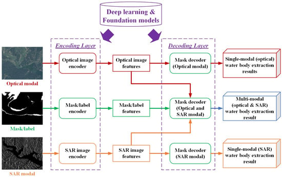
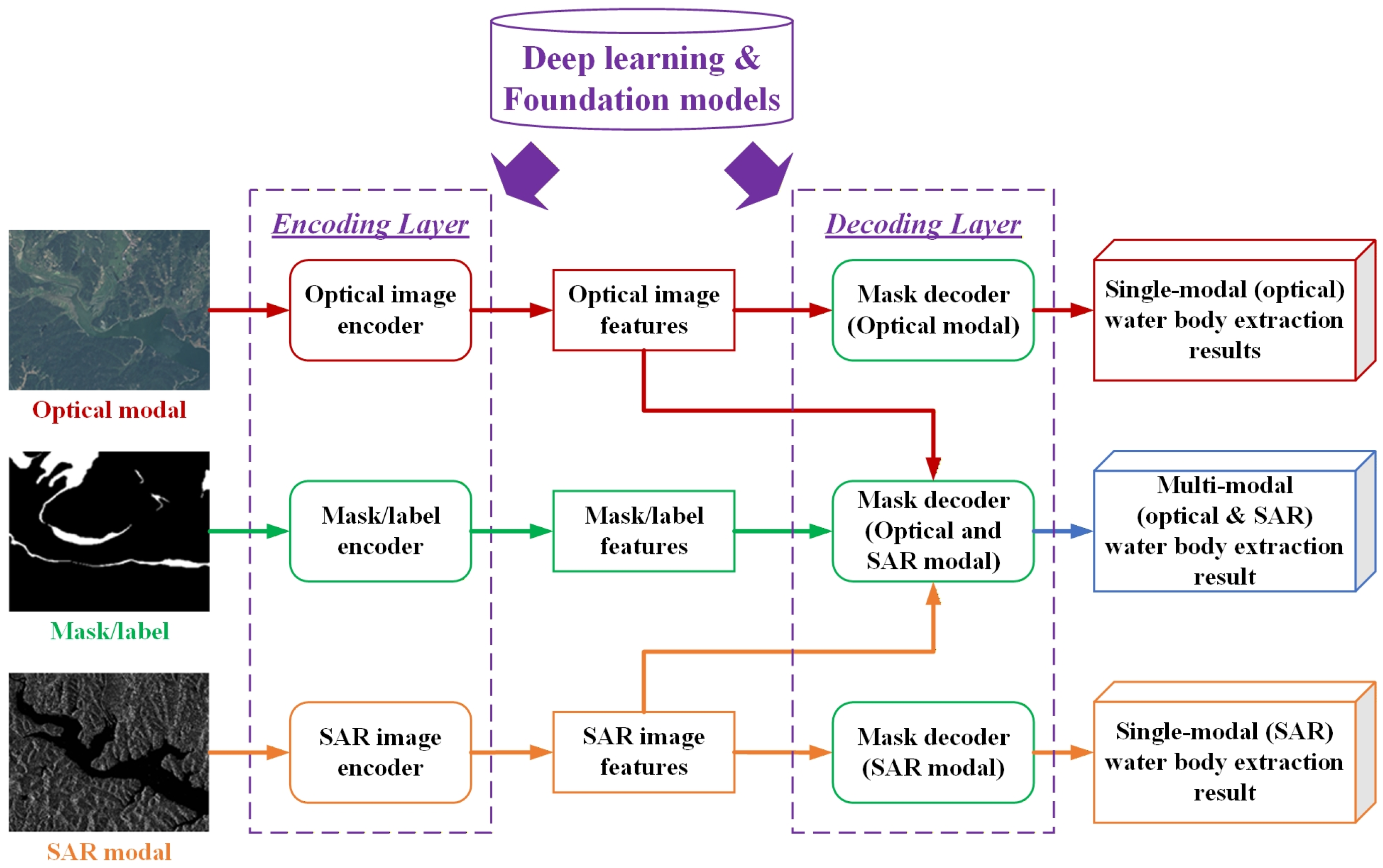
Figure 1 presents the workflow of the methodological framework for various foundation models, which includes the following modules: optical and SAR remote sensing image encoding, mask data encoding, single-modal (optical or SAR) mask decoding, and multi-modal (optical and SAR) mask decoding.
Figure 1.
Framework of optimizing foundation model for multi-modal remote sensing data.
3.1.1. Optical and SAR Remote Sensing Image Encoding
The optical remote sensing image and SAR image encoder, or the SAR image and noising encoder, follows similar architecture. The encoder aims to process the complex data space of the input optical remote sensing image and SAR image to extract nonlinear high-level features. In general, the encoder consists of stacked convolution and transformer blocks, and each includes a number of feed-forward layers. Specifically, the architecture of the feature extraction layer (convolutional layers or self-attention layers) corresponds to the backbone of the foundation models. The details of the convolution blocks and transformer blocks can be read in Reference [33]. For each block, they are hierarchically connected to each other, and the output of the final blocks generates a feature map of the input optical remote sensing images and SAR images.
The image encoder focuses on discovering dependencies among the pixels of the input optical remote sensing image and the SAR image to form relevant image regions. The dependencies are determined by attention weights that measure the similarity among pixels on the feature space.
3.1.2. Labeled Data Training
In the proposed approach, we utilize the mask/labeled images, which are used for training, to generate the prompt regions, or training samples. Each mask/labeled image labels the pixels of water bodies corresponding to the optical remote sensing image and the SAR image. The mask/label encoder converts the input mask/labeled image into an embedding vector for directing the following segmentation. The architecture of the mask/labeled image encoder is similar to the one used in the image encoder. The input mask/labeled image is the image that labels the pixels of water bodies. Then, the prompt encoder employs a series of transformer blocks, which includes a number of self-attention layers and feed-forward layers, to extract high-level features. The final module of the mask/labeled image encoder generates a feature map of the input prompt images.
3.1.3. Mask Image Decoding
The mask encoder is used for fine-tuning the SAM with limited mask images that labels the water body pixels corresponding to the optical and SAR remote sensing images. It enables processing and learning the representative features from the input mask image and its corresponding optical remote sensing image and SAR remote sensing image. The mask encoder aims to decrease the gaps between the source domain modeled by the original SAM and the target domain represented by the input masks.
The architecture of the mask encoder is also similar to the one used for the image encoder. Moreover, the process of feature extraction in the mask encoder is also similar to the one used for the image encoder. The output of the mask encoder is the feature map that represents the high-level semantic meaning of the mask. This feature map is then used to fine-tune the mask decoder to update the initial parameters and weights of the original foundation model.
The mask decoder focuses on processing feature maps initialized from the image encoder and the prompt encoder to generate the final segmentation result. The architecture of the mask decoder is developed based on a CNN or VIT backbone. The input involves feature maps and embedding vectors. The output of the mask decoder is a segmentation mask that labels each pixel into water or non-water.
In this study, mask-based prompts generated from ground-truth water body annotations were employed to guide segmentation. Optical and SAR images were first encoded independently using modality-specific encoders. The resulting feature maps were then concatenated at the decoding stage, allowing complementary spectral and structural cues from both modalities to jointly influence mask prediction.
3.2. Data Processing and Augmentation
3.2.1. Data Preprocessing
The preprocessing of the optical remote sensing image involving radiometric calibration, geometric correction, and atmospheric correction have been well conducted for the higher level of commonly-used optical remote sensing image products, such as Landsat-7, Landsat-8, Sentinel-2, and Gaofen-2. Moreover, the noise influences of the optical remote sensing image could be addressed by adding noises, which are mentioned in Table 2. Thus, we mainly focus on fusing and mosaicking panchromatic and multispectral images with GHIS transform [34].
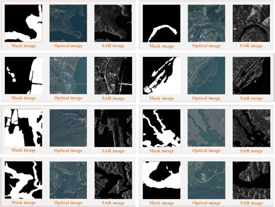
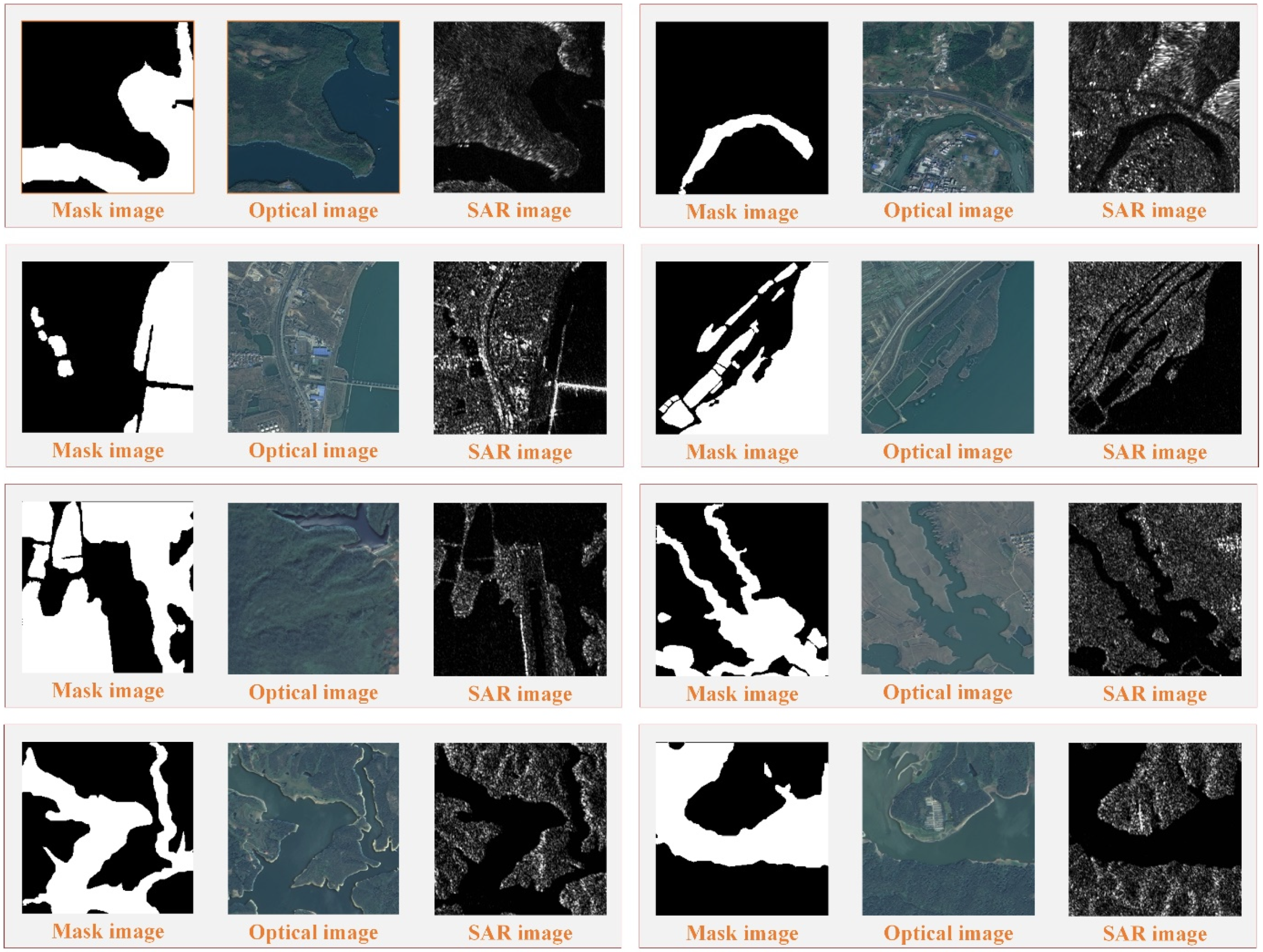
The preprocessing of the SAR remote sensing image aims to detect and filter noises, which are commonly seen in SAR images, as presented in Figure 2. The noises distributed widely in SAR images make it impossible to be removed by state-of-the-art approaches. Considering that the C waveband is sensitive to the moisture degree in land surfaces, we divide the noises of SAR images into the following four types: noises in water areas, noises in impervious surfaces, noises in vegetable surfaces (e.g., grass, forest, etc.), and noises in dry surfaces (e.g., desert, bare soil, etc.). Then, we respectively computed the feature space of these four types of noises, and set specific threshold values of Gaussian filtering to smooth each of these four types of noises. This filtering approach was selected for its ability to effectively preserve speckle noises in SAR images, while minimizing ringing artifacts and preserving sharp boundaries [35,36].
Figure 2.
Illustration on the selected optical remote sensing images, SAR remote sensing images, and mask images used in the experiments.
3.2.2. Data Augmentation
Data augmentation aims to enhance the quality and extend the variance of remote sensing images, which includes image augmentation and SAR remote sensing image denoising. The variance of labeled data is critical to enhance the performance of deep learning approaches [37,38]. Since optical remote sensing and SAR remote sensing images have different modal settings, we designed two separate data augmentation solutions for each of them. Data augmentations for the optical remote sensing image include rotation, translation, flipping, brightness adjustment, contrast adjustment, saturation adjustment, and noise injection. Data augmentations for the SAR remote sensing image include rotation, translation, and flipping. The details of the data augmentation used in this manuscript are listed in Table 3.
Table 3.
List of the data augmentation techniques used in the proposed framework.
3.3. Foundation Models
We employ three types of foundation models: a state-of-the-art foundation model regarding computer vision, a state-of-the-art foundation model regarding remote sensing, and a state-of-the-art foundation model regarding computer vision but fine-tuned with optical and SAR remote sensing images. These foundation models are as follows:
- SAM: foundation model regarding visual features;
- CROMA: foundation model regarding remote sensing;
- SAMRS: foundation model regarding visual features fine-tuned with remote sensing.
3.3.1. Segment Anything Model (SAM)
The SAM is the foundation model regarding computer vision. It is a large-scale foundation model developed for efficient semantic segmentation in the context of images. The backbone of the SAM is established based on the architecture of ViT [39], which includes the image encoder (imgEN()), the prompt encoder (pmtEN()) corresponding to the label/mask encoder, and the mask decoder (mskDN()). The image encoder extracts global semantic features from the image and generates dense, high-dimensional image embedding. The prompt encoder encodes diverse user-provided prompts into vector representations aligned with the image embedding. The mask decoder fuses the image embedding and encoded prompts to produce a final binary segmentation mask, yielding the segmentation result. The values for , , and denote the unlabeled input image, the prompt (target domain sample) within point and polygon shapes, and the image mask, respectively. The values for , , and refer to the feature space of , and , respectively. Based on these three main components, the SAM operates through a three-component pipeline: the image encoder first processes the input image once to produce semantic-rich, high-dimensional image embedding; the prompt encoder then maps diverse user-provided prompts—such as points, bounding boxes, or text—into an embedding space aligned with the image features; finally, the mask decoder fuses these embeddings via a lightweight transformer-based decoder to generate a high-fidelity binary segmentation mask in real time.
Trained on the masked autoencoder (MAE) with 1.1 billion image samples, the SAM and its derivative models have reached state-of-the-art performances on various segmentation tasks [39]. Moreover, the SAM is also competitive to conduct few-shot learning through fine-tuning on a small set of labeled images from the target domain. This makes the SAM efficient for enhancing new tasks of remote sensing where labeled data is scarce. The community of remote sensing have reported the success of fine-tuning the SAM for specific tasks with limited labeled data [39,40,41].
For the FT-SAM, a parameter-efficient fine-tuning strategy was adopted. The image encoder pretrained on large-scale natural images was frozen to preserve its general visual representation capability, while the mask decoder was fine-tuned using water body labeled samples. This strategy enables effective domain adaptation to remote sensing imagery while avoiding overfitting and excessive computational cost.
3.3.2. CROMA
CROMA is a large-scale transformer-based foundation model regarding remote sensing, which is pretrained on a massive dataset of remote sensing images involving a wide range of scenes and conditions [42]. To improve the learning capability of rich and discriminative representations of remote sensing images, CROMA employs contrastive learning to capture the relationships between different parts of an image and between different images for extracting generalizable features. In this manuscript, we select CROMA as the foundation model regarding remote sensing based on the availability of the pretrained foundation model, the scalability of the pretrained foundation model, the spatial resolution of the input image, and the performance of segmentation on the remote sensing benchmark datasets.
3.3.3. SAMRS
The SAMRS is the extension of the SAM in remote sensing, which has been developed based on the backbone of the SAM with four state-of-the-art benchmark datasets, including HRSC2016, DOTA-V2.0, DIOR, and FAIR1M-2.0 [43]. To deal with the arbitrary orientations of land objects on remote sensing images, SAMRS creates a minimum circumscribed horizontal rectangle of the rotated bounding boxes for describing the position of the land object. Moreover, SAMRS defines the center point as the foreground of the point prompt, and the region enclosed by corresponding boxes as the mask prompt. In summary, SAMRS employs the following basic prompts: center point, horizontal bounding box, rotated horizontal bounding box, and the corresponding masks.
To further take advantage of the prompts in feature learning, SAMRS proposes two types of mean intersection over union (mIOU) metrics. These metrics are used to measure the similarity between the predicted LULC mask and the ground truth LULC label at the instance level and pixel level, respectively.
4. Results and Discussions
4.1. Experimental Datasets and Implementations
4.1.1. Experimental Datasets
We collected optical and SAR remote sensing images from the cutting-edge benchmark datasets involving DKDFN [44], Sen1Floods11 [18], and WHU-OPT-SAR [8]. Specifically, we have relabeled the positions of water bodies in some samples where water bodies were annotated incorrectly. The images in DKDFN and Sen1Floods11 were Sentinel-1, and the images in WHU-OPT-SAR were Gaofen-3. We collected 820 SAR remote sensing images to fine-tune the proposed SAM-enhanced framework. The selected optical remote sensing images, SAR remote sensing images, and mask images are illustrated in Figure 2.
4.1.2. Experimental Implementations
All experiments have been conducted on two graphical workstations equipped with 12th Gen Intel CITM i7-12700K (CPU) and NVIDIA GeForce RTX 3080 Ti (GPU). Moreover, all programs have been developed on PyTorch 2.2.2 and CUDA 12.2. For each deep learning model, 80% of the labeled data was utilized to fine-tune the pretrained models, while the remaining 20% was reserved for evaluation. To ensure the rigor and consistency of the experiments, all models were fine-tuned using a consistent set of hyperparameters. We adopted the AdamW optimizer with a weight decay of 0.01. The initial learning rate was set to 1 × 10⁻⁴ and was dynamically adjusted using a cosine annealing scheduler throughout the training process. The batch size was set to 16, and the models were trained for 100 epochs until convergence.
To compare and testify the performance of various foundation models in water body extraction based on multi-modal remote sensing images, we compared the water segmentation results generated by a variety of state-of-the-art deep learning models and foundation models. The deep learning models used for comparison were DeepLabv3 [45,46], FCN [47,48], MobileNetv3 [49,50], RefineNet [51], SegNet [52,53], and UNet [54,55], which were accessed from the GitHub repo: https://github.com/WZMIAOMIAO/deep-learning-for-image-processing/tree/master/pytorch_segmentation/ (accessed on 25 January 2026). For every deep learning model, 70% of the labeled datasets have been used for fine-tuning the pretrained model, and the remainder were used for testing.
For the foundation models, we have utilized SAM, CROMA, and SAMRS to conduct water body segmentation. SAM, CROMA and SAMRS can be accessed from the GitHub repo: https://github.com/facebookresearch/segment-anything (accessed on 25 January 2026), https://github.com/antofuller/CROMA (accessed on 25 January 2026), https://github.com/ViTAE-Transformer/SAMRS (accessed on 25 January 2026). Since CROMA and SAMRS have been developed by large-scale labeled datasets, no further fine-tuning analysis has been conducted.
4.2. Results of Water Body Extraction
The results of water body extraction from the optical remote sensing images alone, SAR remote sensing images alone, and multi-modal remote sensing images are listed in Table 4. All results were evaluated by the commonly-used indices involving Intersection over Union (IoU), accuracy, precision, recall, and F1, which were expressed as follows, where TP, TN, FP, and FN respectively refer to true positive results, true negative results, false positive results, and false negative results.
where , , , and refer to IOU, accuracy, precision, recall, and F1, respectively.
Table 4.
Results of water body extraction by different remote sensing images.
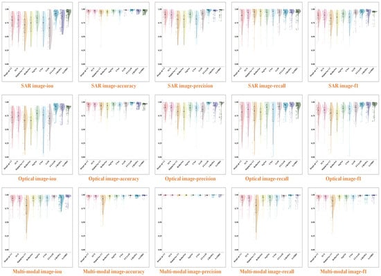
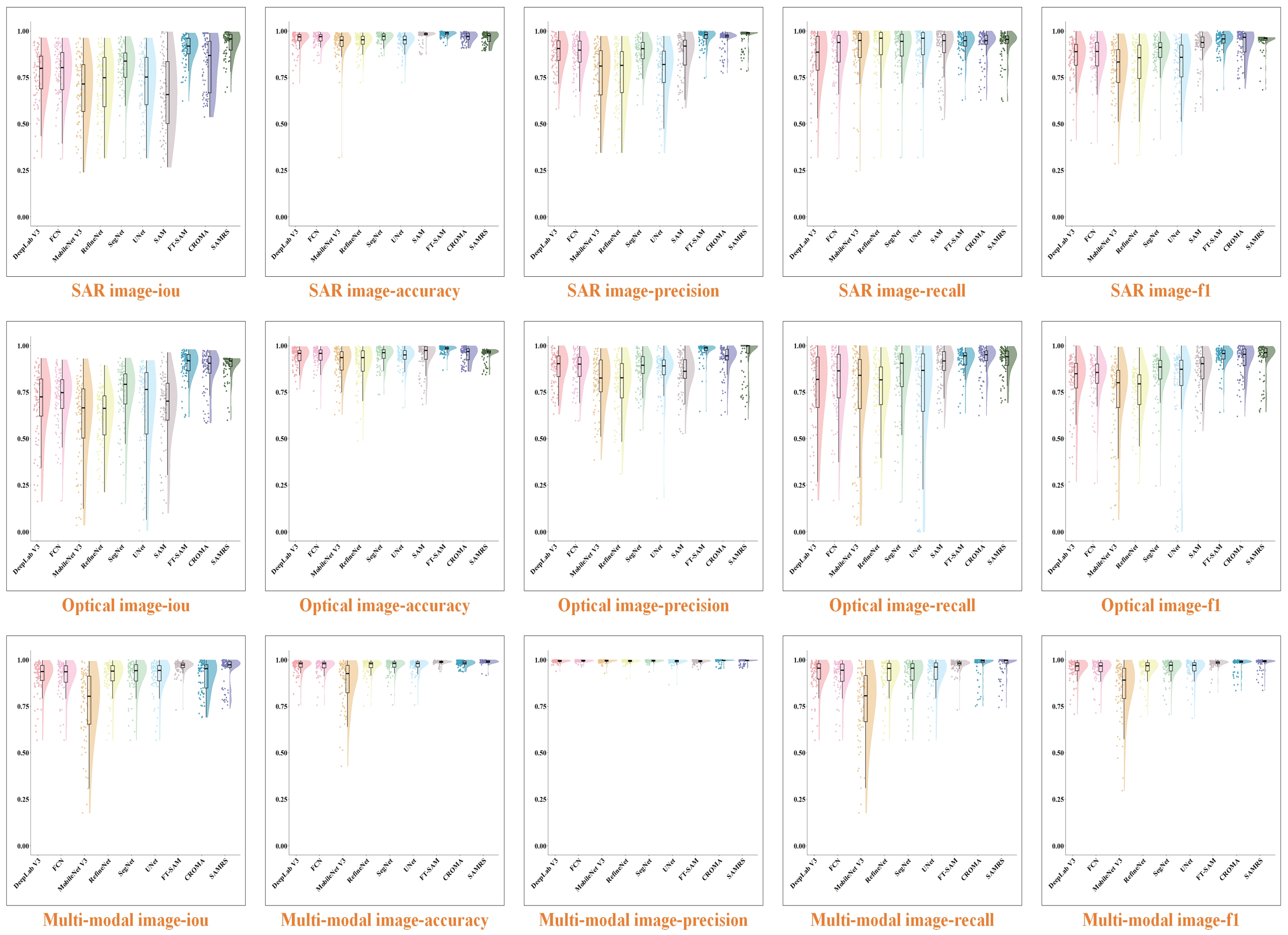
Moreover, the results listed in Table 4 are visualized in Figure 3 to present the trend of the data distribution.
Figure 3.
Visual illustration of the results of water body extraction by different remote sensing images. Red, pink, orange, green, lime, cyan, gray, blue, purple, and olive areas are the statistical distribution of DeepLabv3, FCN, MobileNetv3, SegNet, UNet, SAM, FT-SAM, CROMA, and SAMRS.
We examined the findings presented in Table 4 and Figure 3 from two perspectives: dataset and model. In terms of datasets, the extraction results on multi-modal images were better than single modal images. These outcomes mean that the performances of the models heavily depended on the content of the SAR and the optical remote sensing images, indicating that neither type could fully encapsulate the intricate characteristics of water bodies. Furthermore, all models performed better when utilizing multi-modal remote sensing images compared to results obtained from either SAR or optical remote sensing images. This highlighted the unique representations each type of remote sensing image offered for water bodies, showcasing the benefits of their fusion in effectively portraying these features.
In terms of model dimension, MobileNetv3 exhibited the poorest performance in extracting water bodies from optical and SAR remote sensing images. This subpar performance could be attributed to the lightweight refined atrous spatial pyramid pooling (LR-ASPP) module, which was designed to reduce computational costs by employing fewer parameters than the standard ASPP module in DeepLabv3. However, due to the limited scale of the training data used to fine-tune the model in our experiments, MobileNetv3 might fail to learn the distinctive features from optical and SAR remote sensing images effectively. Among the remaining five models—DeepLabv3, FCN, RefineNet, SegNet, and UNet—the results were similar, with all foundation models (SAM, CROMA, and SAMRS) outperforming them. This observation validated two key assumptions. Firstly, the marginal differences among state-of-the-art deep learning models became negligible when training datasets were constrained in size. Additionally, the foundation model demonstrated a remarkable capacity for learning representative features even from small-scale training datasets.
Moreover, the results of recall were much lower than those of precision and accuracy. This means that extracting the data for the relevant water bodies were very difficult due to the complex characteristics of the water bodies represented on remote sensing images.
4.3. Discussions
Traditional water body extraction methods relying on single sensors or shallow fusion strategies encounter significant limitations in complex environments. Optical imagery is susceptible to interference from cloud cover, illumination angles, and water turbidity, while SAR data often suffer from a lack of spectral information, speckle noise, and sensitivity to surface roughness variations induced by wind waves, which hinders the differentiation between water bodies and low backscatter features, such as asphalt roads, shadows, or dense vegetation. While multi-source data fusion is widely recognized as an effective approach, early or feature-level fusion strategies often depend on manually designed features or shallow neural networks, failing to fully exploit cross-modal semantic correlations and complementary information. This limitation is particularly evident in out-of-distribution scenarios (e.g., highly turbid water bodies, dense urban areas with dark buildings, or wind-swept seas), where generalization capabilities are restricted.
Remote sensing foundation models offer a novel paradigm for multi-modal water body extraction. The experimental results demonstrate that these large models outperform deep learning methods in multi-modal data learning, an advantage stemming not only from their scale but from their data-driven universal representation learning framework and implicit modeling of remote sensing physical processes.
Firstly, foundation models learn high-level semantic–physical joint representations that transcend pixel-level statistical features through self-supervised pretraining on extensive, multi-temporal, and multi-regional optical–SAR paired datasets. These representations are encoded as stable feature vectors within a shared latent space, eliminating reliance on manually designed, isolated indicators, or annotated features. Instead, they automatically discover more discriminative and robust cross-modal association rules, particularly excelling in scenarios with anomalous spectral or scattering characteristics.
Secondly, foundation models exhibit strong contextual reasoning and spatial structural understanding capabilities. Traditional methods frequently misclassify dark roofs, mountain shadows, or dense understory vegetation as water bodies due to local similarities. However, models based on transformer or CNN architecture can integrate multi-kilometer-scale object context through long-range attention mechanisms, enabling semantic differentiation between “isolated dark patches” and “connected waterways”. For example, even when SAR backscatter is minimal and optical imagery is obscured by clouds, the model can infer that a region is likely water based on spatial continuity with upstream/downstream water bodies and surrounding land cover semantics.
Finally, foundation models significantly enhance adaptability to environmental disturbances. For example, changes in wind speed increase surface roughness, leading to amplified SAR backscatter that CNN and transformer might misclassify as non-water. Similarly, turbid water bodies may lose characteristic spectral features in optical imagery. By incorporating training samples covering a wide range of wind speeds, turbidity levels, and solar zenith angles, foundation models learn nonlinear mappings between “water body identity” and their observed representations.
5. Conclusions
Water resources are crucial for the sustainable development of socio-economic and natural systems. An accurate estimation of the spatial extent of water bodies is essential for determining the potential volume of water available for use. However, traditional field investigations and ground-based sensing networks face significant challenges in detecting water bodies. Satellite remote sensing techniques offer a solution by enabling the extraction and monitoring of water bodies without physical contact. Nevertheless, single-modal remote sensing images may not provide comprehensive representations of water areas and their surrounding land surfaces due to limitations imposed by weather conditions, sensor capabilities, and landscape characteristics. Moreover, massive well-labeled imagery samples in terms of water bodies are unattainable due to the complex land surfaces on the Earth. Thus, multi-modal remote sensing images and foundation models enable generating multiple types of spectral information and spatial details to present the characteristics of water bodies, allowing state-of-the-art deep learning approaches to conduct efficient and precise water body extraction.
In this manuscript, we proposed a framework candidate for water body extraction, which is enhanced by foundation models and small-scale optical and SAR remote sensing images. To achieve this, we designed data augmentations to expand the variance of labeled images and to develop an assembled framework based on the architecture of state-of-the-art foundation models regarding computer vision and remote sensing. The experimental results demonstrate that the fusion of optical and SAR remote sensing images and the enhancement of foundation models could be the appropriate solution for implementing GeoAI techniques for precise and accurate water body extraction.
In the future, increasing the variance and volume of well-labeled remote sensing images remains a pressing concern. The volume of labeled datasets and computational training are critical factors for promoting the efficiency of water body extraction. Given the substantial financial investment required to create well-labeled remote sensing images, exploring generative AI-enhanced approaches for generating training samples may prove to be a worthwhile pursuit.
Author Contributions
Conceptualization, X.Z. and M.S.; methodology, G.H., M.S. and K.L.; validation, X.Z. and X.X.; writing—original draft, G.H. and M.S.; writing—review and editing, X.Z.; visualization, G.H.; funding acquisition, X.Z. and X.X. All authors have read and agreed to the published version of the manuscript.
Funding
This manuscript is supported by the National Natural Science Foundation of China [42201473], the Key Research and Development Program of Ningxia Hui Autonomous Region [2025BEG01010], Beijing Nova Program [20230484351], the Open Topic of the Hunan Engineering Research Center of 3D Real Scene Construction and Application Technology [3DRS2024Y1], and the Open Research Fund of State Key Laboratory of Information Engineering in Surveying, Mapping and Remote Sensing, Wuhan University under Grant 25I02.
Data Availability Statement
The raw data supporting the conclusions of this article will be made available by the authors on request.
Conflicts of Interest
The authors declare no conflicts of interest.
References
- Tortajada, C. Contributions of Recycled Wastewater to Clean Water and Sanitation Sustainable Development Goals. NPJ Clean Water 2020, 3, 22. [Google Scholar]
- Zhu, Z.; He, S.; Wang, Y.; Zhao, Y.; Wang, H.; Liu, B.; Li, X. Identification of Priority Areas for Water Ecosystem Services by a Techno-Economic, Social and Climate Change Modeling Framework. Water Res. 2022, 221, 118766. [Google Scholar] [CrossRef] [Scilit] [PubMed]
- Khandelwal, A.; Karpatne, A.; Marlier, M.E.; Kim, J.; Lettenmaier, D.P.; Jain, A.K. An Approach for Global Monitoring of Surface Water Extent Variations in Reservoirs Using MODIS Data. Remote Sens. Environ. 2017, 202, 113–128. [Google Scholar] [CrossRef] [Scilit]
- Li, J.; Sheng, Y.; Feng, L.; Xu, Y. Satellite Detection of Surface Water Extent: A Review of Methodology. Water 2022, 14, 1148. [Google Scholar] [CrossRef] [Scilit]
- Wang, X.; Xie, H. A Review on Applications of Remote Sensing and Geographic Information Systems (GIS) in Water Resources and Flood Risk Management. Water 2018, 10, 608. [Google Scholar] [CrossRef] [Scilit]
- Palmer, S.C.J.; Kutser, T.; Hunter, P.D. Remote Sensing of Inland Waters: Challenges, Progress and Future Directions. Remote Sens. Environ. 2015, 157, 1–8. [Google Scholar]
- Chawla, I.; Karthikeyan, L.; Mishra, A.K. A Review of Remote Sensing Applications for Water Security: Quantity, Quality, and Extremes. J. Hydrol. 2020, 585, 124826. [Google Scholar] [CrossRef] [Scilit]
- Li, X.; Liu, X.; Jiang, S.; Zhang, X.; Hu, J.; Li, X.; Li, M. MCANet: A Joint Semantic Segmentation Framework of Optical and SAR Images for Land Use Classification. Int. J. Appl. Earth Obs. Geoinf. 2022, 106, 102638. [Google Scholar] [CrossRef] [Scilit]
- Chen, J.; Xu, M.; Gao, L.; Peng, X. Remote Sensing Big Data for Water Environment Monitoring: Current Status, Challenges, and Future Prospects. Earth’s Future 2022, 10, e2021EF002289. [Google Scholar] [CrossRef] [Scilit]
- Huang, C.; Chen, Y.; Zhang, S.; Wu, J. Detecting, Extracting, and Monitoring Surface Water from Space Using Optical Sensors: A Review. Rev. Geophys. 2018, 56, 333–360. [Google Scholar] [CrossRef] [Scilit]
- Guo, Z.; Lin, H.; Guo, S.; Wang, M.; Sun, X. Water-Body Segmentation for SAR Images: Past, Current, and Future. Remote Sens. 2022, 14, 1752. [Google Scholar] [CrossRef] [Scilit]
- Hertel, V.; Chow, C.; Wani, O.; Wieland, M.; Martinis, S. Probabilistic SAR-Based Water Segmentation with Adapted Bayesian Convolutional Neural Network. Remote Sens. Environ. 2023, 285, 113388. [Google Scholar] [CrossRef] [Scilit]
- Zhou, X.; Zhang, Y.; Zhang, Y.; Chen, Z. Water Chlorophyll Estimation in an Urban Canal System with High-Resolution Remote Sensing Data. IEEE Geosci. Remote Sens. Lett. 2020, 18, 1876–1880. [Google Scholar] [CrossRef] [Scilit]
- Wieland, M.; Martinis, S.; Kiefl, R.; Gstaiger, V. Semantic Segmentation of Water Bodies in Very High-Resolution Satellite and Aerial Images. Remote Sens. Environ. 2023, 287, 113452. [Google Scholar] [CrossRef] [Scilit]
- Chen, J.; Zhou, Y.; Wang, C.; Li, H.; Chen, L. The Performance of Landsat-8 and Landsat-9 Data for Water Body Extraction Based on Various Water Indices: A Comparative Analysis. Remote Sens. 2024, 16, 1984. [Google Scholar] [CrossRef] [Scilit]
- Venkataramani, K.; Singh, A.; Chawla, I.; Ganasala, P. Harmonizing SAR and Optical Data to Map Surface Water Extent: A Deep Learning Approach. In Proceedings of the IEEE International Geoscience and Remote Sensing Symposium (IGARSS), Pasadena, CA, USA, 16–21 July 2023; IEEE: Piscataway, NJ, USA, 2023; pp. 3349–3352. [Google Scholar]
- Dzinotizei, Z.; Ndagurwa, H.G.T.; Ndaimani, H.; Chichinye, A. Comparability of radar and optical methods in identifying surface water in a semi-arid protected area. Afr. J. Ecol. 2024, 62, e13301. [Google Scholar] [CrossRef] [Scilit]
- Sun, D.; Li, J.; Zhu, J.; Wang, K.; Han, X.; Tian, X.; Liu, Y. Extraction of water bodies from high-resolution remote sensing imagery based on a deep semantic segmentation network. Sci. Rep. 2024, 14, 14604. [Google Scholar] [CrossRef] [Scilit]
- Declaro, A.; Kanae, S. Enhancing surface water monitoring through multi-satellite data-fusion of Landsat-8/9, Sentinel-2, and Sentinel-1 SAR. Remot Sens. 2024, 16, 3329. [Google Scholar] [CrossRef] [Scilit]
- Tian, B.; Li, X.; Wang, L.; Chen, J.; Song, C.; Wu, C. A novel water index fusing SAR and optical imagery (SOWI). Remote Sens. 2022, 14, 5316. [Google Scholar] [CrossRef] [Scilit]
- Purnam, K.K.; Prasad, A.D.; Ganasala, P. Water indices for surface water extraction using geospatial techniques: A brief review. Sustain. Water Resour. Manag. 2024, 10, 70. [Google Scholar] [CrossRef] [Scilit]
- Markert, K.N.; Chishtie, F.; Anderson, E.; Warren, M.; Nelson, A.; Velez, S.; Saah, D.; Savelli, S. On the merging of optical and SAR satellite imagery for surface water mapping applications. Results Phys. 2018, 9, 275–277. [Google Scholar] [CrossRef] [Scilit]
- Druce, D.; Li, J.; Feng, M.; Zhang, Y.; Guo, H. An optical and SAR-based fusion approach for mapping surface water dynamics over Mainland China. Remote Sens. 2021, 13, 1663. [Google Scholar] [CrossRef] [Scilit]
- Markert, K.N.; Chen, X.; Chishtie, F.; Nelson, A.; Anderson, E.; Saah, D.; Verbesselt, J.; Gorelick, N. Dense time series generation of surface water extents through optical–SAR sensor fusion and gap filling. Remote Sens. 2024, 16, 1262. [Google Scholar] [CrossRef] [Scilit]
- Yang, S.; Wang, Q.; Zhang, H.; Wang, X.; Pan, D.; Zhu, J.; Chen, G. Recognition of small water bodies under complex terrain based on SAR and optical image fusion algorithm. Sci. Total Environ. 2024, 946, 174329. [Google Scholar] [CrossRef] [Scilit]
- Irwin, K.; Beaulne, D.; Braun, A.; Fotopoulos, G. Fusion of SAR, optical imagery and airborne LiDAR for surface water detection. Remote Sens. 2017, 9, 890. [Google Scholar]
- Yang, Y.; Zhao, F.; Ling, F.; Du, Y.; Li, X.; Wu, H.; Liu, Y.; Li, Z. A surface water mapping framework combining optical and radar remote sensing and its application in China. Geocarto Int. 2022, 37, 17547–17564. [Google Scholar] [CrossRef] [Scilit]
- Tottrup, C.; Nie, S.; Marti-Cardona, B.; Hostache, R.; Zimmermann, M.; Rainsford, C.; Verpoorter, C.; Poortinga, A. Surface water dynamics from space: A round robin intercomparison of using optical and SAR high-resolution satellite observations for regional surface water detection. Remote Sens. 2022, 14, 2410. [Google Scholar]
- Landuyt, L.; Verhoest, N.E.C.; Van Coillie, F.M.B. Flood mapping in vegetated areas using an unsupervised clustering approach on Sentinel-1 and -2 imagery. Remote Sens. 2020, 12, 3611. [Google Scholar]
- Bai, Y.; Zhang, Y.; Ding, X.; Chen, H.; Chen, Z.; Li, H.; Gong, C.; Jin, X. Enhancement of detecting permanent water and temporary water in flood disasters by fusing Sentinel-1 and Sentinel-2 imagery using deep learning algorithms: Demonstration of Sen1Floods11 benchmark datasets. Remote Sens. 2021, 13, 2220. [Google Scholar] [CrossRef] [Scilit]
- Yin, Z.; Liu, X.; Zhang, P.; Chen, S.; Duan, Y. Super-resolution water body mapping with a feature collaborative CNN model by fusing Sentinel-1 and Sentinel-2 images. Int. J. Appl. Earth Obs. Geoinf. 2024, 134, 104176. [Google Scholar] [CrossRef] [Scilit]
- Guo, S.; Zhou, Y.; Wu, W.; Fang, S.; Li, J.; Xiao, C. Estimates and dynamics of surface water extent in the Yangtze Plain from Sentinel-1&2 observations. Int. J. Appl. Earth Obs. Geoinf. 2024, 134, 104155. [Google Scholar]
- Dosovitskiy, A.; Beyer, L.; Kolesnikov, A.; Weissenborn, D.; Zhai, X.; Unterthiner, T. An image is worth 16 × 16 words: Transformers for image recognition at scale. arXiv 2020, arXiv:2010.11929. [Google Scholar]
- Zhou, X.; Chen, S.; Li, F. A GIHS-based spectral preservation fusion method for remote sensing images using edge restored spectral modulation. ISPRS J. Photogramm. Remote Sens. 2014, 88, 16–27. [Google Scholar] [CrossRef] [Scilit]
- Choi, H.; Jeong, J. Speckle noise reduction technique for SAR images using statistical characteristics of speckle noise and discrete wavelet transform. Remote Sens. 2019, 11, 1184. [Google Scholar] [CrossRef] [Scilit]
- Focsa, A.; Anghel, A.; Datcu, M. Inter-polarization Mapping via Gaussian Process Regression for Sentinel-1 EW Denoising. In Proceedings of the IGARSS 2022—2022 IEEE International Geoscience and Remote Sensing Symposium, Kuala Lumpur, Malaysia, 17–22 July 2022; IEEE: Piscataway, NJ, USA, 2002; pp. 2063–2066. [Google Scholar]
- Shorten, C.; Khoshgoftaar, T.M. A survey on image data augmentation for deep learning. J. Big Data 2019, 6, 60. [Google Scholar] [CrossRef] [Scilit]
- Lv, N.; Shen, H.; Li, X.; Yuan, Q.; Li, H. Remote sensing data augmentation through adversarial training. IEEE J. Sel. Top. Appl. Earth Obs. Remote Sens. 2021, 14, 9318–9333. [Google Scholar] [CrossRef] [Scilit]
- Osco, L.P.; Wu, Q.; De Lemos, E.L.; Gonçalves, W.N.; Ramos, A.P.; Li, J.; Junior, J.M. The segment anything model (SAM) for remote sensing applications: From zero to one shot. Int. J. Appl. Earth Obs. Geoinf. 2023, 124, 103540. [Google Scholar] [CrossRef] [Scilit]
- Sarkar, A.; Ghosh, S.; Paul, M.; Sharma, Y.; Banerjee, B.; Chaudhuri, S. SAM-VQA: Supervised attention-based visual question answering model for post-disaster damage assessment on remote sensing imagery. IEEE Trans. Geosci. Remote Sens. 2023, 61, 4702716. [Google Scholar] [CrossRef] [Scilit]
- Yan, Z.; Zhang, W.; Zhou, Z.; Zhang, T.; Chen, X.; Jiang, J. RingMo-SAM: A foundation model for segment anything in multimodal remote-sensing images. IEEE Trans. Geosci. Remote Sens. 2023, 61, 5625716. [Google Scholar] [CrossRef] [Scilit]
- Li, Y.; Chen, J.; Li, K.; Lin, H.; Zhan, X.; Liu, H. DKDFN: Domain knowledge-guided deep collaborative fusion network for multimodal unitemporal remote sensing land cover classification. ISPRS J. Photogramm. Remote Sens. 2022, 186, 170–189. [Google Scholar] [CrossRef] [Scilit]
- Anthony, F.; Millard, K.; Green, J. CROMA: Remote sensing representations with contrastive radar-optical masked autoencoders. Adv. Neural Inf. Process. Syst. 2023, 36, 5506–5538. [Google Scholar]
- Wang, D.; Zhang, J.; Du, B.; Xu, M.; Liu, L.; Tao, D.; Zhang, L. Samrs: Scaling-up remote sensing segmentation dataset with segment anything model. Adv. Neural Inf. Process. Syst. 2023, 36, 8815–8827. [Google Scholar]
- Bonafilia, D.; Tellman, B.; Anderson, T.; Issenberg, E. Sen1Floods11: A georeferenced dataset to train and test deep learning flood algorithms for Sentinel-1. In Proceedings of the 2020 IEEE/CVF Conference on Computer Vision and Pattern Recognition Workshops (CVPRW), Seattle, WA, USA, 14 2020–June 19 2020; IEEE/CVF: Nashville, TN, USA, 2020; pp. 835–845. [Google Scholar]
- Chen, L.C.; Papandreou, G.; Schroff, F.; Adam, H. Rethinking Atrous Convolution for Semantic Image Segmentation. arXiv 2017, arXiv:1706.05587. [Google Scholar] [CrossRef] [Scilit]
- Long, J.; Shelhamer, E.; Darrell, T. Fully Convolutional Networks for Semantic Segmentation. In Proceedings of the IEEE Conference on Computer Vision and Pattern Recognition (CVPR), Boston, MA, USA, 7–12 June 2015; IEEE: Piscataway, NJ, USA, 2015; pp. 3431–3440. [Google Scholar]
- Eltner, A.; Bressan, P.O.; Akiyama, T.; Gonçalves, W.N.; Marcato Junior, J. Using deep learning for automatic water stage measurements. Water Resour. Res. 2021, 57, e2020WR027608. [Google Scholar] [CrossRef] [Scilit]
- Howard, A.; Sandler, M.; Chu, G.; Chen, L.; Chen, B.; Tan, M.; Wang, W.; Zhu, Y.; Pang, R.; Vasudevan, V.; et al. Searching for MobileNetV3. In Proceedings of the IEEE/CVF International Conference on Computer Vision (ICCV), Seoul, Republic of Korea, 27 October–2 November 2019; IEEE/CVF: Nashville, TN, USA, 2019; pp. 1314–1324. [Google Scholar]
- Ramadasan, S.; Vishnu, P.; Thampi, S.; Ashraf, A.; Raj, A. Automatic Lake and River Detection from Satellite Images Using MobileNet Scheme. In Proceedings of the 2024 International Conference on Science Technology Engineering and Management (ICSTEM), Coimbatore, India, 26–27 April 2024; IEEE: Piscataway, NJ, USA, 2024; pp. 1–5. [Google Scholar]
- Lin, G.; Milan, A.; Shen, C.; Reid, I.; Schiele, B. RefineNet: Multi-path Refinement Networks for High-Resolution Semantic Segmentation. In Proceedings of the IEEE Conference on Computer Vision and Pattern Recognition (CVPR), Honolulu, HI, USA, 21–26 July 2017; IEEE: Piscataway, NJ, USA, 2017; pp. 1925–1934. [Google Scholar]
- Badrinarayanan, V.; Kendall, A.; Cipolla, R. SegNet: A Deep Convolutional Encoder-Decoder Architecture for Image Segmentation. IEEE Trans. Pattern Anal. Mach. Intell. 2017, 39, 2481–2495. [Google Scholar] [CrossRef] [Scilit]
- Li, M.; Wei, L.; Xu, X.; Chen, F.; Zhou, G.; Lin, Z.; Tong, X. A deep learning method of water body extraction from high resolution remote sensing images with multisensors. IEEE J. Sel. Top. Appl. Earth Obs. Remote Sens. 2021, 14, 3120–3132. [Google Scholar] [CrossRef] [Scilit]
- Zhou, Z.; Siddiquee, M.M.R.; Tajbakhsh, N.; Liang, J. UNet++: Redesigning Skip Connections to Exploit Multiscale Features in Image Segmentation. IEEE Trans. Med. Imaging 2019, 39, 1856–1867. [Google Scholar] [CrossRef] [Scilit]
- Xia, M.; Liu, D.; Li, J.; Wang, Z.; Yang, X. DAU-Net: A novel water areas segmentation structure for remote sensing image. Int. J. Remote Sens. 2021, 42, 2594–2621. [Google Scholar] [CrossRef] [Scilit]

Disclaimer/Publisher’s Note: The statements, opinions and data contained in all publications are solely those of the individual author(s) and contributor(s) and not of MDPI and/or the editor(s). MDPI and/or the editor(s) disclaim responsibility for any injury to people or property resulting from any ideas, methods, instructions or products referred to in the content. |
© 2026 by the authors. Licensee MDPI, Basel, Switzerland. This article is an open access article distributed under the terms and conditions of the Creative Commons Attribution (CC BY) license.