Article

Multi-Scale Stereoscopic Hyperspectral Remote Sensing Estimation of Heavy Metal Contamination in Wheat Soil over a Large Area of Farmland

1
State Key Laboratory of Pharmaceutical Biotechnology, Department of Ecology, School of Life Sciences, Nanjing University, Nanjing 210023, China
2
School of Physics, Nanjing University, Nanjing 210023, China
3
College of Agro-Grassland Science, Nanjing Agricultural University, Nanjing 210095, China
*
Authors to whom correspondence should be addressed.
Agronomy 2023, 13(9), 2396; https://doi.org/10.3390/agronomy13092396

Submission received: 29 June 2023 / Revised: 7 August 2023 / Accepted: 12 August 2023 / Published: 16 September 2023
(This article belongs to the Section Precision and Digital Agriculture)

Abstract

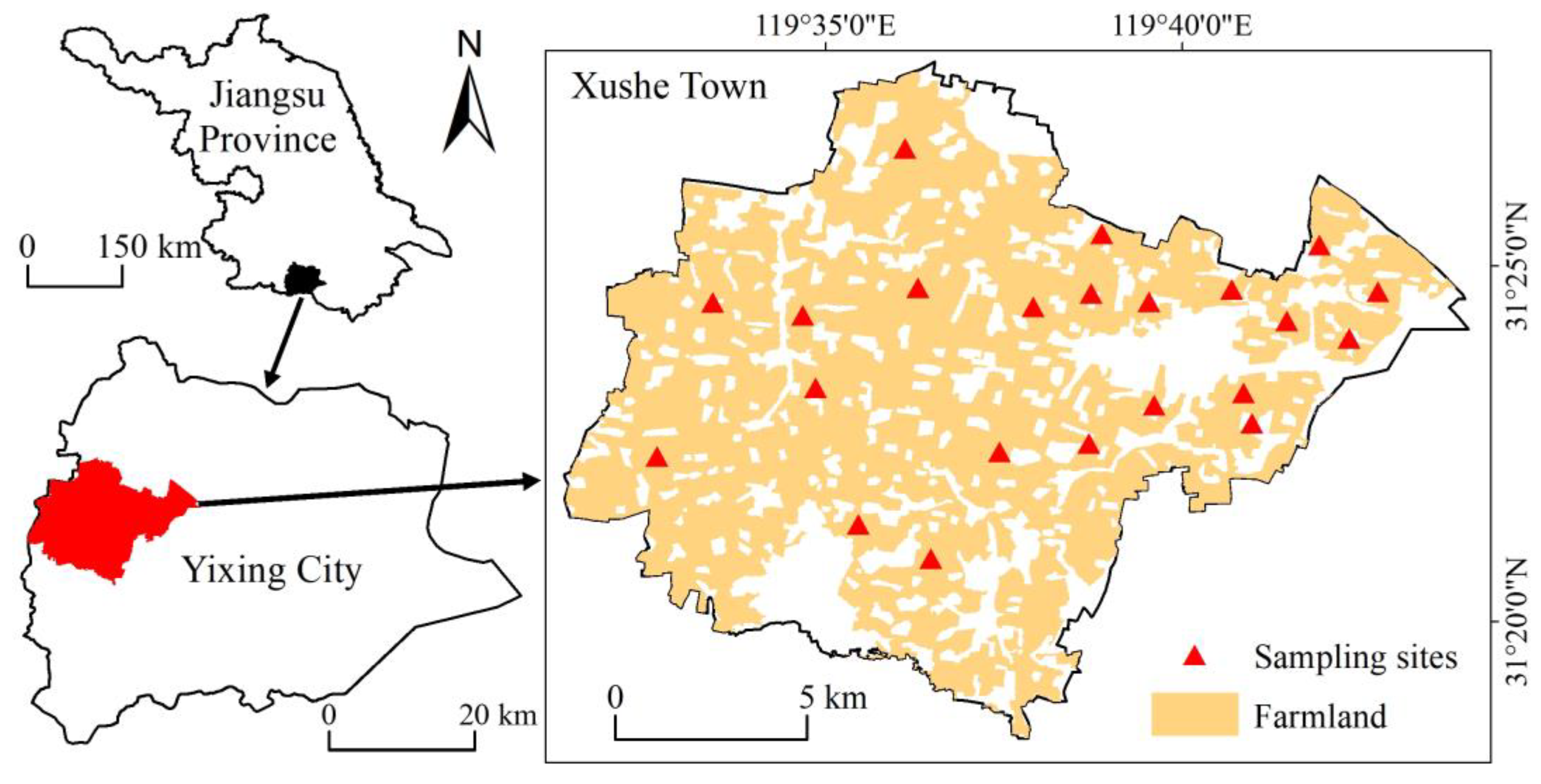
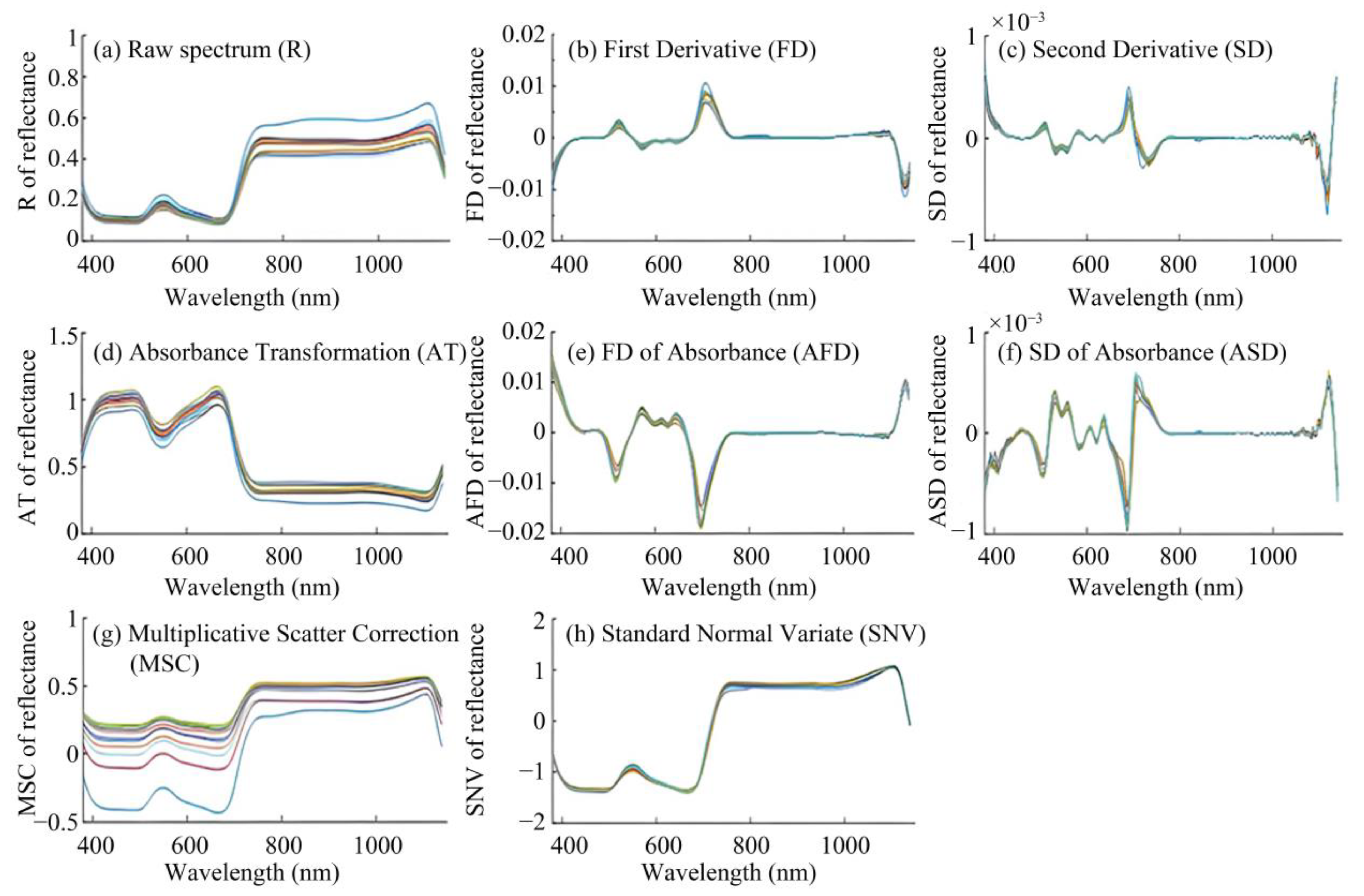
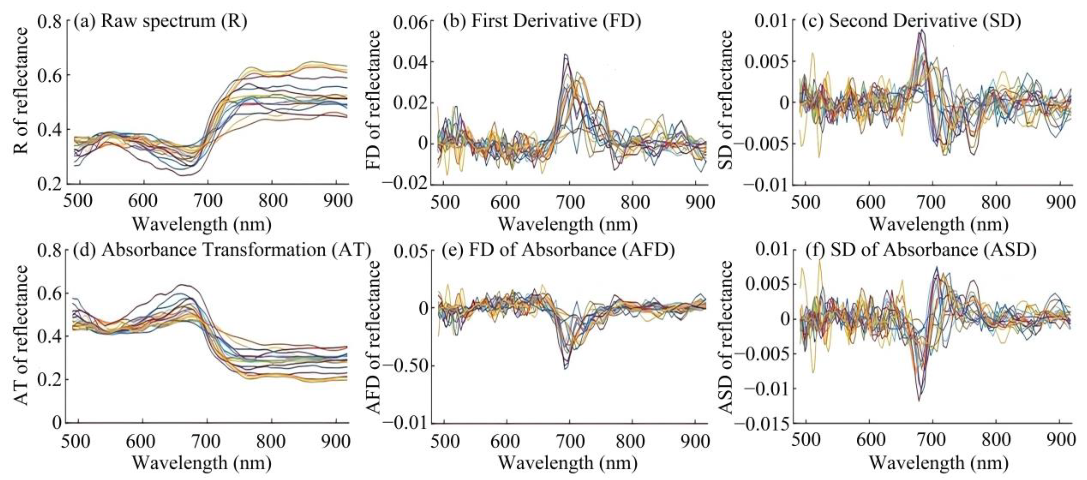
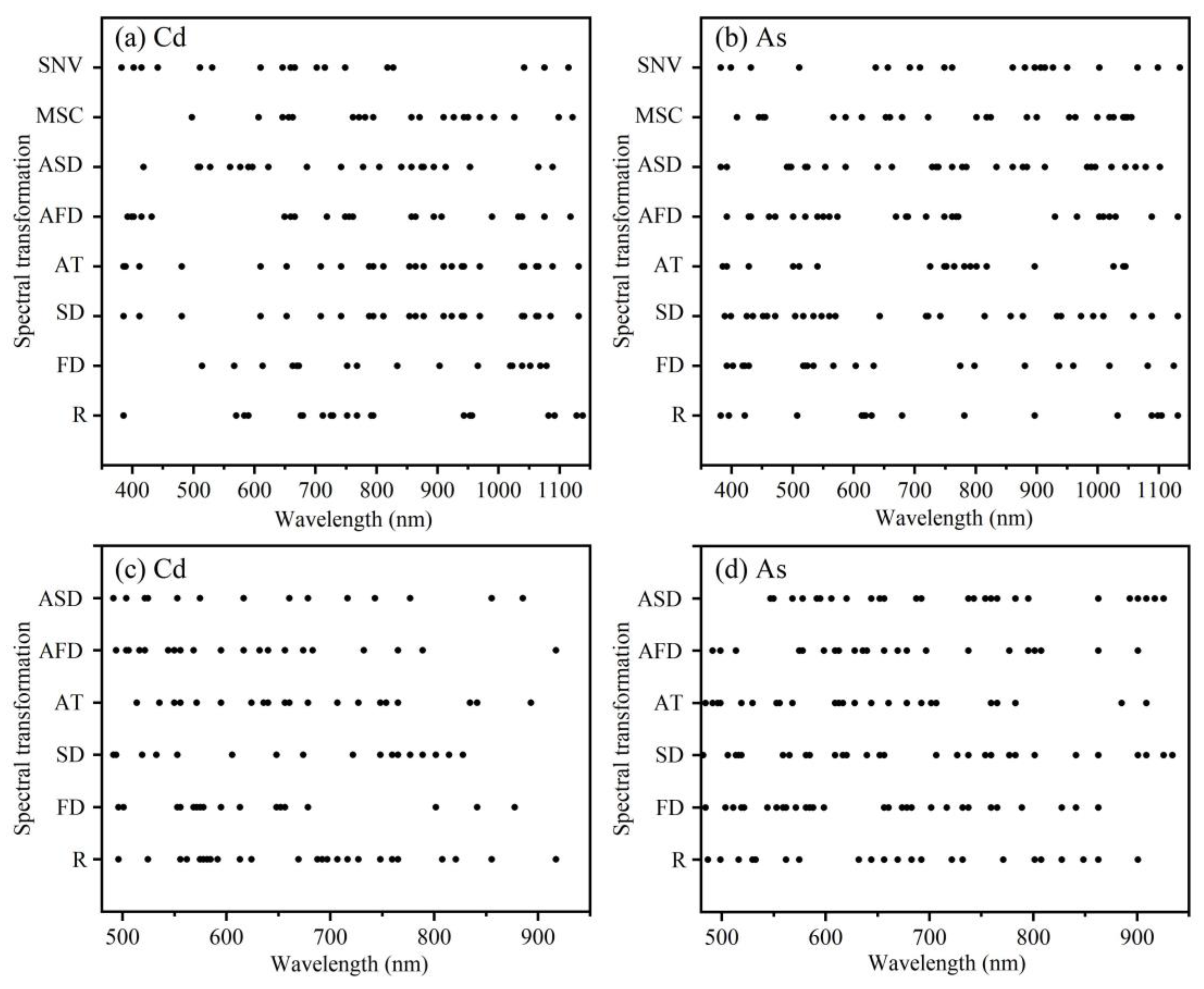
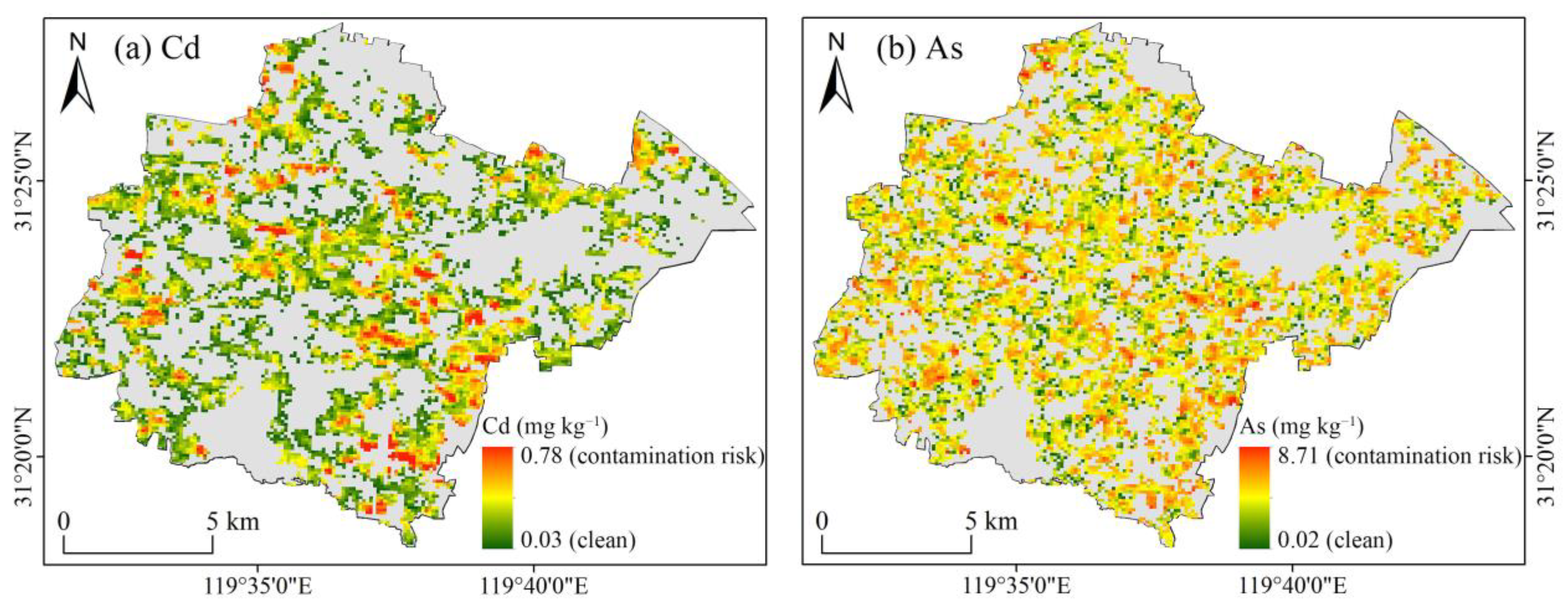
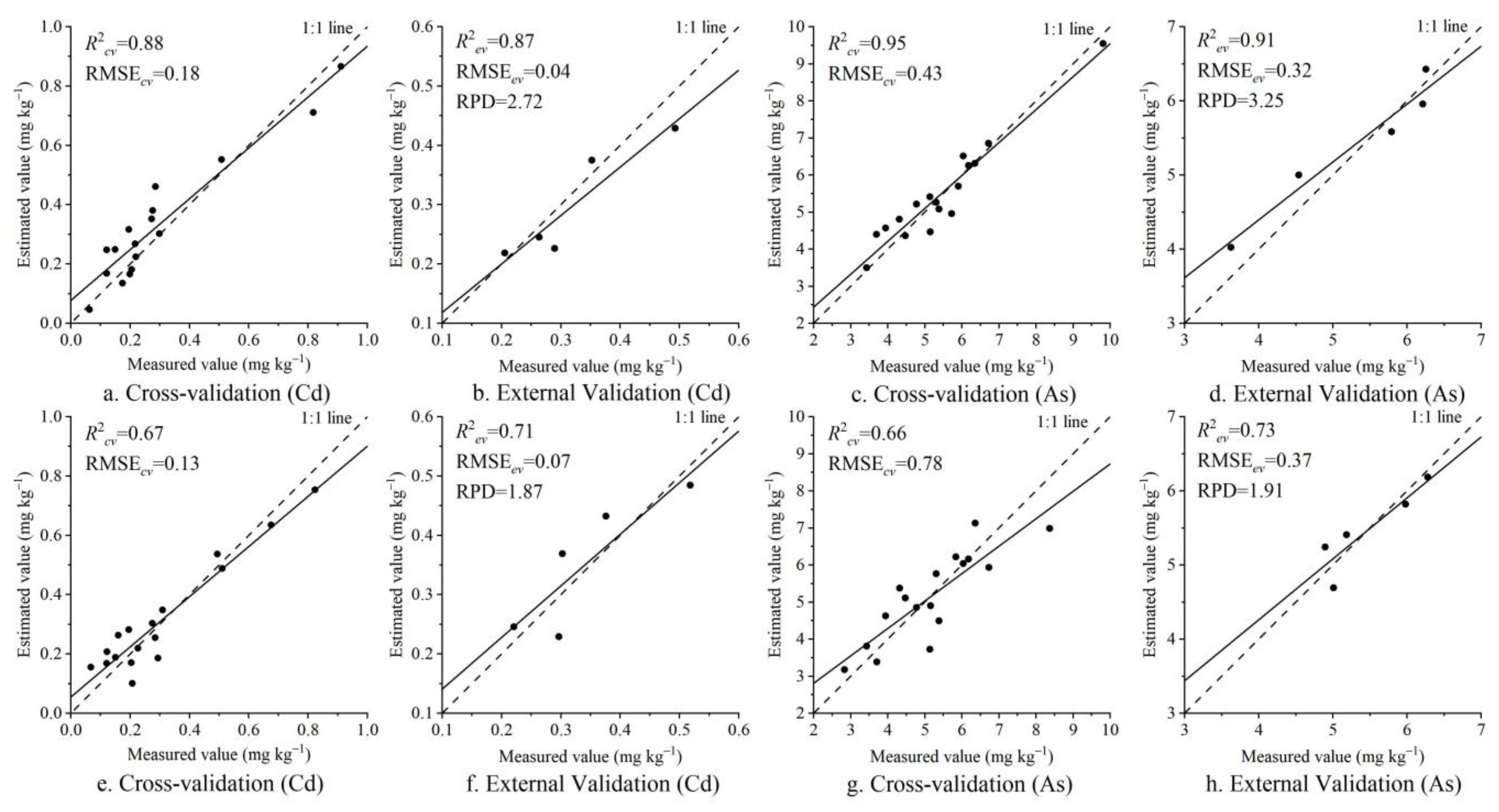
With the rapid development of China’s industrialization and urbanization, the problem of heavy metal pollution in soil has become increasingly prominent, seriously threatening the safety of the ecosystem and human health. The development of hyperspectral remote sensing technology provides the possibility to achieve the rapid and non-destructive monitoring of soil heavy metal contents. This study aimed to fully explore the potential of ground and satellite image spectra in estimating soil heavy metal contents. We chose Xushe Town, Yixing City, Jiangsu Province as the research area, collected soil samples from farmland over two different periods, and measured the contents of the heavy metals Cd and As in the laboratory. At the same time, under field conditions, we also measured the spectra of wheat leaves and obtained HuanJing-1A HyperSpectral Imager (HJ-1A HSI) satellite image data. We first performed various spectral transformation pre-processing techniques on the leaf and image spectral data. Then, we used genetic algorithm (GA) optimized partial least squares regression (PLSR) to establish an estimation model of the soil heavy metal Cd and As contents, while evaluating the accuracy of the model. Finally, we obtained the best ground and satellite remote sensing estimation models and drew spatial distribution maps of the soil Cd and As contents in the study area. The results showed the following: (1) spectral pre-processing techniques can highlight some hidden information in the spectra, including mathematical transformations such as differentiation; (2) in ground and satellite spectral modeling, the GA-PLSR model has higher accuracy than PLSR, and using a GA for spectral band selection can improve the model’s accuracy and stability; (3) wheat leaf spectra provide a good ability to estimate soil Cd (relative percent difference (RPD) = 2.72) and excellent ability to estimate soil As (RPD = 3.25); HJ-1A HSI image spectra only provide the possibility of distinguishing high and low values of soil Cd and As (RPD = 1.87, RPD = 1.91). Therefore, it is possible to indirectly estimate soil heavy metal Cd and As contents using wheat leaf hyperspectral data, and HJ-1A HSI image spectra can also identify areas of key pollution.
Keywords: hyperspectral inversion; soil heavy metal; wheat; soil–crop system; genetic algorithm; source-sink theory hyperspectral inversion; soil heavy metal; wheat; soil–crop system; genetic algorithm; source-sink theory