


Highlights
What are the main findings?
- A multi-dimensional feature-learning framework based on Restricted Boltzmann Machine (RBM) is established. Pixel brightness, local mean, and local standard deviation features are fused by this framework. Deep spatial context information of remote sensing images is excavated. Efficient unsupervised pre-classification of image target zones is realized. Background disturbance from invalid pixels is restrained.
- A modified Quantum Golden Jackal Optimization (QGJO) clustering algorithm is presented for radar image segmentation. Levy flight and quantum gate rotation strategy are integrated into this algorithm. The iteration process of cluster centers is optimized. Stable and precise pixel classification outputs are acquired. Superior convergence performance and intra-class aggregation effect are demonstrated, in comparison with conventional clustering approaches.
What are the implications of the main findings?
- Deep feature-learning based on RBM, and intelligent optimization clustering are integrated. The drawbacks of insufficient feature representation and high tendency to fall into local optimal solutions in conventional remote-sensing image segmentation approaches are effectively addressed. The precision and robustness of weak target segmentation in complex scenarios are notably enhanced.
- Quantum rotation gates and Levy flight mechanisms are incorporated into the Golden Jackal Optimizer. A brand-new metaheuristic approach for addressing clustering issues is supplied. The potential of similar hybrid quantum–classical optimization strategies to be expanded to other relevant challenges is indicated.
Abstract
Marine ecological systems are severely compromised by oil spill incidents, while oceanic economic growth and public well-being are also put at considerable risk. Therefore, the development of high-efficiency and precise detection techniques for marine pollution prevention and control holds substantial practical importance. A marine radar oil spill detection approach is presented herein, integrating Restricted Boltzmann Machine (RBM) feature learning with the Improved Quantum Golden Jackal Optimization (IQGJO) algorithm. Initially, raw radar imagery is preprocessed. Subsequently, unsupervised deep feature extraction is executed via RBM, and oil spill regions of interest are identified using K-means clustering. Ultimately, the IQGJO algorithm is employed to perform adaptive threshold optimization, along with fine segmentation of oil film targets. When benchmarked against conventional Golden Jackal Optimization (GJO) and gravity search algorithm (GSA), quantum mechanisms, along with Lévy flight perturbation, are incorporated within IQGJO. Consequently, the tendency of traditional approaches to converge toward high-gray local optima is effectively mitigated. Moreover, recognition capability for both weak-reflection and fragmented oil films is substantially enhanced. Experimental outcomes reveal that an accuracy of 99.7% is achieved by the IQGJO algorithm, representing a marked improvement over both GJO and GSA counterparts. High-precision automated segmentation of surface oil spills under intricate maritime conditions is thus enabled, while effective technical guidance is offered for radar-based oil spill surveillance and emergency response.
1. Introduction
Driven by the global energy restructuring and marine economic expansion, offshore drilling, transoceanic transport, port storage, and large tanker navigation are continuously being enlarged. Oil spill incidents are characterized by high frequency, massive scale, and escalating severity. This issue is regarded as a critical environmental challenge threatening marine ecological safety, coastal economic sustainability, and public health. On 20 April 2010, a catastrophic blowout was triggered on a drilling rig situated in the Gulf of Mexico. The spill persisted for roughly 87 days, with approximately 780,000 tons of crude oil being discharged. This disaster is widely recognized as the gravest offshore platform leakage ever recorded. The marine ecosystem within the gulf was inflicted with profound ecological deterioration [1]. On 7 December 2007, a tanker was collided with by a barge near Tai’an County along the western coastline of South Korea. Approximately 10,900 tons of Middle Eastern crude was released. Over 375 km of shoreline was contaminated. This catastrophe is classified as the gravest maritime oil leakage ever documented in the nation’s history [2]. On 6 January 2018, the Panamanian tanker Sanchi was struck by a freighter in the East China Sea, located east of the Yangtze River Estuary. Approximately 136,000 tons of condensate was discharged. The vessel was engulfed by flames and subsequently sank. A total of 32 crew members were reported dead [3]. Offshore spills are featured by extreme suddenness, intricate diffusion trajectories, rapid weathering, prolonged remediation, and heavy economic burdens [4]. Gas–liquid exchange is blocked by surface oil films. Hypoxia is induced in water bodies. The food web is severely disrupted. Toxic substances are accumulated and magnified through trophic levels. Biodiversity is jeopardized [5]. Seabirds and coastal biota are killed by contamination. Decades are required for ecological recovery. Fisheries are suspended. Tourism is devastated. Exorbitant repair expenses are incurred. Public health is threatened by hazardous fumes and tainted seafood [6].
Currently, oil spill surveillance is primarily conducted via satellite remote sensing, aerial inspection, and vessel-based observation. Spaceborne monitoring is favored for its extensive coverage, unrestricted geography, and macroscopic scale. It is regarded as a vital component of the three-dimensional offshore surveillance network. This technology has been established as the predominant global means for detecting marine leakage. Liao et al. [7] developed a novel surveillance framework for oil contamination based on polarimetric SAR data and deep-learning theory. Experimental results demonstrate that detection accuracy exceeds 0.95. The accuracy is specifically referenced here. This metric is defined as the ratio of correctly classified pixels to the total number of pixels. Kumar et al. [8] constructed a direct mapping correlation between hybrid polarization (hybrid POL) and full polarization (full POL) datasets under reflection symmetry constraints. Via this approach, diverse full-POL oil spill descriptors are directly derived from hybrid POL observations. Song et al. [9] proposed an oil spill detection approach utilizing deep convolutional neural networks (DCNNs) on dual-polarization SAR imagery. Experiments revealed that this technique outperforms conventional supervised classifiers and classic semantic segmentation models. An overall accuracy of 97.09% and an F1-score of 89.54% were achieved. Li et al. [10] devised a novel network architecture. A multi-convolutional layer (MCL) module was reconstructed. More precise oil spill segmentation was attained. The ultimate segmentation mask was subsequently generated. Zhang et al. [11] devised an enhanced DeepLabv3+ architecture. Overfitting issues in SAR-based oil spill detection were mitigated. The deficiency in extracting fine-grained features from spill zones was also addressed. Nevertheless, satellite remote sensing is constrained by inherent limitations. A fixed revisit interval is possessed by orbital platforms. Sudden spill events are difficult to track continuously. Real-time performance is inadequate. Furthermore, optical sensing is susceptible to interference from clouds, fog, rain, and snow. All-weather stable surveillance cannot be achieved by such systems.
Airborne spill surveillance, utilizing fixed-wing aircraft, helicopters, and UAVs, is deemed critical for monitoring sensitive coastal zones. High flexibility, swift response, superior resolution, and proximity are possessed by these platforms. Emergency response is significantly enhanced by such aerial systems. Wang et al. [12] devised a multi-level spatial–spectral feature extraction network. Oil spill information is effectively extracted by this approach. Various spill types and film thicknesses are accurately recognized. Sun et al. [13] developed an infrared polarization detection system. Polarization features of spilled oil were modeled and analyzed. A long-wave infrared polarization apparatus suitable for leak identification was constructed. Characterization of polarimetric properties was conducted. Accurate spill-type recognition is realized. Emergency response efficiency is enhanced. Scafutto et al. [14] established a real-time sea-spill data-acquisition scheme utilizing a UAV-mounted hyperspectral imager. High-resolution imagery is collected by unmanned platforms. Monitoring precision for short-range spills is significantly enhanced. Integration with the Bonn Agreement appearance specification yields more reliable detection outcomes. Distinct merits are possessed by aerial spill surveillance. However, large-scale continuous routine monitoring is hindered by endurance and payload constraints. Coverage remains restricted. Elevated operational expenditures are incurred. Severe meteorological conditions, including rainstorms, gales, and dense fog, compromise data integrity. Loss and distortion are induced under extreme scenarios. Misidentification of spill targets is easily triggered.
Marine radar constitutes the core of shipborne mobile surveillance. Real-time dynamic spill tracking is enabled by all-weather capability. Harsh environmental interference is effectively overcome. Outstanding merits are demonstrated in emergency response and near-shore routine monitoring. It is regarded as a critical element of the three-dimensional spill surveillance system. Chen et al. [15] employed image texture features, a back-propagation neural network (BPNN) classifier, and threshold segmentation for spill extraction. An accuracy of 93.75% is achieved by the constructed BPNN when the oil film remains intact within a small scope. Negligible false positives are observed in the extraction outcomes. Yang et al. [16] presented a ship-radar-based spill detection approach. The significant boundary ratio (SBR) feature was integrated with a refined Sauvola adaptive threshold algorithm. Comparative experiments utilizing diverse thresholds were conducted. Spill boundaries are effectively preserved by this method. Background noise is suppressed. Superior segmentation outcomes are achieved. Li et al. [17] utilized a U-Net-based semantic segmentation framework. The oil film was categorized into two classes: genuine and suspicious. High reliability is demonstrated by this approach in spill semantic segmentation tasks. Xu et al. [18] proposed an X-band marine radar spill identification approach utilizing a linear interpolation algorithm to suppress co-frequency interference. Experimental results demonstrate that this scheme effectively enhances recognition performance in X-band marine radar imagery. Xu et al. [19] implemented a shipborne radar spill segmentation technique utilizing feature fusion and the artificial bee colony algorithm. Experimental outcomes confirm effective spill target detection. Clear segmentation results are produced. Liu et al. [20] developed a multi-level image-enhancement framework. This framework merges background clutter fitting subtraction, multi-scale Retinex, and Gamma correction. Visual interpretation indicates that the oil spill detection accuracy attains 95%, according to the experimental findings. Liu et al. [21] introduced an enhanced segmentation method for oil spill detection in X-band ocean radar images. They employed an improved Sauvola algorithm for this purpose. The experimental outcomes demonstrate that the segmentation results align well with visual interpretation, validating the algorithm’s effectiveness.
2. Materials and Methods
2.1. Experimental Data
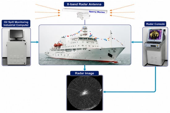
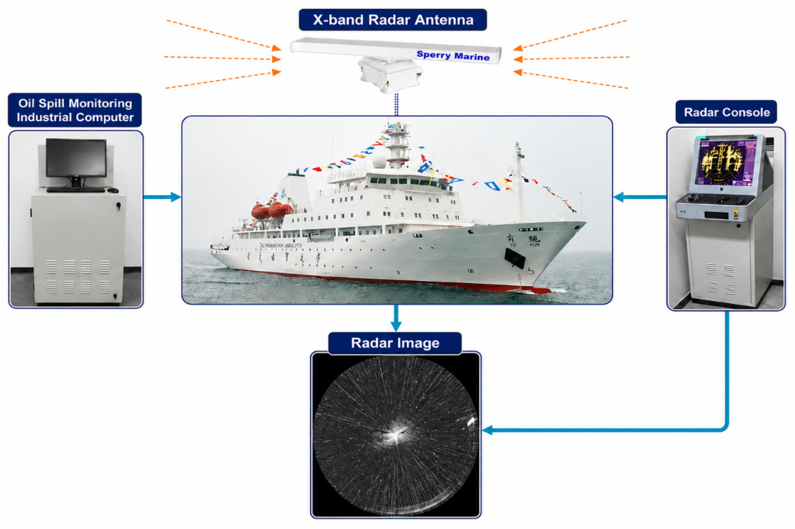
The X-band shipborne navigation radar manufactured by Sperry Marine (London, UK) is employed as the principal data-acquisition instrument in this study, as shown in Figure 1. Recognized globally as a mainstream nautical radar platform, the system is endowed with high-accuracy object detection, robust anti-interference capability, and superior operational dependability. Stable target recognition is retained even under harsh sea states. These images were obtained from an independent oil spill incident. Forty-nine photographs contain oil leakage, and 52 photographs are devoid of oil leakage. Sperry Marine X-band radar was utilized for the acquisition of all images. The relevant radar parameters are detailed in Table 1. The reference mask is manually delineated by two remote-sensing experts on the staff.
Figure 1.
Data-acquisition device’s architecture.
Table 1.
Radar parameters.
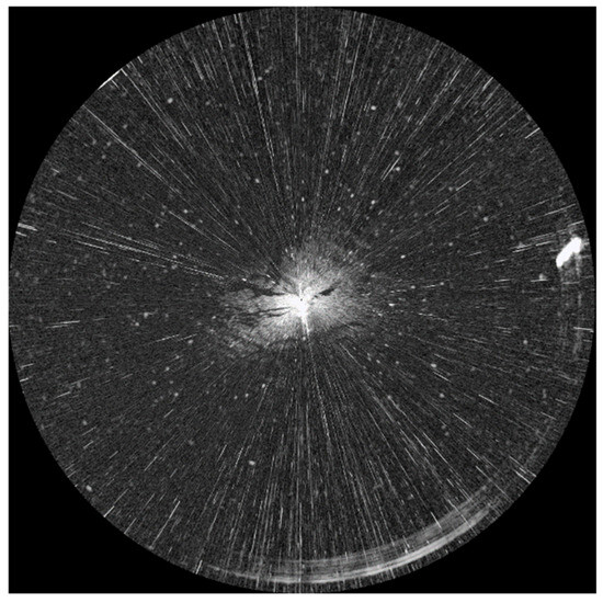
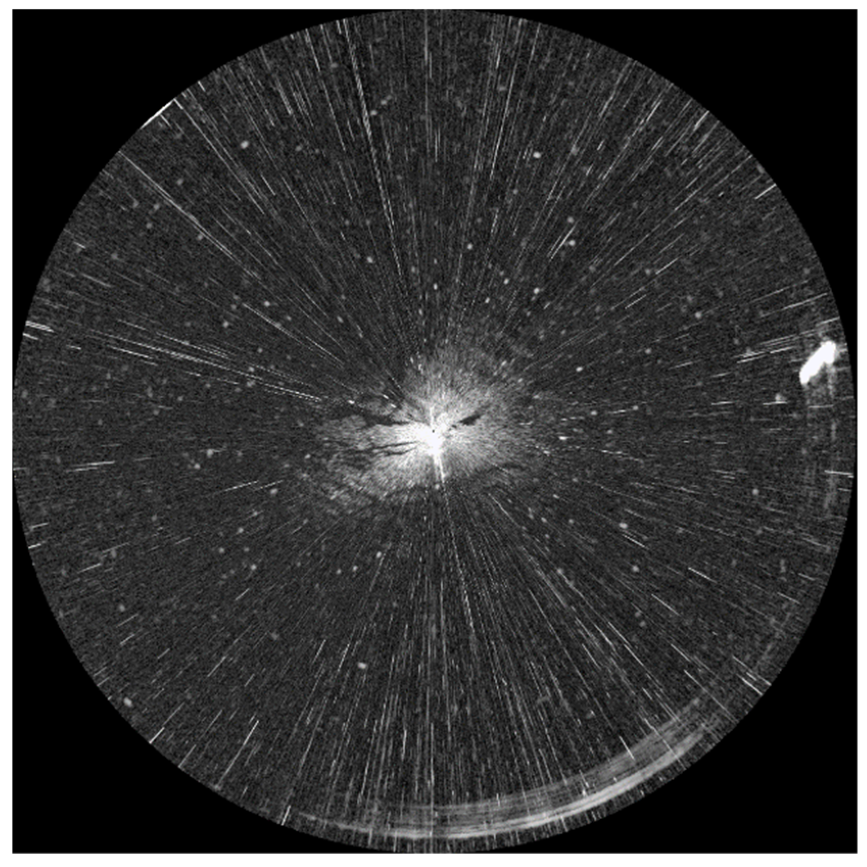
Antennas are adopted by the marine radar system to emit microwave signals with precise wavelengths toward designated sea areas. These microwave signals are bounced back from the surface once various oceanic targets are located. The reflection orientation of microwave signals is remarkably altered by the presence of an oil slick on the sea surface. The surface tension of seawater is reduced by the oil film, and the sea surface is rendered more even. Bragg scattering of the reflected electromagnetic waves is subsequently lowered by this smoothness, and the echo signals are effectively suppressed. On radar imagery, the area covered by the oil slick is presented as a relatively dark zone due to the attenuated echo signals. A comparatively bright appearance is shown at the perimeters of the oil slick by contrast, and a sharp contrast is formed to enable more convenient detection. Therefore, the data-collection requirements for oil spill surveillance in complicated maritime environments are efficiently satisfied. Experimental imagery was obtained aboard the teaching practice vessel Yukun, affiliated with Dalian Maritime University. Acquisition was carried out during routine voyages and oil spill remediation operations within Dalian’s coastal waters. A range of 0.75 nautical miles was adopted, accompanied by a resolution of 1024 × 1024 pixels, as depicted in Figure 2.
Figure 2.
Original marine radar image.
2.2. Experimental Process
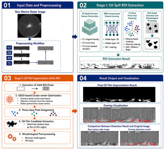
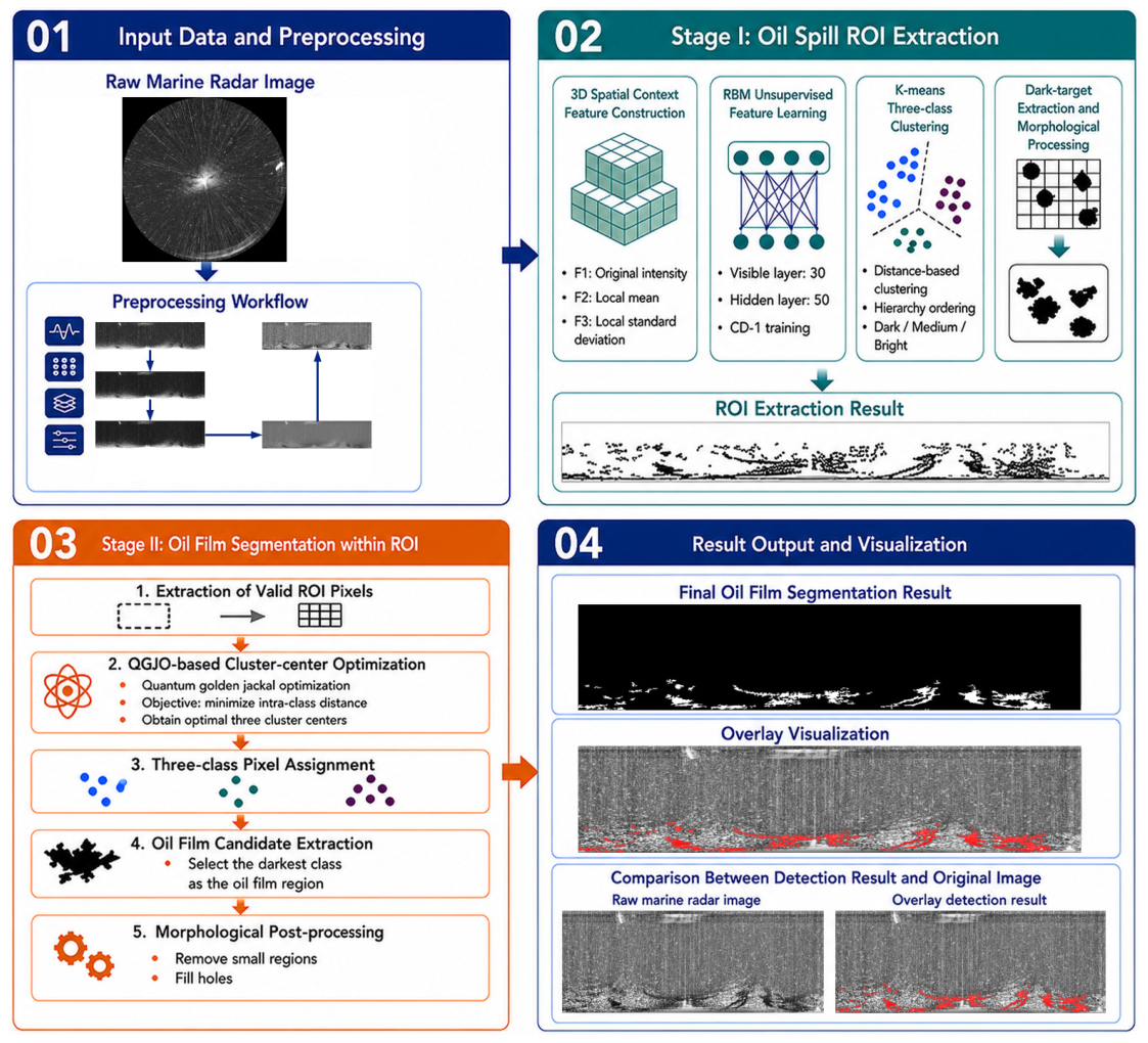
The detection workflow for oil spill regions utilizing marine radar, as adopted in this study, is depicted in Figure 3. Initially, raw oceanic radar data are normalized through standardization procedures. Subsequently, the Restricted Boltzmann Machine (RBM) model is employed for target localization based on preprocessed inputs, enabling precise extraction of regions of interest (ROIs) containing potential oil spill candidates. Ultimately, the improved Quantum Golden Jackal Optimization (QGJO) algorithm is introduced to conduct adaptive threshold segmentation on the identified oil spill ROI images.
Figure 3.
Technology roadmap.
2.3. Data Preprocessing
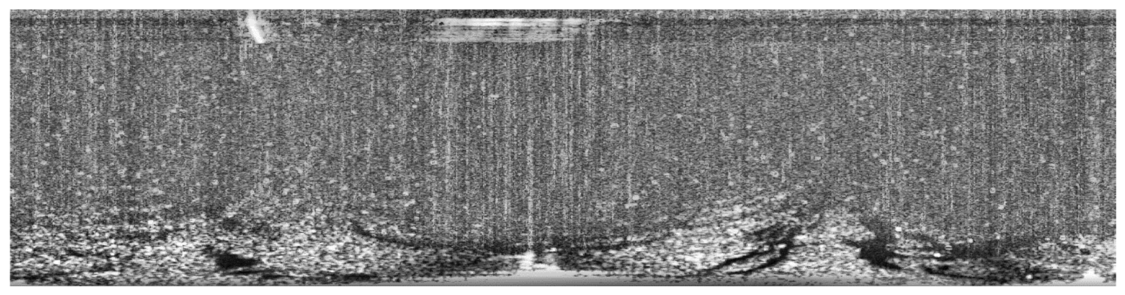
Raw marine radar imagery is readily contaminated by co-frequency interference, speckle noise, sea clutter, and non-target bright regions. A low signal-to-noise ratio is exhibited. Low signal-to-noise ratio is defined. The strength of the signal is similar to the strength of the noise. Uneven background gray distribution is observed. Strong target–background coupling is also identified. These deficiencies severely constrain oil spill feature extraction and model detection accuracy. The original data inherently possess substantial noise. A higher signal-to-noise ratio can be attained only after denoising is applied. Consequently, standardized data preprocessing is required to enhance data quality. Data preprocessing primarily encompasses several key stages. First, co-frequency interference is eliminated through Laplacian sharpening combined with Otsu thresholding and pixel interpolation. Second, speckle noise is suppressed using a dual-threshold median filtering strategy. This strategy preserves edge integrity. Third, global gray-level correction is implemented to compensate for brightness nonuniformity. This nonuniformity is induced by range attenuation and varying sea states. Finally, contrast-limited adaptive histogram equalization (CLAHE) is adopted to enhance local contrast. The visual distinction between weakly backscattering oil films and the surrounding sea surface is amplified. Oil spill textures and boundary characteristics are thereby highlighted. Figure 4 shows the complete data-preprocessing process proposed in this study. Figure 5 shows the preprocessed images in this study.
Figure 4.
Pretreatment process.
Figure 5.
Preprocessing image.
2.4. Restricted Boltzmann Machine
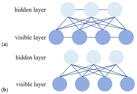
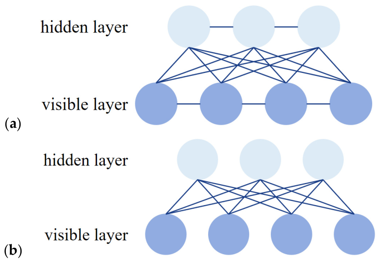
Boltzmann Machine (BM) is a stochastic neural network grounded in statistical mechanics theory. It was originally proposed by Hinton and Sejnowski in 1985 [22]. From a structural perspective, BM is recognized as a recurrent neural network. It consists of stochastic neurons fully interconnected. The architecture, comprising a visible layer and a hidden layer, is illustrated in Figure 6a. Robust unsupervised-learning capabilities are possessed by BM. However, extreme computational costs are incurred during training.
Figure 6.
Two model structures. (a) BM model structure. (b) RBM model structure.
To overcome these limitations, the RBM was proposed by Hinton. A visible layer and a hidden layer are contained within RBM. No connections are established between neurons within the same layer [23]. This network architecture is depicted in Figure 6b. RBM exhibits superior conditional independence. Given the visible layer unit states, hidden layer unit activations are rendered mutually independent. Conversely, visible layer unit activations are also decoupled when hidden layer states are fixed. Rapid training is enabled by the Contrast Divergence (CD-1) algorithm.
The input to the RBM is constructed on a per-pixel basis. Local image patches are not used for this construction. Specifically, each valid pixel contributes to the input individually. We extract a three-dimensional feature vector, v = [F1, F2, F3]T, where each component is defined as follows:
- (1)
- F1 (Normalized Original Intensity):
- (2)
- F2 (local mean):
The computation utilizes a 3 × 3 averaging filter. This specific feature generates a smoothed representation of the local background. It effectively suppresses impulsive speckle noise and concurrently preserves regional brightness trends.
- (3)
- F3 (local standard deviation):
The computation also occurs within a 3 × 3 neighborhood. The result is then normalized by its maximum value across the entire image. This particular feature captures local texture and edge information.
The main calculation process of RBM is as follows:
- (1)
- RBM model:
The Restricted Boltzmann Machine is an undirected probability graph model with bipartite graph structure, and its energy function is defined as follows:
where is the weight matrix, and and are the offset vectors of the visible layer and the hidden layer, respectively. Based on the energy function, the joint probability distribution of the visible layer and the hidden layer is as follows:
The conditional probability distribution is given by the sigmoid function:
- (2)
- CD training algorithm:
The CD-1 is used for unsupervised training of RBM. For each training sample, v(k), in a small batch, perform the following Gibbs sampling steps:
Positive phase: Calculate the activation probability of the hidden layer and sample, .
Negative phase: Reconstruct the visible layer, , and then calculate .
The parameter update rule is as follows:
The training iteration is carried out t times (t = 300 in this paper), with the goal of minimizing the reconstruction mean square error. The reconstruction error, , is defined as follows:
- (3)
- Hidden layer feature extraction:
After training convergence, for any pixel eigenvector, v, its high-dimensional representation is activated by the hidden layer probability, :
The 5-dimensional vector encodes the local brightness, texture, and context information of pixels.
2.5. K-Means Clustering
K-means clustering is a common distance-based clustering algorithm which aims to divide the dataset into K clusters. The goal of the algorithm is to minimize the sum of the distances from the points in the cluster to the center of the cluster. The following are the steps of the k-means algorithm used in this paper:
Input the hidden layer feature set of all effective pixels into the K-means algorithm, and set the clustering number C = 3. Algorithm objective function J:
where is the c-th clustering center, and Cc is the index set of pixels belonging to this class.
The original label obtained by clustering is . In order to avoid semantic ambiguity, the pixels in each category are sorted according to the average original brightness v1:
2.6. Improved Quantum Golden Jackal Optimization Algorithm
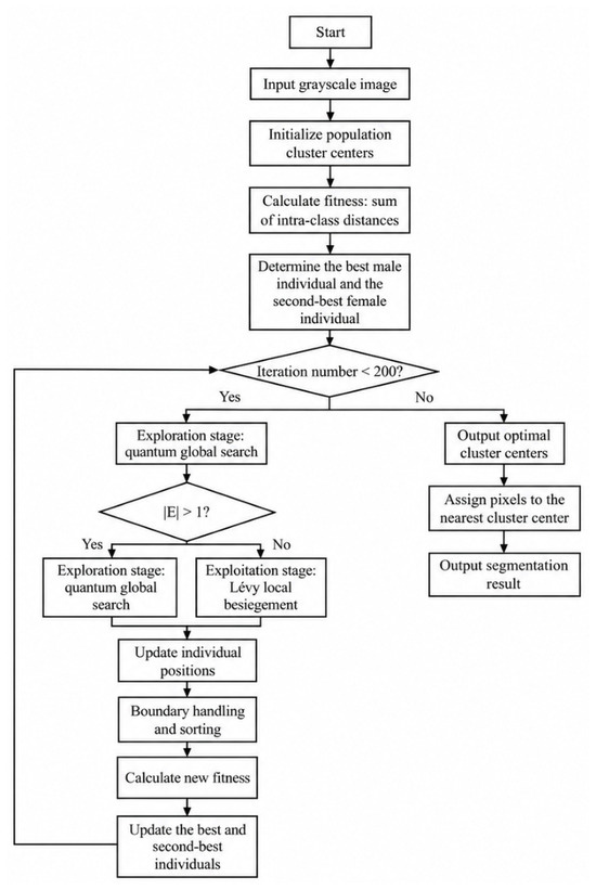
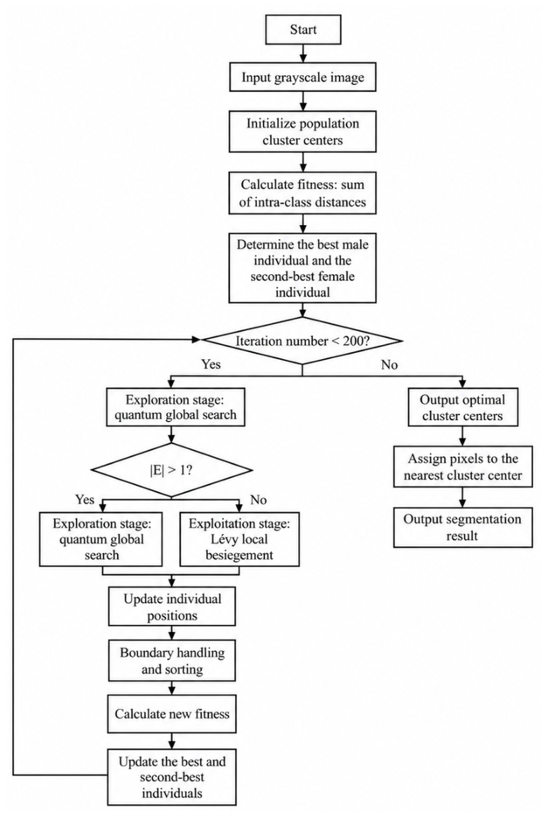
Golden Jackal Optimization (GJO) is a novel meta-heuristic algorithm introduced in 2022. The population in GJO is represented by prey items. The optimization process is accomplished by updating the positions of the prey [24]. Improved Quantum Golden Jackal Optimization (IQGJO) is proposed in this study. It is an improved meta-heuristic algorithm grounded in quantum computing principles. The method is designed to solve the optimal clustering center problem in image segmentation. Compared with the conventional Golden Jackal Optimization, quantum concepts are incorporated. These include quantum state superposition and collapse mechanisms, quantum rotation gates, and qubit probability amplitudes. Global search capability is significantly enhanced. Convergence accuracy is also substantially improved. The specific flowchart is shown in Figure 7.
Figure 7.
IQGJO flowchart.
In the IQGJO algorithm, every gold jackal position is regarded as a quantum state. Collapse to various locations occurs with specific probabilities. Two elite individuals are preserved: a male gold jackal, representing the global optimum, and a female gold jackal, signifying the global sub-optimum. Cooperative hunting behavior is simulated. The population is guided to converge toward the optimal solution region. The specific calculation procedure is detailed as follows:
- (1)
- Problem definition and fitness function:
- (a)
- Clustering segmentation problem:Let the gray image, , and the set of effective pixel values be , where , , and . To divide the pixels into three categories, we need to find the optimal clustering center, , which meets c1 < c2 < c3.
- (b)
- Fitness function:where Pi is the gray value of the ith pixel, cj is the clustering center of class j, and N is the total number of effective pixels.
- (2)
- Population initialization:The population size is NPOP = 30, and each individual represents a group of cluster centers:where is a uniform random vector, and denotes element by element multiplication.
- (3)
- Initialize optimal and suboptimal individuals:Calculate the fitness of each individual, , definition:
- (4)
- Energy factor and escape energy:
- (a)
- Linear decreasing energy factor:where t is the current iteration number, and Tmax is the maximum number of iterations (set to 200 in this study).
- (b)
- Prey escape energy:Decision:If ∣E(t)∣ ≥ 1, enter the exploration stage.If ∣E(t)∣ < 1, enter the development stage.
- (5)
- Quantum revolving gate parameters:
- (a)
- Quantum rotation angle, :
- (b)
- Quantum state probability amplitude:where α(t) + β(t) = 1 is satisfied.
- (6)
- Exploratory stage:
- (a)
- Quantum position update:Define the quantum phase angle, :Quantum search based on male individuals:of which, . Sign (⋅) is a symbolic function.Quantum search based on female individuals:
- (b)
- Quantum revolving gate:of which, .
- (7)
- Development phase:
- (a)
- Lévy flight step:Lévy distribution, s, generation formula:of which, β = 1.5; u ∼ N(0, σu2), v ∼ N(0, 1); .Scaled Lévy step size:
- (b)
- Quantum bit probability amplitude:
- (c)
- Position update formula:Development based on male individuals:Development based on female individuals:
- (8)
- Boundary processing and sorting:
- (a)
- Boundary clipping:
- (b)
- Cluster center sorting:
- (9)
- Optimal individual update:
- (a)
- Fitness assessment:
- (b)
- Renew male and female:If ,Otherwise, if ,
3. Results
3.1. Extraction Results of Oil Spill Regions of Interest Based on RBM Unsupervised Feature Learning
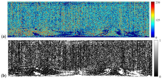
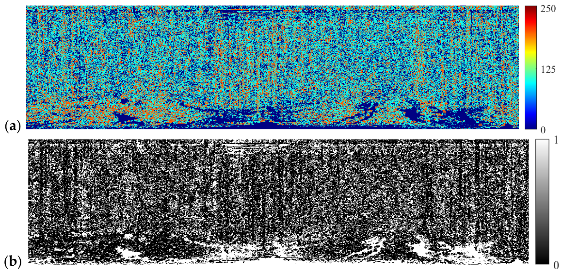
The extraction procedure for sea surface spill zones utilizing RBM and K-means clustering is depicted in Figure 8. Initially, a three-dimensional feature set incorporating gray level, mean, and standard deviation is established from raw radar imagery. Subsequently, a Restricted Boltzmann Machine network comprising three visible nodes and five hidden nodes is formulated. The Contrast Divergence (CD-1) algorithm is employed for unsupervised RBM training. Iterations are set to 300. A learning rate of 0.05 is adopted, and 3000 valid pixels are randomly sampled from training data. More than 2 million pixels are contained in the whole image, and extremely slow matrix operations will be triggered if all of these pixels are adopted for RBM training. RBM is defined as an unsupervised feature extractor, and the inherent distribution of data can be learned by this model through training on a small set of representative samples. Three thousand valid pixels are randomly selected from the pre-detection image for RBM training, so memory consumption is lowered and the training speed is notably boosted. Post-training, all effective pixels are fed into the model to extract 5-dimensional hidden layer features. K-means clustering is executed on this feature space, as illustrated in Figure 8a.
Figure 8.
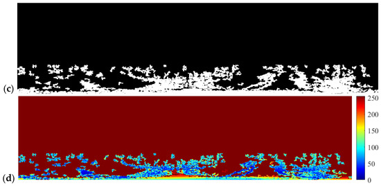
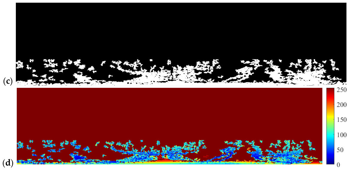
Extraction of oil spill ROI. (a) K-means three classification results. (b) Binarization results of the darkest class. (c) Oil spill ROI mask. (d) Image of oil spill ROI.
Based on K-means three-category outcomes, the darkest class representing spills is binarized to yield a preliminary candidate mask, as depicted in Figure 8b. Specifically, the radar scene shown in Figure 8 was captured under low sea conditions. This determination is mainly based on the effective range of backscattering of sea clutter: in low sea conditions, wave echoes are mainly concentrated in the near range, and the distant range is relatively clean, which can be clearly observed in the figure. In Figure 3, the original image in the Cartesian coordinate system is clearly observed. No waves are present in the area beyond 0.25 nautical miles. White regions correspond to target pixels identified, while black areas denote sea background and clutter. To suppress noise and enhance connectivity, area threshold filtering and morphological expansion are applied. Isolated noise points are removed. Gaps within targets are closed. A clear boundary and complete spill ROI mask are ultimately generated, as shown in Figure 8c. Following morphological post-processing, the preprocessed image is pixel-wise multiplied by the ROI mask. The final spill ROI image is obtained, as illustrated in Figure 8d.
3.2. Segmentation Results of Oil Spill Image Based on IQGJO
Adaptive clustering segmentation is implemented via the IQGJO algorithm on the preliminarily extracted spill ROI. Core IQGJO parameters are configured as follows: The cluster count, k, is set to 3. The population size is defined as 30. A maximum iteration limit of 200 is established. Search boundaries are dynamically determined by the pixel gray range within the ROI.
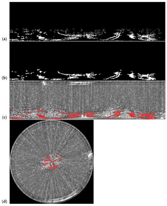
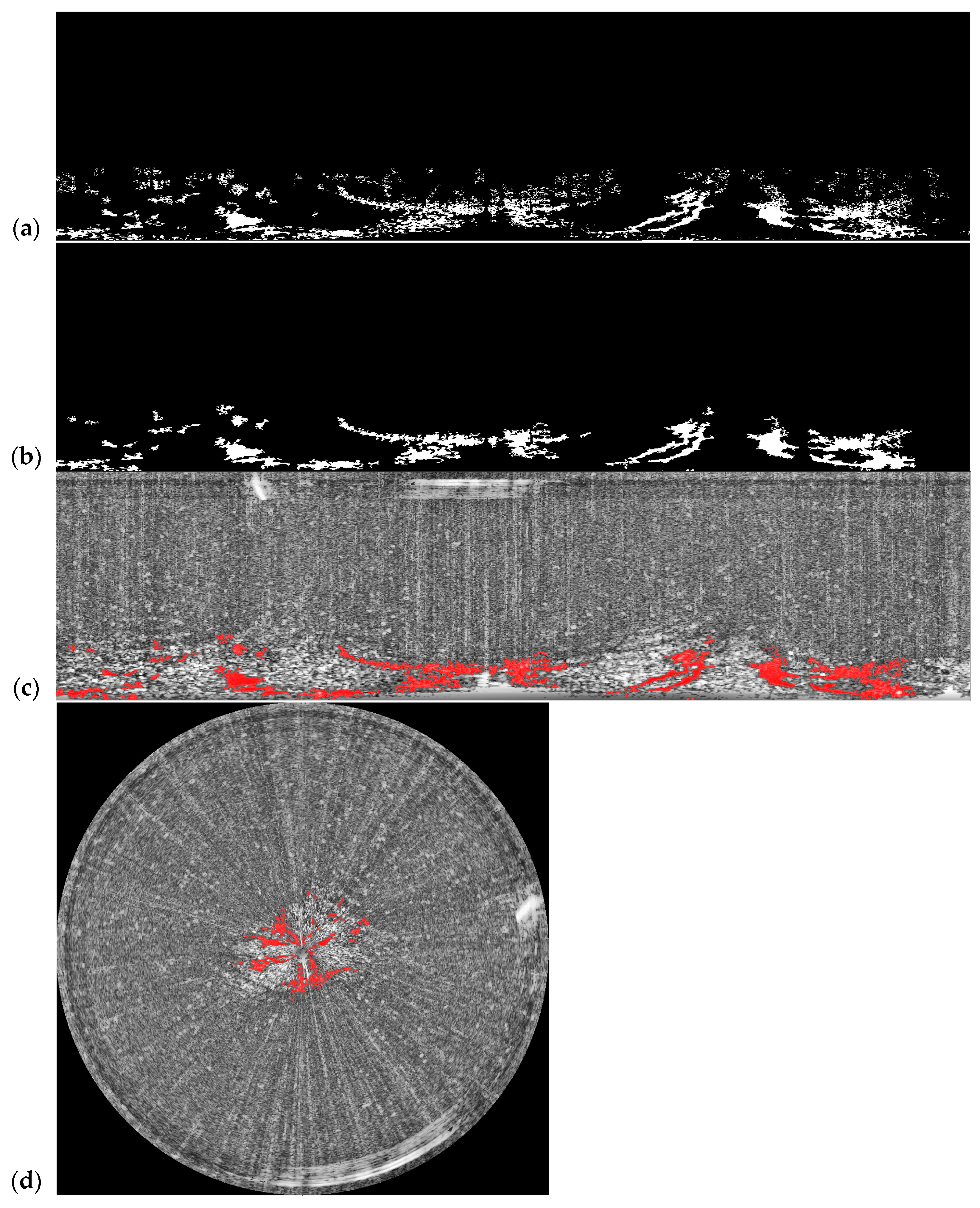
Optimal cluster centers are derived via IQGJO optimization. Pixel categorization is determined subsequently. Binary extraction is applied to the target class in segmentation outcomes (Figure 9a). Minor noise spots are eliminated through area filtering. Hole-filling operations optimize regional integrity. A spill segmentation map with regular geometry is acquired, as shown in Figure 9b. The mask is fused with the original radar imagery at the pixel level (Figure 9c). Polar coordinate transformation is utilized to display azimuth range, as illustrated in Figure 9d.
Figure 9.
Segmentation results of oil spill image based on IQGJO. (a) Binary extraction results. (b) Oil spill segmentation results. (c) Fused image in Cartesian coordinates. (d) Fused image in polar coordinates.
4. Discussion
4.1. Comparation with Other Effective Oil Spill Monitoring Region Extraction Method
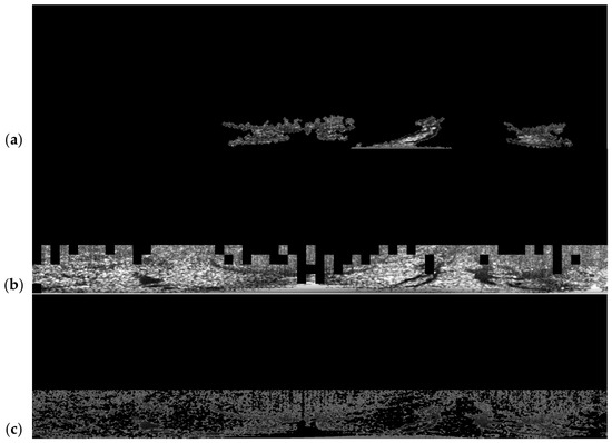
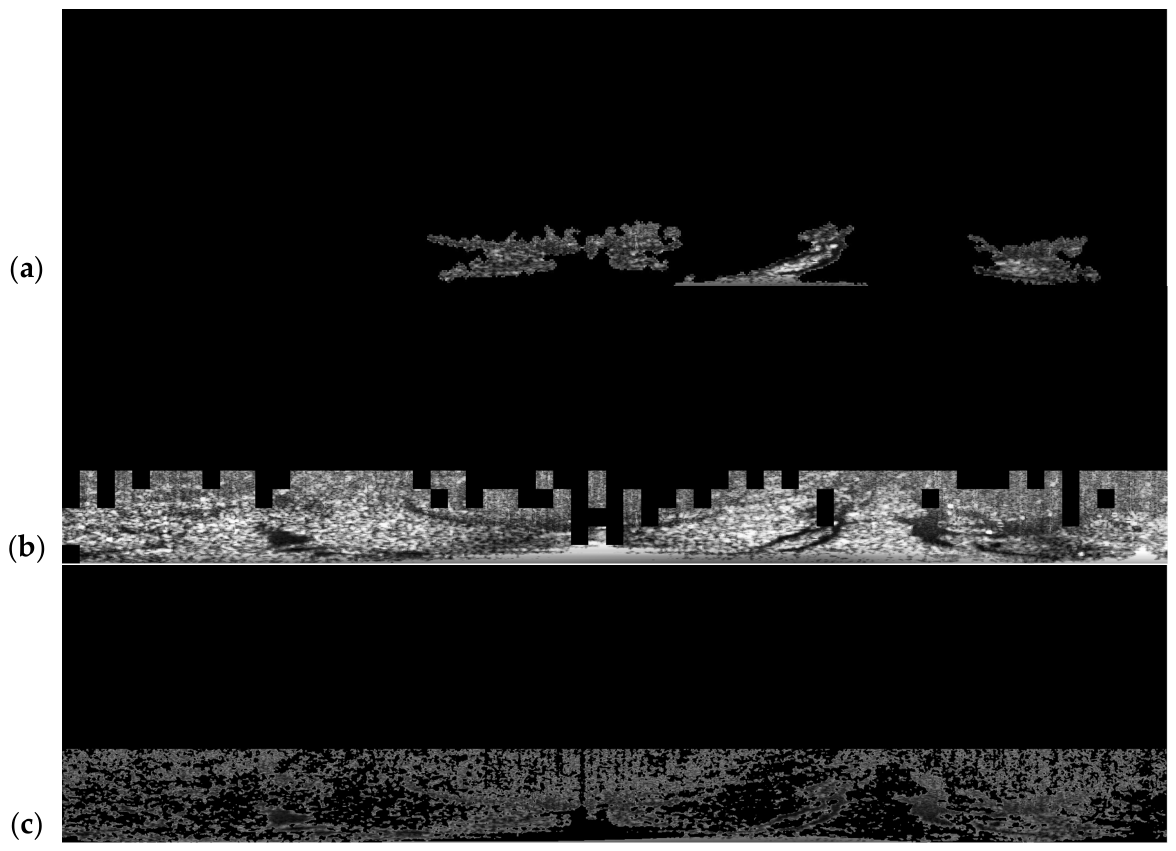
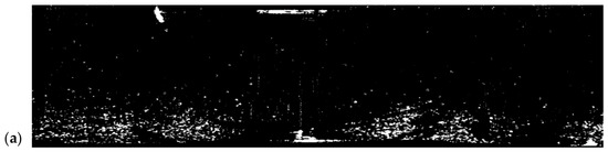
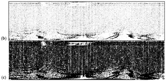
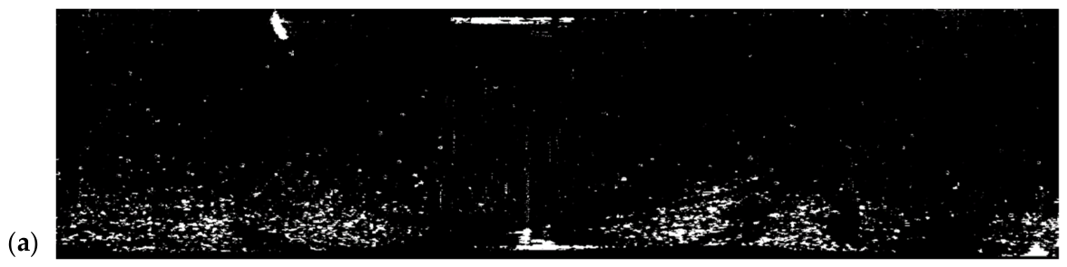
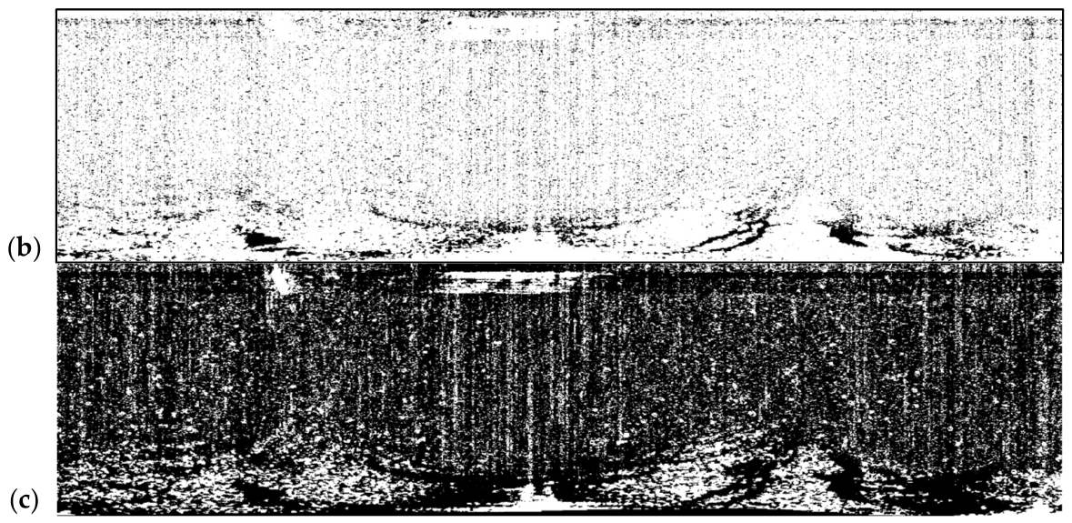
The RBM method used in this paper is compared with the hierarchical agglomerative clustering (HAC) method, LBP-HOG feature-enhancement method, and support vector machine (SVM) method. The results are shown in Figure 10. Deep gray and texture disparities between oil film and sea clutter in radar imagery are adaptively extracted via the RBM approach, which relies on the unsupervised feature-learning mechanism inherent to Restricted Boltzmann Machines; sea clutter interference is effectively suppressed, while edge details and scattered small-scale oil film regions are entirely preserved. Hierarchical clustering segmentation is accomplished by the HAC approach based on pixel gray distance; the primary oil film region is roughly localized, yet only shallow gray similarity clustering is exploited, so overall target integrity proves insufficient, as depicted in Figure 10a. Gradient texture information within oil film regions is highlighted by the LBP-HOG feature-enhancement strategy, which fuses local binary patterns with directional gradient histograms; effective recognition of principal oil film zones is thereby achieved. Nevertheless, sensitivity to interfering textures such as sea clutter and ship wakes is exhibited, and non-oil-film disturbance areas are readily misclassified as targets, as illustrated in Figure 10b. Binary distinction between oil film and background is achieved by the support vector machine (SVM) approach through supervised classification, and basic oil film region segmentation, along with extraction, is thereby completed. Nevertheless, a fixed classification hyperplane is relied upon, resulting in a low overall signal-to-noise ratio for the segmentation outcome, as presented in Figure 10c. Extraction details of oil film via diverse approaches are compared; mere crude results are yielded by HAC, satisfactory contour recognition yet deficient background suppression is shown by SVM, and the poorest overall segmentation accuracy accompanied by noise artifacts is demonstrated by LBP-HOG feature enhancement. Conversely, continuous and scattered oil film zones are precisely identified through RBM; clear plus complete target boundaries are maintained; no conspicuous impurities or artifacts appear; and oil film and interfering textures remain stably distinguishable even within strong disturbance zones, such as ship wakes.
Figure 10.
ROI extraction results of other methods. (a) HAC extraction results. (b) LBP- HOG feature-enhancement extraction results. (c) SVM extraction results.
4.2. Comparison with Automatic Threshold Method
The oil spill segmentation method proposed in this paper is compared with the triangle automatic threshold method, the minimum automatic threshold method, and the maximum entropy automatic threshold method. The segmentation outcomes are presented in Figure 11a–c separately. From the dimension of global segmentation completeness, the three conventional automatic threshold algorithms can only roughly distinguish the broad region of the oil film, and abundant discrete noise blots are retained in the segmentation outputs. The flaws of missed detection on tiny scattered oil film fragments and false detection on sea clutter are highlighted. The segmentation findings are exhibited, and varied extents of target distortion are identified in the three automatic threshold algorithms, namely the triangle, minimum, and maximum entropy approaches. Only a limited batch of highlighted oil film pixels are retrieved by the triangle method, and extensive omission of thin oil film edges is induced. The intact profile of tiny, thin oil film is directly discarded by the minimum method due to grayscale disruption from surrounding ripples. The general span of thin oil film can be circumscribed by the maximum entropy method, yet copious discrete background clutter is intermingled, and the dividing margin between target and backdrop is rendered indistinct. The continuous boundary of thin oil film can be fully delineated by the approach put forward in this study, no noticeable pixel omission is generated, and the capacity for capturing micro-oil-film targets is markedly superior to the three contrast algorithms.
Figure 11.
Automatic threshold segmentation results. (a) Triangle segmentation results. (b) Minimum segmentation results. (c) Maximum entropy segmentation results.
4.3. Comparison of Other Marine Radar Oil Spill Detection Methods
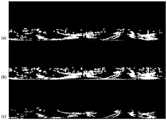
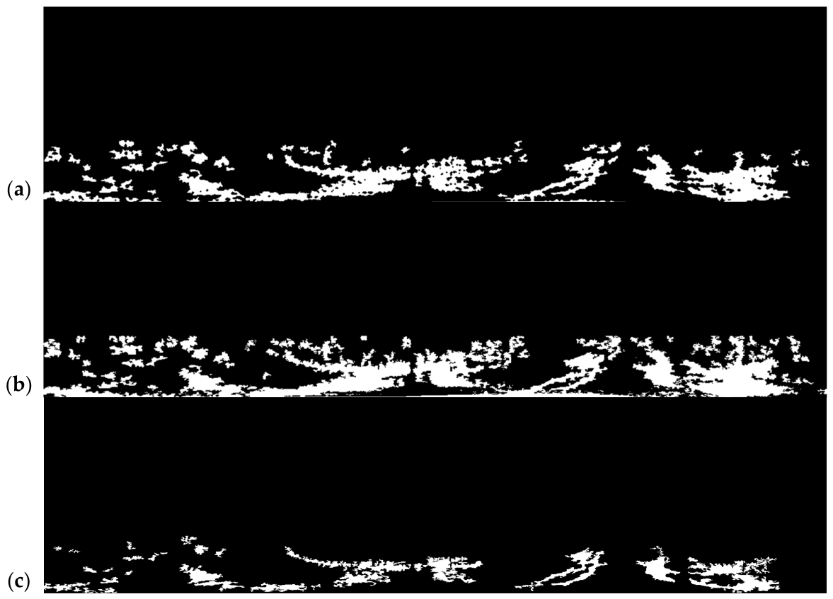
The IQGJO proposed in this paper is compared with the traditional Golden Jackal Optimizer (GJO) and gravitational search algorithm (GSA). The results are shown in Figure 12. Quantum revolving gates and quantum state collapse mechanisms are integrated into IQGJO. Exploration capability and exploitation accuracy are strengthened via quantum-behavior tactics. Adaptive iteration transitions are enabled by levy flight perturbation. A segmentation threshold of 95 is identified as optimal. Pronounced gray-level variability plus intricate sea-surface conditions within spill zones are accommodated. Refined and comprehensive oil-film extraction is thereby achieved.
Figure 12.
Oil film extraction results of other methods. (a) GJO extraction results. (b) GSA extraction results. (c) Visual interpretation results.
The GJO method is driven by male–female jackal cooperative hunting behavior. Optimization search is thus accomplished. Basic threshold tuning is enabled. A segmentation value of 172 is yielded. Conventional position-update rules are solely employed. Insufficient global search depth is observed. Excessive threshold values are produced. These findings are depicted in Figure 12a. Traditional jackal hunting update rules are adopted by GJO. Long-range random perturbation and global escape tactics are absent. Radar image nonuniformity is encountered. The dense grayscale interval of 170–175 cannot be exited. Local optima trap persistence is observed. Low-grayscale genuine spill zones are not reached. Deep optimization is unachieved. Similar threshold convergence is ultimately produced.
Threshold optimization is performed by GSA via particle gravitational interaction. A segmentation value of 127 is obtained, which is lower than that yielded by GJO. However, the gravity-based update rule is readily confined by dense local pixels. Premature convergence is easily triggered. Local optima entrapment is observed. The resultant threshold remains elevated. Strong scattering clutter cannot be effectively distinguished from sea-surface returns. Significant residual background noise persists in segmentation outputs, as illustrated in Figure 12b. Global escape capacity is strengthened by IQGJO, enabling local optima intervals to be exited. Gravitational interaction is solely relied upon by GSA. Escape capability is thereby limited. A segmentation value of 127 is merely reduced. High gray-level clutter still constrains the result.
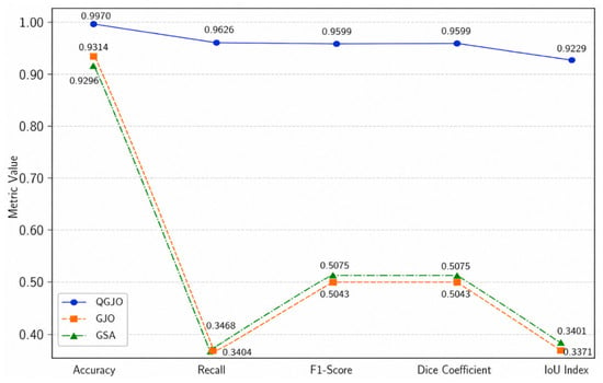
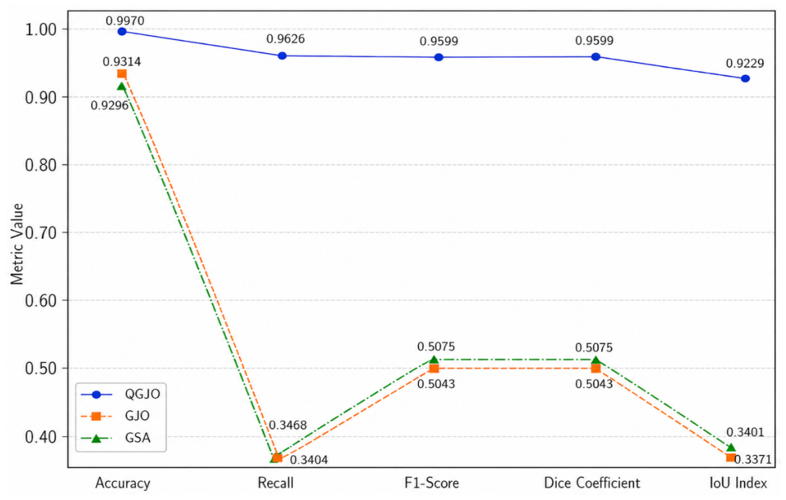
In the task of ship radar oil spill detection, the IQGJO method shows significant performance advantages over traditional GJO and GSA methods. The specific results are shown in Table 2: The accuracy of IQGJO was 0.9970, which was higher than GJO and GSA. The recall rate was 0.9626, which significantly reduced the risk of missing detection of oil spill targets compared with the two comparison methods. The F1 score and Dice coefficient were both 0.9599, which was about twice that of the comparison method. The IOU index reached 0.9229, showing an advantage over GJO and GSA in oil spill area segmentation accuracy. Experimental outcomes demonstrate that overall recognition performance, target detection completeness, and segmentation precision are enhanced by the IQGJO approach. Complex sea-condition spill-detection requirements are effectively satisfied. The visual interpretation result is shown in Figure 12c. Evaluation metric distributions are presented in Figure 13.
Table 2.
Evaluation index of 3 methods.
Figure 13.
Statistical chart of evaluation indicators.
4.4. Compared with K-Means, K-NN, and OTSU Algorithms
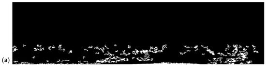
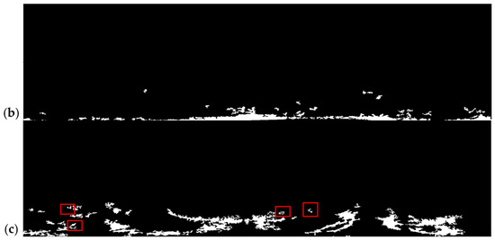
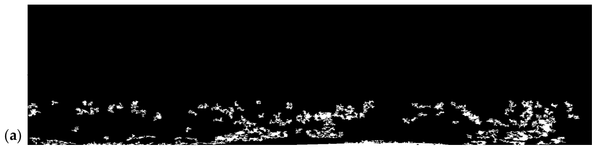
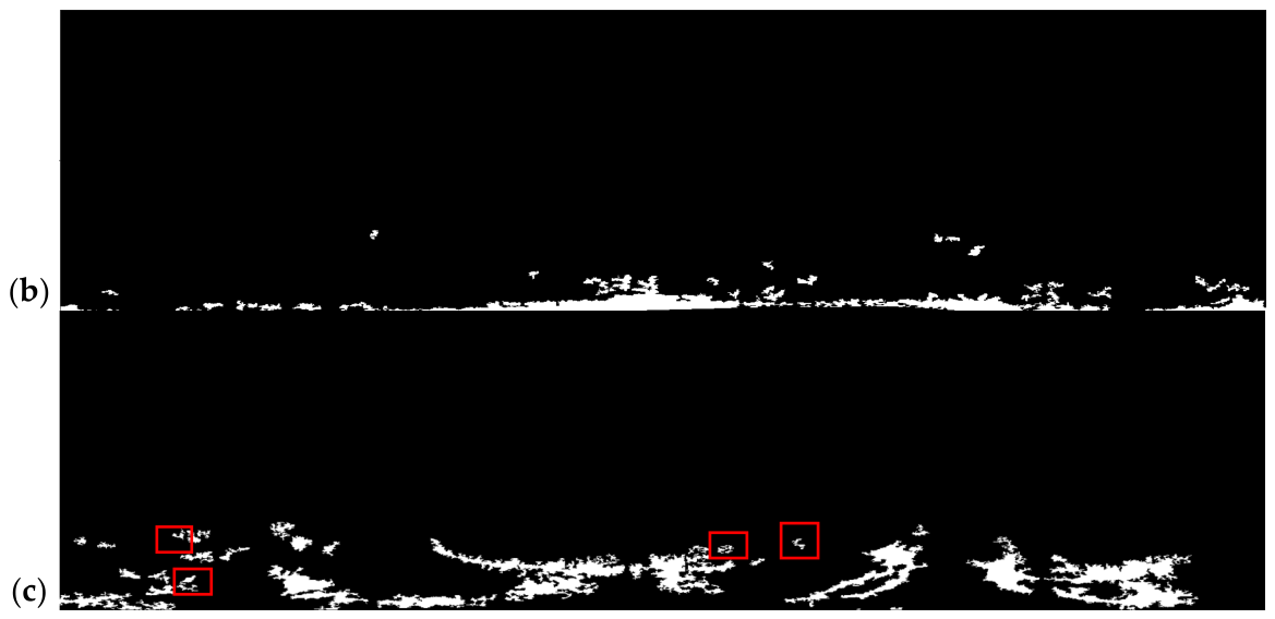
The proposed IQGJO approach is contrasted and analyzed with K-means, K-NN, and OTSU algorithms, and the corresponding outcomes are visualized in Figure 14. A global-local joint optimization mechanism is adopted by the IQGJO method to adaptively resolve segmentation thresholds, the grayscale distribution features of the image are deeply excavated, and outstanding adaptability to sea oil film targets under complex backgrounds is exhibited. The K-means algorithm relies on distance metrics to fulfill pixel clustering tasks, yet it shows distinct sensitivity to initial clustering centroids and easily triggers category misjudgment in regions with intricate grayscale gradients. It delivers inadequate completeness for oil film edge segmentation, as demonstrated in Figure 14a. The K-NN algorithm accomplishes pixel classification by leveraging adjacent pixel attributes, but its performance is governed by the distribution traits of training samples. It exhibits feeble anti-disturbance capacity under complex background perturbation, and its segmentation outputs readily generate scattered noise blots, as presented in Figure 14b. The OTSU algorithm identifies the segmentation threshold following the maximum inter-class variance criterion. It holds the inherent assumption of binary classification for foreground and background, so it easily triggers missed detection on fine oil film targets in red boxes that occupy a tiny proportion and share similar grayscale traits with the background, as visualized in Figure 14c. The missed regions, highlighted via red boxes, in the OTSU algorithm are shown to signal that large swathes of primary oil films can be effectively recognized by this method, yet tiny oil film fragments cannot be extracted, and the omission of target information is thus triggered. Large-scale oil film bodies can be segmented by the K-means algorithm, but edge fracture and background misjudgment on fine oil films are encountered by this approach, and the integrity of target contours is therefore impaired. Massive background noise is contained in the segmentation outputs of the K-NN algorithm, the discrimination between foreground and background is reduced, and severe pseudo-target interference is generated. By comparison, global threshold optimization and local detail retention capacities are integrated by the IQGJO method, superior performance over other algorithms is demonstrated in the aspects of oil film edge completeness and detection accuracy for small oil film targets, and more satisfactory comprehensive performance is obtained in the segmentation tasks of sea-surface images.
Figure 14.
Comparison results with K-means, K-NN, and OTSU algorithms. (a) K-means extraction results. (b) K-NN extraction results. (c) OTSU extraction results.
4.5. The Influence of Different Sea Conditions on the Oil Spill Monitoring Performance of Navigation Radar
The physical foundation of marine radar oil spill detection is built on the Bragg backscattering effect of microwaves generated by surface capillary waves and short gravity waves, which are defined as sea clutter signals. Sea clutter is attenuated by the oil film through the damping effect, and dark patches are formed on the corresponding image. The existence of sea clutter is therefore regarded as a necessary precondition for the detection task. Under calm sea circumstances with low wind velocities and extremely limited effective wave heights, the roughness of the sea surface is close to zero, and nearly no backscatter echo is captured in both the clean water surface zone and the oil film coverage area. Uniform dark regions are presented for both zones in radar imagery. No usable sea clutter information can be acquired from the physical perspective, and the corresponding detection task is judged to be infeasible. For moderate sea states, the intensity of sea clutter is maintained at a medium level, the contrast between the oil film and the background sea surface reaches the optimal state, and the detection performance is demonstrated as the most favorable. Under high sea conditions, wave breaking and whitecaps introduce massive false echoes, and potential disturbance to oil film identification is triggered.
4.6. The Characteristic of Attenuation of Long-Distance Wave Echoes
This study employed a Sperry Marine X-band shipborne navigation radar. The range was configured to 0.75 nautical miles. The image resolution was set to 1024 × 1024 pixels. Shipborne radar exhibits a short observation distance, in contrast to spaceborne SAR. The distance attenuation of electromagnetic wave propagation path loss and antenna gain exerts minimal influence within such a short observation range. The distance difference in echo intensity can be disregarded. The image acquisition range in this study is entirely located within the effective detection envelope of the radar. The contrast between the oil film and seawater maintains uniformity across the entire image. No performance degradation in detection occurs due to signal attenuation in distant areas.
5. Conclusions
A novel oil spill target segmentation approach grounded in RBM feature extraction combined with IQGJO optimization is put forward in this study, specifically designed for marine radar-based oil spill detection scenarios. Initially, multi-dimensional image feature extraction is performed via RBM, and the oil spill candidate region is automatically identified through integration with K-means clustering. Subsequently, the IQGJO algorithm is applied to conduct adaptive threshold optimization, along with fine segmentation. Both quantum behavioral mechanisms and Lévy flight perturbation are incorporated, ensuring a balance between global exploration and local exploitation, thus enabling stable identification of the optimal segmentation threshold. Experimental outcomes indicate that boundaries derived from the proposed approach are well preserved, and clutter-suppression performance is significantly enhanced. Furthermore, satisfactory recognition capability is demonstrated for both low-gray weak-reflection oil films and fragmented oil film targets. In comparison with conventional GJO and GSA optimization methods, the IQGJO strategy effectively mitigates the risk of being trapped in high-gray local optima. Superior advantages are exhibited regarding target integrity, boundary precision, and anti-interference robustness under complex maritime conditions. Consequently, feasible technical solutions are offered for offshore oil spill surveillance and emergency response operations. Future work will focus on further enhancing computational efficiency, and detection robustness under extreme maritime scenarios, including strong wakes and massive waves, is also expected to be improved. The influence of fluctuating wind velocities and wave heights on the performance of marine radar-based oil spill detection will be systematically explored in subsequent research.
Author Contributions
Conceptualization, J.X. and B.Y.; methodology, Q.Q. and B.L.; software, B.X. and J.X.; validation, Y.D. and Z.G.; resources, J.X. and P.L.; data curation, J.X.; writing—original draft preparation, B.Y.; writing—review and editing, J.X. and B.Y.; supervision, J.X. and Q.Q.; project administration, J.X.; funding acquisition, J.X. and Q.Q. All authors have read and agreed to the published version of the manuscript.
Funding
The Guangdong Basic and Applied Basic Research Foundation, grant number 2025A1515010886; the National Natural Science Foundation of China, grant number 52271359; the Postgraduate Education Innovation Project of Guangdong Ocean University, grant number 202421; and the Guangdong Provincial Key Laboratory of Intelligent Equipment for South China Sea Marine Ranching, grant number 2023B1212030003.
Data Availability Statement
The raw data supporting the conclusions of this article will be made available by the authors on request.
Conflicts of Interest
The authors declare that they have no known competing financial interests.
References
- Yan, B.; Passow, U.; Chanton, J.P.; Nöthig, E.-M.; Asper, V.; Sweet, J.; Pitiranggon, M.; Diercks, A.; Pak, D. Sustained deposition of contaminants from the Deepwater Horizon spill. Proc. Natl. Acad. Sci. USA 2016, 113, E3332–E3340. [Google Scholar] [CrossRef] [Scilit]
- Yim, U.H.; Kim, M.; Ha, S.Y.; Kim, S.; Shim, W.J. Oil spill environmental forensics: The Hebei Spirit oil spill case. Environ. Sci. Technol. 2012, 46, 6431–6437. [Google Scholar] [CrossRef] [Scilit]
- Qiao, F.; Wang, G.; Yin, L.; Zeng, K.; Zhang, Y.; Zhang, M.; Xiao, B.; Jiang, S.; Chen, H.; Chen, G. Modelling oil trajectories and potentially contaminated areas from the Sanchi oil spill. Sci. Total Environ. 2019, 685, 856–866. [Google Scholar] [CrossRef] [Scilit]
- Bhattacharya, B.; Hossain, S.K.A.; Ghosh, M.; Das, S. Harnessing cloud-based SAR earth observation and GNOME numerical simulation for modelling the MSC ELSA III oil spill trajectory: Insight from the Kochi coast in south-eastern Arabian sea. Reg. Stud. Mar. Sci. 2026, 95, 104844. [Google Scholar] [CrossRef] [Scilit]
- Hettithanthri, O.; Nguyen, T.B.T.; Fiedler, T.; Phan, C.; Vithanage, M.; Pallewatta, S.; Nguyen, T.M.L.; Nguyen, P.Q.A.; Bolan, N. A review of oil spill dynamics: Statistics, impacts, countermeasures, and weathering behaviors. Asia-Pac. J. Chem. Eng. 2024, 19, e3128. [Google Scholar] [CrossRef] [Scilit]
- Soares, M.O.; Teixeira, C.E.P.; Bezerra, L.E.A.; Rabelo, E.F.; Castro, I.B.; Cavalcante, R.M. The most extensive oil spill registered in tropical oceans (Brazil): The balance sheet of a disaster. Environ. Sci. Pollut. Res. Int. 2022, 29, 19869–19877. [Google Scholar] [CrossRef] [Scilit]
- Liao, L.; Zhao, Q.; Song, W. Monitoring of oil spill risk in coastal areas based on Polarimetric SAR satellite images and deep learning theory. Sustainability 2023, 15, 14504. [Google Scholar] [CrossRef] [Scilit]
- Kumar, A.; Mishra, V.; Panigrahi, R.K.; Martorella, M. Application of hybrid-pol SAR in oil-spill detection. IEEE Geosci. Remote Sens. Lett. 2023, 20, 4004505. [Google Scholar] [CrossRef] [Scilit]
- Song, W.; Ma, X.; Song, W. Automatic detection of marine oil spills from polarimetric SAR images using deep Convolutional neural network model. Ecol. Indic. 2024, 169, 112934. [Google Scholar] [CrossRef] [Scilit]
- Li, C.; Yang, Y.; Yang, X.; Chu, D.; Cao, W. A novel multi-scale feature map fusion for oil spill detection of SAR remote sensing. Remote Sens. 2024, 16, 1684. [Google Scholar] [CrossRef] [Scilit]
- Zhang, J.; Yang, P.; Ren, X. Detection of oil spill in SAR image using an improved DeepLabV3. Sensors 2024, 24, 5460. [Google Scholar] [CrossRef] [Scilit]
- Wang, J.; Li, Z.; Yang, J.; Liu, S.; Zhang, J.; Li, S. A multilevel spatial and spectral feature extraction network for marine oil spill monitoring using airborne hyperspectral image. Remote Sens. 2023, 15, 1302. [Google Scholar] [CrossRef] [Scilit]
- Sun, H.; Ma, L.; Fu, Q.; Li, Y.; Shi, H.; Liu, Z.; Liu, J.; Wang, J.; Jiang, H. Long-wave infrared polarization-based airborne marine oil spill detection and identification technology. Photonics 2023, 10, 588. [Google Scholar] [CrossRef] [Scilit]
- Scafutto, R.D.M.; Lassalle, G.; Alves, M.N.; de Paula Miranda, L.; da Costa, P.M.O.; de Souza Filho, C.R. Monitoring oil spill thickness and weathering using UAV-borne hyperspectral sensing. Mar. Pollut. Bull. 2025, 218, 118134. [Google Scholar] [CrossRef] [Scilit]
- Chen, R.; Jia, B.; Ma, L.; Xu, J.; Li, B.; Wang, H. Marine radar oil spill extraction based on texture features and BP neural network. J. Mar. Sci. Eng. 2022, 10, 1904. [Google Scholar] [CrossRef] [Scilit]
- Yang, Y.; Yan, J.; Xu, J.; Zhong, X.; Huang, Y.; Rui, J.; Cheng, M.; Huang, Y.; Wang, Y.; Liang, T.; et al. Oil film detection for marine radar image using SBR feature and adaptive threshold. J. Mar. Sci. Eng. 2025, 13, 1178. [Google Scholar] [CrossRef] [Scilit]
- Li, B.; Xu, J.; Chu, L.; Yang, Y.; Huang, X.; Liu, P. Oil film semantic segmentation method in X-band marine radar remote sensing images. IEEE Geosci. Remote Sens. Lett. 2023, 20, 1503205. [Google Scholar] [CrossRef] [Scilit]
- Xu, J.; Cui, C.; Feng, H.; You, D.; Wang, H.; Li, B. Marine radar oil-spill monitoring through local adaptive thresholding. Environ. Forensics 2019, 20, 196–209. [Google Scholar] [CrossRef] [Scilit]
- Xu, J.; Xu, B.; Mou, X.; Yao, B.; Guo, Z.; Wang, X.; Huang, Y.; Qian, S.; Cheng, M.; Liu, P.; et al. Oil film segmentation method using marine radar based on feature fusion and artificial bee colony algorithm. J. Mar. Sci. Eng. 2025, 13, 1453. [Google Scholar] [CrossRef] [Scilit]
- Liu, P.; Zhao, X.; Wang, X.; Shao, P.; Chen, P.; Zhu, X.; Xu, J.; Li, Y.; Liu, B. A Multi-Stage Enhancement Based on the Attenuation Characteristics of X-Band Marine Radar Images for Oil Spill Extraction. Oceans 2025, 6, 39. [Google Scholar] [CrossRef] [Scilit]
- Liu, P.; Wang, X.; Shao, P.; Zhao, X.; Liu, B.; Chen, P.; Zhu, X.; Xu, J.; Li, Y. Oil Spill Segmentation in Marine Radar Images Based on the Improved Sauvola Algorithm. Remote Sens. Lett. 2026, 17, 182–189. [Google Scholar] [CrossRef] [Scilit]
- Ackley, D.; Hinton, G.; Sejnowski, T. A learning algorithm for boltzmann machines. Cogn. Sci. 1985, 9, 147–169. [Google Scholar] [CrossRef] [Scilit]
- Hinton, G.E. Training products of experts by minimizing contrastive divergence. Neural Comput. 2002, 14, 1771–1800. [Google Scholar] [CrossRef] [Scilit]
- Chopra, N.; Mohsin Ansari, M. Golden jackal optimization: A novel nature-inspired optimizer for engineering applications. Expert Syst. Appl. 2022, 198, 116924. [Google Scholar] [CrossRef] [Scilit]



Disclaimer/Publisher’s Note: The statements, opinions and data contained in all publications are solely those of the individual author(s) and contributor(s) and not of MDPI and/or the editor(s). MDPI and/or the editor(s) disclaim responsibility for any injury to people or property resulting from any ideas, methods, instructions or products referred to in the content. |
© 2026 by the authors. Licensee MDPI, Basel, Switzerland. This article is an open access article distributed under the terms and conditions of the Creative Commons Attribution (CC BY) license.