You are currently viewing a new version of our website. To view the old version click .

Remote Sensing, Volume 12, Issue 5

March-1 2020 - 153 articles

Cover Story: 
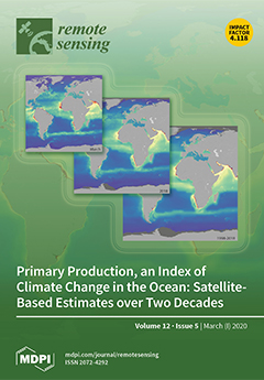
Primary production by marine phytoplankton is one of the largest fluxes of carbon on our planet. In the past few decades, considerable progress has been made in estimating global primary production at high spatial and temporal scales by combining in situ measurements of primary production with remote sensing observations of phytoplankton biomass. Here, we address one of the major challenges in this approach by improving the assignment of appropriate model parameters that define the photosynthetic response of phytoplankton cells. A global database of over 9,000 in situ photosynthesis–irradiance measurements and a 20-year record of climate quality satellite observations were used to assess global primary production and its variability between 1998 and 2018.View this paper.
  • Issues are regarded as officially published after their release is announced to the table of contents alert mailing list .
  • You may sign up for email alerts to receive table of contents of newly released issues.
  • PDF is the official format for papers published in both, html and pdf forms. To view the papers in pdf format, click on the "PDF Full-text" link, and use the free Adobe Reader to open them.

Articles (153)

  • Article
  • Open Access
14 Citations
6,954 Views
25 Pages

10 March 2020

The study of post-disaster recovery requires an understanding of the reconstruction process and growth trend of the impacted regions. In case of earthquakes, while remote sensing has been applied for response and damage assessment, its application ha...

  • Article
  • Open Access
17 Citations
5,454 Views
19 Pages

10 March 2020

Taiwan is located at the junction of the tropical and subtropical climate zones adjacent to the Eurasian continent and Pacific Ocean. The island frequently experiences typhoons that engender severe natural disasters and damage. Therefore, efficiently...

  • Letter
  • Open Access
36 Citations
7,168 Views
14 Pages

Effectiveness of Innovate Educational Practices with Flipped Learning and Remote Sensing in Earth and Environmental Sciences—An Exploratory Case Study

  • Juan Antonio López Núñez,
  • Jesús López Belmonte,
  • Antonio José Moreno Guerrero and
  • Santiago Pozo Sánchez

10 March 2020

The rapid advancements in the technological field, especially in the field of education, have led to the incorporation of remote sensing in learning spaces. This innovation requires active and effective teaching methods, among which is flipped learni...

  • Article
  • Open Access
52 Citations
7,788 Views
25 Pages

Combining InfraRed Thermography and UAV Digital Photogrammetry for the Protection and Conservation of Rupestrian Cultural Heritage Sites in Georgia: A Methodological Application

  • William Frodella,
  • Mikheil Elashvili,
  • Daniele Spizzichino,
  • Giovanni Gigli,
  • Luka Adikashvili,
  • Nikoloz Vacheishvili,
  • Giorgi Kirkitadze,
  • Akaki Nadaraia,
  • Claudio Margottini and
  • Nicola Casagli

10 March 2020

The rock-cut city of Vardzia is an example of the extraordinary rupestrian cultural heritage of Georgia. The site, Byzantine in age, was carved in the steep tuff slopes of the Erusheti mountains, and due to its peculiar geological characteristics, it...

  • Article
  • Open Access
39 Citations
11,059 Views
29 Pages

Taking the Motion out of Floating Lidar: Turbulence Intensity Estimates with a Continuous-Wave Wind Lidar

  • Felix Kelberlau,
  • Vegar Neshaug,
  • Lasse Lønseth,
  • Tania Bracchi and
  • Jakob Mann

10 March 2020

Due to their motion, floating wind lidars overestimate turbulence intensity ( T I ) compared to fixed lidars. We show how the motion of a floating continuous-wave velocity–azimuth display (VAD) scanning lidar in all six degrees of freedo...

  • Article
  • Open Access
33 Citations
4,812 Views
24 Pages

9 March 2020

Accurately estimating growing stem volume (GSV) is very important for forest resource management. The GSV estimation is affected by remote sensing images, variable selection methods, and estimation algorithms. Optical images have been widely used for...

  • Article
  • Open Access
103 Citations
9,454 Views
20 Pages

Multi-scale Adaptive Feature Fusion Network for Semantic Segmentation in Remote Sensing Images

  • Ronghua Shang,
  • Jiyu Zhang,
  • Licheng Jiao,
  • Yangyang Li,
  • Naresh Marturi and
  • Rustam Stolkin

9 March 2020

Semantic segmentation of high-resolution remote sensing images is highly challenging due to the presence of a complicated background, irregular target shapes, and similarities in the appearance of multiple target categories. Most of the existing segm...

  • Article
  • Open Access
10 Citations
4,842 Views
21 Pages

The Potential of Space-Based Sea Surface Salinity on Monitoring the Hudson Bay Freshwater Cycle

  • Wenqing Tang,
  • Simon H. Yueh,
  • Daqing Yang,
  • Ellie Mcleod,
  • Alexander Fore,
  • Akiko Hayashi,
  • Estrella Olmedo,
  • Justino Martínez and
  • Carolina Gabarró

9 March 2020

Hudson Bay (HB) is the largest semi-inland sea in the Northern Hemisphere, connecting with the Arctic Ocean through the Foxe Basin and the northern Atlantic Ocean through the Hudson Strait. HB is covered by ice and snow in winter, which completely me...

  • Article
  • Open Access
77 Citations
14,167 Views
24 Pages

Morphometric Analysis for Soil Erosion Susceptibility Mapping Using Novel GIS-Based Ensemble Model

  • Alireza Arabameri,
  • John P. Tiefenbacher,
  • Thomas Blaschke,
  • Biswajeet Pradhan and
  • Dieu Tien Bui

9 March 2020

The morphometric characteristics of the Kalvārī basin were analyzed to prioritize sub-basins based on their susceptibility to erosion by water using a remote sensing-based data and a GIS. The morphometric parameters (MPs)—linear, relief, and sh...

  • Article
  • Open Access
10 Citations
5,641 Views
23 Pages

9 March 2020

High-accuracy peat maps are essential for peatland restoration management, but costly, labor-intensive, and require an extensive amount of peat drilling data. This study offers a new method to create an accurate peat depth map while reducing field dr...

of 16

Get Alerted

Add your email address to receive forthcoming issues of this journal.

XFacebookLinkedIn
Remote Sens. - ISSN 2072-4292Creative Common CC BY license