


Abstract
Walkability has reemerged as a central interest within planning, public health, and built environment research, yet evidence demonstrates that new urban extensions or emerging New Towns across England continue to reproduce conditions of car dependency and limited active travel options. This paper examines the structural, spatial, and sociocultural factors shaping walkability through an in-depth analysis of five residential case studies. It draws on spatial analysis and assessment of resident behaviour using sociodemographic data. Findings indicate significant disparities in walkability outcomes, with some developments characterised by fragmented layouts, weak public transport integration, and environments that make walking impractical or undesirable. The paper argues that walkability must be understood as a multidimensional, relational property of place, rather than a static design feature. The current dominant planning practices continue to prioritise vehicular access and associated infrastructure, undermining national goals for decarbonisation, health equity, and sustainable mobility. Thus, this study identifies the spatial, governance, and policy conditions necessary to deliver genuinely walkable neighbourhoods and highlights the systemic barriers that continue to constrain progress. The findings offer critical insights for planners, policymakers, and developers seeking to create environments that support healthier, more equitable, and less car dependent futures.
Keywords:
walkability; New Towns; urban extensions; sustainable developments; Poundbury; England; housing 1. Introduction
The extent to which urban extensions and New Towns—defined respectively as the planned outward expansion of existing urban areas or the creation of purpose-built, self-contained settlements on previously undeveloped land, each designed to accommodate growth through comprehensive planning and the provision of housing, infrastructure, and services—incorporate attributes that support walkability, and the ways in which planning and development practices continue to shape patterns of physical inactivity, has become a central concern within built-environment scholarship. Declining rates of walking in England reflect cumulative structural, cultural, and behavioural shifts rather than changes in individual preference alone. Historically, everyday life embedded significantly higher levels of occupational and incidental physical activity; estimates suggest that routine exertion fifty years ago was equivalent to running a marathon each week [1]. While the psychological and physiological benefits of physical activity are well established [1], the widespread adoption of private vehicles has substantially reduced the necessity of active travel, particularly in suburban and rural contexts characterised by high car dependency. This transition has been reinforced by planning models favouring low-density development, segregated land uses, and infrastructure prioritising private vehicles—patterns long associated with reduced feasibility and attractiveness of walking [2].
Recent planning evidence demonstrates that these outcomes are structurally embedded within spatial and regulatory systems. The Location of Development report by the Royal Town Planning Institute and LandTech [3] identifies a decade-long shortfall in delivering physically connected and sustainable housing. Despite policy commitments under the former National Planning Policy Framework (NPPF), measurable improvements in access to essential services by walking, cycling, or public transport remain limited. Public transport journeys are approximately 1.5 times longer than equivalent car trips; although 96% of new homes are within a 20 min drive of a town centre, only 66% achieve this threshold by public transport and 47% on foot [3]. Thus, these findings illustrate a persistent disconnect between policy objectives and spatial outcomes, constraining opportunities for modal shift. At the same time, residential location decisions reflect multiple social and lifestyle considerations, including preferences for quieter environments and larger plots, underscoring the complexity of housing demand.
Within this context, walkability has emerged as a core concept in contemporary place-making, broadly defined as the capacity of neighbourhoods to support pedestrian movement and contribute to community wellbeing. Environments characterised by mixed land use, accessible amenities, and safe, connected pedestrian infrastructure are associated with improved public health, reduced carbon emissions, and strengthened social cohesion [4,5]. Evidence from the Scottish Longitudinal Study indicates that pedestrian commuting is linked to lower risks of hospitalisation, cardiovascular disease, and mental health-related prescriptions [6]. Walkability is therefore increasingly positioned as a key dimension of sustainable and liveable neighbourhoods. Recent planning discourse has further developed walkability through the concept of the “15-min city”, which proposes that essential services such as employment, education, retail, and healthcare should be accessible within a short walking or cycling distance from residents’ homes. The model emphasises proximity, mixed land uses, and connected street networks as key principles of sustainable urban development [7,8]. Although widely discussed in planning policy and research, relatively limited empirical work has examined how effectively new urban extensions and New Towns achieve these proximity-based accessibility objectives.
However, against this backdrop, scholarship cautions against reducing walkability to a checklist of measurable physical attributes. Zuniga-Teran et al. [9] argue that planning frameworks often overemphasise density and connectivity while overlooking experiential, environmental, and social dimensions that shape walking behaviour. Emerging research conceptualises walkability as a dynamic and relational process embedded within broader spatial and socio-economic systems. Empirical evidence supports this systemic perspective. The ‘But can I walk to work?’ study by Space Syntax [10] integrates spatial modelling, Census travel-to-work data, and public health evidence to demonstrate that walking behaviour is strongly influenced by settlement configuration, network integration, land-use patterns, access to employment and services, and demographic characteristics. Even where distances are short, walking is frequently constrained by fragmented networks, segregated uses, and weak integration within wider urban systems.
This broader framing suggests that walkability should be understood as a multidimensional urban asset than solely an infrastructural feature. As Rogers et al. [11] note, the positive correlation between built environment characteristics and social capital indicates that social dimensions of sustainability can be empirically assessed. Structural constraints further shape mobility behaviour. The Walking and Cycling Index [12] reports that 36% of respondents frequently use a car because they perceive “no other choice,” highlighting the role of spatial and infrastructural conditions instead of individual preference alone. Car-oriented infrastructure also consumes extensive land and material resources, limiting opportunities to prioritise active travel. Reducing car dominance therefore represents both a transport and urban sustainability imperative.
Evidence indicates that new urban extensions or New Towns continue to reproduce car-dependent patterns. The Building Car Dependency report by Transport for New Homes [13], based on observational assessments of over twenty housing developments, shows that peripheral siting, limited local services, and layouts dominated by distributor roads and parking infrastructure inhibit active travel. Such environments exacerbate social exclusion for individuals unable to drive due to financial, medical, or personal constraints. National scale analysis in the Trapped Behind the Wheel report [14] similarly finds that housing built since 2009 across England is disproportionately located in areas of high car dependency—typically low-density greenfield sites with limited public transport and poor service access. Although these sites may reduce upfront development costs, they impose long-term environmental, financial, and social burdens, including higher transport expenditure and increased emissions. The report identifies structural drivers—including speculative land markets, fragmented governance, and limited regulatory capacity—that incentivize poorly connected development.
Wider social and psychological factors compound these structural conditions. Concerns about personal safety, particularly among women, children, and older adults, reduce willingness to walk [15]. Young people face additional constraints linked to reduced physical education provision and parental concerns regarding unsupervised mobility [16]. Increased sedentary leisure associated with digitalization [17], alongside experiences of racial harassment that restrict access to public space for some ethnic minority groups [18], further shape walking behaviour. Whilst diversity within our population using the built environment has been touched upon, in terms of engaging with various stakeholders, we need to look beyond an ‘average’ able-bodied human simply walking. Greater consideration could be given to those with visual, cognitive, or physical disabilities and those using crutches, in wheelchairs, pushing prams, carrying luggage, or delivering items. Walkability must therefore be understood as socially mediated, as well as spatially structured.
Thus, the measurement of walkability remains an active area of debate within the literature. Different methodological approaches combine indicators such as density, land-use diversity, street connectivity, proximity to services, and accessibility of public transport, often drawing on the “5Ds” framework widely used in transport and urban design research [19,20,21,22]. More recent approaches also incorporate spatial configuration measures derived from space syntax theory, which analyse how the structure and integration of street networks influence accessibility to everyday destinations and patterns of walking behaviour [23]. Systematic reviews highlight that no single universally accepted Walkability Index exists, with measurement frameworks often shaped by data availability, analytical scale, and research objectives [24,25]. At the same time, much of the existing research has focused either on conceptual frameworks or on analyses of established metropolitan environments, with relatively limited empirical attention given to how new urban extensions or New Towns perform once delivered [4,22,24,25]. While these broader human, social, and behavioural dimensions are critical to understanding walking behaviour, spatial accessibility remains a key structural determinant shaping the opportunities available to residents. For this reason, the present study focuses on the spatial configuration of these new emerging towns as a measurable component of walkability using the Space Syntax Walkability Index. England provides a particularly relevant context for examining these dynamics given the renewed national policy focus on New Towns and large-scale planned settlements as mechanisms for addressing housing shortages and accommodating future population growth [26].
This study therefore addresses the following research question: What structural, spatial, and sociocultural factors truly shape walkability in new urban extensions and emerging New Towns in England?
The Value of Walkability
The value of walkability is increasingly recognised across urban policy and planning scholarship, supported by substantial evidence linking pedestrian-oriented environments to land-use efficiency, public health savings, and local economic performance [19,24,27,28,29,30]. Properties in walkable neighbourhoods consistently command higher market values due to proximity to amenities, transit accessibility, and interconnected street networks. This is evident across the globe. A study of over 14,000 housing transactions in Stockholm, Sweden, found that walkability indicators—including population density, retail presence, transit accessibility, and street connectivity—explained up to 90% of variation in residential and office property values, while car access had negligible influence [31]. In the United States, even a one-point increase in Walk Score has been associated with residential price premiums ranging from $500 to $3000, depending on regional context [32,33].
Walkable, mixed-use neighbourhoods also generate sustained fiscal benefits through more efficient infrastructure provision and reduced service liabilities. Evidence suggests that pedestrian-oriented urban form attracts business investment and skilled workers, particularly within innovation-driven sectors, while enhancing the vitality of town centres [34]. The Building Better, Building Beautiful Commission [35] contends that well-designed, walkable developments retain value more effectively over time and secure stronger public support. Despite these returns, conventional transport appraisal frameworks continue to prioritise vehicle-based metrics, systematically undervaluing short, everyday walking trips and contributing to underinvestment in pedestrian infrastructure.
The relationship between walkability and health outcomes is robust [5]. Walkable environments embed physical activity into daily routines, mitigating risks of obesity, cardiovascular disease, type 2 diabetes, and certain cancers. A systematic review of Health Impact Assessments found strong evidence that improvements to walkability reduce mortality and increase quality-adjusted life years [5]. Walking also supports mental wellbeing by fostering social interaction, reducing stress, and strengthening attachment to place [19,32]. The Sustrans Walking and Cycling Index [12] estimates that walking prevents approximately 4444 premature deaths annually across 23 UK cities, generating public health benefits valued at £16.1 billion.
Importantly, walkability enhances equity. As the most affordable mode of mobility, walking expands access to employment, services, and social opportunities for socioeconomically disadvantaged groups, children, older adults, and disabled people. Walkable environments should therefore be understood not as lifestyle amenities but as foundational investments in long-term public health, resilience, and social inclusion.
Encouraging modal shift, however, requires engagement with prevailing norms and expectations. For many individuals, walking is framed as leisure instead of a practical mode of travel or is perceived as incompatible with time pressures and daily routines. Promoting walkability therefore extends beyond infrastructural provision to encompass cultural change, behavioural adaptation, and inclusive design. Effective walking environments must accommodate diverse physical abilities, sensory experiences, and perceptions of safety across the life course. Designing for walkability is therefore both a spatial and sociocultural challenge, demanding integrated approaches that recognise the complexity of human experience within urban systems. Thus, this study examines five new urban extensions and emerging New Towns in England to identify the spatial, governance, and policy conditions required to deliver genuinely walkable neighbourhoods. In doing so, it critically interrogates the systemic barriers—embedded within land markets, planning practice, delivery sequencing, and regulatory frameworks—that continue to constrain progress toward less car-dependent and more health-supportive urban environments.
2. Methodology
This study employs a comparative case study approach to investigate variations in walkability performance across a selection of new urban extensions and emerging New Towns in England, enabling systematic cross-case comparison of built environment characteristics. Although these developments are described using different planning or policy terms, they share the common characteristic of being planned, large-scale residential developments, designed and delivered as part of contemporary growth strategies. Focusing on such developments enables the study to examine how the built environment can promote health through walkability from the point of neighbourhood design. As England continues to address a significant housing shortage, large numbers of new homes are being delivered through planned developments, creating opportunities to incorporate walkability-supportive features such as connected street networks and access to local amenities. Studying these new areas allows for a clearer assessment of how contemporary planning and design can support healthier behaviours, whereas pre-existing neighbourhoods often reflect decades of incremental change that may obscure the effects of built environment characteristics. Five case studies were selected to demonstrate both the value and variation in walkability outcomes. Selection criteria were based on (i) overlapping development periods, (ii) broad comparability in scale, and (iii) availability of consistent spatial and sociodemographic data. These criteria enable a robust comparison while limiting confounding effects associated with settlement size or urban form. Furthermore, the use of multiple case studies allows for analytical generalisation rather than statistical generalisation, supporting an exploration of how differing spatial configurations and land use patterns influence walkability outcomes within broadly similar delivery contexts. This approach aligns with established methodologies in urban design and built environment research [22,36], where walkability is understood as context dependent and multidimensional, as opposed to a single, universally comparable attribute. In line with current best practice, objective spatial modelling with secondary sociodemographic data is presented, addressing a common limitation of perception-only approaches and enhancing replicability across sites [4,5].
A comparison with national walkability benchmarks was intentionally not undertaken. National datasets frequently include highly connected metropolitan environments such as London and other historic urban centres, where dense street networks, established service hierarchies, and extensive public transport systems generate structurally high walkability scores. Benchmarking against such contexts would risk creating unrealistic baselines for newly planned settlements delivered through contemporary development frameworks. Instead, this study adopts a controlled comparative approach focusing on broadly comparable urban extensions and New Town developments delivered under similar planning and market conditions. This allows the analysis to isolate how spatial configuration, land-use distribution, and development sequencing influence walkability outcomes within contemporary planned settlements than historically evolved urban environments.
Case Study Selection
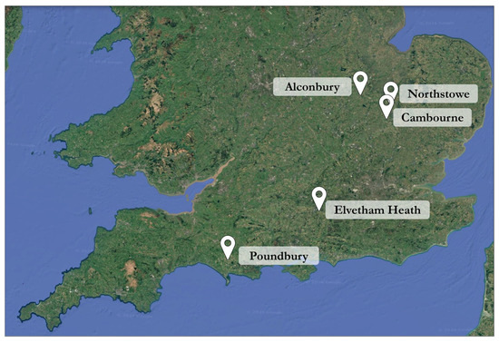
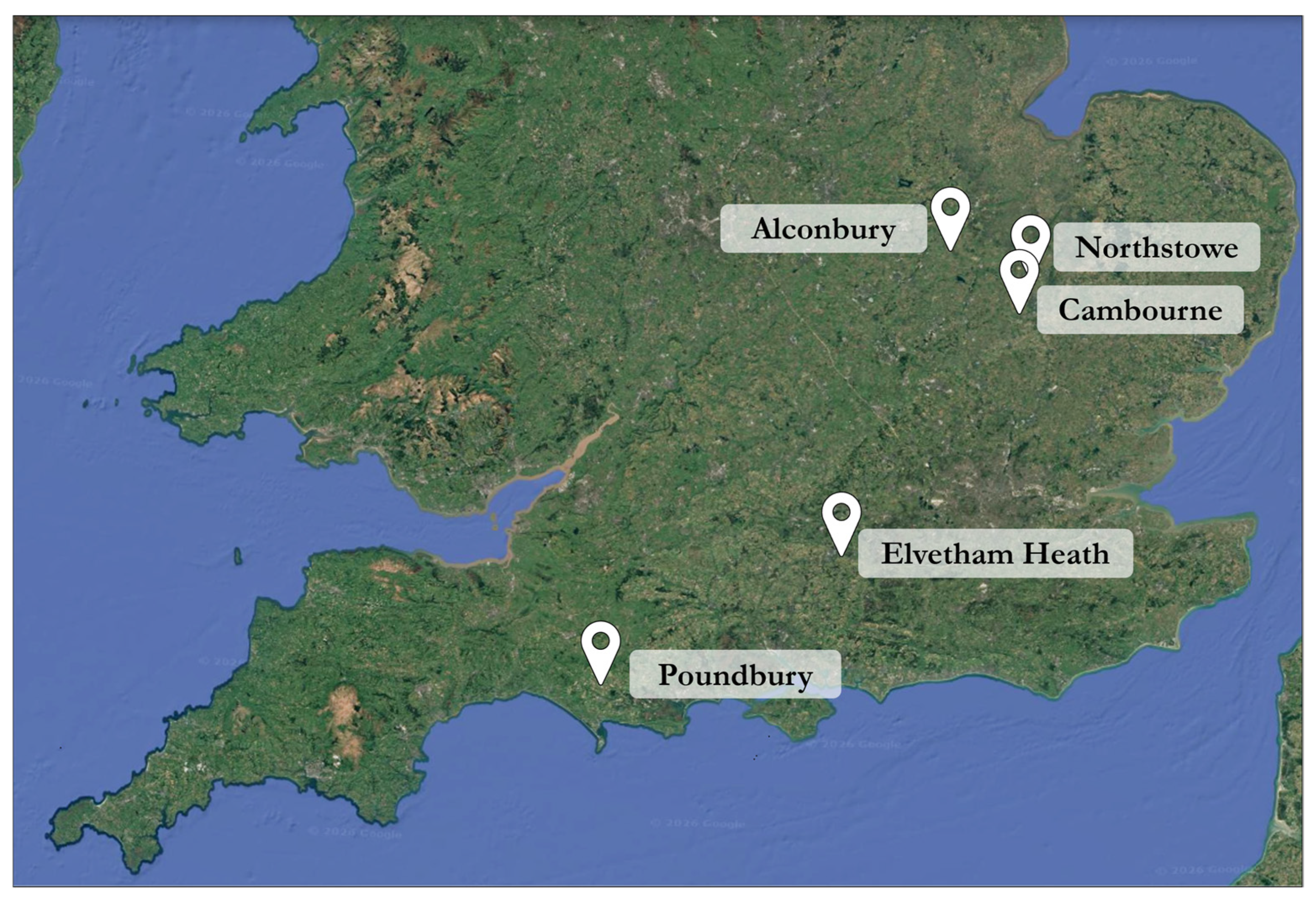
The selected five case studies (see Figure 1, Table 1,) represent a range of new developments in England over the past three decades. While each project differs slightly in scale, design approach, and delivery model, all were conceived as master-planned communities intended to provide residential neighbourhoods supported by local services and infrastructure. Poundbury represents a mixed-use settlement explicitly designed around principles of integrated land use and walkable neighbourhood structure. Elvetham Heath and Cambourne represent suburban extensions developed during the late 1990s and early 2000s, reflecting prevailing planning approaches of the period. Northstowe and Alconbury Weald represent more recent large-scale developments delivered through phased expansion models. Together these cases provide a comparative framework for examining how differences in spatial configuration, land-use distribution, and development sequencing influence walkability outcomes.
Figure 1.
Geographic distribution of the five case studies in England.
Table 1.
Profile of the 5 case study sites.
The analytical instrument used is the Walkability Index developed by Space Syntax, a tool that benchmarks existing places; it tests proposals within a consistent spatial framework grounded in space syntax theory [37]. Space Syntax conceptualises walkability as an emergent property of the urban system—arising from the configuration of street networks, block structures, and the distribution of everyday land uses—rather than as a function of any single design attribute [23,38]. Adopting this focus allows the analysis to move beyond street geometry to consider how morphology and land-use localisation jointly produce (or inhibit) everyday walking opportunities [39].
Space syntax methods have been widely applied in urban research to analyse how street network configuration influences patterns of movement, accessibility, and land-use distribution. Empirical studies have demonstrated strong relationships between spatial network integration, pedestrian flows, and the location of commercial and social activities, providing a robust analytical basis for evaluating walkability within urban environments [23]. By capturing how spatial configuration shapes accessibility to everyday destinations, the approach provides a systematic framework for examining how urban form influences opportunities for active travel. The Space Syntax Walkability Index therefore evaluates the accessibility and diversity of essential non-residential land uses reachable within a defined walking catchment. The model combines spatial configuration metrics derived from street network analysis with the distribution of everyday destinations (including retail, education, employment, and health services), reflecting established research linking built environment characteristics and accessibility to walking behaviour [20,21,39].
The analysis applies to a 15 min walking threshold to define the spatial catchment for accessible destinations. This benchmark aligns with the broader conceptual framework of the “15 min city”, which proposes that essential daily services such as employment, education, retail, and healthcare should be accessible within a short walking or cycling distance from residential areas [7,8]. While the precise threshold used in accessibility studies varies, a 15-min walking catchment (approximately 1–1.2 km) is widely used in urban planning and transport research as a practical representation of neighbourhood-scale pedestrian reach.
In practical terms, the index measures how the structure of the street network interacts with the location of activities to determine the diversity of destinations accessible within walking distance. Higher index values therefore indicate locations where the spatial configuration of the street network and the distribution of land uses jointly support a greater range of everyday walking opportunities.
To situate the spatial findings, publicly available socio-demographic statistics are compiled from the Office for National Statistics (ONS) and the UK Census for each case study area [40]. The census data used in this study represents population-level travel behaviour within the output areas corresponding to each settlement. These data provide a descriptive context (e.g., population structure, employment patterns, household characteristics) that aids the interpretation of spatial accessibility patterns and avoids the volatility of purely attitudinal indicators [5,22]. While causality is not inferred, juxtaposing spatial walkability with demographic profiles helps identify plausible mechanisms and boundary conditions for observed differences between sites.
3. Findings
Across all five case studies, the Walkability Index was applied at the building level, enabling a detailed evaluation of the number and diversity of essential non-residential land uses—such as retail, education, healthcare, and employment—accessible within a 15 min walking catchment. This threshold corresponds with established neighbourhood accessibility standards and reflects widely recognised patterns in everyday pedestrian behaviour [4,22]. The granularity of this approach allows for fine-scale differentiation within settlements, revealing intra-neighbourhood variations that may be obscured by zone-based analyses and supporting more robust cross-case comparison [36,37,38].
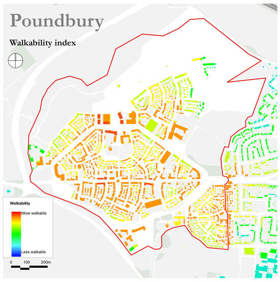
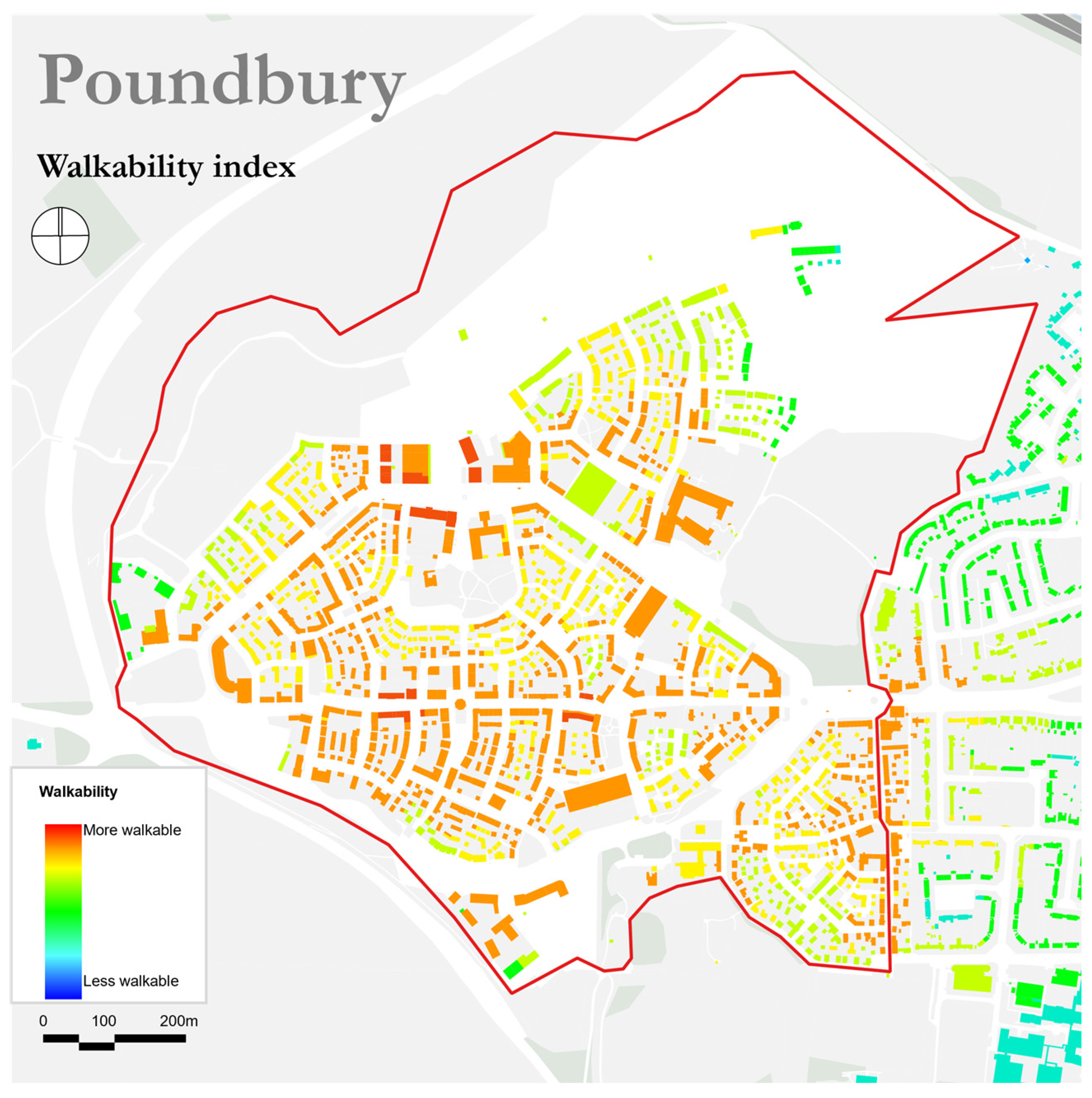
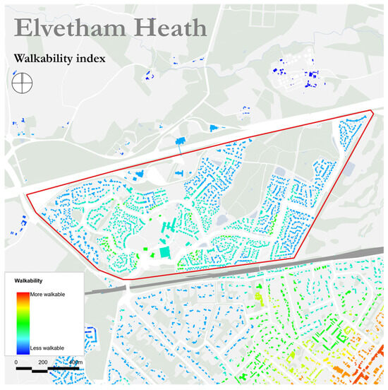
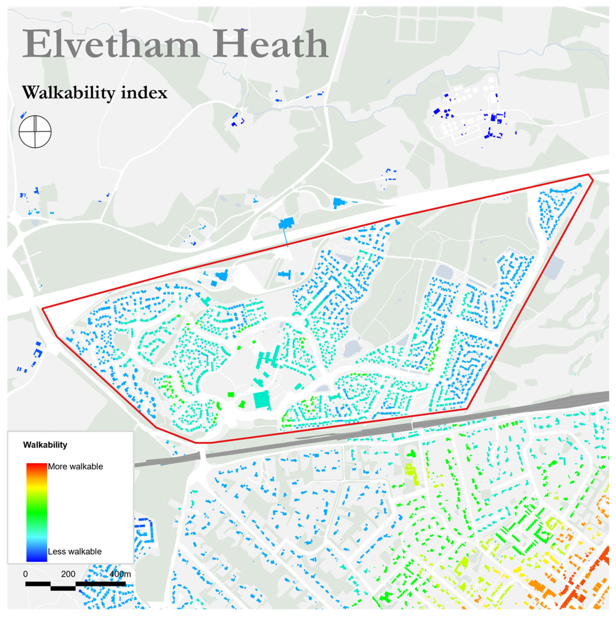
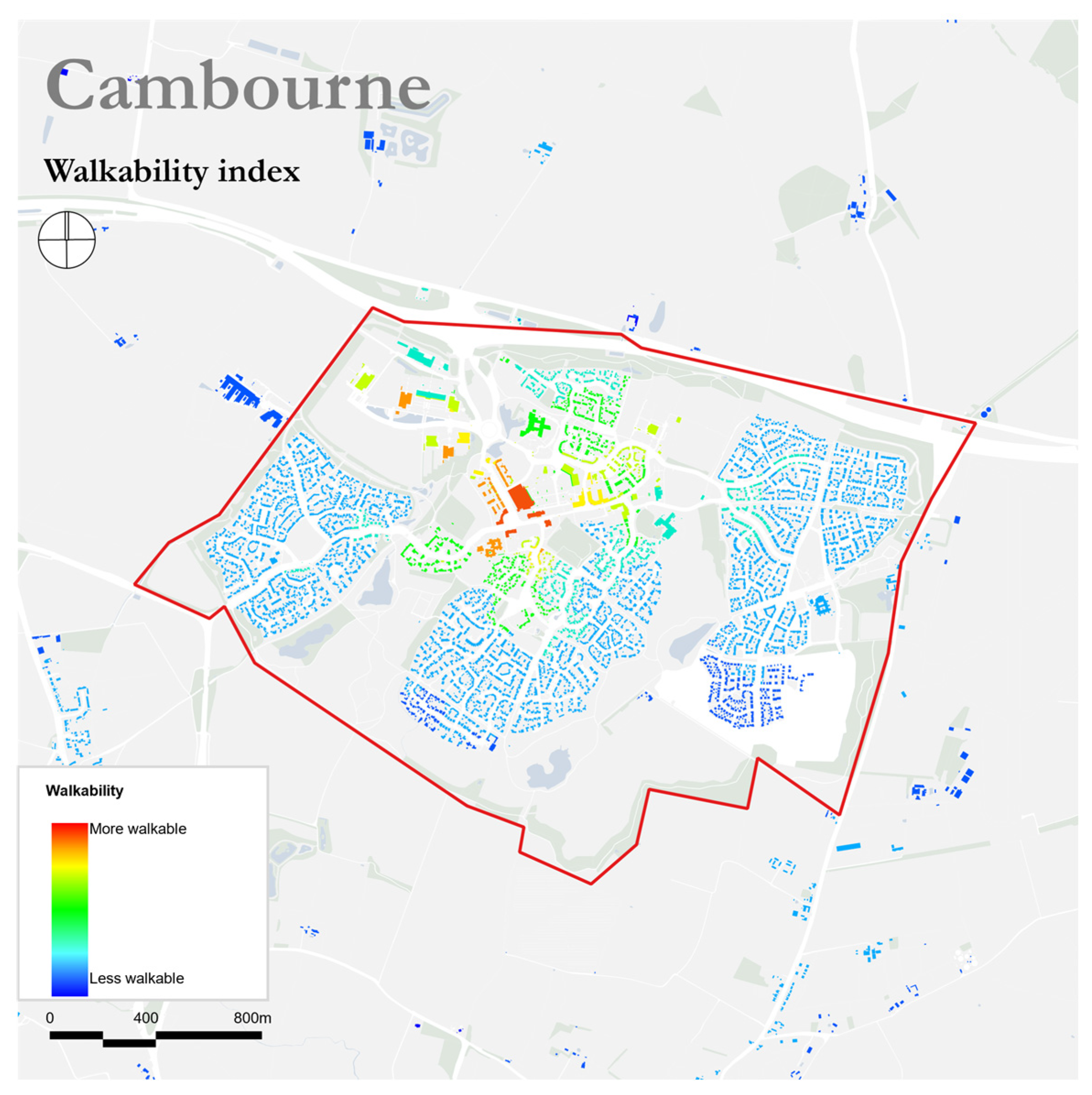
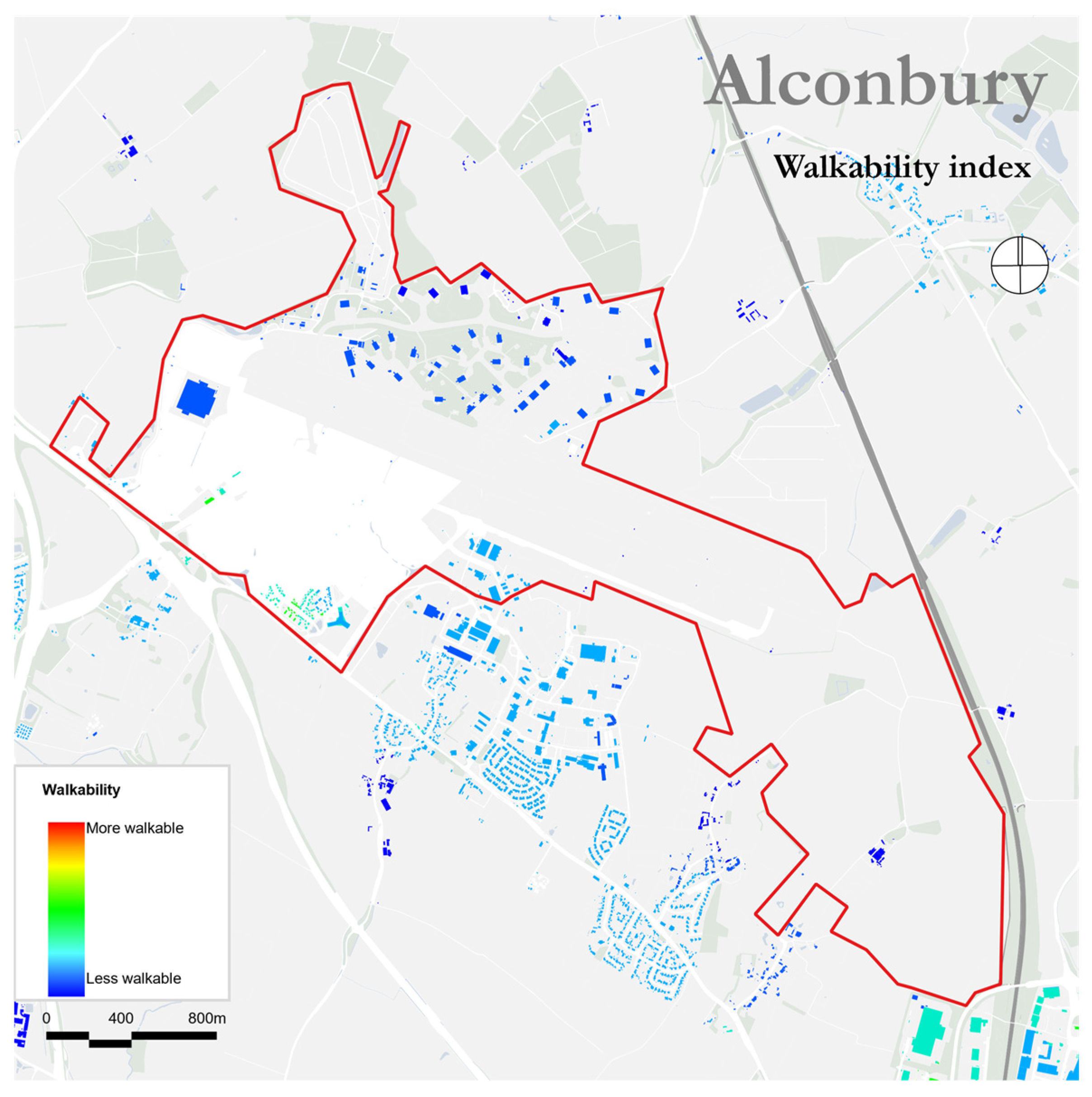
Walkability Index heat maps (Figure 2, Figure 3, Figure 4, Figure 5 and Figure 6) reveal distinct spatial structures across the case study settlements. Poundbury (Figure 2) exhibits a coherent, settlement-wide walkability pattern, reflecting the deliberate integration of services, employment, and civic functions within the residential fabric. This embedded land-use strategy generates consistently high levels of accessibility and demonstrates how mixed-use master planning can produce walkability at scale.
Figure 2.
Space Syntax Walkability Index heat maps of Poundbury © Space Syntax. The red line depicts the boundary of the development.
Figure 3.
Space Syntax Walkability Index heat maps of Elvetham Heath © Space Syntax. The red line depicts the boundary of the development.
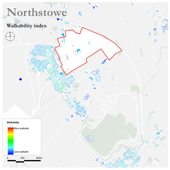
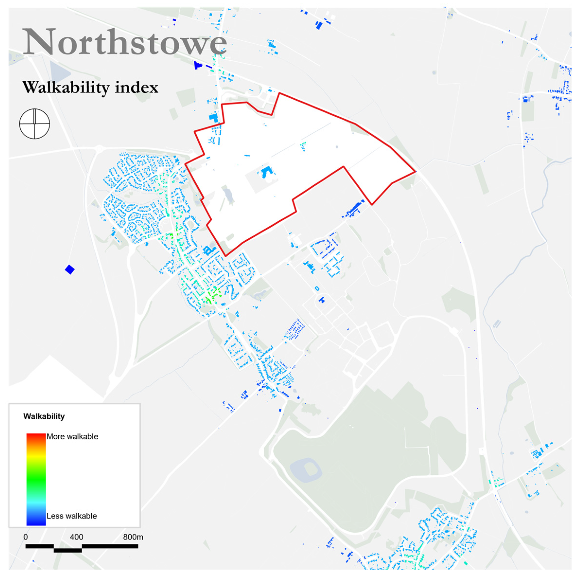
Figure 4.
Space Syntax Walkability Index heat maps of Northstowe (Phase 1) © Space Syntax. The red line depicts the boundary of the development (Phase 1).
Figure 5.
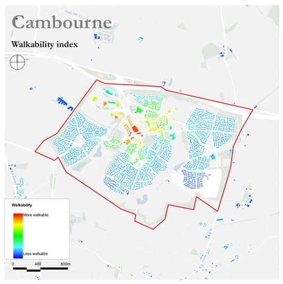
Space Syntax Walkability Index heat maps of Cambourne (Phase 1) © Space Syntax. The red line depicts the boundary of the development.
Figure 6.
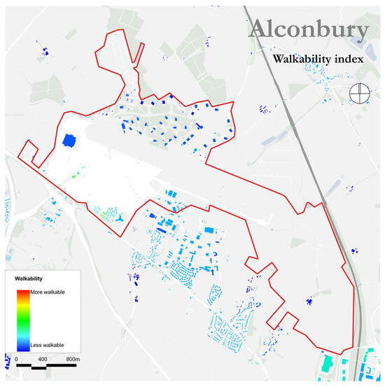
Space Syntax Walkability Index heat maps of Alconbury Weald © Space Syntax. The red line depicts the boundary of the development.
In contrast, Elvetham Heath and Cambourne (Figure 3 and Figure 5) display more constrained and uneven accessibility profiles. In both settlements, services are concentrated in discrete nodes as opposed to being distributed throughout the urban fabric. This configuration supports short internal trips within defined catchments but restricts destination diversity and limits accessibility for residents located beyond centralised hubs. As a result, walkability is proximity-dependent, with substantial portions of each settlement experiencing comparatively low levels of pedestrian access. These patterns illustrate how segregated land-use arrangements spatially confine everyday walkability.
Alconbury Weald presents a different configuration (Figure 6). Here, walkability is evident within individual development clusters; however, the large spatial extent of the settlement and the dispersed distribution of land uses reduce accessibility at the settlement-wide scale. Although localised clusters may support routine walking, the broader urban structure inhibits cross-neighbourhood connectivity, producing fragmented pedestrian patterns. Northstowe (Figure 4) demonstrates an even more uneven structure, shaped significantly by development phasing. With services concentrated in early delivery phases and several planned amenities not yet realised, current walkability is strongly proximity-based rather than structurally embedded. Residents located further from initial centres experience limited access to services, highlighting the decisive role of delivery sequencing in shaping early mobility behaviour.
Across all sites, the heatmap visualisations underscore the influence of block size, street network permeability, land-use distribution, and service location on walkability outcomes. They make explicit how master planning decisions and phasing strategies translate into measurable differences in pedestrian accessibility [39]. By employing consistent spatial metrics, the analysis responds to longstanding critiques regarding methodological inconsistency in walkability assessment and enables transparent comparison between developments [4,22]. These spatial differences reflect underlying morphological characteristics of the settlements, including variations in network integration, block structure, and the degree to which services are embedded within the residential fabric.
Collectively, the findings demonstrate that achieving walkability at a 15 min neighbourhood scale cannot be secured through street design alone. Instead, walkability emerges as a systemic outcome produced through the interaction of permeable movement networks and the early, spatially distributed provision of services and employment. Developments that integrate everyday uses throughout the residential fabric—such as Poundbury—achieve coherent, settlement-wide accessibility. In contrast, schemes characterised by clustered, segregated, or delayed service provision generate fragmented and proximity-dependent walking patterns. In large or phased developments, delays in service delivery risk entrenching car dependency, even where street networks offer strong theoretical permeability. These results underscore the importance of land-use strategy and implementation sequencing in shaping both walkability outcomes and residents’ lived experience.
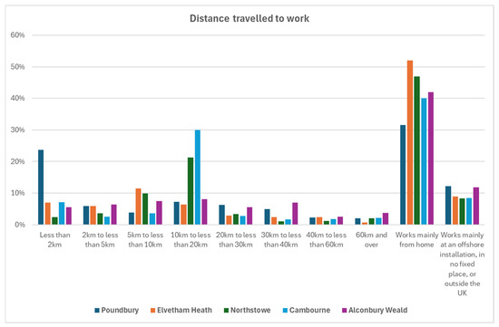
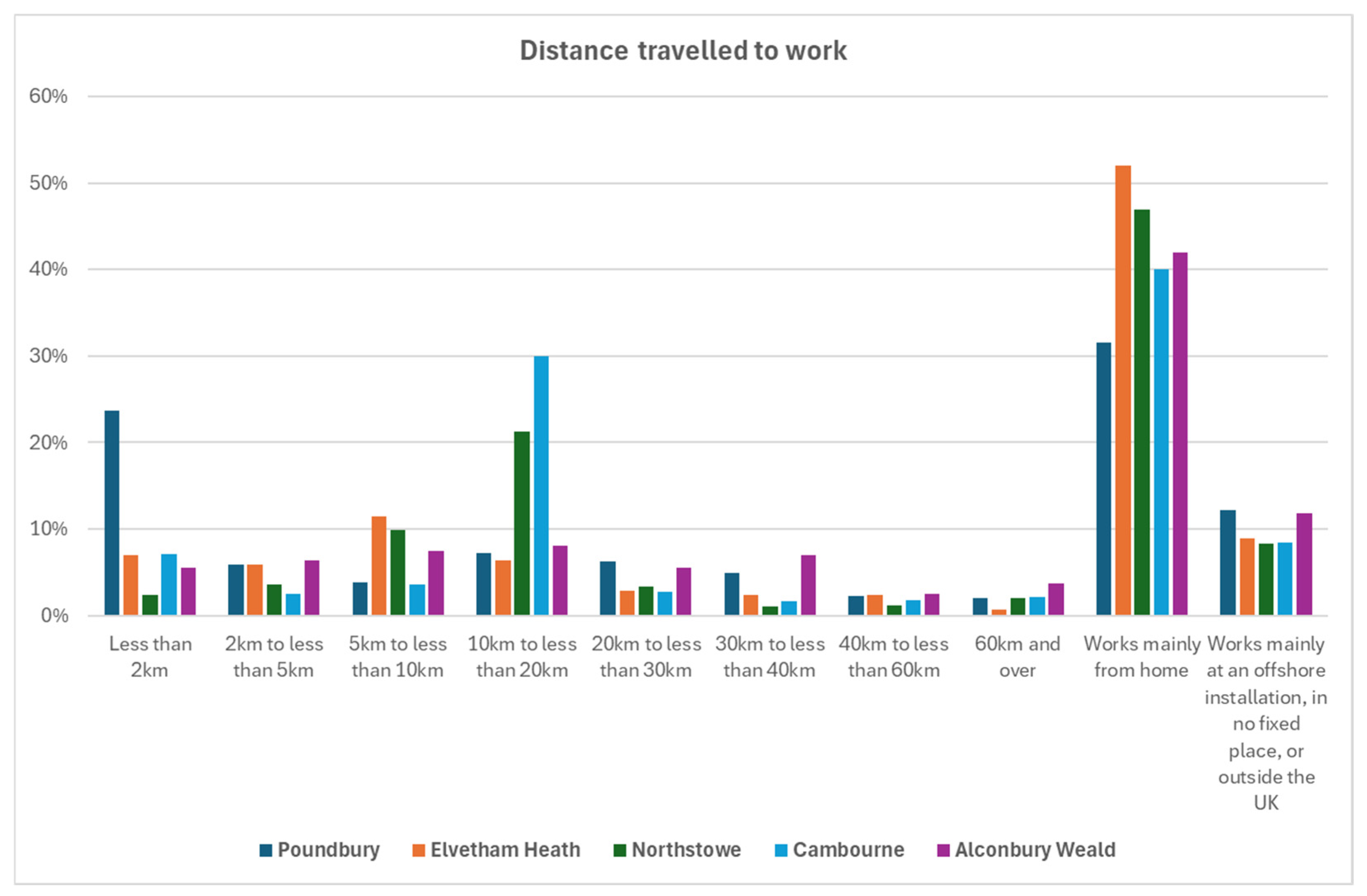
Socio-demographic analysis of 2021 Census travel-to-work data [40] further highlights differences in how the five settlements support local employment and active travel (Figure 7). Poundbury demonstrates the strongest alignment between urban structure and commuting behaviour, recording the highest proportion of residents travelling less than 2 km to work. This reflects the close spatial relationship between housing, employment, and services within its mixed-use framework and enhances the feasibility of active travel.
Figure 7.
Distance travelled to work across selected case study developments (%). Source: 2021 Census for England and Wales [40].
Elvetham Heath and Northstowe, by contrast, exhibit notably high levels of home working (over 50% and approximately 45%, respectively). While this partly reflects post-pandemic shifts in employment practices, it may also indicate more limited access to local employment opportunities within walking or cycling distance. Cambourne presents a contrasting profile, with approximately 30% of residents commuting 10–20 km, signalling strong reliance on external employment centres. This outward-oriented commuting pattern aligns with a more dispersed land-use structure and a weaker job–housing balance. Alconbury Weald displays a mixed pattern, combining moderate levels of remote working with longer-distance commuting, consistent with its transitional development stage and evolving employment base.
Taken together, these findings reinforce the relationship between settlement form and travel behaviour. Developments that co-locate housing, employment, services, and amenities at neighbourhood scale are better positioned to support shorter commutes and reduce structural car dependence. However, spatial proximity alone is insufficient. Without the parallel delivery of local employment opportunities and viable transport alternatives, car reliance remains embedded within everyday mobility practices.
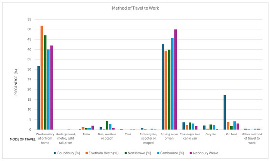
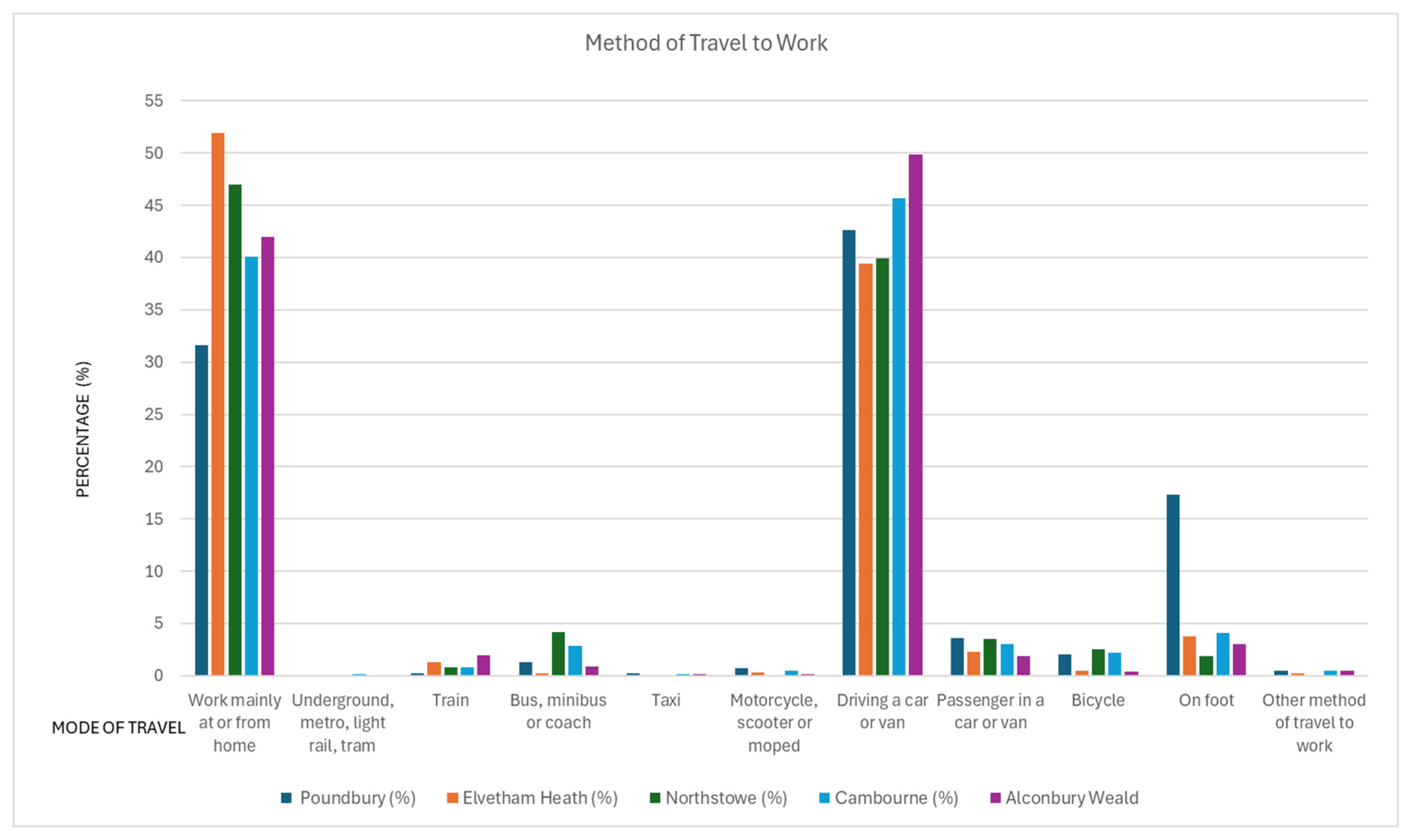
Across all five case studies, travel-to-work mode share data indicate persistently high levels of car dependency, with driving remaining the dominant commuting mode irrespective of settlement form (Figure 8). Notably, these figures should be interpreted cautiously, as the Office for National Statistics 2021 Census [40] was conducted during the post-COVID-19 period, when elevated levels of home working continued across England.
Figure 8.
Methods of travel to work across selected case study developments (%). Source: 2021 Census for England and Wales [40].
Poundbury records the highest proportion of walking commuters (approximately 17%), reflecting its permeable street network and integrated mixed-use structure. However, even in this comparatively favourable context, short commuting distances do not consistently translate into modal shift; private car use remains predominant. The data therefore suggests partial instead of comprehensive behavioural change. While proximity and land-use integration create supportive conditions for active travel, they are insufficient in isolation to displace entrenched patterns of car use.
In Elvetham Heath, Northstowe, Cambourne, and Alconbury Weald, high levels of home working complicate interpretation. Instead of indicating widespread short-distance commuting, these patterns reflect a bifurcated structure: a substantial share of residents work from home, while those who commute tend to travel longer distances, primarily by car. This dynamic is particularly pronounced in Cambourne, where a significant proportion of residents commute 10–20 km, reinforcing the association between limited local employment provision and outward-oriented, car-based travel. Alconbury Weald exhibits a comparable reliance on longer-distance commuting, consistent with its phased development trajectory and evolving employment base.
Across all cases, public transport use remains marginal. This highlights the structural difficulty of establishing competitive services in new or low-density settlements where dispersed land uses and phased delivery constrain demand for frequent, reliable provision. Consequently, even trips that might feasibly be accommodated by public transport default to private vehicles. Collectively, these findings underscore the resilience of car dependency within contemporary development patterns and demonstrate that urban form alone cannot secure substantive modal shift without parallel investment in employment provision and viable transport alternatives.
4. Conclusions
This study demonstrates that walkability in urban extensions or New Towns is neither an automatic outcome of contemporary planning rhetoric nor a simple function of street design. Instead, it emerges as a multidimensional and systemic condition produced through the interaction of spatial configuration, land-use integration, development phasing, local employment provision, and broader sociodemographic and governance contexts shaping everyday mobility. The comparative analysis of the five case study settlements shows that permeability alone is insufficient. Where land uses are clustered, services are delayed, or employment is weakly embedded, opportunities for genuinely walkable and self-sufficient neighbourhoods remain constrained. These findings highlight that walkability outcomes are closely tied to contemporary planning frameworks, in which spatial configuration, land-use planning, and development sequencing are actively shaped by policy and delivery decisions, while also underscoring the need to integrate infrastructure provision, and governance mechanisms throughout the development process so that services, employment opportunities, and transport connectivity are delivered alongside housing rather than deferred to later phases.
Among the cases, Poundbury is the only development to achieve coherent settlement-wide walkability, illustrating the transformative potential of embedding mixed uses within the residential fabric from the outset. In contrast, Elvetham Heath, Cambourne, Northstowe, and Alconbury Weald demonstrate how segregated land uses, dispersed spatial structures, and phased delivery models produce fragmented or proximity-dependent walking patterns. In these contexts, accessibility is uneven and contingent, limiting the capacity of residents to meet daily needs through active travel.
It is important, however, to recognise the distinctive status of Poundbury. Conceived under the stewardship of the Duchy of Cornwall (King Charles III, formerly the Prince of Wales), the development was explicitly framed around principles of place-making, mixed use, and long-term stewardship rather than speculative housing delivery. Its governance and landownership model differ significantly from mainstream development practice in England. Additionally, Northstowe remains partially complete, with only its first phase delivered at the time of analysis, limiting direct comparability with more mature settlements.
Sociodemographic analysis further indicates that spatial potential does not automatically translate into behavioural change. Even when commuting distances are relatively short, private car use remains dominant. This reflects both the cultural normalisation of car ownership and driving and the structural absence of competitively viable alternatives. High levels of home working in several settlements complicate commuting analysis but also reveal a bifurcated mobility landscape: while many residents do not commute daily, those who do often travel medium-to-long distances, reinforcing the spatial consequences of weak job–housing balance. Persistently low public transport use across all sites underscores the difficulty of establishing frequent and reliable services in low-density or phased developments where dispersed land uses suppress demand. Walkability must therefore be understood as a relational property of place, shaped simultaneously by land-use strategy, employment geography, service delivery timing, and prevailing mobility norms.
From a policy perspective, the findings reveal a persistent misalignment between national ambitions for decarbonization, health equity, and sustainable mobility and the spatial practices that continue to reproduce car-dependent development. Recurring patterns across the case studies reflect deeper structural forces, including speculative land markets favouring greenfield expansion, fragmented governance separating transport and land-use decision-making, and limited regulatory mechanisms to secure early and spatially distributed service provision. Without addressing these systemic drivers, walkability initiatives risk remaining design-led and localised, improving permeability while leaving the structural determinants of mobility behaviour largely intact.
More broadly, the research supports emerging scholarship that conceptualises walkability as both a spatial and sociocultural condition whilst aligned with notions of strong sustainability. Designing for walkability requires attention not only to urban form but also to user experience, perceptions of safety, social norms, and the practical realities of work, care, and household routines. Creating genuinely walkable neighbourhoods therefore demands integrated approaches that align spatial planning, transport policy, public health strategy, and cultural change.
Achieving less car-dependent futures will require a fundamental reframing of how planning systems conceptualise and deliver neighbourhood development. Mixed-use planning, employment integration, service delivery sequencing, and governance reform must be treated as central components of walkability rather than secondary considerations. If planners and policymakers are to advance healthier, more equitable, and resilient communities, walkability must function as a foundational organising principle in the design, regulation, and long-term stewardship of new residential settlements.
The analysis presented here focuses primarily on spatial modelling and secondary statistical data. While this approach enables systematic comparison across settlements, it does not capture experiential dimensions of walkability such as perceptions of safety, comfort, or environmental quality.
Future research should adopt longitudinal approaches to examine how walkability evolves as new urban extensions and New Towns mature and as supporting infrastructure, services, and population density become established. In addition, studies linking built environment measures with health outcomes would help determine whether neighbourhood design features associated with walkability translate into increased walking behaviour and improved physical activity levels among residents. Finally, incorporating resident perspectives through qualitative methods would also provide valuable insight into perceptions of walkability, accessibility, and everyday mobility, helping to contextualise spatial measures with lived experience.
Author Contributions
Conceptualization, A.L., G.D.L. and M.Z.; methodology, A.L., G.D.L. and M.Z.; investigation, A.L. and M.Z.; data curation, A.L. and M.Z.; writing—original draft preparation, A.L.; writing—review and editing, A.L., G.D.L. and M.Z.; visualisation, A.L. and M.Z.; supervision, A.L. and G.D.L.; project administration, A.L. and G.D.L.; funding acquisition, A.L. and G.D.L. All authors have read and agreed to the published version of the manuscript.
Funding
This research was funded by Innovate UK via a Knowledge Transfer Partnership (KTP), project number 10071937, delivered in collaboration by the University of the Built Environment and The King’s Foundation.
Institutional Review Board Statement
Not applicable.
Informed Consent Statement
Not applicable.
Data Availability Statement
Data derived from public domain resources.
Acknowledgments
The authors would like to acknowledge Space Syntax for their analytical input and for providing the walkability modelling and methodological guidance that informed the spatial analysis within this study.
Conflicts of Interest
The authors declare no conflicts of interest. The funders had no role in the design of the study; in the collection, analyses, or interpretation of data; in the writing of the manuscript; or in the decision to publish the results.
References
- National Audit Office (NAO). Tackling Obesity in England; The Stationery Office: London, UK, 2001.
- Cervero, R.; Kockelman, K. Travel demand and the 3Ds: Density, diversity, and design. Transp. Res. Part D Transp. Environ. 1997, 2, 199–219. [Google Scholar] [CrossRef] [Scilit]
- Royal Town Planning Institute (RTPI); LandTech. Location of Development: Sustainable Transport and the Location of Residential Planning Permissions, 2012–2021; RTPI: London, UK, 2024. [Google Scholar]
- Baobeid, A.; Koç, M.; Al Ghamdi, S.G. Walkability and its relationships with health, sustainability, and livability: Elements of physical environment and evaluation frameworks. Front. Built Environ. 2021, 7, 721218. [Google Scholar] [CrossRef] [Scilit]
- Westenhöfer, J.; Nouri, E.; Reschke, M.L.; Seebach, F.; Buchcik, J. Walkability and urban built environments—A systematic review of health impact assessments (HIA). BMC Public Health 2023, 23, 518. [Google Scholar] [CrossRef] [Scilit]
- Friel, C.; Walsh, D.; Whyte, B.; Dibben, C.; Feng, Z.; Baker, G.; Kelly, P.; Demou, E.; Dundas, R. Health benefits of pedestrian and cyclist commuting: Evidence from the Scottish Longitudinal Study. BMJ Public Health 2024, 2, e001295. [Google Scholar] [CrossRef] [Scilit]
- Moreno, C.; Allam, Z.; Chabaud, D.; Gall, C.; Pratlong, F. Introducing the “15-Minute City”: Sustainability, resilience and place identity in future post-pandemic cities. Smart Cities 2021, 4, 93–111. [Google Scholar] [CrossRef] [Scilit]
- Pozoukidou, G.; Chatziyiannaki, Z. 15-Minute City: Decomposing the new urban planning eutopia. Sustainability 2021, 13, 928. [Google Scholar] [CrossRef] [Scilit]
- Zuniga-Teran, A.A.; Orr, B.J.; Gimblett, R.H.; Chalfoun, N.V.; Guertin, D.P.; Marsh, S.E. Neighborhood design, physical activity, and wellbeing: Applying the Walkability Model. Int. J. Environ. Res. Public Health 2017, 14, 76. [Google Scholar] [CrossRef] [Scilit]
- Parham, E.; Jones, E.; McCoshan, E.; Chen, P.N. Understanding how urban form enables walking. In Proceedings of the ISOCARP World Planning Congress 2022, Brussels, Belgium, 3–6 October 2022. [Google Scholar]
- Rogers, S.H.; Gardner, K.H.; Carlson, C.H. Social capital and walkability as social aspects of sustainability. Sustainability 2013, 5, 3473–3483. [Google Scholar] [CrossRef] [Scilit]
- Sustrans. Walking and Cycling Index: The UK and Ireland’s Biggest Ever Survey of Walking, Wheeling and Cycling; Sustrans: Bristol, UK, 2023; Available online: https://www.sustrans.org.uk/media/13416/sustrans-2023-walking-and-cycling-index-uk-aggregated-report.pdf (accessed on 3 November 2025).
- Transport for New Homes. Building Car Dependency: The Impact of New Housing on Sustainable Transport; Transport for New Homes: London, UK, 2022; Available online: https://www.transportfornewhomes.org.uk/reports/building-car-dependency/ (accessed on 5 November 2025).
- New Economics Foundation. Trapped Behind the Wheel: How England’s New Builds Lock Us into Car Dependency; New Economics Foundation: London, UK, 2024. [Google Scholar]
- Pain, R. Gender, race, age and fear in the city. Urban Stud. 2001, 38, 899–913. [Google Scholar] [CrossRef]
- Sport England. Active Lives Children and Young People Survey: Academic Year 2018/19; Sport England: London, UK, 2020. [Google Scholar]
- Twenge, J.M.; Spitzberg, B.H.; Campbell, W.K. Less in-person social interaction with peers among US adolescents in the 21st century and links to loneliness. J. Soc. Pers. Relat. 2019, 36, 1892–1913. [Google Scholar] [CrossRef] [Scilit]
- Karlsen, S.; Nazroo, J.Y. Agency and structure: The impact of ethnic identity and racism on the health of ethnic minority people. Sociol. Health Illn. 2002, 24, 1–20. [Google Scholar] [CrossRef] [Scilit]
- Litman, T.A. Economic Value of Walkability. Transp. Res. Rec. 2003, 1828, 3–11. [Google Scholar] [CrossRef] [Scilit]
- Ewing, R.; Cervero, R. Travel and the built environment: A meta-analysis. J. Am. Plan. Assoc. 2010, 76, 265–294. [Google Scholar] [CrossRef] [Scilit]
- Frank, L.D.; Schmid, T.L.; Sallis, J.F.; Chapman, J.; Saelens, B.E. Linking objectively measured physical activity with objectively measured urban form: Findings from SMARTRAQ. Am. J. Prev. Med. 2005, 28, 117–125. [Google Scholar] [CrossRef] [Scilit] [PubMed]
- Venerandi, A.; Mellen, H.; Romice, O.; Porta, S. Walkability indices—The state of the art and future directions: A systematic review. Sustainability 2024, 16, 6730. [Google Scholar] [CrossRef] [Scilit]
- Koohsari, M.J.; Owen, N.; Cerin, E.; Giles-Corti, B.; Sugiyama, T. Walkability and walking for transport: Characterizing the built environment using space syntax. Int. J. Behav. Nutr. Phys. Act. 2016, 13, 121. [Google Scholar] [CrossRef] [Scilit]
- Telega, A.; Telega, I.; Bieda, A. Measuring walkability with GIS—Methods overview and new approach proposal. Sustainability 2021, 13, 1883. [Google Scholar] [CrossRef] [Scilit]
- Ramos, C.D.G.; Mourato, J.; Vale, D.S. Uncovering walkability: A chronological literature review. Transp. Rev. 2025, 46, 109–130. [Google Scholar] [CrossRef] [Scilit]
- New Towns Taskforce. New Towns Taskforce: Report to Government; Ministry of Housing, Communities and Local Government (MHCLG): London, UK, 2025. Available online: https://www.gov.uk/government/publications/new-towns-taskforce-report-to-government (accessed on 5 November 2025).
- Larsen, G.D.; Lee, A.; Zala, M. Reimaging Place Building: Advancing Sustainable, Inclusive, and Locally Anchored Developments in the UK. University of the Built Environment Report. 2026. Available online: https://ube.repository.guildhe.ac.uk/id/eprint/258/ (accessed on 1 March 2026).
- Mulley, C.; Tyson, R.; McCue, P.; Rissel, C.; Munro, C. Valuing active travel: Including the health benefits of sustainable transport in transportation appraisal frameworks. Res. Transp. Bus. Manag. 2013, 7, 27–34. [Google Scholar] [CrossRef] [Scilit]
- World Health Organization (WHO). Health Economic Assessment Tool (HEAT) for Cycling and Walking; WHO Regional Office for Europe: Copenhagen, Denmark, 2014; Available online: https://www.who.int/tools/heat-for-walking-and-cycling (accessed on 15 December 2025).
- Roper, J.; Pettit, C.; Ng, M. Understanding the economic value of walkable cities. In Urban Informatics and Future Cities, 2nd ed.; Geertman, S.C.M., Pettit, C., Goodspeed, R., Staffans, A., Eds.; Springer: Cham, Switzerland, 2021. [Google Scholar] [CrossRef] [Scilit]
- UN-Habitat. Developing Public Space and Land Values in Cities and Neighbourhoods—Discussion Paper; UN-Habitat: Nairobi, Kenya, 2018; Available online: https://unhabitat.org/ (accessed on 15 December 2025).
- Zolnik, E. Capturing the value of walkability. Future Transp. 2024, 4, 1334–1349. [Google Scholar] [CrossRef] [Scilit]
- Cisneros, C. Value of Walkable Communities. Master’s Thesis, California State University, Sacramento, CA, USA, 2015. Available online: https://scholars.csus.edu/esploro/outputs/graduate/Value-of-walkable-communities/99257831113901671 (accessed on 19 December 2025).
- Arup. Cities Alive: Towards a Walking World; Arup: London, UK, 2016; Available online: https://www.arup.com/perspectives/publications/research/section/cities-alive-towards-a-walking-world (accessed on 15 December 2025).
- Building Better; Building Beautiful Commission. Living with Beauty: Promoting Health, Well-Being and Sustainable Growth; Ministry of Housing, Communities & Local Government: London, UK, 2020. Available online: https://www.gov.uk/government/publications/living-with-beauty-report-of-the-building-better-building-beautiful-commission (accessed on 15 December 2025).
- Space Syntax. Walkability Index; Walkability Index—Space Syntax; Space Syntax: London, UK, 2026. [Google Scholar]
- McCormack, G.R.; Koohsari, M.J.; Turley, L.; Nakaya, T.; Shibata, A.; Ishii, K.; Yasunaga, A.; Oka, K. Evidence for urban design and public health policy and practice: Space syntax metrics and neighbourhood walking. Health Place 2021, 67, 102277. [Google Scholar] [CrossRef] [Scilit] [PubMed]
- Zaleckis, K.; Chmielewski, S.; Kamičaitytė, J.; Grazuleviciute Vileniske, I.; Lipińska, H. Walkability Compass—A space syntax solution for comparative studies. Sustainability 2022, 14, 2033. [Google Scholar] [CrossRef] [Scilit]
- Porta, S.; Renne, J.L. Linking urban design to sustainability: Formal indicators of social urban sustainability field research in Perth, Western Australia. Urban Des. Int. 2005, 10, 51–64. [Google Scholar] [CrossRef] [Scilit]
- Office for National Statistics (ONS). ONS Website—Data and Analysis from Census 2021 and Other Official Statistics; ONS: London, UK, 2026. Available online: https://www.ons.gov.uk/ (accessed on 22 September 2025).

Disclaimer/Publisher’s Note: The statements, opinions and data contained in all publications are solely those of the individual author(s) and contributor(s) and not of MDPI and/or the editor(s). MDPI and/or the editor(s) disclaim responsibility for any injury to people or property resulting from any ideas, methods, instructions or products referred to in the content. |
© 2026 by the authors. Licensee MDPI, Basel, Switzerland. This article is an open access article distributed under the terms and conditions of the Creative Commons Attribution (CC BY) license.