


Abstract
Ecological restoration of abandoned mines with high and steep slopes is challenging due to their steepness, water scarcity, and lack of soil, and restoration effects vary with applied techniques. This study aims to assess the ecological restoration effectiveness of restored steep bare rock slopes in Jiangsu Province. The restoration status of steep bare rock slopes was assessed through field surveys, with corresponding methods for vegetation data collection and soil sample analysis subsequently selected. An evaluation system consisting of 14 evaluation indicators from 3 aspects was established using the analytic hierarchy process (AHP). Based on the on-site investigation results and test data, the evaluation criteria and evaluation intervals for the five evaluation levels of “optimum, excellent, good, medium, and poor” have been determined. After obtaining the weights of each indicator, the Technique for Order Preference by Similarity to an Ideal Solution (TOPSIS) method is used to establish a normalized matrix of evaluation indicators, calculate the weighted decision matrix, and determine the ideal solution. The results showed that (1) the proportion of ecological restoration effects in the excellent–optimum, good–excellent, and medium–good was 30%, 43.3%, and 26.7%, respectively, which is consistent with the on-site investigation results; (2) the on-site investigation and evaluation results indicate that the ecological restoration effect of steep bare rock slopes is easily affected by the slope’s soil and water conservation capacity; (3) the weights of each indicator layer are slope ecosystem stability > vegetation > soil, with a maximum value of 0.443, indicating that ecosystem stability is the main factor affecting the ecological restoration effect of mines. This evaluation system is based on on-site investigations and indoor test results, and objectively and effectively evaluates the ecological restoration effect of steep bare rock slopes through qualitative evaluation and quantitative analysis. The methodology demonstrates high applicability and reliability for steep bare rock slopes, thereby serving as a valuable reference for selecting and evaluating the efficacy of ecological restoration technologies in similar environments.
1. Introduction
The development of mineral resources has provided important support for China’s economic development [1,2]. At the same time as mining, a large number of sites with high and steep have been formed Without appropriate management and restoration, these slopes may trigger a cascade of adverse effects, including severe soil erosion [3,4], prolonged deterioration of ecosystem functions [5,6], and geotechnical instability [7], collectively posing substantial risks to the surrounding environment, ecological equilibrium, and regional sustainable development. In recent years, to improve the stability of the mining area’s ecosystem and the sustainability of regional development, the “mine greening” action has been carried out throughout the country. Due to the complex characteristics of slope gradient, lithology, maintenance, and construction difficulty, steep bare rock slopes are more difficult to repair than ordinary slopes, and the repair effect varies depending on the technology used. Owing to such restoration difficulties and divergences in technical approaches, steep bare rock slopes have increasingly become a focal point in ecological restoration studies [8]. The repair difficulties mainly include (1) the absence of soil on the slope surface, making it difficult to accumulate nutrients [9]; (2) low water content and limited water-holding capacity [10]; and (3) difficulties in maintaining slope ecosystems [11].
The primary objective of mines’ ecological restoration encompasses mitigating potential geological hazards, developing soil layers on slopes, selecting appropriate plant species, implementing ecological restoration techniques, and evaluating restoration effectiveness [12,13,14]. The selection and configuration of vegetation types for ecological restoration exhibit notable variation across geographical regions and project specifications [15,16,17,18]. Representative cases include vegetation selection for steep slope restoration in North China [19], species selection for rocky reservoir drawdown zones [20,21], and appropriate plant assemblages for slope ecological restoration in plateau regions [22]. The choice of appropriate ecological restoration technologies represents a primary determinant of the variations observed in mine restoration outcomes [23]. Based on the ecological restoration technologies employed, these approaches can be categorized into two groups: engineering measures (e.g., lattice beams and fish-scale pits) [24,25] and biological measures (e.g., spraying, layering, pit-trench planting, and vegetation concrete) [26,27]. The primary objective of ecological restoration is to establish a suitable soil–water environment that supports plant growth on slopes [28]. For instance, studies have investigated the incorporation of soil stabilizers [29] or organic polymer soil amendments [30] into the substrate to enhance soil reinforcement, promote vegetation establishment, and facilitate ecological recovery. Based on the technical approaches for establishing soil–water environments, ecological restoration technologies can be further categorized into: ecological spray seeding [31], ecological groove drilling [32], ecological framework stabilization, and ecological pillow bag techniques [33].
After remediation, the ecological remediation effect of most steep unvegetated mine slopes have not been systematically and accurately evaluated. The restoration effect of different ecological restoration technologies for slopes is inconsistent [34,35], and there are many factors that influence the ecological restoration effect [36,37,38]. The ecological restoration effect is key to evaluating the overall quality of ecological restoration of mine slopes and provides scientific evidence for decision-making and further management of ecological restoration [39,40]. In order to select the ecological restoration technology for similar steep slopes and the sustainable development of the ecological environment of the mine, it is necessary to make a fair evaluation of the ecological restoration effect of the restored steep slope. Therefore, the establishment of a scientific and reasonable evaluation system for the ecological restoration effect of steep bare rock slopes and the evaluation of the ecological restoration effect has become an important part of the ecological restoration project, which is of great significance to the evaluation of the stability of the ecosystem in the mining area and the sustainable development of the region [41,42].
Previous studies have proved that the mine slope can be well repaired through ecological restoration technology, and relevant studies have studied the mine ecological restoration effect through remote sensing image interpretation, soil physical and chemical properties, vegetation community indicators, and landscape characteristics [43,44,45]. For example, Wang et al. [46] have found that the impact of vegetation on the ecological restoration effect is greater than its soil matrix conditions in the ecosystem. However, its ecological restoration effect evaluation is mainly aimed at ordinary slopes [47,48], but there is little research on the ecological restoration effect evaluation system for steep bare rock slopes. Existing studies have selected corresponding indicators to establish an ecological restoration effect evaluation system based on the particularity of the repaired slope [49], providing guidance for the establishment of similar evaluation systems.
The selection of suitable evaluation methods can realize the objectivity, rationality, and reliability of the evaluation results of the evaluation objectives [50,51]. The analytic hierarchy process (AHP) can be used to determine the weighting and importance of the evaluation indices, while the Technique for Order Preference by Similarity to an Ideal Solution (TOPSIS) can sort the evaluation objects by calculating the degree of approximation to the ideal solution. Combined with AHP-TOPSIS, it can realize the evaluation of targets [52,53]. Wei [54] integrated interval numbers and triangular fuzzy numbers into the AHP-TOPSIS method to optimize the vegetation configuration of the Nenjiang flexible breakwater forest. In addition, relevant studies have used the AHP-TOPSIS method to build an evaluation model for ecosystem restoration effect assessment. For example, Li et al. [55] developed an evaluation model for the ecological protection of urban rivers based on the AHP-TOPSIS method to evaluate the ecological protection effect of rivers in the study area to maintain the balance of the river ecosystem, improve the ecological function of riverbank protection, and promote the sustainable development of the river ecosystem.
Therefore, in order to evaluate the ecological restoration effectiveness of different techniques, the completed ecological restoration projects of the high and steep rocky slope in China’s Jiangsu Province were taken as the study object. Building upon existing research on mined slope restoration, this study integrates field surveys of high, steep slope conditions with laboratory analyses of soil nutrients to formulate an index system for evaluating the ecological restoration of steep bare rock slopes. Subsequently, this system is applied to assess the restoration outcomes achieved by different technologies on such slopes. Employing quantifiable metrics—including vegetation coverage, soil nutrient levels, and ecosystem stability—facilitates the transition from qualitative characterization to quantitative analysis of restoration effectiveness. The system establishes replicable technical evaluation standards that elucidate performance differentials among various restoration techniques in water conservation, soil stabilization, and vegetation establishment, thereby providing a scientific basis for comparing and optimizing engineering solutions. Furthermore, the system enables the verification of ecological benefits from implemented projects and supports the continuous refinement of restoration strategies through feedback mechanisms. This framework is particularly applicable to erosion-sensitive areas such as the middle and lower Yangtze River Basin, thus providing a standardized tool for assessing restoration effectiveness in mining areas and advancing regional ecological civilization initiatives.
2. Methods
2.1. Brief Introduction of the Study Area
Jiangsu Province is situated in the middle and lower reaches of China’s Yangtze River Basin, characterized by a transitional climate between temperate and subtropical zones. The annual average temperature in Jiangsu Province ranges from 13.6 °C to 16.1 °C, exhibiting a decreasing gradient from south to north. Monthly average temperatures vary between −1.0 °C and 22.8 °C. Seasonal averages are 3.0 °C in winter, 14.9 °C in spring, 25.9 °C in summer, and 16.4 °C in autumn. Annual precipitation varies from 704 mm to 1250 mm. Monthly precipitation fluctuates from 50 mm to 206.4 mm, being lowest in winter (approximately 30–50 mm per month) and highest in summer (averaging about 206.4 mm per month). Its climatic profile features sufficient rainfall coupled with favorable light and heat conditions [56,57].
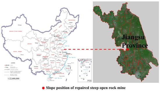
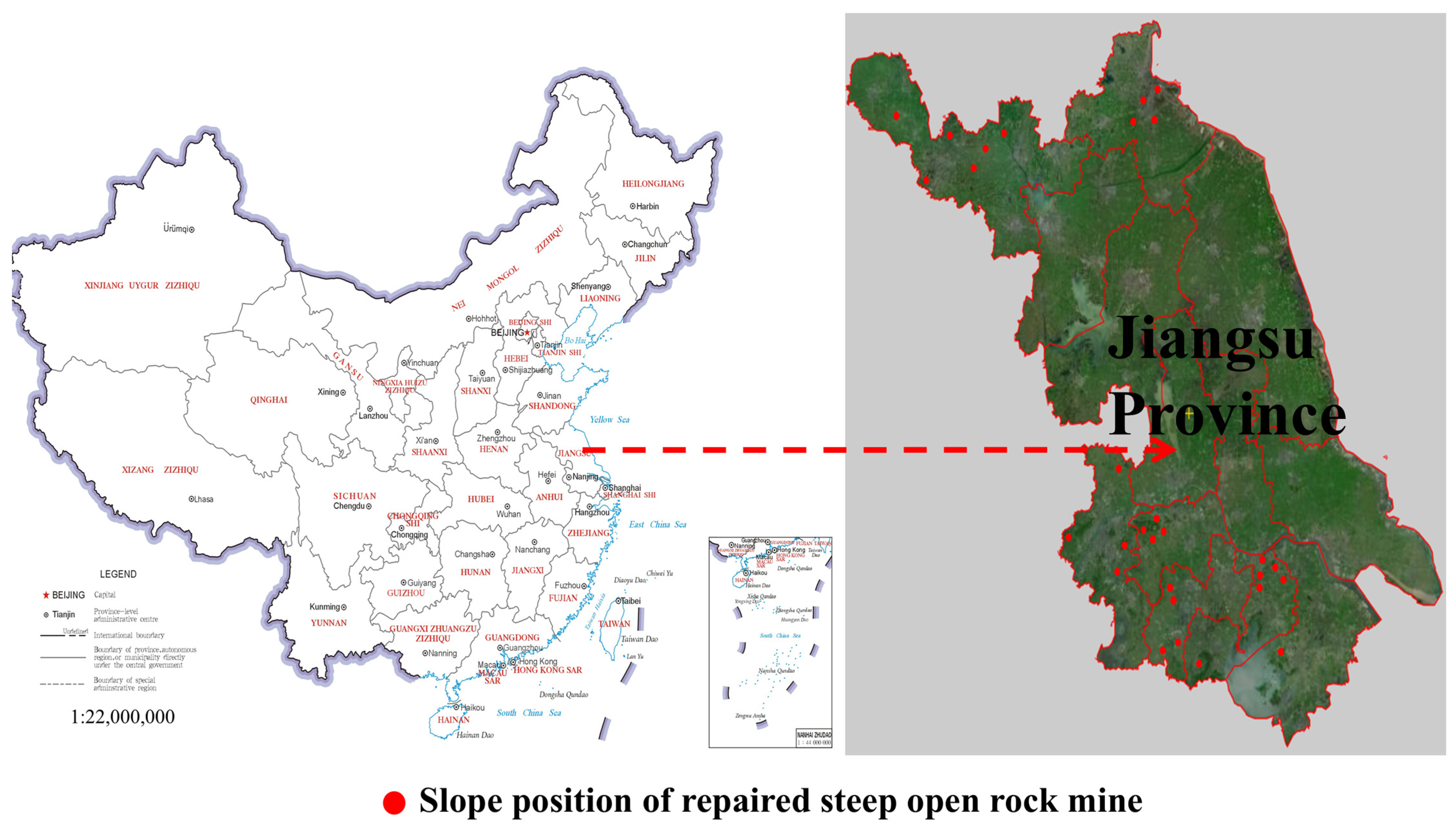
Driven by rapid economic expansion, extensive mining operations primarily targeting limestone, sandstone, granite, and other construction materials led to the formation of steep bare rock slopes with gradients of 60–80°. The fundamental characteristics and spatial distribution of these mined slopes are detailed in Table 1 and Figure 1.
Table 1.
The description and the information of the selected restoration mines.
Figure 1.
Slope distribution of restored steep bare rock mines in Jiangsu Province, China.
2.2. Sampling, Data Collection, and Laboratory Test
To assess the ecological restoration status of each rehabilitated mine slope, quadrats were established and soil samples collected for analysis. To ensure data reliability and representativeness, three quadrats per slope were deployed for standardized data collection and laboratory testing. Direct sampling from the mid-slope sections of steep bare rock slopes is often precluded by their inaccessible and precipitous nature. Consequently, the guiding principle for setting the quadrats stipulates the establishment of at least one quadrat each at the slope crest and toe. The precise placement of these quadrats was determined primarily by the distribution of vegetation and soil.
2.2.1. Sampling
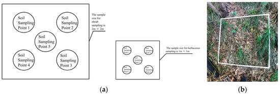
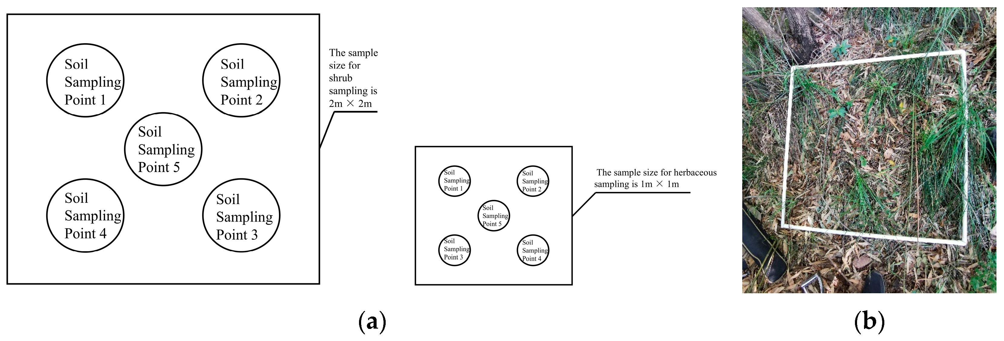
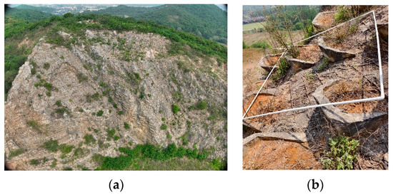
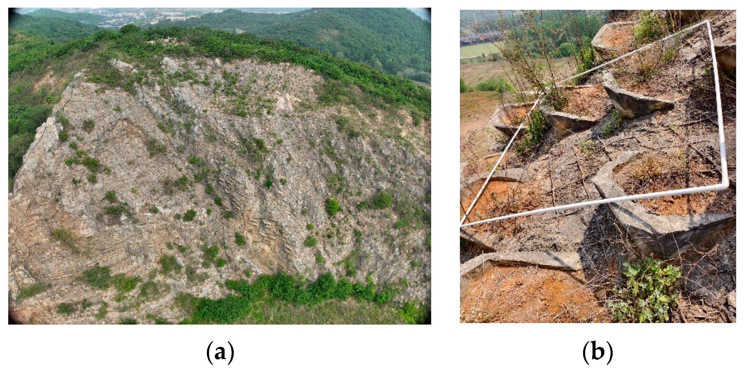
The position of the quadrat was determined by installing PVC pipes on-site and recorded using GPS. Soil samples were collected in the vegetation survey quadrat, and 500–1000 g soil samples were collected using the five-point sampling method (Figure 2).
Figure 2.
Schematic diagram of soil sampling: (a) sampling diagram; (b) site layout of the quadrat.
2.2.2. Field Investigation Data Collection
Vegetation and soil data can reflect the growth of vegetation and soil properties and should be recorded from quadrats. The stability of the slope and the integrity of the maintenance system reflect the stability of the slope and the sustainable development of the ecosystem. See Table 2 for field data collection requirements. Since the surface of the steep slope is not suitable for the growth of tall trees, the vegetation quadrat mainly surveys herbaceous and shrub vegetation, with the size of the herbaceous quadrat being 1 m × 1 m and that of the shrub quadrat being 2 m × 2 m.
Table 2.
The main data and requirements of the field investigation data collection.
2.2.3. Laboratory Test
The pH value, organic matter content, total nitrogen content, available phosphorus content, available potassium content, and moisture content of soil samples were obtained through indoor experiments. The specific details of each experimental process and the quality control of the test results met the requirements and guidelines of relevant experimental methods and technical standards. All soil samples were subjected to pre-treatment, such as drying, grinding, screening, and storage, before testing.
According to the potential method HJ 962-2018 [58], the pH value of soil was measured using a pH meter (FE28 Standard 3000, FS262, Shanghai Youyi Instrument Co., Ltd., Shanghai, China). According to the determination method of soil organic matter in NY/T 1121.6-2006 [59], the organic matter content in soil samples was measured using a burette (50 mL, FQ24-1, Nanjing Wanqing Glass Instrument Co., Ltd., Suzhou, China). According to the LY/T 1232-2015 [60] method for determining forest soil nitrogen, the total nitrogen content in the soil was measured using a fully automatic Kjeldahl nitrogen analyzer (K1100-FS306, Shandong Ocean Energy Co., Ltd., Qingdao, China). According to NY/T 1121.7-2014 [61], the determination of available phosphorus in soil was carried out using a UV–visible spectrophotometer (UV-2600-FS119, Shimadzu Corporation, Suzhou, China). According to the determination of soil available potassium and slow-release potassium in NY/T889-2004 [62], soil available potassium was determined using a flame photometer (FP6430-FS190, Shanghai Yidian Analysis Instrument Co., Ltd., Shanghai, China). According to the Standard for Soil Test Methods GB/T50123-2019 [63] (China National Standard), the moisture content in soil samples was determined using the drying method.
2.3. Establishment of Evaluation System for the Ecological Restoration Effect of Abandoned Steep Bare Rock Slopes
The ecological restoration effect of rehabilitated steep bare rock slopes should be assessed using a systematic assessment system consisting of scientific and independent assessment indicators. The AHP method was used to decompose the ecological restoration effect of steep exposed rocky slopes into a target level, a criterion level, and an indicator level, and to assign weights to each assessment indicator in the assessment system. The TOPSIS method was used to convert qualitative assessment indicators into quantitative data to solve the ambiguity in the assessment of the ecological restoration effect of steep exposed rocky slopes by combining with interval numbers and triangular fuzzy numbers.
Therefore, the assessment system for the ecological restoration effect of steep, exposed rocky slopes was created using the AHP-TOPSIS method. The weights of the individual evaluation indices were determined using the matrix of relative importance of the evaluation indices. Then, the original data matrix of the evaluation index was created based on the TOPSIS method, and the normalized data matrix was obtained through standardized data processing. By synthesizing the weights of each evaluation index with the normalized data matrix to obtain a weighted decision matrix, the ideal solution of the evaluation target and the degree of approximation to the ideal solution were further solved to finally determine the ecological restoration effect of each steep exposed rock slope. Calculations and data processing were performed using Excel 2021, and evaluation was conducted in MATLAB 2017. The specific evaluation steps are explained below.
2.3.1. Establishment of Evaluation Indexes and Evaluation Criteria
The ecological restoration of steep bare rock slopes faces several key challenges, including adverse edaphic conditions, limited slope stability, and hydrological constraints, which collectively inhibit vegetation establishment. Consequently, the assessment of restoration effectiveness primarily focused on three observable indicators: vegetation development on the slope surface, soil nutrient status, and overall ecosystem stability.
The selection of evaluation indicators should comprehensively reflect the ecological restoration effectiveness of steep bare rock slopes. This requires consideration of slope stability, soil physicochemical properties, and nutrient availability, as well as the degree of vegetation recovery and its contribution to landscape integrity. Consequently, an evaluation system was established based on three critical dimensions: stability of the slope system, soil nutrient conditions, and vegetation restoration.
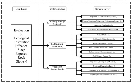
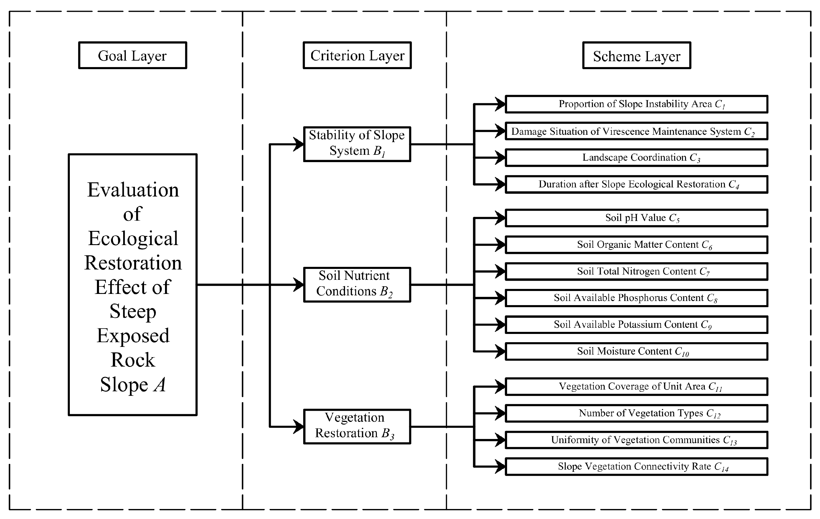
Based on the indicator data derived from field surveys and laboratory experiments, supplemented by expert input, a preliminary set of evaluation indicators for the assessment system was established. Evaluation indices for the stability of slope system included proportion of slope instability area (C1), damage situation of the virescence maintenance system (C2), landscape coordination (C3), and duration after slope ecological restoration (C4). Evaluation indices for the soil nutrient conditions included soil pH value (C5), soil organic matter content (C6), soil total nitrogen content (C7), soil available phosphorus content (C8), soil available potassium content (C9), and soil moisture content (C10). Evaluation indices for the vegetation restoration included vegetation coverage of unit area (C11), number of vegetation types (C12), uniformity of vegetation communities (C13), and slope vegetation connectivity rate (C14).
In this study, the ecological restoration effect of the repaired steep, bare rock slope was taken as the assessment objective. Based on the difficulties of steep bare rock slope restoration, the recommendations of experts, and the collected data, the criteria level was divided into the restoration of vegetation, soil nutrients, and the stability of the steep bare rock slope ecosystem. There are 14 evaluation indicators (Figure 3), and the evaluation criteria for each level are listed in Table 3.
Figure 3.
Structure of the evaluation system.
Table 3.
The evaluation level standards for each index.
2.3.2. Determination of Index Weight
1. Establishment of Judgment Matrix
The interrelationships among elements were determined through the Delphi method. The evaluation team was composed of ten experts, who were assigned to two groups for structured deliberation on the linkages between evaluation elements. The consensus was finalized after multiple rounds of this consultative process. Based on the evaluation system structure shown in Figure 3, a judgment matrix was established using the 1–9 scale method in combination with the dominance relationship between evaluation structures. The scale and meaning of the judgment matrix are detailed in Table 4. The judgment matrix A is shown in Equation (1):
where is the comparison value of the importance of i to j (, , i j = 1, 2…, n).
Table 4.
Scale of judgment matrix and its meaning.
2. Calculation of Index Weight
The weight vector of the evaluation indicators is calculated according to Equation (2):
The weight vectors of each evaluation indicator are normalized to obtain the weight of each evaluation indicator. The weight of each evaluation indicator is calculated according to Equation (3):
3. Consistency Check of Judgment Matrix
The maximum eigenvalue of the importance discrimination matrix for evaluation indicators is calculated according to Equation (4):
where is the largest eigenvalue of the judgment matrix, and n is the order of the judgment matrix.
The consistency index of the evaluation index in the importance discrimination matrix is calculated according to Equation (5):
where is the consistency index.
The consistency ratio of the evaluation index in the importance discrimination matrix is calculated according to Equation (6):
where is the consistency ratio, and is the average Consistency Index. When the calculation result , it is considered that the judgment matrix has consistency, and the weight can be obtained, while , it is necessary to readjust the matrix.
2.3.3. Technique for Order Preference by Similarity to an Ideal Solution
The TOPSIS method introduces positive and negative ideal solutions, calculates the Euclidean distance between the evaluation indicators within the scheme and the ideal solution, and obtains the relative closeness between different schemes and the ideal solution, in order to rank the superiority and inferiority of the schemes.
The qualitative description of evaluation indicators, such as vegetation community uniformity, maintenance system damage, and landscape coordination in the evaluation system, is difficult to convert into quantitative data. The method of triangular fuzzy number closeness can effectively solve the contradiction that the performance of the evaluated object cannot be accurately measured and can only be evaluated using natural language. The linguistic evaluation set I = (i0, i1, …, im, …, in) is transformed into a set of triangular fuzzy numbers I = ((m − 1)/n, m/n, (m + 1)/n) to represent it. The triangular fuzzy numbers corresponding to optimum, excellent, good, medium, and poor are (0.75, 1, 1), (0.5, 0.75, 1), (0.25, 0.5, 0.75), (0, 0.25, 0.5), and (0, 0, 0.25).
Due to the heterogeneous distribution of vegetation growth, the unit-area vegetation coverage within the evaluation system varies across different zones of the restored slope. These variations can be quantitatively represented using interval number ranges.
By combining interval numbers and triangular fuzzy numbers with the TOPSIS method, it is possible to effectively solve the problem of converting some qualitative or interval range changing evaluation indicators into quantitative data calculation. At the same time, the five evaluation levels of excellent, good, medium, and poor were added to the ecological restoration effect evaluation model of steep exposed rock mines, so that it could determine the evaluation interval of ecological restoration effect. The specific calculation steps are as follows:
1. Establishment of the initial data matrix for evaluation indicators
The initial data matrix X of evaluation indicators is established according to Equation (7):
where is the initial data matrix, is the evaluation target for various evaluation indicators, n is the number of evaluation indicators, and m is the number of evaluation targets.
2. Normalization of the initial data matrix
The initial data matrix normalization process is expressed in Equation (8):
where is the normalized data matrix, is the normalized number of evaluation indicators for the evaluation target, n is the number of evaluation indicators, and m is the number of evaluation targets.
Evaluation indicators can be divided into extremely large indicators, extremely small indicators, and intermediate indicators based on their data types, and corresponding normalization methods are used for different indicator types.
(a) Normalization method for precise number evaluation indicators
The property of extremely large indicators is that the larger the data, the better. The normalization for extremely large indicators is calculated according to Equation (9):
The property of extremely small indicators is that the smaller the data, the better. The normalization for extremely small indicators is calculated according to Equation (10):
The property of intermediate indicators is that the closer they are to a specific value, the better. The normalization method for intermediate indicators is to convert intermediate data into extremely large data and then normalize it. According to equation (11), the intermediate data are converted into extremely large data:
where is the maximum value in the intermediate indicator data.
(b) The normalization of the interval index () as the evaluation indicator is calculated according to Equation (12):
where is the lower bound of the interval number, and is the upper bound of the interval numbers.
(c) The normalization of the triangular fuzzy number index () as the evaluation index is calculated according to Equation (13):
where is the lower bound of triangular fuzzy numbers, is the median of triangular fuzzy numbers, and is the upper bound of triangular fuzzy numbers.
3. Establishment of the weighted decision matrix
where is the weighted decision matrix, is the weight of each evaluation indicator, and is the normalized matrix data.
4. Ideal solution for the computational scheme
(a) The positive ideal solution and the negative ideal solution of the precision index are calculated according to Equation (15):
where are the values of the evaluation indicators in the weighted decision matrix.
(b) The positive ideal solution and the negative ideal solution of the interval index are calculated according to Equation (16):
where is the lower bound value of the interval number evaluation index for the weighted decision matrix, and is the upper bound value of the interval number evaluation index for the weighted decision matrix.
(c) The positive ideal solution and the negative ideal solution of the triangular fuzzy number index are calculated according to Equation (17):
where is the lower bound value of the interval number evaluation index for the weighted decision matrix, is the median of triangular fuzzy numbers as the evaluation index in the weighted decision matrix, is the upper bound value of the interval number evaluation index for the weighted decision matrix.
5. Calculate the Euclidean distance between all schemes and the ideal solution
The Euclidean distance between the evaluation index of the evaluation object and the ideal solution is calculated according to Equation (18):
where is the Euclidean distance between the evaluation index of the evaluation object and the positive ideal solution, is the Euclidean distance between the evaluation index of the evaluation object and the negative ideal solution.
(a) The Euclidean distance from the exact number evaluation index to the positive ideal solution and the euclidean distance to the negative ideal solution are calculated by using Equation (19):
where is the Euclidean distance between the exact number evaluation index and the positive ideal solution of the index, and is the Euclidean distance between the precise number evaluation index and the negative ideal solution of the index.
(b) The Euclidean distance from the interval number evaluation index to the positive ideal solution and the Euclidean distance to the negative ideal solution are calculated using Equations (20) and (21):
where is the upper bound of the positive ideal solution of the interval number evaluation index, is the lower bound of the positive ideal solution of the interval number evaluation index: is the upper bound of the positive ideal solution of the interval number evaluation index, is the lower bound of the positive ideal solution of the interval number evaluation index.
(c) The Euclidean distance from the triangular fuzzy number evaluation index to the positive ideal solution and the Euclidean distance to the negative ideal solution are calculated according to Equations (22) and (23):
where is the upper bound of the positive ideal solution of the triangular fuzzy number evaluation index, is the median of the positive ideal solution of the triangular fuzzy number evaluation index, is the lower bound value of the positive ideal solution of the triangular fuzzy number evaluation index: is the upper bound of the negative ideal solution of the triangular fuzzy number evaluation index, is the median of the negative ideal solution of the triangular fuzzy number evaluation index, and is the lower bound of the negative ideal solution of the triangular fuzzy number evaluation index.
6. Calculate the closeness between all schemes and the ideal solution
The closeness of each evaluation object is calculated according to Equation (24):
According to the above calculation process, it can be concluded that the closer the is to 1, the better the ecological restoration effect. The closer the value is to 0, the worse the ecological restoration effect.
3. Results
The proposed evaluation system was employed to assess the ecological restoration effectiveness of restored steep bare rock slopes in mining areas. The computational and evaluative procedures are detailed below.
3.1. Evaluation Indicator Data
The results of the field survey and laboratory tests on the slope indicate that the ecological restoration effect evaluation indices for both the repaired steep slope and the bare rock slope are presented in Table 5, Table 6 and Table 7, of which C1–C4 are the evaluation index of system stability, C5–C10 are the evaluation index of soil nutrients, C11–C14 are the evaluation indexes of vegetation restoration. Since the evaluation indicators C2, C3, and C13 are qualitative fuzzy data, the data of these three indicators are converted into five grades, A, B, C, D, and E. Due to the size of the table, the specific rating indicators corresponding to each grade are seen in Table 8.
Table 5.
C1–C4 evaluation index data from steep bare rock slopes.
Table 6.
C5–C10 evaluation index data from steep bare rock slopes.
Table 7.
C11–C14 evaluation index data from steep bare rock slopes.
Table 8.
Qualitative description corresponding to the evaluation grade.
3.2. Comprehensive Evaluation on the Ecological Restoration Effect of Steep Bare Rock Slope
The evaluation process of the ecological restoration effect of 30 repaired steep bare rock slopes in the field investigation is explained below.
3.2.1. Calculation of Index Weight of the Case Study
According to the relative importance of each evaluation indicator at different evaluation levels, the evaluation judgment matrices for different levels are as follows:
A–B:
B1–C:
B2–C:
B3–C:
Calculate the eigenvectors and eigenvalues of each judgment matrix and perform consistency checks on the judgment matrices:
For the judgment matrix A–B:
For the judgment matrix B1–C:
For the judgment matrix B2–C:
For the judgment matrix B3–C:
Thus, the comprehensive weight results of the ecological restoration effect index system for steep bare rock slopes can be obtained, as shown in Table 9. When assessing ecological restoration effectiveness, the evaluation results should align with field survey findings from the mining site. Should discrepancies arise, the weighting factors must be re-evaluated and confirmed by experts to ensure the calculated restoration outcomes accurately reflect actual site conditions.
Table 9.
Comprehensive weight of ecological restoration effect evaluation indicators for steep bare rock slopes.
3.2.2. Calculation of the Ideal Solution
When evaluating the ecological restoration of steep bare rock slopes, the five criteria of extremely excellent, excellent, good, medium, and poor were added to the evaluation model, and together with 30 repaired steep bare rock slopes, 35 evaluation objects were formed. Based on the relationship between quantitative indicators, qualitative descriptions, and triangular fuzzy numbers, an initial matrix for evaluating the ecological restoration effect of steep bare rock mine slopes is obtained. By performing trend normalization and normalization on the initial matrix data, and combining the comprehensive weights of various evaluation indicators in Table 6, a weighted decision matrix for evaluating the ecological restoration effect of steep bare rock mine slopes is obtained, and the ideal and negative ideal solutions of the problem are obtained.
The ideal solution for evaluating the ecological restoration effect of steep bare rock slopes is as follows:
Ideal solution = [0.005, (0.017,0.027,0.040), (0.007,0.011,0.017), 0.034, 0.005, 0.007, 0.006, 0.013, 0.009, 0.004, (0.023,0.040), 0.012, (0.007,0.010,0.016), 0.041].
Negative ideal solution = [0.000, (0.000,0.005,0.013), (0.000,0.002,0.006), 0.000, 0.000, 0.000, 0.001, 0.000, 0.002, 0.001, (0.000,0.012), 0.000, (0.000,0.002,0.005), 0.0041].
3.2.3. Evaluation Results of Ecological Restoration Effect
Based on the evaluation index data of the evaluation object in the weighted decision matrix, the Euclidean distance between the evaluation object and the positive and negative ideal solutions is calculated. Combined with the Euclidean distance between the evaluation object and the positive and negative ideal solutions, the closeness between the evaluation object and the ideal solution is calculated, and the ecological restoration effect evaluation result of the steep bare rock slope is finally obtained. The closeness calculation result is shown in Table 10.
Table 10.
Evaluation results of the ecological restoration effect on the steep bare rock slope.
3.2.4. Analysis of Evaluation Results
The ecological restoration of steep, bare rock slopes consists first of stabilising the slope and then restoring the soil and vegetation on the basis of slope stability. The influence of vegetation on the ecological restoration effect of the ecosystem is greater than that of soil, and with the increase in restoration years, the role of vegetation in slope stability and protection of water and soil on the slope becomes more and more important [64,65]. Combined with the calculation results of the criterion level weight, the stability of the steep bare rock slope has a maximum value of 0.443, followed by the vegetation restoration of 0.387 and the weight of soil nutrients of 0.169. It can be seen that the stability of the slope system and the restoration of vegetation are the most important factors influencing the ecological restoration effect of the steep bare rock slope, and the restoration of vegetation is the external expression of the sustainability of the slope ecosystem.
The ecological restoration measures for steep bare rock, based on field survey results, comprise spray seeding with net suspension, high-order pellet spraying, planting holes, ecological planting tanks, planting bags, and frame beams. Combined with the evaluation results of the ecological rehabilitation effect of the steep bare rock slope under different ecological rehabilitation technologies, it can be seen that the proportion of ecological rehabilitation mines with excellent ecological rehabilitation effect is 30.0%, and the main rehabilitation measures are net suspension spray seeding and high-order pellet spraying, while some mines adopt the measures of planting bags and ecological planting tanks. Notably, 43.3% of mines undergoing ecological restoration are in the good to excellent range. The main restoration measures include spray seeding with net suspension, high-order pellet spraying, ecological planting tanks, planting holes, and a combination of different restoration measures. The ecological restoration mines in the medium to good range accounted for 26.7%, and the most important restoration measures were ecological planting tanks, planting holes, and slope mowers. The slopes of the pits with slope cutting and platform planting lacked soil for vegetation growth, resulting in sparse surface vegetation and the worst ecological restoration effect. Based on current mine rehabilitation status and evaluation results, spray-seeding techniques (net-suspended spray seeding and high-grade pellet spraying) demonstrate superior ecological restoration effectiveness compared to pillow-bag methods (e.g., planting bags), which in turn exceed the performance of drill-groove approaches (e.g., planting holes and ecological planting tanks). Where site conditions permit, spray-seeding restoration should be prioritized for steep bare rock slopes.
4. Discussion
4.1. Analysis of Ecological Restoration Effect on Steep Bare Rock Slopes
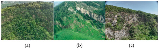
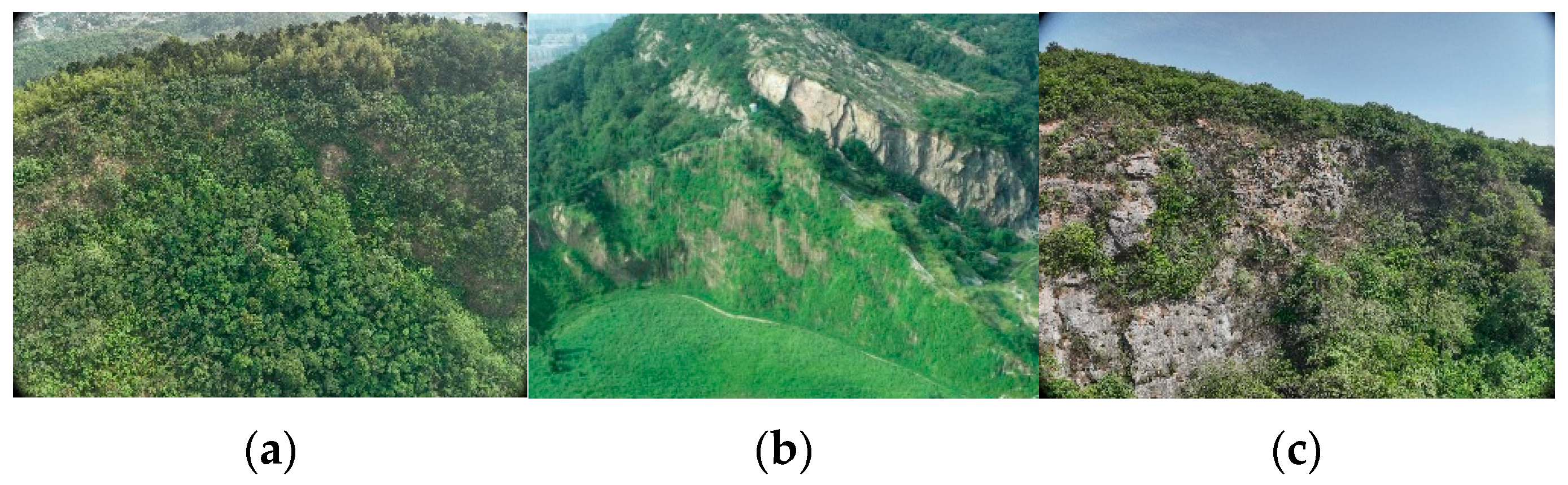
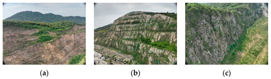
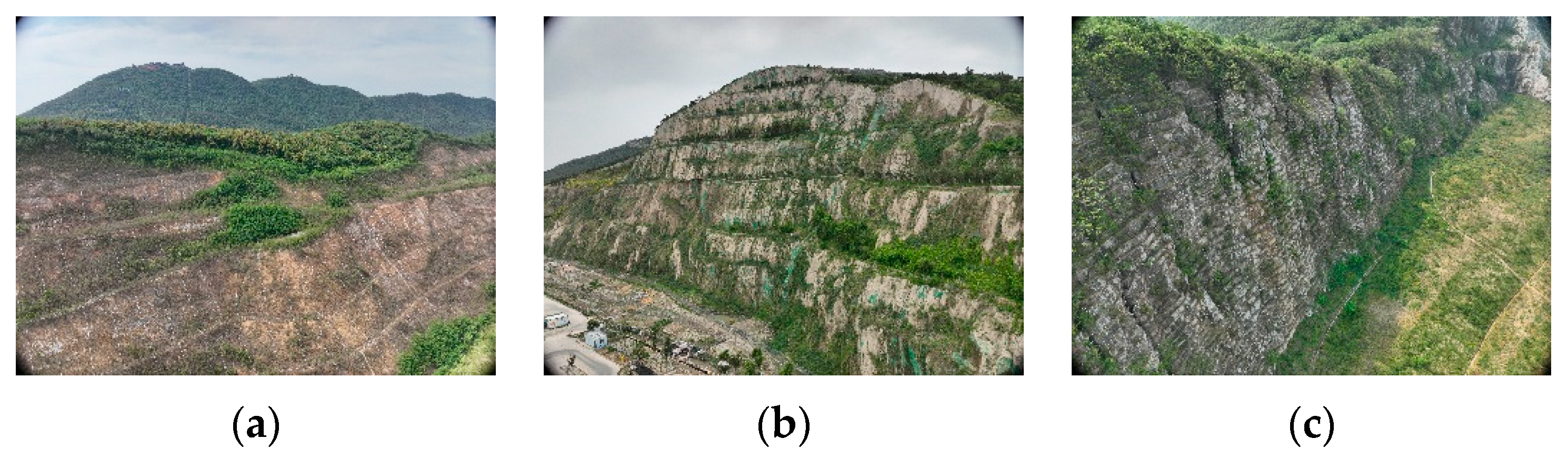
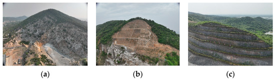
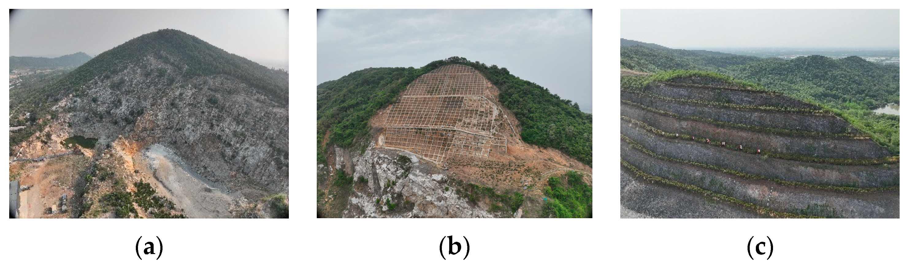
Although the ecosystem of the steep bare rock slope was restored to a certain extent after the technical restoration, the effect of the ecological restoration varies due to the different structural characteristics of the slope and the ecological restoration measures. According to the calculation results of the ecological restoration effect evaluation system, 73.3% of the ecological restoration mines were found to be in the good to optimum range. The results show that most of the steep bare rock slopes recovered well after rehabilitation, while some of the steep bare rock slopes showed poor ecological restoration effect due to slope characteristics, unsuitable ecological restoration technology, damaged maintenance system, and unsuitable vegetation. The current situation of the rehabilitated mines with different assessment levels is shown in Figure 4, Figure 5 and Figure 6.
Figure 4.
Steep bare rock mines with excellent to optimum ecological restoration effect: (a) M19 net-suspended spray seeding; (b) M8 high-order pellet spraying + planting bag; (c) M4 ecological planting tank + planting bag.
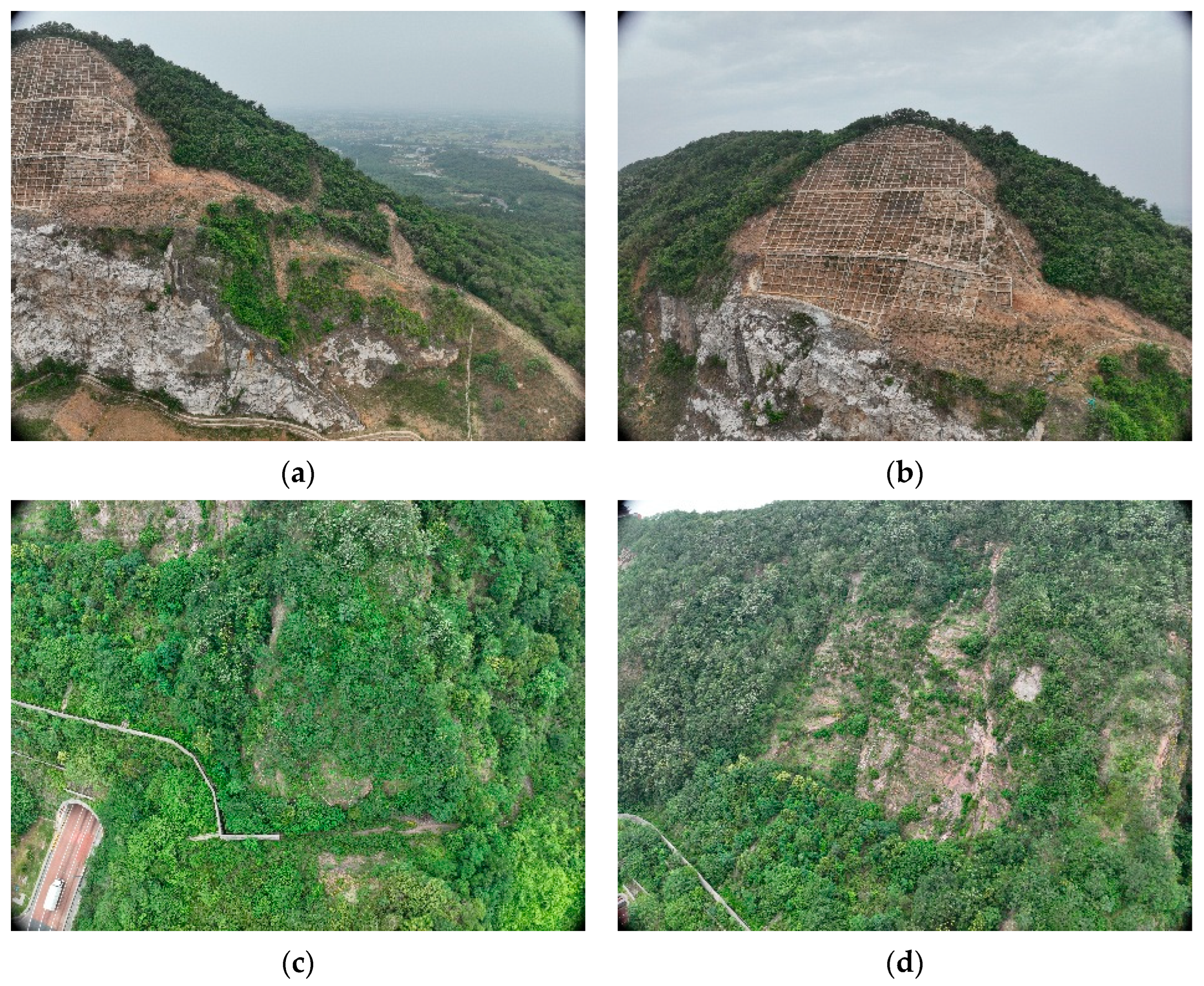
Figure 5.
Steep bare rock mines with good to excellent ecological restoration effect: (a) M3 net-suspended spray seeding; (b) M5 high-order pellet spraying; (c) M11 ecological planting tank.
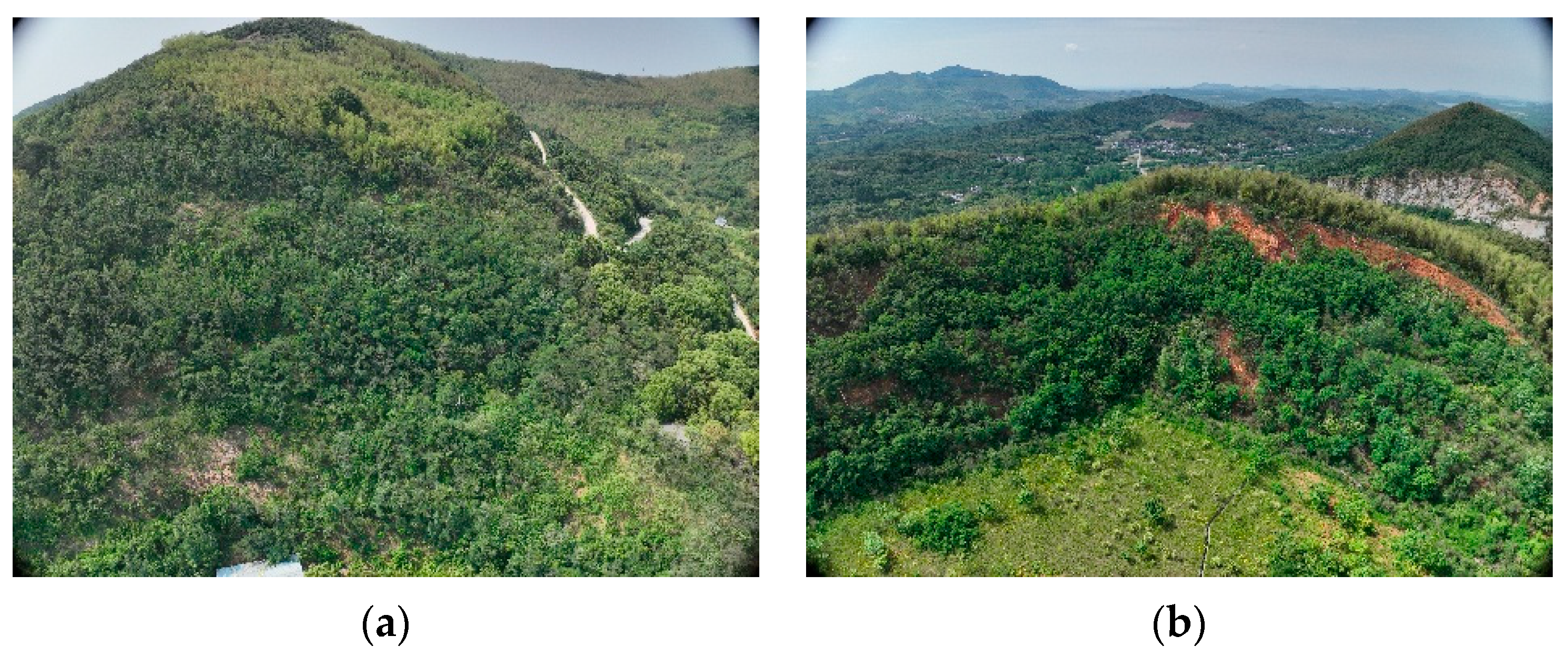
Figure 6.
Steep bare rock mines with medium to good ecological restoration effect: (a) M23 ecological planting tank; (b) M29 frame beam + net-suspended spray seeding; (c) M9 platform planting + slope cutting.
4.2. Different Ecological Restoration Technologies Have Varying Restoration Effects
4.2.1. Disparities in Ecological Restoration Effectiveness Across Mining Sites
Different remediation measures are taken in different areas of the same steep, bare rock slope, and the ecological remediation effect is also different. As can be seen in Figure 7a, the vegetation cover in the lower right corner of the slope is much higher than that of the frame beam in Figure 7b, which may be due to the rich organic matter, fertilizer and water retention agent in the matrix of the net spraying, the poor soil conditions in the frame, and the goats eating the Indigofera tinctoria L planted in the frame beam, resulting in a poor repair effect.
Figure 7.
Impact of different ecological restoration measures on slope ecological restoration effect: (a) M29 net-suspended spray seeding; (b) M29 frame beam; (c) M20 net-suspended spray seeding; (d) M20 ecological planting tank.
M20 uses the combination of net spraying and ecological planting tanks to ecologically rehabilitate the slope. After comparing Figure 7c,d, it can be seen that the net spraying has a high vegetation cover, while the subsoil in the area where the ecological planting tank is located is exposed over a large area, the vegetation cover is not high, and the ecological restoration effect is limited. Therefore, for non-vertical slopes, it is more reasonable to prioritize net spraying if the conditions of net spraying for ecological restoration of abandoned steep slopes are met, and consider the ecological planting tank or planting hole if the other conditions are not met.
The normal operation of the vegetation maintenance system has a great impact on the ecological restoration effect of the slope. Taking M20 and M2 (Figure 8) as examples, M20 and M2 both adopt the method of hanging nets and spraying seeding to repair the mine. The difference is that the maintenance system of M20 is intact, and the slope vegetation coverage is high. However, a certain range of slopes is exposed at the top of M2 slope, because part of the maintenance system at the top of the slope is damaged, which cannot effectively supply water to the vegetation within the range of the top of the slope, thus affecting the growth of the vegetation on the top of the slope.
Figure 8.
Impact of intact maintenance system on ecological restoration effect of slope: (a) M20 net-suspended spray seeding, intact virescence maintenance; (b) M2 net-suspended spray seeding, and the virescence maintenance at the top of the slope is damaged.
The suitability of vegetation species on steep, bare rock slopes significantly influences the effectiveness of ecological restoration efforts. This is primarily due to the challenges posed by limited water and soil resources, as well as low soil fertility, which hinder vegetation restoration on such slopes. If the selected plant species fail to adapt to the local environment and the unique conditions of steep inclines, secondary ecosystem degradation may ensue, ultimately resulting in restoration failure [66]. For instance, M12 (Figure 9) employs a combination of fish scale pits and ecological planting tanks for restoration. However, no vegetation has survived in the ecological planting tanks. While Amorpha fruticosa, Lespedeza, and Euphorbia quinquefolia are commonly found in the fish scale pit, their coverage remains low. This can be attributed to the fact that some of the planted species are unsuitable for the mining environment. Moreover, the maintenance practices associated with the mine have compromised the slope, and insufficient water supply has led to the death of vegetation on the slope surface, leaving only drought-resistant species such as Amorpha fruticosa and Lespedeza.
Figure 9.
M12 mine slope with fish scale pit + ecological planting tank as the restoration measure: (a) vegetation growth and distribution on slope surface; (b) survey the vegetation growth in the quadrat.
4.2.2. Comparative Analysis of Ecological Restoration Effectiveness Across Rehabilitation Techniques
This study examines the ecological restoration of steep bare rock slopes in Jiangsu Province, focusing primarily on spray seeding, cushion bag, and drill-grooving techniques. The fundamental distinction among these methodologies resides in their respective capacities to establish and maintain environments conducive to sustainable vegetation development while ensuring slope system stability.
Spray-seeding technology involves the homogeneous mixing of imported soil, binding agents, organic fertilizers, slow-release fertilizers, water-retaining additives, pH regulators, and other components in specific proportions to form a reconstituted growth medium. When combined with support mesh systems, spray-seeding technology promotes the formation of a root–soil composite on slopes. This integrated approach effectively mitigates soil erosion and nutrient loss, thereby contributing to the long-term stability and sustainable development of the slope ecosystem.
Planting bag technology involves stacking and securing vegetation bags on the slope surface. These bags are filled with growth media containing essential nutrients and water-retaining additives. Following seed germination and plant establishment in the surface layer, a stable vegetative cover develops across the slope. However, as vegetation develops exclusively within the individual bags, it fails to form an integrated root–soil composite with the surrounding slope matrix, resulting in limited structural integrity. Although this approach can provide adequate erosion resistance on moderately inclined slopes, its efficacy in controlling erosion and maintaining soil stability on steep gradients remains constrained. However, Jiangsu Province receives considerable precipitation, which contributes to severe soil erosion and leads to the depletion of soil moisture and nutrients.
The drill-grooving technique is primarily applicable to areas characterized by intact, steep hard rock formations or arid to semi-arid climatic conditions. This method entails drilling ecological pits and trenches, directly constructing grooves or installing planting units on slopes, followed by backfilling with soil and introducing vegetation into these cavities. Due to the limited and predominantly discontinuous soil coverage on the slope surface, a continuous and integrated root–soil composite system cannot be established, consequently resulting in reduced resistance to rainwater erosion. The deterioration of the mining area’s maintenance infrastructure has exacerbated water supply constraints for the slope ecosystem and degraded conditions for plant establishment, consequently compromising ecological restoration outcomes.
4.3. Limitations of This Study and Future Work
Based on the field investigation, laboratory test, and evaluation system, this study studied the ecological restoration effect of the steep bare rock slope. Although the visual characteristics of the field investigation and the test data were combined to evaluate the ecological restoration effect of the slope, and the differences in the ecological restoration effects of different ecological restoration technologies were analyzed, there are still some limitations.
In terms of the survey object, the mine data samples of different ecological restoration technologies are limited. The mine restoration measures investigated are mainly net spraying, high-grade aggregates, ecological planting tanks, fish scale pit, planting holes, frame beams, and slope cutting platform planting. There is a lack of mines adopting other restoration measures, such as vegetation concrete, ecological rod, etc. The follow-up study will supplement the investigation of relevant measures.
In the process of data collection, the index data in the evaluation system are more dependent on the results of field investigation and indoor test, and there is a lack of long-term ecological restoration effect monitoring. In the later stage, the restored steep slope can be monitored in real time, combined with remote sensing data, to realize the long-term effective ecological restoration effect evaluation.
During the field investigation, some vegetation on the repaired steep bare rock slope grew vigorously, while some slope vegetation with poor repair effect had the characteristics of large area death. However, this study lacks the screening of suitable vegetation for the steep bare rock slope under different ecological restoration technologies in different areas. In the future, the suitable vegetation for ecological restoration will be determined based on the vegetation on the repaired steep bare rock slope and field tests.
5. Conclusions
The ecological restoration effect serves as a crucial indicator for assessing the overall quality of mine slope rehabilitation. However, research on evaluating these effects for steep bare rock slopes remains limited. To address this gap, an evaluation system integrating the AHP-TOPSIS methodology was developed. This system accounts for the challenges inherent in restoring steep bare rock slopes and incorporates 14 indicators across three dimensions: slope ecosystem stability, soil nutrients, and vegetation recovery. A comprehensive assessment was conducted using laboratory analyses and field survey data.
The results of the weight calculations indicate that the slope ecosystem is the most significant factor influencing the ecological restoration of steep bare rock slopes, with a weight value of 0.443. In comparison, the weight values for vegetation and soil are 0.387 and 0.169, respectively. The comprehensive weight values for factors such as slope instability, damage to the maintenance system, restoration duration, vegetation coverage per unit area, and slope vegetation connectivity are notably high, indicating their substantial impact on the ecological restoration of steep bare rock slopes. Furthermore, the evaluation of the ecological restoration outcomes for the restored steep bare rock reveals that 30.0% of the mine slopes fall within the excellent to optimum category, 43.3% are classified as good to excellent, and 26.7% are rated as medium to good. These evaluation results align with the findings from field qualitative investigations.
The results of the closeness calculation show that mines using hanging net spraying and high-order pellet spraying account for 88.9% of the number of mines in the ecological restoration effect evaluation range of excellent to optimum, while ecological planting tanks account for only a small proportion. The effect of single restoration measures such as plant holes, ecological planting tanks, and fish scale pits on the ecological restoration of the mine is limited, and most of the vegetation on it died in the later stage of restoration; finally, the restoration effect of slope cutting + platform planting is the worst. Furthermore, the slope maintenance system plays a crucial role in the ecological restoration of the mine. Damage to this maintenance system can result in vegetation loss and potentially lead to ecosystem degradation. The results indicate that most mines employing spray seeding techniques, such as hanging net spray seeding and high-order aggregate seeding, achieve superior ecological restoration outcomes. In contrast, only a limited number of mines utilizing planting holes and planting troughs demonstrate enhanced restoration effects. Therefore, when conditions are favorable, it is advisable to prioritize spray seeding ecological restoration measures. For mines where spray seeding is not suitable, alternative restoration strategies, such as planting troughs and planting holes, should be considered.
The weight calculation, field investigations, and evaluation results indicate that the evaluation system is highly applicable for assessing the ecological restoration effects of steep bare rock slopes across various restoration technologies. This system can serve as a reference for evaluating similar restoration efforts in steep bare rock slopes and guide subsequent mining operations in selecting appropriate ecological restoration strategies. Future work should focus on analyzing soil and water loss on the slope through field tests and identifying suitable vegetation for ecological restoration in different regions. The findings from this research may contribute to the sustainable development of the steep bare rock slope ecosystem in mining areas.
This study centers on evaluating the ecological restoration effects of repaired steep bare rock slopes within Jiangsu Province. Subsequent research will extend this assessment to such slopes beyond this region, thereby validating the broader applicability of the evaluation framework. Additionally, as the investigation was limited to restored steep bare rock slopes in Jiangsu Province, data on the original rock structure—including slope angle, gradient, surface roughness, weathering degree, and joint development—could not be obtained. In subsequent investigations, the rock mass structure of unrestored steep bare rock slopes, the implemented ecological restoration measures, and the corresponding restoration outcomes will be integrated to comprehensively evaluate the factors influencing the effectiveness of restoration technologies, thereby informing the selection of appropriate techniques for different slope conditions.
Author Contributions
Conceptualization, Y.L. (Yuhong Liang) and Y.L. (Yingjie Lin); methodology, F.Z. and H.S.; software, X.Z., H.Z. and M.D.; validation, Y.L. (Yuhong Liang), Y.L. (Yingjie Lin) and H.S.; investigation, F.Z. and H.S.; writing—original draft preparation, X.Z., F.W. and M.D.; writing—review and editing, M.D., F.W. and H.Z. All authors have read and agreed to the published version of the manuscript.
Funding
The research was funded by Jiangsu Geological Exploration Project Fund [2024-No.33-Item.39].
Institutional Review Board Statement
Not applicable.
Informed Consent Statement
Not applicable.
Data Availability Statement
The data presented in this study are available upon request from the corresponding author.
Conflicts of Interest
Author Fangyong Wang is employed by Jiangsu Zhujiu Building Conservation & Technology Co., Ltd. The remaining authors declare that the research was conducted in the absence of any commercial or financial relationships that could be construed as a potential conflict of interest.
References
- Cao, Z.Z.; Xiong, Y.; Xue, Y.; Du, F.; Li, Z.H.; Huang, C.H.; Wang, S.R.; Yu, Y.Q.; Wang, W.Q.; Zhai, M.L. Diffusion Evolution Rules of Grouting Slurry in Mining-induced Cracks in Overlying Strata. Rock Mech. Rock Eng. 2025, 58, 6493–6512. [Google Scholar] [CrossRef] [Scilit]
- Li, X.L.; Huan, H.H.; Lin, H.X.; Li, Z.H.; Du, F.; Cao, Z.Z.; Fan, X.; Ren, H. Determination method of rational position for working face entries in coordinated mining of section coal pillars and lower sub-layer. Sci. Rep. 2025, 15, 29440. [Google Scholar] [CrossRef] [Scilit]
- Chen, T.; Shu, J.S.; Han, L.; Tian, G.; Yang, G.Y.; Lv, J.X. Modeling the effects of topography and slope gradient of an artificially formed slope on runoff, sediment yield, water and soil loss of sandy soil. Catena 2022, 212, 106060. [Google Scholar] [CrossRef] [Scilit]
- Wang, Z.G.; Wang, G.C.; Wang, C.S.; Wang, X.H.; Li, M.L.; Ren, T.Y. Effect of Environmental Factors on Soil Nutrient Loss under Conditions of Mining Disturbance in a Coalfield. Forests 2021, 12, 1370. [Google Scholar] [CrossRef] [Scilit]
- Ahirwal, J.; Pandey, V.C. Restoration of mine degraded land for sustainable environmental development. Restor. Ecol. 2020, 29, 13268. [Google Scholar] [CrossRef] [Scilit]
- Cristina, G.; Miquel, C.; Cinzia, C.; Dell’Anno, A.; Manea, E.; Pusceddu, A.; SanchezVidal, A.; Danovaro, R. Impact of resuspended mine tailings on benthic biodiversity and ecosystem processes: The case study of Portmán Bay, Western Mediterranean Sea, Spain. Environ. Pollut. 2022, 301, 119021. [Google Scholar] [CrossRef] [Scilit]
- Zhou, C.; Chang, M.; Xu, L.; Che, H.X. Risk Assessment of Typical Urban Mine Geological Disasters in Guizhou Province. Geomat. Inf. Sci. Wuhan Univ. 2020, 45, 1782–1791. [Google Scholar]
- Padró, J.C.; Cardozo, J.; Montero, P.; Ruiz-Carulla, R.; Alcañiz, J.M.; Serra, D.; Carabassa, V. Drone-Based Identification of Erosive Processes in Open-Pit Mining Restored Areas. Land 2022, 11, 212. [Google Scholar] [CrossRef] [Scilit]
- Zhang, Y.; Ge, J.K.; Li, H.L.; Yang, C.; Dai, Z.F.; Chen, H.N. Relationship between Volume Fissure Rate and Plant Growth Rate of High and Steep Rock Slope. Saf. Environ. Eng. 2022, 29, 93–100. [Google Scholar]
- Su, D.H.; Zhou, J.W.; Feng, H.B.; Li, R.; Zheng, X.M.; Zhu, Y.; Han, X.; Hou, Q.Q. Distribution and transformation characteristics of water vapor field in the fissured rock mass and its ecological significance. J. Hydrol. 2024, 631, 130785. [Google Scholar] [CrossRef] [Scilit]
- Zhao, J.Z.; Li, Y.Z.; Sun, S.S.; Liu, Y.; Kang, X.D. Application of Capillary Water in Ecological Restoration and Greening Maintenance of High and Steep Rock Slope in Mines. Water Sav. Irrig. 2022, 1, 80–84. [Google Scholar]
- Zhao, X.F.; Li, H.B.; Li, P.; Chen, Y.J.; Dai, Q.; Shi, P.; Li, X.; Qu, Y.L.; Ma, J.Y. Impact of Mining Area Steep Slope Conditions on the Soil and Water Conservation Benefits of Ecological Restoration. Water 2025, 17, 256. [Google Scholar] [CrossRef] [Scilit]
- Zhou, S.L.; Li, X.K.; Zhang, P.C.; Lu, G.; Zhang, X.L.; Zhang, H.Q.; Zhang, F.M. Carbon Sequestration Capacity after Ecological Restoration of Open-Pit Mines: A Case Study in Yangtze River Basin, Jurong City, Jiangsu Province. Sustainability 2024, 16, 8149. [Google Scholar] [CrossRef] [Scilit]
- Zhang, J.M.; Cheng, J.P.; Yang, J.Q.; He, Y.Q.; Tian, L. Advances in Biological Protection of Rock Slopes in China. J. Soil Water Conserv. 2019, 33, 1–7. [Google Scholar]
- Wang, Z.Y.; Cao, J.S. Research advances in vegetation restoration and its ecological effects in earth-rock mountain areas of North China. Chin. J. Eco-Agric. 2019, 27, 1319–1331. [Google Scholar]
- Zhu, Z.H.; Lai, T.; Chen, X.R.; Xu, G.G.; Lai, Q.W. Process Selection, Target Community Design and Effect Assessment on Ecological Restoration Engineering of Damaged Slope. J. Northwest For. Univ. 2017, 32, 78–83. [Google Scholar]
- Xie, J.Y.; Liu, Y.X.; Xie, M.M.; Xia, L.; Yang, R.J.; Li, J.G. Exploring the restoration stability of abandoned open-pit mines by vegetation resilience indicator based on the LandTrendr algorithm. Ecol. Indic. 2024, 166, 112392. [Google Scholar] [CrossRef] [Scilit]
- Sun, D.Y.; Li, J.Z.; Gong, Y.B. Effects of Planting Density of Poaceae Species on Slope Community Characteristics and Artificial Soil Nutrients in High-Altitude Areas. Sustainability 2023, 15, 8321. [Google Scholar] [CrossRef] [Scilit]
- Wang, C.; Zhang, Y.F.; Yu, D.L.; Chen, B.; Li, J.L. Optimized plant allocation for ecological restoration of highly-steep rocky slopes in North China. Sci. Soil Water Conserv. 2025, 23, 164–175. [Google Scholar]
- Yang, Z.C.; Ma, X.X.; Chang, S.J.; Tang, Y.X.; Zhao, R.Y.; Wan, D.; Zhang, Q.Z. Regreening Practices and Effectiveness Evaluation for Rocky Slope Drawdown Zones in Pumped Storage Power Station Reservoirs. J. Chang. River Sci. Res. Inst. 2025, 42, 86–93. [Google Scholar]
- Zhou, H.M.; Yu, J.; Wang, D.; Gan, G.Q.; Lu, Y.; Jin, K. Plant Screening and Vegetation Arrangement for Ecological Restoration in Water-level-fluctuating Zone of Wudongde Resevoir. J. Chang. River Sci. Res. Inst. 2022, 39, 50–55. [Google Scholar]
- Fang, R.Y.; Yin, J.; Zhou, L.; Wang, Y.L.; Tang, H. Research on Vegetation Restoration of Highway Slopes in the Western Sichuan Plateau. Highway 2025, 70, 330–337. [Google Scholar]
- Hou, D.; Xu, M.C.; Wang, M.L.; Li, X.S.; Li, S.J.; Wang, J.W.; Cao, M.Z. Research on ecological restoration and green reclamation technology of goaf in phosphorus mines. Front. Environ. Sci. 2024, 12, 1343185. [Google Scholar] [CrossRef] [Scilit]
- Guan, C.M.; Zhang, G.R.; Zhao, B.; Chen, D.P.; Fei, Z.R. Advances on Ecological Restoration of Urban River in China and New Technologies of Bank Revetment. Yellow River 2014, 36, 77–80. [Google Scholar]
- Chen, X.D.; Nie, X.J.; Zhang, Y.H.; Liu, J.J. Study Status and Prospect of Revegetation Technology for High and Steep Rocky Slopes in China. Environ. Sci. Technol. 2024, 47, 70–78. [Google Scholar]
- Liu, L.M.; Song, Y.S.; Zhong, B.; Fang, S.D.; Xu, W.N.; Wang, Y.Y.; Li, M.W. Research progress on ecological restoration technology of vegetation concrete. J. Environ. Eng. Technol. 2022, 12, 916–927. [Google Scholar]
- Xu, H.; Nie, G.; Deng, X.L. Research and Application of Comprehensive Technology for Ecological Restoration of an Abandoned Mining Area. Min. R & D 2024, 44, 181–188. [Google Scholar]
- Feng, Y.; Wang, J.M.; Bai, Z.K.; Reading, L. Effects of surface coal mining and land reclamation on soil properties: A review. Earth-Sci. Rev. 2019, 191, 12–25. [Google Scholar] [CrossRef] [Scilit]
- Wang, Y.; Liu, J.; Lin, C.; Ma, X.F.; Song, Z.Z.; Chen, Z.H.; Jiang, C.H.; Qi, C.Q. Polyvinyl acetate-based soil stabilization for rock slope ecological restoration. J. Environ. Manag. 2022, 324, 116209. [Google Scholar] [CrossRef] [Scilit] [PubMed]
- Wang, L.; Yao, Y.S.; Li, J.; Liu, K.F.; Wu, F. A State-of-the-Art Review of Organic Polymer Modifiers for Slope Eco-Engineering. Polymers 2023, 15, 2878. [Google Scholar] [CrossRef] [Scilit]
- Li, R.P.; Shi, C.Q.; Yang, J.Y.; Wei, G.K.; Liu, J.Q.; Kui, G.X.; Ai, X.F.; Xiao, F.; Su, R.D. Site Type Classification and Ecological Restoration Technology Selection of Open-Pit Coal Mine Dumps in Grassland Mining Area. J. Resour. Ecol. 2023, 14, 757–766. [Google Scholar] [CrossRef] [Scilit]
- Wu, Y.; Xia, D.; Liang, B.; Jia, Y.F.; Yang, Y.D. Ecological reconstruction technology of rock slope in open pit based on rock mass quality evaluation and division. J. China Coal Soc. 2019, 44, 2133–2142. [Google Scholar]
- Kong, L.W.; Xue, C.X.; Su, F.; Shi, L. Evaluation and Effect of Different Construction Techniques on the Ecological Restora-tion of the Stackpile in Opencast Coal Mine. Res. Soil Water Conserv. 2017, 24, 187–193. [Google Scholar]
- Chen, C.X.; Zhang, L.; Zhao, W.; Ye, H.; Xie, H.X.; Lai, W.Q. The response of degraded grasslands to different types of restoration measures in western China: A Meta-analysis. Pratacultural Sci. 2023, 40, 3048–3061. [Google Scholar]
- Yang, Y.S.; Liu, D.X.; Xiao, H.; Chen, J.G.; Ding, Y.; Xia, D.; Xia, Z.Y.; Xu, W.N. Evaluating the Effect of the Ecological Restoration of Quarry Slopes in Caidian District, Wuhan City. Sustainability 2019, 11, 6624. [Google Scholar] [CrossRef] [Scilit]
- Ai, X.Y.; Yang, H.; Ai, S.H.; Sheng, M.H.; Tian, X.S.; Teng, J.; Wang, Y.; Ai, Y.W. Effects of different restoration methods on soil organic carbon and its fractions of cut slopes in mountainous areas of southwestern China. J. Soils Sediments 2024, 24, 1933–1943. [Google Scholar] [CrossRef] [Scilit]
- Li, R.R.; Zhang, W.J.; Yang, S.Q.; Zhu, M.K.; Kan, S.S.; Chen, J.; Ai, X.Y.; Ai, Y.W. Topographic aspect affects the vegetation restoration and artificial soil quality of rock-cut slopes restored by external-soil spray seeding. Sci. Rep. 2018, 10, 12109. [Google Scholar] [CrossRef] [Scilit]
- Hu, Y.W.; Jia, J.B.; Shen, X.S.; Wang, Z.Y.; Zhang, M.J. Evaluation of different restoration techniques and their effectiveness on coal gague slopes in Wuhai city. Sci. Soil Water Conserv. 2024, 22, 116–125. [Google Scholar]
- Zhu, T.Y.; Li, C.Z.; Liu, X.C.; Zhao, X.B. Assessing Ecological Restoration in Arid Mining Regions: A Progressive Evaluation System. Sustainability 2024, 16, 2266. [Google Scholar] [CrossRef] [Scilit]
- Hancock, G.; Duque, M.J.; Willgoose, G. Mining rehabilitation—Using geomorphology to engineer ecologically sustainable landscapes for highly disturbed lands. Ecol. Eng. 2020, 155, 105836. [Google Scholar] [CrossRef] [Scilit]
- Yuan, M.; Ouyang, J.Y.; Zheng, S.N.; Tian, Y.; Sun, R.; Bao, R.; Li, T.; Yu, T.S.; Li, S.; Wu, D.; et al. Research on Ecological Effect Assessment Method of Ecological Restoration of Open-Pit Coal Mines in Alpine Regions. Int. J. Environ. Res. Public Health 2022, 19, 7682. [Google Scholar] [CrossRef] [Scilit]
- Li, Y.S.; Wang, L.C.; Cao, Q.; Yang, L.; Jiang, W.X. Revealing ecological restoration process and disturbances of mineral concentration areas based on multiscale and multisource data. Appl. Geogr. 2024, 162, 103155. [Google Scholar] [CrossRef] [Scilit]
- Mao, Z.J.; Wang, M.N.; Chu, J.W.; Sun, J.W.; Liang, W.; Yu, H.Y. Feature extraction and analysis of reclaimed vegetation in ecological restoration area of abandoned mines based on hyperspectral remote sensing images. J. Arid. Land 2024, 16, 1409–1425. [Google Scholar] [CrossRef] [Scilit]
- Aishajiang, A.L.; Xu, H.L.; Yuan, K.Y. Assessment of the effects of artificial restoration measures in abandoned gold mining area in Altay Mountains using PCA and monitoring data. Arid. Land Geogr. 2019, 42, 288–294. [Google Scholar]
- Carabassa, V.; Ortiz, O.; Alcañiz, J.M. RESTOQUARRY: Indicators for self-evaluation of ecological restoration in open-pit mines. Ecol. Indic. 2019, 102, 437–445. [Google Scholar] [CrossRef] [Scilit]
- Wang, Y.M.; Tao, Y.C.; Cheng, Z.Y.; Li, B.W. Long-term Protective Effect of External-Soil Spray Seeding on Highway Cutting Slope. Ecol. Environ. Sci. 2021, 30, 1724–1731. [Google Scholar]
- Chen, W.Q.; Sun, Y.A.; Shi, K.H. Dynamic evaluation on slope ecological restoration effect based on cosine similarity and markov chain. Sci. Rep. 2023, 13, 13533. [Google Scholar] [CrossRef] [Scilit]
- Qin, T.L.; He, S.; Liu, S.S.; Nie, H.J.; Dong, B.Q.; Lv, X.Z. Optimal Allocation of Slope Ecological Restoration for the Climate Change Mitigation and Natural Function Improvement. Front. Earth Sci. 2022, 10, 837311. [Google Scholar] [CrossRef] [Scilit]
- Jiang, Y.Y.; Wang, X.W.; Tan, C.M.; Sun, D.Y.; Li, J.Z. Effect Analysis and Evaluation on Ecological Restoration of Post-earthquake Slopes along Chuanzhusi-Jiuzhaigou Highway. J. Highw. Transp. Res. Dev. 2023, 40, 208–215. [Google Scholar]
- Yue, Y.S.; Luo, Z.Y.; Ji, L. Construction and application of monitoring index for mine ecological restoration. Bull. Surv. Mapp. 2022, 12, 136–140. [Google Scholar]
- Jia, C.; Fan, C.J.; Li, S.; Liu, X.S.; Wang, X.Z.; Luo, M.K.; Yang, Z.H. Optimization of support parameters of development roadway passing through collapse column based on AHP−entropy weight combination. Coal Sci. Technol. 2025, 53, 187–201. [Google Scholar]
- Du, Y.M.; Chen, W.W.; Cui, K.; Zhang, K.W. Study on Damage Assessment of Earthen Sites of the Ming Great Wall in Qinghai Province Based on Fuzzy-AHP and AHP-TOPSIS. Int. J. Archit. Herit. 2020, 14, 903–916. [Google Scholar] [CrossRef] [Scilit]
- Zhang, L.X.; Wang, Y.W.; Zhang, J.K.; Zhang, S.; Guo, Q.L. Rockfall hazard assessment of the slope of Mogao Grottoes, China based on AHP, F-AHP and AHP-TOPSIS. Environ. Earth Sci. 2022, 81, 377. [Google Scholar] [CrossRef] [Scilit]
- Wei, Y.M.; Dong, Z.C.; Xu, W.; Wang, J.T.; Reng, J. Optimization of Vegetation in a Flexible Wave Break Forest for NenjiangRiver Using a Multi attribute TOPSIS-AHP Model. J. Hydroecology 2019, 40, 20–25. [Google Scholar]
- Li, S.T.; Yang, L.; Fang, J.Y. Comprehensive evaluation of urban river ecological bank protection based on AHP-TOPSIS method. Environ. Technol. 2024, 46, 1201–1214. [Google Scholar] [CrossRef] [Scilit]
- Huang, C.C.; Zhang, M.L.; Zou, J.; Zhu, A.X.; Chen, X.; Mi, Y.; Wang, Y.H.; Yang, H.; Li, Y.M. Changes in land use, climate and the environment during a period of rapid economic development in Jiangsu Province, China. Sci. Total Environ. 2015, 536, 173–181. [Google Scholar] [CrossRef] [Scilit]
- Wen, L.; Zhang, W.; Yang, C.; Chen, G.; Hu, Y.J.; Zhang, H. Near Homogeneous Microphysics of the Record-Breaking 2020 Summer Monsoon Rainfall during the Northward Migration over East China. Adv. Atmos. Sci. 2023, 40, 1783–1798. [Google Scholar] [CrossRef] [Scilit]
- HJ 962-2018; Potentiometric Method for the Determination of Soil pH. Chinese Standard: Beijing, China, 2018.
- NY/T 1121.6-2006; Soil Testing Part 6: Method for Determination of Soil Organic Matter. Chinese Standard: Beijing, China, 2006.
- LY/T 1232-2015; Phosphorus Determination Methods of Forest Soils. Chinese Standard: Beijing, China, 2015.
- NY/T 1121.7-2014; Soil Testing. Part 7: Method for Determination of Available Phosphorus in Soil. Chinese Standard: Beijing, China, 2014.
- NY/T889-2004; Determination of Exchangeable Potassium and Non-Exchangeable Potassium Content in Soil. Chinese Standard: Beijing, China, 2004.
- GB/T50123-2019; Standard for Geotechnical Testing Method. Chinese Standard: Beijing, China, 2019.
- Wang, B.; Zhang, G.H.; Yang, Y.F.; Li, P.P.; Liu, J.X. The effects of varied soil properties induced by natural grassland succession on the process of soil detachment. Catena 2018, 166, 192–199. [Google Scholar] [CrossRef] [Scilit]
- Xu, G.C.; Zhi, Z.X.; Li, Z.B.; Zhuang, J.; Guo, M.J.; Fang, K.; Yi, J.; Ren, Z.P.; Gao, H.D.; Jia, L. Attribution of sediment changes and influencing factors of microbial communities in sediment in the Wuding River basin of the Yellow River. Catena 2025, 249, 108626. [Google Scholar] [CrossRef] [Scilit]
- Pan, S.L.; Gu, B. Study on Soil Property and Plant Diversity of Roadside Slopes of YanTian Harbor in Shenzhen Under Ecological Restoration. Soils 2013, 45, 366–372. [Google Scholar]

Disclaimer/Publisher’s Note: The statements, opinions and data contained in all publications are solely those of the individual author(s) and contributor(s) and not of MDPI and/or the editor(s). MDPI and/or the editor(s) disclaim responsibility for any injury to people or property resulting from any ideas, methods, instructions or products referred to in the content. |
© 2026 by the authors. Licensee MDPI, Basel, Switzerland. This article is an open access article distributed under the terms and conditions of the Creative Commons Attribution (CC BY) license.