


Abstract
Rugged terrain dominates the Qinghai–Tibet Plateau, where complex landforms profoundly modulate solar energy availability. The reasonable distribution and development of solar energy resources in this region should be based on the accurate assessment of the effects of complex topography. This study proposes a high-resolution methodological framework to quantify the topographic–climatic interactions within Lhasa. Based on GIS technology (ArcGIS 10.8), this study employs a topographic decomposition method to extract micro-topographic variables, which are integrated into a distributed solar radiation model with 30 m resolution to simulate spatial–temporal radiation dynamics. Furthermore, we utilize the geographical detector (GD) model to attribute the spatial variance of radiation to specific topographic and surface drivers. The results show that: (1) The seasonal distribution of solar radiation is highly heterogeneous, with the monthly average extraterrestrial solar radiation (ESR) peaking in July (1190 MJ/m2) and reaching its lowest in December (469 MJ/m2). (2) Factor detection using the GD model indicates that slope aspect (q = 0.49) and Sky View Factor (SVF, q = 0.38) are the primary individual drivers of direct solar radiation, followed by surface albedo (q = 0.26) and DEM (q = 0.12). (3) Interaction detection reveals strong non-linear synergies, where the combined interaction of aspect and SVF yields the highest explanatory power (q = 0.889), followed by slope and albedo (q = 0.732). The outcomes of this research provide both a theoretical foundation and high-resolution spatial datasets to support photovoltaic site selection, enhance passive solar building design, and advance refined sustainable energy planning in complex alpine terrains globally.
1. Introduction
Solar radiation, as a clean and abundant energy source, serves as a fundamental driver in Earth’s system processes in many different fields, and it determines the climatic environmental factors that humans inhabit and drives the cycles of water, heat, carbon, etc., in Earth’s system [1,2]. Driven by global decarbonization mandates and regional sustainable development goals, high-precision solar irradiance data have become increasingly critical for optimizing renewable energy deployment, expanding solar-assisted agricultural productivity, and refining building energy efficiency designs [3,4]. However, acquiring spatially continuous, fine-grained solar radiation measurements remains a formidable challenge worldwide. Ground-based pyranometer networks are severely constrained by high instrumentation costs, labor-intensive maintenance, and sparse spatial distribution [5,6,7]. While satellite remote sensing facilitates macro-scale Earth observation, it predominantly provides instantaneous snapshots that suffer from temporal discontinuity and coarse spatial resolution, rendering it inadequate for fine-scale, site-specific energy modeling [8,9]. Consequently, developing robust, high-resolution solar radiation estimation models has emerged as an essential pathway for the spatialization and rasterization of surface radiation parameters [10].
To mitigate the limitations of observational data scarcity, extensive efforts have been devoted to improving solar radiation prediction and spatial mapping. Recently, advanced computational paradigms, including novel machine learning frameworks [11] and ensemble learning algorithms [12], have been widely applied to enhance radiation prediction accuracy under complex atmospheric conditions. Despite these algorithmic advances, the vast majority of existing estimation models remain established upon idealized flat-surface assumptions or homogeneous macroscale climatic boundaries [13]. This introduces substantial uncertainties when applying such models to complex landforms where topographical modulation governs surface energy partitioning [14]. In China, current building energy codes and solar resource classifications still largely overlook the profound impact of undulating terrain, relying instead on horizontal radiation assumptions and coarse administrative climate division maps [15]. Such macroscale simplifications fail to capture localized microclimatic gradients, ultimately hindering the refined spatial planning of clean energy infrastructure [16].
Rugged terrain covers approximately 24% of the Earth’s land surface, plays an important role in the complex Earth system, and forms a unique mountainous climate and ecosystem [17,18]. When incident solar radiation penetrates the atmosphere and reaches complex landforms, it is dynamically redistributed into direct, diffuse, and terrain-reflected components [19]. Topographic attributes—including elevation, slope gradient, slope aspect, SVF, and horizon obstruction—profoundly modulate both the effective solar incidence angle and the duration of sunshine [20]. In thermal and shortwave electromagnetic bands, terrain self-shadowing and mutual obstruction between adjacent peaks create pronounced energy disparities, frequently causing deep canyon bottoms and north-facing slopes to receive drastically less irradiance than unobstructed ridges and south-facing inclines [21].
While recent studies have utilized machine learning models to predict solar radiation shading rates in mountainous regions [10,21], radiative transfer modeling in complex terrain broadly falls into three methodological categories: (1) Empirical approaches, such as those proposed by Paulescu et al. [19], Zang et al. [22], and Zhou et al. [23]. These methods typically employ solar radiation data or radiative transfer models to derive horizontal solar radiation and construct the atmospheric irradiance parameters, and incorporate ground-level inputs. They subsequently apply terrain corrections to direct and diffuse radiation separately, ultimately establishing a statistical model for solar radiation over complex terrain. (2) Physical model-based methods, such as those used by Schroeder et al. [24], Fibbi et al. [25], and Ma et al. [26]. These approaches often rely on data from meteorological satellites or numerical weather prediction products to estimate solar radiation data. (3) Parametric methods, which utilize parametric equations to simulate the influences of astronomical and atmospheric factors on solar radiation. Digital Elevation Model (DEMs) data are integrated for terrain correction [27,28].
Although considerable advances have been made, existing studies reveal two major gaps that limit precise solar energy estimation across complex alpine terrains: (1) Insufficient spatial resolution and mechanistic representation of micro-topography: Most existing mountain solar radiation models depend on coarse-resolution DEMs, which fail to resolve sub-grid terrain blocking, narrow gorge self-shadowing, and localized surface albedo variations [29,30]. As demonstrated by Kumar et al. [31], Park et al. [32], and Miloud et al. [33], spatial variation in incoming irradiance is strongly controlled by topographic boundary conditions; yet, conventional coarse-scale frameworks inadequately delineate the sharp micro-topographic boundaries characteristic of alpine valleys. (2) Absence of quantitative attribution for multi-factor non-linear coupling: Existing studies have predominantly focused on the bivariate or isolated influences of individual terrain factors (e.g., elevation or slope alone) on clear-sky radiation [34,35]. In reality, the spatial variance of surface solar radiation in complex terrain is governed by intricate, multi-dimensional couplings among slope aspect, sky view factor, terrain shading, surface albedo, and vegetation cover. Consequently, quantitative methodologies remain limited in separating individual factor contributions from their non-linear interactive synergies among these coupled environmental drivers [36].
These methodological limitations become particularly pronounced when evaluating regions characterized by both extraordinary solar potential and extreme topographical complexity. As the quintessential plateau metropolis and the administrative center within Tibet’s Class-A direct-radiation zone, Lhasa serves as an ideal yet challenging testbed, featuring extreme geomorphological heterogeneity encompassing river terraces, alluvial plains, and deeply incised alpine valleys [37,38]. Failure to account for high-resolution micro-topographic modulation in this region leads to severe spatial misallocation and curtailment of photovoltaic generation capacity, while compromising passive solar architectural optimization and fragile plateau ecological barrier conservation [39]. Therefore, establishing a fine-scale distributed solar radiation framework coupled with an advanced spatial attribution model is a vital prerequisite for rational clean energy planning and regional sustainable development.
To fulfill this objective, this study proposes an integrated methodological framework that combines high-resolution digital terrain decomposition with spatial stratified heterogeneity attribution to quantify clear-sky direct solar radiation (DSR) dynamics across the complex terrain of Lhasa: (1) Utilizing 30 m high-resolution ASTER GDEM data, we implement a parallel-computed topographic decomposition algorithm in a GIS environment to extract fine-scale micro-topographic components (slope, aspect, SVF, and dynamic hillshade arrays) and establish a 30 m distributed astronomical and DSR simulation model. (2) We simulate the seasonal and monthly spatial–temporal radiation patterns across complex alpine landscapes, explicitly determining how seasonal shifts in solar zenith angles regulate terrain self-shadowing and energy redistribution. (3) By coupling simulation outputs with the geographical detector (GD) model, we quantitatively measure the individual explanatory power (q-values) of discrete topographic and land-surface drivers (DEM, slope, aspect, SVF, surface albedo, and NDVI) and reveal their non-linear interactive enhancement mechanisms. The outcomes of this research provide both a theoretical foundation and high-resolution spatial datasets to support photovoltaic site selection, enhance passive solar building design, and advance refined sustainable energy planning in complex alpine terrains globally.
2. Materials and Methods
2.1. Study Area and Data Collection
2.1.1. Overview and the Solar Energy Resources in Lhasa
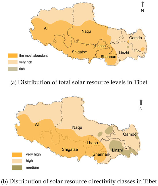
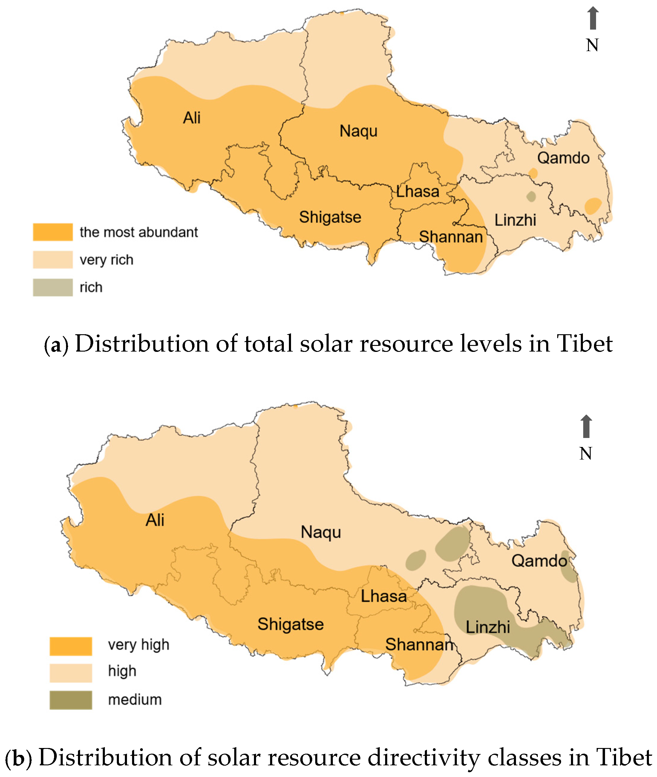
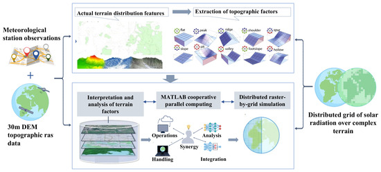
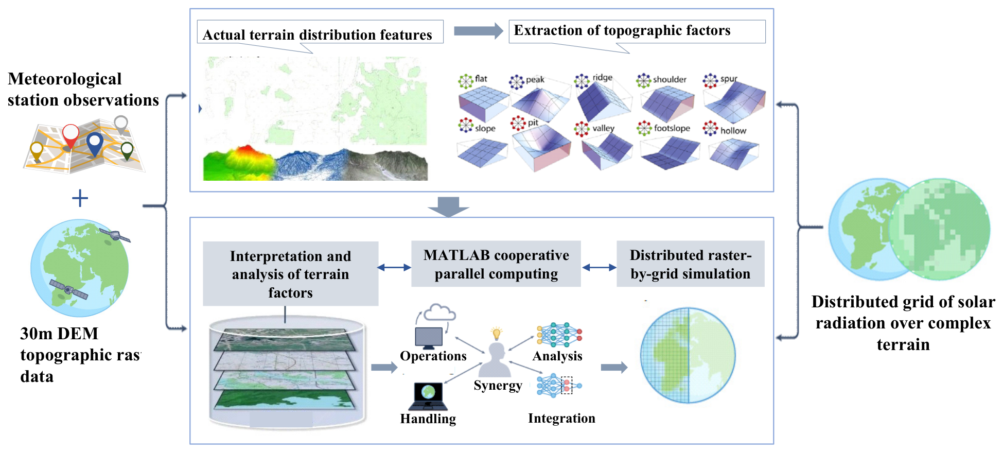
The study area is Lhasa (29.67° N, 91.13° E), a high-altitude city on the Qinghai–Tibet Plateau. The local climate is classified as cold and dry (Köppen–Geiger Dwb [40]; GB50178-93 [41] cold zone), with low annual precipitation (200–510 mm) concentrated in May-September. Key features include low temperatures, high diurnal ranges, low humidity, and strong, persistent solar radiation [37]. Atmospheric transparency is high due to thin, clean air. With annual solar radiation reaching 6000–8000 MJ/m2 [38], the area is classified as most resource-abundant under Chinese national standards ([42] GB/T 31155-2014) [13,43]. Lhasa is situated within Tibet’s Class A direct-radiation zone, covering 47.7% of the region (Figure 1).
Figure 1.
Flowchart showing the methodology applied in this study.
2.1.2. The Topography and the Geomorphic Features of Lhasa
The topography of the Qinghai–Tibet Plateau is highly complex and heterogeneous. Within the Lhasa area alone, three dominant topographic types are identified: high mountain valleys (Nimu County), plateau meadows (Damxung County), and river valley plains (Lhasa River basin) [44]. The valley plains (3650–3900 m elevation) descend gently from northeast to southwest. Here, the Lhasa River forms a wide channel with developed terraces and alluvial fans. The high mountains and deep gorges are distributed as a mosaic, with a slight slope from northeast to southwest [45]. This rugged terrain, characteristic of this agropastoral zone, significantly constrains human settlement and activity to confined areas [39,46].
2.1.3. Data Sources and Descriptions
- (1)
- Digital elevation model data
A 30 m resolution ASTER GDEM (http://www.gscloud.cn) served as the topographic base. The ASTER GDEM raster dataset, with a spatial resolution of 30 m × 30 m, served as the primary topographic base. ENVI 5.6 software was employed to extract the longitude, latitude, elevation, slope, and aspect for each raster point. To mitigate the impact of negative or null values in marginal areas on calculations, a terrain attribute classification method was applied. This method determined actual elevation values by analyzing the differential between the central grid point and its eight neighboring points [47].
- (2)
- Meteorological observation data
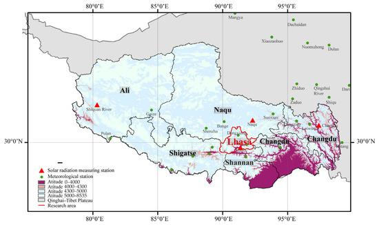
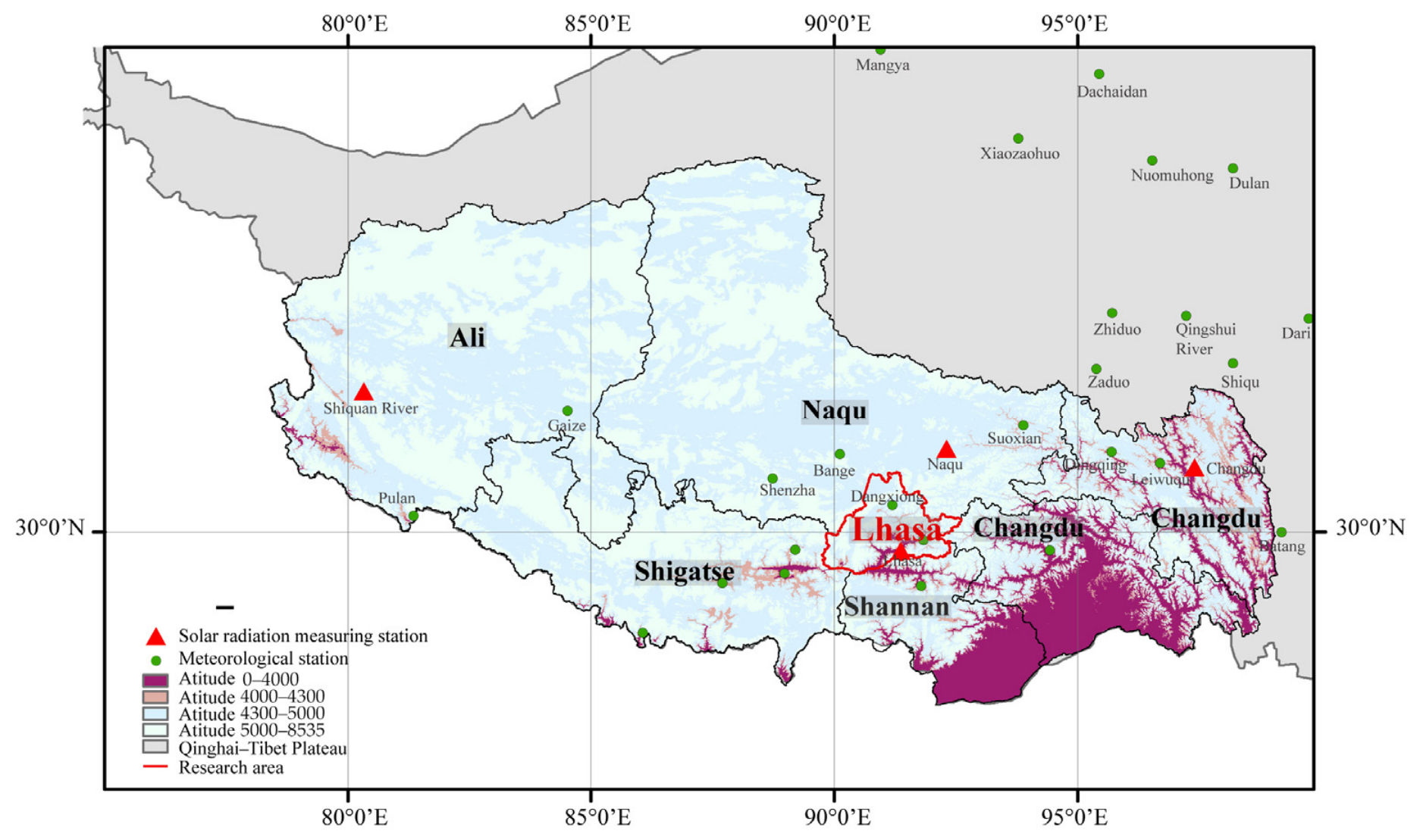
Meteorological data were obtained from the Fundamental Data Sharing Platform for Building Energy Efficiency Design, Xi’an University of Architecture and Technology (https://buildingdata.xauat.edu.cn), which originated from the “Research on Basic Parameters for Energy-saving Building Design” project under China’s 13th Five-Year Plan National Key R&D Program [48]. This study utilized observations from 26 standard meteorological stations and 4 dedicated solar radiation stations within the Tibet Autonomous Region (TAR). The dataset was subjected to stringent quality control: Records with global solar radiation greater than extraterrestrial solar radiation were eliminated, and radiation data unaccompanied by conventional meteorological parameters were filtered out by matching with sunshine percentage records. Subsequently, a validated meteorological database was generated. The sunshine percentage on a 1 km × 1 km grid was obtained through inverse distance weighting (IDW) interpolation of station data. The topographic context and distribution of the meteorological stations in the Lhasa area are presented in Figure 2.
Figure 2.
The topographic environment and distribution of meteorological observation stations in the Lhasa Autonomous Region.
- (3)
- MODIS data product
This study utilized the MOD09A1 surface reflectance product from the Terra satellite, part of the MODIS series, which provides a long-term record (2000–2019) over the Qinghai–Tibet Plateau. The dataset was obtained from the U.S. Geological Survey (USGS) Earth Explorer platform (https://earthexplorer.usgs.gov/). It features a spatial resolution of 500 m and a daily temporal resolution. Using the GDAL tools, the tile-based data were mosaicked and reprojected to a unified geographic coordinate system. The digital number values were converted to actual surface reflectance by applying a scale factor of 0.0001. Pixels with the fill value (−28,672) were identified and excluded as invalid data. The preprocessed surface reflectance data were subsequently used to retrieve the land surface albedo for the study area. The detailed descriptions, spatial/temporal resolutions, and sources of all data products used in this study are summarized in Table 1.
Table 1.
Multi-source spatial and meteorological datasets utilized for topographical analysis and solar radiation modeling in Lhasa.
2.2. Data Processing Method
Figure 3 illustrates the methodological workflow developed in this study to simulate and attribute high-resolution direct solar radiation over complex terrain. High-relief alpine landscapes like Lhasa exhibit pronounced spatial heterogeneity and substantial data volume across 30 m grid scales, making conventional serial computation computationally prohibitive for regional-scale micro-topographic simulations. To resolve this computational bottleneck, we established a parallel processing architecture within the MATLAB 2024a computational framework. Multi-source datasets, including interpolated station observations and ASTER GDEM raster layers, are dynamically processed to extract discrete micro-geomorphological components such as slope, aspect, sky view factor, and dynamic hillshade occlusion matrices. These extracted variables are integrated into the raster-based distributed radiation model to execute cell-by-cell numerical simulations, effectively improving processing throughput while preserving fine-scale topographic boundary details.
Figure 3.
Methodological framework for 30 m distributed solar radiation simulation and spatial attribution over complex alpine terrain based on parallel computing and multi-source geodata integration.
2.3. The Distributed Models for ESR in Terrain
Extraterrestrial solar radiation (ESR) over complex terrain was defined as the maximum theoretical radiation at a location [49], considering topographic occlusion but excluding atmospheric effects [50]. For any raster pixel, its sunlit condition at a given time is determined by its solar elevation and azimuth angles, as well as the horizon angle (the elevation angle of the surrounding terrain in the sun’s direction) [1]. By accumulating the insolation duration over the method of segmental integration within a day, the daily ESR for a pixel was calculated as:
where T is the duration of the day, i.e., 1440 min; E0 is the eccentricity correction factor; is the revised distance factor for solar-terrestrial; is the solar constant, 0.082 MJ·m−2.min−1; m is the number of sunrise-to-sunset segments according to the time step, which was set to 20 min in this research; and and are the starting and ending solar time angle of the slope during the illuminable period. The daily astronomical radiation was calculated by adding up the illuminable hours and further integrating them to obtain the monthly, seasonal, and annual astronomical radiation [1,49].
In the above equations, is the day angle (rad); and are characteristic parameters related to geographical and topographic features; represents the slope angle, i.e., the angle between the slope surface and the horizontal plane; and is the aspect, defined as the angle between the normal of the slope and the meridian. In this study, the aspect is set to be positive in the clockwise direction.
Terrain shading refers to the calculation of occlusion caused by topography at a specific orientation and time angle [50]. The hillshade function in ArcGIS 10.8 is applied to calculate the effect of solar radiation on the surrounding terrain, and the basic principle is to evaluate the effect of solar radiation on the terrain by calculating the assumed brightness of the surface based on a specified solar altitude for each grid cell [51,52]. The resulting output is an integer grayscale gradient between 0 and 255. By modeling these hillshade values, pixels with a value of 0 are identified as masked; while those between 1 and 255 are reclassified as 1(illuminated), yielding an array of masking functions . The status of two adjacent elements can be classified into four groups (Table 2).
Table 2.
Transition states and physical definitions of adjacent elements in the terrain shading function array.
2.4. Distributed Model of DSR in Complex Terrain
Direct radiation is the predominant component in the Lhasa region, which is categorized under Zone A of the Tibetan direct radiation ratio scale. Consequently, the spatial distribution of DSR is a critical factor in determining how topographic features influence the total radiation reaching the ground [53]. Derived from slope radiation models, the DSR in complex terrain is calculated as follows:
In the above formula, Q0αβ represents the amount of DSR in complex terrain, while Qbαβ denotes the DSR on a horizontal surface; Q0 is the amount of astronomical radiation in the horizontal plane; and Qb is the amount of DSR in the horizontal plane. All radiation components are expressed in units of MJ/m2. Rb is the ratio of astronomical radiation in undulating terrain to astronomical radiation in the horizontal plane. When Rb equals 1, the astronomical radiation on the complex terrain is identical to that on the horizontal surface. The variability of the curve characterizes the extent to which topographic factors influence astronomical radiation. Specifically, more pronounced fluctuations signify a greater topographic impact, whereas a smoother curve indicates a diminished effect.
2.5. Calculation of Spatial Topographic Factors
2.5.1. The Surface Albedo Calculation Method
Surface albedo cannot be directly measured by satellite-borne sensors, which instead record the directional radiance from the Earth–atmosphere system. Consequently, a series of retrieval processes is required to derive the actual albedo. First, atmospheric correction is performed on the upward radiance observed by the satellite. Subsequently, the corrected radiance is converted into surface upward radiation to calculate the surface albedo. In this study, the conversion from narrow-band to broad-band albedo was implemented using the algorithm developed by Liang [54]. This method accounts for the solar radiation spectrum and the filter transmittance function of each band to calculate the short-wave and visible albedo, respectively.
2.5.2. The SVF Calculation Method
In complex terrain, the openness of a specific location depends on the degree of mutual shading by surrounding topographic features. Consider the openness of a mountain in a single orientation V. Let the maximum spherical crown at any point P under undulating terrain in any orientation be S spherical crown and the area of the hemisphere be S hemisphere, then the formula for the openness of the terrain is
is the maximum masking angle of a grid on a given orientation to point P. The topographic openness at point P is the average of the sum of the integrals of the azimuthal values within the circumference of 2π circles; is the number of azimuthal dispersions and is taken as 72 for this study.
2.6. The Method of GD
The geographical detector is a statistical method to detect the spatial stratified heterogeneity and reveal the driving factors behind it [55]. The method can quantify the main drivers of a spatial–temporal phenomenon and the interactions between different drivers, making the Geo-detector more efficient than other spatial heterogeneity detection tools. The method assumes that there is a statistical correlation between the dependent variable and the independent variable when they are spatially distributed in the same trend.
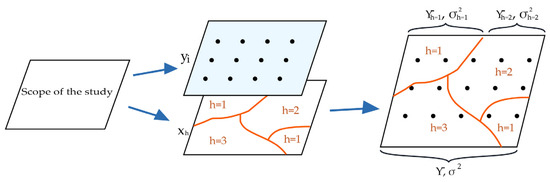
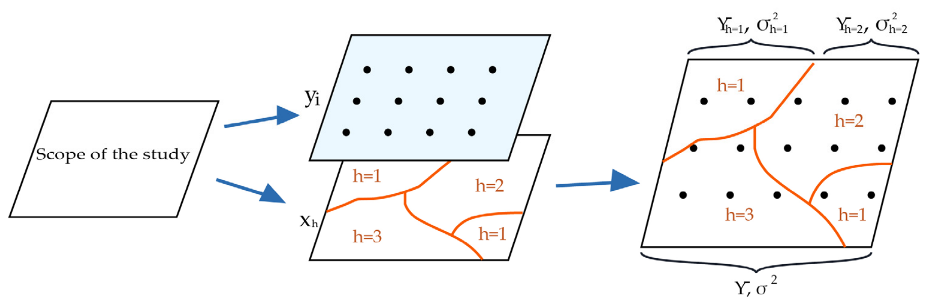
As illustrated in Figure 4, the spatial domain is stratified into distinct sub-regions according to classified environmental and micro-topographic drivers, such as elevation belts, slope gradients, aspect orientations, and sky view factor intervals. The factor detector evaluates the strength of these drivers by measuring whether the dispersion of solar radiation within each individual stratum is significantly smaller than the total spatial variance across the entire study area. A higher proportion of variance explained indicates that the selected topographic stratum exerts a dominant control on surface irradiance. Through this framework, the model rigorously quantifies the independent explanatory contribution of each environmental factor while uncovering non-linear interactive synergies among coupled terrain variables.
Figure 4.
The principle of geographical detector.
The most central model of the GD is factor detection, which reflects the degree of influence of each factor on DSR by the magnitude of the explanatory power or contribution of the factor, as measured by the q-value, which is given by:
In the above formula, N is the number of sample units across the study area, σ2 is the discrete variance of the independent variables across the study area, h is the partitioning of the variables Y and X, and L is the number of partitions and takes on values ranging from 0 to 1. The larger the value, the stronger the explanatory power and contribution of the factor to the spatial partitioning of solar radiation production, and the weaker the opposite [56].
3. Results and Discussion
In this section, we present the spatial characteristics of solar radiation over the complex terrain of Lhasa, simulated using the high-resolution distributed modeling framework established in Section 2. The analysis follows a logical progression: first, we characterize the spatial distribution of key terrain factors; second, we simulate the spatial–temporal distribution of ESR and DSR; and finally, we quantify the relative contributions and interactions of various topographic and surface factors using the GD model. This structured approach aims to elucidate the mechanisms by which rugged topography modulates solar energy availability, providing a comprehensive basis for the refined assessment of solar resources on the Qinghai–Tibet Plateau.
3.1. Extraction and Spatial Distribution of Each Terrain Factor
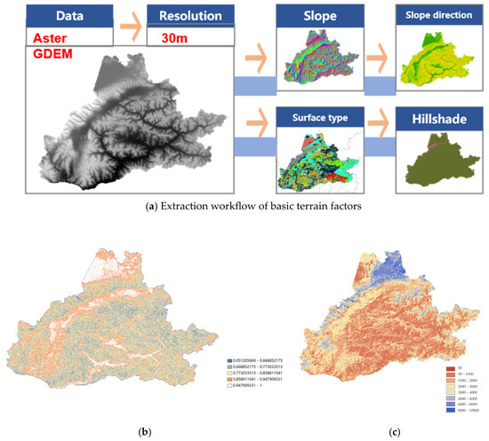
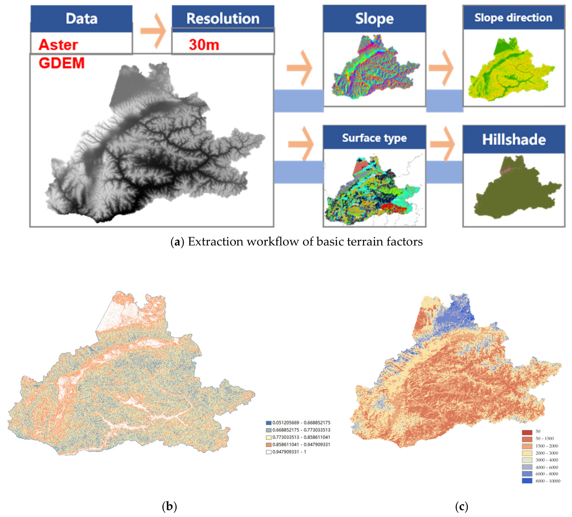
The information contained in the DEM terrain information data as a set of two-dimensional signals is extracted using a layer-by-layer approach by introducing a terrain decomposition method to obtain microscopic terrain components with different physical significance [57]. Meanwhile, the raster resolution of the DEM is an important spatial scale parameter. In this study, DEM data with a higher resolution of 30 m were selected and various terrain factors were calculated separately, as shown below; these factors were used as input conditions to determine the degree of accuracy of the terrain data rendering (Figure 5). Compared with coarse-resolution DEMs (≥90 m) that often smooth rugged ridge crests and underestimate valley incision depth by 15–30% [16,29], the 30 m resolution captures fine-scale micro-topographic variations and effectively prevents the systematic overestimation of sky openness in deeply incised valleys.
Figure 5.
Spatial distribution of 30 m micro-topographic and land-surface factors in the Lhasa region: (a) extraction workflow of basic terrain factors (slope, aspect, surface type, and hillshade) based on ASTER GDEM; (b) SVF; and (c) monthly mean surface albedo for July 2019 derived from MODIS observations.
The spatial distribution of topographic factors, including slope, aspect, and SVF, reveals the inherent geomorphological heterogeneity of the Lhasa region. As shown in Figure 5a, the slope distribution is predominantly concentrated in the steep-sided valleys flanking the Lhasa River, where high-gradient areas (>35°) correlate with intensive geomorphic erosion processes. The aspect distribution reflects the complex fold-and-thrust structures of the surrounding mountains, characterized by a significant contrast between sun-facing (southern/southwestern) and shaded slopes. Furthermore, as depicted in Figure 5b. SVF values, which quantify the proportion of unobstructed hemispherical sky, are notably lower (SVF < 0.6) in deeply incised, narrow canyons compared to expansive plateau basins (SVF > 0.9). This spatial variability has direct physical significance: the convergence of low SVF in high-slope areas indicates that these regions suffer from substantial self-shadowing and terrain-induced radiation occlusion. In addition to geometric terrain features, surface albedo serves as an essential land-surface boundary condition governing terrain-reflected radiation and energy partitioning. Given that MODIS albedo products exhibit strong agreement with in situ pyranometer observations [58], this dataset was incorporated to characterize spatial albedo dynamics, with Figure 5c illustrating the monthly mean surface albedo distribution grid for July 2019. The extracted low SVF in canyon bottoms (SVF < 0.6) and the spatial gradient of surface albedo (0.12–0.65 from valley floors to glaciated peaks) agree closely with the terrain parameterization and ground validation results reported across the Tibetan Plateau by Kumar and Skidmore [31] and Chen et al. [58].
3.2. Distributed Grid Study of DSR in Lhasa Under Actual Topography
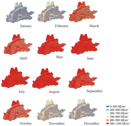
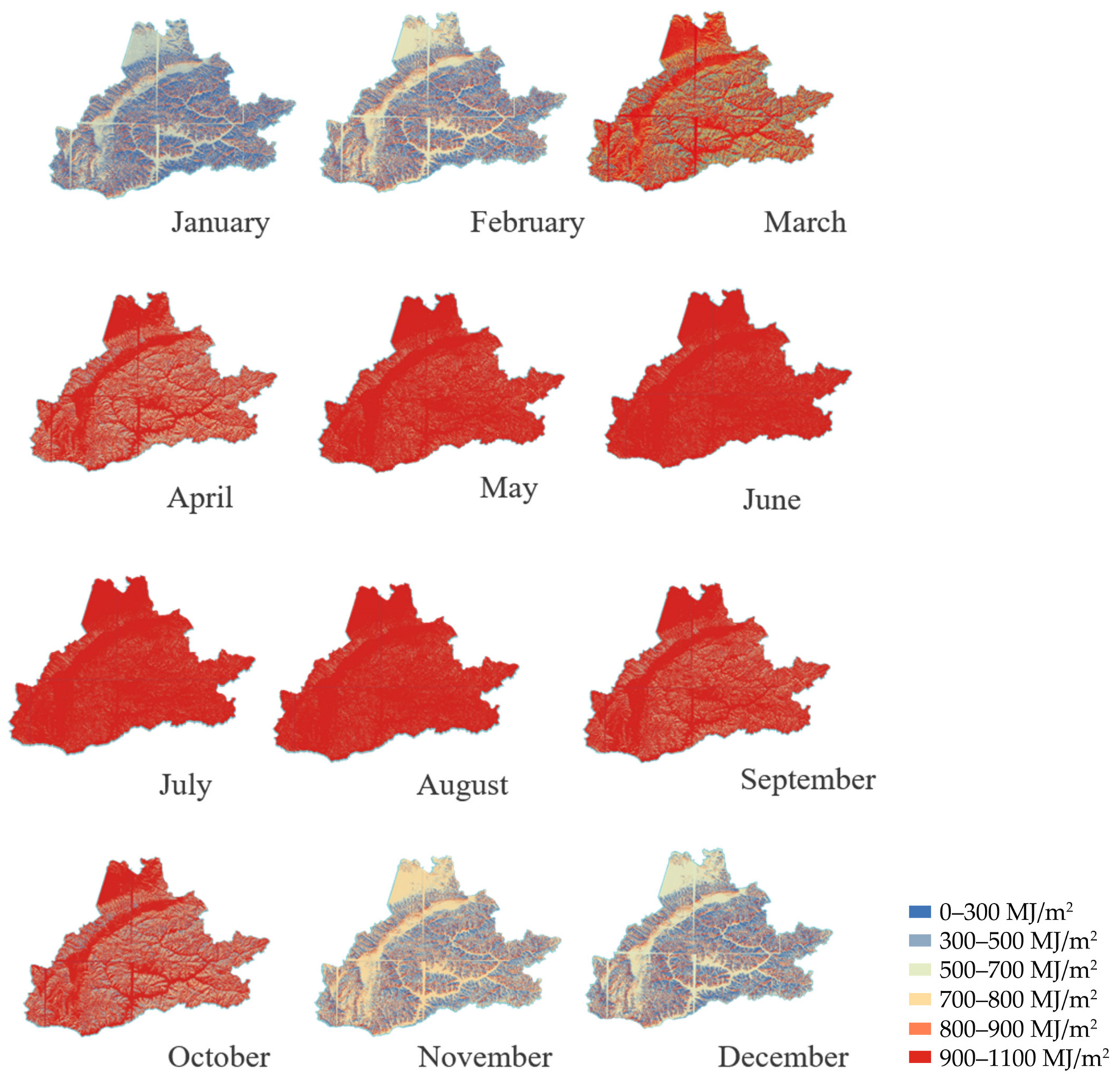
The 30 m resolution DEM data used in this study is a more accurate representation of the actual surface conditions, which has been demonstrated in previous studies and can effectively improve the calculation accuracy in areas with fewer local undulations. Using MATLAB, monthly extraterrestrial radiation was simulated across nine representative DEM sub-regions in Lhasa. Figure 6 presents the monthly accumulated solar radiation (MJ/m2) across the Lhasa region, computed cell-by-cell at a 30 m spatial resolution by incorporating dynamic solar zenith angles, terrain self-shadowing, and inter-mountain occlusion throughout the annual cycle. Temporally, the regional monthly radiation exhibited a distinct unimodal trend: the monthly mean peaked in July at 1190 MJ/m2 and reached its minimum in December 469 MJ/m2, with monthly values consistently exceeding 1000 MJ/m2 from April through August. This annual range and unimodal trajectory align well with the extraterrestrial and surface solar radiation baseline calculated across China by Lin et al. [49] and Ma et al. [26].
Figure 6.
Monthly spatial distributions of total solar radiation (MJ/m2) across the complex terrain of Lhasa at a 30 m grid resolution simulated by the distributed radiation model.
Spatially, the degree of topographic radiation modulation varied markedly with seasonal shifts in solar elevation angles. During the winter months (such as December and January), low solar elevation angles exacerbated terrain shading, creating sharp radiation disparities where deep valleys and north-facing slopes received less than 500 MJ/m2, while unobstructed ridges received substantially higher irradiance (>800 MJ/m2). In contrast, higher solar elevation angles between May and August substantially reduced terrain obstruction effects, resulting in monthly totals exceeding 900 MJ/m2 across most valley basins and open plateau plains. This localized 35–50% winter radiation deficit in narrow valleys corroborates the 3D topographic radiative transfer simulations of Liou et al. [39], confirming that rugged topography significantly modulates solar radiation receipt.
During winter, the solar elevation angle is at its minimum, leading to a substantial elongation of terrain-induced shadows. In this period, the “shadowing mask” created by the rugged topography is most effective, causing high-gradient terrain areas to become primary barriers to DSR. Conversely, during summer, the high solar elevation angle minimizes the impact of topographic occlusion, allowing radiation to penetrate deep into the narrow valleys. This seasonal modulation reveals that in high-altitude environments like Lhasa, the terrain acts as a dynamic seasonal regulator of solar energy [59]. The spatial heterogeneity of DSR is therefore most pronounced when the sun is low in the sky, as the self-shadowing effect of deep valleys (where SVF is low) disproportionately reduces the received radiation, leading to the high spatial variance observed in our simulations. This mechanism underscores the necessity of high-resolution topographic correction in solar energy assessment for mountainous regions.
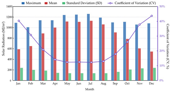
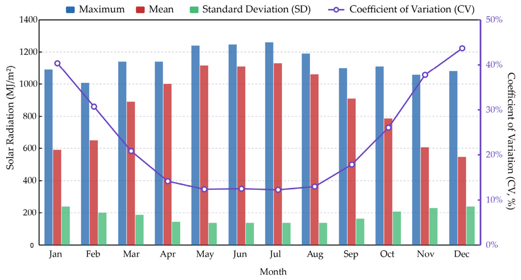
To further quantify the spatial dispersion and seasonal fluctuations of regional solar radiation, the monthly mean, standard deviation, and coefficient of variation (CV) were evaluated (Figure 7). The CV quantifies the spatial dispersion and relative variability of a given variable across a study region, mathematically defined as the ratio of the standard deviation to the mean. Based on established statistical classification criteria, the degree of spatial variability is categorized into three distinct levels: weak variability (CV < 10%); moderate variability (10% ≤ CV ≤ 100%); and strong variability (CV > 100%).
Figure 7.
Monthly statistical characteristics of simulated solar radiation (maximum, mean, and standard deviation, MJ/m2) and spatial coefficient of variation (CV, %) across the Lhasa region.
As illustrated in Figure 7, the monthly statistical metrics of regional solar radiation, including the maximum value, mean value, standard deviation, and coefficient of CV, demonstrate distinct seasonal dynamics across the annual cycle. The spatial CV exhibits a pronounced seasonal trajectory, remaining at its lowest level during the summer months (reaching the annual minimum between May and August at approximately 12%) and peaking in December (exceeding 43%).
In July, the spatial distribution of solar radiation shows minimal variability along the north-to-south gradient, indicating that local slope aspect serves as the dominant governing factor while the macro-scale influence of latitude remains relatively minor. In contrast, this latitudinal disparity becomes substantially more pronounced in December. This marked seasonal divergence is driven by the coupled interaction between latitude and slope orientation. Because the solar elevation angle reaches its annual minimum in December, terrain self-shadowing and obstruction effects induced by rugged relief are substantially intensified, which greatly magnifies spatial heterogeneity across the region and leads to the highest recorded CV.
3.3. Distributed Grid Study of Direct Radiation in Lhasa Under Actual Topography
Since solar resources across the Qinghai–Tibet Plateau are dominated by direct irradiance, the ratio of clear-sky direct radiation on an inclined surface to that on an unobstructed horizontal surface is defined as the terrain factor (Rb). In this research, we use the ArcGIS 10.8 systematic fishnet sampling grid tool, and nearly 40,000 fishing net points data were selected, with each point spaced about 500 m apart, to extract topographic decomposition factors such as longitude, latitude, elevation, elevation, slope, and aspect of the fishing net points, and to conduct correlation and geostatistical studies respectively. According to the formula for calculating DSRs on slopes, the analysis of the influence of topographic factors on DSRs is the same as the influence of topographic factors on solar astronomical radiation, and the influence of topographic factors does not correlate with the direct atmospheric transmittance.
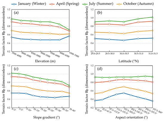
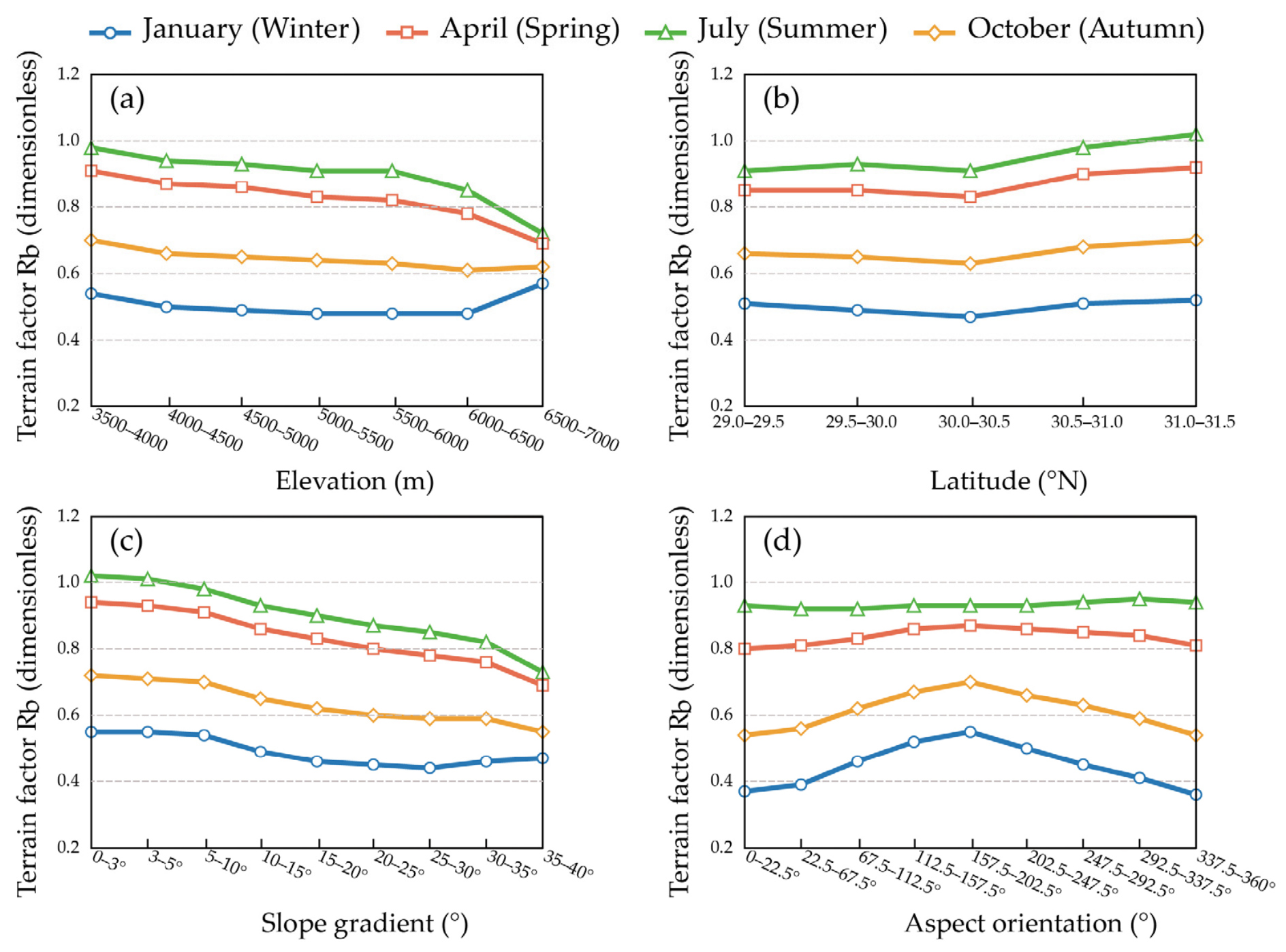
The responses of Rb across discrete topographic gradients throughout four representative months (January, April, July, and October) are illustrated in Figure 8.
Figure 8.
Relationships between the terrain factor (Rb, dimensionless) and key topographic variables across representative seasonal months (January, April, July, and October): (a) elevation effects; (b) latitudinal variations; (c) slope gradient responses; and (d) aspect orientation dynamics. Data were extracted from a systematic fishnet grid of approximately 40,000 sample points spaced at 500 m intervals across Lhasa.
- (a)
- Elevation effects (Figure 8a)
In July, Rb values for elevations below 6500 m remain close to 1.0, indicating that gentle terrain at moderate altitudes receives solar exposure comparable to horizontal plains. In January, Rb across all elevation zones falls below 1.0 due to prevailing low solar elevation angles. Across all seasons, Rb gradually declines in high-altitude zones exceeding 6500 m. Unlike traditional elevation-only empirical models that assume a monotonic increase in solar radiation with altitude due to atmospheric thinning [14,19], our high-resolution results reveal that severe ridge self-shadowing and steep summit terrain above 6500 m offset atmospheric transparency gains, leading to a net reduction in direct irradiance.
- (b)
- Latitudinal variations (Figure 8b)
The topographic factor Rb rises with increasing latitude, with particularly significant changes in July and little fluctuation in January, indicating that the effect of latitude on Rb is stronger in summer. This seasonal shift occurs because the northward migration of the sun in summer enhances the exposure of north-facing slopes, thereby creating a latitude-dependent gradient in terrain-induced radiation redistribution.
- (c)
- Slope gradient responses (Figure 8c)
The relationship between Rb and slope gradient is distinctly non-linear. As the slope steepens from 0° to 40°, Rb values in January remain well below 1.0 and decrease continuously as self-shading intensifies. In contrast, high solar elevation angles in July allow moderate and steep slopes to receive substantial irradiance, with Rb remaining near 1.0 across gentle slopes before decreasing on gradients steeper than 25°. This non-linear seasonal inversion between slope gradient and solar altitude is fully consistent with the theoretical derivations of Corripio [50] and empirical observations of Zhang et al. [28].
- (d)
- Aspect orientation dynamics (Figure 8d)
Aspect-driven radiation variation is muted during April and July, but becomes the dominant governing factor in January, where Rb exhibits a pronounced convex curve peaking on south-facing slopes (Rb = 0.55) and reaching its minimum on shaded northern slopes (Rb = 0.36), confirming that south-facing slopes act as critical thermal corridors in winter [44].
3.4. Spatial Stratified Heterogeneity Attribution of Solar Radiation Drivers
To quantitatively identify the environmental controls governing the DSR and evaluate their interactive mechanisms across complex terrain, this study employed the GD model. The GD calculates the power of determinant (q-value) to evaluate how effectively individual terrain and surface parameters account for the spatial variance of surface irradiance. In high-altitude mountainous landscapes, solar energy distribution reflects a coupled topographic-climatic system rather than the isolated influence of a single variable. Simulated clear-sky DSR for January 2019 was designated as the target-dependent variable (Y), while six environmental parameters served as explanatory independent variables (X1 to X6), including elevation (X1), slope gradient (X2), aspect orientation (X3), sky view factor (X4), surface albedo (X5), and normalized difference vegetation index (X6). To satisfy the algorithmic requirement of the GD model for stratified categorical inputs, continuous variables were discretized into 8 to 10 homogeneous strata using the Natural Breaks (Jenks) classification method, while aspect was partitioned into 8 standard directional categories (as shown in Table 3). A spatial dataset of 1000 random sampling points was generated across the Lhasa region using the ArcGIS spatial sampling module to extract cell values from both the continuous DSR raster and the stratified environmental factor layers. The coupled attribute table from these sample points was subsequently processed in the GD software (GeoDetector Pro v5.1.0) to execute factor attribution and multi-variable interaction detection.
Table 3.
Variable definitions, factor designations, and discretization schemes for spatial stratified heterogeneity attribution in the GD model.
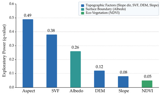
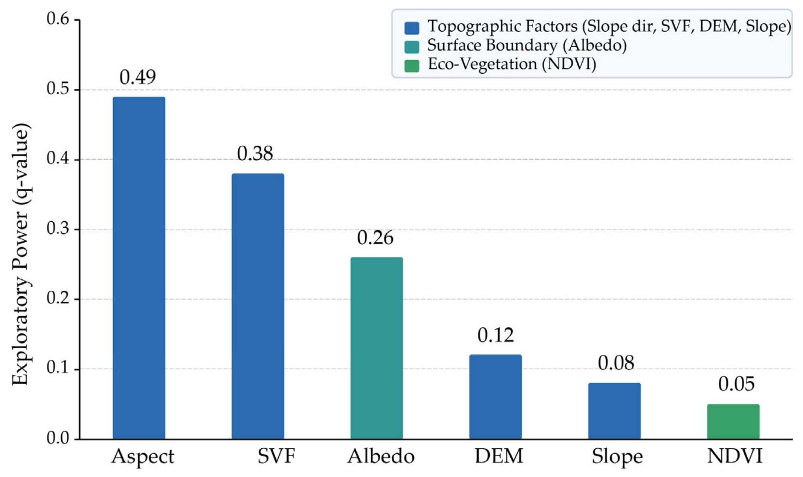
Among the examined environmental factors, single-factor detection results indicate that slope aspect (q = 0.49) and SVF (q = 0.38) exhibit the strongest explanatory power for DSR distribution (Figure 9), followed by surface albedo (q = 0.26), DEM (q = 0.12), slope (q = 0.08) and NDVI (q = 0.05). The substantial explanatory power of surface albedo stems from high-altitude winter snow cover, which enhances local terrain-reflected radiation and magnifies irradiance contrasts between sunlit and shaded slopes. Conversely, individual elevation and slope gradient exhibit relatively low independent q-values because, under the high atmospheric clearness of the plateau, altitude-dependent atmospheric attenuation is far less variable than immediate micro-topographic geometry. This hierarchy challenges the traditional premise of regional radiation models that treat elevation as the primary governing predictor [14,18]. Instead, it corroborates the micro-scale solar acquisition findings of Song et al. [38] and the mountain shading models of Xu et al. [21], demonstrating that aspect and SVF function as the primary physical gatekeepers governing mountain surface irradiance.
Figure 9.
Geographical detection analysis of influencing factors for solar radiation over complex terrain.
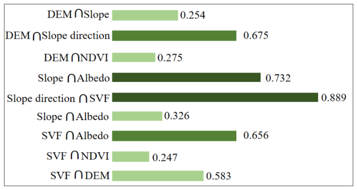
To further analyze the relationship between the various factors and DSRs, two-by-two interactions of the influencing factors were detected to analyze the interaction between the factors and the magnitude of their explanatory power for the solar radiation in the complex area, the results of which are shown in Figure 10.
Figure 10.
Geographical detection analysis of influencing factors for solar radiation.
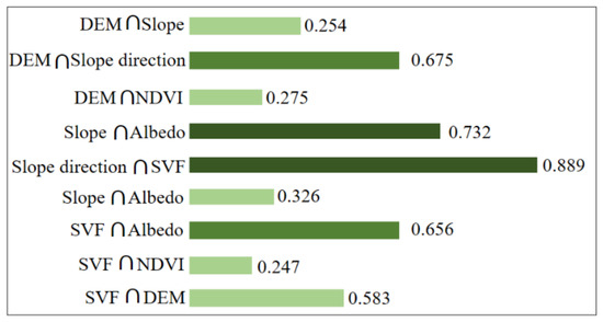
The interaction is analyzed by detecting and identifying the interaction between the two types of independently variable factors and whether they enhance or weaken the explanatory power of the total annual solar radiation at Lhasa. The results show that the solar radiation reaching the ground is the result of a combination of factors and that there is variability in the magnitude of the explanatory power of the two factors for solar radiation. The stronger explanatory power is for aspect ∩ SVF (q = 0.889), followed by slope ∩ Albedo (q = 0.732); the medium level is for DEM ∩ aspect (q = 0.675) and SVF ∩ Albedo (q = 0.656); and the remaining factors have less influence in the two-by-two interaction. This hierarchy confirms that in the high-altitude, rugged terrain of Lhasa, the geometric relationship between the surface normal vector and solar zenith angle primarily defined by slope and aspect acts as the fundamental “gatekeeper” of radiation receipt. Elevation, while traditionally cited for atmospheric attenuation, plays a secondary role compared to the immediate, high-resolution impacts of topographic shading and orientation-driven energy partitioning.
This phenomenon of “non-linear enhancement” is critical: it reveals that the coupling of factors produces a synergistic effect that exceeds the simple summation of individual contributions. Specifically, the interaction between aspect and SVF (q = 0.889) represents the most potent driver. This synergy suggests a “shading-slope coupling mechanism”: steep slopes establish the potential for radiation reception, whereas the degree of SVF acts as a dynamic modifier that determines the actual duration and intensity of illumination. Similarly, the significant interaction between slope and albedo (q = 0.732) highlights how surface properties and geometric configurations co-determine the final energy budget. These high q-values in interactive detection prove that surface solar radiation in mountainous areas is governed by multi-dimensional topographic constraints; therefore, empirical estimation models that rely on isolated indices often fail to capture the nuanced non-linear energy redistribution inherent to the Qinghai–Tibet Plateau’s complex geomorphology.
4. Conclusions
In the current reality of sparse ground-based solar radiation monitoring stations and the difficulty in refining the temporal resolution of remote sensing observations, this study leverages advanced digital terrain methods to correlate terrain factors with landscape characteristics, and to establish a reasonable spatial distribution model of solar radiation, which holds substantial theoretical and practical significance. Compared with the traditional horizontal solar radiation calculation model, the solar radiation distribution model in complex terrain can objectively reflect the influence of terrain undulation on radiation, and visually reflect the difference between radiation on sunny and shady slopes and the shading effect of the mountain itself and the surrounding terrain. The main quantitative findings are summarized as follows:
(1) Spatiotemporal Radiation Dynamics: Regional solar radiation exhibits a pronounced unimodal monthly trajectory, peaking in July at 1190 MJ/m2 (with local maxima reaching 1260 MJ/m2) and dropping to its minimum in December at 469 MJ/m2. Monthly accumulated values consistently exceed 1000 MJ/m2 from April through August. The coefficient of variation (CV) demonstrates marked seasonal divergence, remaining minimal during the summer months (approximately 12.0% from May to August) and peaking in December at 43.2%. During winter, low solar elevation angles elongate terrain-induced shadow masks, causing narrow valleys to suffer a 35–50% radiation deficit (<500 MJ/m2), whereas high summer solar elevation angles diminish topographic shading and allow irradiance to penetrate deeply into canyon basins (>900 MJ/m2).
(2) Topographic Modulation Factor (Rb) Responses: Topographic factor responses extracted across approximately 40,000 grid points reveal that elevation, slope, and aspect exert distinct seasonal controls on direct radiation. Below 6500 m, July Rb remains near 1.0 (0.92–0.98), but drops significantly at extreme elevations exceeding 6500 m (down to 0.72 in July and 0.51 in January) due to acute ridge self-shadowing. In winter, aspect acts as the decisive thermal regulator, creating a 52.8% relative irradiance gap between sunlit south slopes (Rb = 0.55) and shaded north slopes (Rb = 0.36), whereas summer Rb remains uniformly high (0.91–0.95) across all aspects.
(3) Spatial Heterogeneity Attribution and Non-Linear Enhancement: Geographical Detector attribution quantified the explanatory power hierarchy of single environmental drivers on January DSR as Aspect (q = 0.49) > SVF (q = 0.38) > Surface Albedo (q = 0.26) > DEM (q = 0.12) > Slope (q = 0.08) > NDVI (q = 0.05). All two-factor interactions exhibited non-linear enhancement, with the strongest synergy produced by Aspect ∩ SVF (q = 0.889) and Slope ∩ Albedo (q = 0.732). This proves that elevation alone (q = 0.12) is fundamentally insufficient for mountainous solar radiation estimation, and that micro-topographic geometry (aspect, SVF) coupled with land-surface reflectance (albedo) must be jointly parameterized.
Based on the above conclusions, this study suggests that the preferred factors for future empirical models for estimating surface solar radiation in complex mountainous terrain are aspect, SVF, and Albedo. The study also suggests that the use of elevation alone in the estimation of surface solar radiation in complex mountainous terrain is inadequate and the influence of surrounding terrain needs to be considered.
The limitations and Future Research Perspectives:
Although the developed framework provides high-resolution spatial datasets and theoretical insights for solar energy assessment in high-relief alpine regions, several limitations should be recognized, pointing to key priorities for future investigations:
(1) Incorporation of Real-Sky Atmospheric Dynamics: The present model primarily evaluates clear-sky extraterrestrial and direct solar radiation. In real alpine environments, dynamic cloud cover, cloud optical thickness, and aerosol scattering induce substantial temporal fluctuations in diffuse radiation fractions. Future work will integrate all-weather radiative transfer schemes with high-frequency geostationary meteorological satellite observations (such as Fengyun-4 or Himawari series) to achieve real-sky, time-continuous direct and diffuse irradiance simulations.
(2) Cross-Scale Topographic and Micro-Environmental Coupling: While the 30 m grid resolution successfully captures regional landform features, it does not fully resolve sub-grid micro-scale terrain roughness, vegetation canopy interception, and localized urban geometric structures. Subsequent research should incorporate multi-platform UAV-LiDAR point clouds and high-resolution building surface models to bridge macro-regional solar resource mapping with micro-scale building envelope and photovoltaic array simulations.
(3) Integration with Sustainable Energy Planning and Decision-Support Platforms: Future research will focus on embedding these high-resolution distributed radiation datasets into spatial multi-criteria decision-support systems (SDSS). This will enable refined photovoltaic site optimization, terrain-adaptive array inclination design, passive solar architectural optimization, and ecological carrying capacity assessments, directly supporting renewable energy transitions and regional carbon-neutrality targets across the Qinghai–Tibet Plateau.
Author Contributions
Conceptualization, B.H.; Methodology, B.H.; Software, Z.L.; Formal analysis, B.H.; Investigation, Z.L. and Y.L.; Resources, Q.C.; Data curation, Q.C. and Y.L.; Writing—original draft, B.H.; Visualization, Z.L. All authors have read and agreed to the published version of the manuscript.
Funding
This work was financially supported by the National Natural Science Foundation of China General Program (No. 52578046), and “the 14th Five-Year” National Science and Technology Major Project of China (No. 2022YFC3802701).
Institutional Review Board Statement
Not applicable.
Informed Consent Statement
Not applicable.
Data Availability Statement
The original contributions presented in this study are included in the article. Further inquiries can be directed to the corresponding author.
Acknowledgments
The authors would like to express their sincere gratitude to Liu Yang (Xi’an University of Architecture and Technology) for her insightful guidance, constructive advice, and valuable support throughout this research.
Conflicts of Interest
The authors declare no conflict of interest.
Abbreviations
| MODIS | moderate-resolution imaging spectroradiometer |
| DSSR | downward surface shortwave radiation |
| DSR | direct solar radiation |
| DEM | digital elevation model |
| GD | geographical detector |
| SRTM | shuttle radar topography mission |
| SVF | sky view factor |
| CV | coefficient of variation |
| NDVI | normalized difference vegetation index |
| LULC | land use and land cover |
| GIS | geographical information system |
| ESR | extraterrestrial solar radiation |
| SD | standard deviation |
References
- Dozier, J.; Frew, J. Rapid calculation of terrain parameters for radiation modeling from digital elevation data. IEEE Trans. Geosci. Remote Sens. 1990, 28, 963–969. [Google Scholar] [CrossRef] [Scilit]
- Song, Y.C.; Ju, S.; Shen, P.Y. A review of studies and modeling of solar radiation on human thermal comfort in outdoor environment. Build. Environ. 2022, 214, 108891. [Google Scholar] [CrossRef] [Scilit]
- Huang, G.H.; Li, Z.Q.; Li, X.; Liang, S.L.; Yang, K.; Wang, D.D.; Zhang, Y. Estimating surface solar irradiance from satellites: Past, present, and future perspectives. Remote Sens. Environ. 2018, 233, 111371. [Google Scholar] [CrossRef] [Scilit]
- Fernández-Ahumada, L.M.; Ramírez-Faz, J.; López-Luque, R.; Márquez-García, A.; Varo-Martínez, M. A Methodology for Buildings Access to Solar Radiation in Sustainable Cities. Sustainability 2019, 11, 6596. [Google Scholar] [CrossRef] [Scilit]
- Wang, T.X.; Yan, G.J.; Mu, X.H.; Jiao, Z.H.; Chen, L.; Chu, Q. Toward operational shortwave radiation modeling and retrieval over rugged terrain. Remote Sens. Environ. 2018, 205, 419–433. [Google Scholar] [CrossRef] [Scilit]
- Tang, N.N.; Zhang, Y.N.; Niu, Y.G.; Du, X.Z. Solar energy curtailment in China: Status quo, reasons, and solutions. Renew. Sustain. Energy Rev. 2018, 97, 509–528. [Google Scholar] [CrossRef] [Scilit]
- Qiu, R.J.; Liu, C.W.; Cui, N.; Gao, Y.; Li, L.A.; Wu, Z.J.; Jiang, S.Z.; Hu, M. Generalized Extreme Gradient Boosting model for predicting daily global solar radiation for locations without historical data. Energy Convers. Manag. 2022, 258, 115488. [Google Scholar] [CrossRef] [Scilit]
- Qiu, R.J.; Li, L.A.; Wu, L.F.; Agathokleous, E.; Liu, C.W.; Zhang, B.Z.; Luo, Y.F.; Sun, S.L. Modeling daily global solar radiation using only temperature data: Past, development, and future. Renew. Sustain. Energy Rev. 2022, 163, 112511. [Google Scholar] [CrossRef] [Scilit]
- Tang, B.H.; Li, Z.L.; Zhang, R.H. A direct method for estimating net surface shortwave radiation from MODIS data. Remote Sens. Environ. 2006, 103, 115–126. [Google Scholar] [CrossRef] [Scilit]
- Husi, L.T.; Shi, J.C.; Li, M.; Wang, T.X.; Shang, H.Z.; Lei, Y.H.; Ji, D.B.; Wen, J.G.; Yang, K.; Chen, L.F. A review of the estimation of downward surface shortwave radiation based on satellite data: Methods, progress, and problems. Sci. China Earth Sci. 2020, 63, 774–789. [Google Scholar] [CrossRef] [Scilit]
- Hissou, H.; Benkirane, S.; Guezzaz, A.; Azrour, M.; Beni-Hssane, A. A Novel Machine Learning Approach for Solar Radiation Estimation. Sustainability 2023, 15, 10609. [Google Scholar] [CrossRef] [Scilit]
- Ramírez-Rivera, F.A.; Guerrero-Rodríguez, N.F. Ensemble Learning Algorithms for Solar Radiation Prediction in Santo Domingo: Measurements and Evaluation. Sustainability 2024, 16, 8015. [Google Scholar] [CrossRef] [Scilit]
- Chen, L.; Yan, G.J.; Wang, T.X.; Ren, H.Z.; Calbó, J.; Zhao, J.; McKenzie, R. Estimation of surface shortwave radiation components under all sky conditions: Modeling and sensitivity analysis. Remote Sens. Environ. 2012, 123, 457–469. [Google Scholar] [CrossRef] [Scilit]
- Liu, M.; Bárdossy, A.; Li, J.; Jiang, Y. GIS-based modelling of topography-induced solar radiation variability in complex terrain for data sparse region. Int. J. Geogr. Inf. Sci. 2012, 26, 1281–1308. [Google Scholar] [CrossRef] [Scilit]
- Cao, Q.M.; Yang, L.; Liu, Y.; Wang, S.Y. Development criterion of estimating hourly global solar radiation for all sky conditions in China. Energy Convers. Manag. 2023, 284, 116946. [Google Scholar] [CrossRef] [Scilit]
- Wang, L.G.; Wang, K.C. Impacts of Dem Uncertainty on Estimated Surface Solar Radiation and Extracted River Network. Bull. Am. Meteorol. Soc. 2015, 96, 297–304. [Google Scholar] [CrossRef] [Scilit]
- Wen, J.G.; Liu, Q.; Xiao, Q.; Liu, Q.H.; You, D.Q.; Hao, D.L.; Wu, S.B.; Lin, X.W. Characterizing Land Surface Anisotropic Reflectance over Rugged Terrain: A Review of Concepts and Recent Developments. Remote Sens. 2018, 10, 370. [Google Scholar] [CrossRef] [Scilit]
- Ghazouani, N.; Bawadekji, A.; El-Bary, A.A.; Elewa, M.M.; Becheikh, N.; Alassaf, Y.; Hassan, G.E. Performance Evaluation of Temperature-Based Global Solar Radiation Models—Case Study: Arar City, KSA. Sustainability 2022, 14, 35. [Google Scholar] [CrossRef] [Scilit]
- Paulescu, M.; Paulescu, E.; Gravila, P. Modeling Solar Radiation at the Earth Surface. In Weather Modeling and Forecasting of PV Systems Operation; Springer: London, UK, 2008; Volume 103, pp. 127–179. [Google Scholar]
- Clementi, M.; Dessì, V.; Podestà, G.M.; Chien, S.-C.; Wei, B.A.T.; Lucchi, E. GIS-Based Digital Twin Model for Solar Radiation Mapping to Support Sustainable Urban Agriculture Design. Sustainability 2024, 16, 6590. [Google Scholar] [CrossRef] [Scilit]
- Xu, L.; Li, Y.; Wang, X.; Liu, L.; Ma, M.; Yang, J. A Machine Learning Approach to Estimating Solar Radiation Shading Rates in Mountainous Areas. Sustainability 2024, 16, 931. [Google Scholar] [CrossRef] [Scilit]
- Zang, H.; Cheng, L.; Ding, T.; Cheung, K.W.; Wang, M.; Wei, Z.; Sun, G. Estimation and validation of daily global solar radiation by day of the year-based models for different climates in China. Renew. Energy 2019, 135, 984–1003. [Google Scholar] [CrossRef] [Scilit]
- Zhou, Y.; Wang, D.J.; Liu, Y.F.; Liu, J.P. Diffuse solar radiation models for different climate zones in China: Model evaluation and general model development. Energy Convers. Manag. 2019, 185, 518–536. [Google Scholar] [CrossRef] [Scilit]
- Schroeder, T.A.; Hember, R.; Coops, N.C.; Liang, S. Validation of Solar Radiation Surfaces from MODIS and Reanalysis Data over Topographically Complex Terrain. J. Appl. Meteorol. Climatol. 2009, 48, 2441–2458. [Google Scholar] [CrossRef] [Scilit]
- Fibbi, L.; Maselli, F.; Pieri, M. Improved estimation of global solar radiation over rugged terrains by the disaggregation of Satellite Applications Facility on Land Surface Analysis data. Meteorol. Appl. 2020, 27, e1940. [Google Scholar] [CrossRef] [Scilit]
- Ma, Y.C.; He, T.; Liang, S.L.; Tim, R.; Vicar, M.; Hao, D.L.; Liu, T.; Jiang, B. Estimation of fine spatial resolution all-sky surface net shortwave radiation over mountainous terrain from Landsat 8 and Sentinel-2 data. Remote Sens. Environ. 2023, 285, 113364. [Google Scholar] [CrossRef] [Scilit]
- Cui, L.; Zhang, J.R.; Su, Y.Y.; Li, S.Y. A GIS-Based Multidimensional Evaluation Method for Solar Energy Potential in Shanxi Province, China. Energies 2023, 16, 1305. [Google Scholar] [CrossRef] [Scilit]
- Zhang, Y.L.; Li, X.; Bai, Y.L. An integrated approach to estimate shortwave solar radiation on clear-sky days in rugged terrain using MODIS atmospheric products. Sol. Energy 2015, 113, 347–357. [Google Scholar] [CrossRef] [Scilit]
- Chen, N. Scale problem: Influence of grid spacing of digital elevation model on computed slope and shielded extra-terrestrial solar radiation. Front. Earth Sci. 2019, 14, 171–187. [Google Scholar] [CrossRef] [Scilit]
- Zhao, W.; Wang, W.; Zhou, J.; Ding, L.; Yu, D. A Spatial Downscaling Method for Deriving High-Resolution Downward Shortwave Radiation Data Under All-Sky Conditions. IEEE Trans. Geosci. Remote Sens. 2023, 61, 4102611. [Google Scholar] [CrossRef] [Scilit]
- Kumar, L.; Skidmore, A.K. Modelling topographic variation in solar radiation in a GIS environment. Int. J. Geogr. Inf. Sci. 1997, 11, 475–497. [Google Scholar] [CrossRef] [Scilit]
- Park, J.K.; Amrita, D.; Jong-Hwa, P. A new approach to estimate the spatial distribution of solar radiation using topographic factor and sunshine duration in South Korea. Energy Convers. Manag. 2015, 101, 30–39. [Google Scholar] [CrossRef] [Scilit]
- Miloud, B.; Vishwamitra, O.; Abdel, K.; Guillaume, J.; François, B.; Patrick, J.; Mathieu, D.; Jean-Pierre, C.; Muhammad, Z.D. Downscaling solar irradiance using DEM-based model in young volcanic islands with rugged topography. Renew. Energy 2018, 126, 584–593. [Google Scholar] [CrossRef] [Scilit]
- Appelbaum, J.; Aronescu, A. Distribution of Solar Radiation on Greenhouse Convex Rooftop. Sustainability 2020, 12, 7197. [Google Scholar] [CrossRef] [Scilit]
- Wang, N.; Cheng, W.M.; Wang, B.X.; Liu, Q.Y.; Zhou, C.H. Geomorphological regionalization theory system and division methodology of China. J. Geogr. Sci. 2020, 30, 212–232. [Google Scholar] [CrossRef] [Scilit]
- Mghouchi, Y.E.; Chham, E.; Zemmouri, E.M.; Bouardi, A.E. Assessment of different combinations of meteorological parameters for predicting daily global solar radiation using artificial neural networks. Build. Environ. 2019, 149, 607–622. [Google Scholar] [CrossRef] [Scilit]
- Wang, Q.; Qiu, H.N. Situation and outlook of solar energy utilization in Tibet, China. Renew. Sustain. Energy Rev. 2009, 13, 2181–2186. [Google Scholar] [CrossRef] [Scilit]
- Song, G.; Liu, Y.; Li, W.; Tan, J.; Cho, S. Comprehensive Comparative Analysis of Morphology Indexes for Solar Radiation Acquisition Potential in Lhasa Urban Residential Area. Sustainability 2024, 16, 4893. [Google Scholar] [CrossRef] [Scilit]
- Liou, K.N.; Lee, W.L.; Hall, A. Radiative transfer in mountains: Application to the Tibetan Plateau. Geophys. Res. Lett. 2007, 34, L23809. [Google Scholar] [CrossRef] [Scilit]
- Kottek, M.; Grieser, J.; Beck, C. World map of the Köppen Geiger climate classification updated. Meteorol. Z. 2006, 15, 259–263. [Google Scholar] [CrossRef] [Scilit]
- GB 50178-93; Standard of Climatic Regionalization for Architecture. China Planning Publishing House: Beijing, China, 1993.
- GB/T 31155-2014; Classification of Solar Energy Resources-Global Radiation. China National Standardization Administration Committee: Beijing, China, 2014.
- Li, T.D. The process and mechanism of the rise of the Qinghai-Tibet Plateau. Tectonophysics 1995, 260, 45–53. [Google Scholar] [CrossRef] [Scilit]
- Huang, L.J.; Kang, J. Thermal comfort in winter in corporating solar radiation effects at high altitudes and performance of improved passive solar design-Case of Lhasa. Build. Simul. 2021, 6, 1633–1650. [Google Scholar] [CrossRef] [Scilit]
- Li, D.; Tian, P.; Luo, H.; Hu, T.; Dong, B.; Cui, Y.; Khan, S.; Luo, Y. Impacts of land use and land cover changes on regional climate in the Lhasa River basin, Tibetan Plateau. Sci. Total Environ. 2020, 742, 140570. [Google Scholar] [CrossRef] [Scilit]
- Yang, B.; Fang, Y.P. The classification of China mountain areas and its spatial distribution characteristics. J. Guizhou Norm. Univ. Nat. Sci. 2017, 35, 7–14. [Google Scholar]
- Jasiewicz, J.; Stepinski, F.T. Geomorphons—A pattern recognition approach to classification and mapping of landforms. Geomorphology 2013, 182, 147–156. [Google Scholar] [CrossRef] [Scilit]
- Building Energy Efficiency Design Site, Xi’an University of Architecture and Technology. Available online: https://buildingdata.xauat.edu.cn (accessed on 10 March 2025).
- Lin, S.W.; Chen, N.; Zhou, Q.Q.; Lin, T.M.; Li, H.G. A Scheme for Quickly Simulating Extraterrestrial Solar Radiation over Complex Terrain on a Large Spatial-Temporal Span—A Case Study over the Entirety of China. Remote Sens. 2022, 14, 1753. [Google Scholar] [CrossRef] [Scilit]
- Corripio, J.G. Vectorial algebra algorithms for calculating terrain parameters from DEMs and solar radiation modelling in mountainous terrain. Int. J. Geogr. Inf. Sci. 2003, 17, 1–23. [Google Scholar] [CrossRef] [Scilit]
- Najafifar, A.; Hosseinzadeh, J.; Karamshahi, A. The role of Hillshade, aspect, and toposhape in the woodland dieback of arid and semiarid ecosystems: A case Study in Zagros Woodlands of Ilam Province, Iran. J. Landsc. Ecol. 2019, 12, 79–91. [Google Scholar] [CrossRef] [Scilit]
- Hong, T.; Lee, M.; Koo, C.; Jeong, K.; Kim, J. Development of a method for estimating the rooftop solar photovoltaic (PV) potential by analyzing the available rooftop area using Hillshade analysis. Appl. Energy 2017, 194, 320–332. [Google Scholar] [CrossRef] [Scilit]
- Shi, G.P.; Sun, Z.; Qiu, X.F.; Zeng, Y.; Chen, P.; Liu, C.J. Comparison of two air temperature gridding methods over complex terrain in China. Theor. Appl. Climatol. 2018, 133, 1009–1019. [Google Scholar] [CrossRef] [Scilit]
- Liang, S.L. Narrowband to broadband conversions of land surface albedo I: Algorithms. Remote Sens. Environ. 2001, 76, 213–238. [Google Scholar] [CrossRef] [Scilit]
- Wang, J.F.; Xu, C.D. Geodetector: Principle and prospective. Acta Geogr. Sin. 2017, 72, 116–134. (In Chinese) [Google Scholar]
- Wang, J.F.; Zhang, T.L.; Fu, B.J. A measure of spatial stratified heterogeneity. Ecol. Indic. 2016, 67, 250–256. [Google Scholar] [CrossRef] [Scilit]
- Dozier, J. Revisiting Topographic Horizons in the Era of Big Data and Parallel Computing. IEEE Geosci. Remote Sens. Lett. 2021, 19, 8024605. [Google Scholar] [CrossRef] [Scilit]
- Chen, A.J.; Meng, W.T.; Hu, S.S. Comparative analysis on land surface albedo from MODIS and GLASS over the Tibetan Plateau. Trans. Atmos. Sci. 2020, 43, 932–942. (In Chinese) [Google Scholar]
- Liu, W.; Zhang, Q.; Fu, Z.; Chen, X.; Li, H. Analysis and Estimation of Geographical and Topographic Influencing Factors for Precipitation Distribution over Complex Terrains: A Case of the Northeast Slope of the Qinghai-Tibet Plateau. Atmosphere 2018, 9, 349. [Google Scholar] [CrossRef] [Scilit]

Disclaimer/Publisher’s Note: The statements, opinions and data contained in all publications are solely those of the individual author(s) and contributor(s) and not of MDPI and/or the editor(s). MDPI and/or the editor(s) disclaim responsibility for any injury to people or property resulting from any ideas, methods, instructions or products referred to in the content. |
© 2026 by the authors. Licensee MDPI, Basel, Switzerland. This article is an open access article distributed under the terms and conditions of the Creative Commons Attribution (CC BY) license.