


Abstract
Landscape values are addressed by planning tools in several diversified ways. Many European countries have joined the European Landscape Convention which just turned 20 last year. This work aims at investigating its implementations and relationships with general and local planning tools, focusing on two main objectives: the first one concerns the analysis of principles regulating regional strategies, deriving from European dictates and State norms. It has been focused in the Sicily region in Italy, the largest island in the Mediterranean basin. The second objective concerns the in-depth analysis of territories of a fragile nature in which the two terms that characterize the landscape, culture and nature, merge together. This paper consists in gathering information deriving from the various planning levels, proposing a comparison methodology which takes into account physical–environmental and landscape–visual features in some sample cases within protected areas, but in a highly urbanized context. A system and database were created and implemented within the geographic information system, drawing up a comparison between environmental requirements and development strategies.
1. Introduction
The landscape brings together two terms: nature and culture. Scholars of different fields are interested in landscape in order to highlight its peculiarities and the risks due to the land use changes it faces. The European Landscape Convention (ELC), signed in 2000 and to which member states continue to adhere to today, is just turning 20 years old. As known, it reads: “Landscape means an area, as perceived by people, whose character is the result of the action and interaction of natural and/or human factors” [1,2]. Its major innovation consists in the ability to underline the impact of public landscape issues and it highlights the importance in the participation of both people and local authorities. The main concern is its application in European countries: the ELC expects individual member states to develop their own evaluation methodologies, aimed at managing their different geographical contexts. The problem is, thus, how these policies fit into each country’s planning tools, and then how each state favours their implementation through regional strategies, which are also always highly diversified.
Furthermore, the relationship with urbanized centres is one of the crucial issues to be addressed. In principle, urbanization, which began with the industrial revolution of the 18th century, has produced a process in which the city and its suburbs have grown in different ways and times [3]. By virtue of the changes in the shape and size of the city, the relationship between the city and nature has changed, with implications often seen as negative factors, gradually leading to local identity loss. Thus, the concept of cultural landscape has changed over time, as a form that has gradually adapted to changes in land use [4,5]. As the literature argues, there should be a favourable mutual exchange between cities and natural resources [6,7,8,9,10], even often seen as a great competition [11]. This issue is further compounded by the presence of non-urbanized areas surrounded by highly urbanized contexts [12,13] and by the complex management processes, especially in peri-urban areas of larger cities [14,15,16,17].
The focus is on the role of spatial planning systems which must be integrated with landscape issues [18,19]. The complexity of landscape planning issues necessarily combines the aims of spatial planning tools with requests of local communities for their economic development [2,20,21]. The proximity of naturalistically valuable areas with urban centres is, therefore, a central topic for policies relating to sustainability. The thesis, supported in this paper, is not to defend the natural context by considering settlement expansion only as a factor to be stemmed, but rather to highlight the need for greater accuracy in urban policies. Thereby, natural areas could be a driver for the improvement of quality of life, in urban settlements too.
The research, for several years led by the authors, aims at deepening this relationship, in search of a balance between these two requirements. The case study is Sicily Island, and in particular its coastal areas, in which extreme conflict occurs. The coast, in fact, is the environment in which the increasing economic development (also linked to tourist exploitation) needs to be combined with the strong landscape values of these areas. For this purpose, it was decided to investigate the inconsistencies that inevitably derive from conflicting planning tools.
The research focused mainly on a particular landscape context, that is the terraced landscape—often recurring in the European panorama—which is interesting from several points of view. As far as the literature is concerned, different conditions exist in the countries of the Mediterranean Basin. In the Italian context, in particular, the discrepancy between the planning tools’ intent and the real situation emerged: planning and management tools often collide with the rapid evolution of the landscape (for example following calamitous events). Terraces are a landscape scenery type deriving from a particular slope morphology. They constitute a sensitive indicator of local transformation, passing from the more traditional role related to agricultural field productions (fruit, oil and wine) to the more recent role related to tourist activities. Several studies and research projects have been analysed, investigating their geographical distribution and their functions. Terraces are recognized as “cultural landscapes”: many of them are included in the UNESCO World Heritage List, as “places which testify to the creative genius, social development and the imaginative and spiritual vitality of humanity” [22]. They are widely represented in many countries: China, Philippines, Switzerland and eight European countries: Cyprus, Croatia, France, Greece, Slovenia, Spain, Switzerland and also Italy [23]. A further peculiarity of these landscapes consists in their building techniques, so much so that UNESCO decreed the inclusion of the “art of dry-stone walling” (by stacking stones upon each other, without any mortar) in the Intangible Cultural Heritage List [24]. Terraces also have an important function for soil conservation: in fact, they play a key role in contrasting slope degradation and are useful to reduce soil erosion phenomena. Moreover, agricultural activities carried out on them increase the effectiveness of soil protection [25]. They also have an important impact on the geological features, related to the substrate origin and to the soil properties [26]. They act directly on hydrogeological processes: transforming the natural slope, improving the water drainage [27,28] and reducing hydrological connectivity [29], runoff times [30,31] and consequently the erosive processes. After comparing similar situations in European countries, the case study refers to Italy, characterised by mainly mountainous and hilly morphology with very extensive coastal areas, being a peninsula of almost 300,000 km2, with more than 7000 km of coastline. Therefore, a comparison methodology has been proposed between the planning tools and the management documents of some protected areas, located in Sicily Island. This research has been carried out based on joint experiences developed by the authors during research funded by the European Community (This methodology was carried out by the l.a.co.s.t.a. Laboratory and experimented for the following projects (responsible D. Cialdea): GES.S.TER.—Sustainable Management of Coastal Areas, acronym funded by the INTERREG IIIA; SEA-EAS—Environmental and Archaeological Sites funded by the NPPA INTERREG/CARDS-PHARE; Model for the Coastal Landscape Units for the National and Cross-Border Adriatic Coasts funded by the Interlink MIUR Programme. Sandro Privitera participated in all above-mentioned projects.).
As regards the subdivision of the work, the introduction is followed by the methods (which deals with the description of the study area, the definition of the investigation methodology used and finally explores the aspects of protection from a naturalistic point of view and the enhancement of the landscape elements). The next section contains the results and discussion and reflects on the possible expansion of the research, followed by Section 4: conclusions, summarizing the main goals of this paper.
2. Materials and Methods
2.1. Study Area
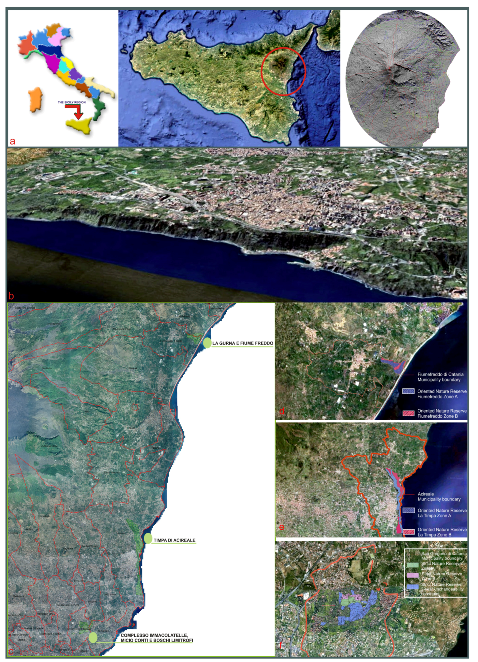
The case study is the eastern Sicilian coast at foot of the Etna Mountain, which is the most active volcano in Europe and the highest peak of the whole Mediterranean Basin. In this area, the beauty of the volcanic coastal scenery is evidenced by various protected areas and numerous urban centres with significant historical–artistic elements. The favourable climate, the pedological features of the volcanic soils and the ability of the farmers to terrace much of the coastal strip over the centuries, have given rise to an important historical phase related to the agricultural activities’ development with valuable productions, such as vines and citrus fruits. The vegetable and cultivated landscape is under various headings according to altimetry. In particular, the “Mediterranean maquis” and “lemon groves” cover most of the eastern flank up to about 500 m (Figure 1).
Figure 1.
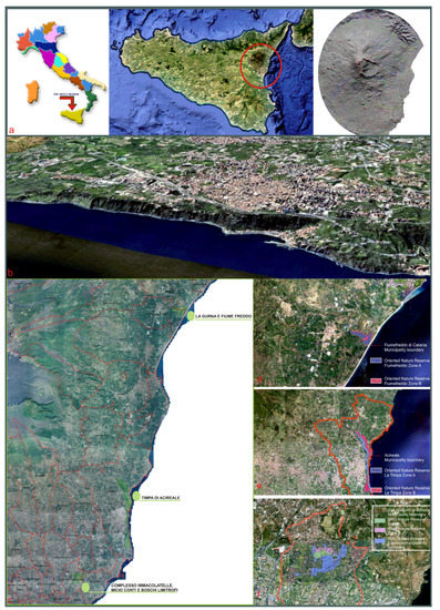
Location of the sample area. (a): Italy, Sicily and the Etna area; (b): the sample area survey vision; (c): identification and location of reserves within that area with orthophotos and technical map; (d): the Gurna lagoon and Fiumefreddo River Reserve; (e): the Timpa of Acireale Reserve; (f): the Immacolatelle—Micio Conti Reserve (source: processing in ArcGis by l.a.co.s.t.a. Laboratory, Cialdea 2020).
The coastline offers an interesting landscape, characterized by headlands and small creeks, towering cliffs, terraces, and narrow beaches bordered by cliffs. In these areas, human settlement dates back to the period of Greek colonization [32,33,34,35]. The combination of these positive elements made these areas particularly attractive starting from the 1960s to 1970s, when the post-war economic development allowed the local population to integrate into rural landscape frameworks in an impactful way: thousands of houses were built without urban norms able to preserve landscape and environmental features.
In the case study area, there are three nature reserves: “La Gurna e Fiumefreddo” (This area includes two SCIs (Riserva Naturale Fiume Fiumefreddo and La Gurna). The whole was established as ONR in 1984. This is the last part of the ancient rear-dune marsh area that until the last century, with the “papyrus” rare species.), “Immacolatelle—Micio Conti” (This reserve consists of a system of nine volcanic caves. Its establishment firstly dated in 1998, was later cancelled and subsequently reinstated in 2013: it was entrusted in management to the Catania University Centre for the Protection and Management of Natural Environments and Agrosystems (C.U.T.G.A.N.A.) to which belongs one of the authors, Sandro Privitera, currently Director of the Palombara Cave Nature Reserve.) and “La Timpa di Acireale”. The most attractive is “La Timpa di Acireale”, classified as an Oriented Nature Reserve. It was established twice, for the first time in 1984; later, the classification was cancelled and in 1999 the reserve was re-established [36,37]. Its territorial extension is of 225,34 hectares: its surface coincides almost exactly with the perimeter of the Natura 2000 Network ITA070004 SCI (site community importance), similarly named “Timpa di Acireale”: it is now classified as a special area of conservation, by virtue of the approval of its management plan. In it, there are numerous landscape and hydrogeological risk constraints. Moreover, there is an important geosite (Palombe’ Cave—columnar basalts) of national level volcanological interest. Within the case study, there are also two SCIs to safeguard residual woods (S. Maria La Stella and Linera), increasing the naturalistic value of the whole area. It acquires an exceptional naturalistic importance, being the last remaining forest of the Etna foothills. This forest is also mentioned in numerous ancient texts (see Supplementary Material File S1).
2.2. The Methodological Approach
The methodology is based on the choice of indicators deriving from the literature, as subsequently specified for each element category. They have been examined for sample cases carried out both at European and national level, especially suitable for the analysis of nature protected areas.
While the literature is rich in papers dealing with indicators related to natural resources, the innovative component of this methodology consists in introducing and comparing parameters related to the planning tools previsions.
2.2.1. Information Collation: From Resources to Indicators
Regarding “resources systems”, most of the investigation was based on resources systems analysis, and they aim at defining the “condition classes”, oriented to express the good condition level of these elements: from these conditions derive a “trigger for management response”, which necessitates intervention. The general outcome is to evaluate the effectiveness of resource management [38,39]. This information was processed starting from elementary data, classified according to the resources systems assessment [40,41,42]. For each one, following indicators were defined (Table 1):
Table 1.
Resources systems indicators.
The new step evaluates qualitative and quantitative aspects of “landscape values”. Additionally, in this case, literature samples—dealing with the issue of landscape quality assessment—were examined [4,43]. In particular, the data collected relating to resources systems indicators were entered in a database, according to previous experimental application in research for the territory of other regions [44,45,46,47], especially for the protocol defined in agreement with the Molise Region for the creation of the new regional landscape plan. Its main perspective was to improve the protection of the territory’s assets, refine the landscape value settings and to enhance the potential of sustainable development. “Values” have always been examined in relation to the presence of “detractors” who in fact change the value itself. These “detractors” are elements—related to infrastructural, industrial, or energy assessments—that invaded the territory over time, creating an uncontrolled development of the territory itself. These elements, therefore, have been named “detractors”, meaning the presence of elements that lower the landscape values previously identified and evaluated (see Table 2). They are:
Table 2.
Resources systems detractors.
Subsequently, a comparison with local undertaken efforts has been carried out.
Study areas have been analysed focusing on the planning and management tools in force, aimed at highlighting interventions carried out or to be carried out, oriented to the protection from a naturalistic point of view or to the enhancement for their development (tourism and agriculture activities or new urban settlements). Even in this case, methodologies utilised in the literature have been considered [48,49]. Several comparisons of the outcomes of the actions envisaged by the plans were carried out at various levels in different countries [50,51,52,53,54]; also referring to the analysis of this Italian case study [55,56,57]. After comparing the literature and previous application cases, an innovative phase was carried out: the in-depth examination of planning and management tools, in order to face troubles or to enhance local issues. Therefore, these documents were examined, after dividing them with respect both to the administrative area and to their own purposes (as shown in Table 3). In fact, they have been divided into:
Table 3.
Planning and management tools levels.
The first category includes scientific texts, illustrated documents and statistical databases, including surveys and photos in situ. An important role in this case has been attributed to the historical component, with an in-depth analysis of cultural landscapes, searching for the identity memory, which in some cases has been lost and which in others can still be preserved. The second category includes the processing of geographic data (Materials used for cartographic bases are: Sicilian Region Technical Map (Regional WMS service) and the Digital Terrain Model (LIDAR flight ATA 20,072,008 in GAUSS Boaga 2 m step data). Moreover, materials used for geographical databases derive from different sources. For Retenatura2000: www.artasicilia.eu/w (accessed on 10 April 2021); for Geological Cartography: www.artasicilia.eu/web/carg/ (accessed on 10 April 2021). Furthermore, for thematic maps: the Sicilian Region GIS Portal (http://www.sitr.regione.sicilia.it/ (accessed on 10 April 2021)); and the GIS ISPRA Portal: www.sinanet.isprambiente.it/it/sia-ispra/ (accessed on 10 April 2021).) relating to the landscape: for this purpose, prescriptive sources are important—not only because they constitute the legal and planning framework, but also because regulations for activities development define the future assessment. Examining these two aspects in parallel—the “past” one (assumed by historical documents) and the “future” one (through the in-depth examination of urban planning tools at regional, urban and sectoral levels)—is the innovative aspect of this work.
2.2.2. Final Goal
Therefore, to conclude the evaluation process in order to define various landscape conditions, a comparison between different parameters—as identified above—has been made.
As will be seen later in the results section, this methodology leads to the preparation of “analysis schedules” and “interpretation schedules”. In this paper, the protected areas of the sample case were analysed as components of the investigated areas repository. In particular, this paper examines in detail the analyses carried out for the “La Timpa di Acireale” reserve. As described above, based on measurements of landscaped values (protected areas, restricted areas, etc.), indicators were identified and evaluated, giving importance to the “upcoming projects”, as indicators of “effectiveness”.
The methodology includes four cases of interpretation, which are four landscape typology sheets, relating to the conditions of the preserved, disappeared, residual and endangered landscapes.
To sum up:
ΣS1 (V − D) + (UP/100) + ΣS2 (V − D) + (UP/100) + ΣS3 (V − D) + (UP/100) + ΣS4 (V − D) + (UP/100)/4
V = values (by indicators for each system S1 to S4);
D = detractors (by detractors for each system S1 to S4);
UP = upcoming projects (by projects—calculated in percentage as an increment of the value -for each system S1 to S4);
If >1 good condition class = preserved landscape;
If <1 warning condition class = endangered landscape.
Furthermore, two intermediate situations have been identified: residual areas (in which some political decision is needed) and disappeared areas (in which some intervention is necessary to preserve the memory of places).
3. Results and Discussion
The proposed integrated approach is aimed to improve knowledge and awareness about the strategic choices at policy level. The research was divided into different phases, which produced various results, with the primary aim being to identify landscapes to which to devote more attention.
The first step was oriented to define the investigation areas, inside the macro-areas surrounding the three reserves under study, as described in Section 2.1; the first product was the “investigated areas repository”.
The second phase consisted of analysing the numerous planning tools and programming documents: the product related to this phase was the comparison between them and it is particularly innovative, in the writer’s opinion. This product, named “planning tools analysis” (added to the analyses carried out in the initial data sheet) is useful for defining “conflict areas”. To this end, the third product was drawn up, that is the description of the type of conservation of the landscape features, defined as landscape performances (through the “landscape typology schedules”). For the catalogue, the file was prepared taking into consideration the most significant information. The schedule (Table 4) consists of many parts that can be grouped into four different types of data:
Table 4.
Landscape schedule framework.
Some factors need to be emphasized: the value of the coastal scenery factor (max value, on the scale 1–5) and the presence of landscape restriction, in addition to the values related to hydrogeological instability. In order to highlight any sort of contradictions—in relation to the wishes expressed by local populations—the following table was drawn up which lists the wishes of the main planning tools, with inconsistencies or conflicts (Table 5); references related to this table are located in the Supplementary Material File S2.
Table 5.
Planning and Management Tools Analysis.
Subsequently, Table 6 and Table 7, as defined in the “methods” section, summarizes the procedure followed for the evaluation of landscape performances in two sub-areas of the Timpa area. As regards the physical–environmental system, conditions of the two cases under study present comparable situations; similarly, for the historical–cultural system (albeit with small differences).
Table 6.
Preserved landscape schedule 3/15.
Table 7.
Endangered landscape schedule 8/30.
The greatest differences are recorded for the perceptive landscape system, where it is evident that in the case of the Pietramonaca district, the high values are accompanied by strong detractors, but above all, the upcoming projects are insufficient. A tricky situation occurs for the agricultural–productive system where the value of detractors is very strong and above all increased by the abandonment factor; moreover, there are almost no upcoming projects at all. The set of these considerations leads to including this area in the category of endangered landscapes (following Table 6 and Table 7). As far as the Chiazzette landscape is concerned, strongly positive elements emerge, especially with respect to upcoming projects, in all systems and in particular on perception (abandonment of panoramic points, made more usable even with numerous interventions aimed at safety and park proposals). The set of these considerations leads to inclusion of this area in the category of preserved landscapes (following Table 6 and Table 7).
To sum up, in the first instance analyses were carried out; subsequently, scores to values, detractors and UP were assigned; finally, the formula was used (in order to classify areas in the different typologies of landscape conservation).
The catalogued landscapes are: endangered: 30; residual: 12; disappeared: 10 and preserved: 15.
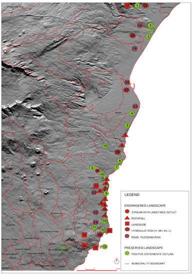
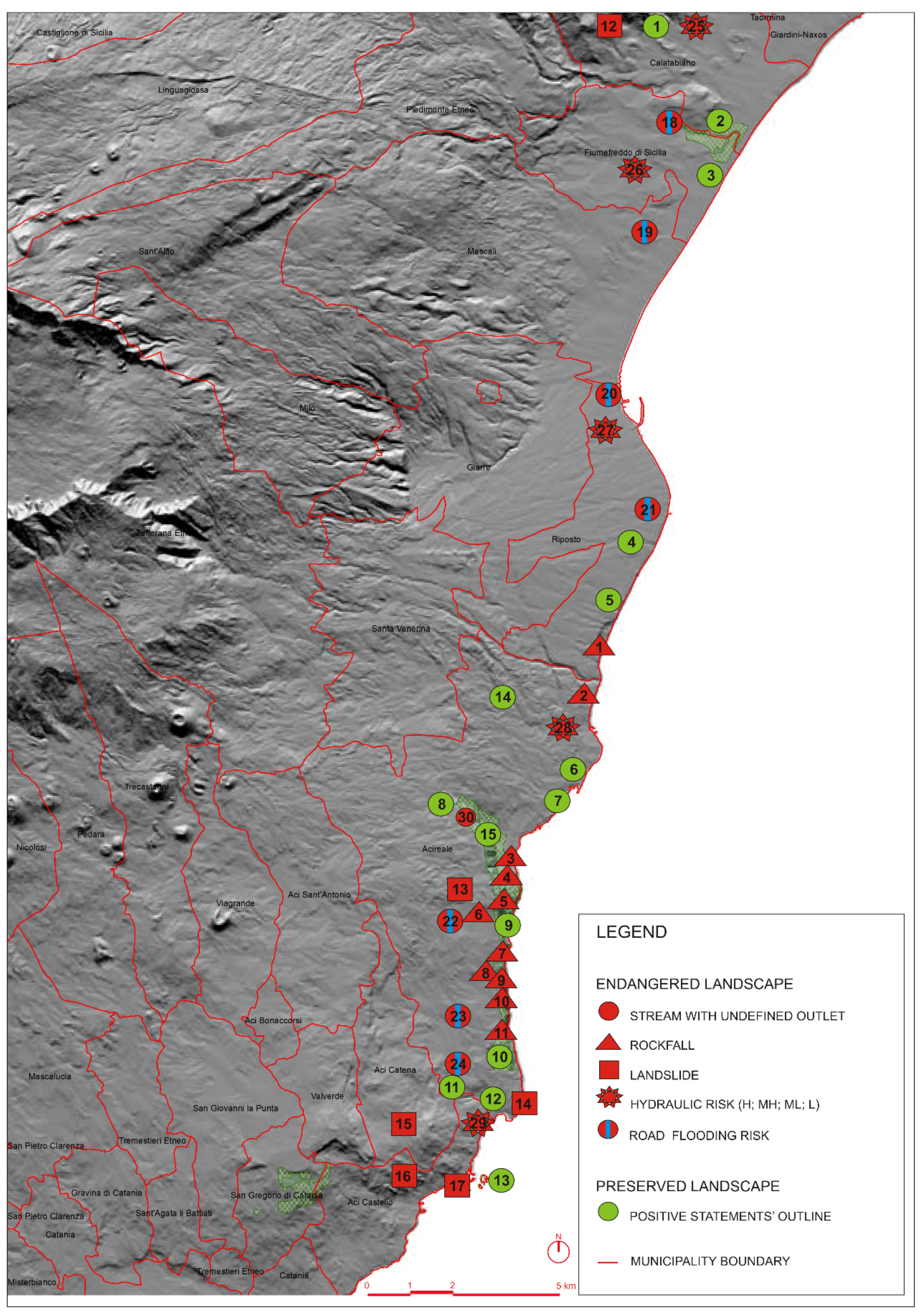
In this paper, by way of example, two cases are reported, relating to the conditions of preserved and endangered landscapes in the Timpa sample area, as shown in Figure 2.
Figure 2.
Sample area analysis. (Source: processing in ArcGis by l.a.co.s.t.a. Laboratory, Cialdea 2020).
As can be deduced from it, many of the landscapes in danger derive from physical conditions, which also in the form of the methodology used weigh heavily, while in the case of preserved landscapes, the weight of upcoming projects is relevant, even if not always in the proportion that was expected.
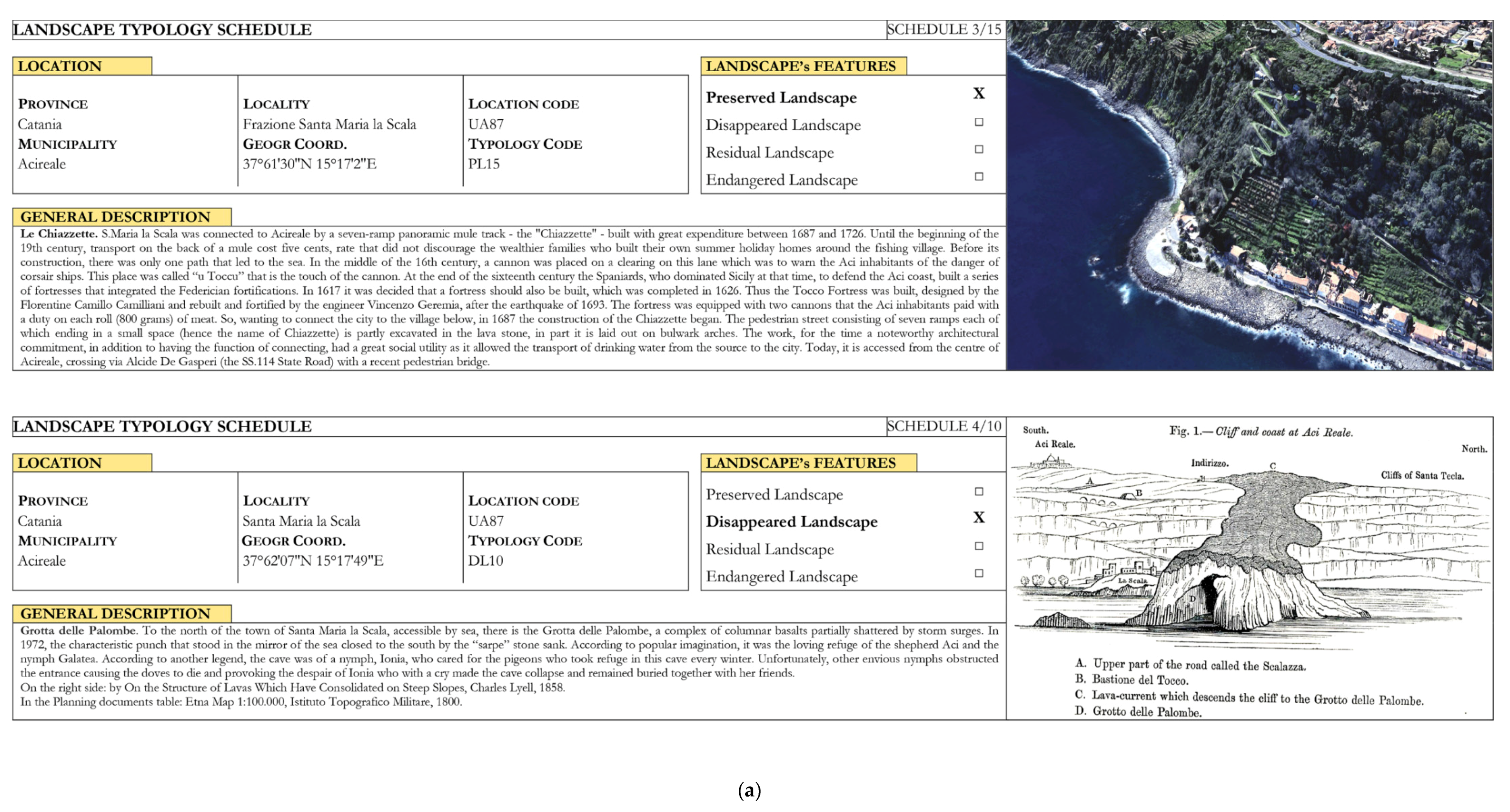
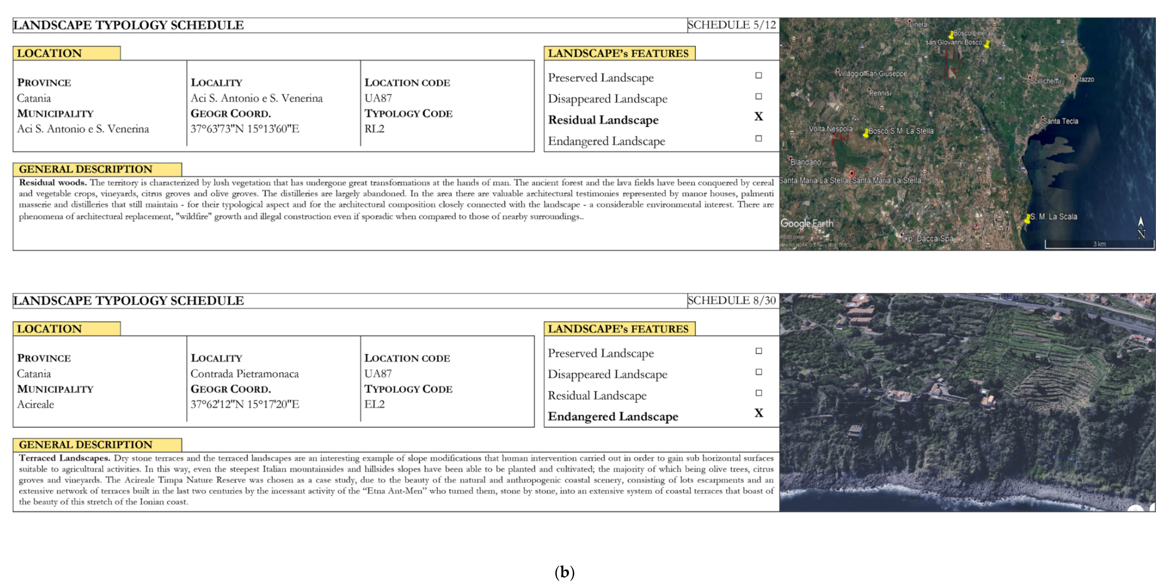
The work, however, also concerned the other two types of landscape, namely the residuals and the disappeared. As for the former, it is mostly woods, peri-urban vegetable gardens of ancient plants, and ancient paths such as the ‘trazzere’ for livestock movement. As for the latter, the cases are very different from each other: for example, there is the Grotta delle Colombe which has now completely disappeared, the loss of coastline continuity due to aggressive building interventions, and the areas in which collapsed historic buildings fall into neglect.
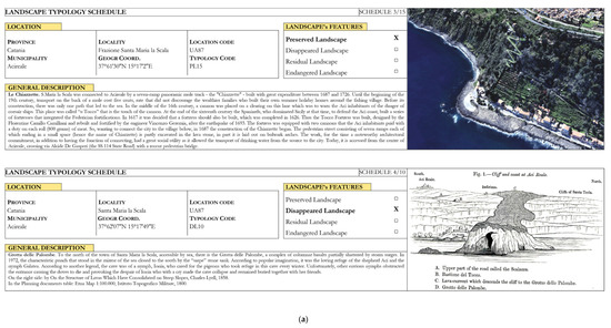
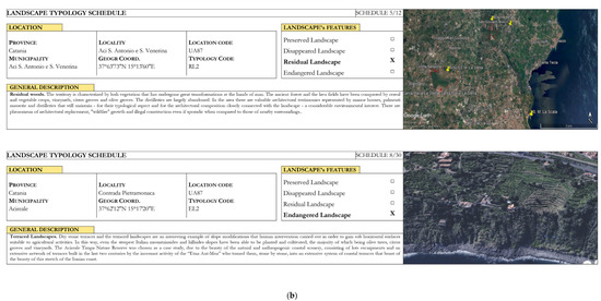
Only one example for each typology is illustrated in Figure 3.
Figure 3.
Part 1 (a): Landscape performances: preserved and disappeared (author’s own elaboration, 2020). Part 2 (b): landscape performances: residual and endangered (author’s own elaboration, 2020).
4. Conclusions
The relationship between the needs of economic development and protected areas is a topic that mainly involves coastal areas. This is a highly conflicting issue, especially in the countries of the Mediterranean Basin and particularly in Italy. The case study examined the largest island in the basin, Sicily, which displays valuable landscapes simultaneously with remarkable transformation, mostly due to residential settlements for tourism purposes and second homes.
The results gained should have a wide potential, expressly open to integrations with the various scientific disciplines dealing with landscape. During the work, one of the situations that deserves more attention was found to be the condition of many terraced landscapes. The most interesting cases were found on the coast where the mountain falls steeply into the sea. These areas were traditionally dedicated to agriculture, but, especially in the more industrialized countries, the phenomenon of abandoning agricultural activities occurred in the middle of the last century and still occurs nowadays.
In Italy, as in every Mediterranean Basin European country, the fundamental problem, therefore, is abandonment with the consequent landscape degradation. While needs for the agriculture maintenance highlight the shortcomings above all of a typicality of its products, urban planning tools often favour residential destinations, especially related to tourism purposes. This, in fact, appears to be the emerging problem, especially because of the neighbouring nature reserves.
This work aimed to provide a methodology for verifying these contrasting needs, and therefore, a system and a database have been created and implemented within the geographic information system, elaborating a comparison between environmental requirements and development strategies. Great attention has been paid to the in-depth examination of the wishes expressed in the numerous planning and economic programming tools, which have been issued in recent years, in order to point out the inconsistencies that they very often bring.
To expand this research, the quality of the GIS can undoubtedly be improved. As a matter of fact, it was necessary to digitize many of the urban planning tools or to make digital—with territorial reference—some information deriving from the written documents, and certainly this phase of work would require a general data validation. However, the main issue is related to the land use changes, and in particular to the maintenance of the peri-urban agriculture [6,12,13,14,30,33,58,59,60].
Therefore, terraced landscapes are interesting from multiple points of view. What is less addressed by the literature is precisely the main interest of this research: the discrepancy between the will of the planning tools and the real situation, which often changes the aspect of the landscape in a sudden way and, more often than not, as a result of calamitous events. The planning and management tools (which do not always have the same aim) therefore clash with the rapid evolution of the landscape.
The effort was to compare two different worlds, that of researchers who mainly address the needs of landscape conservation, with those who deal with the future development tools of those territories. The detected inconsistencies between development needs and conservation needs always have consequences on the territory. The main product of this research phase is the introduction of the landscape conservation typologies; they can be an innovative contribution to investigations. The extension of this classification to the entire regional coastal area will constitute a benchmark for local authorities, who have a duty to safeguard the landscape and at the same time to provide for local economic development.
Supplementary Materials
The following are available online at https://www.mdpi.com/article/10.3390/su13126621/s1.
Author Contributions
Conceptualization and supervision, D.C. and S.P.; investigation and writing, D.C. and S.P. Both authors have read and agreed to the published version of the manuscript.
Funding
This work was supported by the Regione Molise, under agreement with the l.a.co.s.t.a. Laboratory (Director D. Cialdea) of the University of Molise for the creation of the ‘New Regional Landscape Plan of Molise’, DEL. No. 406 (25-10-2019), published in BURM No. 47 (16 November 2019). Available online: http://cloud.urbi.it/urbi/progs/urp/ur2DE001.sto?StwEvent=101&DB_NAME=l1200158&IdDelibere=75417 (accessed on 10 April 2021).
Institutional Review Board Statement
Not applicable.
Informed Consent Statement
Not applicable.
Data Availability Statement
Not applicable.
Conflicts of Interest
The authors declare no conflict of interest.
References
- Council of Europe. European Landscape Convention, European Treaty Series—No. 176; Council of Europe Publishing: Strasbourg, France, 2000. [Google Scholar]
- Council of Europe. Landscape in Planning Policies and Governance, No 89; Council of Europe Publishing: Strasbourg, France, 2009. [Google Scholar]
- Council of Europe. Landscape Dimensions. Reflections and Proposals for the Implementation of the European Landscape Convention; Council of Europe Publishing: Strasbourg, France, 2017. [Google Scholar]
- Antrop, A. Landscape change and the urbanization process in Europe. Landsc. Urban Plan. 2004, 67, 9–26. [Google Scholar] [CrossRef] [Scilit]
- Antrop, A. Why landscapes of the past are important for the future. Landsc. Urban Plan. 2005, 70, 21–34. [Google Scholar] [CrossRef] [Scilit]
- Mcdonald, R.; Forman, R.T.T.; Kareiva, P.; Neugartena, R.; Salzer, D.; Fisher, J. Urban effects, distance, and protected areas in an urbanizing world. Landsc. Urban Plan. 2009, 93, 63–75. [Google Scholar] [CrossRef] [Scilit]
- Rodrigo de la O Cabrera, M.; Marine, N.; Escudero, D. Spatialities of cultural landscapes: Towards a unified vision of Spanish practices within the European Landscape Convention. Eur. Plan. Stud. 2020, 28, 1877–1898. [Google Scholar] [CrossRef] [Scilit]
- Leone, A. Ambiente e Pianificazione. Uso del Suolo e Processi di Sostenibilità; Franco Angeli Editore: Milano, Italy, 2019. (In Italian) [Google Scholar]
- Cialdea, D. The city and natural resources. Tema. J. Land Use Mobil. Environ. 2020, 14, 67–79. [Google Scholar] [CrossRef]
- Cialdea, D.; Pompei, C. The territorial framework of the river courses: A new methodology in evolving perspectives. Eur. Plan. Stud. 2020, 29, 1–20. [Google Scholar] [CrossRef] [Scilit]
- Dorning, M.A.; Koch, J.; Shoemaker, D.A.; Meentemeyer, R. Simulating urbanization scenarios reveals tradeoffs between conservation planning strategies. Landsc. Urban Plan. 2015, 136, 28–39. [Google Scholar] [CrossRef] [Scilit]
- La Rosa, D.; Privitera, R. Characterization of non-urbanized areas for land-use planning of agricultural and green infrastructure in urban contexts. Landsc. Urban Plan. 2013, 109, 94–106. [Google Scholar] [CrossRef] [Scilit]
- Arnold, J.; Kleemann, J.; Fürst, C.A. Differentiated Spatial Assessment of Urban Ecosystem Services Based on Land Use Data in Halle, Germany. Land 2018, 7, 101. [Google Scholar] [CrossRef] [Scilit]
- Shaw, B.J.; van Vliet, J.; Verburg, P.H. The peri-urbanization of Europe: A systematic review of a multifaceted process. Landsc. Urban Plan. 2020, 196, 103733. [Google Scholar] [CrossRef] [Scilit]
- Honeck, E.; Moilanen, A.; Guinaudeau, B.; Wyler, N.; Schlaepfer, M.A.; Martin, P.; Sanguet, A.; Urbina, L.; von Arx, B.; Massy, J.; et al. Implementing Green Infrastructure for the Spatial Planning of Peri-Urban Areas in Geneva, Switzerland. Sustainability 2020, 12, 1387. [Google Scholar] [CrossRef] [Scilit]
- European Environmental Agency (EEA). Urban Sprawl in Europe. The Ignored Challenge, Report No 10/2006; European Environmental Agency (EEA): Copenhagen, Denmark, 2006. [Google Scholar]
- European Environmental Agency (EEA). Urban Sprawl in Europe, Report No 11/2016; European Environmental Agency: Copenhagen, Denmark, 2016. [Google Scholar]
- Nadin, V.; Stead, D. European spatial planning systems, social models and learning. Plan. Rev. 2008, 44, 35–47. [Google Scholar] [CrossRef] [Scilit]
- Vizzari, M.; Sigura, M. Landscape sequences along the urban–rural–natural gradient. Landsc. Urban Plan. 2015, 140, 42–55. [Google Scholar] [CrossRef] [Scilit]
- Zasada, I.; Häfner, K.; Schaller, L.; van Zanten, B.T.; Lefebvre, M.; Malak-Rawlikowska, A.; Nikolov, D.; Rodríguez-Entrena, M.; Manrique, R.; Ungaro, F.; et al. A conceptual model to integrate the regional context in landscape policy, management and contribution to rural development: Literature review and European case study evidence. Geoforum 2017, 82, 1–12. [Google Scholar] [CrossRef] [Scilit]
- Cialdea, D. Landscape Features of Coastal Waterfronts: Historical Aspects and Planning Issues. Sustainability 2020, 12, 2378. [Google Scholar] [CrossRef] [Scilit]
- UNESCO. Intangible Cultural Heritage List. 2020. Available online: https://ich.unesco.org/en/lists (accessed on 9 October 2020).
- UNESCO World Heritage Centre. World Heritage Agricultural Landscapes. World Heritage. 2013, p. 69. Available online: https://ich.unesco.org (accessed on 9 October 2020).
- UNESCO World Heritage Centre. Cultural Landscapes. 2020. Available online: https://whc.unesco.org/ (accessed on 9 October 2020).
- Dorren, L.; Rey, F. A Review of the Effect of Terracing on Erosion; Scape, Soil Conservation and Protection for Europe, 2004; pp. 97–108. Available online: http://ecorisq.org/docs/ (accessed on 3 March 2021).
- Grove, A.T.; Rackham, O. The Nature of Mediterranean Europe, an Ecological History; Yale University Press: New Haven, CT, USA, 2003. [Google Scholar]
- Arnàez, J.; Lana-Renault, N.; Lasanta, T.; Ruiz-Flano, P.; Castroviejo, J. Effects of farming terraces on hydrological and geomorphological processes. A review. Catena 2015, 128, 122–134. [Google Scholar] [CrossRef] [Scilit]
- Tarolli, P.; Preti, F.; Romano, N. Terraced landscapes. Anthropocene 2014, 6, 10–25. [Google Scholar] [CrossRef] [Scilit]
- Cammeraat, L.H. Scale dependent thresholds in hydrological and erosion response of a semi-arid catchment in southeast Spain. Agric. Ecosyst. Environ. 2004, 104, 317–332. [Google Scholar] [CrossRef] [Scilit]
- Perlotto, C.; D’Agostino, V. Performance assessment of bench-terraces through 2-D modelling: Performance assessment of bench-terraces. Land Degrad. Dev. 2016, 29. [Google Scholar] [CrossRef] [Scilit]
- Agnoletti, M.; Errico, A.; Santoro, A.; Dani, A.; Preti, F. Terraced landscapes and hydrogeological risk. effects of land abandonment in Cinque Terre (Italy) during Severe Rainfall Events. Sustainability 2019, 11, 235. [Google Scholar] [CrossRef] [Scilit]
- Barbera, G.; Cullotta, S.; Rossi-Doria, I.; Rühl, J.; Rossi-Doria, B. I Paesaggi a Terrazze in Sicilia; ARPA: Palermo, Italy, 2010. [Google Scholar]
- Barbera, G.; Biasi, R.; Marino, D. I Paesaggi Agrari Tradizionali; Palmieri, M., Ed.; FrancoAngeli: Milano, Italy, 2014. [Google Scholar]
- Privitera, S. Geomorphological characters of the Etna coast (eastern Sicily): Examples of irreversible environmental degradation due to anthropic activities. Geologie 2010, 160, 173–177. [Google Scholar]
- Privitera, S. Il territorio del Monte Etna da Parco Regionale a Patrimonio Naturale Mondiale dell’UNESCO. Geotema 2018, 57, 143–148. (In Italian) [Google Scholar]
- Regione Siciliana. Regional Decree 14 March 1984, no. 84 Costituzione della riserva naturale «La Timpa», ricadente nel comune di Acireale. Available online: http://www.regione.sicilia.it/agricolturaeforeste/ (accessed on 9 October 2020).
- Regione Siciliana. Regional Decree 23 Avril 1999 Istituzione della riserva naturale orientata La Timpa, ricadente nel territorio del comune di Acireale, 1999. Available online: http://www.regione.sicilia.it/agricolturaeforeste/ (accessed on 9 October 2020).
- Melzer, R.; Ezzy, L.; Hines, H.B. Health checks: A simple tool for assessing the condition of values and effectiveness of reserve management. Parks 2019. [Google Scholar] [CrossRef] [Scilit]
- Dolomiti Unesco Rete delle Aree Protette. La Rete Delle Aree Protette Dolomiti Unesco, 2014. Available online: https://www.dolomitiunesco.info/ (accessed on 9 January 2020).
- Cialdea, D. Planning activities in coastal areas italian and cross-border approaches along the adriatic sea. Int. J. Sustain. Dev. Plan. 2017, 12, 853–866. [Google Scholar] [CrossRef] [Scilit]
- Cialdea, D. Smart land: Regeneration and sustainability in lost scenarios and new performances. In Smart Planning: Sustainability and Mobility in the Age of Change; Rocco, P., Fistola, R., Gargiulo, C., Eds.; Springer International: Cham, Switzerland, 2018; pp. 1–25. [Google Scholar] [CrossRef] [Scilit]
- Cialdea, D. Spatial evolutions between identity values and settlements changes. Territorial analyses oriented to landscape regeneration. In Planning, Nature and Ecosystem Services; Gargiulo, C., Zoppi, C., Eds.; Fedoapress: Napoli, Italy, 2019; pp. 10–19. [Google Scholar] [CrossRef]
- Peano, A.; Cassatella, C. (Eds.) Landscape Indicators. Assessing and Monitoring Landscape Quality; Springer: Dordrecht, NL, USA, 2011. [Google Scholar]
- Cialdea, D. (Ed.) Environmental Assessment Interreg Report 3 GES.S.TER./Interreg IIIA; Arti Grafiche La Regione: Campobasso, Italy, 2007. [Google Scholar]
- Regione Molise. Agreement with the University of Molise—l.a.co.s.t.a. Laboratory (Director Prof. D. Cialdea) for Preliminary Researches for the “New Regional Landscape Plan of Molise”. Available online: http://www3.regione.molise.it/flex/cm/pages/ServeBLOB.php/L/IT/IDPagina/1 (accessed on 11 February 2011).
- Regione Molise. Agreement with the University of Molise—l.a.co.s.t.a. Laboratory BURM No. 47 (16.11.2019). Available online: http://cloud.urbi.it/urbi/progs/urp/ur2DE001.sto?StwEvent=101&DB_NAME=l1200158&IdDelibere=75417 (accessed on 10 April 2021).
- Privitera, D.; Privitera, S. Laboratory as experiment in field learning: An application in a touristic city. J. Res. Didact. Geogr. 2018, 1, 77–88. [Google Scholar] [CrossRef] [Scilit]
- Simeonova, V.; van der Valk, A. Environmental policy integration. Land Use Policy 2016, 57, 80–93. [Google Scholar] [CrossRef] [Scilit]
- Ledda, A.; Anna Di Cesare, E.; Satta, G.; Calia, G.; Arras, F.; Congiu, A.; Manca, E.; De Montis, A. Adaptation to Climate Change and Regional Planning: A Scrutiny of Sectoral Instruments. Sustainability 2020, 12, 3804. [Google Scholar] [CrossRef] [Scilit]
- Tewdwr-Jones, M.; Bishop, K.; Wilkinson, D. Euroscepticism. Political Agendas and Spatial Planning: British National and Regional Planning Policy in Uncertain Times. Eur. Plan. Stud. 2000, 8, 651–668. [Google Scholar] [CrossRef] [Scilit]
- Getimis, P. Comparing spatial planning systems and planning cultures in Europe. Plan. Pract. Res. 2012, 27, 25–40. [Google Scholar] [CrossRef] [Scilit]
- Liberato, D.; Alén, E.; Liberato, P.; Domínguez, T. Governance and cooperation in Euroregions: Border tourism between Spain and Portugal. Eur. Plan. Stud. 2018. [Google Scholar] [CrossRef] [Scilit]
- Amdam, J. Structure and strategy for regional learning and innovation. Eur. Plan. Stud. 2003, 11, 439–459. [Google Scholar] [CrossRef] [Scilit]
- Rudolf, S.C.; Grădinaru, S.R.; Hersperger, A.M. Impact of planning mandates on local plans. Eur. Plan. Stud. 2017, 25, 2192–2211. [Google Scholar] [CrossRef] [Scilit]
- Brunetta, G.; Voghera, A. Evaluating landscape for shared values: Tools, principles, and methods. Landsc. Res. 2008, 33, 71–87. [Google Scholar] [CrossRef] [Scilit]
- De Montis, A. Impacts of the European landscape convention on national planning systems. Landsc. Urban Plan. 2014, 124, 53–65. [Google Scholar] [CrossRef] [Scilit]
- De Montis, A. Measuring the performance of planning: The conformance of Italian landscape planning practices with the European Landscape Convention. Eur. Plan. Stud. 2016, 24, 1727–1745. [Google Scholar] [CrossRef] [Scilit]
- Finn, D.; Hopkins, L.D.; Wempe, M. The information system of plans approach: Using and making plans for landscape protection. Landsc. Urban Plan. 2007, 81, 132–145. [Google Scholar] [CrossRef] [Scilit]
- Gambino, R.; Peano, A. (Eds.) Nature Policies and Landscape Policies. Towards an Alliance; Springer: Cham, Switzerland, 2015. [Google Scholar] [CrossRef] [Scilit]
- Wissen Hayek, U.; von Wirth, T.; Neuenschwander, N.; Grêt-Regamey, A. Organizing and facilitating Geodesign processes. Landsc. Urban Plan. 2016, 156, 59–70. [Google Scholar] [CrossRef] [Scilit]

Publisher’s Note: MDPI stays neutral with regard to jurisdictional claims in published maps and institutional affiliations. |
© 2021 by the authors. Licensee MDPI, Basel, Switzerland. This article is an open access article distributed under the terms and conditions of the Creative Commons Attribution (CC BY) license (https://creativecommons.org/licenses/by/4.0/).