

ISPRS Int. J. Geo-Inf. 2024, 13(5), 142; https://doi.org/10.3390/ijgi13050142 (registering DOI) - 27 Apr 2024
Abstract
Access to rural primary healthcare services has been broadly studied in the past few decades. However, most earlier studies that focused on examining access to rural healthcare services have conventionally treated spatial and non-spatial access as separate factors. This research aims to measure
[...] Read more.
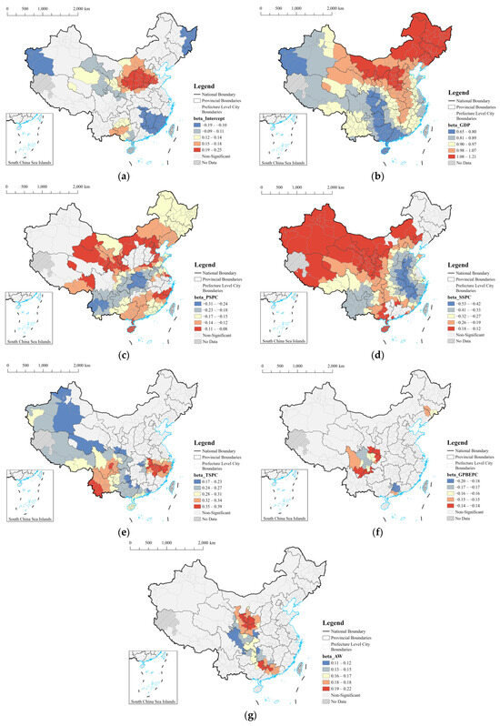
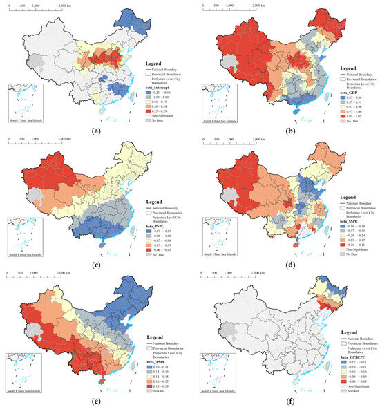
Access to rural primary healthcare services has been broadly studied in the past few decades. However, most earlier studies that focused on examining access to rural healthcare services have conventionally treated spatial and non-spatial access as separate factors. This research aims to measure access to primary healthcare services in rural areas with the consideration of both spatial and non-spatial dimensions. The methodology of study is threefold. First, the Gaussian two-step floating catchment area (G-2SFCA) method was adopted to measure spatial access to primary healthcare services. Then, a questionnaire survey was conducted to investigate non-spatial access factors, including demographic condition, patient’s household income, healthcare insurance, education level, and patient satisfaction level with the services. After that, a comprehensive evaluation index system was employed to integrate both spatial and non-spatial access. The empirical study showed a remarkable disparity in spatial access to primary healthcare services. In total, 78 villages with 185,137 local people had a “low” or “very low” level of spatial access to both clinics and hospitals. For the non-spatial dimension, the results depicted that Songzi had significant inequalities in socioeconomic status (e.g., income, education) and patient satisfaction level for medical service. When integrating both spatial and non-spatial factors, the disadvantaged areas were mainly located in the eastern and middle parts. In addition, this study found that comprehensively considering the spatial and non-spatial access had a significant impact on results in healthcare access. In conclusion, this study calls for policymakers to pay more attention to primary healthcare inequalities within rural areas. The spatial and non-spatial access should be considered comprehensively when the long-term rural medical support policy is designated.
Full article


