Next Issue
Volume 3, September
Previous Issue
Volume 3, March


Quaternary, Volume 3, Issue 2 (June 2020) – 9 articles

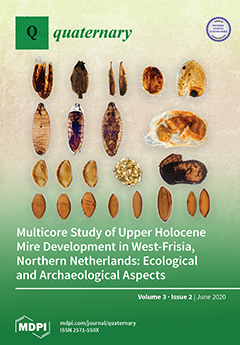
Cover Story (view full-size image): Microfossils and macroremains in twelve cores were used to reconstruct changing environmental conditions during the late Holocene in West-Frisia, Netherlands. At the end of the Bronze Age the area changed from a cultivated landscape to a freshwater wetland. Solar forcing of climate change may have delivered the final push to the inundation and depopulation of West-Frisia. The wetland developed from shallow lakes to rainwater dependent raised bog vegetation. The successions from shallow lakes to raised bog lasted between 1000 and 1500 calendar years. We deliver a long-term perspective on contemporary ecosystem dynamics of freshwater wetlands, relevant for nature conservation. View this paper
  • Issues are regarded as officially published after their release is announced to the table of contents alert mailing list.
  • You may sign up for e-mail alerts to receive table of contents of newly released issues.
  • PDF is the official format for papers published in both, html and pdf forms. To view the papers in pdf format, click on the "PDF Full-text" link, and use the free Adobe Reader to open them.
Order results
Result details
Select all
Export citation of selected articles as:
17 pages, 9459 KiB  
Article
The Role of El Niño in Driving Drought Conditions over the Last 2000 Years in Thailand
by Katherine Power, Jamie Barnett, Travis Dickinson and Josefine Axelsson
Quaternary 2020, 3(2), 18; https://doi.org/10.3390/quat3020018 - 26 Jun 2020
Cited by 5 | Viewed by 4861
Abstract
Irregular climate events frequently occur in Southeast Asia due to the numerous climate patterns combining. Thailand sits at the confluence of these interactions, and consequently experiences major hydrological events, such as droughts. Proxy data, speleothem records, lake sediment sequences and tree ring chronologies [...] Read more.
Irregular climate events frequently occur in Southeast Asia due to the numerous climate patterns combining. Thailand sits at the confluence of these interactions, and consequently experiences major hydrological events, such as droughts. Proxy data, speleothem records, lake sediment sequences and tree ring chronologies were used to reconstruct paleo drought conditions. These trends were compared with modelled and historic El Niño Southern Oscillation (ENSO) data to assess if the ENSO climate phenomena is causing droughts in Thailand. Drought periods were found to occur both during El Niño events and ENSO neutral conditions. This indicates droughts are not a product of one climate pattern, but likely the result of numerous patterns interacting. There is uncertainty regarding how climate patterns will evolve under climate change, but changes in amplitude and variability could potentially lead to more frequent and wider reaching hydrological disasters. It is vital that policies are implemented to cope with the resulting social and economic repercussions, including diversification of crops and reorganisation of water consumption behaviour in Thailand. Full article
Show Figures

Figure 1

21 pages, 7540 KiB  
Article
Between Foragers and Farmers: Climate Change and Human Strategies in Northwestern Patagonia
by Adolfo F. Gil, Ricardo Villalba, Fernando R. Franchetti, Clara Otaola, Cinthia C. Abbona, Eva A. Peralta and Gustavo Neme
Quaternary 2020, 3(2), 17; https://doi.org/10.3390/quat3020017 - 17 Jun 2020
Cited by 22 | Viewed by 4120
Abstract
In this paper we explore how changes in human strategies are differentially modulated by climate in a border area between hunter-gatherers and farmers. We analyze multiple proxies: radiocarbon summed probability distributions (SPDs), stable C and N isotopes, and zooarchaeological data from northwestern Patagonia. [...] Read more.
In this paper we explore how changes in human strategies are differentially modulated by climate in a border area between hunter-gatherers and farmers. We analyze multiple proxies: radiocarbon summed probability distributions (SPDs), stable C and N isotopes, and zooarchaeological data from northwestern Patagonia. Based on these proxies, we discuss aspects of human population, subsistence, and dietary dynamics in relation to long-term climatic trends marked by variation in the Southern Annular Mode (SAM). Our results indicate that the farming frontier in northwestern Patagonia was dynamic in both time and space. We show how changes in temperature and precipitation over the last 1000 years cal BP have influenced the use of domestic plants and the hunting of highest-ranked wild animals, whereas no significant changes in human population size occurred. During the SAM positive phase between 900 and 550 years cal BP, warmer and drier summers are associated with an increase in C4 resource consumption (maize). After 550 years cal BP, when the SAM changes to the negative phase, wetter and cooler summer conditions are related to a change in diet focused on wild resources, especially meat. Over the past 1000 years, there was a non-significant change in the population based on the SPD. Full article
Show Figures

Figure 1

13 pages, 4756 KiB  
Article
Influences of West Pacific Sea Surface Temperature on Covarying Eurasian Droughts Since the Little Ice Age
by Huanhuan Li, Keyan Fang, Jianhua Du, Feifei Zhou, Zhipeng Dong, Peng Zhang and Gang Huang
Quaternary 2020, 3(2), 16; https://doi.org/10.3390/quat3020016 - 03 Jun 2020
Viewed by 2667
Abstract
The Western Pacific Warm Pool (WP), with the highest sea surface temperature (SST) in the world, has strong impacts on the drought variations in Eurasia. However, since the little ice age (1250–1850, LIA), the co-climatic drought pattern due to WP warming in Eurasia [...] Read more.
The Western Pacific Warm Pool (WP), with the highest sea surface temperature (SST) in the world, has strong impacts on the drought variations in Eurasia. However, since the little ice age (1250–1850, LIA), the co-climatic drought pattern due to WP warming in Eurasia remains unclear. This is a long-term warming background for the current warming period (CWP). In this paper, we use both instrumental data and 1625 tree-ring width records from Eurasia to investigate the drought patterns in both modern and historical periods. This study revealed two seesaw precipitation patterns, namely the Central Asia–Mongolia (CAMO) and Northern Europe–Southern Europe (NESE) patterns. When the Western Pacific Warm Pool sea surface temperature (WPSST) is high, precipitation increases in Central Asia and Northern Europe, and decreases in Mongolia and southern Europe. When the positive (negative) phase event of the El Niño–Southern Oscillation (ENSO) occurs, the WPSST is reduced (increased), and the decreases (increases) of precipitation in Central Asia and Northern Europe and the increases (decreases) in precipitation in Mongolia and southern Europe are more obvious. The CAMO dipole has been strengthened since the LIA. The CAMO dipole is positively correlated with solar radiation and Northern Hemisphere temperature, and negatively correlated with Pacific decadal oscillations (PDO). Full article
(This article belongs to the Special Issue Feature Papers in Quaternary)
Show Figures

Figure 1

3 pages, 166 KiB  
Editorial
The Sound of ”Quaternary”
by Jef Vandenberghe
Quaternary 2020, 3(2), 15; https://doi.org/10.3390/quat3020015 - 19 May 2020
Viewed by 2133
Abstract
It is useful to re-consider at specific times the strategy of a journal. Some thoughts are expressed here at the occasion of the renewal of the editorship of ”Quaternary”. No changes are envisaged in the multidisciplinary character of the journal. In addition, it [...] Read more.
It is useful to re-consider at specific times the strategy of a journal. Some thoughts are expressed here at the occasion of the renewal of the editorship of ”Quaternary”. No changes are envisaged in the multidisciplinary character of the journal. In addition, it is felt necessary to increasingly attract the creative input from underrepresented researchers in Quaternary science (e.g., young scientists, female scientists, scientists from weakly developed countries). Full article
23 pages, 11315 KiB  
Article
The Eneolithic/Bronze Age Transition at Tegole di Bovino (Apulia): Geoarchaeological Evidence of Climate Change and Land-Use Shift
by Guido S. Mariani, Italo M. Muntoni and Andrea Zerboni
Quaternary 2020, 3(2), 14; https://doi.org/10.3390/quat3020014 - 16 May 2020
Cited by 4 | Viewed by 2765
Abstract
Human communities at the transition between the Eneolithic period and the Bronze Age had to rapidly adapt to cultural and climatic changes, which influenced the whole Mediterranean. The exact dynamics involved in this crucial passage are still a matter of discussion. As newer [...] Read more.
Human communities at the transition between the Eneolithic period and the Bronze Age had to rapidly adapt to cultural and climatic changes, which influenced the whole Mediterranean. The exact dynamics involved in this crucial passage are still a matter of discussion. As newer studies have highlighted the key role of climatic fluctuations during this period, their relationship with the human occupation of the landscape are yet to be fully explored. We investigated the infilling of negative structures at the archaeological site of Tegole di Bovino (Apulia, Southern Italy) looking at evidence of the interaction between climate changes and human strategies. The archaeological sedimentary deposits, investigated though geoarchaeological and micromorphological techniques, show the presence of natural and anthropogenic infillings inside most structures. Both human intervention and/or natural events occurred in the last phases of occupation of the site and its subsequent abandonment. The transition to unfavorable climatic conditions in the same period was most likely involved in the abandonment of the site. The possible further impact of human communities on the landscape in that period, testified by multiple other archives, might have in turn had a role in the eventual change in land use. Full article
Show Figures

Graphical abstract

25 pages, 9750 KiB  
Meeting Report
State of the Art in Paleoenvironment Mapping for Modeling Applications in Archeology—Summary, Conclusions, and Future Directions from the PaleoMaps Workshop
by Christian Willmes, Kamil Niedziółka, Benjamin Serbe, Sonja B. Grimm, Daniel Groß, Andrea Miebach, Michael Märker, Felix Henselowsky, Alexander Gamisch, Masoud Rostami, Ana Mateos, Jesús Rodríguez, Heiko Limberg, Isabell Schmidt, Martin Müller, Ericson Hölzchen, Michael Holthausen, Konstantin Klein, Christian Wegener, Bernhard Weninger, Trine Kellberg Nielsen, Taylor Otto, Gerd-Christian Weniger, Olaf Bubenzer and Georg Barethadd Show full author list remove Hide full author list
Quaternary 2020, 3(2), 13; https://doi.org/10.3390/quat3020013 - 08 May 2020
Cited by 6 | Viewed by 6814
Abstract
In this report, we present the contributions, outcomes, ideas, discussions and conclusions obtained at the PaleoMaps Workshop 2019, that took place at the Institute of Geography of the University of Cologne on 23 and 24 September 2019. The twofold aim of the workshop [...] Read more.
In this report, we present the contributions, outcomes, ideas, discussions and conclusions obtained at the PaleoMaps Workshop 2019, that took place at the Institute of Geography of the University of Cologne on 23 and 24 September 2019. The twofold aim of the workshop was: (1) to provide an overview of approaches and methods that are presently used to incorporate paleoenvironmental information in human–environment interaction modeling applications, and building thereon; (2) to devise new approaches and solutions that might be used to enhance the reconstruction of past human–environmental interconnections. This report first outlines the presented papers, and then provides a joint protocol of the often extensive discussions that came up following the presentations or else during the refreshment intervals. It concludes by adressing the open points to be resolved in future research avenues, e.g., implementation of open science practices, new procedures for reviewing of publications, and future concepts for quality assurance of the often complex paleoenvironmental data. This report may serve as an overview of the state of the art in paleoenvironment mapping and modeling. It includes an extensive compilation of the basic literature, as provided by the workshop attendants, which will itself facilitate the necessary future research. Full article
Show Figures

Graphical abstract

31 pages, 4180 KiB  
Article
Multicore Study of Upper Holocene Mire Development in West-Frisia, Northern Netherlands: Ecological and Archaeological Aspects
by Bas van Geel, Otto Brinkkemper, Guido B.A. van Reenen, Nathalie N.L. Van der Putten, Jasmijn E. Sybenga, Carla Soonius, Annemieke M. Kooijman, Tom Hakbijl and William D. Gosling
Quaternary 2020, 3(2), 12; https://doi.org/10.3390/quat3020012 - 07 May 2020
Cited by 6 | Viewed by 5610
Abstract
We studied twelve late Holocene organic deposits in West-Frisia, The Netherlands. Pollen, spores, non-pollen palynomorphs, mosses, other botanical macrofossils and insect remains were recorded for reconstructions of changing environmental conditions. Eastern West-Frisia was a cultivated landscape during the Bronze Age, but it became [...] Read more.
We studied twelve late Holocene organic deposits in West-Frisia, The Netherlands. Pollen, spores, non-pollen palynomorphs, mosses, other botanical macrofossils and insect remains were recorded for reconstructions of changing environmental conditions. Eastern West-Frisia was a cultivated landscape during the Bronze Age, but it became a freshwater wetland in the Late Bronze Age. In most of our sites, radiocarbon dates show that time transgressive inundation of soils preceded the climate shift at 850 cal BC for several centuries. We suggest that solar forcing of climate change may have delivered the final push to the inundation and depopulation of West-Frisia, which had already commenced several centuries before, due to sealevel rise. We did not find evidence for significant Bronze Age tree growth in West-Frisia before the inundations. Vegetation successions in the new wetlands developed from shallow mineral-rich freshwater to rich-fen vegetation. Subsequently poor fen vegetation with birch and pine developed, and the natural succession led to ombrotrophic raised bog vegetation. Complete successions from shallow, mineral-rich lakes to raised bog lasted between 1000 and 1500 calendar years. We hypothesize that medieval drainage and reclamation became possible only when the mires of West-Frisia had reached the raised bog stage. Reclamation of raised bogs by medieval farmers (drainage, eutrophication, peat digging) caused compaction, oxidation and loss of the upper part of the peat deposit. Seeds of salt-tolerant and salt-demanding plant species indicate that the medieval sites were inundated during storm surges with brackish or salt water, which triggered the farmers to build artificial mounds and, later, dikes. Under mounds and dikes, peat deposits remained protected against further decay. With our data we deliver a long-term perspective on contemporary ecosystem dynamics of freshwater wetlands, relevant for nature conservation and future climate change. Full article
(This article belongs to the Special Issue Feature Papers in Quaternary)
Show Figures

Figure 1

18 pages, 8977 KiB  
Article
A Top-to-Bottom Luminescence-Based Chronology for the Post-LGM Regression of a Great Basin Pluvial Lake
by Jeffrey S. Munroe, Caleb K. Walcott, William H. Amidon and Joshua D. Landis
Quaternary 2020, 3(2), 11; https://doi.org/10.3390/quat3020011 - 16 Apr 2020
Cited by 5 | Viewed by 3224
Abstract
We applied luminescence dating to a suite of shorelines constructed by pluvial Lake Clover in northeastern Nevada, USA during the last glacial cycle. At its maximum extent, the lake covered 740 km2 with a mean depth of 16 m and a water [...] Read more.
We applied luminescence dating to a suite of shorelines constructed by pluvial Lake Clover in northeastern Nevada, USA during the last glacial cycle. At its maximum extent, the lake covered 740 km2 with a mean depth of 16 m and a water volume of 13 km3. In the north-central sector of the lake basin, 10 obvious beach ridges extend from the highstand to the lowest shoreline over a horizontal distance of ~1.5 km, representing a lake area decrease of 35%. These ridges are primarily composed of sandy gravel and rise ~1.0 m above the alluvial fan surface on which they are superposed. Single grain luminescence dating of K-feldspar using the pIRIR SAR (post-infrared infrared single-aliquot regenerative dose) protocol, corroborated by SAR dating of quartz, indicates that the highstand shoreline was constructed ca. 16–17 ka during Heinrich Stadial I (Greenland Stadial 2, GS-2), matching 14C age control for this shoreline elsewhere in the basin. The lake regressed rapidly during the Bølling/Allerød (GI-1), before the rate of regression slowed during the Younger Dryas interval (GS-1). The lowest shoreline was constructed ca. 10 ka. Persistence of Lake Clover into the early Holocene may reflect enhanced monsoonal precipitation driven by the summer insolation maximum. Full article
Show Figures

Graphical abstract

12 pages, 733 KiB  
Review
Diatoms in Paleoenvironmental Studies of Peatlands
by Rafael Carballeira and Xabier Pontevedra-Pombal
Quaternary 2020, 3(2), 10; https://doi.org/10.3390/quat3020010 - 01 Apr 2020
Cited by 14 | Viewed by 4511
Abstract
The great diversity of diatoms in aquatic ecosystems and their close relationship with water chemistry make them one of the most informative and widely used biological proxies in paleoenvironmental studies of wetlands, except for peatland ecosystems. Currently, significant controversy still exists over the [...] Read more.
The great diversity of diatoms in aquatic ecosystems and their close relationship with water chemistry make them one of the most informative and widely used biological proxies in paleoenvironmental studies of wetlands, except for peatland ecosystems. Currently, significant controversy still exists over the preservation of diatoms in peat. However, considerable evidence indicates that diatoms remain in good condition in minerotrophic peatlands, and they have been successfully used in paleoenvironmental studies in high-latitude regions and especially in Southern Europe. Full article
Show Figures

Figure 1

Previous Issue
Next Issue
Back to TopTop