Next Issue
Volume 5, March
Previous Issue
Volume 4, September


Drones, Volume 4, Issue 4 (December 2020) – 19 articles

Cover Story (view full-size image): 
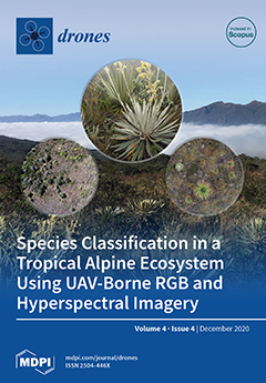
At the summit of the tropical Andes are the páramos, which are major water suppliers for millions of Latin American inhabitants. The páramos host more than 3,500 species, 60% of which are endemic. Unfortunately, the páramos are threatened by mining, land-use change, species invasions, and climate change. Recognizing the need to find efficient and precise ways to study the páramos on a large scale, we explored, for the first time in this ecosystem, whether drones, RGB, and hyperspectral imagery could be used to identify and map species. We found promising results, including accuracies above 98% in the manual detection of species using RGB and above 89% for automated mapping using hyperspectral imaging. The combined use of RGB and hyperspectral data offers great potential to monitor the páramos at the landscape scale and constitutes a valuable tool for their conservation. View this paper
  • Issues are regarded as officially published after their release is announced to the table of contents alert mailing list.
  • You may sign up for e-mail alerts to receive table of contents of newly released issues.
  • PDF is the official format for papers published in both, html and pdf forms. To view the papers in pdf format, click on the "PDF Full-text" link, and use the free Adobe Reader to open them.
Order results
Result details
Section
Select all
Export citation of selected articles as:
24 pages, 5242 KiB  
Article
Aerial and Ground Robot Collaboration for Autonomous Mapping in Search and Rescue Missions
by Dimitrios Chatziparaschis, Michail G. Lagoudakis and Panagiotis Partsinevelos
Drones 2020, 4(4), 79; https://doi.org/10.3390/drones4040079 - 19 Dec 2020
Cited by 32 | Viewed by 9140
Abstract
Humanitarian Crisis scenarios typically require immediate rescue intervention. In many cases, the conditions at a scene may be prohibitive for human rescuers to provide instant aid, because of hazardous, unexpected, and human threatening situations. These scenarios are ideal for autonomous mobile robot systems [...] Read more.
Humanitarian Crisis scenarios typically require immediate rescue intervention. In many cases, the conditions at a scene may be prohibitive for human rescuers to provide instant aid, because of hazardous, unexpected, and human threatening situations. These scenarios are ideal for autonomous mobile robot systems to assist in searching and even rescuing individuals. In this study, we present a synchronous ground-aerial robot collaboration approach, under which an Unmanned Aerial Vehicle (UAV) and a humanoid robot solve a Search and Rescue scenario locally, without the aid of a commonly used Global Navigation Satellite System (GNSS). Specifically, the UAV uses a combination of Simultaneous Localization and Mapping and OctoMap approaches to extract a 2.5D occupancy grid map of the unknown area in relation to the humanoid robot. The humanoid robot receives a goal position in the created map and executes a path planning algorithm in order to estimate the FootStep navigation trajectory for reaching the goal. As the humanoid robot navigates, it localizes itself in the map while using an adaptive Monte-Carlo Localization algorithm by combining local odometry data with sensor observations from the UAV. Finally, the humanoid robot performs visual human body detection while using camera data through a Darknet pre-trained neural network. The proposed robot collaboration scheme has been tested under a proof of concept setting in an exterior GNSS-denied environment. Full article
Show Figures

Figure 1

13 pages, 22177 KiB  
Article
Volitional Swimming Kinematics of Blacktip Sharks, Carcharhinus limbatus, in the Wild
by Marianne E. Porter, Braden T. Ruddy and Stephen M. Kajiura
Drones 2020, 4(4), 78; https://doi.org/10.3390/drones4040078 - 18 Dec 2020
Cited by 11 | Viewed by 5097
Abstract
Recent work showed that two species of hammerhead sharks operated as a double oscillating system, where frequency and amplitude differed in the anterior and posterior parts of the body. We hypothesized that a double oscillating system would be present in a large, volitionally [...] Read more.
Recent work showed that two species of hammerhead sharks operated as a double oscillating system, where frequency and amplitude differed in the anterior and posterior parts of the body. We hypothesized that a double oscillating system would be present in a large, volitionally swimming, conventionally shaped carcharhinid shark. Swimming kinematics analyses provide quantification to mechanistically examine swimming within and among species. Here, we quantify blacktip shark (Carcharhinus limbatus) volitional swimming kinematics under natural conditions to assess variation between anterior and posterior body regions and demonstrate the presence of a double oscillating system. We captured footage of 80 individual blacktips swimming in the wild using a DJI Phantom 4 Pro aerial drone. The widespread accessibility of aerial drone technology has allowed for greater observation of wild marine megafauna. We used Loggerpro motion tracking software to track five anatomical landmarks frame by frame to calculate tailbeat frequency, tailbeat amplitude, speed, and anterior/posterior variables: amplitude and frequency of the head and tail, and the body curvature measured as anterior and posterior flexion. We found significant increases in tailbeat frequency and amplitude with increasing swimming speed. Tailbeat frequency decreased and tailbeat amplitude increased as posterior flexion amplitude increased. We found significant differences between anterior and posterior amplitudes and frequencies, suggesting a double oscillating modality of wave propagation. These data support previous work that hypothesized the importance of a double oscillating system for increased sensory perception. These methods demonstrate the utility of quantifying swimming kinematics of wild animals through direct observation, with the potential to apply a biomechanical perspective to movement ecology paradigms. Full article
(This article belongs to the Special Issue Drone Technology for Wildlife and Human Management)
Show Figures

Figure 1

19 pages, 9079 KiB  
Article
Using UAV to Capture and Record Torrent Bed and Banks, Flood Debris, and Riparian Areas
by Paschalis Koutalakis, Ourania Tzoraki, Giorgos Gkiatas and George N. Zaimes
Drones 2020, 4(4), 77; https://doi.org/10.3390/drones4040077 - 14 Dec 2020
Cited by 11 | Viewed by 13431
Abstract
Capturing and recording fluvio-geomorphological events is essential since these events can be very sudden and hazardous. Climate change is expected to increase flash floods intensity and frequency in the Mediterranean region, thus enhancing such events will also impact the adjacent riparian vegetation. The [...] Read more.
Capturing and recording fluvio-geomorphological events is essential since these events can be very sudden and hazardous. Climate change is expected to increase flash floods intensity and frequency in the Mediterranean region, thus enhancing such events will also impact the adjacent riparian vegetation. The aim of this study was to capture and record the fluvial-geomorphological changes of the torrent bed and banks and flood debris events with the use of UAV images along a reach of Kallifytos torrent in northern Greece. In addition, a novel approach to detecting changes and assessing the conditions of the riparian vegetation was conducted by using UAV images that were validated with field data based on a visual protocol. Three flights were conducted using the DJI Spark UAV. Based on the images collected from these flights, orthomosaics were developed. The orthomosaics clearly identified changes in the torrent bed and detected debris flow events after major flood events. In addition, the results on the assessment of riparian vegetation conditions were satisfactory. Utilizing UAV images shows great potential to capture, record, and monitor fluvio-geomorphological events and riparian vegetation. Their utilization would help water managers to develop more sustainable management solutions based on actual field data. Full article
Show Figures

Figure 1

17 pages, 5200 KiB  
Article
Estimating Rooftop Areas of Poultry Houses Using UAV and Satellite Images
by A. Bulent Koc, Patrick T. Anderson, John P. Chastain and Christopher Post
Drones 2020, 4(4), 76; https://doi.org/10.3390/drones4040076 - 09 Dec 2020
Cited by 4 | Viewed by 3506
Abstract
Poultry production requires electricity for optimal climate control throughout the year. Demand for electricity in poultry production peaks during summer months when solar irradiation is also high. Installing solar photovoltaic (PV) panels on the rooftops of poultry houses has potential for reducing the [...] Read more.
Poultry production requires electricity for optimal climate control throughout the year. Demand for electricity in poultry production peaks during summer months when solar irradiation is also high. Installing solar photovoltaic (PV) panels on the rooftops of poultry houses has potential for reducing the energy costs by reducing the electricity demand charges of utility companies. The objective of this research was to estimate the rooftop areas of poultry houses for possible PV installation using aerial images acquired with a commercially available low-cost unmanned aerial vehicle (UAV). Overhead images of 31 broiler houses were captured with a UAV to assess their potential for solar energy applications. Building plan dimensions were acquired and building heights were independently measured manually. Images were captured by flying the UAV in a double grid flight path at a 69-m altitude using an onboard 4K camera at an angle of −80° from the horizon with 70% and 80% overlaps. The captured images were processed using Agisoft Photoscan Professional photogrammetry software. Orthophotos of the study areas were generated from the acquired 3D image sequences using structure from motion (SfM) techniques. Building rooftop overhang obscured building footprint in aerial imagery. To accurately measure building dimensions, 0.91 m was subtracted from building roof width and 0.61 m was subtracted from roof length based on blueprint dimensions of the poultry houses. The actual building widths and lengths ranged from 10.8 to 184.0 m and the mean measurement error using the UAV-derived orthophotos was 0.69% for all planar dimensions. The average error for building length was 1.66 ± 0.48 m and the average error for widths was 0.047 ± 0.13 m. Building sidewall, side entrance and peak heights ranged from 1.9 to 5.6 m and the mean error was 0.06 ± 0.04 m or 1.2%. When compared to the horizontal accuracy of the same building measurements taken from readily available satellite imagery, the mean error in satellite images was −0.36%. The average length error was −0.46 ± 0.49 m and −0.44 ± 0.14 m for building widths. The satellite orthomosaics were more accurate for length estimations and the UAV orthomosaics were more accurate for width estimations. This disparity was likely due to the flight altitude, camera field of view, and building shape. The results proved that a low-cost UAV and photogrammetric SfM can be used to create digital surface models and orthomosaics of poultry houses without the need for survey-grade equipment or ground control points. Full article
Show Figures

Figure 1

9 pages, 1286 KiB  
Technical Note
Cattle Detection Using Oblique UAV Images
by Jayme Garcia Arnal Barbedo, Luciano Vieira Koenigkan and Patrícia Menezes Santos
Drones 2020, 4(4), 75; https://doi.org/10.3390/drones4040075 - 08 Dec 2020
Cited by 17 | Viewed by 4049
Abstract
The evolution in imaging technologies and artificial intelligence algorithms, coupled with improvements in UAV technology, has enabled the use of unmanned aircraft in a wide range of applications. The feasibility of this kind of approach for cattle monitoring has been demonstrated by several [...] Read more.
The evolution in imaging technologies and artificial intelligence algorithms, coupled with improvements in UAV technology, has enabled the use of unmanned aircraft in a wide range of applications. The feasibility of this kind of approach for cattle monitoring has been demonstrated by several studies, but practical use is still challenging due to the particular characteristics of this application, such as the need to track mobile targets and the extensive areas that need to be covered in most cases. The objective of this study was to investigate the feasibility of using a tilted angle to increase the area covered by each image. Deep Convolutional Neural Networks (Xception architecture) were used to generate the models for animal detection. Three experiments were carried out: (1) five different sizes for the input images were tested to determine which yields the highest accuracies; (2) detection accuracies were calculated for different distances between animals and sensor, in order to determine how distance influences detectability; and (3) animals that were completely missed by the detection process were individually identified and the cause for those errors were determined, revealing some potential topics for further research. Experimental results indicate that oblique images can be successfully used under certain conditions, but some practical limitations need to be addressed in order to make this approach appealing. Full article
Show Figures

Figure 1

18 pages, 2714 KiB  
Article
Elasmobranch Use of Nearshore Estuarine Habitats Responds to Fine-Scale, Intra-Seasonal Environmental Variation: Observing Coastal Shark Density in a Temperate Estuary Utilizing Unoccupied Aircraft Systems (UAS)
by Alexandra E. DiGiacomo, Walker E. Harrison, David W. Johnston and Justin T. Ridge
Drones 2020, 4(4), 74; https://doi.org/10.3390/drones4040074 - 08 Dec 2020
Cited by 5 | Viewed by 4360
Abstract
Many coastal shark species are known to use estuaries of the coastal southeastern United States for essential purposes like foraging, reproducing, and protection from predation. Temperate estuarine landscapes, such as the Rachel Carson Reserve (RCR) in Beaufort, NC, are dynamic habitat mosaics that [...] Read more.
Many coastal shark species are known to use estuaries of the coastal southeastern United States for essential purposes like foraging, reproducing, and protection from predation. Temperate estuarine landscapes, such as the Rachel Carson Reserve (RCR) in Beaufort, NC, are dynamic habitat mosaics that experience fluctuations in physical and chemical oceanographic properties on various temporal and spatial scales. These patterns in abiotic conditions play an important role in determining species movement. The goal of this study was to understand the impact of environmental conditions around the RCR on shark density within the high-abundance summer season. Unoccupied Aircraft System (UAS) surveys of coastal habitats within the reserve were used to quantify shark density across varying environmental conditions. A combination of correlation analyses and Generalized Linear Modelling (GLM) revealed that density differs substantially across study sites and increases with rising water temperatures, conclusions that are supported by previous work in similar habitats. Additionally, density appears to increase moving towards dawn and dusk, potentially supporting crepuscular activity in coastal estuarine areas. By describing shark density dynamics in the RCR, this study provides new information on this population and presents a novel framework for studying elasmobranchs in temperate estuaries. Full article
(This article belongs to the Special Issue Drone Technology for Wildlife and Human Management)
Show Figures

Figure 1

25 pages, 2980 KiB  
Article
RPAS Automatic ADS-B Based Separation Assurance and Collision Avoidance System Real-Time Simulation Results
by Vittorio Di Vito and Giulia Torrano
Drones 2020, 4(4), 73; https://doi.org/10.3390/drones4040073 - 07 Dec 2020
Cited by 9 | Viewed by 3746
Abstract
Remotely piloted aircraft systems (RPAS) are increasingly becoming relevant actors that are flying through the airspace and will gain much more importance in the future. In order to allow for their safe integration with manned conventional traffic in non-segregated airspaces, in accordance with [...] Read more.
Remotely piloted aircraft systems (RPAS) are increasingly becoming relevant actors that are flying through the airspace and will gain much more importance in the future. In order to allow for their safe integration with manned conventional traffic in non-segregated airspaces, in accordance with the overall air traffic management (ATM) paradigm, specific enabling technologies are needed. As is well known, the detect and avoid (DAA) technology is fundamental among the enabling technologies identified as crucial for RPAS integration into the overall ATM system. In the meantime, to support extended surveillance, the universal introduction of cooperative automatic dependent surveillance-broadcast (ADS-B) on-board aircraft is being increasingly implemented because it has the potential to allow for the coverage of the entire airspaces in remote areas not usually covered by conventional radar surveillance. In this paper, experimental results that were obtained through the real-time validation, with hardware and human in the loop (RTS-HIL) simulations, of an automatic ADS-B based separation assurance and collision avoidance system aimed to support RPAS automatic operations (as well as remote pilot decision making) are presented and discussed. In the paper, after an introductory outline of the concept of operations (ConOps) of the system and its architectural organization, in addition to basic information about the main system functionalities, a description of the tests that were carried out is reported, and the obtained results are described and discussed in order to emphasize the performance and limitations of the proposed system. In particular, the obtained quantitative performances are reported and commented on, and the feedback presented by pilots in order to improve the system, e.g., in terms of preferred typology of conflict resolution maneuver elaborated by the system, is described. Full article
Show Figures

Figure 1

25 pages, 18850 KiB  
Article
Correlation among Earthwork and Cropmark Anomalies within Archaeological Landscape Investigation by Using LiDAR and Multispectral Technologies from UAV
by Diego Ronchi, Marco Limongiello and Salvatore Barba
Drones 2020, 4(4), 72; https://doi.org/10.3390/drones4040072 - 30 Nov 2020
Cited by 19 | Viewed by 5414
Abstract
This project aimed to systematically investigate the archaeological remains of the imperial Domitian villa in Sabaudia (Italy), using different three-dimensional survey techniques. Particular attention in the research was paid to the identification and documentation of traces that buried structures left on the surface [...] Read more.
This project aimed to systematically investigate the archaeological remains of the imperial Domitian villa in Sabaudia (Italy), using different three-dimensional survey techniques. Particular attention in the research was paid to the identification and documentation of traces that buried structures left on the surface occupied by the villa, which extended for 46 hectares, an area that was fully covered with structures. Since a dense pine forest was planted during the 1940s and is currently covering the site, this contribution investigates particularly the correlation among the presence of cropmarks, identifiable with the processing of multispectral maps and vegetation indices from RGB images, and earthwork anomalies identified in a Digital Terrain Model (DTM) built, by utilizing a light detection and ranging (LiDAR) flight from an Unmanned Aerial Vehicle (UAV). The study demonstrates how the use of vegetation maps—calculated starting from RGB and multispectral aerial photos—can provide a more expeditious preliminary analysis on the position and extension of areas characterized by the presence of buried structures, but also that, in order to investigate in-depth a context in similar conditions, the most effective approach remains the one based on LiDAR technology. The integration between the two techniques may prove fruitful in limiting the extension of the areas to be investigated with terrestrial survey techniques. Full article
Show Figures

Graphical abstract

15 pages, 5149 KiB  
Article
Development, Modeling and Control of a Dual Tilt-Wing UAV in Vertical Flight
by Luz M. Sanchez-Rivera, Rogelio Lozano and Alfredo Arias-Montano
Drones 2020, 4(4), 71; https://doi.org/10.3390/drones4040071 - 25 Nov 2020
Cited by 12 | Viewed by 6780
Abstract
Hybrid Unmanned Aerial Vehicles (H-UAVs) are currently a very interesting field of research in the modern scientific community due to their ability to perform Vertical Take-Off and Landing (VTOL) and Conventional Take-Off and Landing (CTOL). This paper focuses on the Dual Tilt-wing UAV, [...] Read more.
Hybrid Unmanned Aerial Vehicles (H-UAVs) are currently a very interesting field of research in the modern scientific community due to their ability to perform Vertical Take-Off and Landing (VTOL) and Conventional Take-Off and Landing (CTOL). This paper focuses on the Dual Tilt-wing UAV, a vehicle capable of performing both flight modes (VTOL and CTOL). The UAV complete dynamic model is obtained using the Newton–Euler formulation, which includes aerodynamic effects, as the drag and lift forces of the wings, which are a function of airstream generated by the rotors, the cruise speed, tilt-wing angle and angle of attack. The airstream velocity generated by the rotors is studied in a test bench. The projected area on the UAV wing that is affected by the airstream generated by the rotors is specified and 3D aerodynamic analysis is performed for this region. In addition, aerodynamic coefficients of the UAV in VTOL mode are calculated by using Computational Fluid Dynamics method (CFD) and are embedded into the nonlinear dynamic model. To validate the complete dynamic model, PD controllers are adopted for altitude and attitude control of the vehicle in VTOL mode, the controllers are simulated and implemented in the vehicle for indoor and outdoor flight experiments. Full article
Show Figures

Figure 1

18 pages, 17732 KiB  
Article
Developing an Introductory UAV/Drone Mapping Training Program for Seagrass Monitoring and Research
by Bo Yang, Timothy L. Hawthorne, Margot Hessing-Lewis, Emmett J. Duffy, Luba Y. Reshitnyk, Michael Feinman and Hunter Searson
Drones 2020, 4(4), 70; https://doi.org/10.3390/drones4040070 - 03 Nov 2020
Cited by 25 | Viewed by 11014
Abstract
Unoccupied Aerial Vehicles (UAVs), or drone technologies, with their high spatial resolution, temporal flexibility, and ability to repeat photogrammetry, afford a significant advancement in other remote sensing approaches for coastal mapping, habitat monitoring, and environmental management. However, geographical drone mapping and in situ [...] Read more.
Unoccupied Aerial Vehicles (UAVs), or drone technologies, with their high spatial resolution, temporal flexibility, and ability to repeat photogrammetry, afford a significant advancement in other remote sensing approaches for coastal mapping, habitat monitoring, and environmental management. However, geographical drone mapping and in situ fieldwork often come with a steep learning curve requiring a background in drone operations, Geographic Information Systems (GIS), remote sensing and related analytical techniques. Such a learning curve can be an obstacle for field implementation for researchers, community organizations and citizen scientists wishing to include introductory drone operations into their work. In this study, we develop a comprehensive drone training program for research partners and community members to use cost-effective, consumer-quality drones to engage in introductory drone mapping of coastal seagrass monitoring sites along the west coast of North America. As a first step toward a longer-term Public Participation GIS process in the study area, the training program includes lessons for beginner drone users related to flying drones, autonomous route planning and mapping, field safety, GIS analysis, image correction and processing, and Federal Aviation Administration (FAA) certification and regulations. Training our research partners and students, who are in most cases novice users, is the first step in a larger process to increase participation in a broader project for seagrass monitoring in our case study. While our training program originated in the United States, we discuss our experiences for research partners and communities around the globe to become more confident in introductory drone operations for basic science. In particular, our work targets novice users without a strong background in geographic research or remote sensing. Such training provides technical guidance on the implementation of a drone mapping program for coastal research, and synthesizes our approaches to provide broad guidance for using drones in support of a developing Public Participation GIS process. Full article
(This article belongs to the Special Issue Drones in Geography)
Show Figures

Figure 1

18 pages, 3017 KiB  
Article
Species Classification in a Tropical Alpine Ecosystem Using UAV-Borne RGB and Hyperspectral Imagery
by Carol X. Garzon-Lopez and Eloisa Lasso
Drones 2020, 4(4), 69; https://doi.org/10.3390/drones4040069 - 31 Oct 2020
Cited by 13 | Viewed by 6222
Abstract
Páramos host more than 3500 vascular plant species and are crucial water providers for millions of people in the northern Andes. Monitoring species distribution at large scales is an urgent conservation priority in the face of ongoing climatic changes and increasing anthropogenic pressure [...] Read more.
Páramos host more than 3500 vascular plant species and are crucial water providers for millions of people in the northern Andes. Monitoring species distribution at large scales is an urgent conservation priority in the face of ongoing climatic changes and increasing anthropogenic pressure on this ecosystem. For the first time in this ecosystem, we explored the potential of unoccupied aerial vehicles (UAV)-borne red, green, and blue wavelengths (RGB) and hyperspectral imagery for páramo species classification by collecting both types of images in a 10-ha area, and ground vegetation cover data from 10 plots within this area. Five plots were used for calibration and the other five for validation. With the hyperspectral data, we tested our capacity to detect five representative páramo species with different growth forms using support vector machine (SVM) and random forest (RF) classifiers in combination with three feature selection methods and two class groups. Using RGB images, we could classify 21 species with an accuracy greater than 97%. From hyperspectral imaging, the highest accuracy (89%) was found using models built with RF or SVM classifiers combined with a binary grouping method and the sequential floating forward selection feature. Our results demonstrate that páramo species can be accurately mapped using both RGB and hyperspectral imagery. Full article
(This article belongs to the Special Issue She Maps)
Show Figures

Graphical abstract

8 pages, 850 KiB  
Letter
Short-Range Transportation Using Unmanned Aerial Vehicles (UAVs) during Disasters in Japan
by Koki Yakushiji, Hiroshi Fujita, Mikio Murata, Naoki Hiroi, Yuuichi Hamabe and Fumiatsu Yakushiji
Drones 2020, 4(4), 68; https://doi.org/10.3390/drones4040068 - 16 Oct 2020
Cited by 21 | Viewed by 7044
Abstract
Larger types of small unmanned aerial vehicles (UAVs) are beginning to be used in the United States and Europe for commercial transportation. Additionally, some blood product transport systems have been commercialized in Rwanda and other countries and used in pandemic operations for the [...] Read more.
Larger types of small unmanned aerial vehicles (UAVs) are beginning to be used in the United States and Europe for commercial transportation. Additionally, some blood product transport systems have been commercialized in Rwanda and other countries and used in pandemic operations for the coronavirus disease 2019 (COVID-19) in infected areas. Conversely, implementing goods transportation for commercial purposes in Japan has been difficult, especially in urban areas, due to national legislation. This study examined UAV-assisted transportation in Japan, a natural disaster hotspot, with a focus on the potential uses of UAVs in situations where traffic blockages make ground transportation impossible. UAVs were used to transport 17 kg of medical supplies belonging to a disaster medical assistance team (DMAT), along with 100 emergency meals. We also transported insulin under controlled-temperature conditions, as well as many other emergency supplies. Using UAVs to transport emergency supplies could be an effective approach when dealing with disasters. This paper summarizes the effectiveness of this approach for medical care and disaster response activities. We present a method for using drones to bridge the gap between medical and firefighting personnel, such as DMAT personnel, who are engaged in life-saving activities at the time of a disaster, and those who are unable to transport necessary goods by land using terrestrial vehicles due to traffic interruptions. Full article
Show Figures

Figure 1

23 pages, 9575 KiB  
Article
Bridge Inspection with an Off-the-Shelf 360° Camera Drone
by Andreas Humpe
Drones 2020, 4(4), 67; https://doi.org/10.3390/drones4040067 - 11 Oct 2020
Cited by 22 | Viewed by 8150
Abstract
The author proposes a new approach for bridge crack detection by a 360° camera on top of a drone. Traditionally, bridge inspection is performed manually and although the use of drones has been implemented before, researchers used standard high definition cameras underneath the [...] Read more.
The author proposes a new approach for bridge crack detection by a 360° camera on top of a drone. Traditionally, bridge inspection is performed manually and although the use of drones has been implemented before, researchers used standard high definition cameras underneath the drone. To make the approach comparable to the conventional approach, two bridges were selected in Germany and inspected for cracks and defects by applying both methods. The author follows an engineering design process and after developing a prototype of the drone with a 360° camera above the body of the drone, the system is built, tested, and the bridges are inspected. First, the critical parts of the bridges are inspected with an off-the-shelf drone with a high definition camera underneath the drone. The results provide a benchmark for comparison. Next, the new approach to bridge inspection by using a 360° camera on top of the drone is tested. The images of the critical parts of the bridge that were taken with the 360° camera on top of the drone are analyzed and compared to the images of the conventional approach with the camera underneath the drone. The results show that a 360° camera can be used for crack and defect detection with similar results to a standard high definition camera. Furthermore, the 360° camera is more suitable for inspecting corners or the ceiling of, e.g., an arch bridge. Full article
Show Figures

Figure 1

21 pages, 5397 KiB  
Article
An Evaluation of the Drone Delivery of Adrenaline Auto-Injectors for Anaphylaxis: Pharmacists’ Perceptions, Acceptance, and Concerns
by September Beck, Tam T. Bui, Andrew Davies, Patrick Courtney, Alex Brown, Jef Geudens and Paul G. Royall
Drones 2020, 4(4), 66; https://doi.org/10.3390/drones4040066 - 09 Oct 2020
Cited by 17 | Viewed by 7050
Abstract
Anaphylaxis is a life-threatening condition where delays in medical treatment can be fatal. Such situations would benefit from the drone delivery of an adrenaline auto-injector such as EpiPen®. This study evaluates the potential risk, reward, and impact of drone transportation on [...] Read more.
Anaphylaxis is a life-threatening condition where delays in medical treatment can be fatal. Such situations would benefit from the drone delivery of an adrenaline auto-injector such as EpiPen®. This study evaluates the potential risk, reward, and impact of drone transportation on the stability of adrenaline during episodes of anaphylaxis. Further, this study examines pharmacists’ perceptions on drone delivery—pharmacists approved the use of drones to deliver EpiPen® during emergencies but had concerns with drone safety and supply chain security. Laboratory simulated onboard drone conditions reflected typical missions. In these experiments, in vitro model and pharmaceutical equivalent formulations were subjected independently to 30 min vibrations at 5, 8.43, and 13.33 Hz, and temperature storage at 4, 25, 40, and 65 °C for 0, 0.5, 3, and 24 h. The chiral composition (an indicator of chemical purity that relates to molecular structure) and concentration of these adrenaline formulations were determined using ultraviolet (UV) and circular dichroism spectroscopy (CD). Adrenaline intrinsic stability was also explored by edge-of-failure experimentation to signpost the uppermost limits for safe transportation. During drone flight with EpiPen®, the temperature and vibration g-force were 10.7 °C and 1.8 g, respectively. No adverse impact on adrenaline was observed during drone flight and laboratory-simulated conditions shown by conformation to the British Pharmacopeia standards (p > 0.05 for CD and UV). This study showed that drone delivery of EpiPen® is feasible. There are more than 15,000 community pharmacies and ≈9000 GP surgeries spanning the UK, which are likely to provide achievable ranges and distances for the direct drone delivery of EpiPen®. The authors recommend that when designing future missions, in addition to medicine stability testing that models the stresses imposed by drone flight, one must conduct a perceptions survey on the relevant group of medical professionals, because their insights, acceptance, and concerns are extremely valuable for the design and evaluation of the mission. Full article
(This article belongs to the Special Issue Drones for Medicine Delivery and Healthcare Logistics)
Show Figures

Graphical abstract

14 pages, 1062 KiB  
Review
A Review on Communications Perspective of Flying Ad-Hoc Networks: Key Enabling Wireless Technologies, Applications, Challenges and Open Research Topics
by Fazal Noor, Muhammad Asghar Khan, Ali Al-Zahrani, Insaf Ullah and Kawther A. Al-Dhlan
Drones 2020, 4(4), 65; https://doi.org/10.3390/drones4040065 - 30 Sep 2020
Cited by 69 | Viewed by 8825
Abstract
Unmanned aerial vehicles (UAVs), also known as drones, once centric to military applications, are presently finding their way in many civilian and commercial applications. If national legislations permit UAVs to operate autonomously, one will see the skies become populated with many small UAVs, [...] Read more.
Unmanned aerial vehicles (UAVs), also known as drones, once centric to military applications, are presently finding their way in many civilian and commercial applications. If national legislations permit UAVs to operate autonomously, one will see the skies become populated with many small UAVs, each one performing various tasks such as mail and package delivery, traffic monitoring, event filming, surveillance, search and rescue, and other applications. Thus, advancing to multiple small UAVs from a single large UAV has resulted in a new clan of networks known as flying ad-hoc networks (FANETs). Such networks provide reliability, ease of deployment, and relatively low operating costs by offering a robust communication network among the UAVs and base stations (BS). Although FANETs offer many benefits, there also exist a number of challenges that need to be addressed; the most significant of these being the communication one. Therefore, the article aims to provide insights into the key enabling communication technologies through the investigation of data rate, spectrum type, coverage, and latency. Moreover, application scenarios along with the feasibility of key enabling technologies are also examined. Finally, challenges and open research topics are discussed to further hone the research work. Full article
Show Figures

Figure 1

35 pages, 1164 KiB  
Review
Operational Protocols for the Use of Drones in Marine Animal Research
by Vincent Raoult, Andrew P Colefax, Blake M. Allan, Daniele Cagnazzi, Nataly Castelblanco-Martínez, Daniel Ierodiaconou, David W. Johnston, Sarah Landeo-Yauri, Mitchell Lyons, Vanessa Pirotta, Gail Schofield and Paul A Butcher
Drones 2020, 4(4), 64; https://doi.org/10.3390/drones4040064 - 25 Sep 2020
Cited by 78 | Viewed by 18966
Abstract
The use of drones to study marine animals shows promise for the examination of numerous aspects of their ecology, behaviour, health and movement patterns. However, the responses of some marine phyla to the presence of drones varies broadly, as do the general operational [...] Read more.
The use of drones to study marine animals shows promise for the examination of numerous aspects of their ecology, behaviour, health and movement patterns. However, the responses of some marine phyla to the presence of drones varies broadly, as do the general operational protocols used to study them. Inconsistent methodological approaches could lead to difficulties comparing studies and can call into question the repeatability of research. This review draws on current literature and researchers with a wealth of practical experience to outline the idiosyncrasies of studying various marine taxa with drones. We also outline current best practice for drone operation in marine environments based on the literature and our practical experience in the field. The protocols outlined herein will be of use to researchers interested in incorporating drones as a tool into their research on marine animals and will help form consistent approaches for drone-based studies in the future. Full article
(This article belongs to the Special Issue Drone Technology for Wildlife and Human Management)
Show Figures

Figure 1

17 pages, 15599 KiB  
Article
Generic Component-Based Mission-Centric Energy Model for Micro-Scale Unmanned Aerial Vehicles
by Christoph Steup, Simon Parlow, Sebastian Mai and Sanaz Mostaghim
Drones 2020, 4(4), 63; https://doi.org/10.3390/drones4040063 - 25 Sep 2020
Cited by 6 | Viewed by 3879
Abstract
The trend towards the usage of battery-electric unmanned aerial vehicles needs new strategies in mission planning and in the design of the systems themselves. To create an optimal mission plan and take appropriate decisions during the mission, a reliable, accurate and adaptive energy [...] Read more.
The trend towards the usage of battery-electric unmanned aerial vehicles needs new strategies in mission planning and in the design of the systems themselves. To create an optimal mission plan and take appropriate decisions during the mission, a reliable, accurate and adaptive energy model is of utmost importance. However, most existing approaches either use very generic models or ones that are especially tailored towards a specific UAV. We present a generic energy model that is based on decomposing a robotic system into multiple observable components. The generic model is applied to a swarm of quadcopters and evaluated in multiple flights with different manoeuvres. We additionally use the data from practical experiments to learn and generate a mission-agnostic energy model which can match the typical behaviour of our quadcopters such as hovering; movement in x, y and z directions; landing; communication; and illumination. The learned energy model concurs with the overall energy consumption with an accuracy over 95% compared to the training flights for the indoor use case. An extended model reduces the error to less than 1.4%. Consequently, the proposed model enables an estimation of the energy used in flight and on the ground, which can be easily incorporated in autonomous systems and enhance decision-making with reliable input. The used learning mechanism allows to deploy the approach with minimal effort to new platforms needing only some representative test missions, which was shown using additional outdoor validation flights with a different quadcopter of the same build and the originally trained models. This set-up increased the prediction error of our model to 4.46%. Full article
(This article belongs to the Special Issue Drone Mission Planning)
Show Figures

Graphical abstract

13 pages, 2658 KiB  
Letter
Drone-Based Participatory Mapping: Examining Local Agricultural Knowledge in the Galapagos
by Mia Colloredo-Mansfeld, Francisco J. Laso and Javier Arce-Nazario
Drones 2020, 4(4), 62; https://doi.org/10.3390/drones4040062 - 24 Sep 2020
Cited by 9 | Viewed by 5964
Abstract
Agriculture is cultural heritage, and studies of agricultural spaces and practices help this heritage to be valued and protected. In the Galapagos Islands, little focus has been placed on local agricultural practices and agroforestry, despite their increasing importance for food security and invasive [...] Read more.
Agriculture is cultural heritage, and studies of agricultural spaces and practices help this heritage to be valued and protected. In the Galapagos Islands, little focus has been placed on local agricultural practices and agroforestry, despite their increasing importance for food security and invasive species management. This article discusses the possibilities for unoccupied aerial vehicle (UAV) high-resolution imagery in examining agricultural and agroforestry spaces, techniques, and practices. It describes and assesses an UAV-assisted participatory methodology for on-farm qualitative research that aims to investigate the visible and invisible features of farming practices. An analysis of the types of responses elicited by different methods of interviews with Galapagos farmers demonstrates how incorporating UAV data affects what we took away from the interview, and how the perceived relationship between farmer and land is reflected. Specifically, we find that when interacting with orthomosaics created from UAV images of their farms, farmers’ responses reveal a greater focus on management strategies at larger spatial and temporal scales. UAV imagery thus supports studies of agricultural heritage not only by recording agricultural spaces but also by revealing agrarian knowledge and practices. Full article
(This article belongs to the Special Issue She Maps)
Show Figures

Figure 1

17 pages, 3054 KiB  
Article
Thermal and Multispectral Remote Sensing for the Detection and Analysis of Archaeologically Induced Crop Stress at a UK Site
by Katherine James, Caroline J. Nichol, Tom Wade, Dave Cowley, Simon Gibson Poole, Andrew Gray and Jack Gillespie
Drones 2020, 4(4), 61; https://doi.org/10.3390/drones4040061 - 24 Sep 2020
Cited by 17 | Viewed by 5862
Abstract
In intensively cultivated landscapes, many archaeological remains are buried under the ploughed soil, and detection depends on crop proxies that express subsurface features. Traditionally these proxies have been documented in visible light as contrasting areas of crop development commonly known as cropmarks. However, [...] Read more.
In intensively cultivated landscapes, many archaeological remains are buried under the ploughed soil, and detection depends on crop proxies that express subsurface features. Traditionally these proxies have been documented in visible light as contrasting areas of crop development commonly known as cropmarks. However, it is recognised that reliance on the visible electromagnetic spectrum has inherent limitations on what can be documented, and multispectral and thermal sensors offer the potential to greatly improve our ability to detect buried archaeological features in agricultural fields. The need for this is pressing, as ongoing agricultural practices place many subsurface archaeological features increasingly under threat of destruction. The effective deployment of multispectral and thermal sensors, however, requires a better understanding of when they may be most effective in documenting archaeologically induced responses. This paper presents the first known use of the FLIR Vue Pro-R thermal imager and Red Edge-M for exploring crop response to archaeological features from two UAV surveys flown in May and June 2019 over a known archaeological site. These surveys provided multispectral imagery, which was used to create vegetation index (VI) maps, and thermal maps to assess their effectiveness in detecting crop responses in the temperate Scottish climate. These were visually and statistically analysed using a Mann Whitney test to compare temperature and reflectance values. While the study was compromised by unusually damp conditions which reduced the potential for cropmarking, the VIs (e.g., Normalised Difference Vegetation Index, NDVI) did show potential to detect general crop stress across the study site when they were statistically analysed. This demonstrates the need for further research using multitemporal data collection across case study sites to better understand the interactions of crop responses and sensors, and so define appropriate conditions for large-area data collection. Such a case study-led multitemporal survey approach is an ideal application for UAV-based documentation, especially when “perfect” conditions cannot be guaranteed. Full article
Show Figures

Graphical abstract

Previous Issue
Next Issue
Back to TopTop