You are currently viewing a new version of our website. To view the old version click .

ISPRS International Journal of Geo-Information, Volume 8, Issue 11

November 2019 - 55 articles

Cover Story: 
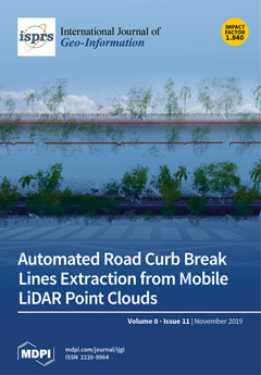
Throughout this work, an efficient method to extract road curb break lines from mobile LiDAR point clouds is presented. The point cloud is decomposed in the original sensor scan profiles. Then, a GPS epoch versus trajectory distance is used to eliminate most nonground points. Finally, through a vertical monotone chain decomposition, candidate points arrays are created, and the curb break lines are formed. The proposed method is revealed to be able to avoid the occlusion effect caused by undergrowth. When compared with a reference manual method, in the tested dataset, the proposed method allowed decreasing the curb break lines’ extraction time from 25 min to less than 30 s. The extraction method provides completeness and correctness rates above 95% and 97%, respectively, and a quality value higher than 93%. View this paper.
  • Issues are regarded as officially published after their release is announced to the table of contents alert mailing list .
  • You may sign up for email alerts to receive table of contents of newly released issues.
  • PDF is the official format for papers published in both, html and pdf forms. To view the papers in pdf format, click on the "PDF Full-text" link, and use the free Adobe Reader to open them.

Articles (55)

  • Article
  • Open Access
7 Citations
3,259 Views
23 Pages

Urban spatial expansion (USE) is an uneven process affected by both natural and human factors, and land use regulation policy is of significance. To indicate the potential effects of different policies at a regional scale and then improving them unde...

  • Article
  • Open Access
7 Citations
3,546 Views
18 Pages

Changes in cropping intensity reflect not only changes in land use but also the transformation of land functions. Although both natural conditions and socioeconomic factors can influence the spatial distribution of the cropping intensity and its chan...

  • Article
  • Open Access
23 Citations
8,623 Views
21 Pages

Dynamic visual simulation of flood risk is crucial for scientific and intelligent emergency management of flood disasters, in which data quality, availability, visualization, and interoperability are important. Here, a seamless integration of a spati...

  • Article
  • Open Access
8 Citations
4,465 Views
19 Pages

Measuring the similarity between a pair of trajectories is the basis of many spatiotemporal clustering methods and has wide applications in trajectory pattern mining. However, most measures of trajectory similarity in the literature are based on prec...

  • Editorial
  • Open Access
8 Citations
4,364 Views
17 Pages

In this Special Issue, we bring together contributions from authors in the scientific discipline Geo-Information Science who engaged with the question: How does Geo-Information Science contribute to the development of Sustainable Development Goals (S...

  • Article
  • Open Access
30 Citations
4,012 Views
18 Pages

Fast and accurate indoor location prediction plays an important part in indoor location services. This work proposes an indoor location prediction framework named Indoor-WhereNext. First, a novel algorithm, “indoor spatiotemporal density-based...

  • Article
  • Open Access
25 Citations
5,790 Views
21 Pages

To investigate the association between physical activity (including active travel modes) and environmental factors, much research has estimated contextual influences based on zones or areas delineated with buffer analysis. However, few studies to dat...

  • Article
  • Open Access
39 Citations
9,248 Views
27 Pages

To achieve the goal of worldwide sustainable protection and utilization of terrestrial ecosystems, it is necessary to quantitatively assess the implementation of Sustainable Development Goal 15 (SDG 15) at all administrative levels, especially at the...

  • Article
  • Open Access
20 Citations
4,290 Views
19 Pages

Grassland coverage, aboveground net primary production (ANPP), and species composition are used as indicators of grassland degradation. However, soil salinization deficiency, which is also a factor of grassland degradation, is rarely used in grasslan...

  • Article
  • Open Access
9 Citations
4,046 Views
19 Pages

Spatio-temporal indexing is a key technique in spatio-temporal data storage and management. Indexing methods based on spatial filling curves are popular in research on the spatio-temporal indexing of vector data in the Not Relational (NoSQL) database...

of 6

Get Alerted

Add your email address to receive forthcoming issues of this journal.

XFacebookLinkedIn
ISPRS Int. J. Geo-Inf. - ISSN 2220-9964Creative Common CC BY license