
A Quantitative Method for Characterizing the Spatial Layout Features of Ethnic Minority Rural Settlements in Southern China

Abstract
1. Introduction
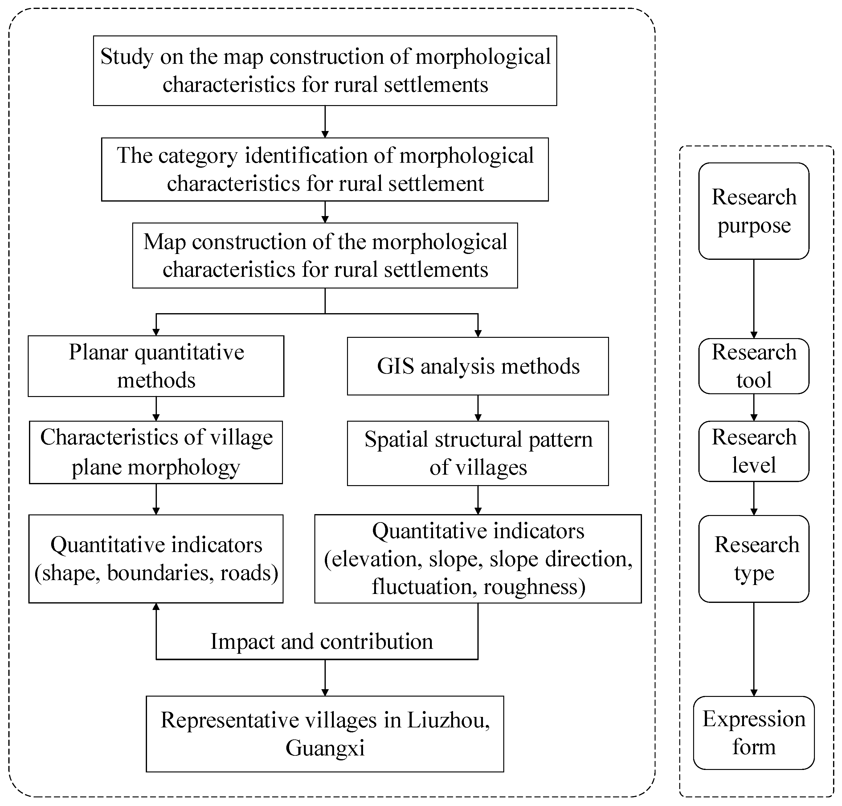
2. Materials and Methods
2.1. GIS Characterization of Spatial Elements for Rural Settlements
2.2. Construction Logic of Spatial Layout Characteristics Map for Rural Settlement Based on GIS
3. Spatial Distribution Characteristics of Ethnic Minority Rural Settlements in Southern China
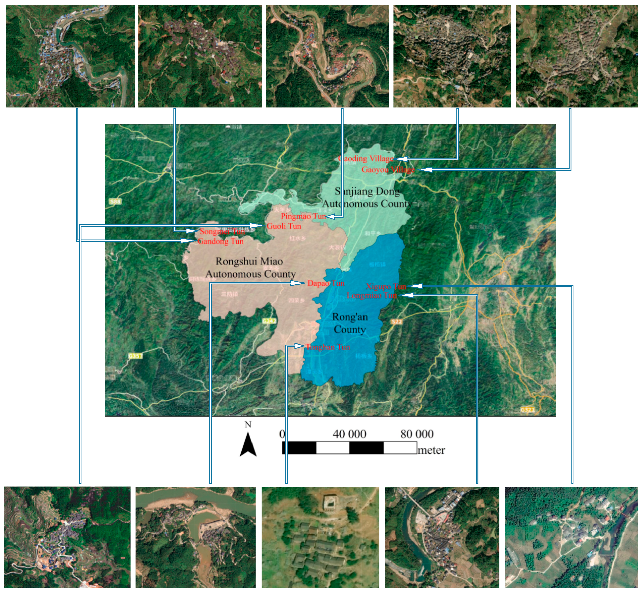
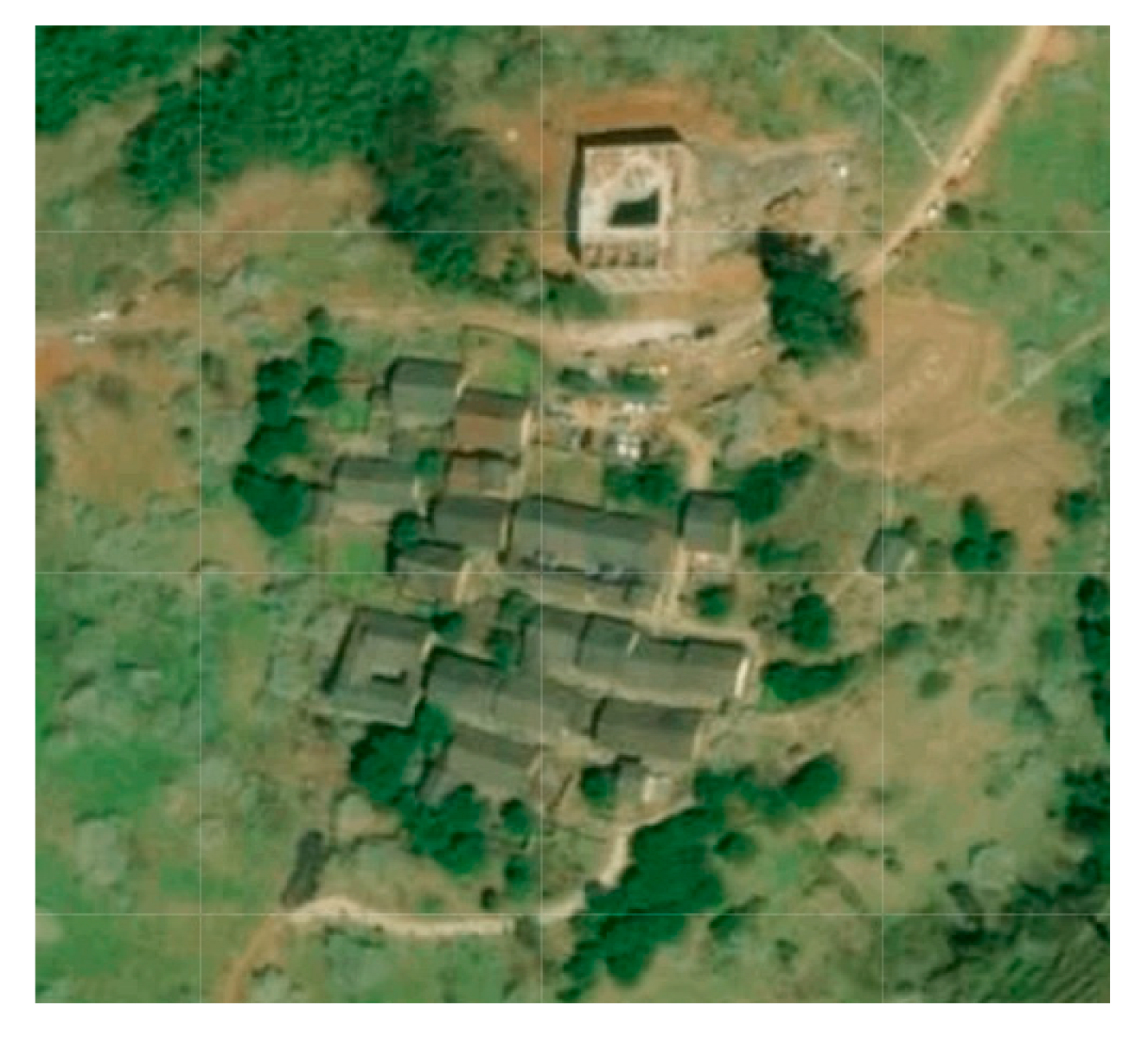
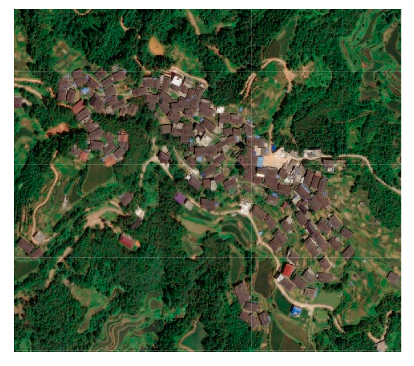
3.1. Case Selection
3.2. Calculation Results of GIS-Based Spatial Features of Rural Settlements
3.3. Analysis of the Relationship Between the Spatial Layout Characteristics and Natural Environment
3.3.1. Terrain and Geomorphology
3.3.2. Slope and Slope Direction
3.3.3. Ground Fluctuation and Ground Roughness
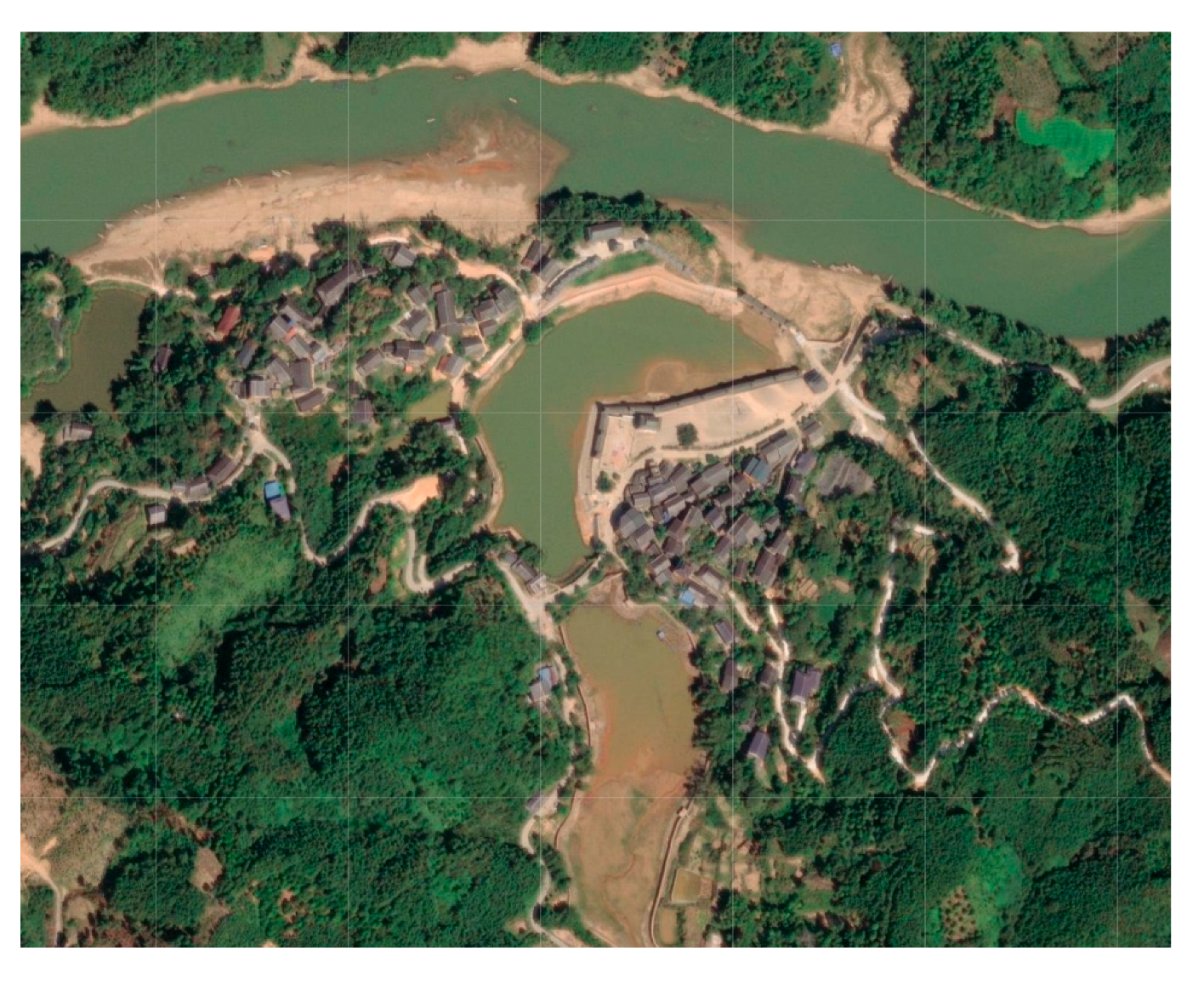
3.3.4. Rivers and Lakes
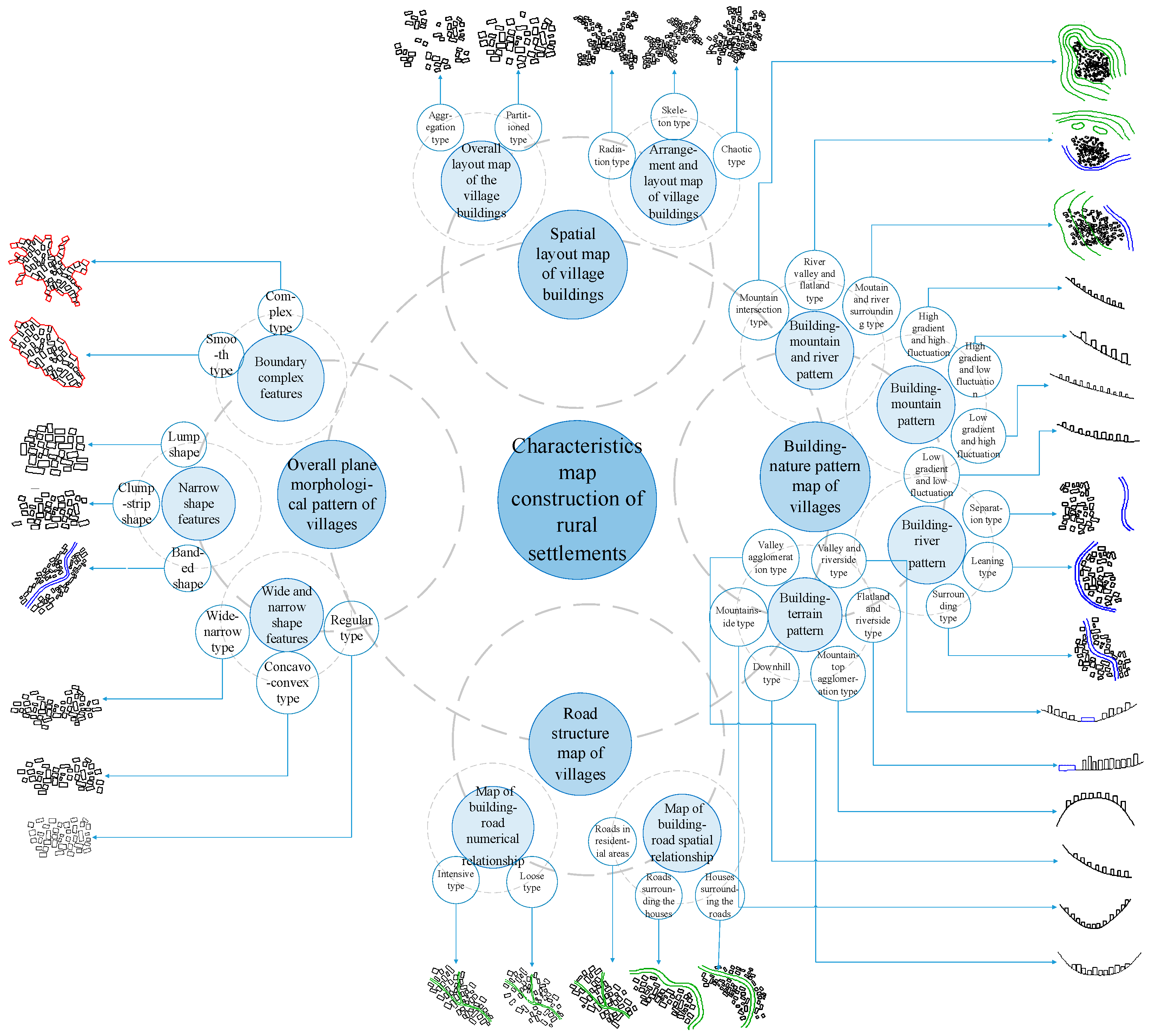
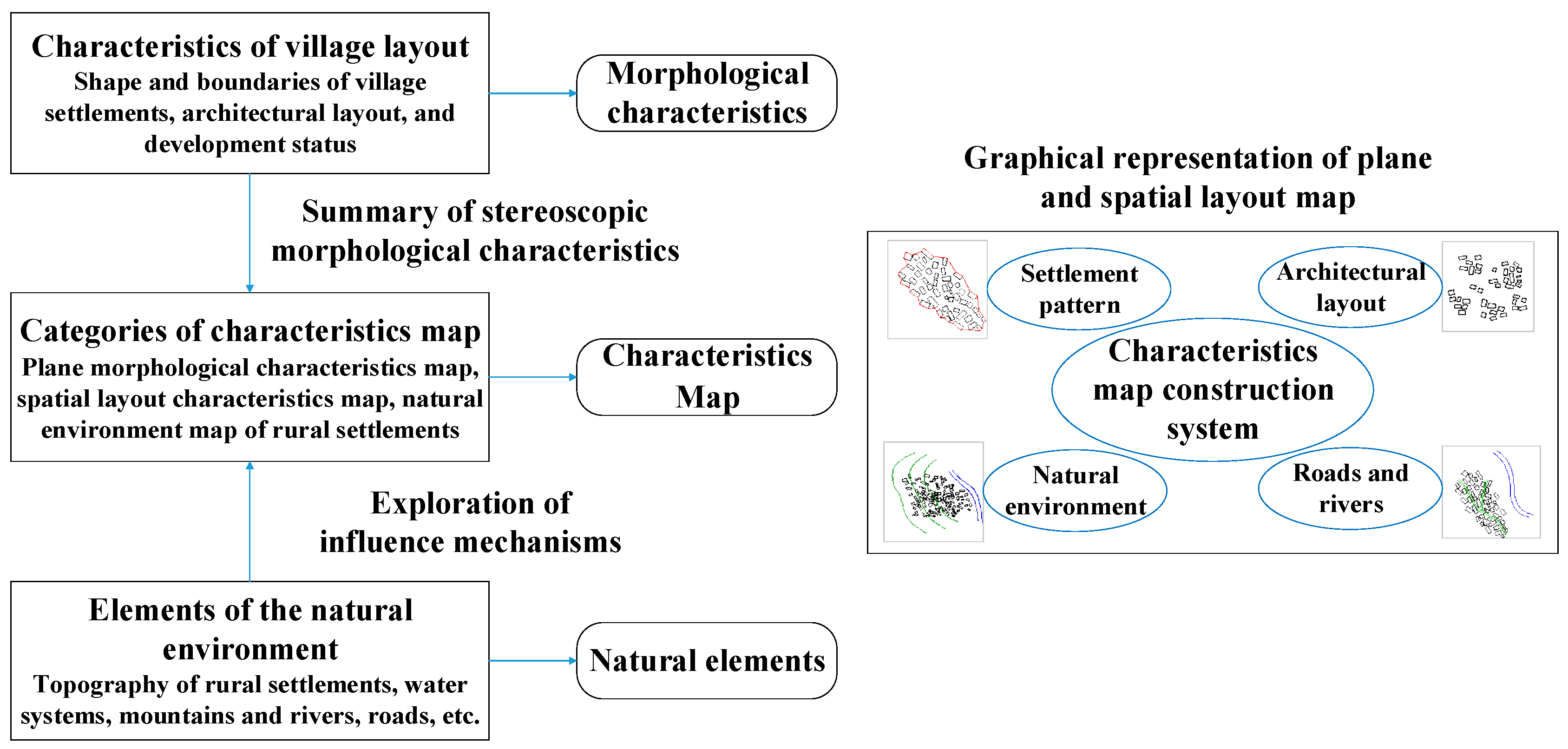
4. The Construction of Spatial Layout Characteristics Map for Ethnic Minority Rural Settlements
4.1. “Architectural Spatial Layout” Map of Villages
4.2. “Road Structure” Map of Villages
4.3. “Building-Nature Pattern” Map of Villages
4.3.1. “Building–Mountain and River Pattern” Map
4.3.2. “Building–Mountain Pattern” Map
4.3.3. “Building–Terrain Pattern” Map
4.4. Construction System and Process of the Planar Morphological and Spatial Layout Characteristics Map of Rural Settlements
5. Discussion
6. Conclusions
- (1)
- ArcGIS software is applied to calculate geographic indicators (slope gradient, slope direction, ground fluctuation, and ground roughness) that can express the topographic and geomorphological features of the settlement. On one hand, these geographic indicators can explain the cause of spatial layout characteristics of the settlement; on the other hand, they extract the factors that can reflect the spatial layout features of rural settlements. Subsequently, the spatial layout characteristics map of the settlement can be constructed according to the manifestation of the factors.
- (2)
- The research shows that ethnic minority rural settlements in southern China generally follow contour lines in their distribution, and they give priority to the gently sloping terrain regardless of the surrounding topography. The slope direction of the settlement site is not limited to the south, and all directions are available, which shows that the site selection of rural settlements does not only consider the sunshine factor, but also takes into account the factors of sunshine, traffic, and water source comprehensively.
- (3)
- This study adopts a single-settlement perspective, focusing on the spatial relationships between residential buildings and topographic features such as landforms, mountains, and rivers. The characteristic map types are classified based on the composition of various elements within the settlement space, while the spatial layout characteristics are quantified and expressed through calculated results of specific indicators. The proposed methodology provides a theoretical foundation for optimizing the utilization of spatial resources in settlements and guiding the planning and development of rural settlements. The method proposed in this paper is general and can be extended to the general study of rural settlements.
Author Contributions
Funding
Data Availability Statement
Conflicts of Interest
References
- Stower, H. A refocus on the rural landscape. Nat. Med. 2019, 25, 1799. [Google Scholar] [CrossRef]
- Vos, W.; Meekes, H. Trends in European cultural landscape development: Perspectives for a sustainable future. Landsc. Urban Plan. 1993, 46, 3–14. [Google Scholar] [CrossRef]
- Ghaderi, Z.; Henderson, J.C. Sustainable rural tourism in lran: A perspective from Hawraman village. Tour. Manag. Perspect. 2012, 2, 47–54. [Google Scholar]
- Olczak, B.; Wilkosz-mamcarczyk, M.; Prus, B.; Hodor, K.; Dixon-gough, R. Application of the building cohesion method in spatial planning to shape patterns of the development in a suburban historical landscape of a ’village within Krakow’. Land. Use Policy 2022, 114, 105997. [Google Scholar] [CrossRef]
- Thinh, N.K.; Kamalipour, H.; Peimani, N. Morphogenesis of forgotten places: A typology of villages-in-the-city in the Global South. Habitat. Int. 2024, 153, 103184. [Google Scholar] [CrossRef]
- Seltzer-Rogers, T.A. Constructing a borderlands in the ancient international four corners: Settlement layout, architecture, and mortuary practices in thirteenth through fifteenth century CE villages along the contemporary united states-Mexico border. J. Anthropol. Archaeol. 2023, 72, 101547. [Google Scholar] [CrossRef]
- Huang, X.Y.; Xu, H.G.; Robert, L. Spatial development of two villages: Bordering, debordering, and rebordering in a community scenic area. Ann. Tour. Res. 2022, 93, 103370. [Google Scholar] [CrossRef]
- Prus, B.; Wilkosz-Mamcarczyk, M.; Salata, T. Landmarks as cultural Heritage Assets Affecting the Distribution of Settlements in Rural Areas—An Analysis Based on LIDAR DTM, Digital Photographs, and Historical Maps. Remote Sens. 2020, 12, 1778. [Google Scholar] [CrossRef]
- Bender, O.; Boehmer, H.J.; Jens, D.; Schumacher, K.P. Using GIS to analyze long-term cultural landscape change in Southern Germany. Landsc. Urban Plan. 2005, 70, 111–125. [Google Scholar] [CrossRef]
- Sesotyaningtyas, M.; Manaf, A. Analysis of Sustainable Tourism Village Development at Kutoharjo Village, Kebumen Region of Central Java. Proc. Soc. Behav. Sci. 2015, 184, 273–280. [Google Scholar] [CrossRef]
- Ma, H.D.; Tong, Y.Q. Spatial differentiation of traditional villages using ArcGIS and GeoDa: A case study of Southwest China. Ecol. Inform. 2022, 68, 101416. [Google Scholar] [CrossRef]
- Hui, Z.; Zheng, W.W.; Liu, P.L.; Liu, X.Y. The forms and structures of traditional landscape genome maps: A case study of Hunan Province. Acta Geogr. Sin. 2018, 73, 317–332. [Google Scholar]
- Hou, A.P.; Chen, X.Y. Research on the traditional settlement landscape based on genetic information—Turpan Mazha Village as example. J. Xinjiang Univ. 2016, 33, 235–240, 252. [Google Scholar]
- Hoskins, W.G. The Making of the English Landscape; Hodder: London, UK, 1955. [Google Scholar]
- Jin, Q.M. Geography of Rural Settlements; Science Press: Beijing, China, 1988. [Google Scholar]
- Li, B.L.; Lu, Y.F.; Li, Y.D.; Zuo, H.Y.; Ding, Z.Q. Research on the Spatiotemporal Distribution Characteristics and Accessibility of Traditional Villages Based on Geographic Information Systems—A Case Study of Shandong Province, China. Land 2024, 13, 1049. [Google Scholar] [CrossRef]
- Chen, S.; Mehmood, M.S.; Liu, S.; Gao, Y. Spatial Pattern and Influencing Factors of Rural Settlements in Qinba Mountains, Shaanxi Province, China. Sustainability 2022, 14, 10095. [Google Scholar] [CrossRef]
- Paquette, S.; Domon, G. Changing ruralities, changing landscapes: Exploring social recomposition using a multi-scale approach. J. Rural Stud. 2003, 19, 425–444. [Google Scholar] [CrossRef]
- Argent, N.M.; Smailes, P.J.; Griffin, T. Tracing the Density Impulse in Rural Settlement Systems: A Quantitative Analysis of the Factors Underlying Rural Population Density Across SouthEastern Australia, 1981–2001. Popul. Environ. 2006, 27, 151–190. [Google Scholar] [CrossRef]
- Gilg, A. An Introduction to Rural Geography; Edward Amold: London, UK, 1985. [Google Scholar]
- McLaughlin, D.K.; Stokes, C.S.; Nonoyama, A. Residence and income inequality: Effects on mortality among U.S. counties. Rural Sociol. 2001, 66, 579–598. [Google Scholar] [CrossRef]
- Martinho, I. Historic Anthropogenic Factors Shaping the Rural Landscape of Portugal’s Interior Alenteio; Arizona University Press: Tucson, AZ, USA, 2001. [Google Scholar]
- Chibilev, A.A.; Akhmetov, R.S.; Petrishchev, V.P.; Cherkasova, Y.V. Cluster differentiation of municipal districts of Orenburg oblast by features of rural settlement pattern. Reg. Res. Russ. 2015, 5, 263–269. [Google Scholar] [CrossRef]
- Porta, J.; Parapar, J.; Doallo, R.; Barbosa, V.; Santé, I.; Crecente, R.; Díaz, C. A population-based iterated greedy algorithm for the delimitation and zoning of rural settlements. Comput. Environ. Urban Syst. 2013, 39, 12–26. [Google Scholar] [CrossRef]
- Latocha, A. Modern transformation of deserted settlements in the Sudetes Mountains, SW Poland. GeoScape 2020, 14, 80–95. [Google Scholar] [CrossRef]
- Hoffman, G.W. Transformation of rural settlement in Bulgaria. Geogr. Rev. 1964, 54, 45–64. [Google Scholar] [CrossRef]
- Roberts, B.K. Landscape of Settlement Prehistory to the Present; Rutledge: London, UK, 1996. [Google Scholar]
- Fatimah, T. Community-based spatial arrangement for sustainable village environmental improvement–case study of Candirejo Village, Borobudur, Indonesia (in 5th International Conference on Energy and Environment Research, ICEER 2018). Energy Procedia 2018, 153, 389–395. [Google Scholar] [CrossRef]
- Kâhya, Y.; Güler, K.; Güler, A.C. Ödemiş-Dereuzunyer: Architectural Features of a Rural Settlement to Be Submerged by Dam Waters. Int. J. Archit. Herit. 2018, 14, 605–629. [Google Scholar] [CrossRef]
- Wilkosz-Mamcarczyk, M.; Olczak, B.; Prus, B. Urban Features in Rural Landscape: A Case Study of the Municipality of Skawina. Sustainability 2020, 12, 4638. [Google Scholar] [CrossRef]
- Chang, Q. Structure and prospective of Chinese vernacular architectural pedigrees—An objective based on a systematic study of sample preservation and holistic regeneration. Archit. J. 2016, 10, 1–9. [Google Scholar]
- Xiao, J.; Zhang, Q.Q.; Xiao, T.Y.; Cao, K. Multi-scale identification and dual system interpretation of landscape gene in traditional settlement: A case study of traditional Qiang minority settlements in western Sichuan. Dev. Small Cities Towns 2021, 39, 57–65, 84. [Google Scholar]
- Zhou, C.S. Urban Spatial Structure and Form; Science Press: Beijing, China, 2017. [Google Scholar]
- Xie, J.L. Research on the Protection and Inheritance of Landscape Genes in Traditional Villages in Guanzhong Region. Master’s Thesis, Chang’an University, Xi’an, China, 2020. [Google Scholar]
- Wang, S.Y. Study on the Construction of Landscape Gene Map of Huizhou Traditional Villages and Its Inheritance and Protection Strategies Based on Landscape Gene Theory. Master’s Thesis, Jiangxi Normal University, Nanchang, China, 2022. [Google Scholar]
- Cai, L. Traditional Villages and Buildings in Dong Inhabited Areas; China Architecture & Building Press: Beijing, China, 2007. [Google Scholar]
- Kevin, L. Urban Morphology; Huaxia Publishing House: Beijing, China, 2001. [Google Scholar]
- Zhai, Z.Y.; Chang, F.; Li, T.S.; Li, J.L.; Shi, Y.; Wu, P. Research on the cultural heritage landscape genome maps of traditional villages in Shanxi Province. Geogr. Geo-Inf. Sci. 2018, 34, 87–94, 113. [Google Scholar]
- Xiang, Y.L. Study on Landscape Genetic Variation Mechanism of Traditional Rural Settlements in Shaanxi Province and Its Restoration. Ph.D. Thesis, Northwest University, Xi’an, China, 2022. [Google Scholar]
- Hui, Z.; Liu, P.L.; Chen, Y. A research on graphic methodology unit model of traditional settlement landscape. Geogr. Geo-Inf. Sci. 2009, 25, 79–84. [Google Scholar]
- Cao, S.Q.; He, J.D.; Deng, Y.Y. Map features of traditional landscape gene symbols in southern China—A case study of the great western Hunan. Econ. Geogr. 2017, 37, 191–198. [Google Scholar]
- Hui, Z.; Liu, P.L. Discussion on the gene information atlas of traditional settlement landscapes in southern China based on GIS. Hum. Geogr. 2008, 23, 13–16. [Google Scholar]
- Luo, X.; Huang, C.P.; Huang, J.Y. A quantitative study on the morphological characteristics of rural Settlements: Taking the ethnic minority villages in Liuzhou, Guangxi as the example. Planners 2023, 39, 88–94. [Google Scholar]
- Xiang, H.W.; Xie, M.J.; Fang, Y.J. Study on the architecture space-social network characteristics based on social network analysis: A case study of Anshun Tunpu settlement. Ain Shams Eng. J. 2024, 15, 102333. [Google Scholar] [CrossRef]
- Gao, W.J.; Zhuo, X.L.; Xiao, D.W. Spatial patterns, factors, and ethnic differences: A study on ethnic minority villages in Yunnan, China. Heliyon 2024, 10, e27677. [Google Scholar] [CrossRef] [PubMed]
- Liu, W.P.; Henneberry, S.R.; Ni, J.P.; Radmehr, R.; Wei, C.F. Socio-cultural roots of rural settlement dispersion in Sichuan Basin: The perspective of Chinese lineage. Land. Use Policy 2019, 88, 104162. [Google Scholar] [CrossRef]
- Li, G.Y.; Jiang, G.H.; Jiang, C.H.; Bai, J. Differentiation of spatial morphology of rural settlements from an ethnic cultural perspective on the Northeast Tibetan Plateau, China. Habitat. Int. 2018, 79, 1–9. [Google Scholar] [CrossRef]
- Wu, Y. Associated Research of Regionality and Ethnicity in Minority Settlements of Northwest Yunnan. Ph.D. Thesis, Tsinghua University, Beijing, China, 2012. [Google Scholar]

| Index | Formula | Symbol Description | Meaning |
|---|---|---|---|
| Elevation | H | H is the height of Earth’s surface or altitude. | GIS elevation data is a digital model, which represents the height information of the earth surface in digital form. |
| Slope gradient | dz is the distance change in the height direction, dx is the distance change in the x-direction, dy is the distance change in the y-direction. | For each pixel, calculating the maximum variation rate in the direction from the pixel to its adjacent pixel. | |
| Slope direction | dz is the distance change in the height direction, dx is the distance change in the x-direction, dy is the distance change in the y-direction. | It is used to identify the downhill direction with the largest variation rate in the direction from each pixel to its adjacent pixel. | |
| Ground fluctuation | is the minimum elevation value. | It refers to the difference between the highest altitude and the lowest altitude in a specific area, and it is a macroscopic index to describe the topographic characteristics of a region. | |
| Ground roughness | is the projected area of the ground on the horizontal plane and S is the slope factor (in degree) in the DEM file. | It is the ratio of the Earth’s surface area to its projected area on the horizontal plane in a specific area, and it is a macroscopic index of surface shape. |
| County | Village Name |
|---|---|
| Rong’an County | Tongban Tun (Han), Longmiao Tun (Zhuang), Dapao Tun (Miao), Xigupo Tun (Zhuang) |
| Rongshui Miao Autonomous County | Gandong Tun (Miao), Guoli Tun (Miao), Songmei Tun (Miao), Pingmao Tun (Dong) |
| Sanjiang Dong Autonomous County | Gaoding Village (Dong), Gaoyou Village (Dong) |
| Village Map | Elevation Data | Slope Gradient |
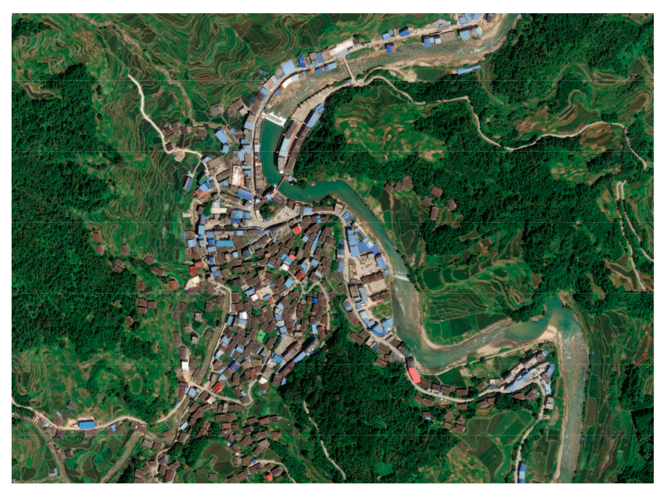 |  | 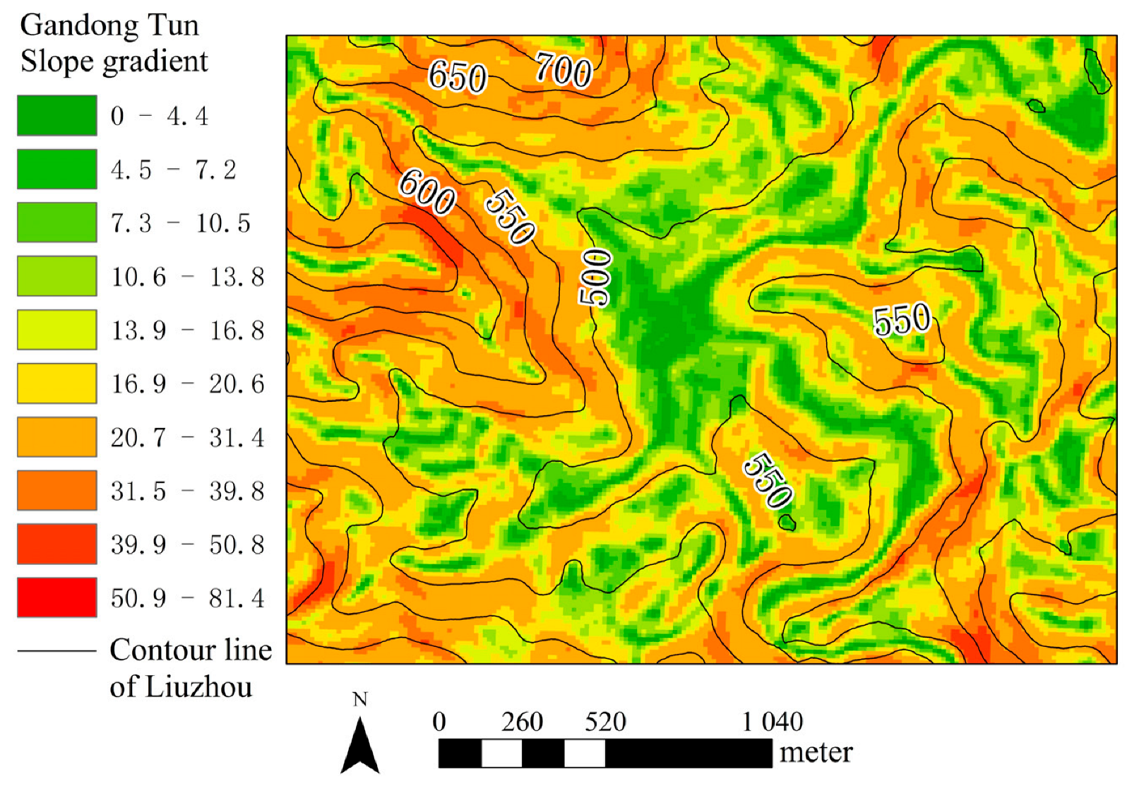 |
| Slope direction | Ground fluctuation | Ground roughness |
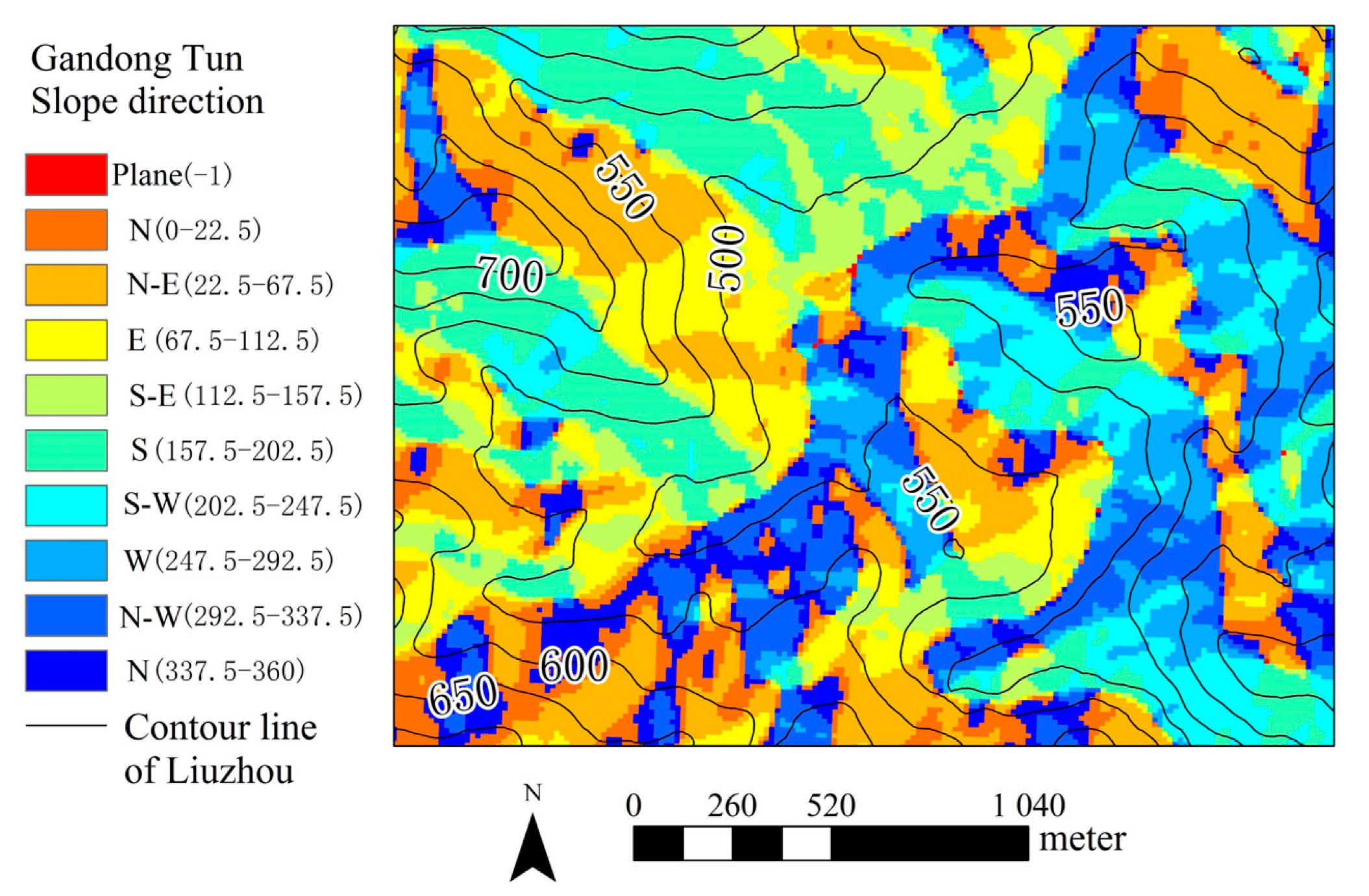 |  |  |
| Village Name | Tongban Tun (Han) | Longmiao Tun (Zhuang) | Xigupo Tun (Zhuang) | Dapao Tun (Miao) |
|---|---|---|---|---|
| Village map | 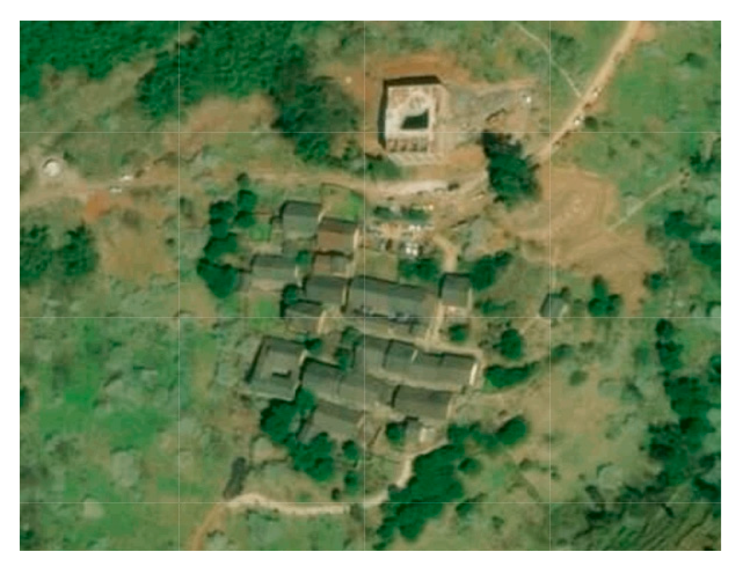 | 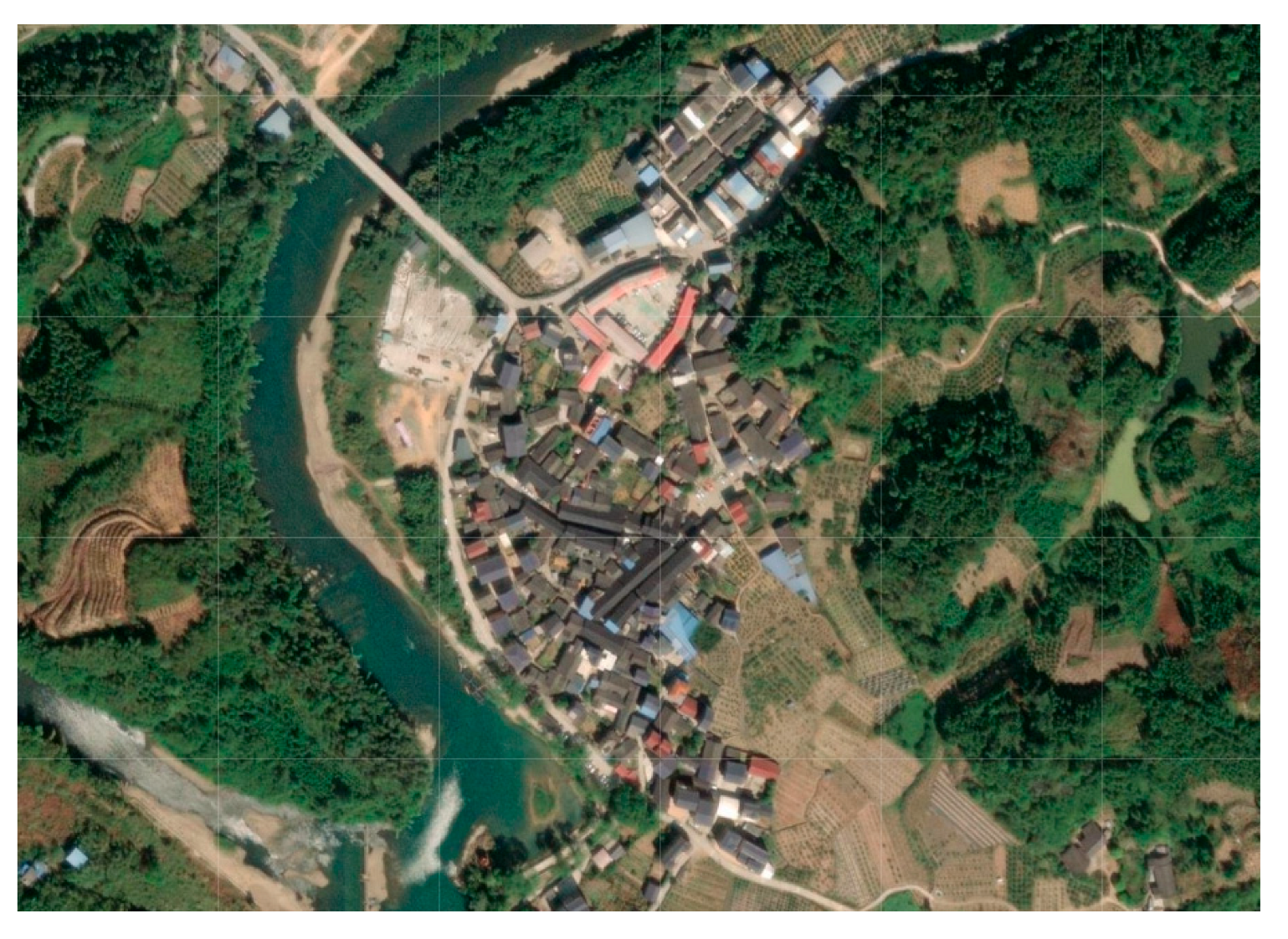 | 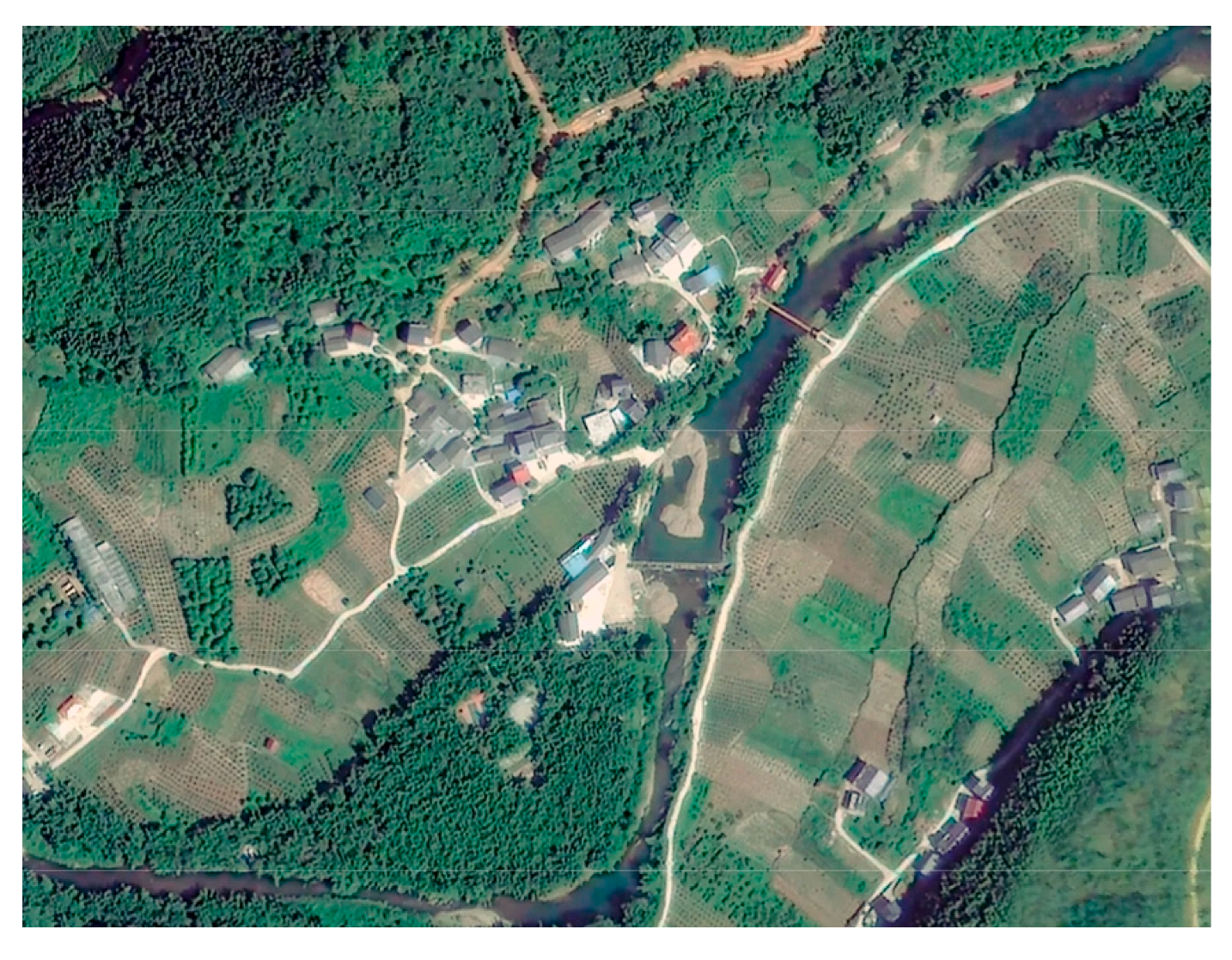 | 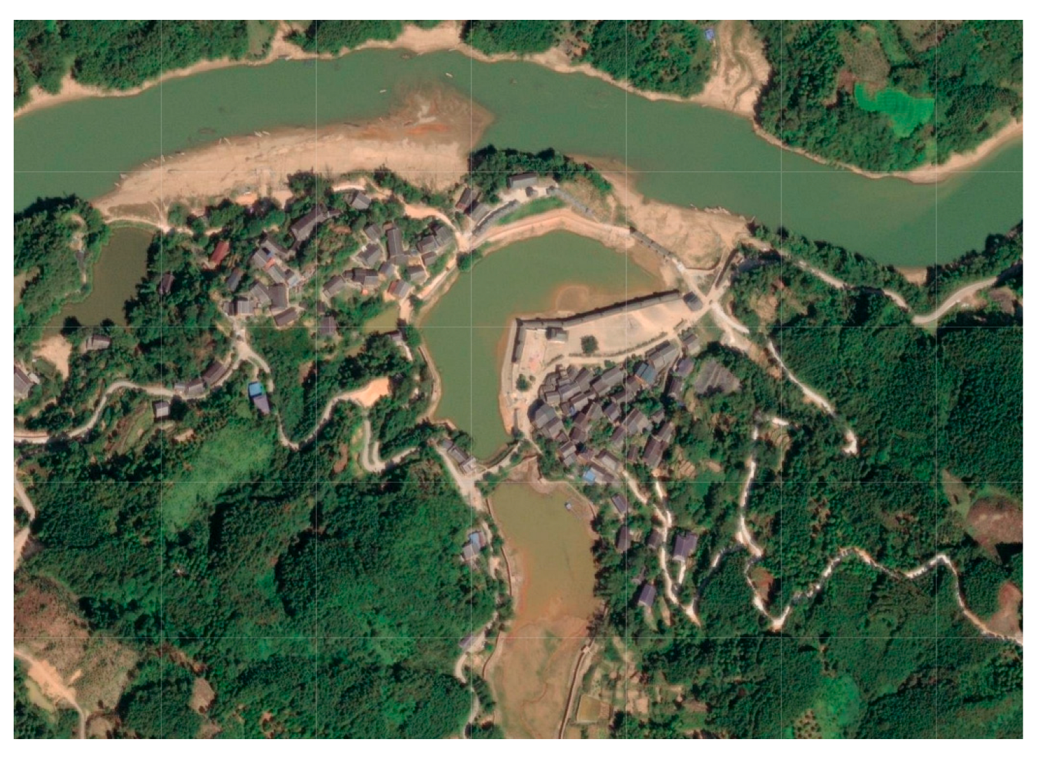 |
| Elevation (meter) | 355–430 | 130–150 | 150–160 | 90–150 |
| Slope gradient (degree) | 11–27 | 6–17 | 0–17 | 0–22 |
| Slope direction | South, Southwest | West, Northwest | South, Southeast | East, West |
| Ground fluctuation (meter) | 25–90 | 0–25 | 0–25 | 5–35 |
| Ground roughness | 1–1.2 | 1–1.06 | 1.03–1.1 | 1–1.09 |
| Village Name | Gandong Tun (Miao) | Guoli Tun (Miao) | Songmei Tun (Miao) | Pingmao Tun (Dong) |
|---|---|---|---|---|
| Village map | 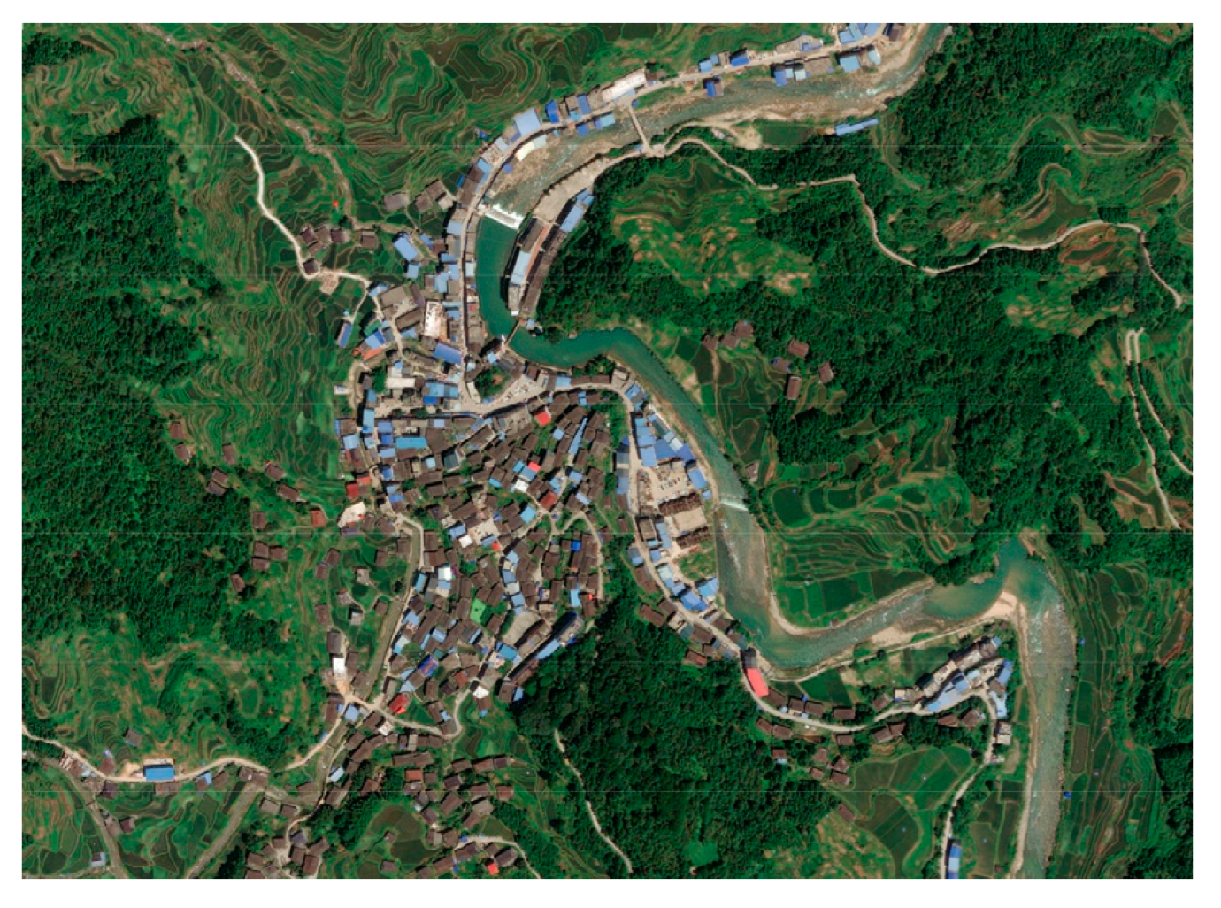 | 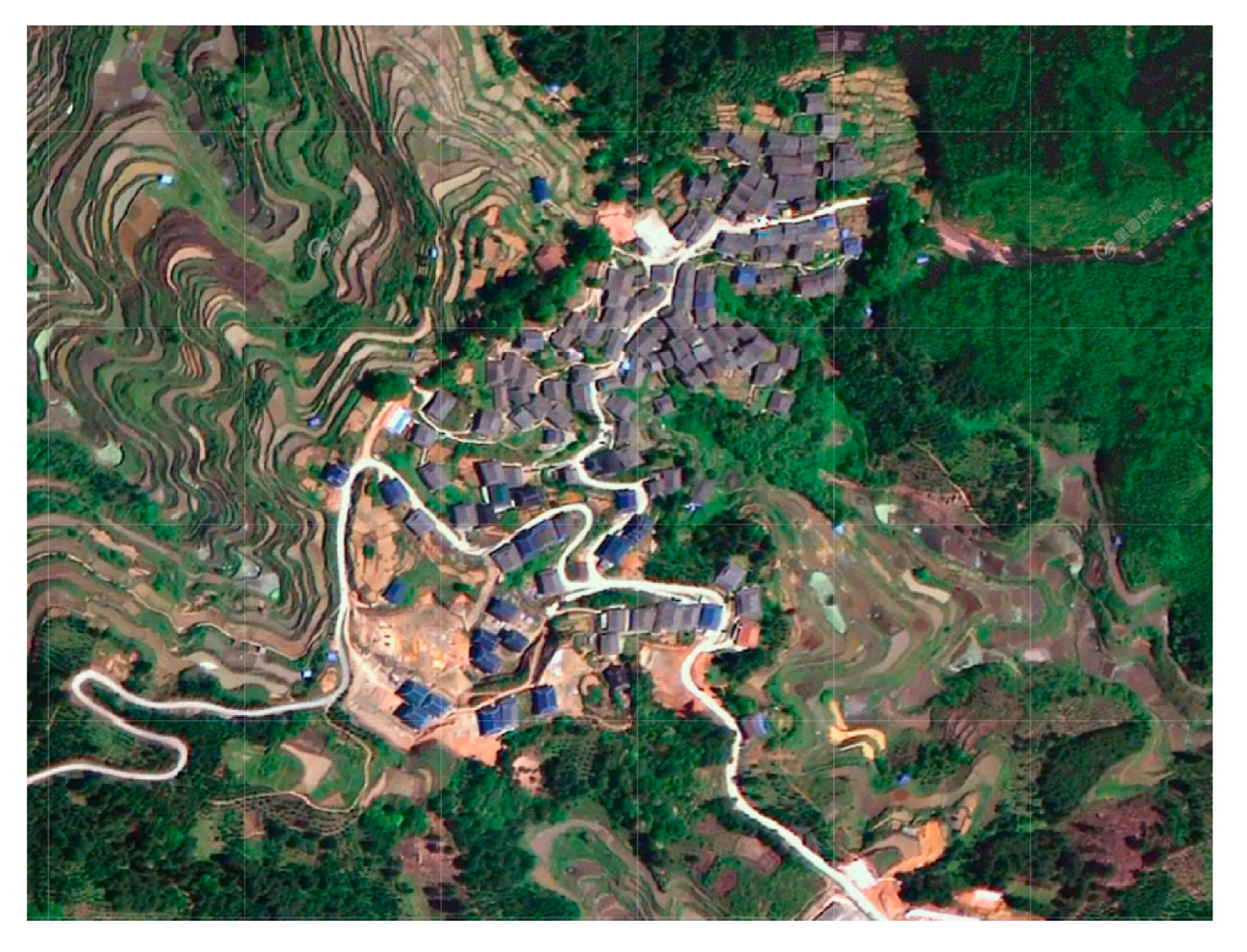 | 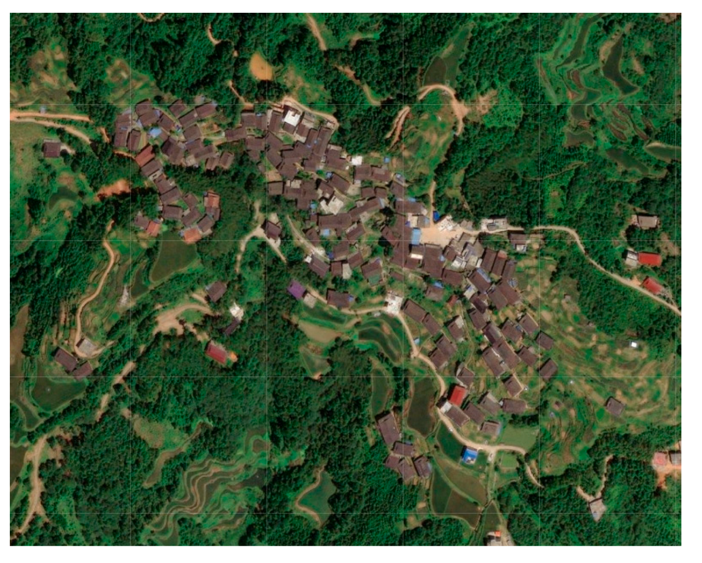 | 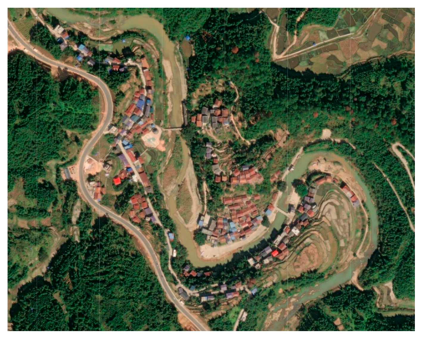 |
| Elevation (meter) | 460–480 | 560–640 | 750–850 | 150–190 |
| Slope gradient (degree) | 0–17 | 0–22 | 0–27 | 0–27 |
| Slope direction | Northwest, East, Northeast | East, Southeast, Northeast | South, Southeast, Southwest | East, Southeast, Northwest |
| Ground fluctuation (meter) | 5–50 | 16–70 | 16–90 | 16–70 |
| Ground roughness | 1–1.06 | 1–1.2 | 1.0–1.2 | 1–1.11 |
| Village Name | Gaoding Village (Dong) | Gaoyou Village (Dong) |
|---|---|---|
| Village map | 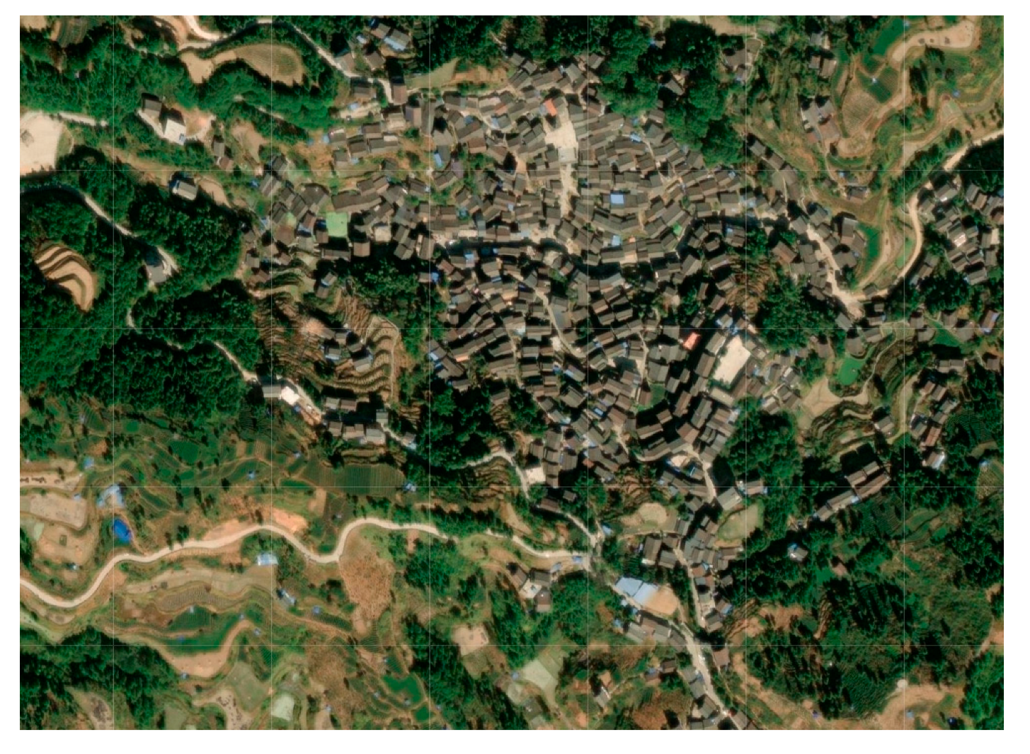 | 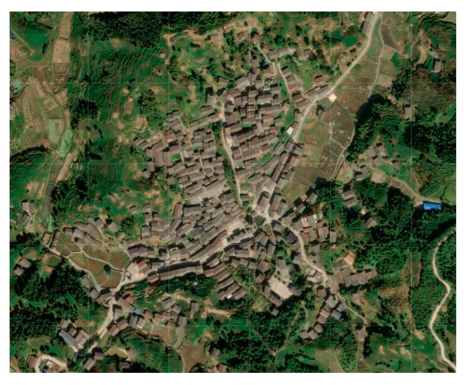 |
| Elevation (meter) | 450–550 | 490–540 |
| Slope gradient (degree) | 0–17 | 0–30 |
| Slope direction | Northwest, East, Northeast | East, Southeast, North, Northwest |
| Ground fluctuation (meter) | 16–70 | 16–50 |
| Ground roughness | 1–1.06 | 1–1.11 |
| Type | Spatial Pattern | Typical Village | Distribution | Cause Analysis |
|---|---|---|---|---|
| Aggregation type |  The houses are clustered together and arranged relatively closely, with no particularly obvious grouping features. |  Tongban Tun 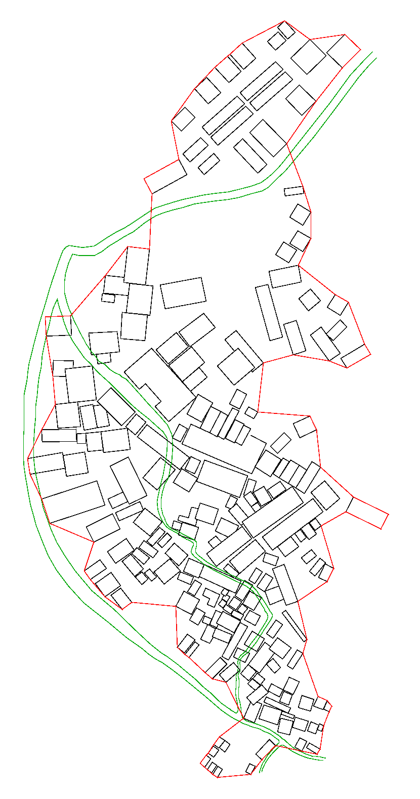 Longmiao Tun | They are generally located in the flat terrain (near the mountains and by the water), on the gentler hillside, or in the hilly land surrounded by mountains. | The dwellings in the settlement are arranged sequentially, relying on favorable terrain and water sources and showing significant aggregation characteristics; the mountains and water bodies did not block or divide the village into blocks. |
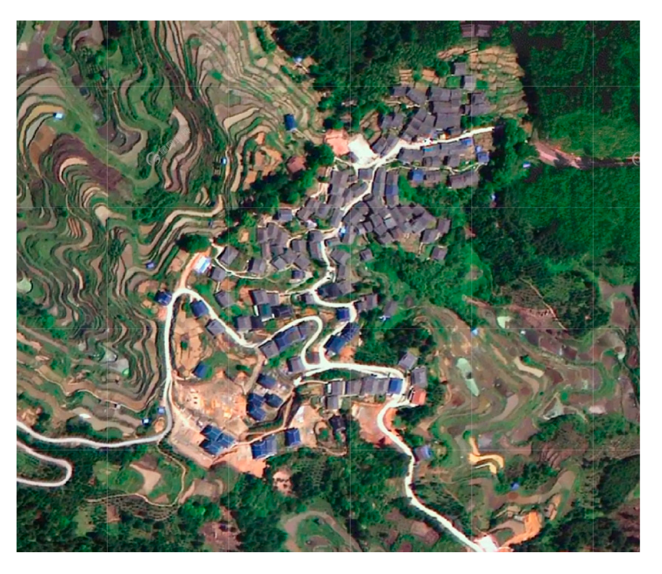
| Partitioned type | 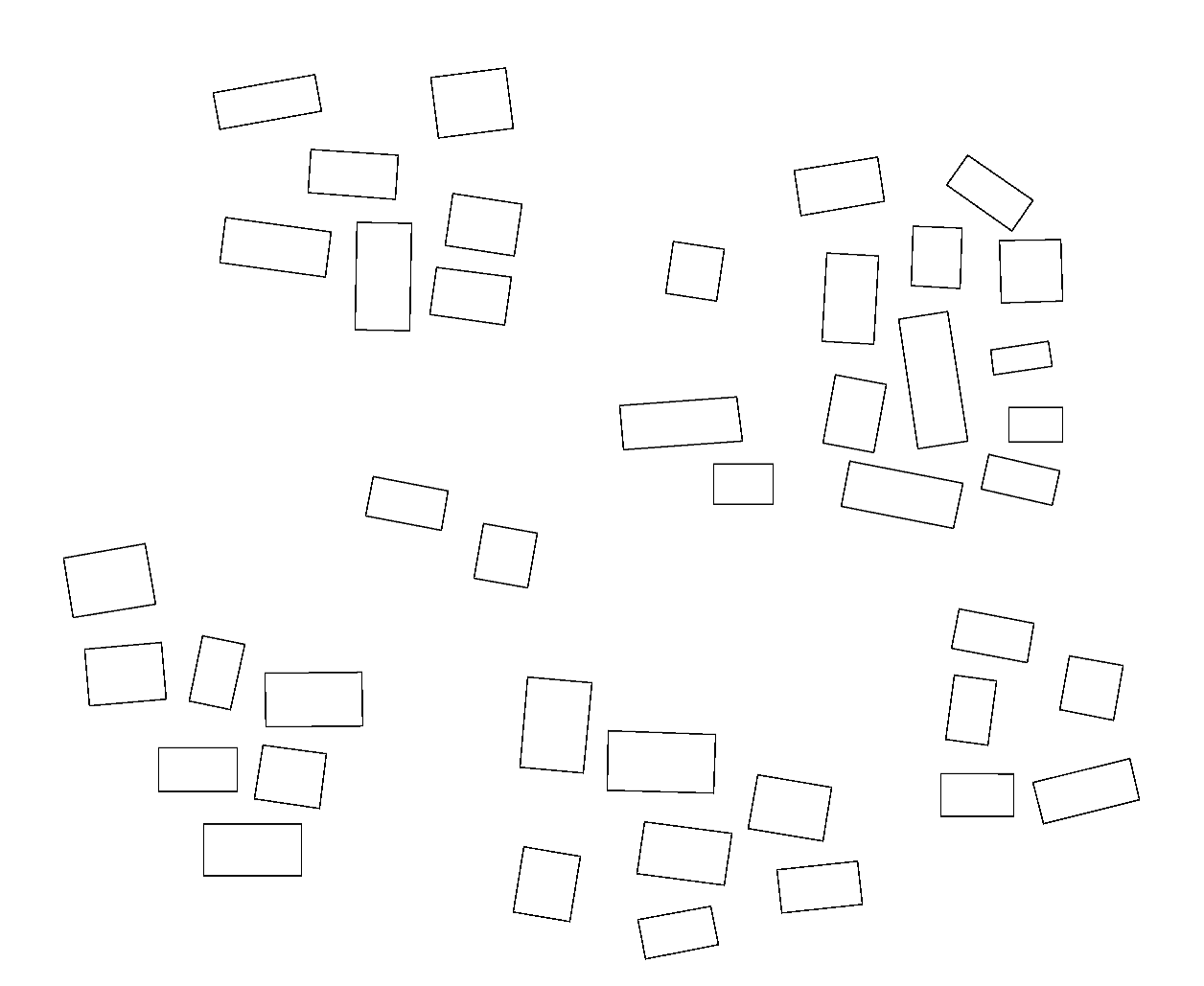 The houses in the settlement are grouped together on a smaller scale to form a number of sub-blocks. | 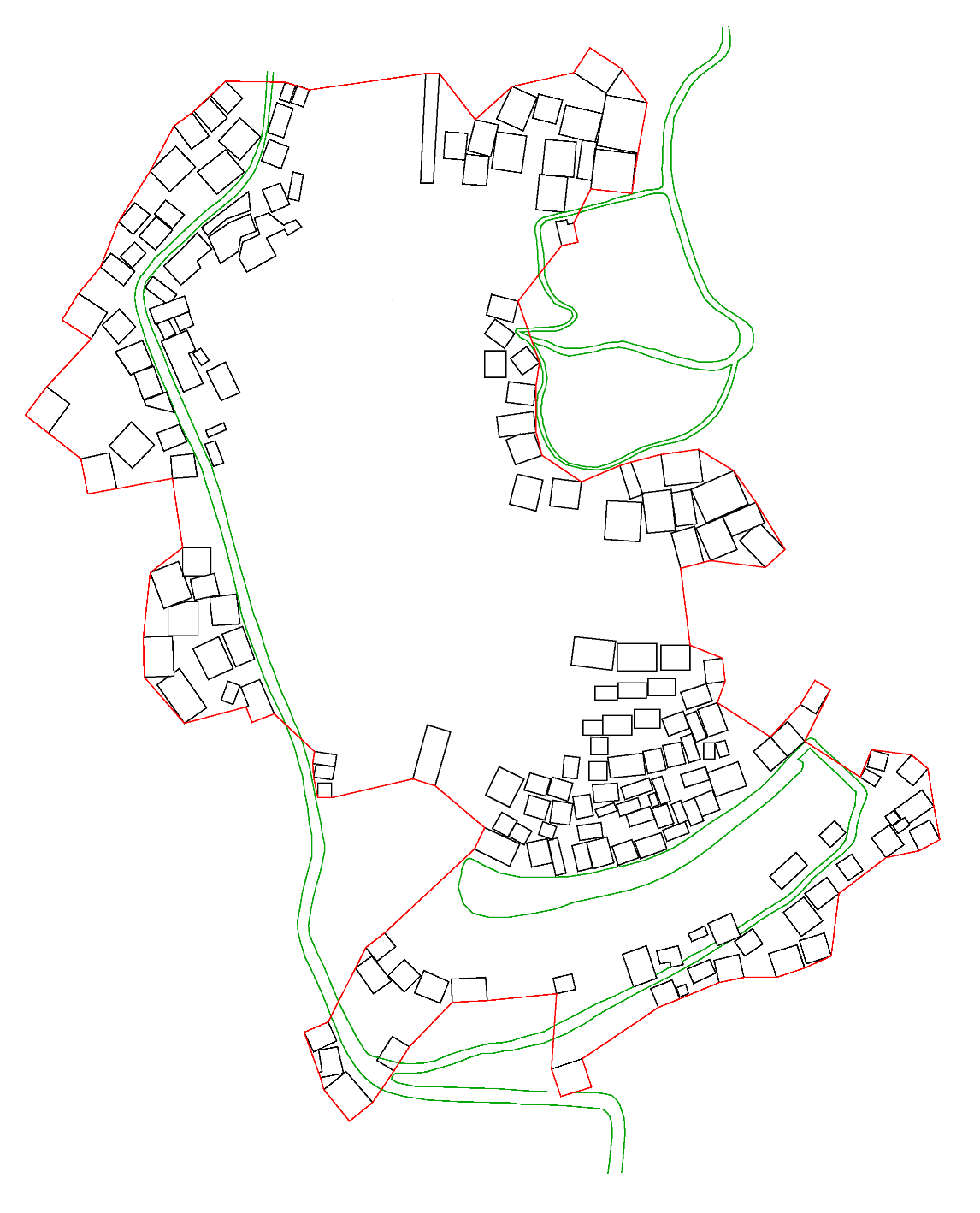 Pingmao Tun 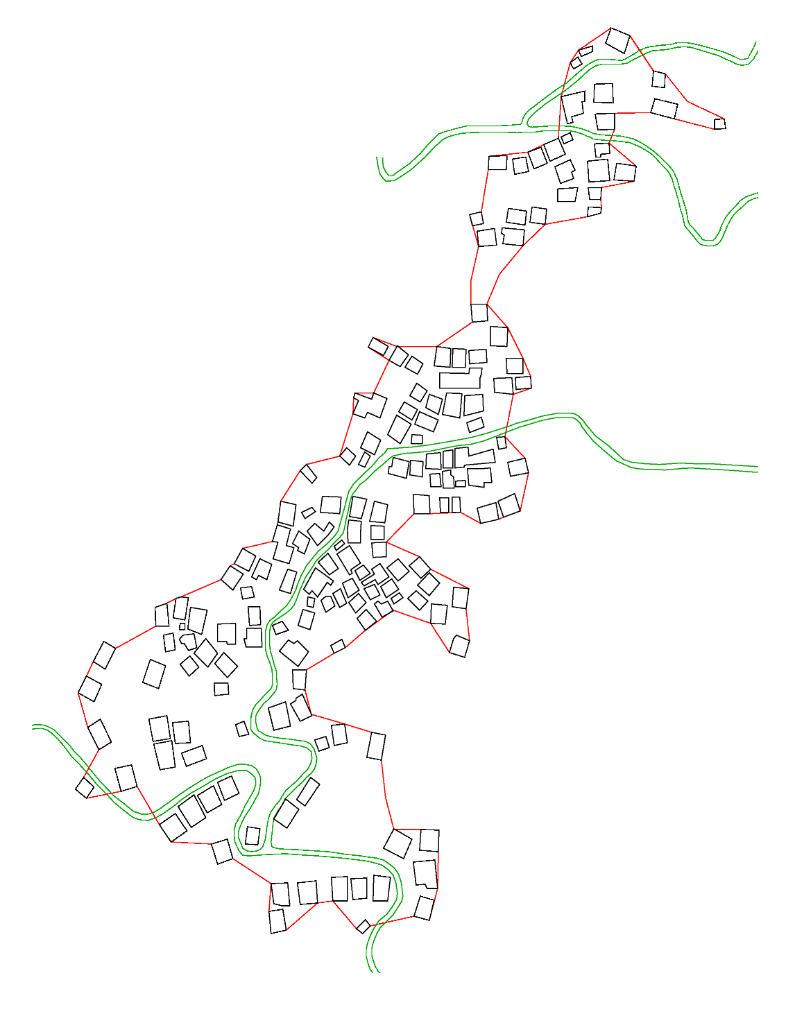 Guoli Tun | They are generally located on both sides of rivers with more complex directions, or on high mountains with higher terrain. | Due to the obstruction of terrain, road or rivers, the village space is divided into several small blocks, which are separated according to the river terrain. Meanwhile, the existence of families and clans makes villagers live together along the road. |
| Type | Spatial Pattern | Typical Village | Distribution | Cause Analysis |
|---|---|---|---|---|
| Radiation type |  Buildings spread out from the center of the settlement, mostly found in cluster villages. |  Gaoding Village | They are generally located in the lower terrain of the valley, that is, the intersection of two mountains, and the residential houses distribute along the col. | The residential houses in the settlement are arranged in the lower terrain, and the buildings are built between the two mountains. As the mountains continue to extend away, the buildings also expand from the center to the surrounding area, thus forming a typical radial shape. |
| Skeleton type |  There are obvious trunk and branch phenomena of dwellings within the settlement. | 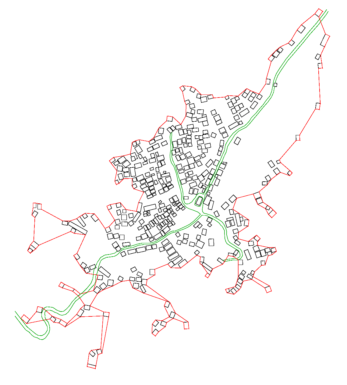 Gaoyou Village 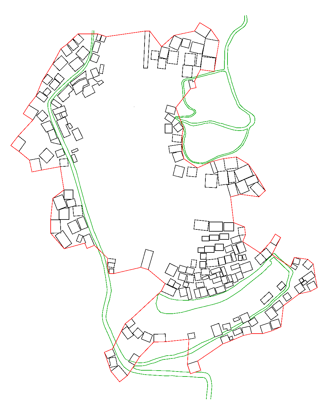 Pingmao Tun | They are generally found in river valleys with low relief, or on high mountains, or at the intersection of two mountain slopes. | Due to the distribution of terrain and rivers, most of the village buildings are arranged along the hillside or along the rivers, forming the main skeleton of the village spatial arrangement, and the remaining few buildings are distributed on both sides of the main body, thus forming a skeleton-shaped development pattern. |
| Chaotic type | 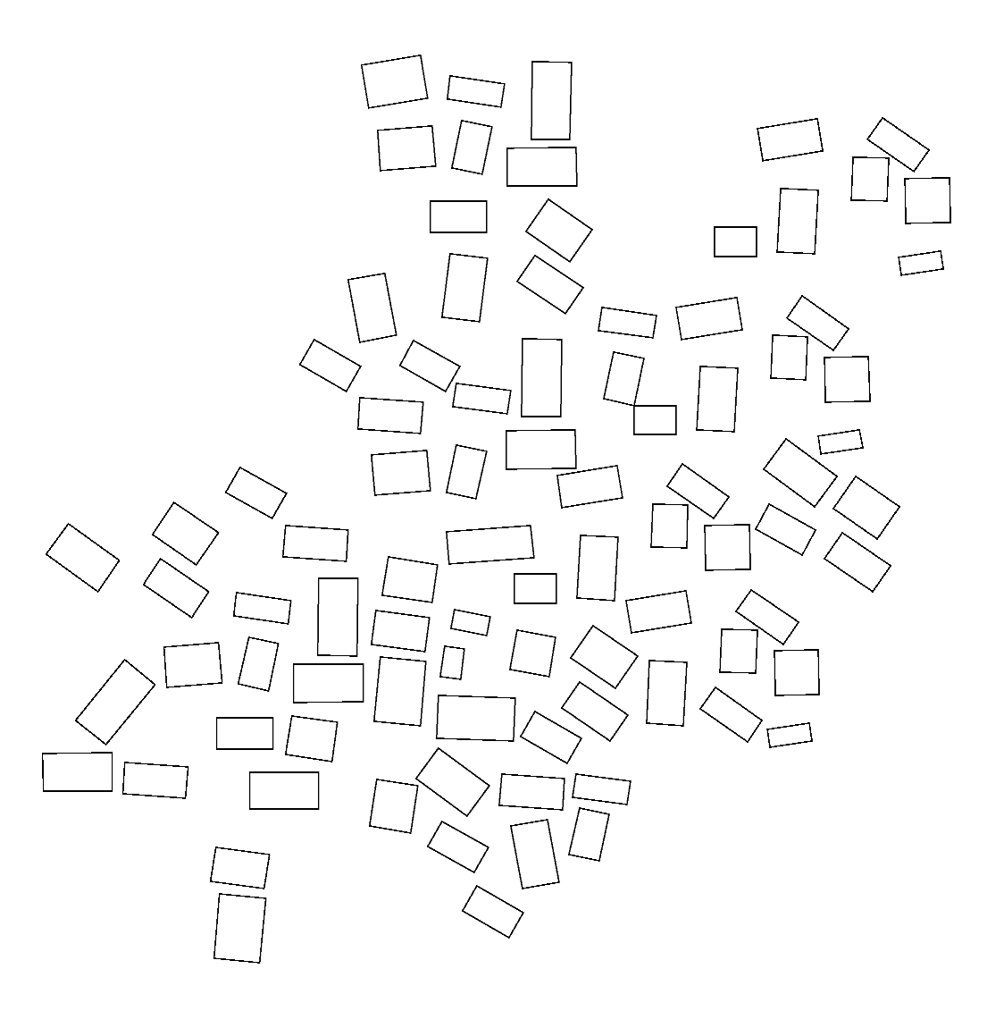 The distribution of buildings in the settlement is chaotic, with no apparent order or symmetry. |  Gandong Tun | It is generally located at the intersection of mountains and rivers, and the buildings constantly meander along the terrain, so the pattern is more chaotic. | The distribution of rivers and terrain is complex, resulting in a haphazard pattern of building development and layout. |
| Type | Spatial Pattern | Typical Village | Distribution | Cause Analysis |
|---|---|---|---|---|
| Roads in residential areas | 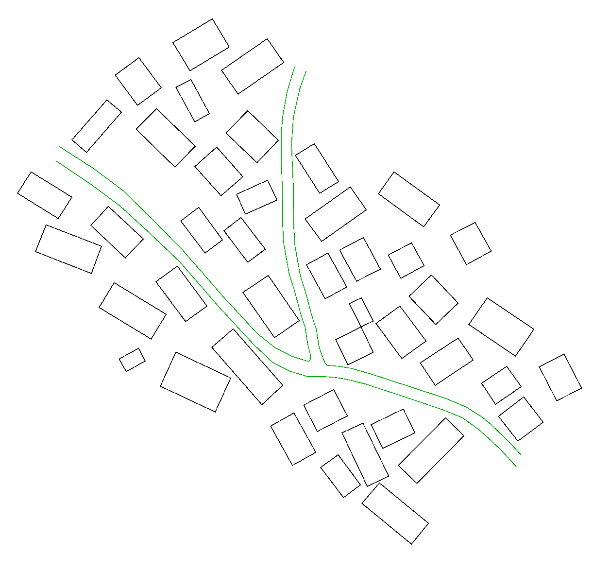 The roads distribute within the building groups and are integrated into the buildings. |  Guoli Tun 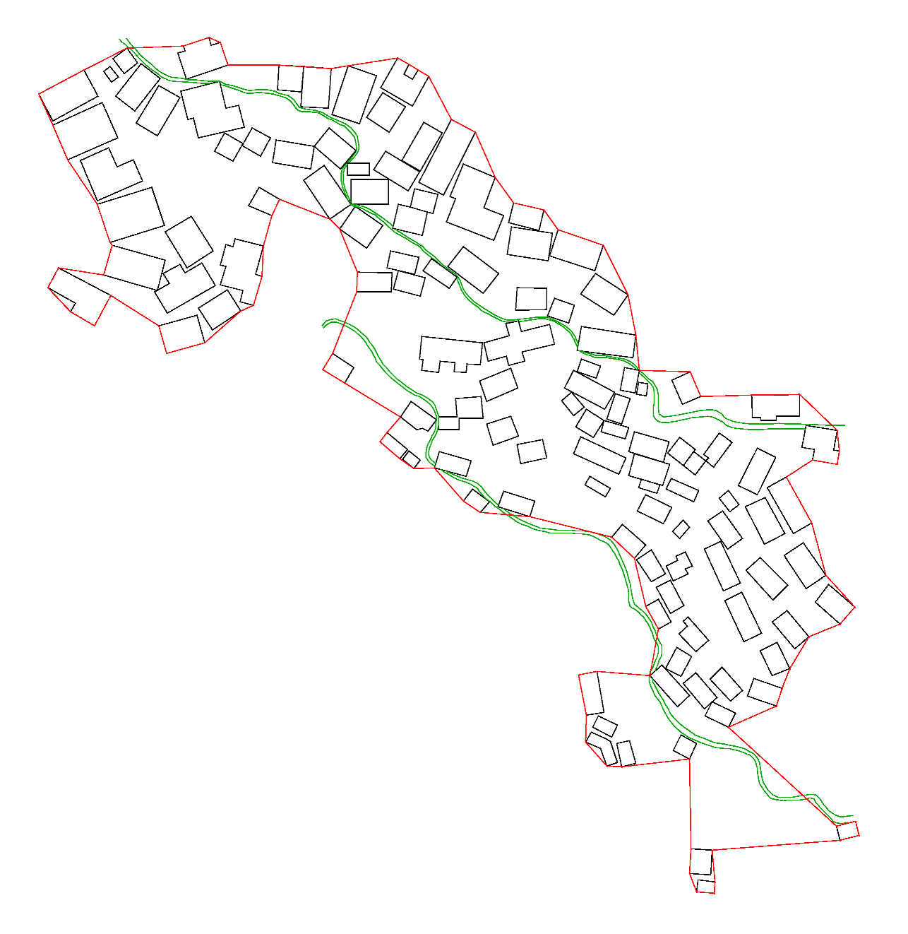 Songmei Tun | They are generally located on the hillside with low slope, or on high mountains with high terrain. | The houses are built on high mountains, and villagers rely on roads to travel, while the roads in the village are in the shape of steps or slopes, and the buildings are connected by a cascade of contour lines. |
| Roads surrounding the houses |  The alignment of the roads revolves around the house layout, that is, the roads are centered on the dwellings. | 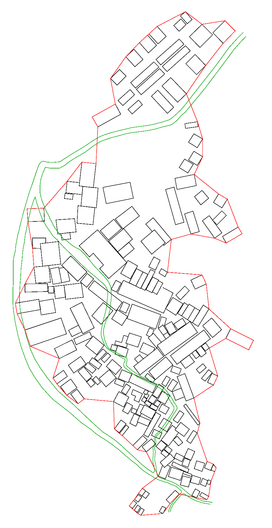 Longmiao Tun | It is generally found on the banks of low and flat river valleys. | In this case, there will be a river near the village, and the road distribution along the river can not only reduce the construction cost, but also reduce the travelling distance. |
| Houses surrounding the roads |  The houses are arranged sequentially against the road and are regularly located on both sides of the roads. | 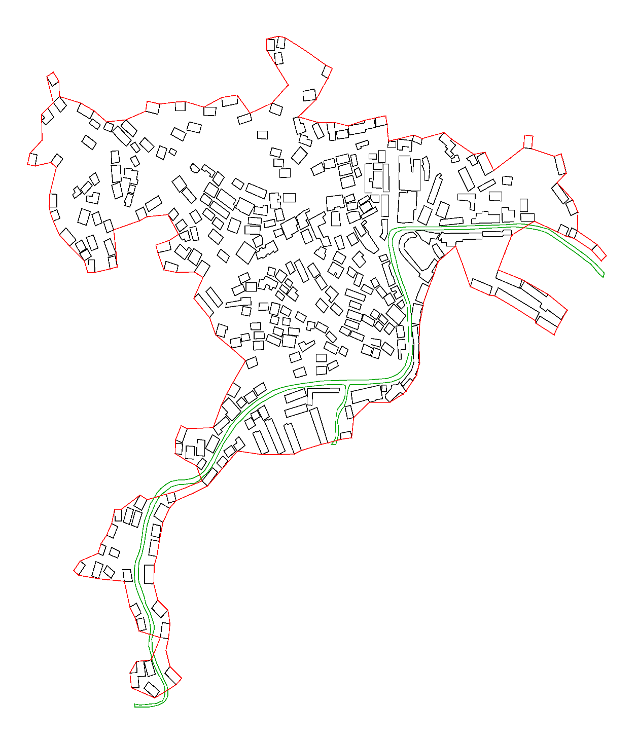 Gandong Tun 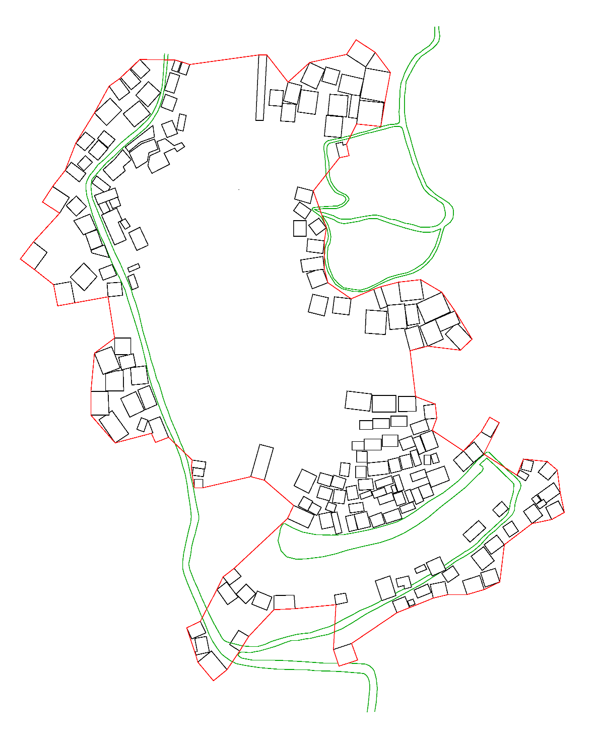 Pingmao Tun | They are located in low-lying valleys, the roads are built along the mountains, and the buildings spread out along the roads. | The buildings are spread around the road in sequence. Firstly, due to the topography and landform, the roads are built in the low-lying areas; secondly, the buildings are distributed next to the roads for easy travelling. |
| Village Topography | Schematic Diagram | Representative Villages | Characterization | |
|---|---|---|---|---|
| Mountain intersection type | 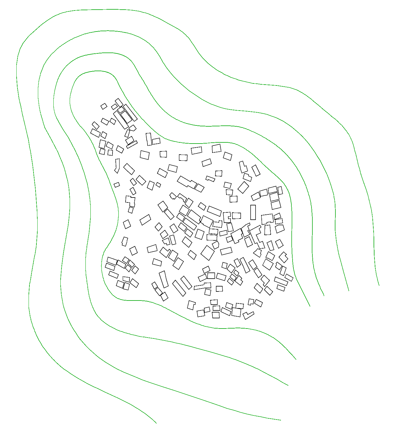 (The green lines are contour lines, and the black squares are village dwellings) |  | 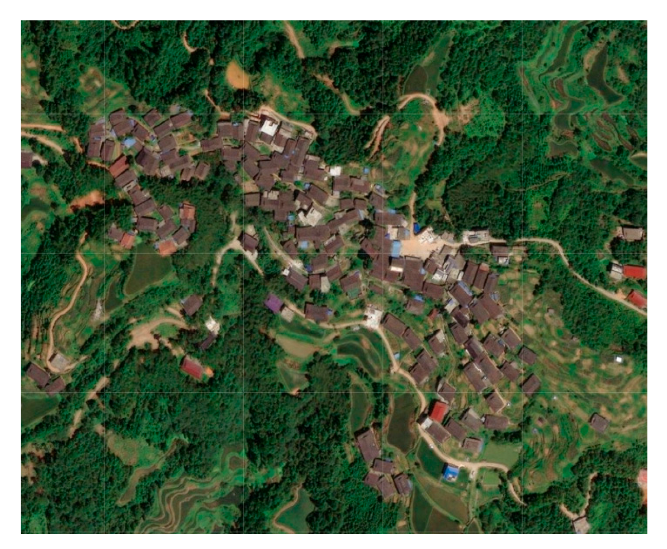 | Most villages of this type are surrounded by mountains, or there is a part of the boundaries of the villages limited by the mountains, and the villages remain in high consistency with the contour lines; in general, the layout of the villages is greatly influenced by the natural environment. |
| Gandong Tun | Songmei Tun | |||
 |  | |||
| Guoli Tun | Gaoding Village | |||
| River valley and flatland type | 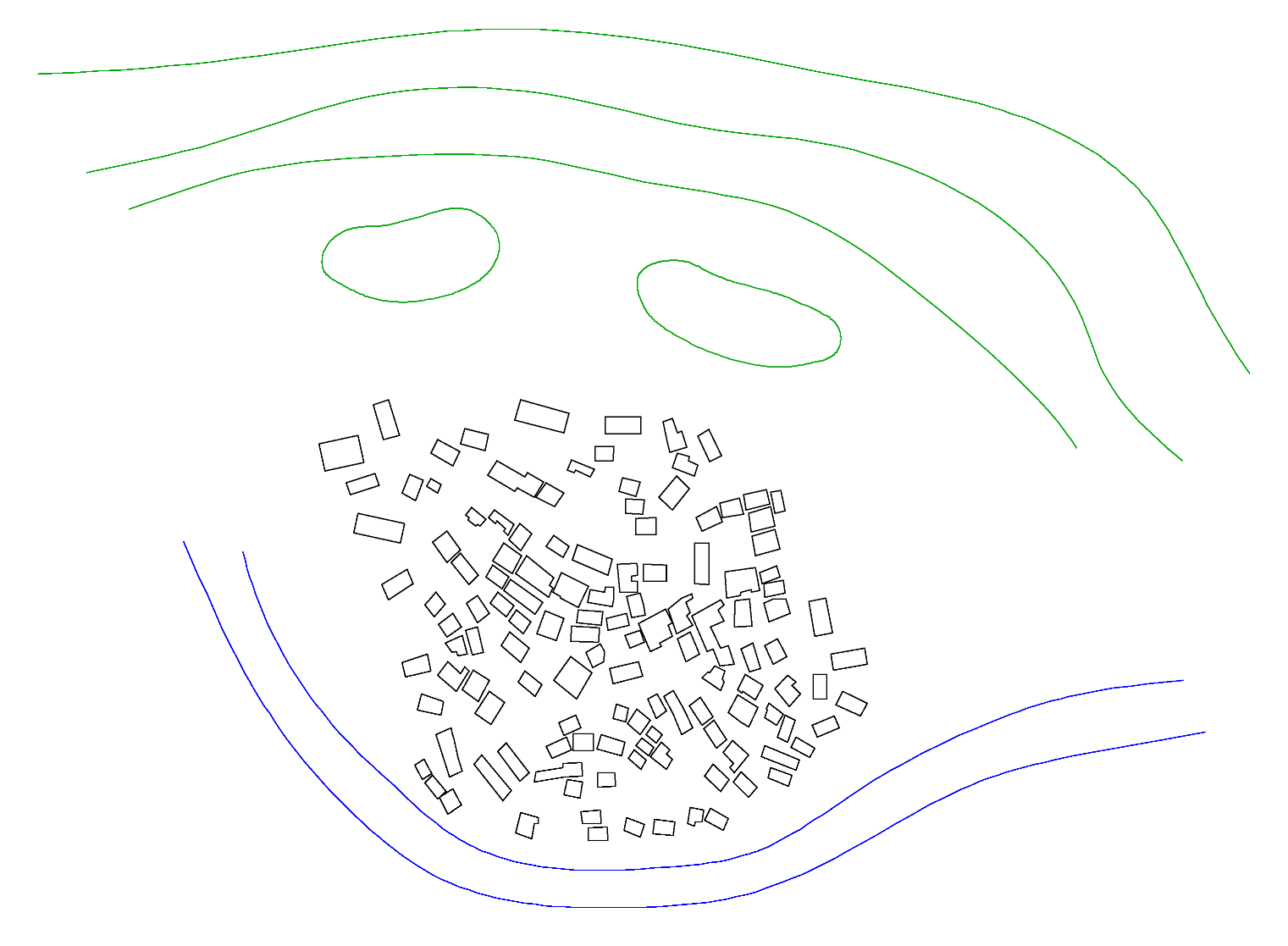 (The green lines are contour lines, blue lines are rivers, and the black squares are village dwellings) |  |  | This type of village is located in a relatively flat river valley; it is arranged along the river and located at the foot of the mountain; the surrounding terrain rises in the distance. |
| Longmiao Tun | Xigupo Tun | |||
 | ||||
| Dapao Tun | ||||
| Mountain and river surrounding type | 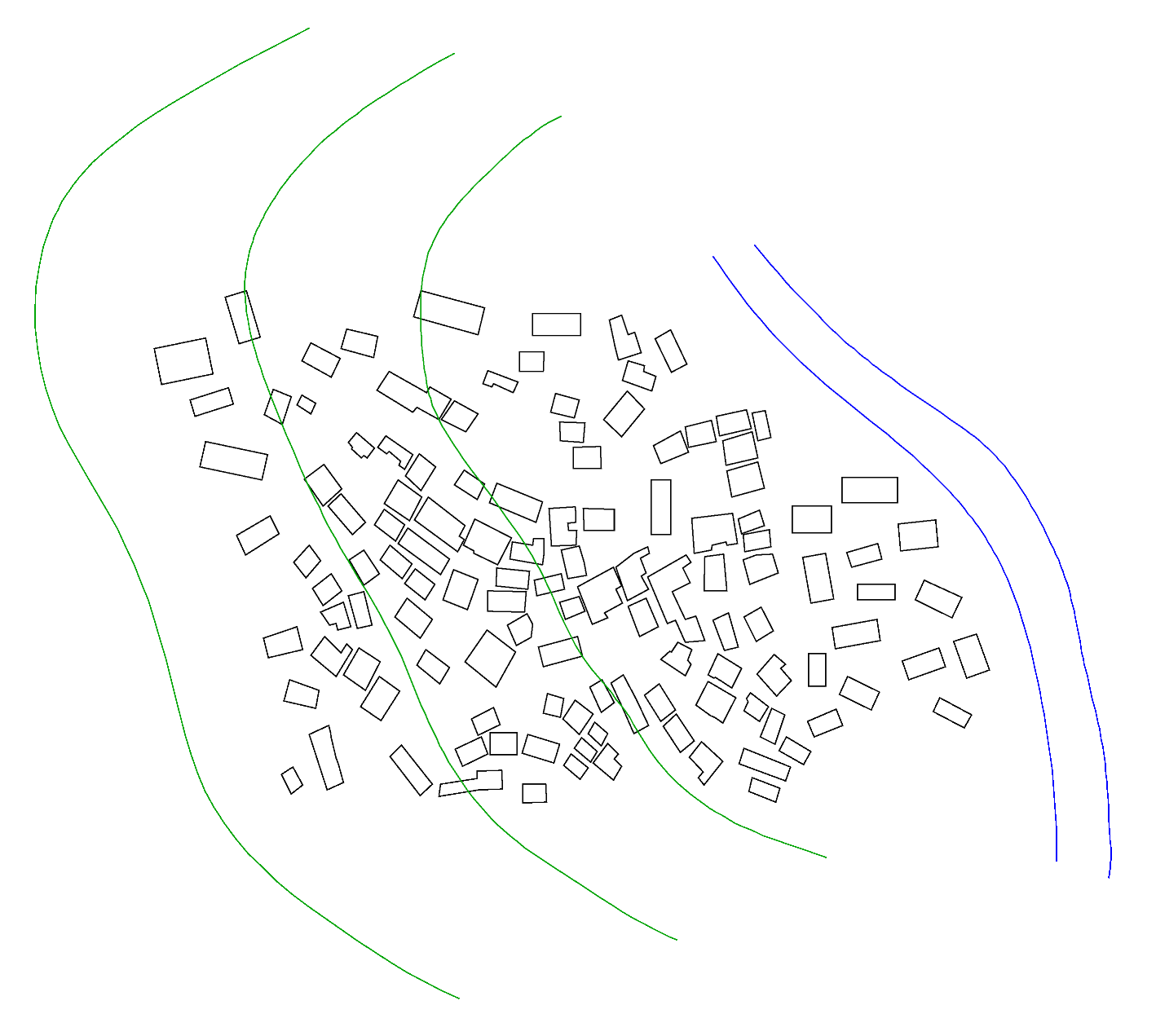 (The green lines are contour lines, blue lines are rivers, and the black squares are village dwellings) | 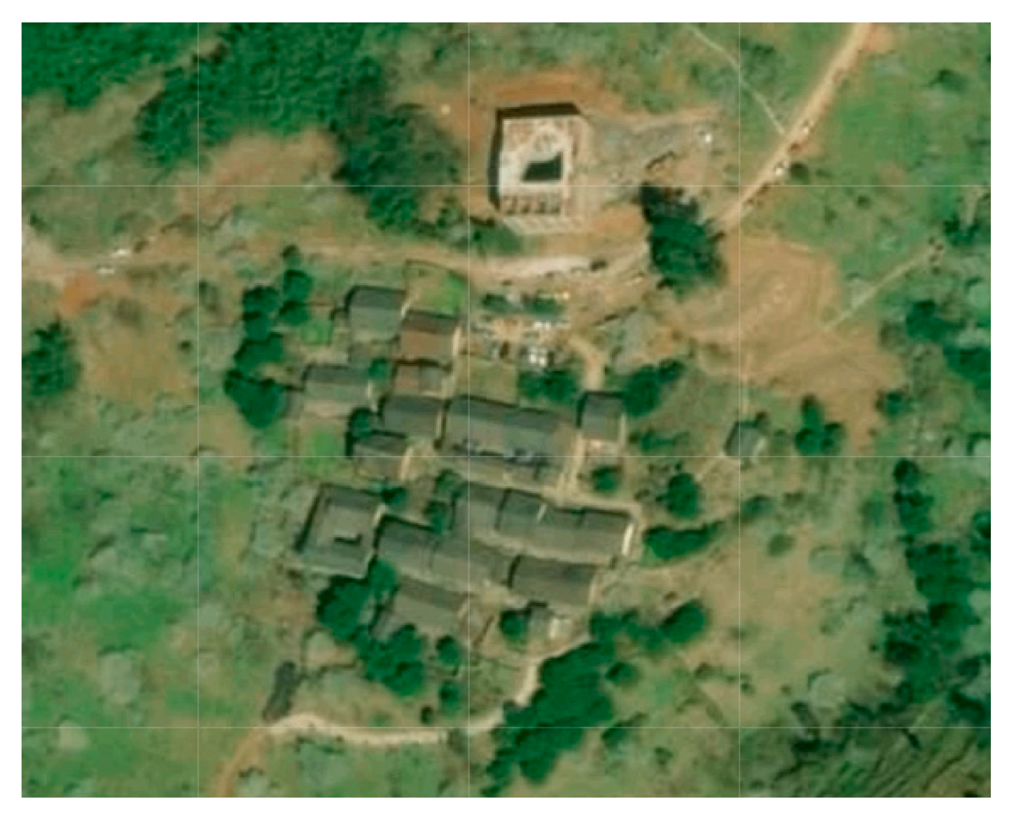 | 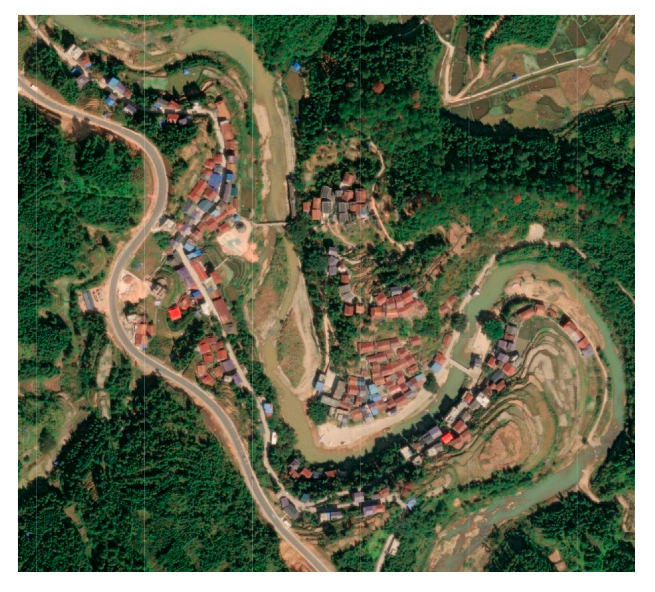 | The village is built on a mountainous terrain or near the river, and the elevation is not decisive at this time. |
| Tongban Tun | Pingmao Tun | |||
| Mountain Features | Schematic Diagram | Representative Villages | Characterization | |
|---|---|---|---|---|
| , ) |  |  |  | This type of village is located on a mountain with a large slope, the hillside is relatively continuous as a whole, and the height continues to increase. |
| Tongban Tun | Songmei Tun | |||
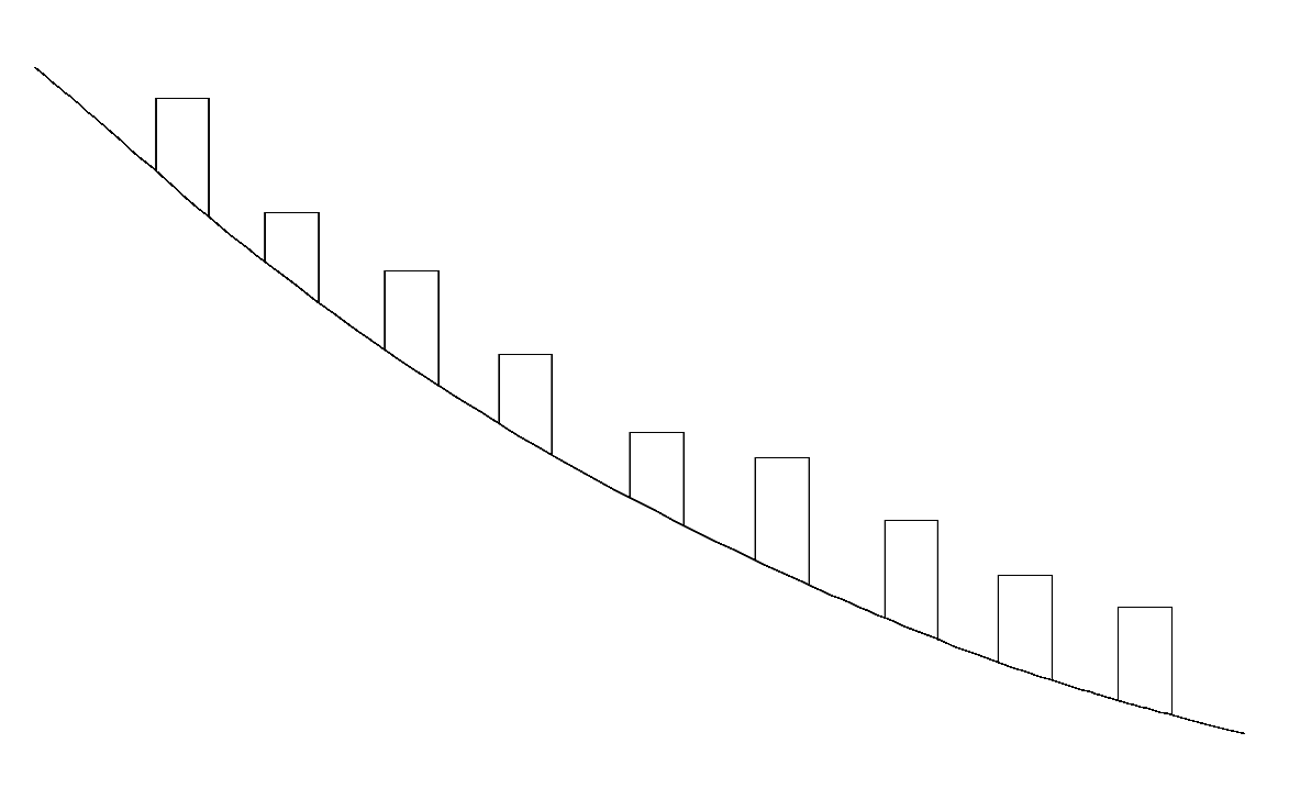
| High gradient and low fluctuation (, ) | 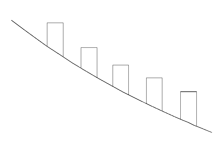 | 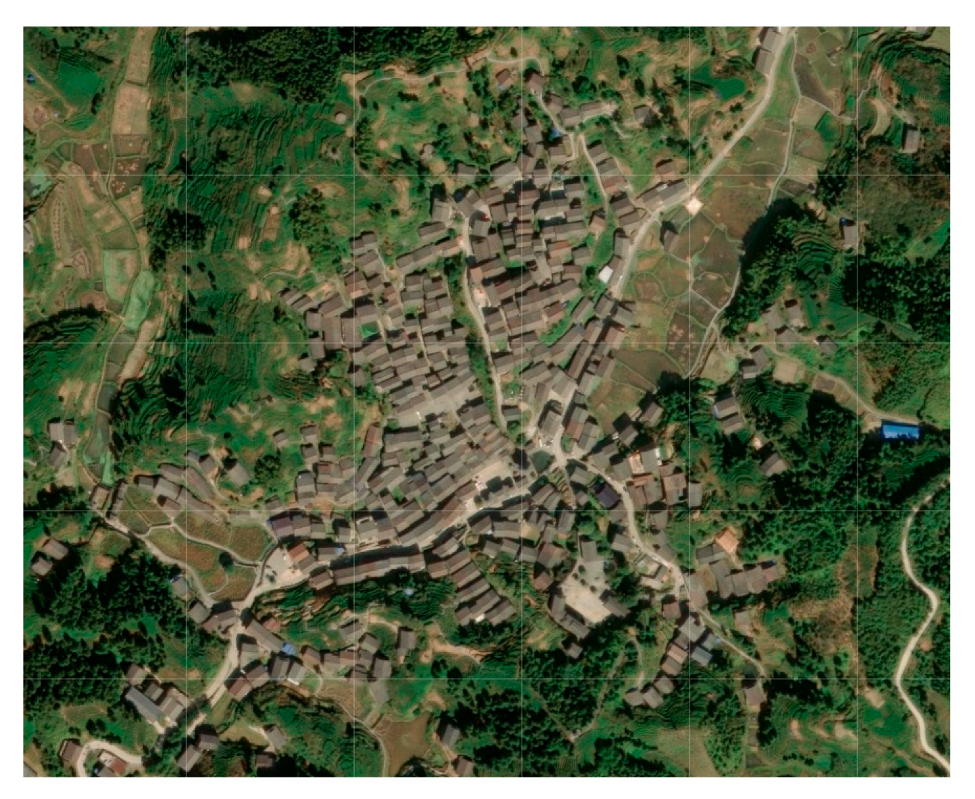 | The settlement is on a steep hillside, but the length of the mountain is low, and the height of the mountain does not increase too much. | |
| Gaoyou Village | ||||
| Low gradient and high fluctuation (, ) | 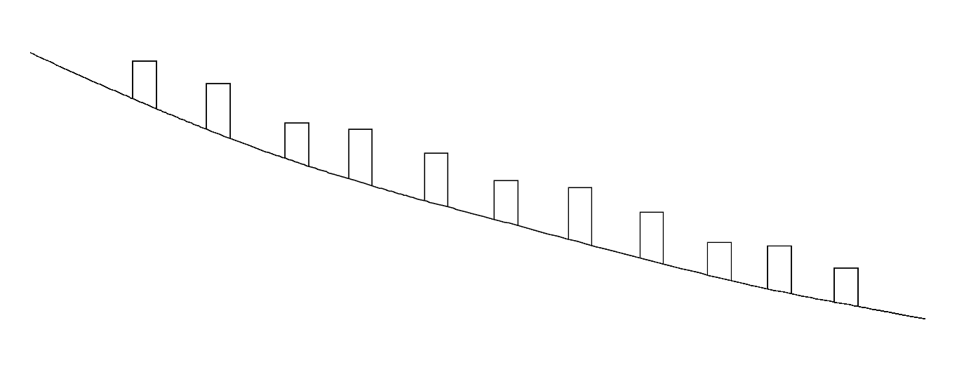 | 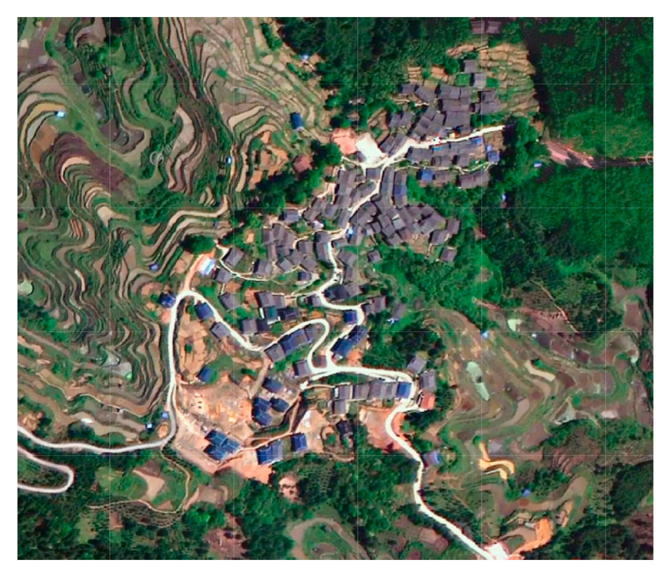 | 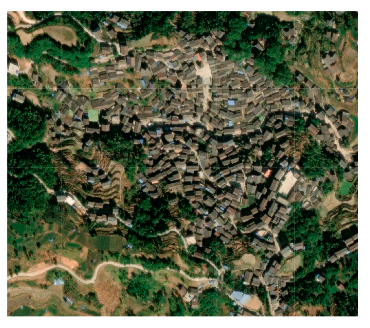 | The village is built on a mountain with a gentle slope, but the length of the mountain is large, so the mountain constantly rises. |
| Guoli Tun | Gaoding Village | |||
| Low gradient and low fluctuation (, ) | 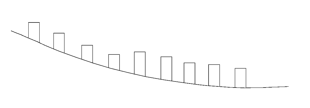 |  | 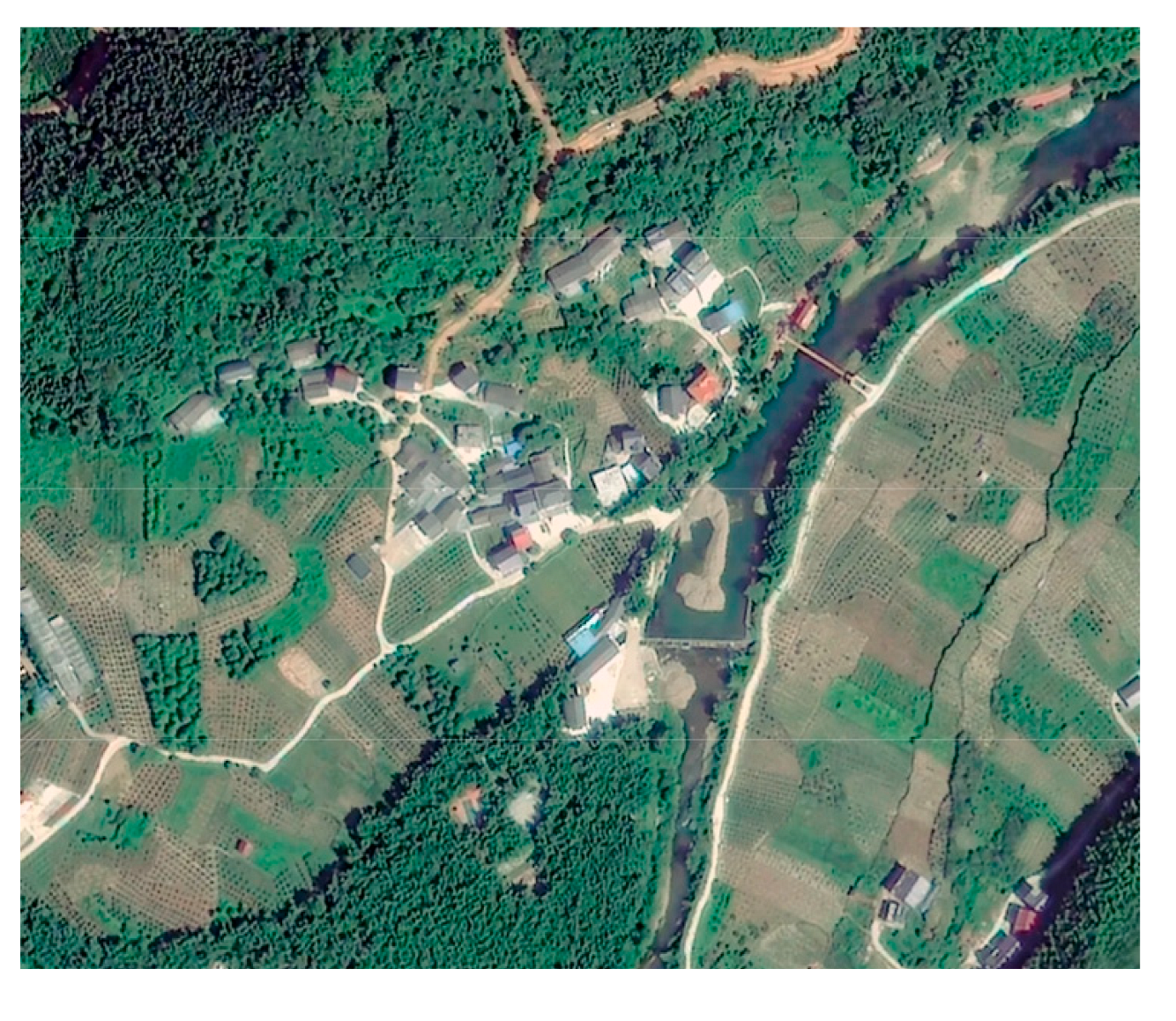 | Villages are usually located in hilly areas with gentle slopes and small scale, and the height fluctuation is low. |
| Longmiao Tun | Xigupo Tun | |||
| Relationship Between Architecture and Terrain | Schematic Diagram | Representative Villages | Characterization | |
|---|---|---|---|---|
| Valley agglomeration type |  |  | 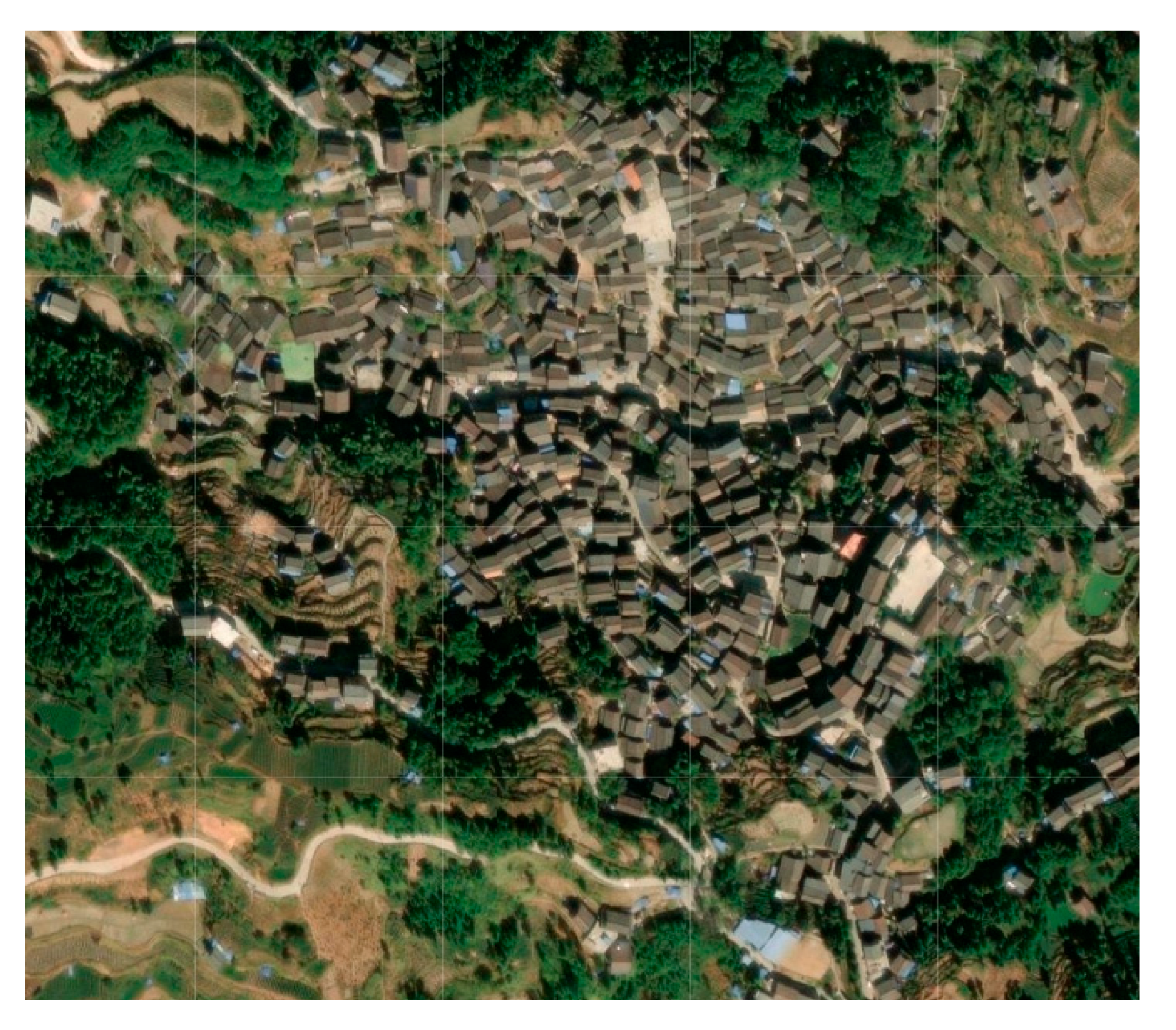 | The villages are located in valley areas, and the residential buildings are concentrated in the valleys, with less distribution on both sides of the mountain. |
| Gandong Tun | Gaoding Village | |||
| Mountainside type |  | 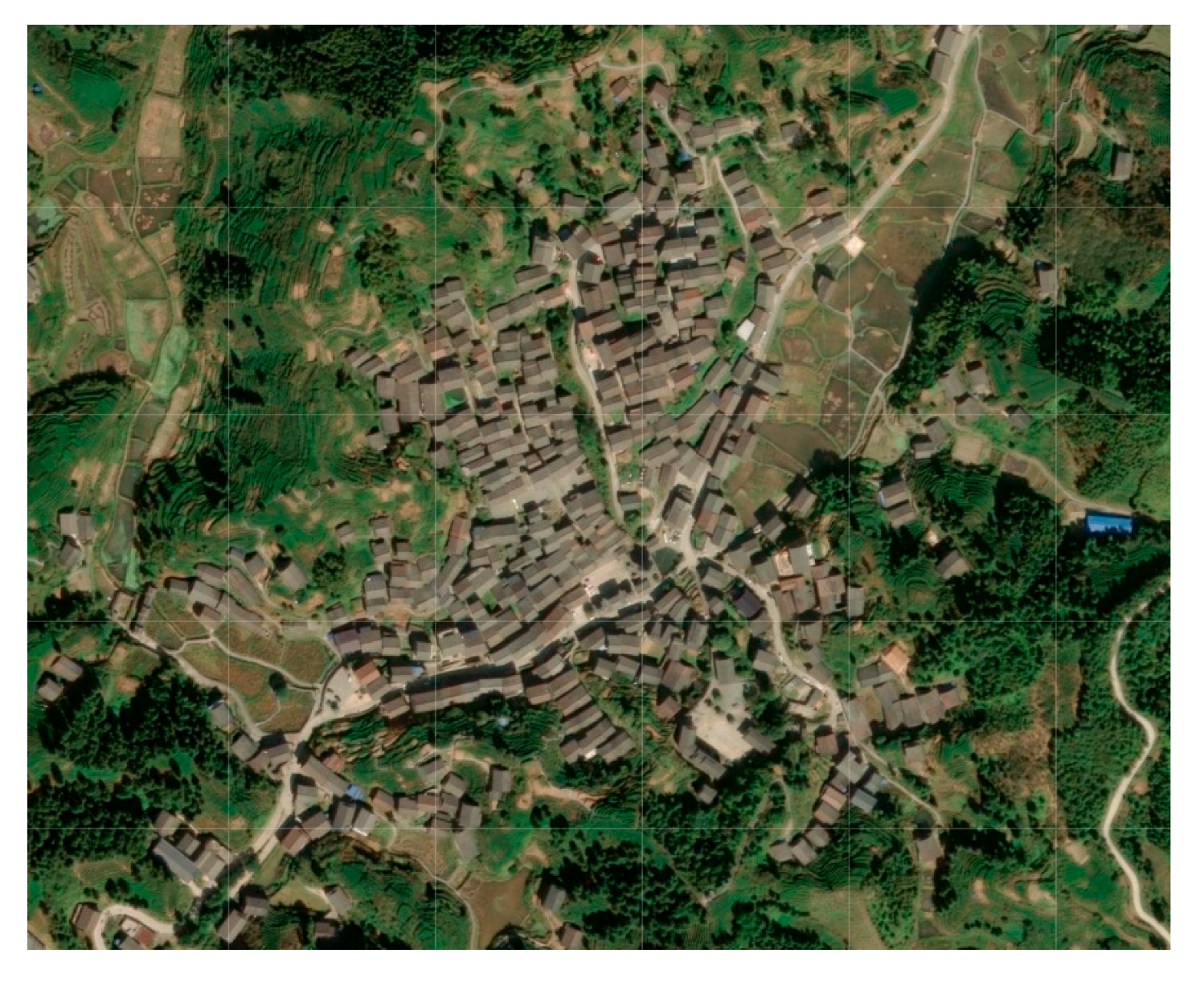 | The buildings are located on the hillside and in the valleys, and the entire surface of the mountain, except for the top, is covered by dwellings. | |
| Gaoyou Village | ||||
| Downhill type |  | 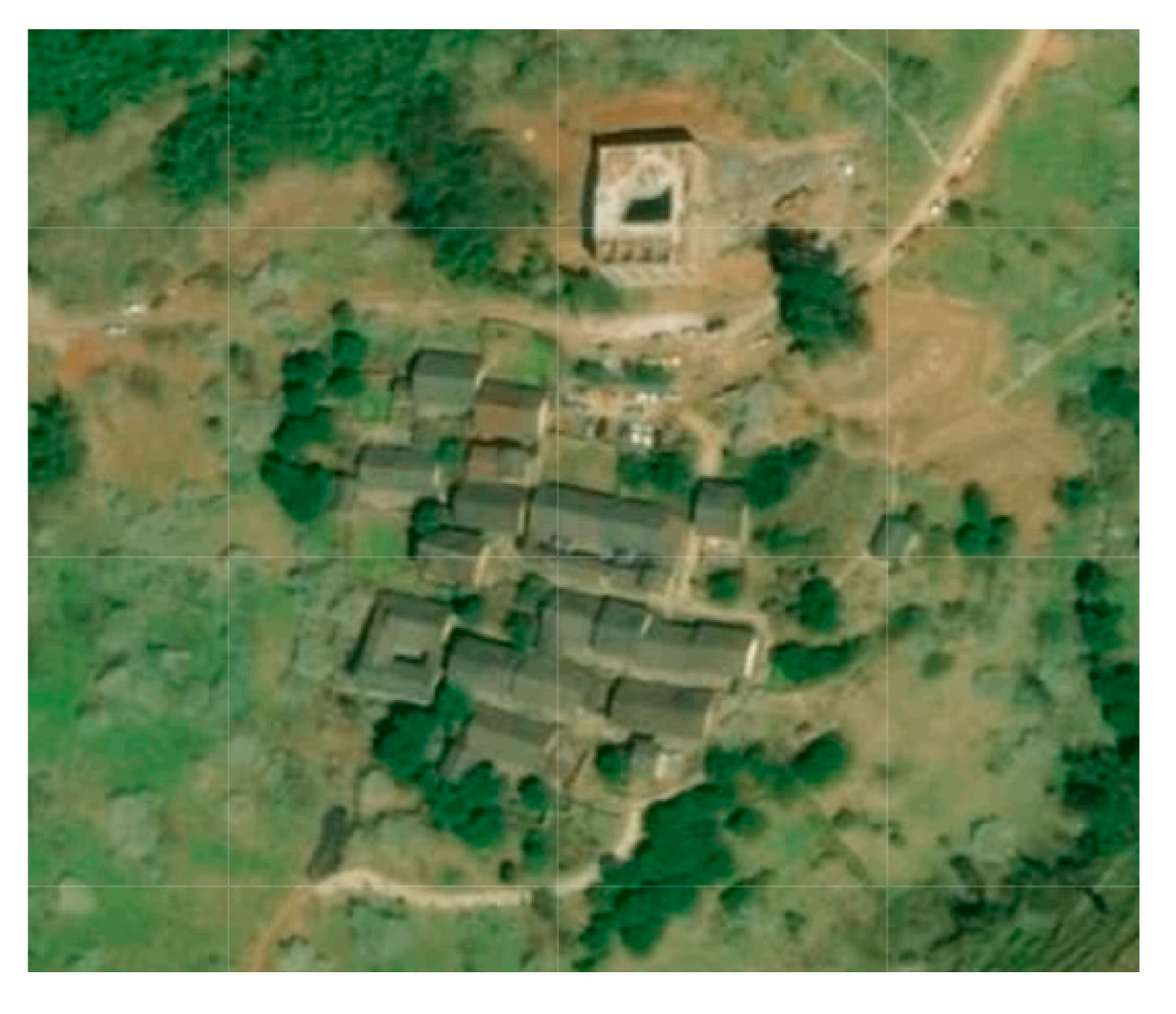 | 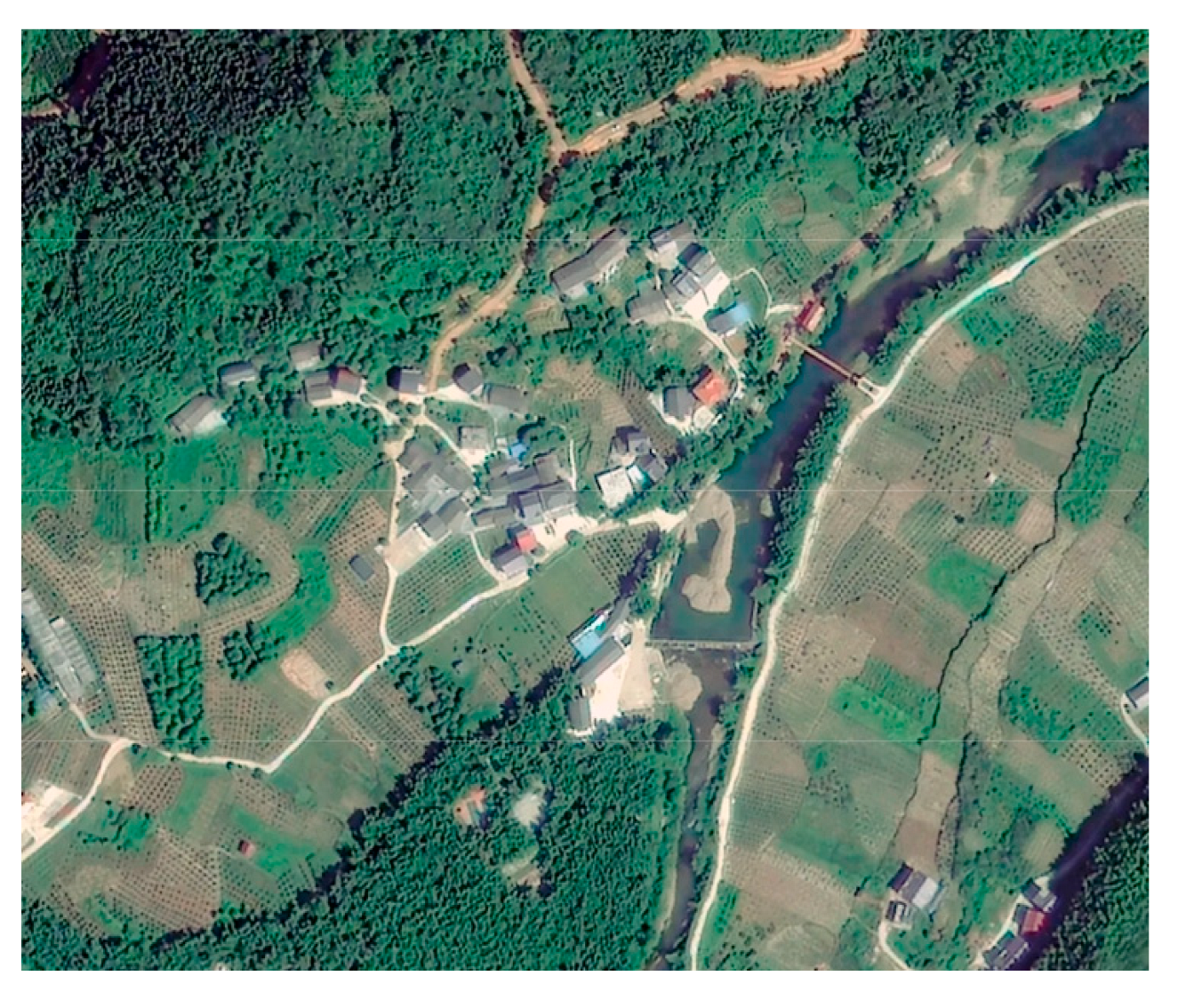 | The buildings are arranged along the side of the mountain and are distributed downward. |
| Tongban Tun | Xigupo Tun | |||
| Mountaintop agglomeration type | 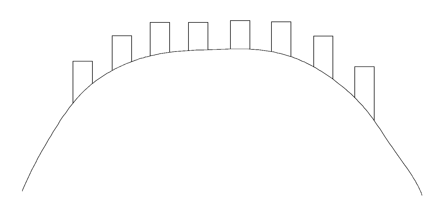 |  | 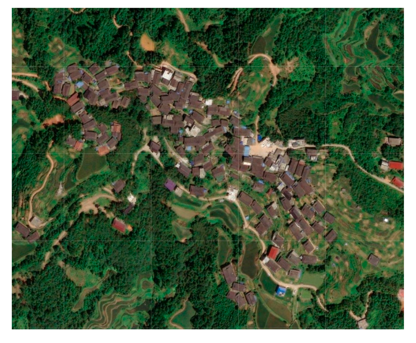 | The buildings are concentrated at the top of the mountain, and there are no buildings on the hillside or valley floor. |
| Guoli Tun | Songmei Tun | |||
| Flatland and riverside type |  |  | The slopes of the hills where the dwellings are located are relatively low, and they are gathered only on one side of the hill, with water sources distributed at the bottom of the hill. | |
| Longmiao Tun | ||||
| Valley and riverside type | 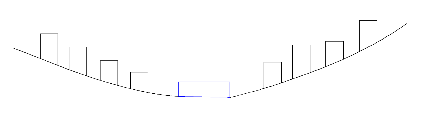 | 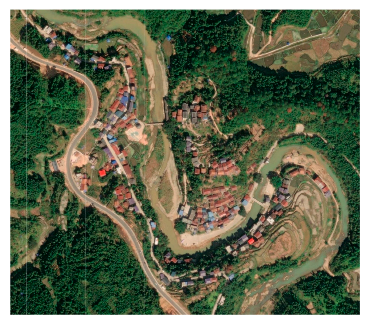 | 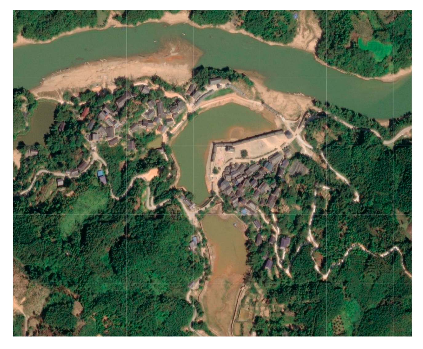 | The dwellings are located on the slopes on both sides of the valley floor in the middle of the mountains, the slopes are slightly steep, and water sources are distributed at the valley floor. |
| Pingmao Tun | Dapao Tun | |||
| County | Settlement of Han | Settlement of Zhuang | Settlement of Miao | Settlement of Dong |
|---|---|---|---|---|
| Rong’an County | Tongban Tun | Longmiao Tun, Xigupo Tun | Dapao Tun | |
| Rongshui Miao Autonomous County | Gandong Tun, Guoli Tun, Songmei Tun | Pingmao Tun | ||
| Sanjiang Dong Autonomous County | Gaoding Village, Gaoyou Village |
Disclaimer/Publisher’s Note: The statements, opinions and data contained in all publications are solely those of the individual author(s) and contributor(s) and not of MDPI and/or the editor(s). MDPI and/or the editor(s) disclaim responsibility for any injury to people or property resulting from any ideas, methods, instructions or products referred to in the content. |
© 2025 by the authors. Licensee MDPI, Basel, Switzerland. This article is an open access article distributed under the terms and conditions of the Creative Commons Attribution (CC BY) license (https://creativecommons.org/licenses/by/4.0/).
Share and Cite
Luo, X.; Zhang, J. A Quantitative Method for Characterizing the Spatial Layout Features of Ethnic Minority Rural Settlements in Southern China. Land 2025, 14, 1144. https://doi.org/10.3390/land14061144
Luo X, Zhang J. A Quantitative Method for Characterizing the Spatial Layout Features of Ethnic Minority Rural Settlements in Southern China. Land. 2025; 14(6):1144. https://doi.org/10.3390/land14061144
Chicago/Turabian StyleLuo, Xi, and Jian Zhang. 2025. "A Quantitative Method for Characterizing the Spatial Layout Features of Ethnic Minority Rural Settlements in Southern China" Land 14, no. 6: 1144. https://doi.org/10.3390/land14061144
APA StyleLuo, X., & Zhang, J. (2025). A Quantitative Method for Characterizing the Spatial Layout Features of Ethnic Minority Rural Settlements in Southern China. Land, 14(6), 1144. https://doi.org/10.3390/land14061144