


Abstract
Oil palm landscapes are often characterised by land conflicts. Multi-stakeholder platforms (MSP) may be a promising means to contribute to conflict resolution. However, the merits of MSPs are limited in contexts with strong power imbalances and entrenched conflict histories. This study analyses an MSP from Myanmar. We developed an analytical framework based on literature on MSPs and social learning and used qualitative methods such as participatory observation and interviews. The study investigates how the MSP was designed and governed and whether it was effective in addressing the land conflicts around oil palm concessions. The study discusses several promising factors of the MSP for being effective, such as adequate inclusion of stakeholders, secured resources, or effective facilitation. However, the analysis also reveals how hindering factors such as lack of a clear mandate, goal, and decision-making competences of the MSP, insufficient communication, or lack of legal and land governance expertise contributed to only limited effectiveness of the MSP. Further, we discuss whether the MSP was a suitable approach in the given context of nontransparent land governance mechanisms, persisting power disparities, and longstanding conflict history. We conclude that designing and governing an MSP in such a context needs to be done very cautiously—if at all—and recommend paying special attention to ten specific points.
Keywords:
Myanmar; Burma; oil palm; land conflict; concession; multi-stakeholder platform; social learning 1. Introduction
Despite offering economic and social benefits for various groups of stakeholders, palm oil is also known to be connected to political violence, land dispossession, and other diverse forms of negative social, economic, or environmental impacts in the countries of origin of palm oil [1,2,3,4]. Oil palm landscapes are also known to be part of war- and state-making strategies of totalitarian governments. In Indonesia, for example, the expansion of oil palm plantations from the 1960s until today has been linked to (re-)territorialisation processes toward achieving centralisation of the state [5,6]. In Myanmar, the military-led state used the handing over of oil palm concessions to companies during the 1990s and 2000s to gain physical access for its troops to a remote rebel-controlled area, which strengthened the military’s territorial control [7]. The expansion of oil palm landscapes is also known to be part of a resource, wealth, and power accumulation strategy of the domestic elite, for example in Guatemala, Indonesia, and Myanmar [3,8,9,10]. Many examples of top-down oil palm expansion as part of war- and state-making, as well as elite-driven accumulation strategies alike, have resulted in land dispossession, food insecurity, and the social and economic marginalisation of segments of the local population [3,6,8,10,11]. These disadvantaged groups are usually indigenous people, ethnic minorities, or smallholders, more generally. Inevitably, oil palm expansions in such contexts lead to conflicts over land tenure, land access, and land use (in short: land conflicts), which tend to remain unsolved as a result of highly unequal power distribution between local populations, totalitarian governments, and/or plantation companies [8,9,10,11,12,13]. Such land conflicts can severely undermine the prospects of peace, and consequently, sustainable development.
Particularly following deeply rooted, historical conflicts such as armed, ethnic, or political conflicts, it is critical to tackle questions of land tenure, access to, and use of land in order to foster durable peace [7,14,15,16]. Windows of opportunity for addressing historical and contemporary land conflicts in oil palm landscapes can occur at various points. In Indonesia, for example, the transnational voluntary standard called the Roundtable on Sustainable Palm Oil was brought to the country by several national NGOs, who joined this international membership organisation as part of their strategy to resolve land conflicts resulting from continued palm oil expansion [17]. In Myanmar, several ceasefire agreements between the government and some armed groups in the 2010s after a long civil war and the election of a civilian government have led to a government-led multi-stakeholder process addressing historical and contemporary land conflicts related to oil palm concessions [18].
Multi-stakeholder platforms (MSPs) are perceived as being a promising means to contribute to solutions for land- and natural resource-related conflicts [19,20,21,22]. Literature often refers to the definition of MSPs authored by Steins and Edwards, in which they define a platform as “a negotiating and/or decision-making body (voluntary or statutory), comprising different stakeholders who perceive the same resource management problem, realise their interdependence in solving it, and come together to agree on action strategies for solving the problem” [23] (p. 244). The Roundtable on Sustainable Palm Oil and the High-Level Multi-Stakeholder Platform on the Implementation of the Sustainable Development Goals are two examples of important, high-level MSPs. MSPs, however, can also exist at a much smaller scale or level, such as in a village, where representatives of different interest groups come together to discuss and find solutions regarding a common problem, for example, a water shortage in their village. Venues, where more than one stakeholder meet to exchange, are not automatically an MSP. There needs to be a common problem, conflict, or crisis, however differing interests among the various affected stakeholders, and these stakeholders collectively aim at solving the challenge. Thus, in our understanding, an MSP is a collective learning, negotiation, and decision-making body aiming towards better governance of problems despite differing interests of the various affected stakeholders. MSPs may facilitate conflict resolution when they offer spaces to nurture common understanding and trust among stakeholders. They may enable stakeholders to negotiate potential solutions in a neutral setting and, if effective, results may have broader ownership [24]. A central element of MSPs is the collective learning among the multiple stakeholders, also referred to as social learning in group processes that goes beyond individual learning, to strengthen knowledge creation and solution finding, and to increase common understanding, constructive relations, and trust among stakeholders [25,26]. However, recent studies indicate that these widely assumed merits of MSPs may be limited in contexts with strong power imbalances and longstanding, entrenched conflict histories, because they may undermine preconditions for MSP effectiveness, in particular the willingness and capability among stakeholders to engage cooperatively and equally [21,27]. Moreover, conflict histories and power imbalances may limit the potential to arrive at a shared problem-framing and MSP goals [21,27]. Nevertheless, there is only scarce evidence on: (i) whether MSPs are effective for conflict resolution with considerable power imbalances and entrenched land conflicts, such as in some oil palm landscapes, and (ii) the conditions for effective set-up and governance of MSPs in such complex and volatile contexts. Having evidence on effective as well as failed practices of MSPs in such settings would be urgently needed. Such evidence could contribute to underpin more sustainable development in the local context, but also prevent MSPs from re-enforcing existing inequalities or other consequences of failure. A mismanaged MSP in a fragile socio-political context could even be harmful, as it could, for example, increase or re-escalate pre-existing tensions, discrimination, or violence.
Against this background, the present article focuses on a case from southern Myanmar, Tanintharyi Region, where an MSP led by the civilian government after 2016 has tried to coproduce data and knowledge to resolve land conflicts around oil palm concessions—an ambitious endeavour in a challenging environment. The MSP was partly effective in its initial stages, however, faced increasing challenges in subsequent stages. This calls for a close analysis of the case to draw and provide lessons learnt for other MSP attempts in comparable settings. Thus, the overall aim of this study is to formulate recommendations for designing and governing MSPs on land conflict resolution in settings with entrenched conflict histories and strong power imbalances, such as in oil palm landscapes. We attend this aim by asking the following research questions (RQ): (1) How was the oil palm MSP in Tanintharyi Region designed and governed? (2) How effective was the MSP?
In this article, we start with presenting the land governance and historical context of Tanintharyi Region as well as an overview of the MSP’s major events and development, to generate an understanding of the context in which the MSP operated. We proceed with describing the analytical framework and methods applied for data collection and analysis. The results section first provides documentation of how the MSP was designed and governed, shedding light on its strengths and weaknesses. Second, the results section analyses how effective the MSP was. In the discussion section, we start with reflecting on promising as well as hindering factors for the effectiveness of the MSP. We then discuss whether MSPs are a suitable approach in settings with strong power imbalances and entrenched conflict histories, such as in Myanmar’s oil palm landscape. In the conclusions section, we argue that designing and governing an MSP in such a setting is a very challenging endeavour and needs to be performed very carefully—if at all. We formulate preliminary recommendations for (a) designing and governing an MSP in such settings as well as (b) for further research. Thus, the novelty of this study is two-fold. Firstly, it provides new in-depth knowledge on an MSP case from Myanmar’s oil palm landscape. It shows how persisting power imbalances in combination with weaknesses in the design and governance of the MSP undermined the ability of the MSP to co-govern decision-making processes on land conflicts. Secondly, the developed framework and recommendations provide a useful starting point for scientists and practitioners to design, govern, analyse, or monitor an MSP in a similar setting.
Readers kindly note that the MSP as well as the research took place before the military coup of 2021. The present article does not refer to the coup itself or the time thereafter. For safety reasons, we refrain from naming most of the Myanmar stakeholders in what is now a politically unpredictable context, even though there is no connection between the research or the analysed MSP and the coup.
2. Context
2.1. Land Governance in Myanmar
Myanmar has experienced one of the world’s longest running civil wars, starting shortly after its independence from the British Empire in 1948, and continuing through periods of military dictatorship from 1962 until the 2010s. The fighting was mainly concentrated in the ethnically diverse borderlands [28]. Especially in these borderlands, armed conflicts have resulted in continued humanitarian crises and countless internally displaced people and refugees in the neighbouring countries [7,28]. During this era, land governance was determined by formal and informal institutions favouring the well-connected and rich domestic elite, including the military high-ranking officials [12,13,29,30]. Many large-scale land concessions were granted between 1988 and 2010, but particularly to those who already had access to political and economic resources such as military-linked companies [29]. Many land appropriations occurred in the borderlands, which are usually lands of ethnic minorities, of which many are using a customary system [31], fuelling already existing armed conflicts. The 1990s and 2000s saw the land of rural communities expropriated in the name of national development projects (agribusiness, resource extraction, hydropower, etc.) or in the name of national defence for security reasons, military encampments, and food and other goods’ production to support military personnel [31,32]. Most investors in Myanmar during these times were typically linked to the military and/or members of the rich Burmese (predominant ethnicity) elite [29,31,33,34].
The passage of the 2008 Constitution, issued under the military regime, paved the way for a semi-civilian rule, albeit where the military was guaranteed 25% of the seats in parliament and an effective veto on constitutional reform [35]. Through general elections, the military-backed Union Solidary and Development Party—with many of its members being (ex-)military members in civilian clothes now, instead of in uniform—formed the government in 2011–2015. This period was marked by various regional ceasefire agreements as well as a national ceasefire agreement in 2015. During these years, many land reforms were enforced by this semi-civilian government. These reforms also pushed land formalisation and thus heavily influenced tenure rights and investment incentives [7,29], promoting formal tenure rights over customary land management systems [35], again mainly favouring the elite [30]. The result was an increase in domestic and foreign investment in natural resources and land, but most of them were still connected to the politically and economically powerful elite [31,33,34]. Simultaneously, the semi-civilian government recognised the long legacy of land confiscations across the country and the respective anger in civil society. During its rule, it started to establish several committees at various administrative levels to document and solve land conflicts, and began a process to draft a new National Land Use Policy, resulting in consultation processes [35].
In 2015, the opposition party, National League for Democracy, under the leadership of Aung San Su Kyi, won the first democratic elections in decades by a landslide. Consequently, a mostly civil government led the state affairs in 2016–2020 (still with 25% of parliament being military members). After coming into power, the civil government halted some of the committees and the National Land Use Policy process established in 2011–2015 [35]. At the beginning of the civil government era, the Myanmar multi-ethnic population and land activists had a rather positive attitude toward and trust in the civil government. After several months, however, criticism increased about, for example, the continued—or partly even increased—ignorance of customary land management systems, ethnic land rights, and gender-related issues [35]. After several years in office, the civil government began to resume halted or to establish new land committees and consultation processes, and to implement pro-farmer articles of the National Land Use Policy, while some other struggles and contradictions continued to remain [35].
The military coup of 1 February 2021 put an abrupt end to the democratisation processes, with an uncertain future for land governance in Myanmar.
To date, Myanmar’s land governance has been characterised by an opaque legal pluralism. Over decades, the different regimes and governments had created “stacked laws” [29]. This term implies that Myanmar has multiple layers of laws that exist simultaneously, leading to conflicts, contradictions, and arbitrariness in the legal system. Moreover, many of them are often kept on a rather general level of formulation, allowing for ambiguity or manipulation in interpretation. Accordingly, powerful stakeholders could—and can continue to—enforce or adhere to the most beneficial law or policy in the given situation, deliberately favouring one law, policy, or interpretation out of the many [29].
2.2. Civil War and the Oil Palm Sector in Tanintharyi Region, Myanmar
Myanmar’s mountainous and resource-rich borderlands, usually home to ethnic minorities, were severely affected by the civil war [28,36,37,38]. Tanintharyi Region is situated in the south of Myanmar and is one of these borderlands. The war in Tanintharyi Region prevailed until 2011 and was fought between the Myanmar military (predominantly persisting of the ethnic majority) and armed organisations of ethnic minorities [7]. The transformation to a semi-civilian government in 2011/2012 led to a regional ceasefire agreement [7,30]. Once armed conflicts declined in 2011/2012, some internally displaced people and refugees returned to their homes. However, many still remain in provisional camps in-country or in Thailand, or settled elsewhere due to the loss of their land to land grabs during their absence, environmental damage of their natural resource base as a result of war, fears of violence, and eroded infrastructure or social institutions [39,40,41].
In the late 1990s, the military-led government of Myanmar promoted oil palm with the main aim of achieving self-sufficiency in edible oil production. Under this policy, Tanintharyi Region was promoted as the oil bowl of Myanmar [42,43,44].
To achieve this plan, large land concessions—later turned into legal permits and contracts—for planting oil palm were granted to private and military-backed companies under the 1991 Wasteland Instructions, which later became the 2012 Vacant, Fallow, and Virgin Lands Management Law, and the 1992 Forest Law and subsequent forest policies [7,12,42]. These legal provisions have been widely criticised for failing to recognise the customary land tenure of local communities [45]. Additionally, many of the granted land permits were rather inaccurate in terms of geographic location [42] and frequently did not consider the existence of villages in these areas. Furthermore, local organisations and researchers have identified the oil palm sector as a leading cause of deforestation, especially in the southern Tanintharyi Region [34,44,46,47,48]. Moreover, the expansion of oil palm has also reduced the local population’s access to natural resources, which are of high importance for their livelihoods, such as for agriculture or for collecting non-timber forest products [30,49]. The local population also did not experience any economic benefits, as the companies offered very low salaries only and, as a consequence, poor migrant workers from central Myanmar settled in to work on the plantations [12].
Scholars as well as some respondents of this study (to remain anonymous) also argue that the military-led government used the handing over of oil palm concessions to companies to gain physical access for its troops to the remote areas, which were, for a long time, mainly under the control of the ethnic armed organisations [7]. Apparently, some companies were even pushed into implementing an oil palm concession. Through the building of physical infrastructure (roads, housing areas, etc.) and the opening up of the dense forests by the companies, the military could increasingly reach these areas and strengthen its territorial control [7].
The consequence of the granting of oil palm concessions and the development of plantations were manifold [7,10,12,34,50,51]. Some villages were dislocated against their will or, if the settlement area was spared, the villagers lost their cultivations around their villages. Human rights violations were reported from many cases. In various places, empty villages, which had been abandoned due to the war and the fleeing of the residents, had been cleared and returning IDPs and refugees found “their” land to be a monoculture or under the possession of a company. The legal provisions mentioned above, which made the large-scale oil palm permits possible, were in favour of the politically and economically strong elite [30], while smallholder farmers were hampered by a rather weak statutory recognition of their land tenure [13].
In 2016, when the democratically elected Tanintharyi regional government took office, the new Regional Chief Minister announced in her election speech that she would address these land conflicts around oil palm concessions.
2.3. The Background and Story of the Multi-Stakeholder Platform
The semi-civilian government of 2011–2015 initiated the OneMap Myanmar (OMM) Initiative, which was also continued under the civilian government. The OMM Initiative is a Myanmar government-led initiative aiming at providing access to accurate, consolidated, and user-friendly data related to people, land, and natural resources, in order to make decision-making and planning for sustainable development more effective [52,53]. With funding support of the Swiss Agency for Development and Cooperation (SDC), the Myanmar government together with the SDC launched an international project call to support the OMM Initiative in its implementation. Consequently, an OMM Project was launched in 2015 (and dissolved again after the military coup in 2021). The implementing organisations of this OMM Project were a Myanmar civil society organisation (anonymised) and the international, Switzerland-based sustainability research institute Centre for Development and Environment (CDE) of the University of Bern. One specific government department from the national level (anonymised) was acting as the focal line department for the OMM Project and therefore serving as a connector between the OMM Project and the Myanmar government.
On 22 September 2016, the OMM Project visited the Regional Chief Minister of Tanintharyi Region after she had publicly announced that she aimed at resolving the countless land conflicts around oil palm concessions. The OMM Project presented the idea to her of launching an MSP. She appreciated this idea and called for a meeting with various governmental ministries and departments (regional level) the next day, in which the OMM Project presented the idea of an MSP again. Everyone agreed to launch the MSP. Table 1 presents an overview of the major events in the MSP process as well as in the land governance related to the overall palm oil sector.
Table 1.
Major events in the multi-stakeholder platform (MSP) process and in the land governance related to the palm oil sector.
The MSP meeting in August 2017 marked an important meeting, in which the above-mentioned report from the Yebyu committee was presented and intensively discussed. One major insight was—as a result of repetitive stressing by the OMM Project—that the extensive field survey and plot-by-plot report, which had been achieved in Yebyu Township, were not replicable to other concessions and other townships. It would take too long a time as the concessions were so many and mostly very large. Moreover, the regional-level MSP members agreed (after several hours of group work) on specific points to tackle over the next months: (1) To clearly describe the mandate of the MSP, as there were still many unclear points from the perspective of many participants. (2) To agree on some coordinative issues of the meetings, such as how often the meetings should take place, how far in advance participants should be invited, what topics to include in the discussions, how to spread information, how many representatives would need to be present for making decisions, etc. (3) To make an orientation meeting with all 44 oil palm concession-holding companies to inform them about the forthcoming mapping activities. (4) To conduct a legal analysis on the surveyed concession in Yebyu Township to learn more about land zones, options for revoking land from the company, distributing land to villagers, etc. (5) To agree on how exactly to continue with the mapping of concessions, as extensive field surveys now seemed impossible to replicate to all concessions.
Although the plans of the regional-level MSP members seemed optimistic and the uttered commitments constructive, from then on, many external and internal challenges arose, as described in Table 1. An MSP meeting was repeatedly postponed, but the MSP never met again. It was also not formally closed.
3. Methods
3.1. Analytical Framework
To analyse the design and governance of the oil palm MSP in Tanintharyi Region, Myanmar, we developed and adopted an analytical framework that draws on literature on MSPs and social learning from the fields of land governance and natural resource management. We included those studies which described recommendations or lessons learnt regarding MSPs based on practical experience of the authors or scientific synthesis. Further, we included studies which developed and used conceptual or analytical frameworks themselves for studying MSPs and other multi-stakeholder processes, or which presented conceptual frameworks as a result of their studies. The literature was searched and screened by a general online literature research. The ultimate articles were selected based on the first, second, and fourth authors’ personal assessment of the articles’ quality and usefulness for the purpose of this study (see also limitations of the study, Section 5.1.3). The complete list of literature integrated in our analytical framework can be found in Table 2.
Table 2.
Analytical framework.
3.2. Data Collection and Analysis
As will be described in the results section, the MSP was founded at the regional level, Tanintharyi Region. After several months, multi-stakeholder committees were also created at the township level (see Figure 1). Our focal unit of analysis is the regional-level MSP, Tanintharyi Region, rather than the township-level committees. Nevertheless, we included incidents from the township level, which were relevant for the regional-level MSP’s effectiveness. The rationale for the focus on the regional level has multiple elements: Firstly, data accessibility for the researchers was higher for the regional level than for the township levels. Secondly, strategic decisions on goals, outputs, etc., were to be taken at the regional-level MSP, while township-level committees were designed to implement these decisions. Thirdly, the regional-level MSP was meant to have access to higher-level, political decision-making, potentially influencing land conflict resolution for the entire region rather than single local cases. However, the regional-level MSP should not be analysed as an isolated MSP, but must rather be understood against its broader context of, for example, major events outside the MSP, the creation of the township-level committees, or mapping challenges.
Figure 1.
Overview of the regional-level multi-stakeholder platform and the township-level committees.
For the present study, qualitative methods were applied. The main data collection period conducted by the first and second authors of the present study lasted from October 2016 until March 2019. During this period, the data collection methods encompassed participatory observation and writing of meeting minutes in the MSP meetings, in-depth semi-structured expert interviews, as well as short narrative interviews with OMM Project staff. Most data were collected by the first author of this paper, often in collaboration with a Myanmar research colleague (anonymous). Some of the data were collected by the second author of this paper. In August 2021, the first author additionally conducted a short, written, retrospective self-evaluation with OMM Project staff regarding the achievements of the MSP. Table 3 provides the details of data collection.
Table 3.
Details of data collection (MSP: multi-stakeholder platform, OMM: OneMap Myanmar).
For analysing the data regarding the MSP’s design and governance (RQ1), we conducted a thematic content analysis, by coding all available data according to the analytical framework (see Table 2). For analysing the data regarding the effectiveness of the MSP (RQ2), we refer to the term “effectiveness” as the extent to which the MSP contributes to solving or mitigating the problems that were the source of motivation for the stakeholders to join the MSP [64]. Thus, in this study, we determine the effectiveness by analysing whether the originally communicated overall goal of the MSP, which served as a motivation for the stakeholders to join the MSP, was achieved. Accordingly, we proceeded in two steps for the data analysis regarding the effectiveness of the MSP. Firstly, we identified the communicated overall goal(s) of the MSP (using all available data sources). In a second step, we compared these communicated goal(s) with the actual achievements, which we also compiled from all the available data sources. For the discussion section on promising and hindering factors of the MSP, we interpreted the results from RQ1 and RQ2 with the help of relevant literature on good practices and lessons learnt from MSPs and social learning.
4. Results
4.1. Design and Governance of the Multi-Stakeholder Platform
The following section presents an overview of the design and governance of the MSP. For a detailed description of results per criteria along the analytical framework (see Table 2), kindly consult Appendix A.
4.1.1. The Set-Up of the Multi-Stakeholder Platform
Management and Representation of Boundaries
In the meeting on 8 October 2016, the nomination process was jointly defined. The formal launch of the MSP took place on 20 December 2016. The participants of the MSP were as follows:
- Government group: Regional Minister of Agriculture, Livestock, and Irrigation as the chair of the MSP, Regional Minister for Natural Resources and Environmental Conservation as first vice-chair, Minister of Ethnic Affairs as second vice-chair, and six departments, each sending either their director or an assistant director.
- Civil society organisations (CSO) group: six CSOs were nominated after the CSOs of Tanintharyi Region had jointly discussed who to delegate.
- Companies group: The companies relied on an existing agreement they had among the oil palm companies, saying that two companies per administrative district would represent their group. Accordingly, in total, six companies were nominated to join the MSP.
- Ethnic political organisations (EPO) group: from the two invited organisations, only one agreed to join the MSP.
- OMM Project: The OMM Project was present as the technical advisor regarding the mapping (including foreign experts). A senior Myanmar member of OMM Project—a well-respected and well-connected senior expert in land politics and leader of Myanmar CSO—served as the facilitator of the MSP. The representative of the focal line department (national level) joined with the OMM Project team.
To our knowledge, there was no communication or engagement strategy for those who were excluded from the MSP. At the beginning of the MSP, it was recommended that the representatives of each group would be responsible to communicate back and forth between the MSP and their networks.
For an MSP to be effective and thus lead to a systemic change, it is important that the constituencies and competences of the representative inside the MSP are matching with her/his constituencies and competences back in the organisation she/he represents. As can be seen in more detail in Appendix A, these were partly matching and partly mismatching.
Initialisation and Preparation of the MSP
Prior to establishing the MSP, the OMM Project performed a situation analysis on the various stakeholders in Tanintharyi Region, including a conflict analysis. There was no analysis of the land governance system carried out for Tanintharyi Region. There was also no conflict sensitivity approach developed for the endeavour. The OMM Project relied on the sensitive guidance by its senior Myanmar members, who were familiar with similar settings.
The reason for establishing the MSP was that the Regional Chief Minister wanted to tackle the land conflicts related to oil palm concessions. At the opening speech of the October meeting, one of the MSP chairmen added (translated from Myanmar language):
“We are facing challenges for getting the complete information of basic land use, land cover, and land ownership. These challenges may be problematic for the transparency and accountability when it comes to land problems. Therefore, a spatial data platform is necessary to have access to land-related data and numbers.”[65]
The stakeholder support for creating the MSP was probably rather ambiguous among the groups and even within the groups. For all groups, it is unclear whether the representatives joined the MSP for reasons of wanting to contribute to a systemic change or for averting risks in case of non-participation. This might even differ for each individual and it might also be a combination of both.
In the first and second formal MSP meetings, the terms of reference—comparable to a mandate of the MSP—were presented. There was a very short slot for questions and comments on the terms of reference, but no MSP participant raised concerns or questions. The terms of reference were as follows:
- To guide and supervise the OMM Project’s tasks for investigating the oil palm sector.
- To collaborate with relevant government institutions and organisations to access data, maps, and other information.
- To collect the relevant data and then analyse it. If needed, supervise the field surveys.
- To supervise and guide a technical unit (OMM Project technical staff) so that the unit finishes the tasks according to the timeline for investigating the oil palm sector.
- To supervise the reporting of progresses and work planning.
Later, the OMM Project additionally presented its ideas of what the MSP could aim for over the months and years to come. There were four major steps in the presented pathway. The first step was the land use assessment (using mapping techniques). The second step was titled with resolution of land disputes and land use planning for remaining land. In a third step, an assessment of the quality of investments in the oil palm sector was envisioned. In the final step, the pathway showed that the MSP could support to develop sectoral policies and approaches to a sustainable oil palm industry. This was, however, never formally discussed or approved. Other than this, there was no presentation or discussion on the entire process and time horizon of the MSP.
Secured Resources
Almost all financial expenses for the MSP and the implementation of activities were covered by the OMM Project, such as travel expenses of MSP participants, in-kind contribution of the OMM Project for its staff, technical equipment for mapping, satellite images, etc.
Given the envisaged overall duration of the OMM Project, the project could have accompanied the MSP for six or seven years. The time horizon of the MSP, however, was not pre-defined. The bigger time-related challenge might have been the limited availability of most representatives given their partly high ranks and many engagements outside the MSP.
Having access to enough and the right human resources is also a prerequisite for an effective MSP, especially when it comes to the implementation of the activities outside the MSP. In our case, the OMM Project (the implementer of activities) brought the right human resources for the mapping. However, there seemed to be a lack of technical expertise in other dimensions (see below, section: technical support to the MSP).
From all types of resources, the equipment seemed to be the smallest challenge. The OMM Project could mobilise most of it.
Access to Decision-Making
For the government group and for the OMM Project, it was understood—but not formally communicated to the other MSP participants—how the access to decision-making was conceptualised. The MSP was led by three regional ministers and supervised by the Regional Chief Minister. These four high-ranking officials were also members of the regional government cabinet, where political decisions for Tanintharyi Region were discussed. The MSP was supposed to serve as a consultation body for and advice provider to the ministers, who would in turn try to influence the regional government cabinet or even the government representatives from the national level. Moreover, the relevant land-related regional-level governmental departments were represented in the MSP. Thus, access to decision-making bodies was given with the structural organisation of the MSP. This, however, was not clearly communicated to the MSP until only August 2017.
Despite the rather well-designed access to decision-making, the effective access to the government cabinet and relevant government departments still depended on the willingness and ability of the ministers and department heads to lobby for what was discussed in the MSP.
Access to decision-making was also—in some ways—not given due to the lack of transparency of and clarity on structures and mechanisms in the land governance system (see Appendix A). Even government staff did not fully understand the entire complexity of Myanmar’s land governance system. Thus, it remained rather opaque for most MSP participants which body (at which administrative level) to approach for certain decisions.
4.1.2. How the Multi-Stakeholder Platform Was Run
Adaptive and Effective Management of the MSP
The MSP was managed highly adaptively. Usually, the outlook on future actions had to be considerably revised after each meeting. It seemed as if the OMM Project and the MSP were on a very explorative path, as no such MSP had taken place before in this regional context and as the complexity around land conflicts and land governance was very high. The management, however, was also highly complex due to government protocols. The process from obtaining a meeting permission to sending out invitations lasted between two to four weeks. Accordingly, the invitations usually arrived to the MSP participants at the last minute, which made it sometimes impossible for the delegated representatives to attend themselves. It was not allowed for the OMM Project to contact the participants directly. Thus, the coordination of the MSP was legitimate in the given context, however, noticeably not sufficiently effective or efficient. One of the OMM Project members stated in an interview:
“It’s very challenging in terms of managing the process, because it is unmanageable.”[66]
The decisions made in MSP meetings were usually made in a repeating pattern. The facilitator (senior expert) suggested a decision based on either bilateral discussions prior to the meeting with members (also within the OMM Project) or based on discussions during the MSP meeting. Usually, no one made any major objections, and his suggestions were silently taken cognizance of. Thus, one could say that decisions and processes were legitimate as there were never any major objections during the meetings. However, it is also possible that MSP participants refrained from making comments due to lacking understanding on the discussion topic, feeling outside their comfort zone or field of responsibility, power imbalances, government protocol, and cultural codex of behaviour.
Constructive Stakeholder and Relations Management
At the very beginning of the MSP in October 2016, trust was greatly lacking, especially on the CSO side, but probably also among the other groups. Later, however, the CSOs also seemed committed to continue the collaboration, as it appeared to be a unique chance for tackling the entrenched land conflicts around oil palm concessions. This seemed to be a considerable progress given the decades-long conflict-affected history of the Tanintharyi Region.
At the beginning, only the roles of a few stakeholders were defined. The three regional ministers held the formal leading position of the MSP. It was also communicated clearly that the OMM Project as an outsider to the Tanintharyi Region did not have any decision-making competences, but that it served only as a technical advisor, enabler, and implementer of and for mapping activities. One of the chairmen stated it this way (translated from Myanmar language):
“We want to benefit our own country and own people. Foreigners want to help Myanmar. But the foreigners have no decision power, only the regional government has. The foreigners will only collect data and operate, and also pay for all expenses.”[67]
Only in August 2017 were the decision-making competences of the MSP clearly communicated to the members, saying that the MSP would be limited to formulating recommendations and requests to the regional government. Additionally, the roles and responsibilities of the different groups have never been specifically discussed, nor the roles and responsibilities of each individual stakeholder. The CSOs repetitively pointed out this deficit, however, the MSP did not react to it anymore before it fell apart. The lacking definition of roles, responsibilities, and decision-making competences led to an increasing frustration on the side of CSOs and the OMM Project.
The ownership and commitment among the stakeholders differed among the groups and even within the groups, and rather depended on the individual representatives. The ownership and commitment of the government group seemed quite high at the beginning, however, the willingness to consult the MSP decreased drastically with rising challenges. As the government group was by no means homogenous, the commitment and leadership also heavily depended on the participating individual. The government representatives, however, changed often due to frequent position rotations and unavailability. On the CSO side, ownership and commitment seemed quite high at some points in time and then again, they appeared to be on the brink of quitting their membership in the MSP due to frustrations. The companies, on the contrary, were mostly quite silent (but not opposing). Some of the companies did not send their top leaders, but lower-level representatives with less decision-making competences, thus, most likely also less discussion-making competences. The ownership and commitment from the side of the EPO seemed unclear from beginning to end. They never sent high-ranking delegates, nor did they participate in discussions.
There were many efforts by the facilitator of being inclusive and treating everyone equally. The facilitator also had a very good systemic understanding and feeling for detecting the influential stakeholders. Further, he was familiar with the complex hierarchies inside the government. As well as acknowledging the formal power structures, he also considered the informally influential individuals. He respected the power setting and dealt with the influential stakeholders by proactively providing them space for talking, asking them specific questions (most likely to foster their learning effect, increasing their willingness to collaborate, and/or to test the feasibility of an idea), or by making sure they had good seats.
Joint activities are known to be helpful for fostering constructive relations among the MSP participants. Apart from lunches and tea breaks, where most groups sat among themselves, there were no joint activities of the MSP members. There were also no other social activities during the MSP meetings. Probably, the setting was too formal and the conflict histories between the stakeholders too entrenched.
Effective Communication and Facilitation
The facilitation of this MSP was of considerable importance. The interim MSP meeting in October 2016 (see Appendix A) proved that a facilitator was needed, who knew how to bring groups to one table, which had been in conflict for several decades. The facilitator, a Myanmar member of the OMM Project, was a senior and well-connected land and facilitation expert. He usually sensed the expressed but also the unexpressed feelings in the room. Noticeable, however, he paid special attention and politeness to the more influential persons in the room (see above), less so to the less relevant stakeholders. In an interview, he confirmed that he would especially focus on the positive learning of the more influential persons, as he believed that the MSP would only make progress if the most influential supported it:
“When, in a process, the most powerful and the least powerful are involved together, target the most powerful to change their mindset first. Without that, collective learning cannot happen.”[68]
The facilitator also strategically led the discussions by providing summaries of speeches, asking powerful questions in a certain direction, highlighting the main points of the meeting from his perspective, or by presenting suggestions of how the MSP could decide on an issue.
Noticeably often, the chairmen and the facilitator motivated all participants to be active, open, and polite in their communication and invited everyone to equally participate. The facilitator stated the ground rules for a polite communication in the following way (translated from Myanmar language):
“We will base on good will, cooperation, mutual respect, common goals. We will not base our interaction on emotions, but on good intentions. The tone and the language we are going to use must be polite. Otherwise we cannot collaborate.”[69]
Even though the different groups experienced decades of entrenched land conflicts and war, at most times, the communication in the MSP meetings was non-violent, with rare incidents of indirect shaming and blaming. The participation, however, remained rather unbalanced among the groups, as described in Appendix A. Additionally, the chairmen were conspicuously quiet. The facilitator invited them several times to express their standpoint on certain topics to get a feeling for their priorities as well as for the feasibility of ideas.
The discussions were usually held neither in a dialogue format nor as debates. Mostly, the communication was limited to presentations and question-and-answer slots after a presentation. The setting was probably too formal and the meetings too short (usually two to three hours) to let dialogue develop. As there were almost no dialogues happening and the MSP only existed for less than a year, the MSP never reached the level of a joint language (see Appendix A). This might be rooted in the problem that the MSP also did not have a joint problem-framing and vision, and/or that the MSP members did not know or express what data they needed to support different kinds of decision-making processes on land. Accordingly, the presentation of technical mapping results was probably disconnected from the needs or interests of the MSP members.
Timely and transparent communication to everyone seemed to be a major challenge, especially between the meetings—less so during the meetings. At almost every MSP meeting, some participants complained about late invitations (see above) and the lack of sharing meeting minutes or other information with everyone. One MSP member stated in the March 2017 meeting (translated from Myanmar language):
“What I would like to say: Since the first meeting, we did not get any information. Nobody gave any information. The staff said that the information letter will pass on. But we have not received it.”[70]
Especially after the last MSP meeting in August 2017, there was a major lack of communication among the MSP participants. Additionally, the OMM Project failed in informing timely and transparently about the steps it undertook in the meantime for various reasons (see Appendix A), especially after August 2017. Additionally, the regional government did not communicate timely and transparently with the MSP. As outlined in Section 2.3, the regional government undertook some serious actions against oil palm concessions without consulting or informing the MSP. This lack of communication was looked on with disquiet or even resentment by some MSP groups. One of the MSP members put it the following way in the August 2017 meeting (translated from Myanmar language):
“[…] the Regional Chief Minister said that this issue [on a specific oil palm concession] will be decided in the cabinet meeting this morning. What we want to know is how much the report [created through the MSP] will be used and considered in the decision-making process. The report is finally out, but did the cabinet make a decision on its own? If that is the case, our participation in the leading committee [the MSP] does not make much sense anymore. That is why we would like to know how much of our input and suggestions will be considered and used by the regional government.”[71]
Culture of Reflecting and Learning
Apart from the August 2017 meeting, there was not much conscious reflecting and learning, as time was always short and the setting formal. The second day of the August 2017 meeting was dedicated to group work, including reflecting on lessons learnt and the way forward. As it seemed, this was a successful exercise with promising outputs for the continuance of the MSP (see Section 2.3). Unfortunately, this was the last time the MSP came together.
The OMM Project also needed to learn and reflect. Due to the limited effectiveness of the MSP, the OMM Project also faced internal disagreements on the way forward, which it did not manage to resolve timely. These internal disagreements proved that this internal learning and self-reflection process did unfortunately not take place sufficiently or probably not with the most useful methods.
Technical Support to the MSP
From the beginning, it was clear that the MSP would need technical support regarding mapping (besides other expertise). The OMM Project could provide the right and sufficient technical support in this regard, as it seemed.
After the first extensive field survey of an oil palm concession in Yebyu Township, however, it became evident that the MSP was also in need of legal advice regarding land conflict resolution and rightful land use and ownership. Additionally, was there a need for expert support regarding understanding the land governance system of Myanmar. It was unclear what would happen to the revoked land, which department or which committee at which level would have the decision-making competences to resolve disputes, etc. The lack of such expert support was clearly identified by everyone in the August 2017 meeting. Afterwards, the OMM Project tried to mobilise respective technical support, however without much effect. It seemed difficult to find such experts and the MSP did not meet anymore afterwards.
It is also possible that the OMM Project could have benefitted from an expert in communication, facilitation, and conflict management from the field of peace- and state-building to advise the OMM Project on its challenging role and internal learning.
Collective Action for Systemic Change
According to various observations and statements by MSP members, most groups were willing to resolve land issues related to oil palm concessions. The perceptions of how exactly the addressing of land issues should be carried out, however, remained presumably different among the groups, even though it was not explicitly discussed. The complexity of the reality and the change thereof was a major issue. The OMM Project (including the facilitator) often reminded the MSP members of the complexity of mapping and that mapping is not free from being political and therefore needs to be done cautiously. The OMM Project also highlighted that “giving land back” to the local people is not as simple as it might seem, and that it can easily lead to new conflicts if not performed in a well-considered way. It might also have appeared disillusioning to some MSP members that the land governance system was highly complex, favouring mostly the elite, and could not be changed within a short time. Moreover, the MSP members themselves presumably did not have the capacities, competences, and probably also not the right skills to effectively address land issues.
The governmental stakeholders highlighted that the support by the OMM Project (for the MSP) was very useful to them, as it enabled them to access maps and better understand the challenges around the concessions in general. Probably, the serious actions on land governance in the oil palm sector taken by the government (see Section 2.3) might also have been indirectly based on the OMM Project’s mapping support. Hence, there were some actions indirectly resulting from the MSP, which had a strong impact on the system (e.g., revoking of oil palm planting permits). These actions, though, were not collectively taken within the MSP as originally intended and they also did not transform institutions much, as was probably hoped for by the CSOs or the OMM Project.
Due to all these reasons, the MSP never saw any collective action for systemic change.
4.1.3. The Closing of the Multi-Stakeholder Platform
The MSP was never officially closed. In August 2017, the last MSP meeting at the regional level took place. After that, there were several plans on the OMM Project’s side to hold the next meetings. However, this was never realised, as the OMM Project itself was caught in challenges and could not ask for an MSP meeting without new outputs. For unknown reasons, the government side, as the formal MSP leaders (Regional Chief Minister or the other ministers), also never called anymore for an MSP meeting. It seemed as if the MSP started falling apart due to the major internal and external disturbances starting from December 2017, worsening until early 2019. After August 2017, it seemed that the old tensions between the stakeholders increased again, especially between the CSO group on the one side and the government and private sector groups on the other side. Additionally, the OMM Project became again more of an outsider in the oil palm landscape. From the beginning, there had never been an exit strategy for the closing of the MSP.
4.2. Effectiveness of the Multi-Stakeholder Platform
By analysing all data sources, we identified in total four communicated or suggested overall goals:
- In the first interim MSP meeting in October 2016, the Regional Minister for Agriculture, Livestock, and Irrigation provided an idea of what the regional government would favour having. He stressed that having a spatial data platform is necessary to gain access to land-related data and numbers to tackle land issues.
- In the December 2016 and March 2017 MSP meetings, the terms of reference of the MSP were presented (see Section 4.1.1). The points referred mainly to tasks such as supervising the OMM Project’s mapping activities, collaborating with various stakeholders to help accessing data, contributing to collecting data, supervising the reporting, and so forth. These tasks could probably be summarised as supervising and assisting the OMM Project in doing a land use assessment.
- The Regional Chief Minister communicated her ambition that the land conflicts around oil palm concessions should be addressed and resolved. She mentioned this towards the OMM Project as well as later in her opening speech of the August 2017 MSP meeting. However, she left it open how exactly this should be carried out and what the exact mandate of the MSP would be in this regard.
- In the March 2017 and August 2017 MSP meetings, the OMM Project additionally presented its ideas of what the MSP could aim for over the months and years to come (see Section 4.1.1).
These communicated or suggested overall goals obviously differed, while also showing some overlap. This ambiguity of goals creates challenges in assessing the MSP’s overall effectiveness. We therefore analysed what the MSP achieved and to what extent these achievements relate to the various communicated or suggested overall goals. Table 4 provides a combination of all four overall goals and respective achievements.
Table 4.
Effectiveness of the MSP, interpreted by comparing the communicated overall goals and respective achievements.
During the time in which the MSP had been functional, only the first overall goal (A: the land use assessment) was partly achieved, as this was the first task of the MSP and OMM. For the other three goals (B–D), only very few achievements were visible during the existence of the MSP, if any at all. Moreover, many of the achievements from all goals (A–D) were only completed after the MSP had stopped functioning. They were completed by the OMM Project, who continued to collaborate with the stakeholders bilaterally instead of through the MSP. Accordingly, we conclude that the MSP as such was only partly effective if the land use assessment was to be the only goal, or even rather ineffective if all four goals would apply for the MSP.
The reasons why some goals were achieved while others were not are various. Regarding the content of the goals, it appears that goal A refers to a mainly technical task, for which the OMM Project brought the right competences as well as the mandate by the MSP to conduct the assessment. Goal C also implies a rather technical task, however includes competences, which the OMM Project did not have per se. Additionally, the MSP never gave a mandate to any stakeholder to conduct such an assessment. Goals B and D are highly political and very complex to address in the Myanmar context. This might explain why mainly goal A was partly achieved.
Looking at the necessary timeframe to achieve each goal, it seems that it would be possible to achieve goals A and C within a relatively short timeframe. Goals B and D seem to be goals which can only be achieved in the medium to long term. The MSP did not function long enough to effectively address medium- to long-term goals.
Last but not least, it is also possible that goals C and D were not addressed, as there was no or little intrinsic motivation by the Myanmar government to tackle these issues in the first place. Accordingly, there was also no mandate by authorities nor the MSP to address these topics.
5. Discussion
MSPs are perceived as being a promising means to contribute to solutions for land- and natural resources-related conflicts [19,20,21,22]. However, longstanding conflict histories and strong power imbalances may also limit the effectiveness of an MSP, in particular if the willingness and capability among the stakeholders to engage cooperatively and equally limits the potential to arrive at a shared problem-framing and definition of vision and goals [21,27]. This study investigated an MSP in Tanintharyi Region, southern Myanmar, which addressed land conflicts around oil palm concessions through a mapping approach. After a promising start and nearly one year with four MSP meetings, the MSP fell apart. The present study analysed the design, governance, and effectiveness of this MSP.
5.1. Promising and Hindering Factors for the Effectiveness of the Multi-Stakeholder Platform
5.1.1. Promising Factors
The set-up regarding the secured resources seemed promising, an integral part of designing an MSP [21,24]. The OMM Project committed to a long-term engagement with considerable financial and time funds, human resources, and equipment for the purpose of the MSP. Additionally, the OMM Project mobilised profound technical support regarding the mapping. The MSP also did not set any limits to the time horizon.
Another promising set-up was the given access to decision-making [21,57] through the chairmen of the MSP, the relevant regional government departments, as well as the Regional Chief Minister (the founder). Through these ministers and departments, the MSP was set-up to have access firstly to cross-sectoral and political regional-level decision-making, and secondly to national-level political decision-making. Unfortunately, the access to decision-making could not be effectively used (see below) despite the promising set-up.
The facilitation of the MSP was another promising factor, despite some weaknesses, too. An effective facilitation contributes critically to a constructive and non-violent communication and atmosphere in an MSP [21,24,55,56,57,58]. The senior facilitation expert—a member of the OMM Project—managed to bring the different groups (which were at conflict) into the same room for the first MSP meeting in October 2016. He also succeeded in creating a non-violent communication style among all participants and a constructive meeting atmosphere. Moreover, he tried his best at fostering the learning and willingness to support the MSP among the most influential stakeholders in the MSP.
Moreover, the purely technical lens on mapping oil palm concessions (instead of directly addressing land conflicts) appeared to be a promising factor at first. The mapping of oil palm concessions pulled the various groups into the MSP, each with different interests, even though they had been at conflict with each other for two to three decades. This technical lens allowed the MSP members to focus on technical steps while familiarising with each other. The MSP got quite far with this approach. At a later stage, the unique focus on technicalities of mapping was not solely constructive for the MSP anymore and hindered an effective continuation (see below). However, having a technical lens at the beginning allowed the MSP to be founded.
5.1.2. Hindering Factors
Besides several promising factors, various hindering factors were also identified. What MSP members criticised the most was the lack of a clear mandate, vision, goals, and decision-making competences of the MSP, which would be a key—and probably underestimated—criteria for an effective initialisation and continuation of an MSP [22,24,56]. Additionally, the lack of clearly defined roles and responsibilities of the participating groups was criticised. The authors of this study, who have accompanied and observed the MSP, confirm that the lack of these definitions led to frustrations and distrust in the MSP, especially on the CSO side and for the OMM Project. Scholars confirm that consensus among the MSP participants on such essential definitions (vision of the MSP, roles, responsibilities, etc.) is necessary to foster constructive relationships among the participants and to make the MSP effective [21,24,25,55,56,57,58,59,60,61]. Such a lack also hinders a shared problem and needs framing, the finding of a joint language, methods and approaches of mapping, collective actions for systemic change in land conflict resolution, and much more. Later in the process, when the government (from the national to the township level) started taking serious actions in the oil palm sector without consulting the MSP, the lack of these definitions also made it impossible for the CSOs and the OMM Project to remind the government of the, for example, mandate and decision-making competences of the MSP.
Another major point of criticism was the lack of information and communication between the MSP meetings. Especially after August 2017, neither the OMM Project nor the regional government frequently and transparently informed the MSP members about news or delays due to occurring challenges. On the side of the OMM Project, this was partly due to the fact that the OMM Project was not allowed to contact the MSP members directly. On the government side, the reasons for the lack of information and communication are not confirmed. Based on our contextual knowledge, we assume that the government representatives were firstly overloaded with other tasks, and secondly also not used to inclusive multi-stakeholder processes and therefore may not have perceived a proactive communication to MSP members as necessary and useful.
Possibly connected to the previous point, the authors also observed a decreasing interest among some (but not all) of the government representatives to work inclusively in decision-making processes. Possibly, they did not see any or enough advantages of consultation and inclusion. Whether this lack of inclusion stemmed from limited willingness or from a lack of ability (for example due to time restraints, top-down orders, or a lack of experience), or a combination of it, is difficult to interpret. Regardless of the reasons, the consequence was a lack of effective access to and influence by the MSP on the decision-making processes at the regional government level and beyond. This, consequently, led to frustrations among various MSP members and distrust in the MSP. In relation to this, the increasing lack of effective leadership, which could have made the MSP thrive, also led to the MSP being rather ineffective and caused frustrations.
Finally, it was observed that some crucial expertise (or access thereof) was missing in the MSP process. The MSP was formed around the topic of mapping oil palm concessions. The OMM Project could provide sufficient expertise on mapping. Increasingly, however, it became evident that land governance and legal expertise would also be necessary to effectively address land conflicts. Moreover, the MSP process might also have benefitted from communication and conflict management support. The MSP, unfortunately, did not manage (and did not push) to gain access to such expertise during its existence.
Reflecting on the relevant stakeholders in land governance and land conflict resolution in Myanmar, the authors noted that there might have been an important connection to decision-makers missing in the MSP. The MSP was not formally connected to the regional-level “Land Reinvestigation Committee”, a rather high-profile committee in charge of reinvestigating and resolving land conflicts [72]. This committee exists on national and each regional level, as well as on some lower administrative levels. The members of this land reinvestigation committee were also members of the MSP, however, there was never a formal connection, consultation, or collaboration between the committee and the MSP. Whether this was a hindering factor for the MSP to be effective remains unclarified. The authors, however, assume that such a collaboration could have been beneficial for both sides.
As the above description of the hindering factors illustrates, the MSP was not fully effectively designed and governed. Consequently, the MSP was not resilient to internal and external disturbances (such as plantation encroachments, political and jurisdictional actions in relation to oil palm concession by the regional government, data access limitations, etc.). The MSP was also never formally terminated. This uncertainty of continuance must have been confusing for the MSP members.
5.1.3. Limitations of the Study
Several limitations should be considered when interpreting the results of this study. First, our assessment of MSP effectiveness goes beyond the first communicated goal of conducting a “land use assessment” (see Table 4), as defined in the MSP’s initial terms of references. It also includes the other communicated goals, which are more ambitious, such as conflict resolution, quality of investment assessment, and policy change (Table 4). Focusing on the narrower goal of a land use assessment from the terms of reference would have led us to a more positive assessment of achievements. Second, this accompanying research benefitted from certain access to MSP members due to close collaboration with the OMM Project. Nonetheless, access to the MSP members for researchers needed to be limited to facilitate the MSP process, even though greater access to MSP members would have enabled the authors to develop more in-depth understanding of the members’ expectations, motivation, challenges, and frustrations. Having had such insights from MSP members might have enriched the results on promising and hindering factors of the MSP. Third, the literature for the analytical framework was searched and selected neither by a snowball sampling nor by any other very stringent procedure, but through the authors’ personal assessment. Additionally, due to the feasibility of the study’s extent, the literature stemmed from the fields of land governance and natural resource management only, not from other potentially relevant fields such as peace and conflict studies. It is thus possible that a more extensive literature review would have resulted in a slightly different analytical framework and results.
5.2. The (In)Ability of the Multi-Stakeholder Platform to Address Land Conflicts
In this section, we discuss whether an MSP is a suitable means for addressing land conflicts in a context of longstanding conflict histories and power imbalances, such as in the Myanmar oil palm landscape. We highlight that the circumstances for designing and governing an effective MSP were not very favourable in the investigated case. Firstly, the existing land governance structures and mechanisms (clarity on relevant stakeholders, decision-making competences and mechanisms, etc.) were not transparent and clear, and mostly unknown to all. Additionally, the laws and policies in place also often did not match perceptions of the reality of local land users. Local farmers and politicians, for instance, presumed that land could simply be revoked from unproductive companies and allocated to villagers. Such assumptions, however, proved to be wrong, as the example from Yebyu Township illustrated. Secondly, the power among the MSP participants was not evenly distributed. The main power was with the high-level government officials. Their interest in and support for the MSP seemed evident at the beginning, however, also appeared to decrease over time. The stakeholders who expressed the most requests towards the MSP were the CSO representatives. Their opinions and requests were heard but did not noticeably find their way into decisions or actions around land conflicts taken by the regional government. This shows that power imbalances regarding decision-making persisted even despite the MSP. Thirdly, for navigating an MSP in a context of longstanding conflict histories, the analysis proved that the stakeholder relations management was very important but also very delicate and challenging. This includes aspects such as tensions between stakeholders, trust, willingness to collaborate, and a clear definition of roles and responsibilities of the MSP participants. In this MSP case, tensions could be temporarily reduced and willingness to collaborate temporarily increased during the promising start of the MSP. However, the tensions emerged, and trust decreased again after some time due to various reasons. Fortunately, there was no further conflict escalation observed compared to the situation before the MSP had started, however, the MSP also did not contribute to reducing conflicts. Additionally, the roles and responsibilities of the MSP participants remained unclear from the beginning until the end. Besides the stakeholder relations management, the definition of a clear scope and mandate would have also been important for navigating the MSP securely in the context of resolving longstanding conflict histories. From the beginning to the end, there remained a lack of clarity on the overall goal and decision-making competences of the MSP. Finally, the (in)ability of the MSP to address land conflicts must also be reflected against the Myanmar socio-cultural tradition. Myanmar’s culture and tradition, and thus society, seems to be characterised by respect of and for seniority and authority, masculism, loyalty, and non-criticism, as was observed by the authors and their anonymous colleagues. Accordingly, even opponents of the oil palm concessions often adhered to respecting senior and high-ranking government officials and not publicly formulating strong criticism against them. Consequently, if MSP participants in Myanmar remain silent, it is difficult to tell whether they do so, for example, as a cultural code of codex, as an act of resistance, or as risk aversion. Vice versa, such a socio-cultural tradition of respect of and for seniority and authority and non-criticism can slow down MSPs or make MSPs a fictitious participatory process.
We thus conclude that, under the given circumstances, the MSP was an ambitious, delicate, and challenging endeavour. It remains unclear whether the MSP might have been able to contribute to resolving land conflicts if the design and governance of the MSP would have been different—or if it would have collapsed anyway at some point due to the difficult context. It appears, at least, that the MSP and all the mapping actions served to keep (or sometimes bring) the land issues related to oil palm concessions on the political agenda. This can be perceived as a positive side-effect of the MSP, bringing an improved law enforcement to Tanintharyi Region’s oil palm sector. We doubt, however, that villagers benefitted greatly from improved law enforcement, as the laws and policies are usually favouring the economically and politically strong elite of Myanmar [7,12,29,30].
5.3. Novelty of the Study for Scientists and Practitioners
This study shows how challenging it is to design and govern an MSP on land conflicts related to oil palm concessions in Myanmar. It elaborated how the imbalance of power in combination with some weaknesses in the MSP design and governance undermined the ability of the MSP to co-govern decision-making processes around these land conflicts. The analysis and discussion of the promising as well as hindering factors in the design and governance of the MSP (Section 5.1) and the challenging context (Section 5.2) provided a reflection on the main strengths, weaknesses, and (in)abilities of the MSP to be effective.
The elaborated analytical framework on MSPs (see Table 2) is a further novelty of this study. It combines frameworks and recommendations on MSPs and social learning of various acknowledged authors from the fields of land governance and natural resource management on how to design and govern an effective MSP. Further, the recommendations presented in the conclusions (see Section 6) contribute to the novelty of the study. Based on the analysed case, these recommendations highlight the ten most important points on how to design and govern an effective MSP in such a challenging context of entrenched land conflicts and power imbalances. Therefore, this framework as well as the recommendations can also be used by practitioners and scientists to design, govern, analyse, or monitor an MSP in a similar setting. It goes without saying that the framework and the recommendations would need to be adapted to the prevailing case and context before application.
6. Conclusions
We conclude that using an MSP for addressing land conflicts in relation to large-scale land concessions such as in oil palm landscapes has many potentials, but also many risks. Especially if the land conflicts are entrenched and power imbalances strong, an MSP needs to be designed and governed very cautiously. A failure of an MSP in such a setting can further increase distrust among the stakeholders and either further entrench existing conflicts or even contribute to conflicts to (re-)escalate. If an MSP seems promising to contribute to land conflict resolution, then many aspects must be thoroughly considered. The framework developed in this study (Table 2 based on acknowledged literature) provides a useful starting point of how to design and govern an MSP to be effective under such complex circumstances. Thus, the framework should be useful for researchers and practitioners in the field, however, it needs to be further developed and adapted based on the respective context and case. Ten specific points, however, need special attention when an MSP in a setting of entrenched land conflicts and strong power imbalances is considered, as presented in Table 5.
Table 5.
Recommendations for designing and governing an effective multi-stakeholder platform (MSP) in a setting of entrenched land conflicts and power imbalances.
The study also showed that further empirical insights on MSPs, which address land conflict resolution in settings of strong power imbalances, are needed, especially also in oil palm landscapes. Further research could strengthen the identification of success factors as well as risks and pitfalls for effective MSPs in such settings. Especially the analysis of successfully completed MSPs would be useful. Additionally, analysing impacts of failed and effective MSPs several years after the MSPs’ completion could deliver further insights into the medium-term positive and negative impacts of an MSP on land conflict resolution. Moreover, if practitioners, decision-makers, and civil societies deemed it worth striving for a guide on effective MSPs in contexts of entrenched land conflicts and power imbalances, it would be crucial to join forces and—in a science–policy–practice collaboration—jointly elaborate such a guide, which should be adaptable to various contexts and cases.
Author Contributions
L.M.L.-H. conceived the idea, conducted the data collection and analysis, and drafted and finalised the manuscript; C.O. collected some of the data; L.M.L.-H., F.S. and C.O. contributed to the study’s conceptualisation and methods, discussed and revised the results and conclusions, and commented on draft versions; G.H. contributed to the discussion and revisions of the contextual background and results of the study and commented on draft versions. All authors have read and agreed to the published version of the manuscript.
Funding
This research was supported by the Swiss Programme for Research on Global Issues for Development (r4d programme), funded by the Swiss National Science Foundation (SNSF) and the Swiss Agency for Development and Cooperation (SDC) (400440 152167), the University of Bern, Institute of Geography (research cluster “Governing telecoupled resource systems for environmental justice”), as well as by the OneMap Myanmar Project, also funded by the SDC (under the SDC’s overall programme on “Strengthening Land Governance” in Myanmar (7F09174)).
Institutional Review Board Statement
Not applicable.
Informed Consent Statement
Not applicable.
Data Availability Statement
Not applicable.
Acknowledgments
The research was carried out as part of the project titled “Managing telecoupled landscapes for the sustainable provision of ecosystem services and poverty alleviation” (Project No. 152167), the research cluster “Governing telecoupled resource systems for environmental justice” as well as of the project “OneMap Myanmar Project” (OMM Project). Due to the unpredictable political context, the Myanmar co-authors chose to refrain from providing their names. We very much respect their decision and are deeply grateful for their unconditional support throughout the entire process. Several Myanmar-based organisations (anonymised) also provided extensive support for the research. We would like to express our gratitude to all of them. It goes without saying that all these persons and organisations would deserve to be highlighted for their contribution, support, and knowledge-sharing—especially considering that their contributions were non-political. We sincerely regret these circumstances and hope that the future holds much more peaceful, worry-free times. We further thank Joan Bastide and Henri Rueff—the former OMM Project coordinators—for supporting the research and publication process, and the anonymous reviewers and editors for their constructive comments.
Conflicts of Interest
The first, second, and fourth authors worked at the Centre for Development and Environment (CDE), one of the implementing organisations of the OMM Project, in the timeframe of this study. Their role was to conduct critical accompanying research alongside the implementation of the MSP, developing and using the criteria for effective MSPs (Table 2 in the text). The third author joined the OMM Project and thus the CDE as a researcher and consultant after the implementation of the MSP. His role in this study was to critically reflect the effectiveness of the MSP together with the three other authors.
Appendix A. Design and Governance of the Multi-Stakeholder Platform
Table A1 provides a detailed presentation of the results per criteria along the analytical framework.
Table A1.
Design and governance of the multi-stakeholder platform—detailed overview of results.
References
- Pacheco, P.; Gynch, S.; Dermawan, A.; Komarudin, H.; Okarda, B. The Palm Oil Global Value Chain: Implications for Economic Growth and Social and Environmental Sustainability; Center for International Forestry Research (CIFOR): Bogor, Indonesia, 2017. [Google Scholar]
- Sayer, J.; Ghazoul, J.; Nelson, P.; Klintuni Boedhihartono, A. Oil Palm Expansion Transforms Tropical Landscapes and Livelihoods. Glob. Food Secur. 2012, 1, 114–119. [Google Scholar] [CrossRef] [Scilit]
- Andrianto, A.; Komarudin, H.; Pacheco, P. Expansion of Oil Palm Plantations in Indonesia’s Frontier: Problems of Externalities and the Future of Local and Indigenous Communities. Land 2019, 8, 56. [Google Scholar] [CrossRef] [Scilit]
- Naidu, L.; Moorthy, R. A Review of Key Sustainability Issues in Malaysian Palm Oil Industry. Sustainability 2021, 13, 10839. [Google Scholar] [CrossRef] [Scilit]
- Schaffartzik, A.; Brad, A.; Pichler, M.; Plank, C. At a Distance from the Territory: Distal Drivers in the (Re)Territorialization of Oil Palm Plantations in Indonesia. In Land Use Competition: Ecological, Economic and Social Perspectives; Niewöhner, J., Bruns, A., Hostert, P., Krueger, T., Nielsen, J.Ø., Haberl, H., Lauk, C., Lutz, J., Müller, D., Eds.; Human-Environment Interactions; Springer International Publishing: Cham, Switzerland, 2016; pp. 41–57. ISBN 978-3-319-33628-2. [Google Scholar]
- Brad, A.; Schaffartzik, A.; Pichler, M.; Plank, C. Contested Territorialization and Biophysical Expansion of Oil Palm Plantations in Indonesia. Geoforum 2015, 64, 100–111. [Google Scholar] [CrossRef] [Scilit]
- Lundsgaard-Hansen, L.M.; Metz, F.; Fischer, M.; Schneider, F.; Myint, W.; Messerli, P. The Making of Land Use Decisions, War, and State. J. Land Use Sci. 2021, 16, 359–381. [Google Scholar] [CrossRef] [Scilit]
- Pietilainen, E.P.; Otero, G. Power and Dispossession in the Neoliberal Food Regime: Oil Palm Expansion in Guatemala. J. Peasant Stud. 2019, 46, 1142–1166. [Google Scholar] [CrossRef] [Scilit]
- Li, T.M. After the Land Grab: Infrastructural Violence and the “Mafia System” in Indonesia’s Oil Palm Plantation Zones. Geoforum 2018, 96, 328–337. [Google Scholar] [CrossRef] [Scilit]
- Tarkapaw; TRIP NET; Southern Youth; Candle Light; Khaing Myae Thitsar; Myeik Lawyer Network; Dawei Development Association. Green Desert: Communities in Tanintharyi Renounce the MSPP Oil Palm Concession. 2016, p. 56. Available online: https://www.farmlandgrab.org/post/view/26866 (accessed on 19 March 2019).
- Lund, C. Predatory Peace. Dispossession at Aceh’s Oil Palm Frontier. J. Peasant Stud. 2018, 45, 431–452. [Google Scholar] [CrossRef] [Scilit]
- Lundsgaard-Hansen, L.M.; Schneider, F.; Zaehringer, J.G.; Oberlack, C.; Myint, W.; Messerli, P. Whose Agency Counts in Land Use Decision-Making in Myanmar? A Comparative Analysis of Three Cases in Tanintharyi Region. Sustainability 2018, 10, 3823. [Google Scholar] [CrossRef] [Scilit]
- Thein, U.S.; Diepart, J.-C.; Moe, U.H.; Allaverdian, C. Large-Scale Land Acquisitions for Agricultural Development in Myanmar: A Review of Past and Current Processes; MRLG Thematic Study Series; Mekong Region Land Governance: Vientiane, Laos, 2018; pp. 1–80. [Google Scholar]
- Baird, I.G.; Le Billon, P. Landscapes of Political Memories: War Legacies and Land Negotiations in Laos. Political Geogr. 2012, 31, 290–300. [Google Scholar] [CrossRef] [Scilit]
- Diepart, J.-C.; Dupuis, D. The Peasants in Turmoil: Khmer Rouge, State Formation and the Control of Land in Northwest Cambodia. J. Peasant Stud. 2014, 41, 445–468. [Google Scholar] [CrossRef] [Scilit]
- Unruh, J.; Williams, R.C. Lessons Learned in Land Tenure and Natural Resource Management in Post-Conflict Societies. In Land and Post-Conflict Peacebuilding; Unruh, J., Williams, R.C., Eds.; Earthscan: London, UK, 2013; pp. 553–594. [Google Scholar]
- Silva-Castañeda, L. What Kind of Space? Multi-Stakeholder Initiatives and the Protection of Land Rights. Int. J. Sociol. Agric. Food 2015, 22, 67–83. [Google Scholar] [CrossRef] [Scilit]
- Bächtold, S.; Bastide, J.; Lundsgaard-Hansen, L. Assembling Drones, Activists and Oil Palms: Implications of a Multi-Stakeholder Land Platform for State Formation in Myanmar. Eur. J. Dev. Res. 2020, 32, 359–378. [Google Scholar] [CrossRef] [Scilit]
- Faysse, N. Troubles on the Way: An Analysis of the Challenges Faced by Multi-Stakeholder Platforms. Nat. Resour. Forum 2006, 30, 219–229. [Google Scholar] [CrossRef] [Scilit]
- Warner, J.F. More Sustainable Participation? Multi-Stakeholder Platforms for Integrated Catchment Management. Int. J. Water Resour. Dev. 2006, 22, 15–35. [Google Scholar] [CrossRef] [Scilit]
- Sarmiento Barletti, J.P.; Larson, A.M.; Hewlett, C.; Delgado, D. Designing for Engagement: A Realist Synthesis Review of How Context Affects the Outcomes of Multi-Stakeholder Forums on Land Use and/or Land-Use Change. World Dev. 2020, 127, 104753. [Google Scholar] [CrossRef] [Scilit]
- Ratner, B.; Burnley, C.; Mugisha, S.; Madzudzo, E.; Oeur, I.; Mam, K.; Rüttinger, L.; Chilufya, L.; Adriázola, P. Facilitating Multi-Stakeholder Dialogue to Manage Natural Resource Competition: A Synthesis of Lessons from Uganda, Zambia, and Cambodia. Int. J. Commons 2017, 11, 733–753. [Google Scholar] [CrossRef] [Scilit]
- Steins, N.A.; Edwards, V.M. Platforms for Collective Action in Multiple-Use Common-Pool Resources. Agric. Hum. Values 1999, 16, 241–255. [Google Scholar] [CrossRef] [Scilit]
- Brouwer, H.; Woodhill, J.; Hemmati, M.; Verhoosel, K.; van Vugt, S. The MSP Guide: How to Design and Facilitate Multi-Stakeholder Partnerships; Practical Action Publishing: Rugby, UK, 2016; ISBN 978-1-85339-965-7. [Google Scholar]
- Reed, M.S.; Evely, A.C.; Cundill, G.; Fazey, I.R.A.; Glass, J.; Laing, A.; Newig, J.; Parrish, B.; Prell, C.; Raymond, C.; et al. What Is Social Learning? Ecol. Soc. 2010, 15. Available online: https://ecologyandsociety.org/vol15/iss4/resp1/ (accessed on 19 March 2019). [CrossRef] [Scilit]
- Cumming, G.S.; Olsson, P.; Iii, F.S.C.; Holling, C.S. Resilience, Experimentation, and Scale Mismatches in Social-Ecological Landscapes. Landsc. Ecol 2012, 28, 1139–1150. [Google Scholar] [CrossRef] [Scilit]
- Pattberg, P.; Widerberg, O. Transnational Multistakeholder Partnerships for Sustainable Development: Conditions for Success. Ambio 2016, 45, 42–51. [Google Scholar] [CrossRef] [Scilit] [PubMed]
- Brenner, D.; Schulman, S. Myanmar’s Top-Down Transition: Challenges for Civil Society. IDS Bull. 2019, 50, 17–36. [Google Scholar] [CrossRef] [Scilit]
- Mark, S. Are the Odds of Justice “Stacked” Against Them? Challenges and Opportunities for Securing Land Claims by Smallholder Farmers in Myanmar. Crit. Asian Stud. 2016, 48, 443–460. [Google Scholar] [CrossRef] [Scilit]
- Schneider, F.; Feurer, M.; Lundsgaard-Hansen, L.M.; Myint, W.; Nuam, C.D.; Nydegger, K.; Oberlack, C.; Tun, N.N.; Zähringer, J.G.; Tun, A.M.; et al. Sustainable Development Under Competing Claims on Land: Three Pathways Between Land-Use Changes, Ecosystem Services and Human Well-Being. Eur. J. Dev. Res. 2020, 32, 316–337. [Google Scholar] [CrossRef] [Scilit]
- Scurrah, N.; Hirsch, P.; Woods, K. The Political Economy of Land Governance in Myanmar; Mekong Region Land Governance: Vientiane, Laos, 2015. [Google Scholar]
- Buchanan, J.; Kramer, T.; Woods, K. Developing Disparity—Regional Investment in Burma’s Borderlands; Transnational Institute (TNI), Burma Center Netherlands (BCN): Amsterdam, The Netherlands, 2013. [Google Scholar]
- Woods, K. The Political Ecology of Rubber Production in Myanmar: An Overview; Global Witness: Yangon, Myanmar, 2012; pp. 1–66. [Google Scholar]
- Woods, K. Commercial Agriculture Expansion in Myanmar: Links to Deforestation, Conversion Timber, and Land Conflicts; Forest Trends Report Series; Forest Trends: Washington, DC, USA, 2015; pp. 1–78. [Google Scholar]
- Kenney-Lazar, M.; Suhardiman, D.; Hunt, G. The Spatial Politics of Land Policy Reform in Myanmar and Laos. J. Peasant Stud. 2022, 1–20. [Google Scholar] [CrossRef] [Scilit]
- Kramer, T. Ethnic Conflict and Lands Rights in Myanmar. Soc. Res. Int. Q. 2015, 82, 355–374. [Google Scholar] [CrossRef] [Scilit]
- Jones, L. The Political Economy of Myanmar’s Transition. J. Contemp. Asia 2014, 44, 144–170. [Google Scholar] [CrossRef] [Scilit]
- South, A. Displacement and Dispossession: Forced Migration and Land Rights in Burma; COHRE Country Report; The Centre on Housing Rights and Evictions (COHRE): Geneva, Switzerland, 2007. [Google Scholar]
- Displacement Solutions. Bridging the HLP Gap—The Need to Effectively Address Housing, Land and Property Rights During Peace Negotiations and in the Context of Refugee/IDP Return; Displacement Solutions and Federal Department of Foreign Affairs Switzerland: Geneva, Switzerland, 2013; pp. 1–52. [Google Scholar]
- KHRG. “Do Not Trespass”: Land Confiscations by Armed Actors in Southeast Myanmar; Karen Human Rights Group (KHRG): Myanmar, 2019; pp. 1–23. [Google Scholar]
- Transnational Institute. Re-Asserting Control: Voluntary Return, Restitution and the Right to Land for IDPs and Refugees in Myanmar; Transnational Institute: Amsterdam, The Netherlands, 2017; pp. 1–34. [Google Scholar]
- Hunt, G.; Oswald, P. Tanintharyi Regional Oil Palm Assessment: Macro-Level Overview of Land Use in the Oil Palm Sector; Centre for Development and Environment (CDE), University of Bern: Bern, Switzerland, 2020. [Google Scholar]
- Woods, K.M. Green Territoriality: Conservation as State Territorialization in a Resource Frontier. Hum. Ecol. 2019, 47, 217–232. [Google Scholar] [CrossRef] [Scilit]
- Woods, K.M.; Wang, P.; Sexton, J.O.; Leimgruber, P.; Wong, J.; Huang, Q. Integrating Pixels, People, and Political Economy to Understand the Role of Armed Conflict and Geopolitics in Driving Deforestation: The Case of Myanmar. Remote Sens. 2021, 13, 4589. [Google Scholar] [CrossRef] [Scilit]
- Oberndorf, R.B. Legal Review of Recently Enacted Farmland Law and Vacant, Fallow and Virgin Lands Management Law; Food Security Working Group: Yangon, Myanmar, 2012; pp. 1–41. [Google Scholar]
- Baskett, J.P.C. Myanmar Oil Palm Plantations: A Productivity and Sustainability Review; Tanintharyi Conservation Programme, a Joint Initiative of Fauna & Flora International and the Myanmar Forest Department: Yangon, Myanmar, 2016; p. 84. [Google Scholar]
- De Alban, J.D.T.; Prescott, G.W.; Woods, K.M.; Jamaludin, J.; Latt, K.T.; Lim, C.L.; Maung, A.C.; Webb, E.L. Integrating Analytical Frameworks to Investigate Land-Cover Regime Shifts in Dynamic Landscapes. Sustainability 2019, 11, 1139. [Google Scholar] [CrossRef] [Scilit]
- Zaehringer, J.G.; Lundsgaard-Hansen, L.; Thein, T.T.; Llopis, J.C.; Tun, N.N.; Myint, W.; Schneider, F. The Cash Crop Boom in Southern Myanmar: Tracing Land Use Regime Shifts through Participatory Mapping. Ecosyst. People 2020, 16, 36–49. [Google Scholar] [CrossRef] [Scilit]
- Feurer, M.; Zaehringer, J.G.; Heinimann, A.; Naing, S.M.; Blaser, J.; Celio, E. Quantifying Local Ecosystem Service Outcomes by Modelling Their Supply, Demand and Flow in Myanmar’s Forest Frontier Landscape. J. Land Use Sci. 2021, 16, 55–93. [Google Scholar] [CrossRef] [Scilit]
- KHRG. Losing Ground: Land Conflicts and Collective Action In Eastern Myanmar; Karen Human Rights Group (KHRG): Myanmar, 2013; pp. 1–92. Available online: https://www.khrg.org/2013/03/losing-ground-land-conflicts-and-collective-action-eastern-myanmar (accessed on 19 March 2019).
- KHRG. “Development Without Us”: Village Agency and Land Confiscations in Southeast Myanmar; Karen Human Rights Group (KHRG): Myanmar, 2018; pp. 1–124. Available online: https://www.khrg.org/2018/08/%E2%80%98development-without-us%E2%80%99-village-agency-and-land-confiscations-southeast-myanmar (accessed on 19 March 2019).
- OneMap Myanmar. What Is OneMap? OneMap Myanmar: Yangon, Myanmar, 2018; p. 2. [Google Scholar]
- OneMap Myanmar. Project Overview Factsheet; Centre for Development and Environment: Yangon, Myanmar, 2020; p. 4. [Google Scholar]
- Nyein, Z. Over 100,000 Acres of Idle Land in Taninthayi without Oil Palm Cultivations to Be Confiscated. Eleven Myanmar, 31 August 2018. Available online: https://data.unhcr.org/en/news/21368 (accessed on 19 March 2019).
- Pahl-Wostl, C.; Craps, M.; Dewulf, E.; Mostert, E.; Tabara, D.; Taillieu, T. Social Learning and Water Resources Management. Ecol. Soc. 2007, 12, 5. [Google Scholar]
- Egger, M.; Mathez-Stiefel, S.-L.; Giger, M. CDE Experience with Multi-Stakeholder Platforms; Centre for Development and Environment (CDE), University of Bern: Bern, Switzerland, 2021; unpublished report. [Google Scholar]
- Hemmati, M. Multi-Stakeholder Processes for Governance and Sustainability: Beyond Deadlock and Conflict; Routledge: London, UK, 2002; ISBN 978-1-84977-203-7. [Google Scholar]
- Rist, S.; Chiddambaranathan, M.; Escobar, C.; Wiesmann, U. “It Was Hard to Come to Mutual Understanding …”—The Multidimensionality of Social Learning Processes Concerned with Sustainable Natural Resource Use in India, Africa and Latin America. Syst. Pract. Action Res. 2006, 19, 219–237. [Google Scholar] [CrossRef] [Scilit]
- Crona, B.; Parker, J. Learning in Support of Governance: Theories, Methods, and a Framework to Assess How Bridging Organizations Contribute to Adaptive Resource Governance. Ecol. Soc. 2012, 17, 32. [Google Scholar] [CrossRef] [Scilit]
- Scholz, G. How Participatory Methods Facilitate Social Learning in Natural Resource Management: An Exploration of Group Interaction Using Interdisciplinary Syntheses and Agent-Based Modeling; University of Osnabrück: Osnabrück, Germany, 2014. [Google Scholar]
- Beers, P.J.; Mierlo, B.; Hoes, A.-C. Toward an Integrative Perspective on Social Learning in System Innovation Initiatives. Ecol. Soc. 2016, 21. [Google Scholar] [CrossRef] [Scilit]
- Baird, J.; Plummer, R.; Haug, C.; Huitema, D. Learning Effects of Interactive Decision-Making Processes for Climate Change Adaptation. Glob. Environ. Change 2014, 27, 51–63. [Google Scholar] [CrossRef] [Scilit]
- Vinke-de Kruijf, J.; Bressers, H.; Augustijn, D.C.M. How Social Learning Influences Further Collaboration: Experiences from an International Collaborative Water Project. Ecol. Soc. 2014, 19, 61. [Google Scholar] [CrossRef] [Scilit]
- Young, O.R. Effectiveness of International Environmental Regimes: Existing Knowledge, Cutting-Edge Themes, and Research Strategies. Proc. Natl. Acad. Sci. USA 2011, 108, 19853–19860. [Google Scholar] [CrossRef] [Scilit]
- Anonymous. MSP interim meeting, Dawei, Myanmar. October 2016.
- Anonymous. OMM Project member. Qualitative Interview, Yangon, Myanmar. 2017.
- Anonymous. MSP meeting, Dawei, Myanmar. 20 December 2016.
- Anonymous. Facilitator of the MSP. Qualitative Interview, Yangon, Myanmar. 2018.
- Anonymous. Facilitator of the MSP. MSP meeting, Dawei, Myanmar. December 2016.
- Anonymous; Anonymous. MSP meeting, Dawei, Myanmar. March 2017.
- Anonymous; Anonymous. MSP meeting, Dawei, Myanmar. August 2017.
- Sommerville, M.; Alvarez, C.; Huth, M. Land Stakeholder Analysis: Governance Structures and Actors in Burma; USAID and Land Core Group: Burlington, Canada, 2017.
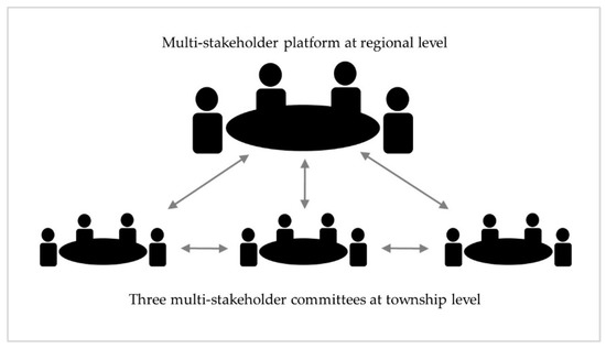
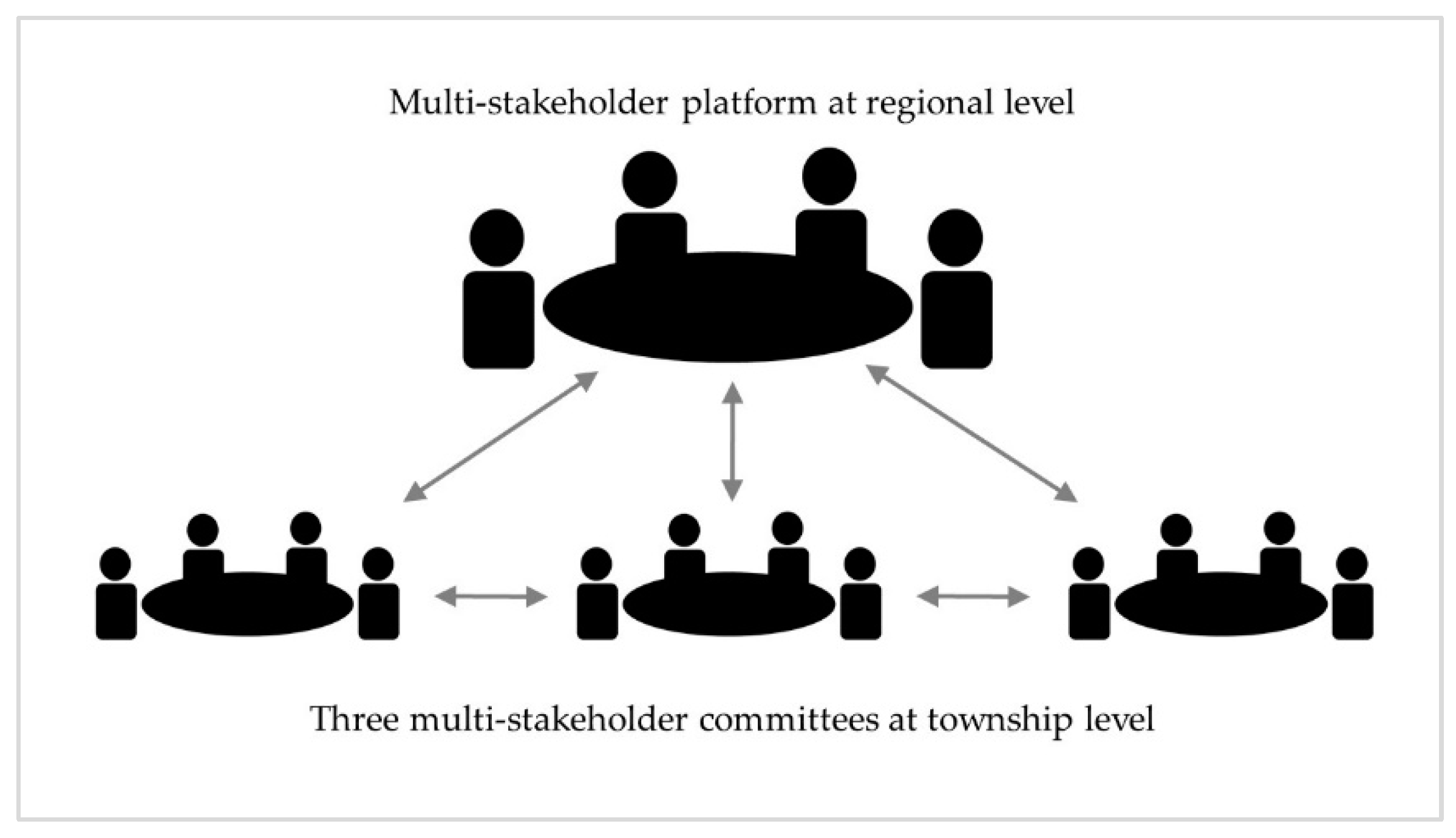

Publisher’s Note: MDPI stays neutral with regard to jurisdictional claims in published maps and institutional affiliations. |
© 2022 by the authors. Licensee MDPI, Basel, Switzerland. This article is an open access article distributed under the terms and conditions of the Creative Commons Attribution (CC BY) license (https://creativecommons.org/licenses/by/4.0/).