Skip to Content
You are currently on the new version of our website. Access the old version .

Remote Sensing, Volume 16, Issue 7

2024 April-1 - 197 articles

Cover Story: 
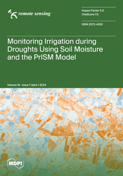
This study introduces PrISM, a method for estimating irrigation amounts using remote sensing soil moisture data. It adapts the Antecedent Precipitation Index model through data assimilation. Tested in Catalonia, Spain, for eight consecutive years and during a severe drought in 2023, PrISM accurately identified areas with water restrictions in 2023. It shows good performance, correlating well with in situ data (0.58 to 0.76) and exhibiting a cumulative weekly RMSE between 7 and 11 mm/week. PrISM's effectiveness varies with irrigation techniques, performing well with sprinkler and flood systems but facing challenges with drip irrigation. This paper fills a gap in remote sensing-based irrigation estimation, focusing on detecting significant reductions in water allocations during droughts. View this paper
  • Issues are regarded as officially published after their release is announced to the table of contents alert mailing list .
  • You may sign up for email alerts to receive table of contents of newly released issues.
  • PDF is the official format for papers published in both, html and pdf forms. To view the papers in pdf format, click on the "PDF Full-text" link, and use the free Adobe Reader to open them.

Articles (197)

  • Article
  • Open Access
3 Citations
2,309 Views
17 Pages

8 April 2024

Applying standard aerosol models for atmospheric correction in nearshore coastal waters introduces significant uncertainties due to their inability to accurately represent aerosol characteristics in these regions. To improve the accuracy of remote se...

  • Article
  • Open Access
3 Citations
2,492 Views
15 Pages

How Land Use Transitions Contribute to the Soil Organic Carbon Accumulation from 1990 to 2020

  • Zihui Zhang,
  • Lang Xia,
  • Zifei Zhao,
  • Fen Zhao,
  • Guanyu Hou,
  • Shixin Wu,
  • Xiao Sun,
  • Shangrong Wu,
  • Peng Yang and
  • Yan Zha

8 April 2024

Soil organic carbon stock (SOCS) changes caused by land use changes are still unclear, and understanding this response is essential for many environmental policies and land management practices. In this study, we investigated the temporal–spati...

  • Article
  • Open Access
3 Citations
4,530 Views
23 Pages

Lunar Surface Resource Exploration: Tracing Lithium, 7 Li and Black Ice Using Spectral Libraries and Apollo Mission Samples

  • Susana del Carmen Fernández,
  • Fernando Alberquilla,
  • Julia María Fernández,
  • Enrique Díez,
  • Javier Rodríguez,
  • Rubén Muñiz,
  • Javier F. Calleja,
  • Francisco Javier de Cos and
  • Jesús Martínez-Frías

8 April 2024

This is an exercise to explore the concentration of lithium, lithium-7 isotope and the possible presence of black dirty ice on the lunar surface using spectral data obtained from the Clementine mission. The main interest in tracing the lithium and pr...

  • Technical Note
  • Open Access
3 Citations
2,002 Views
12 Pages

8 April 2024

Measurement of lightning current plays a critical role in the field of atmospheric electricity. Traditionally, Rogowski coils or low-resistance shunts were employed for measuring lightning currents in the range from several amperes up to several hund...

  • Article
  • Open Access
13 Citations
6,959 Views
26 Pages

8 April 2024

Southern China, one of the traditional rice production bases, has experienced significant declines in the area of rice paddy since the beginning of this century. Monitoring the rice cropping area is becoming an urgent need for food security policy de...

  • Article
  • Open Access
3 Citations
2,575 Views
20 Pages

Weighted Differential Gradient Method for Filling Pits in Light Detection and Ranging (LiDAR) Canopy Height Model

  • Guoqing Zhou,
  • Haowen Li,
  • Jing Huang,
  • Ertao Gao,
  • Tianyi Song,
  • Xiaoting Han,
  • Shuaiguang Zhu and
  • Jun Liu

8 April 2024

The canopy height model (CHM) derived from LiDAR point cloud data is usually used to accurately identify the position and the canopy dimension of single tree. However, local invalid values (also called data pits) are often encountered during the gene...

  • Article
  • Open Access
3 Citations
2,339 Views
22 Pages

8 April 2024

Landslides recurrently cause severe damage and, in some cases, the full disruption of many highways in mountainous areas, which can last from a few days to even months. Thus, there is a high demand for monitoring tools and precipitation data to suppo...

  • Article
  • Open Access
4 Citations
2,884 Views
13 Pages

Early Identification of River Blockage Disasters Caused by Debris Flows in the Bailong River Basin, China

  • Jianjun Zeng,
  • Yan Zhao,
  • Jiaoyu Zheng,
  • Yongjun Zhang,
  • Pengqing Shi,
  • Yajun Li,
  • Guan Chen,
  • Xingmin Meng and
  • Dongxia Yue

7 April 2024

The Bailong River Basin is one of the most developed regions for debris flow disasters worldwide, often causing severe secondary disasters by blocking rivers. Therefore, the early identification of potential debris flow disasters that may block the r...

  • Communication
  • Open Access
1 Citations
1,811 Views
11 Pages

7 April 2024

Single scattering in radiative transfer is separated into rapidly-varying and slowly-varying processes, where the rapidly-varying process (RVP) is mainly contributed by the diffraction effect. Accordingly, the diffraction decomposition order (DDO) me...

  • Technical Note
  • Open Access
3 Citations
3,271 Views
15 Pages

GPU Acceleration for SAR Satellite Image Ortho-Rectification

  • Lei Dong,
  • Tingtao Zhang,
  • Fangjian Liu,
  • Rui Liu and
  • Hongjian You

7 April 2024

Synthetic Aperture Radar (SAR) satellite image ortho-rectification requires pixel-level calculations, which are time-consuming. Moreover, for SAR images with large overlapping areas, the processing time for ortho-rectification increases linearly, sig...

  • Article
  • Open Access
14 Citations
4,263 Views
21 Pages

7 April 2024

Synthetic aperture radar (SAR) plays a crucial role in maritime surveillance due to its capability for all-weather, all-day operation. However, SAR ship recognition faces challenges, primarily due to the imbalance and inadequacy of ship samples in pu...

  • Article
  • Open Access
9 Citations
3,621 Views
22 Pages

Spatiotemporal Patterns of Air Pollutants over the Epidemic Course: A National Study in China

  • Kun Qin,
  • Zhanpeng Wang,
  • Shaoqing Dai,
  • Yuchen Li,
  • Manyao Li,
  • Chen Li,
  • Ge Qiu,
  • Yuanyuan Shi,
  • Chun Yin and
  • Peng Jia
  • + 1 author

7 April 2024

Air pollution has been standing as one of the most pressing global challenges. The changing patterns of air pollutants at different spatial and temporal scales have been substantially studied all over the world, which, however, were intricately distu...

  • Technical Note
  • Open Access
3 Citations
4,325 Views
18 Pages

SSEBop Evapotranspiration Estimates Using Synthetically Derived Landsat Data from the Continuous Change Detection and Classification Algorithm

  • Mikael P. Hiestand,
  • Heather J. Tollerud,
  • Chris Funk,
  • Gabriel B. Senay,
  • Kate C. Fickas and
  • MacKenzie O. Friedrichs

6 April 2024

The operational Simplified Surface Energy Balance (SSEBop) model has been utilized to generate gridded evapotranspiration data from Landsat images. These estimates are primarily driven by two sources of information: reference evapotranspiration and L...

  • Article
  • Open Access
7 Citations
4,376 Views
21 Pages

Three-Dimensional Human Pose Estimation from Micro-Doppler Signature Based on SISO UWB Radar

  • Xiaolong Zhou,
  • Tian Jin,
  • Yongpeng Dai,
  • Yongping Song and
  • Kemeng Li

6 April 2024

In this paper, we propose an innovative approach for transforming 2D human pose estimation into 3D models using Single Input–Single Output (SISO) Ultra-Wideband (UWB) radar technology. This method addresses the significant challenge of reconstr...

  • Article
  • Open Access
2 Citations
3,101 Views
24 Pages

6 April 2024

Nearly 50 million km2 of global land experiences seasonal transitions from predominantly frozen to thawed conditions, significantly impacting various ecosystems and hydrologic processes. In this study, we assessed the capability to retrieve surface f...

  • Article
  • Open Access
2 Citations
2,412 Views
20 Pages

Introducing the Azimuth Cutoff as an Independent Measure for Characterizing Sea-State Dynamics in SAR Altimetry

  • Ourania Altiparmaki,
  • Samira Amraoui,
  • Marcel Kleinherenbrink,
  • Thomas Moreau,
  • Claire Maraldi,
  • Pieter N. A. M. Visser and
  • Marc Naeije

6 April 2024

This study presents the first azimuth cutoff analysis in Synthetic Aperture Radar (SAR) altimetry, aiming to assess its applicability in characterizing sea-state dynamics. In SAR imaging, the azimuth cutoff serves as a proxy for the shortest waves, i...

  • Article
  • Open Access
29 Citations
4,654 Views
19 Pages

Changes in Vegetation NDVI and Its Response to Climate Change and Human Activities in the Ferghana Basin from 1982 to 2015

  • Heli Zhang,
  • Lu Li,
  • Xiaoen Zhao,
  • Feng Chen,
  • Jiachang Wei,
  • Zhimin Feng,
  • Tiyuan Hou,
  • Youping Chen,
  • Weipeng Yue and
  • Mao Hu
  • + 2 authors

6 April 2024

Exploring the evolution of vegetation cover and its drivers in the Ferghana Basin helps to understand the current ecological status of the Ferghana Basin and to analyze the vegetation changes and drivers, with a view to providing a scientific basis f...

  • Article
  • Open Access
1 Citations
2,383 Views
17 Pages

6 April 2024

The self-supervised learning (SSL) technique, driven by massive unlabeled data, is expected to be a promising solution for semantic segmentation of remote sensing images (RSIs) with limited labeled data, revolutionizing transfer learning. Traditional...

  • Article
  • Open Access
7 Citations
6,955 Views
34 Pages

Estimating Carbon Dioxide Emissions from Power Plant Water Vapor Plumes Using Satellite Imagery and Machine Learning

  • Heather D. Couture,
  • Madison Alvara,
  • Jeremy Freeman,
  • Aaron Davitt,
  • Hannes Koenig,
  • Ali Rouzbeh Kargar,
  • Joseph O’Connor,
  • Isabella Söldner-Rembold,
  • André Ferreira and
  • Gavin McCormick
  • + 8 authors

6 April 2024

Combustion power plants emit carbon dioxide (CO2), which is a major contributor to climate change. Direct emissions measurement is cost-prohibitive globally, while reporting varies in detail, latency, and granularity. To fill this gap and greatly inc...

  • Communication
  • Open Access
2,322 Views
19 Pages

Sub-Hourly Variations of Wind Shear in the Mesosphere-Lower Thermosphere as Observed by the China Meteor Radar Chain

  • Chi Long,
  • Tao Yu,
  • Jian Zhang,
  • Xiangxiang Yan,
  • Na Yang,
  • Jin Wang,
  • Chunliang Xia,
  • Yu Liang and
  • Hailun Ye

6 April 2024

Wind shear has important implications for Kelvin–Helmholtz instability (KHI) and gravity waves (GWs) in the mesosphere–lower thermosphere (MLT) region where its momentum transport process is dominated by short-period (<1 h) GWs. Howeve...

  • Article
  • Open Access
4 Citations
2,694 Views
21 Pages

Sparse SAR Imaging Algorithm in Marine Environments Based on Memory-Augmented Deep Unfolding Network

  • Yao Zhao,
  • Chengwen Ou,
  • He Tian,
  • Bingo Wing-Kuen Ling,
  • Ye Tian and
  • Zhe Zhang

5 April 2024

Oceanic targets, including ripples, islands, vessels, and coastlines, display distinct sparse characteristics, rendering the ocean a significant arena for sparse Synthetic Aperture Radar (SAR) imaging rooted in sparse signal processing. Deep neural n...

  • Article
  • Open Access
23 Citations
6,261 Views
24 Pages

Detection of Military Targets on Ground and Sea by UAVs with Low-Altitude Oblique Perspective

  • Bohan Zeng,
  • Shan Gao,
  • Yuelei Xu,
  • Zhaoxiang Zhang,
  • Fan Li and
  • Chenghang Wang

5 April 2024

Small-scale low-altitude unmanned aerial vehicles (UAVs) equipped with perception capability for military targets will become increasingly essential for strategic reconnaissance and stationary patrols in the future. To respond to challenges such as c...

  • Article
  • Open Access
9 Citations
2,769 Views
22 Pages

Time-Series Cross-Radiometric Calibration and Validation of GF-6/WFV Using Multi-Site

  • Yingxian Wang,
  • Yaokai Liu,
  • Weiwei Zhao,
  • Jian Zeng,
  • Huixian Wang,
  • Renfei Wang,
  • Zhaopeng Xu and
  • Qijin Han

5 April 2024

The GaoFen6 (GF-6) satellite, equipped with a wide full-swath (WFV) sensor, offers high spatial resolution and extensive coverage, making it widely utilized in agricultural and forestry classification, land resource monitoring, and other fields. Accu...

  • Article
  • Open Access
5 Citations
2,514 Views
25 Pages

5 April 2024

Existing approaches addressing the few-shot open-set recognition (FSOSR) challenge in hyperspectral images (HSIs) often encounter limitations stemming from sparse labels, restricted category numbers, and low openness. These limitations compromise sta...

  • Article
  • Open Access
22 Citations
6,005 Views
22 Pages

5 April 2024

Rapid urbanisation in the global south has often introduced substantial and rapid uncontrolled Land Use and Land Cover (LULC) changes, considerably affecting the Land Surface Temperature (LST) patterns. Understanding the relationship between LULC cha...

  • Article
  • Open Access
9 Citations
3,770 Views
17 Pages

5 April 2024

Thermal infrared remotely sensed data, by capturing the thermal radiation characteristics emitted by the Earth’s surface, plays a pivotal role in various domains, such as environmental monitoring, resource exploration, agricultural assessment,...

  • Article
  • Open Access
8 Citations
2,358 Views
23 Pages

5 April 2024

In this study, based on hourly ERA5 reanalysis data from July to September, from 1971 to 2020, for Shandong Province, we used mathematical statistical analysis, the Mann–Kendall nonparametric statistical test, cluster analysis, and other method...

  • Article
  • Open Access
4 Citations
2,739 Views
19 Pages

Interannual Variations in the Summer Coastal Upwelling in the Northeastern South China Sea

  • Wuyang Chen,
  • Yifeng Tong,
  • Wei Li,
  • Yang Ding,
  • Junmin Li,
  • Wenhua Wang and
  • Ping Shi

5 April 2024

This study scrutinizes interannual (2003–2023) variations in coastal upwelling along the Guangdong Province during summers (June–August) in the northeastern South China Sea (NESCS) by comprehensively applying the moderate-resolution imagi...

  • Article
  • Open Access
22 Citations
13,127 Views
22 Pages

High-Resolution Canopy Height Mapping: Integrating NASA’s Global Ecosystem Dynamics Investigation (GEDI) with Multi-Source Remote Sensing Data

  • Cesar Alvites,
  • Hannah O’Sullivan,
  • Saverio Francini,
  • Marco Marchetti,
  • Giovanni Santopuoli,
  • Gherardo Chirici,
  • Bruno Lasserre,
  • Michela Marignani and
  • Erika Bazzato

5 April 2024

Accurate structural information about forests, including canopy heights and diameters, is crucial for quantifying tree volume, biomass, and carbon stocks, enabling effective forest ecosystem management, particularly in response to changing environmen...

  • Article
  • Open Access
20 Citations
4,976 Views
20 Pages

5 April 2024

Detecting and attributing vegetation variations in the Yellow River Basin (YRB) is vital for adjusting ecological restoration strategies to address the possible threats posed by changing environments. On the basis of the kernel normalized difference...

  • Article
  • Open Access
4 Citations
3,350 Views
20 Pages

4 April 2024

The task of colour restoration on datasets acquired in deep waters with simple equipment such as a camera with strobes is not an easy task. This is due to the lack of a lot of information, such as the water environmental conditions, the geometric set...

  • Article
  • Open Access
3 Citations
2,618 Views
26 Pages

4 April 2024

Building extraction plays an important role in urban information analysis, which is helpful for urban planning and disaster monitoring. With the improvement of SAR resolution, rich detailed information in urban areas is revealed, but the discretized...

  • Article
  • Open Access
3 Citations
2,250 Views
15 Pages

4 April 2024

The unmanned aerial vehicle (UAV)-borne video synthetic aperture radar (SAR) possesses the characteristic of having high-continuous-frame-rate imaging, which is conducive to the real-time monitoring of ground-moving targets. The real-time imaging-pro...

  • Article
  • Open Access
25 Citations
8,857 Views
31 Pages

PRISMA Hyperspectral Remote Sensing Data for Mapping Alteration Minerals in Sar-e-Châh-e-Shur Region, Birjand, Iran

  • Jabar Habashi,
  • Hadi Jamshid Moghadam,
  • Majid Mohammady Oskouei,
  • Amin Beiranvand Pour and
  • Mazlan Hashim

4 April 2024

Remote sensing satellite imagery consistently provides valuable and frequent information, enabling the exploration of mineral resources across immense, remote and harsh domains. Recent developments in spaceborne hyperspectral remote sensing have open...

  • Article
  • Open Access
11 Citations
2,620 Views
23 Pages

Improving Aboveground Biomass Estimation in Lowland Tropical Forests across Aspect and Age Stratification: A Case Study in Xishuangbanna

  • Yong Wu,
  • Guanglong Ou,
  • Tengfei Lu,
  • Tianbao Huang,
  • Xiaoli Zhang,
  • Zihao Liu,
  • Zhibo Yu,
  • Binbing Guo,
  • Er Wang and
  • Weiheng Xu
  • + 4 authors

4 April 2024

Improving the precision of aboveground biomass (AGB) estimation in lowland tropical forests is crucial to enhancing our understanding of carbon dynamics and formulating climate change mitigation strategies. This study proposes an AGB estimation metho...

  • Article
  • Open Access
3 Citations
3,166 Views
18 Pages

4 April 2024

Deep models may have disappointing performance in real applications due to the domain shifts in data distributions between the source and target domain. Although a few unsupervised domain adaptation methods have been proposed to make the pre-train mo...

  • Article
  • Open Access
2,085 Views
28 Pages

4 April 2024

Network-group targets are a set of objectives that adhere to a shared communication protocol, perform common tasks, and exhibit relatively coordinated movements. Typically, network-group targets emit radar and communication signals. However, they oft...

  • Article
  • Open Access
4 Citations
2,313 Views
23 Pages

4 April 2024

This study investigates the long-term stability of the Suomi National Polar-orbiting Partnership (S-NPP) Visible Infrared Imaging Radiometer Suite (VIIRS) moderate-resolution Thermal Emissive Bands (M TEBs; M12–M16) covering a period from Febru...

  • Article
  • Open Access
3 Citations
3,606 Views
21 Pages

4 April 2024

Human settlements have historically thrived near rivers due to enhanced navigation and trade, and the availability of water supply and resources. The use of night light data, representing economic activities, provides a novel approach to studying the...

  • Article
  • Open Access
35 Citations
4,288 Views
19 Pages

4 April 2024

Change detection is widely used in the field of building monitoring. In recent years, the progress of remote sensing image technology has provided high-resolution data. However, unlike other tasks, change detection focuses on the difference between d...

  • Article
  • Open Access
4 Citations
3,771 Views
24 Pages

4 April 2024

Appropriate environmental sensing methods and visualization representations are crucial foundations for the in situ exploration of planets. In this paper, we developed specialized visualization methods to facilitate the rover’s interaction and...

  • Article
  • Open Access
4 Citations
4,792 Views
16 Pages

Mapping of Forest Structural Parameters in Tianshan Mountain Using Bayesian-Random Forest Model, Synthetic Aperture Radar Sentinel-1A, and Sentinel-2 Imagery

  • Ting Wang,
  • Wenqiang Xu,
  • Anming Bao,
  • Ye Yuan,
  • Guoxiong Zheng,
  • Sulei Naibi,
  • Xiaoran Huang,
  • Zhengyu Wang,
  • Xueting Zheng and
  • Alain De Wulf
  • + 5 authors

4 April 2024

The assessment of forest structural parameters is crucial for understanding carbon storage, habitat suitability, and timber stock. However, the labor-intensive and expensive nature of field measurements, coupled with inadequate sample sizes for large...

  • Article
  • Open Access
14 Citations
3,294 Views
27 Pages

Precipitation Estimation Using FY-4B/AGRI Satellite Data Based on Random Forest

  • Yang Huang,
  • Yansong Bao,
  • George P. Petropoulos,
  • Qifeng Lu,
  • Yanfeng Huo and
  • Fu Wang

3 April 2024

Precipitation is the basic component of the Earth’s water cycle. Obtaining high-resolution and high-precision precipitation data is of great significance. This paper establishes a precipitation retrieval model based on a random forest classific...

  • Article
  • Open Access
2 Citations
3,978 Views
18 Pages

Characterizing Smoke Haze Events in Australia Using a Hybrid Approach of Satellite-Based Aerosol Optical Depth and Chemical Transport Modeling

  • Miles Sowden,
  • Ivan C. Hanigan,
  • Daniel Jamie Victor Robbins,
  • Martin Cope,
  • Jeremy D. Silver and
  • Julie Noonan

3 April 2024

Smoke haze events have increasingly affected Australia’s environmental quality, having demonstrable effects on air quality, climate, and public health. This study employs a hybrid methodology, merging satellite-based aerosol optical depth (AOD)...

  • Article
  • Open Access
5 Citations
3,321 Views
19 Pages

Constructing Rainfall Threshold for Debris Flows of a Defined Hazardous Magnitude

  • Yajun Li,
  • Mengyu Wang,
  • Fukang Ma,
  • Jun Zhang,
  • Guowei Li,
  • Xingmin Meng,
  • Guan Chen,
  • Dongxia Yue,
  • Fuyun Guo and
  • Yan Zhao

3 April 2024

Debris flow can cause damage only when its discharge exceeds the drainage capacity of the prevention engineering. At present, most rainfall thresholds for debris flows mainly focus on the initiation of debris flow and do not adequately consider the m...

  • Article
  • Open Access
6 Citations
2,928 Views
29 Pages

3 April 2024

Mapping benthic habitats with bathymetric, acoustic, and spectral data requires georeferenced ground-truth information about habitat types and characteristics. New technologies like autonomous underwater vehicles (AUVs) collect tens of thousands of i...

  • Article
  • Open Access
2 Citations
3,203 Views
22 Pages

Mapping Erosion Hotspots: Coherent Change Detection in the Quilpie Region, Queensland, Australia

  • Kyran Cook,
  • Armin Agha Karimi,
  • Alistair Grinham and
  • Kevin McDougall

3 April 2024

Erosion is a powerful force that has moulded the Earth ever since water has been present on its rocky surface. In its seemingly harmless pursuit, erosion threatens ecosystems, reduces agricultural production, and impacts water quality. When trying to...

  • Article
  • Open Access
15 Citations
4,043 Views
19 Pages

Dense Time Series Generation of Surface Water Extents through Optical–SAR Sensor Fusion and Gap Filling

  • Kel N. Markert,
  • Gustavious P. Williams,
  • E. James Nelson,
  • Daniel P. Ames,
  • Hyongki Lee and
  • Robert E. Griffin

3 April 2024

Surface water is a vital component of the Earth’s water cycle and characterizing its dynamics is essential for understanding and managing our water resources. Satellite-based remote sensing has been used to monitor surface water dynamics, but c...

  • Article
  • Open Access
10 Citations
2,016 Views
18 Pages

2 April 2024

Personal laser scanning devices employing Simultaneous Localization and Mapping (SLAM) technology have rightfully gained traction in various applications, including forest mensuration and inventories. This study focuses the inherent stochastic noise...

  • Article
  • Open Access
9 Citations
3,011 Views
17 Pages

2 April 2024

The timely and robust prediction of wheat yield is very significant for grain trade and food security. In this study, the yield prediction model was developed by coupling an ensemble model with multi-source data, including vegetation indices (VIs) an...

of 4

Get Alerted

Add your email address to receive forthcoming issues of this journal.

XFacebookLinkedIn
Remote Sens. - ISSN 2072-4292