


Int. J. Environ. Res. Public Health 2022, 19(21), 14575; https://doi.org/10.3390/ijerph192114575 - 6 Nov 2022
Cited by 28 | Viewed by 4276
Abstract
►
Show Figures
In order to protect wetland resources, China has developed wetland conservation policies and has made significant conservation investments, but there is still a lack of pathways for the conversion to economic value, making it difficult to meet the demand for continuous investment. We
[...] Read more.
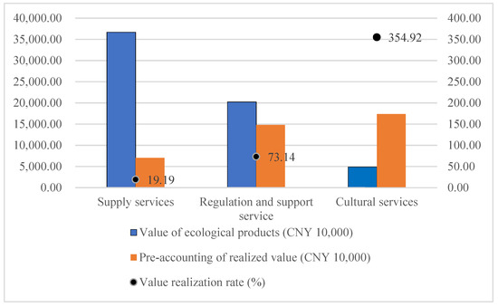
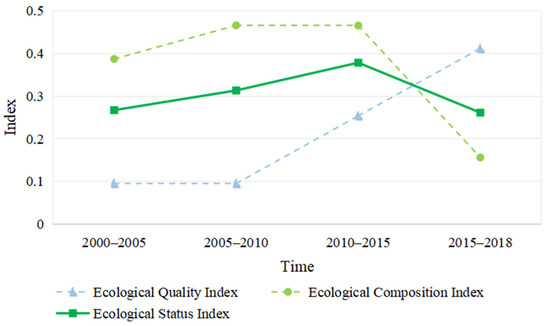
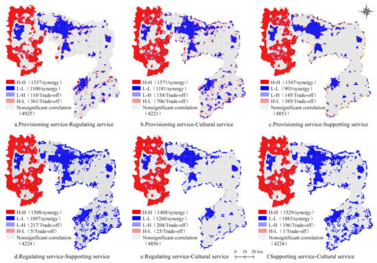
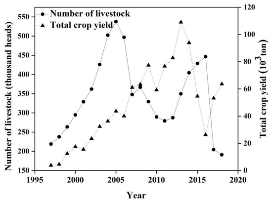
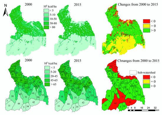
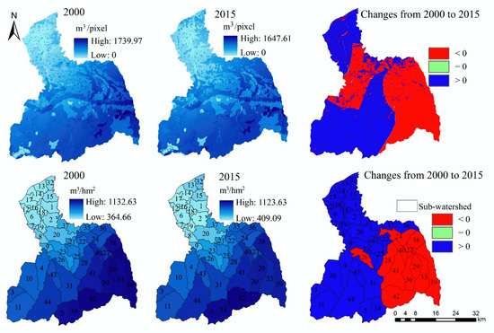
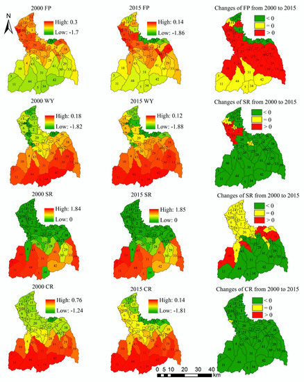
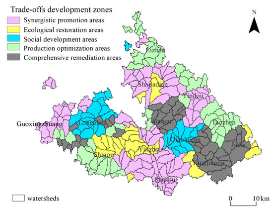
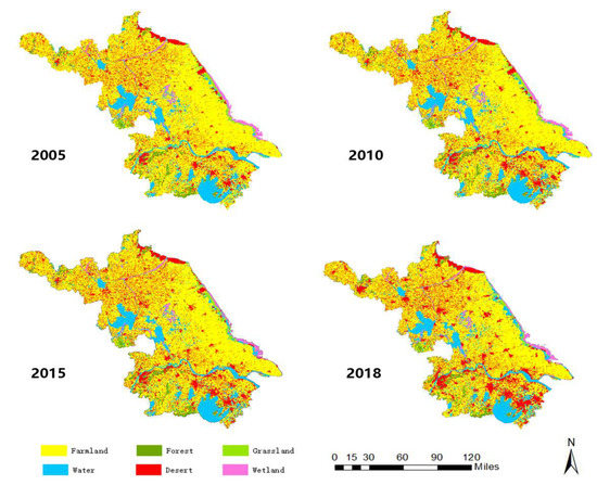
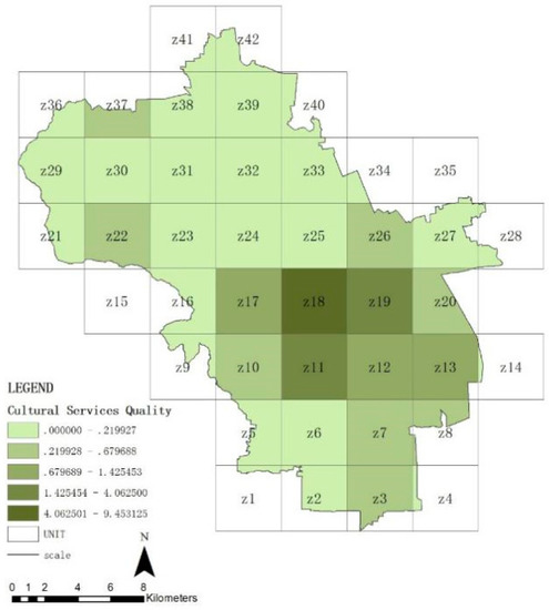
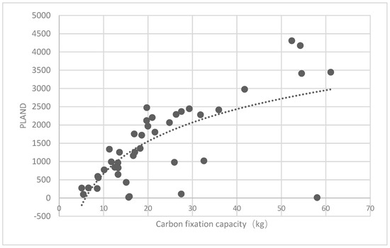
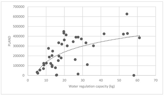
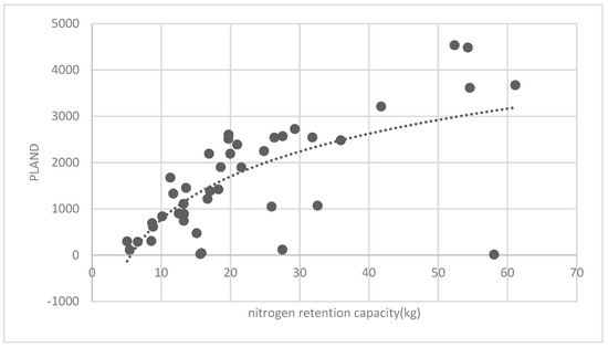
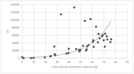
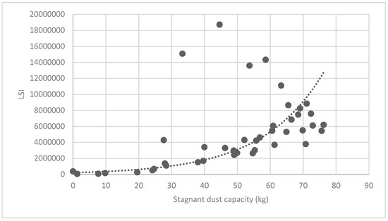
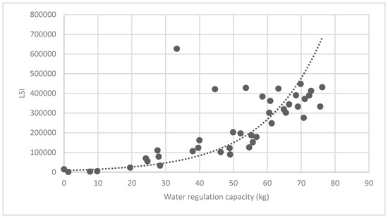
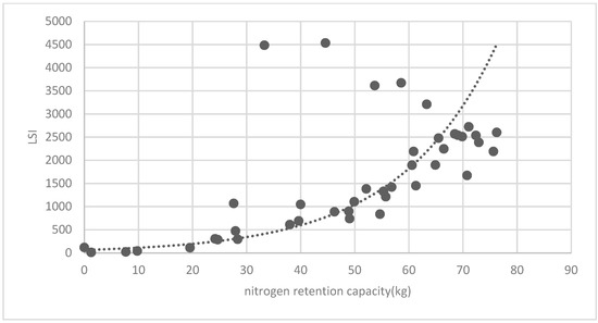
In order to protect wetland resources, China has developed wetland conservation policies and has made significant conservation investments, but there is still a lack of pathways for the conversion to economic value, making it difficult to meet the demand for continuous investment. We have explored a sustainable ecological conservation mechanism using the Seven Mile Sea as a case study, so that ecological conservation costs can be transformed into economic development behaviors and ecological benefits and socio-economic development can be integrated. This paper assesses the ecological product value of the Qilihai Wetland based on the ecosystem service function value assessment method, which designs the realization path of ecological product value and predicts the value transformation efficiency. The results show the following: (1) The total value of ecological products in the study area is CNY 569.06 million (USD 78.36 million), and the main sources of value are plant products in the supply service and water purification functions in the regulation service, accounting for 54.05% and 26.10% of the total, respectively. (2) The predicted value realization of ecological products, ideally, is CNY 689.65 million (USD 94.96 million), with a value realization rate of 111.60%. Considering the management policy restrictions in different areas of the Qilihai Wetland, the actual value realization volume is CNY 391.94 million (USD 53.97 million), with a value realization rate of 63.42%. (3) Owing to the restriction of the development policy of supply services and cultural services, the value realization path mainly contains two types: one is to drive the development of supply services and cultural services in the surrounding areas, along with product premiums, to realize value transformation. This path is mainly aimed at the supply of local characteristic products and the development of tourism. The second is to realize the value of regulating services through ecological compensation and ecological equity trading. This path is mainly for the adjustment and support services in the core area and buffer area. According to the pre-accounting results, the contribution rates of the two paths are 62.25% and 37.75%, respectively. The second path should be further effectively developed to improve the contribution rate. This study helps assess the ecological value and important ecological elements of the Qilihai Wetland to ensure effective protection and development of important ecological resources and to achieve the sustainable development of wetland resources. It provides a reference for exploring feasible paths to realize the value of ecological goods.
Full article

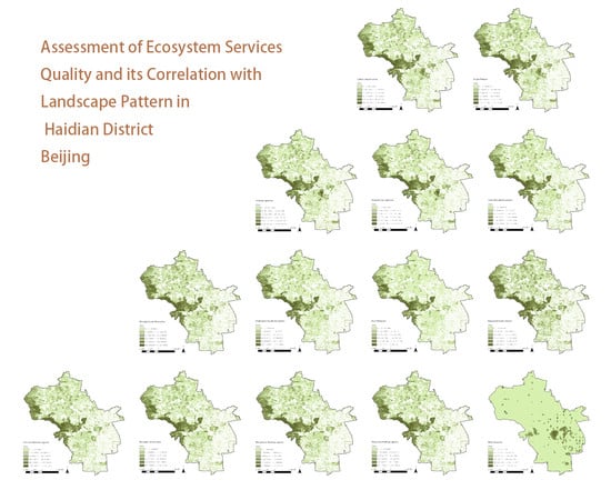
Figure 1


