You are currently viewing a new version of our website. To view the old version click .

ISPRS International Journal of Geo-Information, Volume 9, Issue 12

December 2020 - 69 articles

Cover Story: 
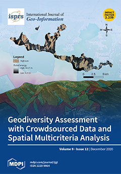
Geodiversity denotes variability in abiotic components in a hierarchical natural environment. Arguably, geodiversity underpins biodiversity. As such, geodiversity is essential to geoheritage, geoconservation, and human well-being. While the value of geodiversity is established, the methods of assessing it are not. Geodiversity assessment mainly involves expert judgement. The reliance on expert judgement rather than on direct quantitative valuation introduces ambiguity into geodiversity assessment. Might, however, the aggregate judgement of many experts be better than the judgement of a few? This paper tries to answer the question by crowdsourcing expert judgements and computing geodiversity with spatial multicriteria techniques. The reliability of geodiversity values is conveyed by uncertainty of assessment, which is computed and mapped. View this paper
  • Issues are regarded as officially published after their release is announced to the table of contents alert mailing list .
  • You may sign up for email alerts to receive table of contents of newly released issues.
  • PDF is the official format for papers published in both, html and pdf forms. To view the papers in pdf format, click on the "PDF Full-text" link, and use the free Adobe Reader to open them.

Articles (69)

  • Article
  • Open Access
7 Citations
4,063 Views
22 Pages

Sci-tech parks (STPs), as a key space carrier of urbanization, have transformed into comprehensive parks with mixed urban functions and advanced hi-tech industries. The jobs–housing relationship, which is closely related to the two major urban...

  • Article
  • Open Access
8 Citations
4,612 Views
15 Pages

Local Segregation of Realised Niches in Lizards

  • Neftalí Sillero,
  • Elena Argaña,
  • Cátia Matos,
  • Marc Franch,
  • Antigoni Kaliontzopoulou and
  • Miguel A. Carretero

Species can occupy different realised niches when sharing the space with other congeneric species or when living in allopatry. Ecological niche models are powerful tools to analyse species niches and their changes over time and space. Analysing how s...

  • Article
  • Open Access
17 Citations
4,182 Views
16 Pages

Participatory Rural Spatial Planning Based on a Virtual Globe-Based 3D PGIS

  • Linjun Yu,
  • Xiaotong Zhang,
  • Feng He,
  • Yalan Liu and
  • Dacheng Wang

With the current spatial planning reform in China, public participation is becoming increasingly important in the success of rural spatial planning. However, engaging various stakeholders in spatial planning projects is difficult, mainly due to the l...

  • Article
  • Open Access
2 Citations
2,528 Views
19 Pages

A regular network of squares is formed by points uniformly distributed (mostly in the square corners) over the surface that is represented by the network. Each point (node) of the network has specified coordinates (X and Y) with a fixed constant dist...

  • Article
  • Open Access
25 Citations
4,785 Views
14 Pages

Synthetic aperture radar (SAR) plays a remarkable role in ocean surveillance, with capabilities of detecting oil spills, icebergs, and marine traffic both at daytime and at night, regardless of clouds and extreme weather conditions. The detection of...

  • Article
  • Open Access
2 Citations
3,431 Views
23 Pages

An Efficient Probabilistic Registration Based on Shape Descriptor for Heritage Field Inspection

  • Yufu Zang,
  • Bijun Li,
  • Xiongwu Xiao,
  • Jianfeng Zhu and
  • Fancong Meng

Heritage documentation is implemented by digitally recording historical artifacts for the conservation and protection of these cultural heritage objects. As efficient spatial data acquisition tools, laser scanners have been widely used to collect hig...

  • Article
  • Open Access
8 Citations
3,678 Views
15 Pages

We present a hybrid approach for modeling complex interior structural elements from the unstructured point cloud without additional information. The proposed approach focuses on an integrated modeling strategy that can reconstruct structural elements...

  • Article
  • Open Access
2 Citations
3,238 Views
18 Pages

Recent years have seen the big growth of app-based taxi services by not only competing for rides with street-hailing taxi services but also generating new taxi rides. Moreover, the innovation in dynamic pricing also makes it competitive in both passe...

  • Article
  • Open Access
15 Citations
5,371 Views
13 Pages

Considering that ports are key nodes of the maritime transport network, it is of great importance to identify ships’ arrivals and departures. Compared with partial proprietary data from a port authority or shipping company, approaches based on...

  • Article
  • Open Access
10 Citations
4,322 Views
16 Pages

Traditionally, chorochromatic maps with a qualitative measurement level are used for land use presentations. Along with the use of UAV (Unmanned Aerial Vehicles), it became possible to register dynamic phenomena in a small space. We analyze the appli...

of 7

Get Alerted

Add your email address to receive forthcoming issues of this journal.

XFacebookLinkedIn
ISPRS Int. J. Geo-Inf. - ISSN 2220-9964