You are currently viewing a new version of our website. To view the old version click .

ISPRS International Journal of Geo-Information, Volume 13, Issue 8

August 2024 - 35 articles

Cover Story: 
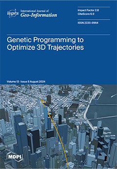
This paper proposes a novel trajectory optimization method using function trees encoded as genetic programs to produce three-dimensional geographic flight routes. Genetic programming (GP), a form of evolutionary computation and an artificial intelligence technique, is used to optimize these functions over tens or hundreds of generations (iterations). A heuristically optimal route is found by applying selective pressures to a population of genetic programs, such as non-intersection with obstacles and restricted areas, along with minimized distance and travel times. GP parameterization is also explored, and its advantageous and detrimental effects are discussed. The proposed algorithm outperforms existing methods in terms of speed and robustness, highlighting the potential for GP applications to complex spatial optimization problems. View this paper
  • Issues are regarded as officially published after their release is announced to the table of contents alert mailing list .
  • You may sign up for email alerts to receive table of contents of newly released issues.
  • PDF is the official format for papers published in both, html and pdf forms. To view the papers in pdf format, click on the "PDF Full-text" link, and use the free Adobe Reader to open them.

Articles (35)

  • Article
  • Open Access
11 Citations
3,443 Views
19 Pages

Flood Susceptibility Mapping Using GIS-Based Frequency Ratio and Shannon’s Entropy Index Bivariate Statistical Models: A Case Study of Chandrapur District, India

  • Asheesh Sharma,
  • Mandeep Poonia,
  • Ankush Rai,
  • Rajesh B. Biniwale,
  • Franziska Tügel,
  • Ekkehard Holzbecher and
  • Reinhard Hinkelmann

Flooding poses a significant threat as a prevalent natural disaster. To mitigate its impact, identifying flood-prone areas through susceptibility mapping is essential for effective flood risk management. This study conducted flood susceptibility mapp...

  • Article
  • Open Access
2 Citations
3,318 Views
25 Pages

With the increasing demand for electric vehicle public charging infrastructure (EVPCI), optimizing the charging network to ensure equal access is crucial to promote the sustainable development of the electric vehicle market and clean energy. Due to l...

  • Article
  • Open Access
2,696 Views
27 Pages

Genetic Programming to Optimize 3D Trajectories

  • André Kotze,
  • Moritz Jan Hildemann,
  • Vítor Santos and
  • Carlos Granell

Trajectory optimization is a method of finding the optimal route connecting a start and end point. The suitability of a trajectory depends on not intersecting any obstacles, as well as predefined performance metrics. In the context of unmanned aerial...

  • Article
  • Open Access
1 Citations
1,677 Views
21 Pages

An Improved ANN-Based Label Placement Method Considering Surrounding Features for Schematic Metro Maps

  • Zhiwei Wu,
  • Tian Lan,
  • Chenzhen Sun,
  • Donglin Cheng,
  • Xing Shi,
  • Meisheng Chen and
  • Guangjun Zeng

On schematic metro maps, high-quality label placement is helpful to passengers performing route planning and orientation tasks. It has been reported that the artificial neural network (ANN) has the potential to place labels with learned labeling know...

  • Article
  • Open Access
4 Citations
1,928 Views
20 Pages

The expansion of the digital economy is crucial for halting climate change, as carbon emissions from urban energy use contribute significantly to global warming. This study uses the Difference-in-Differences Model and the Spatial Durbin Model determi...

  • Article
  • Open Access
1 Citations
1,535 Views
15 Pages

The scientific assessment and prediction of nearshore water quality are crucial for marine environment protection efforts. This study is based on a comprehensive analysis of existing assessment and prediction methods and considers the regular and ran...

  • Article
  • Open Access
1 Citations
1,518 Views
24 Pages

Spatial Semantics for the Evaluation of Administrative Geospatial Ontologies

  • Alia I. Abdelmoty,
  • Hanan Muhajab and
  • Abdurauf Satoti

Administrative geography is concerned with the hierarchy of areas related to national and local government in a country. They form an important dataset in the country’s open data provision and act as the geo-referencing backdrop for many types...

  • Article
  • Open Access
1 Citations
1,848 Views
20 Pages

Spatial Planning Data Structure Based on Blockchain Technology

  • Minwen Tang,
  • Wujiao Dai,
  • Changlin Yin,
  • Bing Hu,
  • Jun Chen and
  • Haoming Liu

Spatial planning requires ensuring the legality, uniformity, authority, and relevance of data. Blockchain technology, characterized by tamper-proofing, complete record-keeping, and process traceability, may effectively organize and manage spatial pla...

  • Article
  • Open Access
1 Citations
1,456 Views
16 Pages

Data supplied by mobile phones have become the basis for identifying meaningful places frequently visited by individuals. In this study, we introduce SAMPLID, a new Supervised Approach for Meaningful Place Identification, based on providing a knowled...

  • Article
  • Open Access
6 Citations
2,739 Views
19 Pages

Pre-hospital emergency medical service (PHEMS) is critical for the treatment outcomes of life-threatening injuries and time-sensitive illnesses. Response time, influenced by traffic conditions and the site planning of pre-hospital emergency medical f...

of 4

Get Alerted

Add your email address to receive forthcoming issues of this journal.

XFacebookLinkedIn
ISPRS Int. J. Geo-Inf. - ISSN 2220-9964Creative Common CC BY license