Article

Research on the Coordination Relationship and Zoning Optimization of Territorial Spatial Functions in Southern Karst Regions Based on a Multi-Scale Fusion Model

1
School of Public Policy and Management, Guangxi University, Nanning 530004, China
2
Research Center for Natural Resources Management and Public Policy, Guangxi University, Nanning 530004, China
*
Author to whom correspondence should be addressed.
Land 2025, 14(2), 430; https://doi.org/10.3390/land14020430
Submission received: 13 January 2025 / Revised: 8 February 2025 / Accepted: 17 February 2025 / Published: 19 February 2025

Abstract

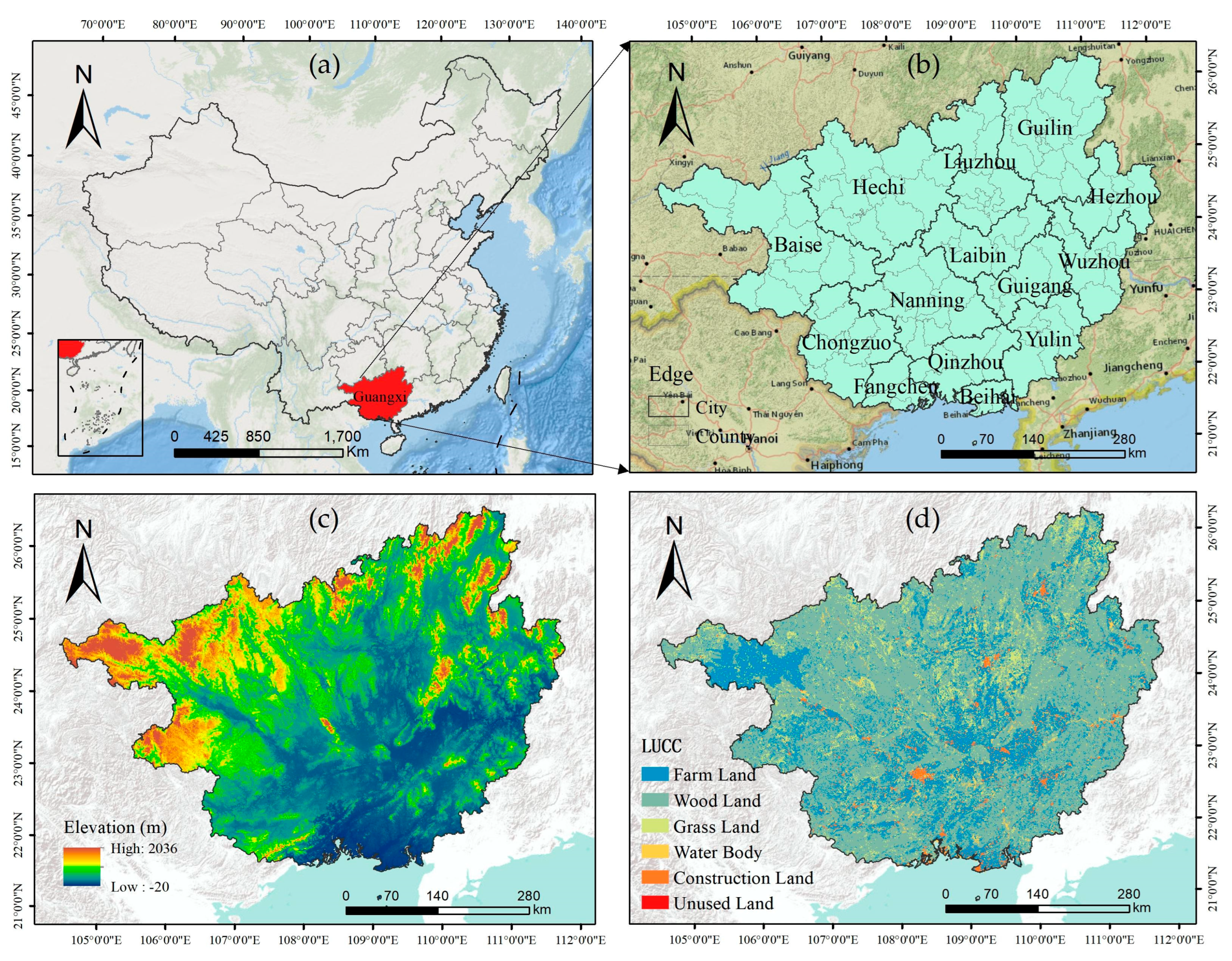
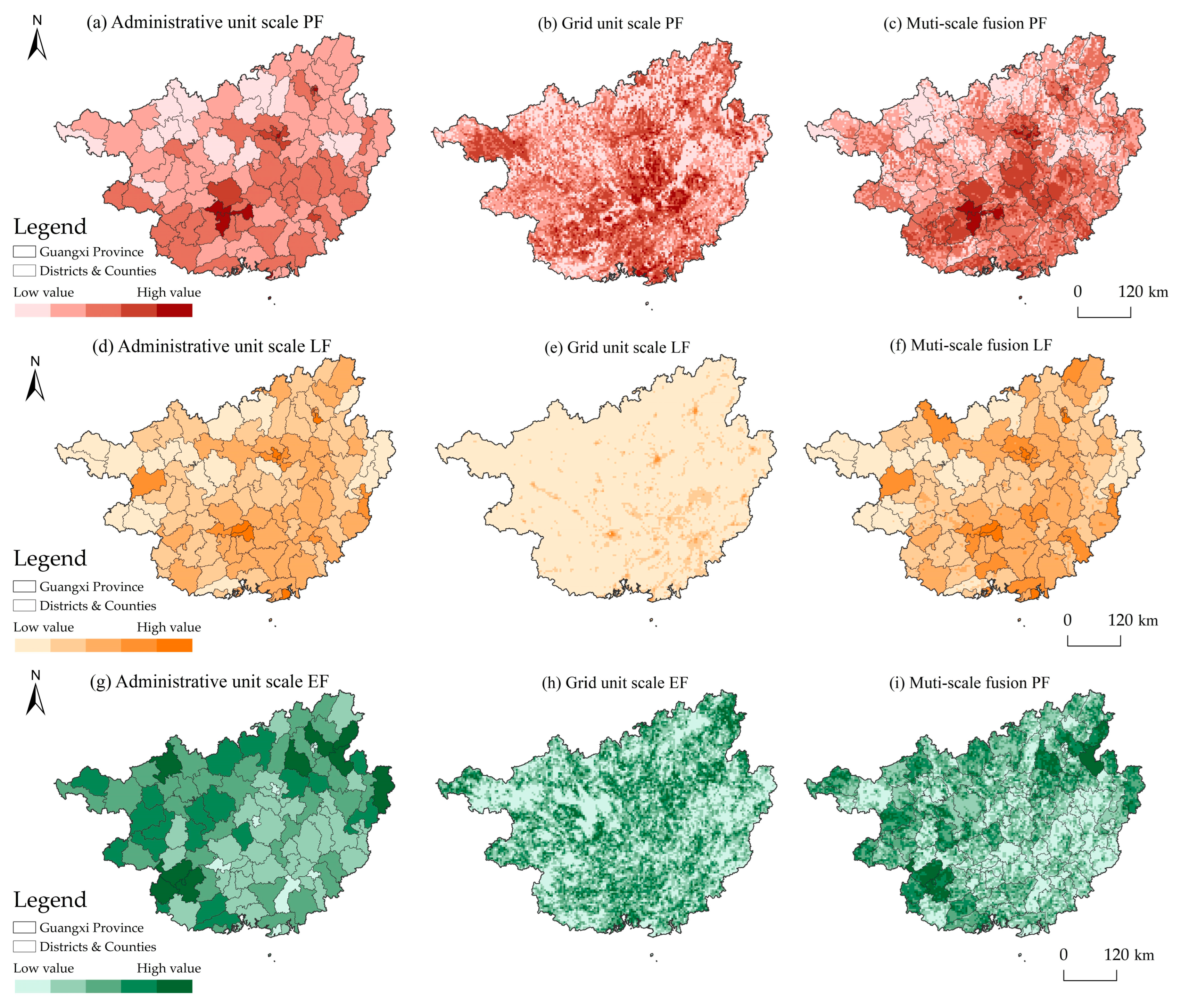
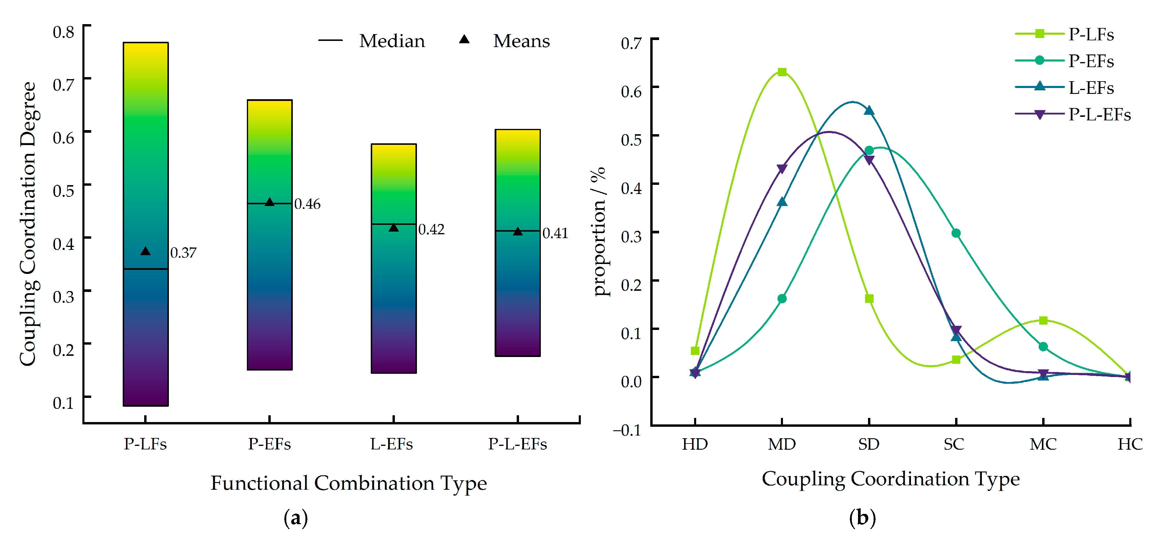
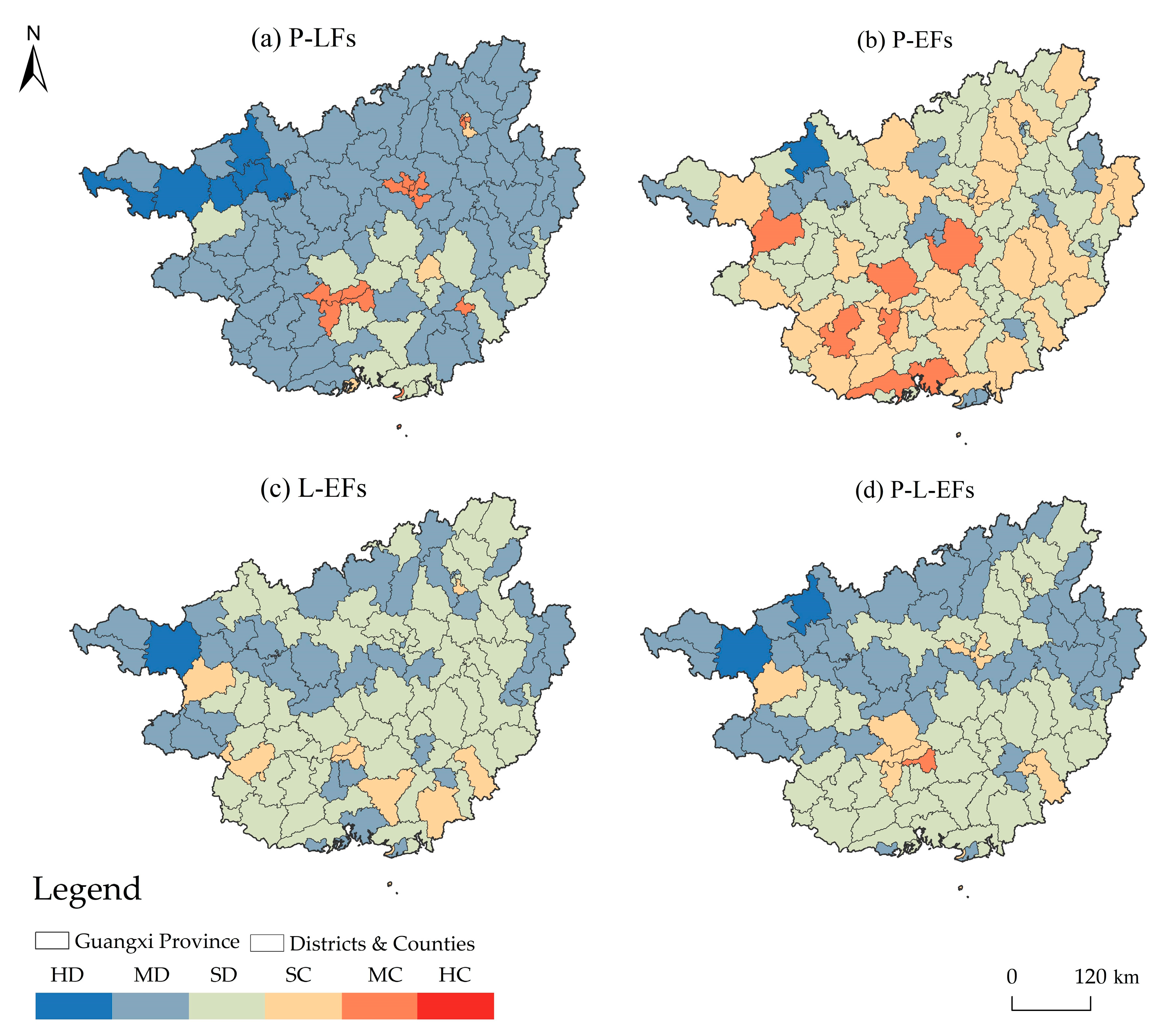
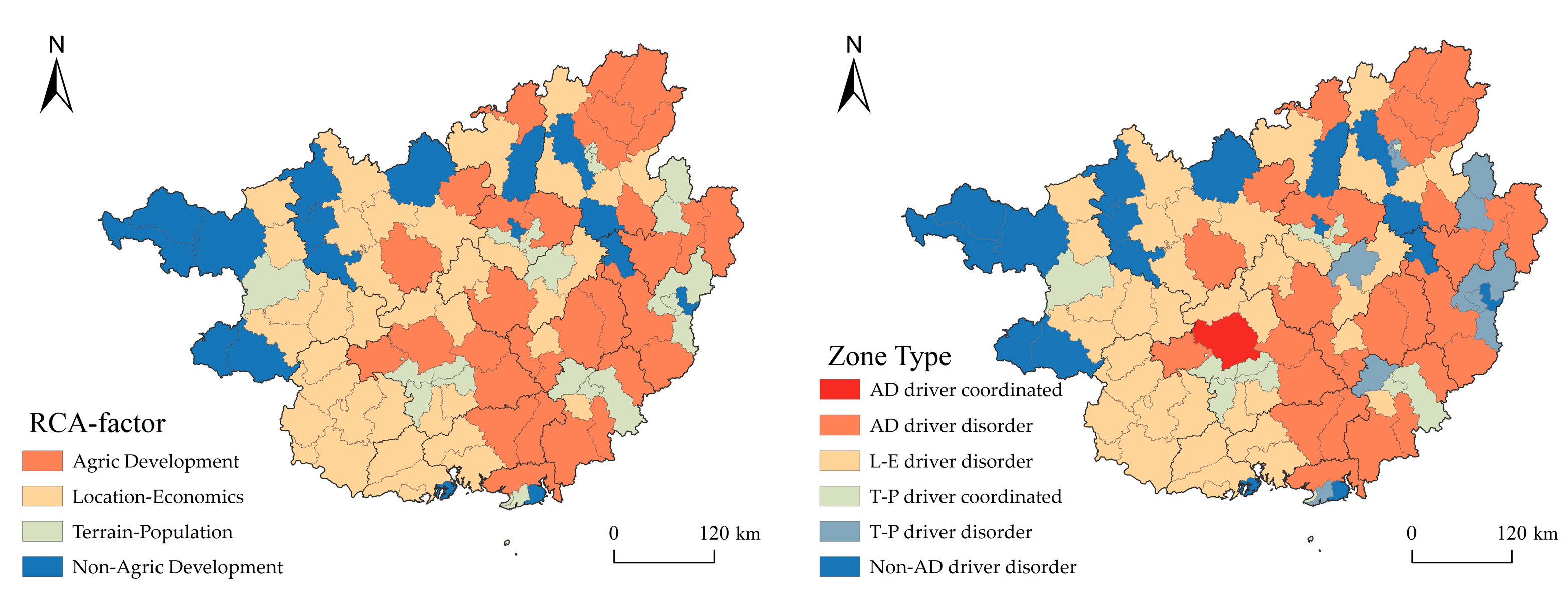
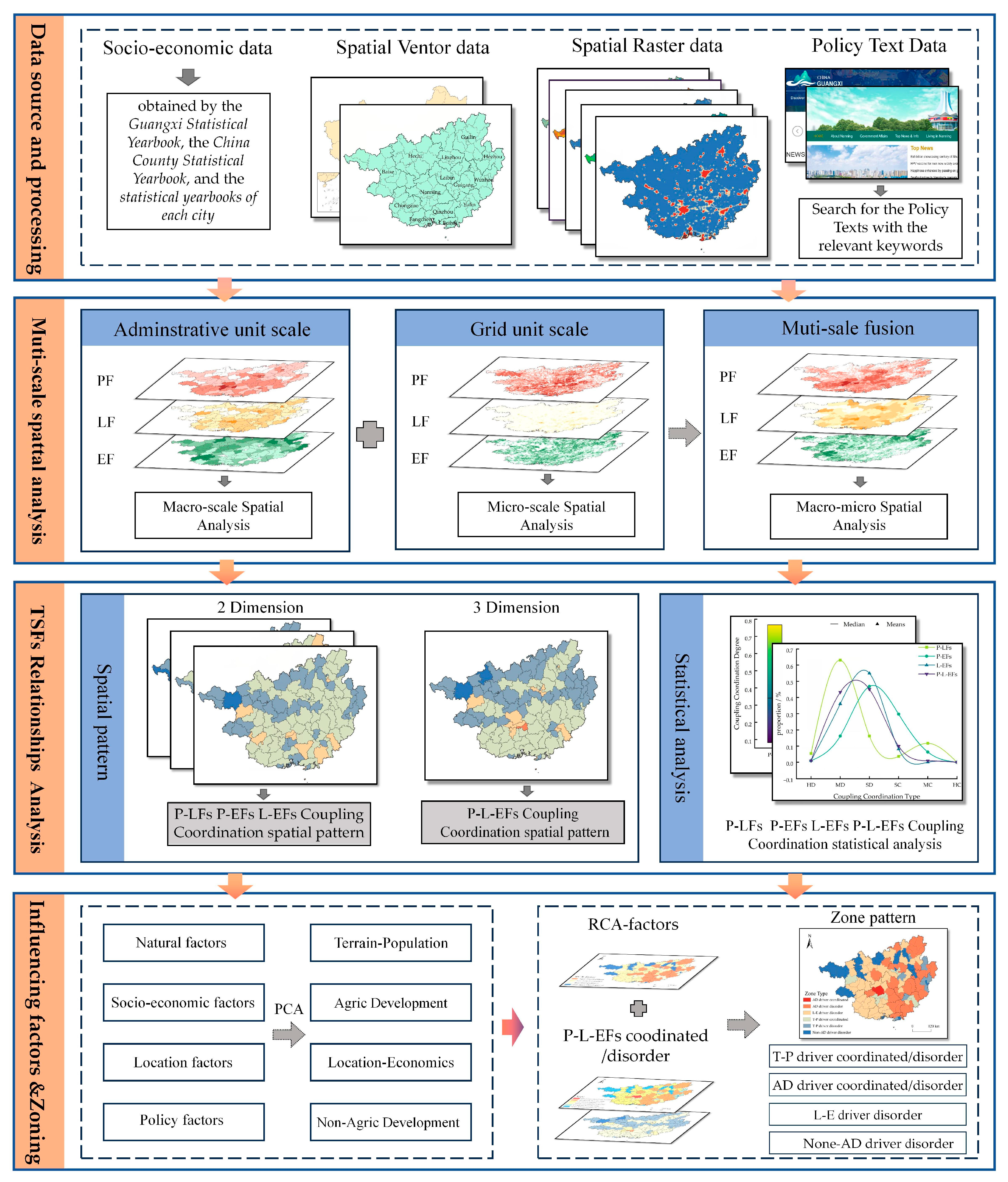
Territorial Space (TS) is characterized by its multifunctionality. The identification and management of Territorial Spatial Functions (TSFs) across multi-scale is crucial for achieving the SDGs. However, previous studies have primarily concentrated on the variations in TSFs within the administrative or grid units at a single scale, with multi-scale investigations remaining a challenge. This study focuses on the typical karst region of Guangxi province in China and develops a Multi-Scale Fusion model (MSF) for assessing TSFs and employs a coupling coordination degree (CCD) model to examine the TSFs relationships. Furthermore, principal component analysis (PCA) is used to classify various types of influencing factors, and the Revealed Comparative Advantage (RCA) index is employed to identify the primary types of influencing factors at the county level. The study integrates coupling coordination types and advantage factors into the zoning process. The results demonstrate: (1) Ecological function is the dominant function. At the administrative unit scale, production and living functions exhibit a spatial pattern of “high in the southeast and low in the northwest”, while ecological function shows the opposite pattern. Under grid units scale and multi-scale fusion, the high and low texture characteristics of production and ecological functions are more pronounced. (2) TSFs are primarily characterized by slight and moderate disorder. Slight disorder is widely distributed, while moderate disorder is predominantly found in the northwest karst mountainous regions. In contrast, coordinated relationships are more frequently observed in urban areas. (3) The driver types of TSFs can be categorized into four categories: Terrain-Population, Agriculture Development, Location-Economy, and Non-Agriculture Development. By integrating the TSFs relationships, six zones are delineated. Based on this, precise and differentiated optimization suggestions are proposed to promote orderly utilization and sustainable development of TS.
Keywords: territorial spatial functions; multi-scale fusion; coupling coordination; influencing factors; southern karst region territorial spatial functions; multi-scale fusion; coupling coordination; influencing factors; southern karst region