Article

Corn Plant Detection Using YOLOv9 Across Different Soil Background Colors, Growth Stages, and UAV Flight Heights


by
Thiago O. C. Barboza
1,
Adão Felipe dos Santos
1,
Emily K. Bedwell
2,
George Vellidis
3,4 and
Lorena N. Lacerda
3,5,*
1
Agriculture Department (DAG), Lavras School of Agricultural Sciences, Federal University of Lavras (UFLA), Lavras 37200-900, Brazil
2
Department of Soil and Water Systems, Kimberly R&E Center, University of Idaho, Kimberly, ID 83341, USA
3
Institute for Integrative Precision Agriculture, University of Georgia, Athens, GA 30602, USA
4
Department of Crop and Soil Sciences, University of Georgia, Tifton, GA 31794, USA
5
Department of Crop and Soil Sciences, University of Georgia, Athens, GA 30602, USA
*
Author to whom correspondence should be addressed.
Remote Sens. 2026, 18(1), 14; https://doi.org/10.3390/rs18010014
Submission received: 29 October 2025 / Revised: 16 December 2025 / Accepted: 17 December 2025 / Published: 20 December 2025

Abstract

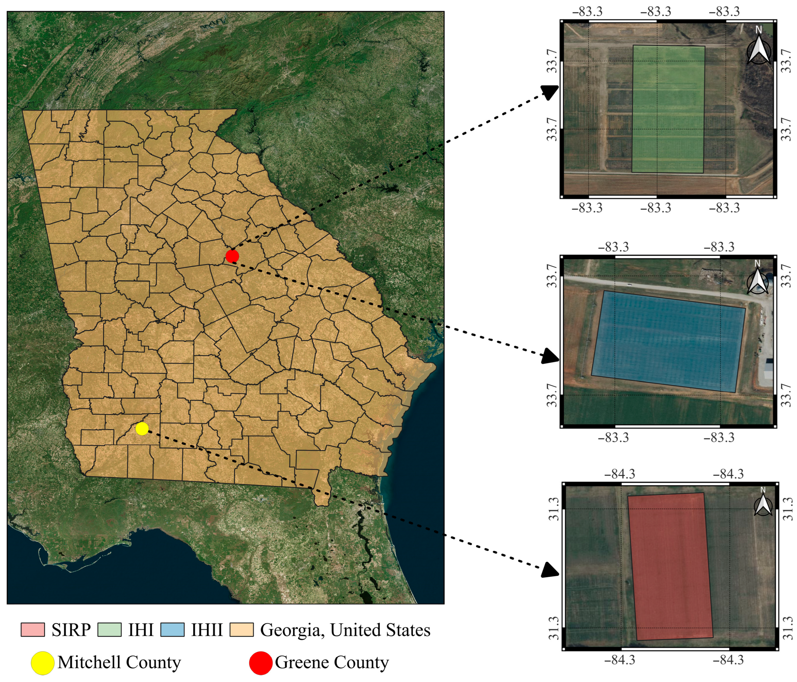
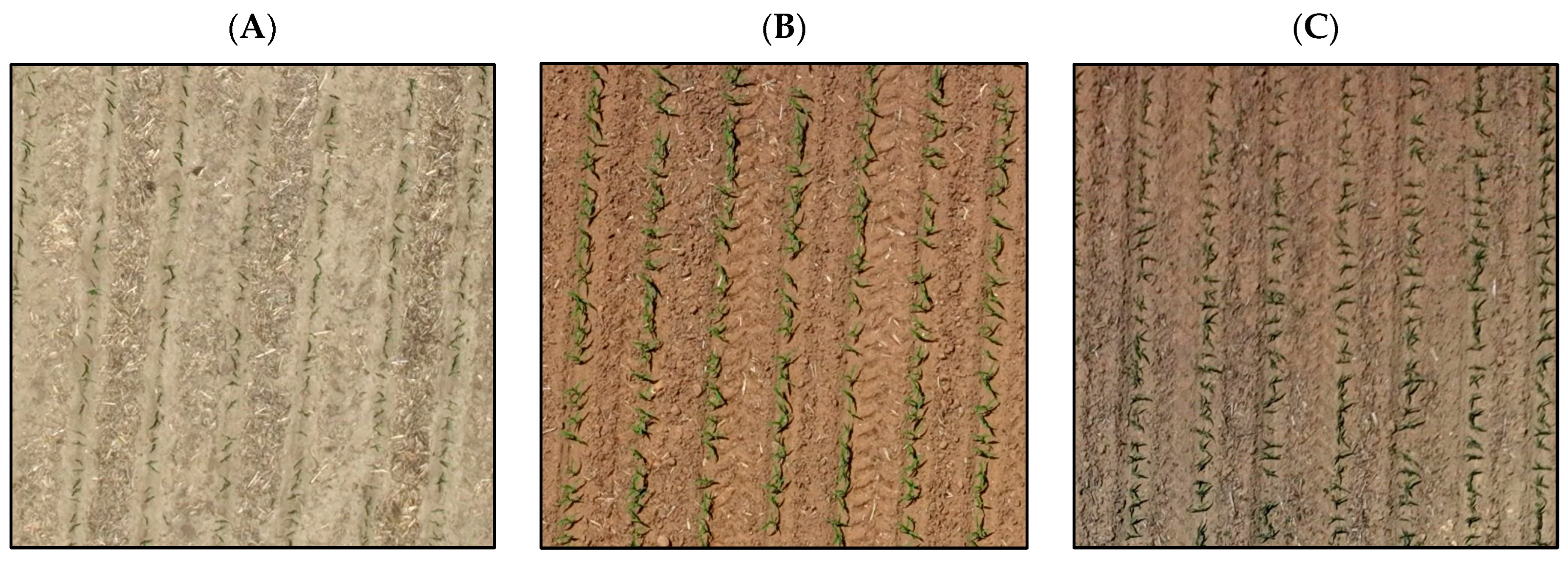
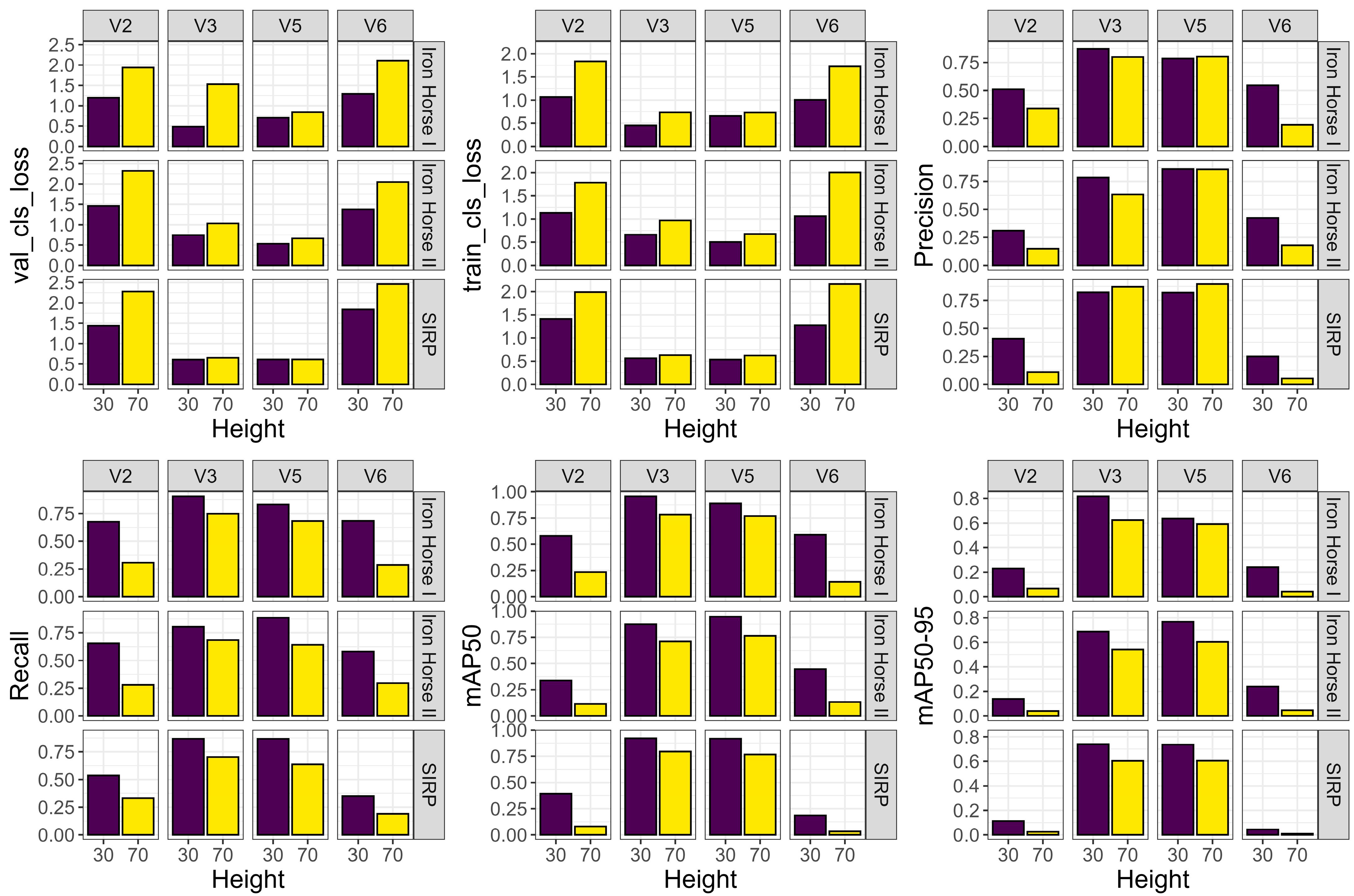
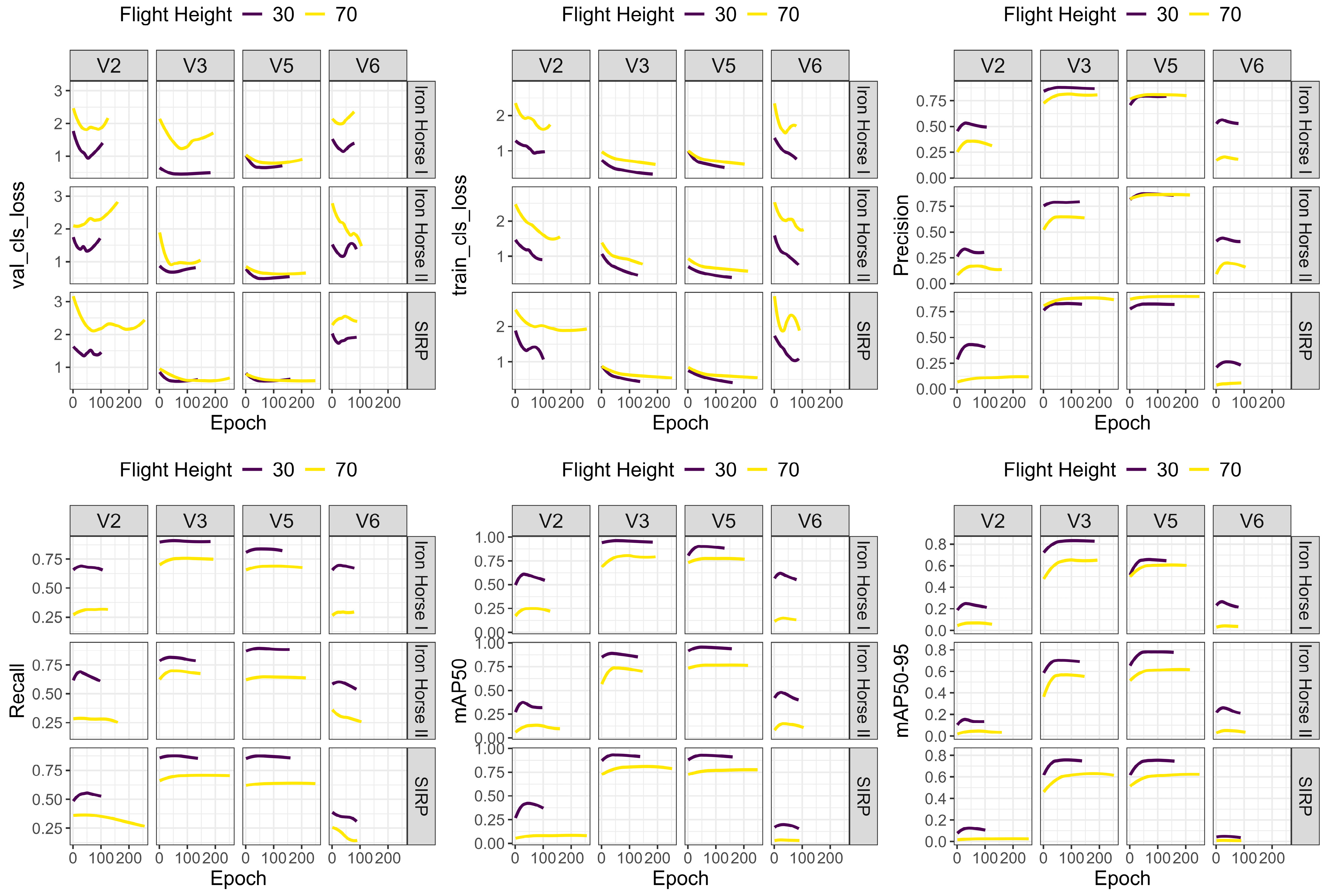
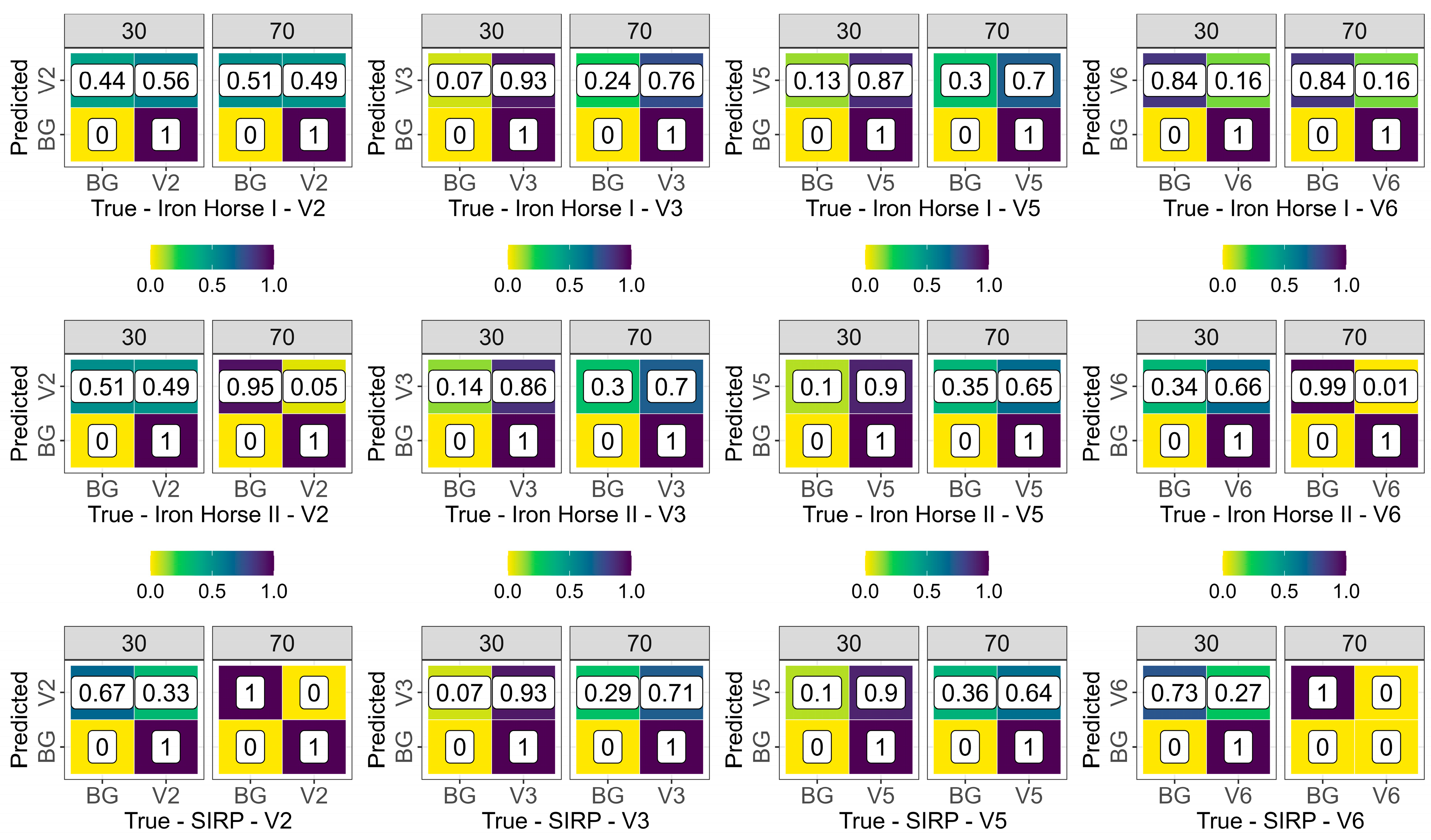
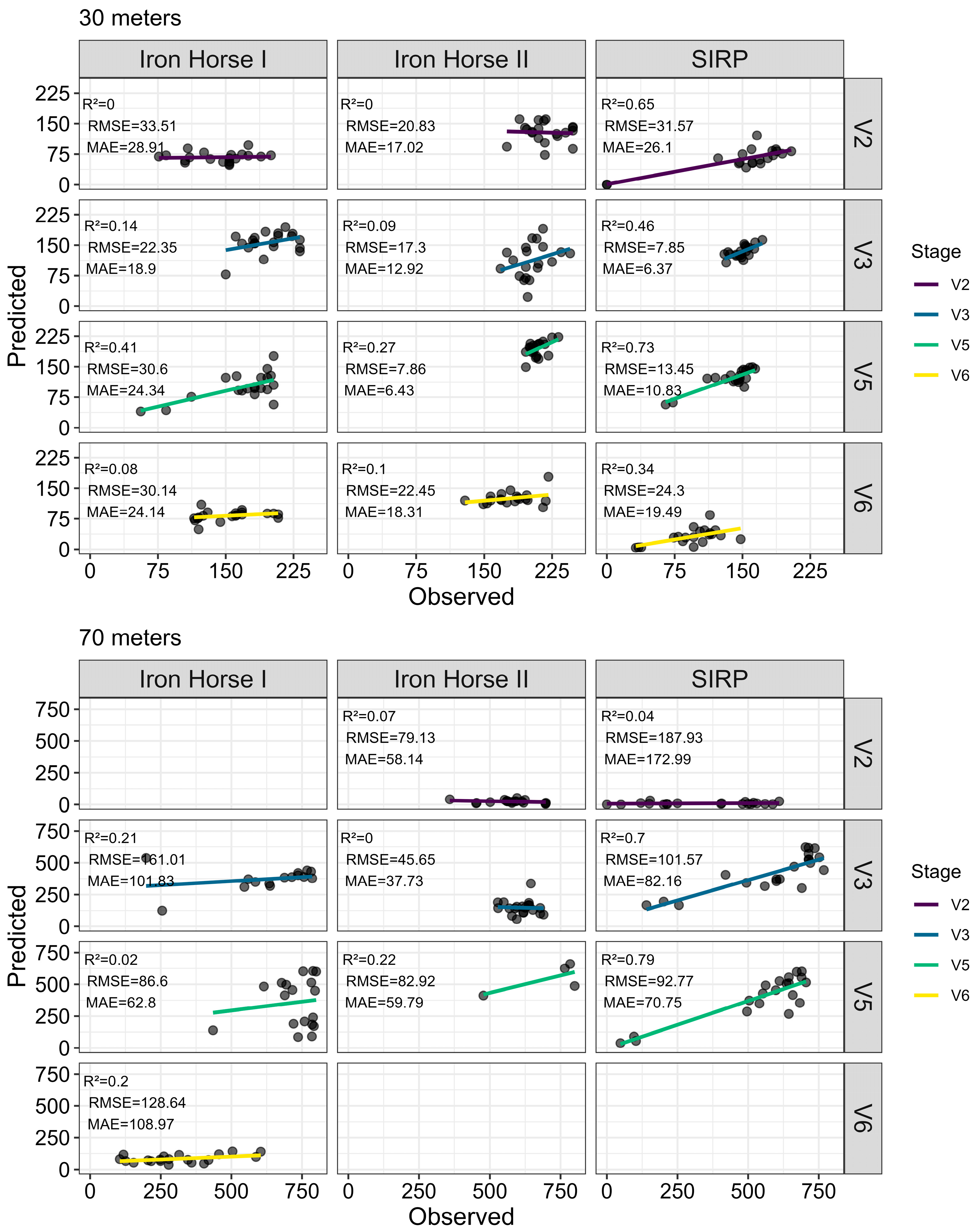
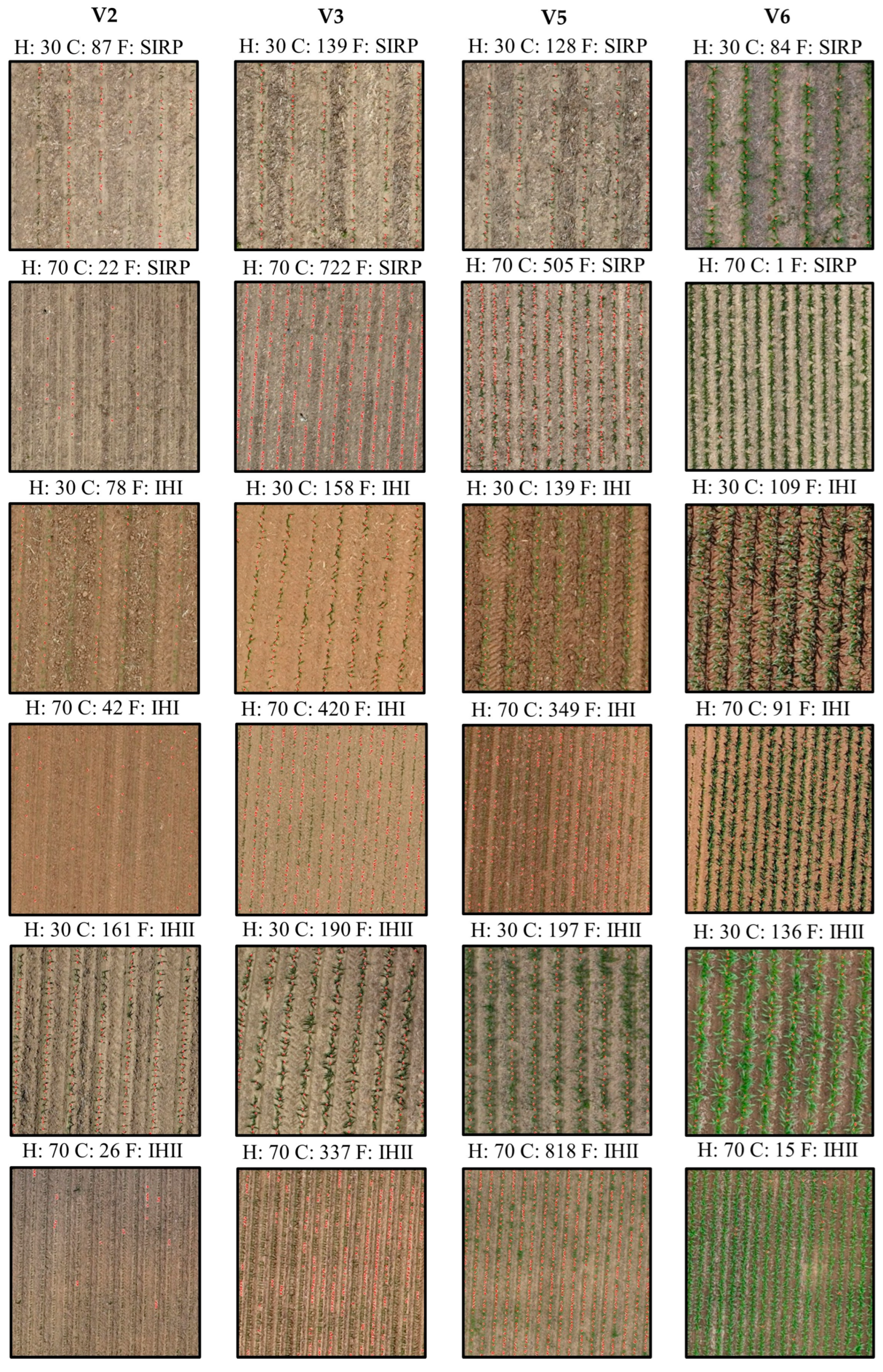
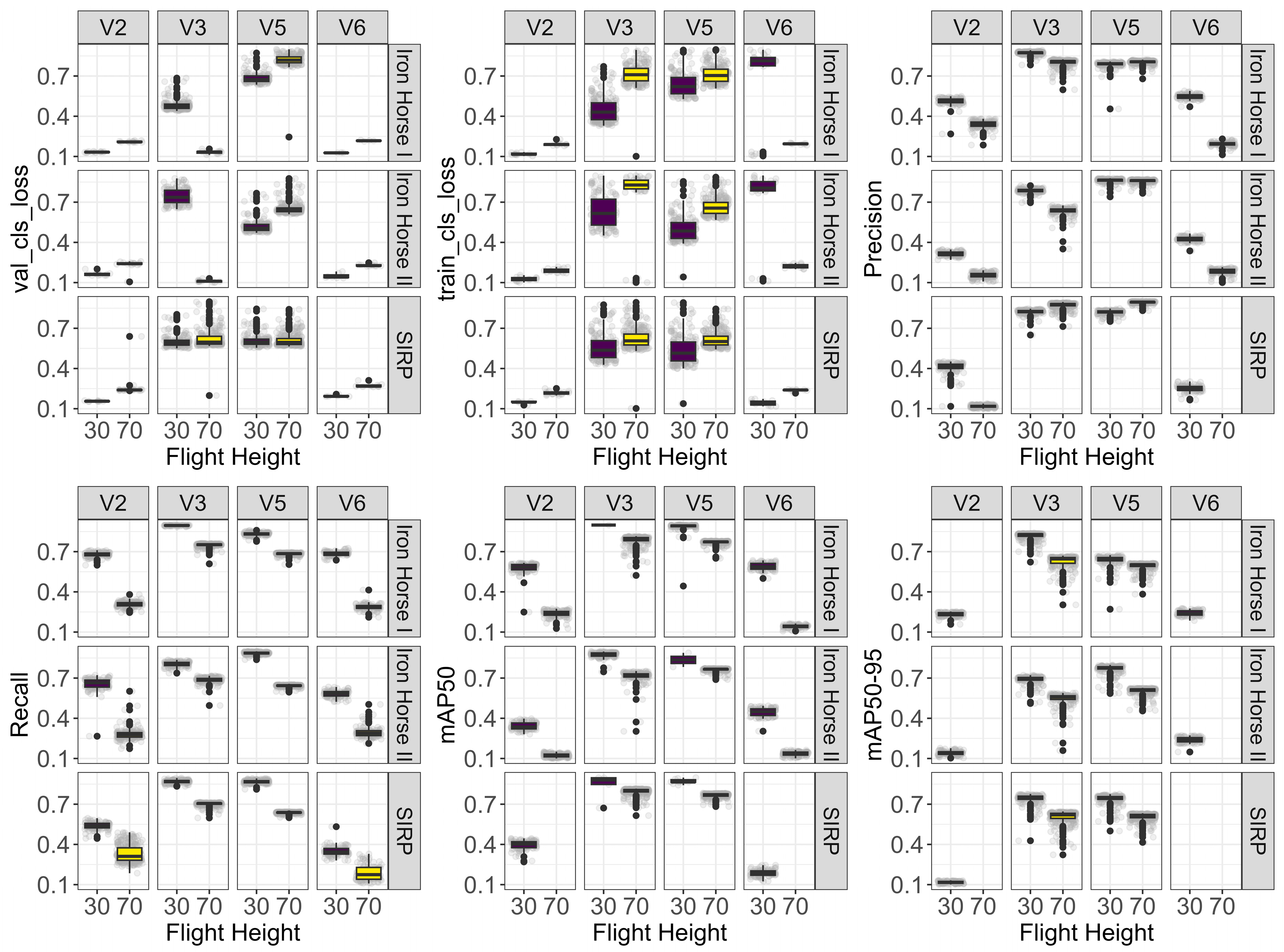
Accurate stand count and growth stage detection are essential for crop monitoring, since traditional methods often overlook field variability, leading to poor management decisions. This study evaluated the performance of the YOLOv9-small model for detecting and counting corn plants under real field conditions. The model was tested across three soil background types, two flight heights (30 and 70 m), and four corn growth stages (V2, V3, V5, and V6). Unmanned aerial vehicle (UAV) imagery was collected from three distinct fields and cropped into 640 × 640 pixels. Datasets were split into training (70%), validation (20%), and testing (10%) datasets. Model performance was assessed using precision, recall, classification loss, and mean average precision of 50% and 50–90%. The results showed that the V3 and V5 stages yielded the highest detection accuracy, with mAP50 values exceeding 85% in conventional tillage fields and slightly lower performance in gray/red-brown conditions due to background interference. Increasing flight height to 70 m reduced accuracy by 8–12%, though precision remained high, particularly at V5, and performance was poorest for V2 and V6. In conclusion, YOLOv9-small is effective for early-stage corn detection, particularly at V3 and V5, with 30 m providing optimal results. However, 70 m may be acceptable at V5 to optimize mapping time.
Keywords: computer vision; deep learning; UAV image; soil background; smart farming computer vision; deep learning; UAV image; soil background; smart farming