You are currently viewing a new version of our website. To view the old version click .

Remote Sensing, Volume 16, Issue 22

November-2 2024 - 223 articles

Cover Story: 
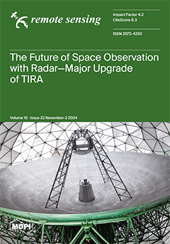
The use of near-Earth space has dramatically increased in recent decades, leading to thousands of active and inactive satellites and significant space debris. To monitor this environment, sensitive high-precision observation systems are essential for detecting, tracking, and imaging space objects. TIRA, with its 34 m antenna, is one of the largest space observation radars, contributing to space domain awareness. A new fully polarimetric imaging radar with enhanced geometrical and radiometric resolution is being developed. Additionally, the tracking radar is being upgraded with a novel modular structure and open design, enabling flexible radar modes and precise tracking for improved space domain awareness. The upgraded TIRA system will start a new era for radar space observation in Europe. View this paper
  • Issues are regarded as officially published after their release is announced to the table of contents alert mailing list .
  • You may sign up for email alerts to receive table of contents of newly released issues.
  • PDF is the official format for papers published in both, html and pdf forms. To view the papers in pdf format, click on the "PDF Full-text" link, and use the free Adobe Reader to open them.

Articles (223)

  • Article
  • Open Access
6 Citations
2,154 Views
22 Pages

Urban Multi-Scenario Land Use Optimization Simulation Considering Local Climate Zones

  • Jie Chen,
  • Zikun Dong,
  • Ruijie Shi,
  • Geng Sun,
  • Ya Guo,
  • Zhuopeng Peng,
  • Min Deng and
  • Kaiqi Chen

20 November 2024

The urban heat island (UHI) effect, a significant environmental challenge within the global urbanization process, poses severe threats to human health, ecological security, and life safety while also impacting the achievement of the United Nations Su...

  • Article
  • Open Access
9 Citations
2,396 Views
28 Pages

Characterization of CYGNSS Ocean Surface Wind Speed Products

  • Christopher Ruf,
  • Mohammad Al-Khaldi,
  • Shakeel Asharaf,
  • Rajeswari Balasubramaniam,
  • Darren McKague,
  • Daniel Pascual,
  • Anthony Russel,
  • Dorina Twigg and
  • April Warnock

20 November 2024

Since its launch in 2016, a number of wind speed retrieval algorithms have been developed for the NASA CYGNSS satellite observations. We assess their accuracy and precision and characterize the dependence of their performance on environmental factors...

  • Article
  • Open Access
11 Citations
3,804 Views
21 Pages

LH-YOLO: A Lightweight and High-Precision SAR Ship Detection Model Based on the Improved YOLOv8n

  • Qi Cao,
  • Hang Chen,
  • Shang Wang,
  • Yongqiang Wang,
  • Haisheng Fu,
  • Zhenjiao Chen and
  • Feng Liang

20 November 2024

Synthetic aperture radar is widely applied to ship detection due to generating high-resolution images under diverse weather conditions and its penetration capabilities, making SAR images a valuable data source. However, detecting multi-scale ship tar...

  • Article
  • Open Access
5 Citations
1,871 Views
24 Pages

20 November 2024

Wildfires increasingly threaten ecosystems and infrastructure, making accurate burn severity mapping (BSM) essential for effective disaster response and environmental management. Machine learning (ML) models utilizing satellite-derived vegetation ind...

  • Article
  • Open Access
3 Citations
1,656 Views
37 Pages

Impacts of Storm “Zyprian” on Middle and Upper Atmosphere Observed from Central European Stations

  • Petra Koucká Knížová,
  • Kateřina Potužníková,
  • Kateřina Podolská,
  • Tereza Šindelářová,
  • Tamás Bozóki,
  • Martin Setvák,
  • Marcell Pásztor,
  • Csilla Szárnya,
  • Zbyšek Mošna and
  • Daniel Kouba
  • + 9 authors

20 November 2024

Mesoscale convective systems are effective sources of atmospheric disturbances that can reach ionospheric heights and significantly alter atmospheric and ionospheric conditions. Convective systems can affect the Earth’s atmosphere on a continen...

  • Article
  • Open Access
4 Citations
2,476 Views
24 Pages

20 November 2024

The present study introduces a comprehensive, open-access atlas of mesoscale eddies in the global ocean, as identified and tracked by the TOEddies algorithm implemented on a global scale. Unlike existing atlases, TOEddies detects eddies directly from...

  • Article
  • Open Access
3 Citations
1,625 Views
21 Pages

20 November 2024

In the process of radiometric calibration, the corrections for bidirectional reflectance distribution functions (BRDFs) and spectral band adjustment factors (SBAFs) are crucial. Time-series MODIS images are commonly used to construct BRDFs by using t...

  • Article
  • Open Access
3 Citations
2,495 Views
20 Pages

20 November 2024

The integrated multi-satellite retrievals for the global precipitation measurement (IMERG) data, which is the latest generation of multi-satellite fusion inversion precipitation product provided by the Global Precipitation Measurement (GPM) mission,...

  • Article
  • Open Access
4 Citations
2,704 Views
25 Pages

Initial Design for Next-Generation BeiDou Integrity Subsystem: Space–Ground Integrated Integrity Monitoring

  • Weiguang Gao,
  • Lei Chen,
  • Feiren Lv,
  • Xingqun Zhan,
  • Lin Chen,
  • Yuqi Liu,
  • Yongshan Dai and
  • Yundi Jin

20 November 2024

It is essential to provide high-integrity navigation information for safety-critical applications. Global navigation satellite systems (GNSSs) play an important role in these applications because they can provide global, high-accuracy, all-weather na...

of 23

Get Alerted

Add your email address to receive forthcoming issues of this journal.

XFacebookLinkedIn
Remote Sens. - ISSN 2072-4292