Article

Determination of GPS Session Duration in Ground Deformation Surveys in Mining Areas

by
Maciej Bazanowski
1,
Anna Szostak-Chrzanowski
2,* and
Adam Chrzanowski
1
1
Department of Geodesy and Geomatics Engineering, University of New Brunswick, P.O. Box 4400, Fredericton, N.B., E3B 5A3, N.B., Canada
2
Faculty of Geoengineering, Mining and Geology, Wrocław University of Science and Technology,,ul. Na Grobli 15, 50-421Wrocław, Poland
*
Author to whom correspondence should be addressed.
Sustainability 2019, 11(21), 6127; https://doi.org/10.3390/su11216127
Submission received: 18 September 2019 / Revised: 22 October 2019 / Accepted: 25 October 2019 / Published: 3 November 2019

Abstract

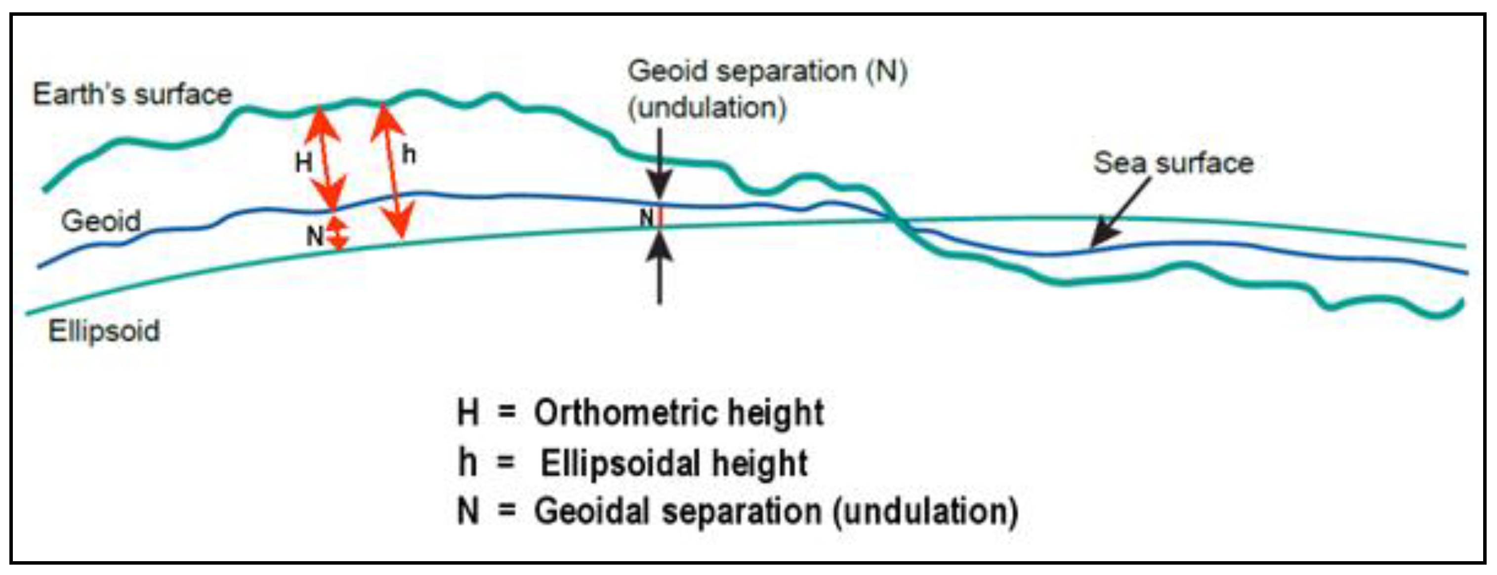
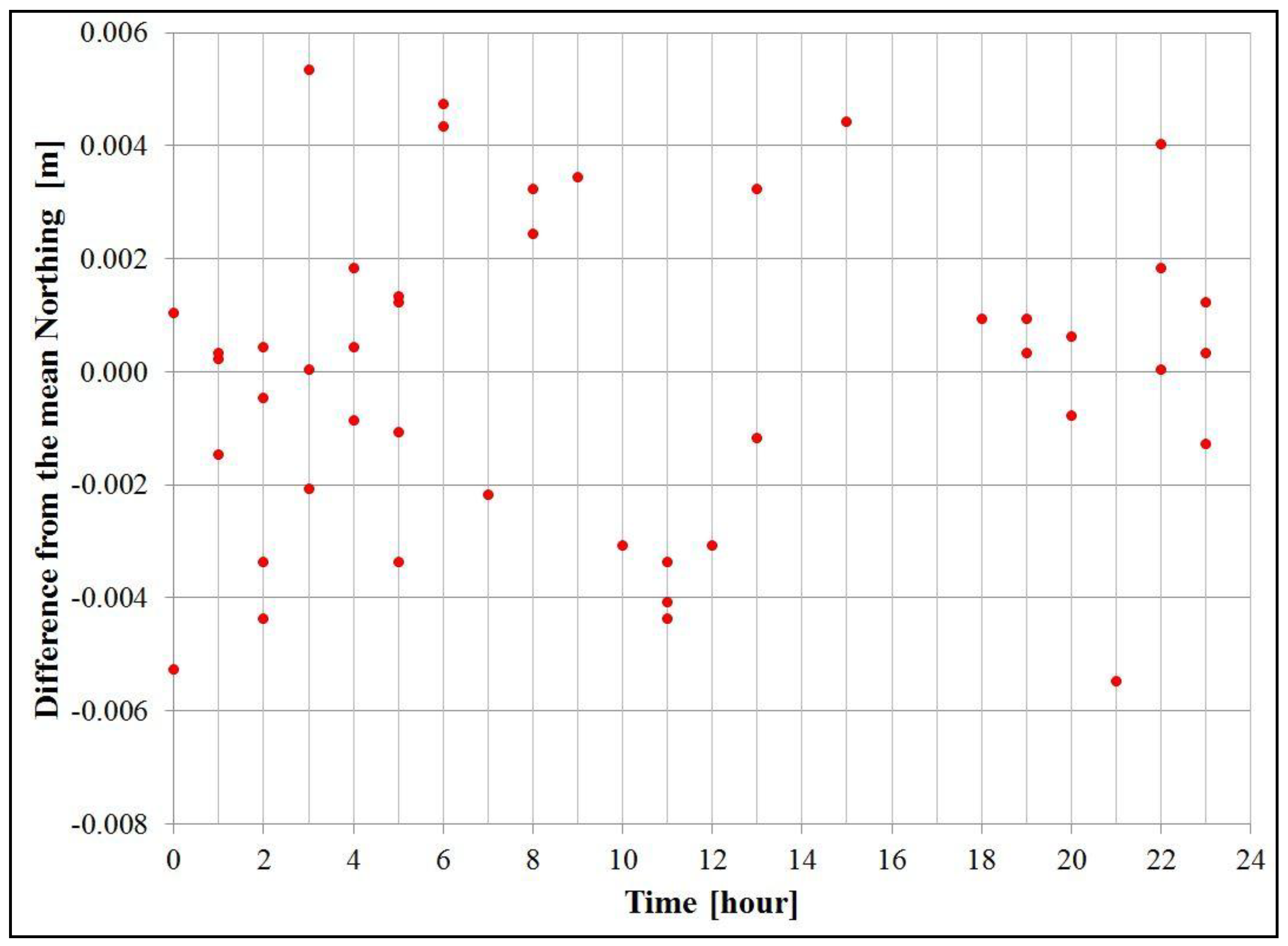
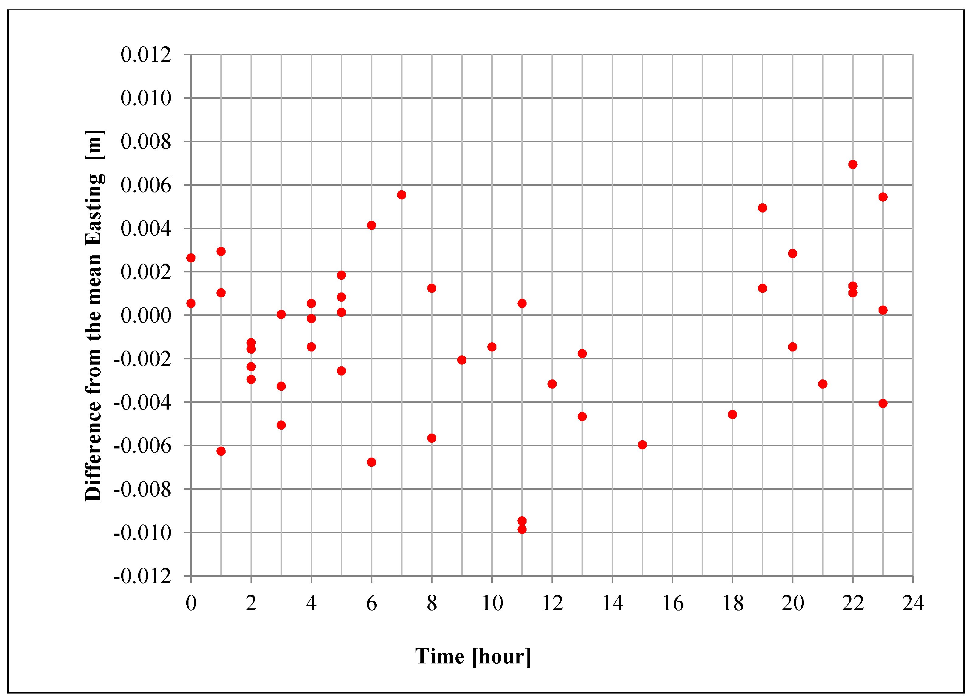
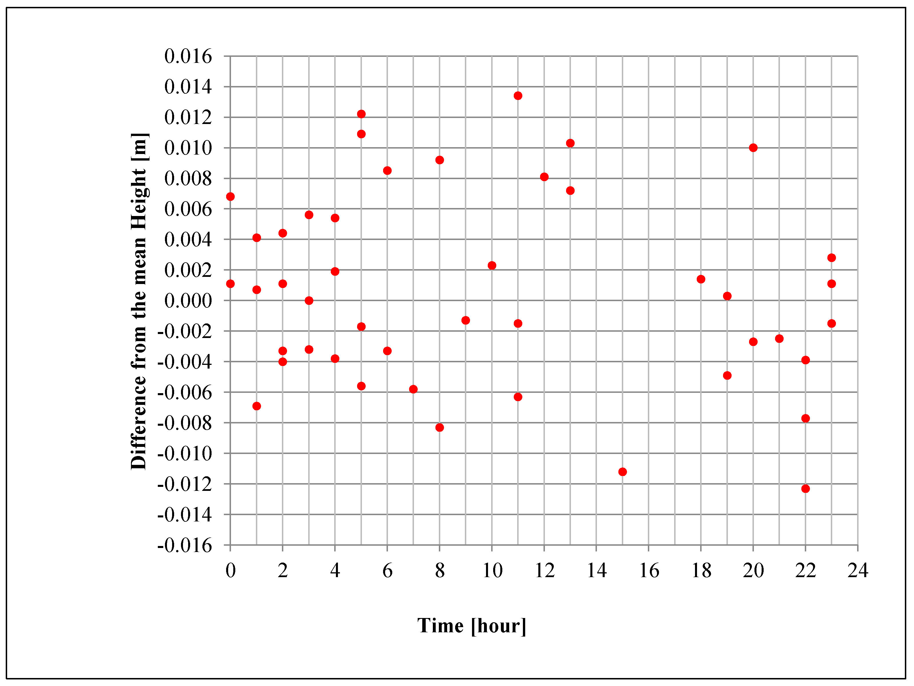
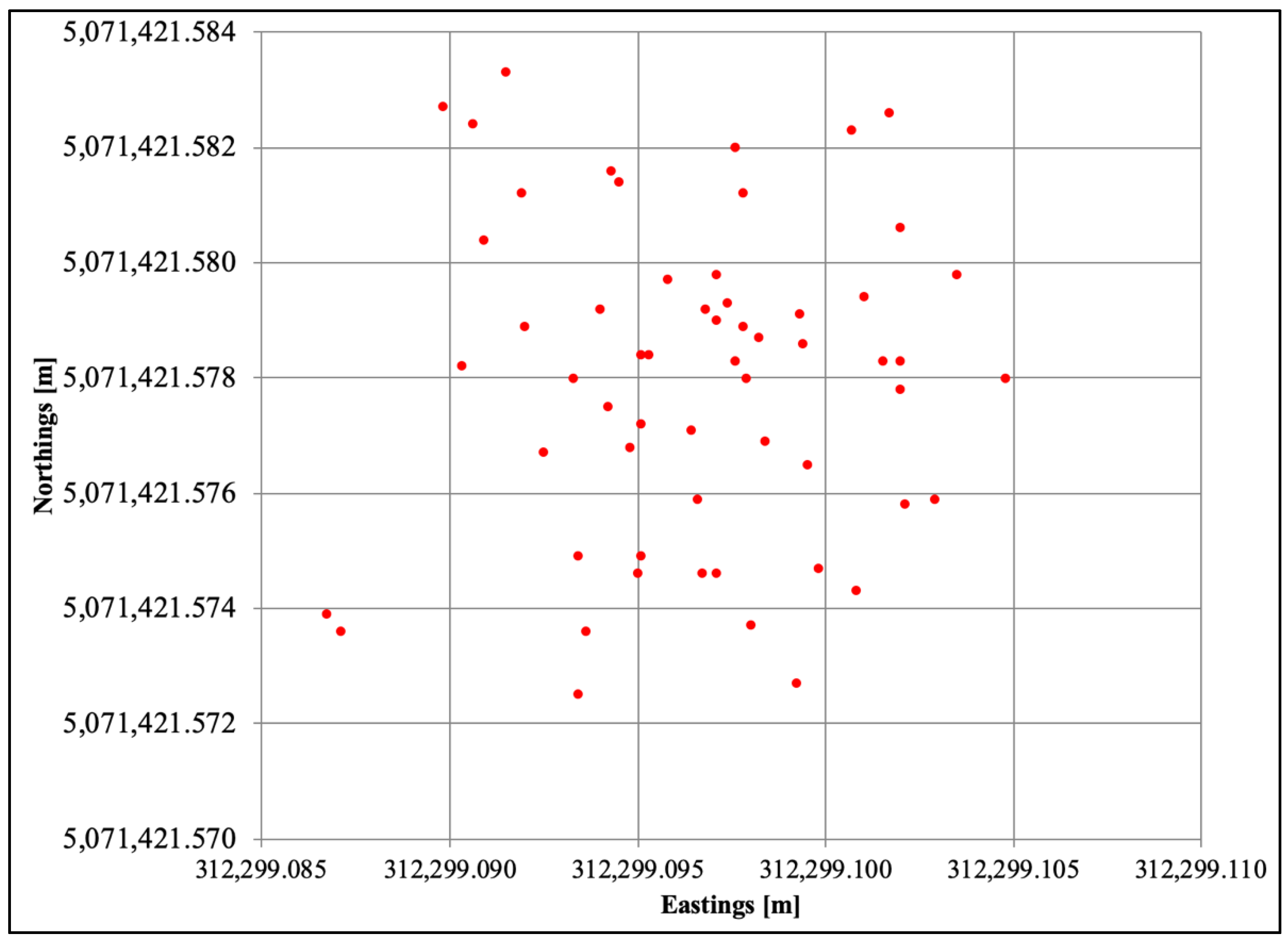
Extraction of underground minerals causes subsidence of the ground surface due to gravitational forces. The subsidence rate depends on the type of extracted ore, as well as its shape, thickness, and depth. Additionally, the embedding and overburden rock properties influence the time needed for the deformations to reach the surface. Using the results of geodetic deformation monitoring, which supply the information on pattern and magnitude of surface deformation, the performance of the mine may be evaluated. The monitoring can supply information on the actual rock mass behaviour during the operation and in many cases during the years after the mining operations have ceased. Geodetic methods of deformation monitoring supply information on the absolute and relative displacements (changes in position in a selected coordinate system) from which displacement and strain fields for the monitored object may be derived. Thus, geodetic measurements provide global information on absolute and relative displacements over large areas, either at discrete points or continuous in the space domain. The geodetic methods are affected by errors caused by atmospheric refraction and delay of electromagnetic signal. Since geodetic measurements allow for redundancy and statistical evaluation of the quality of the data, they generally provide reliable results. Usually, the designed accuracy of deformation measurements should allow for the detection of at least one third of the expected maximum deformations over the desired time span at the 95% probability level. In ground subsidence studies in mining areas, 10 mm accuracy at 95% level in both vertical and horizontal displacements is typically required. In the case of salt mines, the process of ground subsidence in viscous rock is slow; therefore, subsidence monitoring surveys may be performed once a year. In subsidence determination, two techniques are commonly used: leveling and satellite positioning. The satellite positioning technique is used to determine the 3D (horizontal coordinates and height) or 2D position of monitored points (only horizontal coordinates). When comparing the heights determined from satellite and leveling surveys, it has to be noted that the leveling heights are referred with respect to the geoid (orthometric heights), while heights determined from satellite surveys are referred with respect to the ellipsoid (ellipsoidal height). In the case of satellite surveys, the accuracy of horizontal position is typically 2–3 times better than vertical. The analysis of the optimal session duration lead to the conclusion that in order to achieve the sub-cm accuracy of horizontal coordinates at 95% confidence level, the satellite positioning session length using Global Positioning System (GPS) should be at least three hours long. In order to achieve the sub-cm accuracy of height coordinate at 95% confidence level in a single observation session, the GPS session length should be at least twelve hours long.
Keywords: GPS; mining; deformation monitoring GPS; mining; deformation monitoring