Topic Editors

Department of Wildlife, Fisheries and Aquaculture, College of Forest Resources, Mississippi State University, Mississippi, MS 39762-9690, USA
Sate Key Laboratory of Resources and Environmental Information System, Institute of Geographic Sciences and Natural Resources Research, Chinese Academy of Sciences, Beijing 100101, China

Application of Remote Sensing in Forest Fire

Abstract submission deadline
31 December 2023
Manuscript submission deadline
31 March 2024
Viewed by
1586

Topic Information

Dear Colleagues,

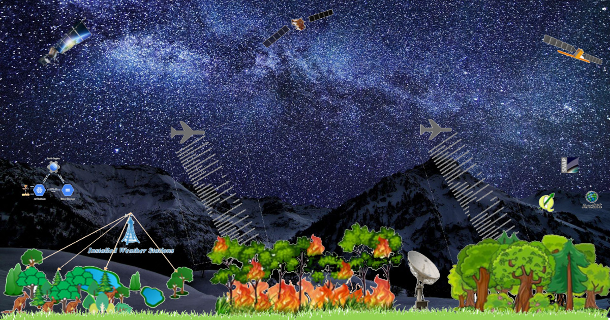
Forest fires are amongst the most prominent disturbance factors in most vegetation zones throughout the world, such as forests and grasslands. Forest fires present a challenge for ecosystem management because of their potential to be at once beneficial and harmful. Drones, unmanned aerial vehicle (UAV) applications and remote sensing technology can be incredibly valuable in assessing forest fire risk over large areas. For example, remote sensing can be used to monitor changes in vegetation that may be the result of invasive species or especially dry conditions. Technology plays an important role in preventing and responding to wildfires. For example, there are numerous remote sensing and geographic information systems (GIS) applications in forest fire management.

Fire detection is a critical stage of wildfire management, which is aimed at either fighting or monitoring the fire. For firefighting, early detection is essential; to date, fire detection for firefighting has been based on human observation, the use of fixed optical cameras to monitor the surrounding environment, or aerial survey. Forest fire managers do not consider the revisit time provided by current satellite sensors sufficient for firefighting operations. However, the monitoring of forest fire and forest fire effects for large territories is mainly based on satellite remote sensing. Mapping of burnt areas and assessment of forest fire effects is one of the most successful applications of satellite remote sensing. Satellite remote sensing provides the means to acquire comprehensive and harmonized information on wildfire effects over large territories at a low cost. For this purpose, burnt area mapping is performed with a wide variety of remote sensors and techniques. A wide variety of optical and radar sensors have been used for fire detection and burnt area mapping, from local to global scales. This section reviews the application of remote sensing in active fire detection and the assessment of fire damage through the mapping of the extent of burnt areas.

This Topic will include papers addressing various aspects of remote sensing applications in forest fires across the globe. It aspires to confront the specific challenges of various aspects of remote sensing applications in the monitoring of forest fire management systems effectively. It addresses the modest trends and benefits of application of remote sensing in forest fire.

Manuscripts should cover, but are not limited to, the following topics:

  • Fire detection and burnt area mapping;
  • Prediction and real-time monitoring of forest fires;
  • Forest fire risk modeling and management;
  • Fuel analysis, modeling and prevention;
  • Mapping of fire risk zones;
  • GIS applications in forest fire management;
  • Regrowth of vegetation aftermath of ablaze;
  • Monitoring fire-prone areas;
  • UAVs to survey damage to plant life;
  • Mapping of burnt scars for recovery;
  • Radar images for pre-fire and post-fire conditions monitoring.

Dr. Aqil Tariq
Dr. Na Zhao
Topic Editors

Keywords

  • remote sensing and GIS
  • SAR
  • forest fire
  • wildfire
  • postfire regeneration
  • optical remote sensing
  • fire severity
  • fire mapping
  • unmannaged aerial vehicles

Participating Journals

Journal Name Impact Factor CiteScore Launched Year First Decision (median) APC
Drones
drones
5.532 7.2 2017 13.6 Days 2000 CHF Submit
Fire
fire
2.726 4.9 2018 13.9 Days 1800 CHF Submit
Forests
forests
3.282 4.0 2010 18.3 Days 2000 CHF Submit
Remote Sensing
remotesensing
5.349 7.4 2009 19.7 Days 2500 CHF Submit
Sustainability
sustainability
3.889 5.0 2009 17.7 Days 2200 CHF Submit

Preprints is a platform dedicated to making early versions of research outputs permanently available and citable. MDPI journals allow posting on preprint servers such as Preprints.org prior to publication. For more details about reprints, please visit https://www.preprints.org.

Published Papers (2 papers)

Order results
Result details
Journals
Select all
Export citation of selected articles as:
Article
Real-Time Wildfire Detection Algorithm Based on VIIRS Fire Product and Himawari-8 Data
Remote Sens. 2023, 15(6), 1541; https://doi.org/10.3390/rs15061541 - 11 Mar 2023
Viewed by 325
Abstract
Wildfires have a significant impact on the atmosphere, terrestrial ecosystems, and society. Real-time monitoring of wildfire locations is crucial in fighting wildfires and reducing human casualties and property damage. Geostationary satellites offer the advantage of high temporal resolution and are gradually being used [...] Read more.
Wildfires have a significant impact on the atmosphere, terrestrial ecosystems, and society. Real-time monitoring of wildfire locations is crucial in fighting wildfires and reducing human casualties and property damage. Geostationary satellites offer the advantage of high temporal resolution and are gradually being used for real-time fire detection. In this study, we constructed a fire label dataset using the stable VNP14IMG fire product and used the random forest (RF) model for fire detection based on Himawari-8 multiband data. The band calculation features related brightness temperature, spatial features, and auxiliary data as input used in this framework for model training. We also used a recursive feature elimination method to evaluate the impact of these features on model accuracy and to exclude redundant features. The daytime and nighttime RF models (RF-D/RF-N) are separately constructed to analyze their applicability. Finally, we extensively evaluated the model performance by comparing them with the Japan Aerospace Exploration Agency (JAXA) wildfire product. The RF models exhibited higher accuracy, with recall and precision rates of 95.62% and 59%, respectively, and the recall rate for small fires was 19.44% higher than that of the JAXA wildfire product. Adding band calculation features and spatial features, as well as feature selection, effectively reduced the overfitting and improved the model’s generalization ability. The RF-D model had higher fire detection accuracy than the RF-N model. Omission errors and commission errors were mainly concentrated in the adjacent pixels of the fire clusters. In conclusion, our VIIRS fire product and Himawari-8 data-based fire detection model can monitor the fire location in real time and has excellent detection capability for small fires, making it highly significant for fire detection. Full article
(This article belongs to the Topic Application of Remote Sensing in Forest Fire)
Show Figures

Graphical abstract

Article
Quantifying Forest Litter Fuel Moisture Content with Terrestrial Laser Scanning
Remote Sens. 2023, 15(6), 1482; https://doi.org/10.3390/rs15061482 - 07 Mar 2023
Viewed by 405
Abstract
Electromagnetic radiation at 1550 nm is highly absorbed by water and offers a novel way to collect fuel moisture data, along with 3D structures of wildland fuels/vegetation, using lidar. Two terrestrial laser scanning (TLS) units (FARO s350 (phase shift, PS) and RIEGL vz-2000 [...] Read more.
Electromagnetic radiation at 1550 nm is highly absorbed by water and offers a novel way to collect fuel moisture data, along with 3D structures of wildland fuels/vegetation, using lidar. Two terrestrial laser scanning (TLS) units (FARO s350 (phase shift, PS) and RIEGL vz-2000 (time of flight, TOF)) were assessed in a series of laboratory experiments to determine if lidar can be used to estimate the moisture content of dead forest litter. Samples consisted of two control materials, the angle and position of which could be manipulated (pine boards and cheesecloth), and four single-species forest litter types (Douglas-fir needles, ponderosa pine needles, longleaf pine needles, and southern red oak leaves). Sixteen sample trays of each material were soaked overnight, then allowed to air dry with scanning taking place at 1 h, 2 h, 4 h, 8 h, 12 h, and then in 12 h increments until the samples reached equilibrium moisture content with the ambient relative humidity. The samples were then oven-dried for a final scanning and weighing. The spectral reflectance values of each material were also recorded over the same drying intervals using a field spectrometer. There was a strong correlation between the intensity and standard deviation of intensity per sample tray and the moisture content of the dead leaf litter. A multiple linear regression model with a break at 100% gravimetric moisture content produced the best model with R2 values as high as 0.97. This strong relationship was observed with both the TOF and PS lidar units. At fuel moisture contents greater than 100% gravimetric water content, the correlation between the pulse intensity values recorded by both scanners and the fuel moisture content was the strongest. The relationship deteriorated with distance, with the TOF scanner maintaining a stronger relationship at distance than the PS scanner. Our results demonstrate that lidar can be used to detect and quantify fuel moisture across a range of forest litter types. Based on our findings, lidar may be used to quantify fuel moisture levels in near real-time and could be used to create spatial maps of wildland fuel moisture content. Full article
(This article belongs to the Topic Application of Remote Sensing in Forest Fire)
Show Figures

Figure 1

Back to TopTop