
Saint John Baptistery in Florence (Italy): Studies for Conservation of the External Marble Cladding

 ,
, 
Abstract
:1. Introduction
2. Materials and Methods
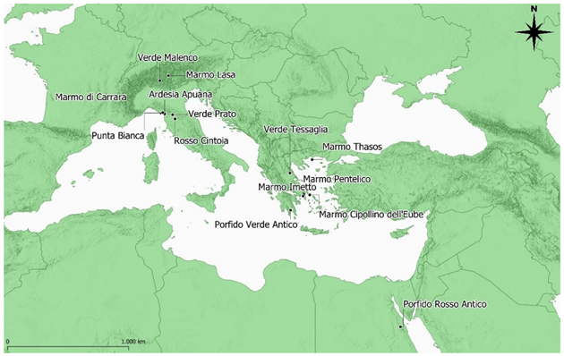
- Document analysis: carried out on commercial and historical text archives that show orders, origin and types of stone materials.
- Technical analysis: petrographic, mineralogical, geochemical, and isotopic analyses allowing the sample analyzed to be attributed to a lithotype on the basis of existing databases.
- Organoleptic analysis: carried out by experts on the basis of their knowledge and regarding stone grain-size, texture and warp.
3. Results
3.1. Document Analysis
3.2. Technical Analysis
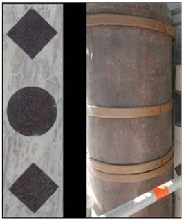
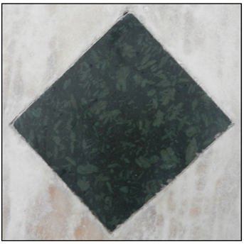
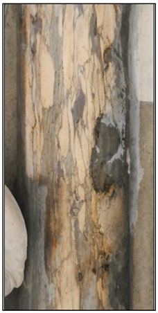
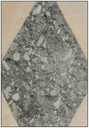
3.3. Organoleptic Analysis
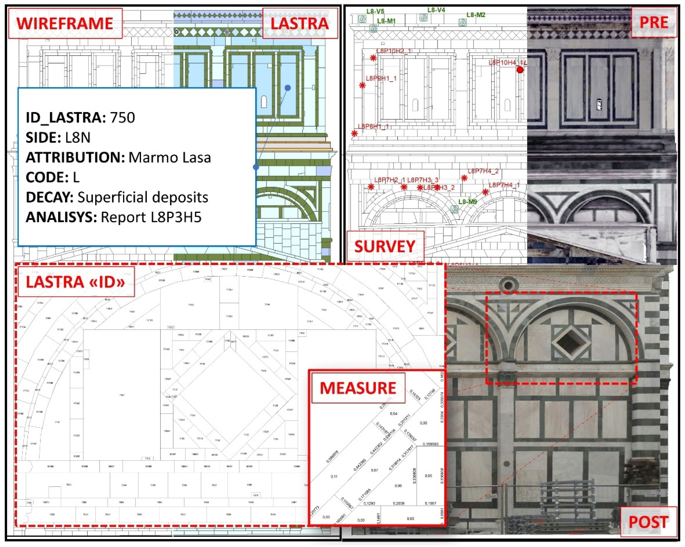
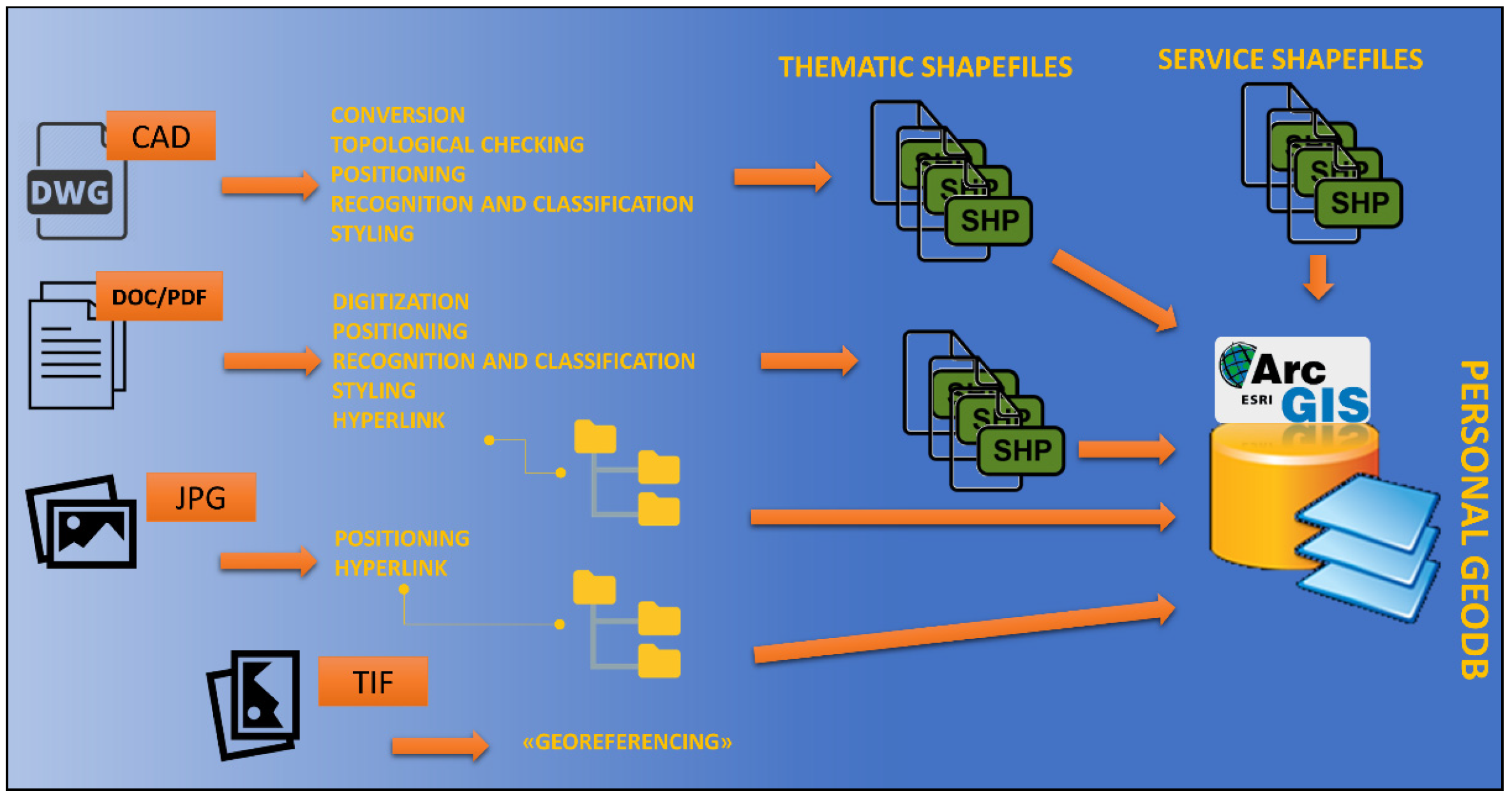
3.4. GIS Implementation
- Unitary management of different data for themes, characteristics and forms;
- Management of historical data and information, without having to resort to the examination of paper sources;
- Univocal data storage, thus avoiding errors connected to non-unique encodings or data processing carried out by different operators;
- Ease and speed of simultaneous and integrated consultation of a large amount of data, their functional query to the needs and their comparison (Figure 3);
- Possibility of customization according to specific graphic and document query needs;
- Possibility of elaboration, updating and further implementation in the phases following the design phase;
- Integration of data with results deriving from the monitoring phase.
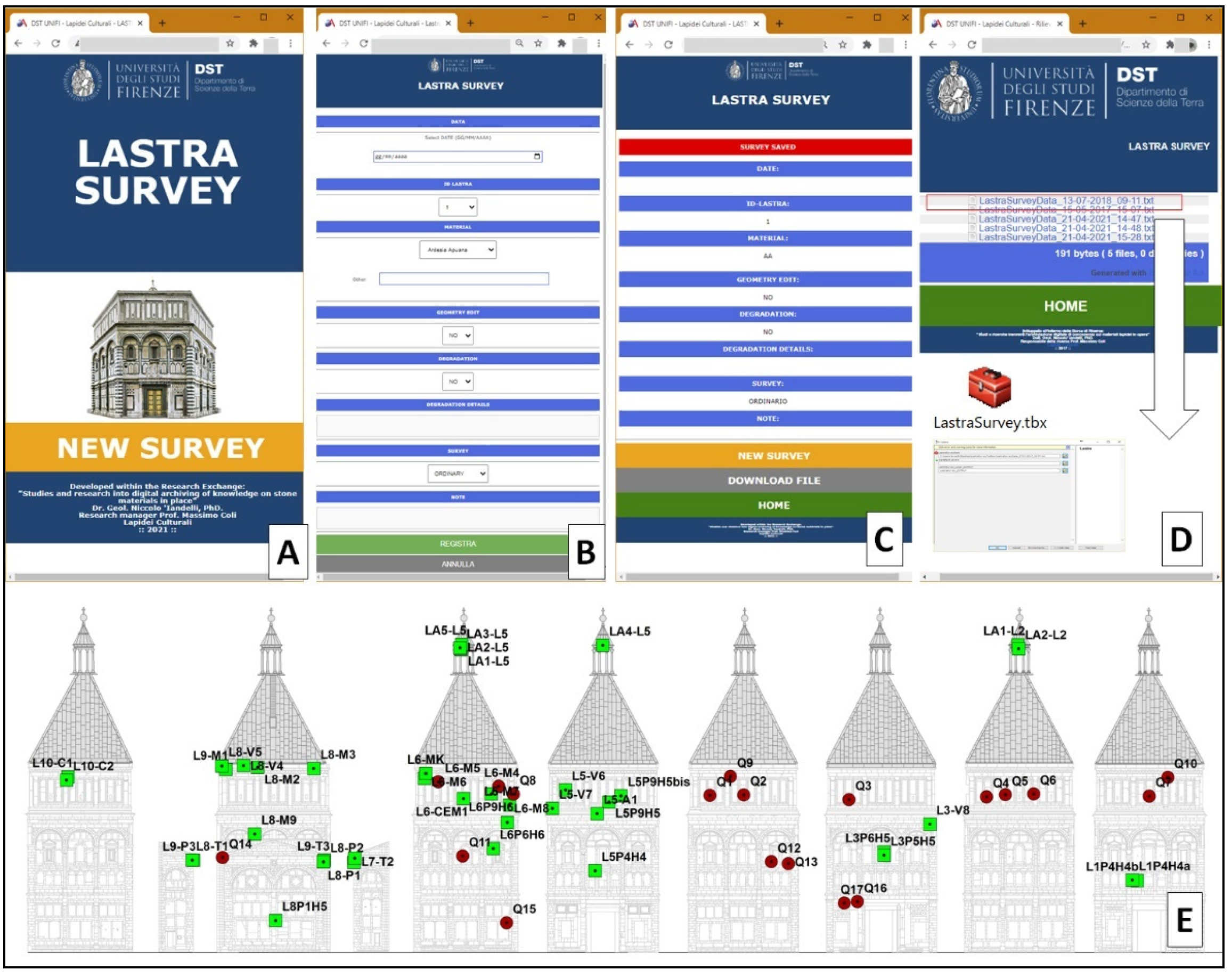
3.5. The LastraSurvey Web App
4. Discussion
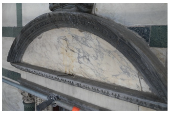
- White marble slabs are about 7 cm thick, which corresponds to a Roman palmo (7.4 cm), and are fixed to the masonry behind by iron clamps.
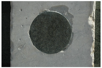
- Verde Prato is always as quoins about 15–20 cm deep and mortared into the masonry due to its intense micro-fracturing, which does not allow it to be cut into slabs.
- Most of the original with marble is from spolia of Roman monuments, while all the others are from Carrara.
- The concomitance of large restoration works with many tiles’ substitution in the Second World War resulted in the forced use of Lasa Marble from northern Italy, instead of the original Hymettus Marble from Greece.
- It has been possible to define the provenance and the exploitation history of all the marble.
5. Conclusions
Author Contributions
Funding
Institutional Review Board Statement
Informed Consent Statement
Data Availability Statement
Acknowledgments
Conflicts of Interest
Appendix A

| Sites of Provenience of the Marbles in Opera on the Saint John Baptistery | |
 | |
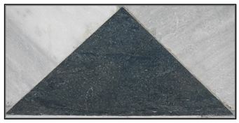
Verde Prato
|  |
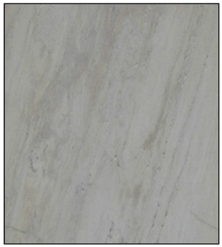
Carrara Marble
|  |
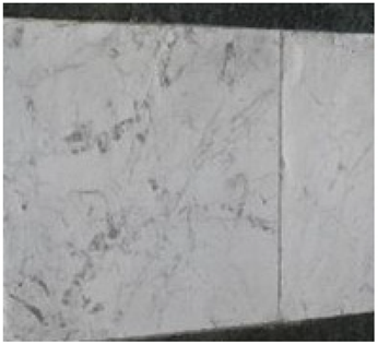
Hymettus Marble
|  |
Pentelicum Marble
|  |
Lasa Marble
|  |
Punta Bianca Marble
|  |
Thasos Marble
|  |
Verde Malenco
|  |
Porfido Rosso Antico
|  |
Porfido Verde Antico
|  |
Cipollino Rubrio from Eubea
|  |
Breccia Greca Antica
|  |
Apuan slate
|  |
Rosso Cintoia
|  |
Syenite
|  |
References
- Morolli, G. L’architettura del Battistero e l’ordine antico. In Il Battistero di San Giovanni, Mirabilia Italie; Paolucci, A., Ed.; Franco Cosimo Panini: Modena, Italy, 1994; pp. 33–132. [Google Scholar]
- Cardini, M. L’ipotesi tardo antica del Battistero. In Il bel San Giovanni e Santa Maria del Fiore; Cardini, D., Ed.; Le Lettere: Firenze, Italy, 1996; pp. 62–93. [Google Scholar]
- Rocchi Coopmans de Yoldi, G. Il Battistero di San Giovanni: Lo svolgimento della fabbrica. In Santa Maria del Fiore—Piazza, Battistero, Campanile; Rocchi Coopmans de Yoldi, G., Ed.; Università Degli Studi di Firenze, Dipartimento di Architettura, Il Torchio: Firenze, Italy, 1996; pp. 27–72. [Google Scholar]
- Degl’Innocenti, P. Misurare, disegnare, conoscere: Dai rilievi del San Giovanni alle ipotesi styorico-costruttive. In Il Battistero di San Giovanni, Conoscenza, Diagnostica, Conservazione; Gurrieri, F., Ed.; Mandragora: Firenze, Italy, 2017; pp. 87–103. [Google Scholar]
- Barattin, L.; Bertozzi, S.; Moetti, E. Tecnologia GIS per la manutenzione programmata dei beni culturali. La conservazione preventiva e programmata. In Proceedings of the PCC Conference, Monza-Mantova, Italy, 5–9 May 2014; Nardini: Firenze, Italy, 2014; pp. 73–84. [Google Scholar]
- Iandelli, N.; Coli, M.; Donigaglia, T.; Ciuffreda, A.L. An Unconventional Field Mapping Application: A Complete Opensource Workflow Solution Applied to Lithological Mapping of the Coatings of Cultural Heritage. ISPRS Int. J. Geo. Inf. 2021, 10, 357. [Google Scholar] [CrossRef]
- Garzonio, C.A.; Cantisani, E.; Coli, M.; Cuzman, O.; Del Luca, D.; Lubrito, C.; Ricci, M.; Vettori, S.; Sibilia, E. I materiali costitutivi del Battistero. In Il Battistero di San Giovanni, Conoscenza, Diagnostica, Conservazione; Gurrieri, F., Ed.; Mandragora: Firenze, Italy, 2017; pp. 179–191. [Google Scholar]
- Iandelli, N.; Agostini, B.; Coli, M. Strumenti GIS Come Aiuto Nella Gestione, Monitoraggio e Conservazione dei beni Culturali. Conferenza ESRI Italia, Roma. 21 May 2018. Available online: https://www.youtube.com/watch?v=SFZpwJZqZ84&list=PL8TX2bZOHutH-uGDZNa_4cobxpbYGhg6R&index=23&t=0s (accessed on 9 June 2021).
- Coli, M.; Ciuffreda, A.L.; Donigaglia, T. Informative models for the cultural heritage buildings: Applications and case histories. In Proceedings of the VII Convegno Internazionale ReUSO Matera, Patrimonio in Divenire, Matera, Italy, 23–26 October 2019; Conte, A., Guida, A., Eds.; Gangemi Ed. Int.: Rome, Italy, 2019; pp. 421–432, ISBN 9788849238006. [Google Scholar]
- Bianchini, P. I Paramenti esterni. I materiali, i restauri degli anni 1938-1944 e cenni sullo stato di conservazione attuale. In Santa Maria del Fiore—Piazza, Battistero, Campanile; Rocchi Coopmans de Yoldi, G., Ed.; Università Degli Studi di Firenze, Dipartimento di Architettura; Il Torchio: Firenze, Italy, 1996; pp. 97–98. [Google Scholar]
- Nenci, C. E’ il monumento più bello del mondo. Il Battistero di San Giovanni, da mito storiografico-letterario a monumento storico da tutelare. In E L’Informe si fa Forma, Studi Intorno a santa Maria del Fiore in Ricordo di Patrizio Orticesi; Fabbri, L., Giusti, A.M., Eds.; Mandragora: Firenze, Italy, 2012; pp. 191–199. [Google Scholar]
- Agapiou, A.; Lysandrou, V.; Alexakis, D.D.; Themistocleous, K.; Cuca, B.; Argyriou, A.; Sarris, A.; Hadjimitsis, D.G. Cultural heritage management and monitoring using remote sensing data and GIS: The case study of Paphos area, Cyprus. Comput. Environ. Urban. Syst. 2015, 54, 230–239. [Google Scholar] [CrossRef]
- Ortiz, R.; Ortiz, P.; Martín, J.M.; Vázquez, M.A. A new approach to the assessment of flooding and dampness hazards in cultural heritage, applied to the historic centre of Seville (Spain). Sci. Total Environ. 2016, 551, 546–555. [Google Scholar] [CrossRef] [PubMed]
- Lazzeaini, M.; Antonelli, F.; Colombu, S.; Gadducci, R.; Marradi, A.; Miriello, D.; Parosi, L.; Secchiari, L.; Lazzeri, A. Cultural Heritage Documentation and Conservation: Three-Dimensional (3D) Laser Scanning and Geographical Information System (GIS) Techniques for Thematic Mapping of Facade Stonework of St. Nicholas Church (Pisa, Italy). Int. J. Archit. Herit. 2016, 10, 9–19. [Google Scholar] [CrossRef]
- Xiao, W.; Mills, J.; Guidi, G.; Rodrìguez-Gonzálves, P.; Barsanti, S.G.; González-Aguilera, D. Geoinformatics for the conservation and promotion of cultural heritage in support of UN sustainable development goals. ISPRS J. Photogramm. Remote Sens. 2018, 142, 389–406. [Google Scholar] [CrossRef]
- Goodchild, M.F.; Yuan, M.; Cova, T.J. Towards a general theory of geographic representation in GIS. Int. J. Geogr. Inf. Sci. 2007, 21, 239–260. [Google Scholar] [CrossRef] [Green Version]
- Burrough, P.A.; McDonnell, R. Principles of Geographical Information Systems; Oxford University Press: Oxford, UK, 1998. [Google Scholar]
| Years | Work | Marble Types |
|---|---|---|
| 1296 | Cladding of the corner pillars | Verde Prato, Carrara Marble |
| 1778–1792 | Substitution of tiles | Carrara Marble |
| 1818 | Restoration and substitution of basement ashlars | Carrara Marble |
| 1820–1841 | Substitution of tiles | Carrara Marble |
| 1854–1856 | Substitutions of tiles | Verde Prato, Carrara Marbles from the dismantling of the Choro of the Cathedral |
| 1860, 1861, 1862 | Substitution of tiles | Carrara Marble from Ravaccione |
| 1939–1941 | Several substitutions of tiles, well documented by maps | Verde Prato, Lasa marble from northern Italy in substitution of the original Hymettus from Greece, not available due to the Second World War |
| 1993–1996 | Substitution of a few tiles | Verde Malenco in substitution of the Verde Prato no more available on the market |
| Sample | Marble Type | Sample | Marble Type |
|---|---|---|---|
| M4 | Hymettus | Q8 | Carrara Marble |
| M5 | Lasa marble | Q9 | Hymettus |
| M8 | Carrara Marble | Q10 | Hymettus |
| M9 | Carrara Marble | Q11 | Carrara Marble |
| Q1 | Carrara Marble | Q12 | Carrara Marble |
| Q2 | Carrara Marble | Q13 | Carrara Marble |
| Q3 | Pentelicum | Q14 | Thassos |
| Q4 | Carrara Marble | Q15 | Pentelicum |
| Q5 | Carrara Marble | Q16 | Apuan slate |
| Q6 | Carrara Marble | Q17 | Pentelicum |
| Q7 | Lasa marble |
| Marble Type | Elements | Marble Type | Elements |
|---|---|---|---|
| Verde Prato | 10,920 | Verde Malenco | 4 |
| Carrara Marble | 6817 | Porfido Verde Antico | 2 |
| Hymettus Marble | 1256 | Cipollino Rubrio from Eubea | 2 |
| Lasa Marble | 584 | Calcschist | 2 |
| Punta Bianca Marble | 315 | Thassos Marble | 1 |
| Pentelicum Marble | 147 | Breccia Greca Antica | 1 |
| Apuan slate | 51 | Syenite | 1 |
| Porfido Rosso Antico | 9 | ||
| Inlays | |||
| Verde Prato | 2.327 | Rosso Cintoia | 284 |
Publisher’s Note: MDPI stays neutral with regard to jurisdictional claims in published maps and institutional affiliations. |
© 2021 by the authors. Licensee MDPI, Basel, Switzerland. This article is an open access article distributed under the terms and conditions of the Creative Commons Attribution (CC BY) license (https://creativecommons.org/licenses/by/4.0/).
Share and Cite
Coli, M.; Ciuffreda, A.L.; Donigaglia, T.; Bencaster, A.; Caciagli, S.; Agostini, B.; Iandelli, N. Saint John Baptistery in Florence (Italy): Studies for Conservation of the External Marble Cladding. Appl. Sci. 2021, 11, 6329. https://doi.org/10.3390/app11146329
Coli M, Ciuffreda AL, Donigaglia T, Bencaster A, Caciagli S, Agostini B, Iandelli N. Saint John Baptistery in Florence (Italy): Studies for Conservation of the External Marble Cladding. Applied Sciences. 2021; 11(14):6329. https://doi.org/10.3390/app11146329
Chicago/Turabian StyleColi, Massimo, Anna Livia Ciuffreda, Tessa Donigaglia, Attilio Bencaster, Samuele Caciagli, Beatrice Agostini, and Niccolò Iandelli. 2021. "Saint John Baptistery in Florence (Italy): Studies for Conservation of the External Marble Cladding" Applied Sciences 11, no. 14: 6329. https://doi.org/10.3390/app11146329
APA StyleColi, M., Ciuffreda, A. L., Donigaglia, T., Bencaster, A., Caciagli, S., Agostini, B., & Iandelli, N. (2021). Saint John Baptistery in Florence (Italy): Studies for Conservation of the External Marble Cladding. Applied Sciences, 11(14), 6329. https://doi.org/10.3390/app11146329