You are currently viewing a new version of our website. To view the old version click .

Remote Sensing, Volume 9, Issue 6

June 2017 - 128 articles

Cover Story: 
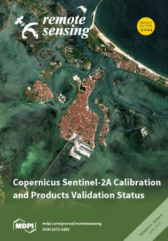
As part of the Copernicus programme of the European Commission (EC), the European Space Agency (ESA) has developed and now operates the Sentinel-2 mission that acquires high spatial resolution optical images. This article, written by the ESA and CNES teams and the collaborating private partners, provides a description of the calibration activities and the status of the mission products’ validation activities. Measured performances, from the validation activities, cover both Top-Of-Atmosphere (TOA) and Bottom-Of-Atmosphere (BOA) products from processing Level 1 and Level 2 respectively. The presented results show the good quality of the mission products both in terms of radiometry and geometry, and provide an overview of data quality aspects. The five images shown here are recent Sentinel-2 Level-2A colour composites generated over Venice, Italy. View the paper
  • Issues are regarded as officially published after their release is announced to the table of contents alert mailing list .
  • You may sign up for email alerts to receive table of contents of newly released issues.
  • PDF is the official format for papers published in both, html and pdf forms. To view the papers in pdf format, click on the "PDF Full-text" link, and use the free Adobe Reader to open them.

Articles (128)

  • Article
  • Open Access
13 Citations
6,063 Views
15 Pages

21 June 2017

Autumn senescence progresses over several weeks during which leaves change their colors. The onset of leaf coloring and its progression have environmental and economic consequences, however, very few efforts have been devoted to monitoring regional f...

  • Article
  • Open Access
6 Citations
5,872 Views
19 Pages

21 June 2017

In an effort to detect the region-of-interest (ROI) of remote sensing images with complex data distributions, sparse representation based on dictionary learning has been utilized, and has proved able to process high dimensional data adaptively and ef...

  • Feature Paper
  • Article
  • Open Access
107 Citations
16,045 Views
14 Pages

21 June 2017

The Defense Meteorological Satellite Program (DMSP)/Operational Linescan System (OLS) stable nighttime light (NTL) data provide a wide range of potentials for studying global and regional dynamics, such as urban sprawl and electricity consumption. Ho...

  • Article
  • Open Access
20 Citations
12,151 Views
19 Pages

21 June 2017

Spaceborne Synthetic Aperture Radar (SAR) interferometry has been utilised to acquire high-resolution Digital Elevation Models (DEMs) with wide coverage, particularly for persistently cloud-covered regions where stereophotogrammetry is hard to apply....

  • Article
  • Open Access
33 Citations
8,711 Views
21 Pages

21 June 2017

The standard ratio of spatial resolution between bands for high resolution satellites is 1:4, which is typical when combining images obtained from the same sensor. However, the cost of simultaneously purchasing a set of panchromatic and multispectral...

  • Article
  • Open Access
33 Citations
8,055 Views
19 Pages

Automatic Evaluation of Photovoltaic Power Stations from High-Density RGB-T 3D Point Clouds

  • Luis López-Fernández,
  • Susana Lagüela,
  • Jesús Fernández and
  • Diego González-Aguilera

20 June 2017

A low-cost unmanned aerial platform (UAV) equipped with RGB (Red, Green, Blue) and thermographic sensors is used for the acquisition of all the data needed for the automatic detection and evaluation of thermal pathologies on photovoltaic (PV) surface...

  • Feature Paper
  • Article
  • Open Access
104 Citations
12,999 Views
25 Pages

20 June 2017

In this study, a 1-D Convolutional Neural Network (CNN) architecture was developed, trained and utilized to classify single (summer) and three seasons (spring, summer, fall) of hyperspectral imagery over the San Francisco Bay Area, California for the...

  • Article
  • Open Access
27 Citations
5,858 Views
19 Pages

20 June 2017

Soil contamination by arsenic and heavy metals is an increasingly severe environmental problem. Efficiently investigation of soil contamination is the premise of soil protection and further the foundation of food security. Visible and near-infrared r...

  • Article
  • Open Access
24 Citations
9,376 Views
18 Pages

20 June 2017

Alaskan glaciers are among the largest contributors to sea-level rise outside the polar ice sheets. The contributions include dynamic discharge from marine-terminating glaciers which depends on the seasonally variable ice velocity. Columbia Glacier i...

  • Article
  • Open Access
16 Citations
8,060 Views
22 Pages

20 June 2017

Within-class spectral variation and between-class spectral confusion in remotely sensed imagery degrades the performance of built-up area detection when using planar texture, shape, and spectral features. Terrain slopes and building heights extracted...

of 13

Get Alerted

Add your email address to receive forthcoming issues of this journal.

XFacebookLinkedIn
Remote Sens. - ISSN 2072-4292