You are currently viewing a new version of our website. To view the old version click .

Remote Sensing, Volume 11, Issue 21

November-1 2019 - 136 articles

Cover Story: 
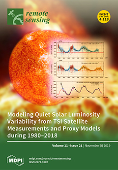
Uncertainties in the multi-decadal variability of the total solar irradiance (TSI) still persist because of the difficulty measuring the luminosity variation of the quiet solar regions. The ACRIM-PMOD TSI controversy needs to be resolved to determine the magnitude of TSI as a driver of climate change. ACRIM uses published TSI satellite measurements that show TSI increasing from 1980 to 2000 (when the Earth’s climate warmed), followed by a decrease from 2000 to date. PMOD uses model-altered satellite measurements and derives a TSI decrease from 1980 to the present. Our new study evaluates TSI proxy models that appear to confirm PMOD. Yet, the observed discrepancies between their predictions and the available high-quality TSI satellite data suggest that they are missing a slow multidecadal TSI variation that confirms the ACRIM TSI record. View this paper.
  • Issues are regarded as officially published after their release is announced to the table of contents alert mailing list .
  • You may sign up for email alerts to receive table of contents of newly released issues.
  • PDF is the official format for papers published in both, html and pdf forms. To view the papers in pdf format, click on the "PDF Full-text" link, and use the free Adobe Reader to open them.

Articles (136)

  • Article
  • Open Access
46 Citations
10,694 Views
16 Pages

Oil Palm (Elaeis guineensis) Mapping with Details: Smallholder versus Industrial Plantations and their Extent in Riau, Sumatra

  • Adrià Descals,
  • Zoltan Szantoi,
  • Erik Meijaard,
  • Harsono Sutikno,
  • Guruh Rindanata and
  • Serge Wich

5 November 2019

Oil palm is rapidly expanding in Southeast Asia and represents one of the major drivers of deforestation in the region. This includes both industrial-scale and smallholder plantations, the management of which entails specific challenges, with either...

  • Article
  • Open Access
55 Citations
10,187 Views
20 Pages

5 November 2019

The Landsat record represents an amazing resource for discovering land-cover changes and monitoring the Earth’s surface. However, making the most use of the available data, especially for automated applications ingesting thousands of images wit...

  • Article
  • Open Access
27 Citations
6,395 Views
15 Pages

5 November 2019

In this study, satellite radar observations are employed to reveal spatiotemporal changes in ground surface height of peatlands that have, and have not, undergone restoration in Central Kalimantan, Indonesia. Our time series analysis of 26 scenes of...

  • Article
  • Open Access
4 Citations
3,425 Views
19 Pages

Semi-Coupled Convolutional Sparse Learning for Image Super-Resolution

  • Lingling Li,
  • Sibo Zhang,
  • Licheng Jiao,
  • Fang Liu,
  • Shuyuan Yang and
  • Xu Tang

5 November 2019

In the convolutional sparse coding-based image super-resolution problem, the coefficients of low- and high-resolution images in the same position are assumed to be equivalent, which enforces an identical structure of low- and high-resolution images....

  • Article
  • Open Access
17 Citations
6,502 Views
30 Pages

A Machine Learning Approach to Crater Classification from Topographic Data

  • Qiangyi Liu,
  • Weiming Cheng,
  • Guangjian Yan,
  • Yunliang Zhao and
  • Jianzhong Liu

5 November 2019

Craters contain important information on geological history and have been widely used for dating absolute age and reconstructing impact history. The impact process results in a lot of ejected fragments and these fragments may form secondary craters....

  • Article
  • Open Access
5 Citations
3,782 Views
20 Pages

5 November 2019

Real-time multi-GNSS precise point positioning (PPP) requires the support of high-rate satellite clock corrections. Due to the large number of ambiguity parameters, it is difficult to update clocks at high frequency in real-time for a large reference...

  • Article
  • Open Access
48 Citations
5,829 Views
28 Pages

4 November 2019

Algal blooms in eutrophic lakes have been a global issue to environmental ecology. Although great progress on prevention and control of algae have been made in many lakes, systematic research on long-term temporal-spatial dynamics and drivers of alga...

  • Article
  • Open Access
35 Citations
6,619 Views
21 Pages

Fuzzy Object-Based Image Analysis Methods Using Sentinel-2A and Landsat-8 Data to Map and Characterize Soil Surface Residue

  • Payam Najafi,
  • Hossein Navid,
  • Bakhtiar Feizizadeh,
  • Iraj Eskandari and
  • Thomas Blaschke

4 November 2019

Soil degradation, defined as the lowering and loss of soil functions, is becoming a serious problem worldwide and threatens agricultural production and terrestrial ecosystems. The surface residue of crops is one of the most effective erosion control...

  • Article
  • Open Access
32 Citations
5,259 Views
18 Pages

4 November 2019

Short-range radar has become one of the latest sensor technologies for the Internet of Things (IoT), and it plays an increasingly vital role in IoT applications. As the essential task for various smart-sensing applications, radar-based human activity...

  • Article
  • Open Access
98 Citations
8,398 Views
15 Pages

Automated Detection of Conifer Seedlings in Drone Imagery Using Convolutional Neural Networks

  • Michael Fromm,
  • Matthias Schubert,
  • Guillermo Castilla,
  • Julia Linke and
  • Greg McDermid

4 November 2019

Monitoring tree regeneration in forest areas disturbed by resource extraction is a requirement for sustainably managing the boreal forest of Alberta, Canada. Small remotely piloted aircraft systems (sRPAS, a.k.a. drones) have the potential to decreas...

of 14

Get Alerted

Add your email address to receive forthcoming issues of this journal.

XFacebookLinkedIn
Remote Sens. - ISSN 2072-4292