

Remote Sens., Volume 10, Issue 6 (June 2018) – 171 articles
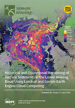
Cover Story (view full-size image):
Land use change and reservoir construction alter sediment transport within rivers. These changes can impact river morphology and aquatic ecosystems. The integrity of the Lower Mekong Basin is crucial to surrounding countries for transportation, energy production, sustainable water supply, and food production. In response to this need, countries have developed regional scale water quality programs, but they are limited by point-based measurements. To augment in situ surface sediment concentrations (SSSC) data from the current monitoring program, an empirical model to estimate SSSC across the Lower Mekong Basin using decades of Landsat observations was developed. This operational model was implemented in Google Earth Engine and Google App Engine, allowing users, without any prior knowledge of remote sensing, to freely access and interpret sediment data across the region. View this paper.
- Issues are regarded as officially published after their release is announced to the table of contents alert mailing list.
- You may sign up for e-mail alerts to receive table of contents of newly released issues.
- PDF is the official format for papers published in both, html and pdf forms. To view the papers in pdf format, click on the "PDF Full-text" link, and use the free Adobe Reader to open them.
Previous Issue
Next Issue