You are currently viewing a new version of our website. To view the old version click .

Remote Sensing, Volume 10, Issue 7

July 2018 - 187 articles

Cover Story: 
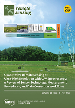
In the last 10 years, developments in robotics, computer vision, and sensor technology have provided new spectral remote sensing tools to capture unprecedented ultra-high spatial and high spectral resolution data with unmanned aerial vehicles (UAVs). This development has led to a revolution in geospatial data collection in which not only a small number of specialists collect and deliver remotely sensed data, but a whole diverse community is potentially able to gather geospatial data that fit their needs. However, the diversification of sensing systems challenges the common application of good practice procedures that ensure the quality of the data. This challenge can only be met by establishing and communicating common procedures. In our review, we evaluate the state-of-the-art methods in UAV spectral remote sensing that have proven successful in scientific experiments and operational demonstrations. View this paper.
  • Issues are regarded as officially published after their release is announced to the table of contents alert mailing list .
  • You may sign up for email alerts to receive table of contents of newly released issues.
  • PDF is the official format for papers published in both, html and pdf forms. To view the papers in pdf format, click on the "PDF Full-text" link, and use the free Adobe Reader to open them.

Articles (187)

  • Article
  • Open Access
67 Citations
7,824 Views
25 Pages

23 July 2018

Aerial scene classification is an active and challenging problem in high-resolution remote sensing imagery understanding. Deep learning models, especially convolutional neural networks (CNNs), have achieved prominent performance in this field. The ex...

  • Article
  • Open Access
6 Citations
5,274 Views
17 Pages

23 July 2018

This paper presents a method and results for the estimation of residual Doppler frequency, and consequently the range velocity component of point targets in single-channel synthetic aperture radar (SAR) focused single-look complex (SLC) data. It is s...

  • Article
  • Open Access
24 Citations
4,892 Views
18 Pages

23 July 2018

The Mongolian Plateau (MP) and Tibetan Plateau (TP) have experienced higher-than-global average warming in recent decades, resulting in many significant changes in ecosystem structure and function. Among them are the leaf area index (LAI) and albedo,...

  • Article
  • Open Access
31 Citations
5,862 Views
27 Pages

23 July 2018

Global, near-real-time satellite-based soil moisture (SM) datasets have been developed over recent decades. However, there has been a lack of comparison among different passing times, retrieving algorithms, and sensors between SM products over variou...

  • Article
  • Open Access
33 Citations
8,329 Views
26 Pages

Resolving Surface Displacements in Shenzhen of China from Time Series InSAR

  • Peng Liu,
  • Xiaofei Chen,
  • Zhenhong Li,
  • Zhenguo Zhang,
  • Jiankuan Xu,
  • Wanpeng Feng,
  • Chisheng Wang,
  • Zhongwen Hu,
  • Wei Tu and
  • Hongzhong Li

23 July 2018

Over the past few decades, the coastal city of Shenzhen has been transformed from a small fishing village to a mega city as China’s first Special Economic Zone. The rapid economic development was matched by a sharp increase in the demand for us...

  • Article
  • Open Access
42 Citations
8,397 Views
22 Pages

GRACE-Based Terrestrial Water Storage in Northwest China: Changes and Causes

  • Yangyang Xie,
  • Shengzhi Huang,
  • Saiyan Liu,
  • Guoyong Leng,
  • Jian Peng,
  • Qiang Huang and
  • Pei Li

23 July 2018

Monitoring variations in terrestrial water storage (TWS) is of great significance for the management of water resources. However, it remains a challenge to continuously monitor TWS variations using in situ observations and hydrological models because...

  • Article
  • Open Access
22 Citations
7,411 Views
21 Pages

23 July 2018

Long time coherent integration is a vital method for improving the detection ability of global navigation satellite system (GNSS)-based passive radar, because the GNSS signal is not radar-designed and its power level is very low. For aircraft detecti...

  • Article
  • Open Access
51 Citations
5,794 Views
18 Pages

22 July 2018

In Global Navigation Satellite System (GNSS) positioning, observation precisions are frequently impacted by the site-specific unmodeled errors, especially for the code observations that are widely used by smart phones and vehicles in urban environmen...

  • Feature Paper
  • Article
  • Open Access
38 Citations
7,767 Views
16 Pages

21 July 2018

Yedoma—extremely ice-rich permafrost with massive ice wedges formed during the Late Pleistocene—is vulnerable to thawing and degradation under climate warming. Thawing of ice-rich Yedoma results in lowering of surface elevations. Quantita...

  • Technical Note
  • Open Access
30 Citations
7,260 Views
17 Pages

Estimation of Gap Fraction and Foliage Clumping in Forest Canopies

  • Andres Kuusk,
  • Jan Pisek,
  • Mait Lang and
  • Silja Märdla

21 July 2018

The gap fractions of three mature hemi-boreal forest stands in Estonia were estimated using the LAI-2000 plant canopy analyzer ( LI-COR Biosciences, Lincoln, NE, USA), the TRAC instrument (Edgewall, Miami, FL, USA), Cajanus’ tube, hemispherical...

of 19

Get Alerted

Add your email address to receive forthcoming issues of this journal.

XFacebookLinkedIn
Remote Sens. - ISSN 2072-4292