You are currently viewing a new version of our website. To view the old version click .

Remote Sensing, Volume 10, Issue 1

January 2018 - 153 articles

Cover Story: 
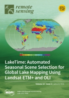
Advances in computing power and the increased availability of high-resolution remote sensing data products have made it possible to map lake surface area at the global scale and monitor changes over time. However, because lake surface area changes seasonally, we must use images acquired from a consistent season in order to isolate long-term changes. At the global scale, this means identifying the hydrological season independently at each location. The LakeTime algorithm uses global hydrological data and a simple water balance model to identify a consistent, ideal lake mapping time for each Landsat tile (Cover Image). When combined with the Landsat archive, we are able to provide nearly complete, seasonally consistent, global coverage for circa 2000 Landsat Enhanced Thematic Mapper Plus (ETM+) and circa 2014 Landsat Operational Land Imager (OLI) imagery. View this paper
  • Issues are regarded as officially published after their release is announced to the table of contents alert mailing list .
  • You may sign up for email alerts to receive table of contents of newly released issues.
  • PDF is the official format for papers published in both, html and pdf forms. To view the papers in pdf format, click on the "PDF Full-text" link, and use the free Adobe Reader to open them.

Articles (153)

  • Article
  • Open Access
17 Citations
5,637 Views
20 Pages

Analysis of Azimuthal Variations Using Multi-Aperture Polarimetric Entropy with Circular SAR Images

  • Feiteng Xue,
  • Yun Lin,
  • Wen Hong,
  • Qiang Yin,
  • Bingchen Zhang,
  • Wenjie Shen and
  • Yue Zhao

19 January 2018

In conventional synthetic aperture radar (SAR), sensors with a fixed look angle are assumed, and the scattering properties are considered as invariant in the azimuth. In some new SAR modes such as wide-angle SAR and circular SAR (CSAR), the azimuthal...

  • Article
  • Open Access
121 Citations
15,097 Views
18 Pages

19 January 2018

NASA’s Gravity Recovery and Climate Experiment (GRACE) has already proven to be a powerful data source for regional groundwater assessments in many areas around the world. However, the applicability of GRACE data products to more localized studies an...

  • Article
  • Open Access
67 Citations
11,830 Views
25 Pages

19 January 2018

An influential underlying driver of human-induced landscape change is civil war and other forms of conflict that cause human displacement. Internally displaced persons (IDPs) increase environmental pressures at their destination locations while reduc...

  • Communication
  • Open Access
11 Citations
6,530 Views
13 Pages

19 January 2018

The identification and mapping of the mineral composition of by-products and residues on industrial sites is a topic of growing interest because it may provide information on plant-processing activities and their impact on the surrounding environment...

  • Article
  • Open Access
14 Citations
5,684 Views
18 Pages

19 January 2018

Understanding irrigator responses to changes in water availability is critical for building strategies to support effective management of water resources. Using remote sensing data, we examine farmer responses to seasonal changes in water availabilit...

  • Article
  • Open Access
15 Citations
6,968 Views
20 Pages

A Satellite-Based Model for Simulating Ecosystem Respiration in the Tibetan and Inner Mongolian Grasslands

  • Rong Ge,
  • Honglin He,
  • Xiaoli Ren,
  • Li Zhang,
  • Pan Li,
  • Na Zeng,
  • Guirui Yu,
  • Liyun Zhang,
  • Shi-Yong Yu and
  • Fawei Zhang
  • + 9 authors

19 January 2018

It is important to accurately evaluate ecosystem respiration (RE) in the alpine grasslands of the Tibetan Plateau and the temperate grasslands of the Inner Mongolian Plateau, as it serves as a sensitivity indicator of regional and global carbon cycle...

  • Article
  • Open Access
61 Citations
8,341 Views
25 Pages

Hyperspectral Shallow-Water Remote Sensing with an Enhanced Benthic Classifier

  • Rodrigo A. Garcia,
  • Zhongping Lee and
  • Eric J. Hochberg

19 January 2018

Hyperspectral remote sensing inversion models utilize spectral information over optically shallow waters to retrieve optical properties of the water column, bottom depth and reflectance, with the latter used in benthic classification. Accuracy of the...

  • Article
  • Open Access
16 Citations
7,271 Views
16 Pages

18 January 2018

In the Indian monsoon region, frequent cloud cover in the rainy season results in less valid satellite observations during the vegetation growth period, making it difficult to extract land surface phenology (LSP). Even worse, many valid but humid obs...

  • Article
  • Open Access
7 Citations
7,933 Views
19 Pages

18 January 2018

This study explores the relationship between the Agulhas Current system and El Niño Southern Oscillation (ENSO) events. Specifically, it addresses monthly to yearly variations in Agulhas leakage where the Agulhas Current sheds waters into the Atlanti...

  • Article
  • Open Access
14 Citations
7,820 Views
22 Pages

18 January 2018

Sea surface temperature is a key component of the climate record, with multiple independent records giving confidence in observed changes. As part of the European Space Agencies (ESA) Climate Change Initiative (CCI) the satellite archives have been r...

of 16

Get Alerted

Add your email address to receive forthcoming issues of this journal.

XFacebookLinkedIn
Remote Sens. - ISSN 2072-4292