Abstract
A well-performing road network is essential for modern society. But any road is nothing without its users—cyclists, drivers, pedestrians. Road network cannot be managed without knowing who the roads serve. The gaps in this knowledge lead to decisions that hinder efficiency, equality, and sustainability. This is why monitoring traffic is imperative for road management. However, traditional short-term traffic counting methods fail to provide full coverage at a reasonable cost. This study assessed the economic feasibility of drone-enabled traffic monitoring systems across Estonian urban environments through comparative spatial and economic analysis. Hexagonal tessellation was applied to 255 urban locations, identifying 47,530 monitoring points across 4077 grid cells. Economic modeling compared traditional counting costs with drone-based systems utilizing ultralight drones and nomadic 5G infrastructure. Monte Carlo simulation evaluated robustness under varying operational intensities from 30 to 180 days annually. Analysis identified an 8-point density threshold for economic viability, substantially lower than previously reported requirements. Operational intensity emerged as the critical determinant: minimal operations (30 days) proved viable for 9.0% of locations, while semi-continuous deployment (180 days) expanded viability to 81.6%. The findings demonstrate that drone-based monitoring achieves 60–80% cost reductions compared to traditional methods while maintaining equivalent accuracy (95–100% detection rates for vehicles, cyclists, and pedestrians), presenting an economically superior alternative for 67% of Estonian urban areas, with viability extending to lower-density locations through increased operational utilization.
1. Introduction
Good road management relies on good data. One of the most important aspects of said data is knowing who uses the roads and at what volumes, be they cyclists, drivers, or pedestrians. In modern times, the amount of data is not an issue. There are many platforms and sources that are more than willing to collect and occasionally share the data [,,]. However, these sources provide a somewhat biased [] picture as they only cover the people and vehicles who opt in to the collection and thus only the areas they traverse. Therefore, to gather full and unbiased information about the whole road network, the whole road network must be counted at least once. For this purpose, traffic monitoring studies should be performed periodically, relying on short-term countings [].
Traditional traffic counting methods face high costs, limited coverage areas, and significant deployment complexity. Still, having up-to-date data is imperative for road network performance measurement, and full coverage is needed for calibrating the data from models []. Manual counting requires at least one person per direction studied, while fixed automated systems demand substantial infrastructure investments and are suitable only for point counts without trajectories [,]. Recent research demonstrates that integrated drone-based systems achieve 60–80% cost reductions while increasing coverage radius with single units, reshaping the economics of on-site traffic analysis [,].
1.1. Aerial Traffic Counting
Technological maturity across different domains has reached a convergence point where mobile aerial-based platforms as traffic monitoring options have become not just feasible, but superior to traditional alternatives. Computer vision systems now achieve 95–100% accuracy rates for bicycle and pedestrian counting from aerial-based platforms [], while drone perching mechanisms extend mission durations by 300–400% through energy conservation strategies []. Simultaneously, nomadic 5G networks enable 50% reductions in communication failure rates with 58.3% latency improvements, creating a foundation for real-time intelligent traffic management systems [].
The evolution of automated traffic counting has been rather fast in recent years, with multiple technologies demonstrating commercial viability for aerial deployment. GoodVision’s AI platform achieves 95–100% accuracy for both pedestrian and bicycle counting from drone footage [], while Miovision Scout Plus systems maintain 95% + accuracy using computer vision algorithms capable of simultaneous multi-modal detection []. These advances represent significant improvements over traditional pneumatic tube, radar, and induction loop systems, which typically achieve 85–95% accuracy with substantial installation and maintenance requirements [].
LiDAR-based detection systems provide complementary capabilities with documented 97% + accuracy at disaggregate levels and minimal environmental sensitivity []. Research from 2019 demonstrates that 2D LiDAR systems achieve 0.7% over-counting errors and 1.3–2.7% under-counting errors with real-time embedded processing capabilities []. Technology’s immunity to occlusion issues makes it particularly valuable for drone-based implementations where multiple detection methods can be integrated on a single platform. PIR sensor network implementations offer additional validation pathways, with Macquarie University’s deployment of 74 sensor nodes achieving 95% accuracy at $250 per node []. While primarily ground-based, these IoT-enabled systems provide reference data for calibrating aerial counting systems and demonstrate the broader ecosystem integration potential of modern traffic monitoring technologies.
Aerial-based platforms fundamentally solve several limitations inherent in ground-based counting systems. Beach usage studies from Gold Coast, Australia, demonstrate 91–95% accuracy for crowd counting using AI models on drone platforms [], while YOLOv5 + DeepSORT implementations track nearly 1000 people continuously with greater than 95% accuracy []. The bird’s-eye perspective eliminates occlusion issues that plague ground-based systems, particularly in high-density urban environments [
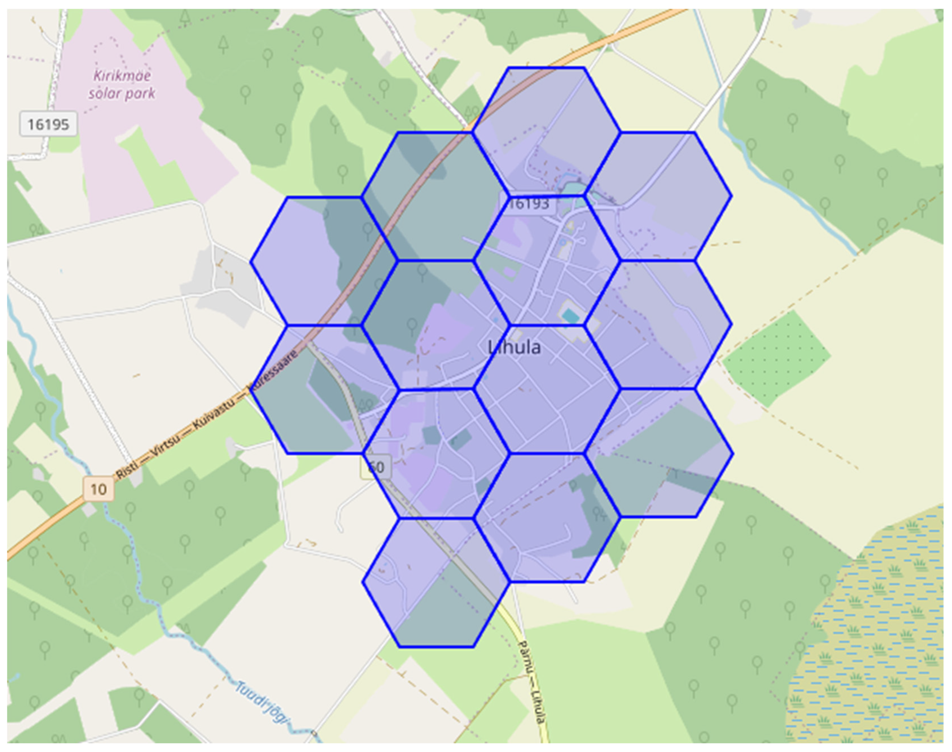
]; an example is shown in Figure 1.
Figure 1.
Vehicles detected (indicated by red square) from drone imagery at an intersection.
Coverage efficiency represents a critical advantage, with single drone units covering areas equivalent to multiple fixed installations. Traditional traffic cameras provide 100–130 feet range limitations, while drone systems achieve 200 × 200 feet coverage with 4K + video quality and multi-spectral sensor capabilities []. This coverage advantage becomes particularly significant for bicycle and pedestrian monitoring, where distributed counting points are essential for comprehensive network analysis.
Multi-sensor fusion approaches combine RGB cameras, thermal imaging, and LiDAR sensors on unified platforms, achieving detection precision rates of 91.8% in complex urban environments []. The F1-score performance of 90.5% for vehicle detection and classification, combined with 92.1% MOTA (Multiple Object Tracking Accuracy), demonstrates that integrated sensor systems significantly outperform single-technology approaches []. Weather resilience capabilities extend operational windows compared to traditional systems. Radar-based SensMax TAC-B technology operates effectively in rain, fog, and snow conditions while maintaining speed detection capabilities that enable differentiation between pedestrians (≈5 km/h) and cyclists (≈15–20 km/h) []. This environmental independence proves crucial for generating reliable year-round traffic data.
Spatial network analysis methods have evolved substantially, with betweenness-based modeling achieving an R2 = 0.85 correlation between predicted and actual cycling flows. Research by Chan and Cooper (2019) demonstrates that cyclist-adjusted distance metrics incorporating slope, traffic deterrence, and turn factors significantly improve prediction accuracy over traditional Euclidean distance models []. Multi-variate hybrid models integrating trip purposes and distance decay achieve R2 = 0.78 for cross-validated predictions, providing robust frameworks for extrapolating short-term drone counts to network-wide estimates [].
XGBoost algorithms demonstrate superior performance in estimating vulnerable road user exposure, outperforming traditional regression methods for both intersection and segment analysis []. Random Forest models excel at imputing missing daily traffic records, proving more effective than conventional day-of-year adjustment factors []. These machine learning approaches prove particularly valuable for drone-based systems where data collection patterns may differ from traditional continuous counter deployments. Deep learning frameworks using hybrid VAE-LSTM models with self-attention mechanisms enable sophisticated bicycle and pedestrian flow forecasting []. Neural network implementations achieve 86% accuracy for bicycle classification and 98% for pedestrian classification, demonstrating the potential for real-time pattern recognition from aerial data streams []. Factor-based AADT conversion methods have been refined through comprehensive validation studies. Day-of-year (DOY) factors produce smaller errors than traditional day-of-week/month-of-year methods, particularly for counts lasting less than one week []. Similarly, the choice of counting period allows better results when counting is done in a less variable period []. Advanced statistical methods incorporate weather and activity factors through regression-based correcting functions, achieving superior accuracy over traditional seasonal adjustment approaches []. Bayesian hierarchical methods explicitly incorporate temporal fluctuations and seasonal variations, while negative binomial models using temporal and weather variables achieve a validation R2 ≈ 0.70 for bicycle traffic estimation [].
Climate-dependent variations show quantifiable patterns across different geographic regions. Temperature effects demonstrate 4–5% volume increases per 10% temperature rise, with quadratic relationships peaking at 20–25 °C []. Precipitation impacts reduce volumes by 8–19% for light rain (0.2–10 mm) and 13–25% for heavy rain (>10 mm) []. These environmental sensitivities require location-specific calibration but provide predictable adjustment frameworks for extrapolating short-term aerial counts. Montreal studies demonstrate multi-variable weather integration with facility-specific variations. Temperature, humidity, and precipitation effects show lagged impacts persisting 3 + hours, requiring sophisticated modeling approaches []. Seasonal peaks in July–August represent 60% higher weekend volumes than weekdays, with geographic and land use variations showing 70% higher activity in commercial areas compared to mixed residential-commercial zones [].
1.2. Advances in Drone Technology
Advances in drone perching technology in recent years have demonstrated practical solutions for extended surveillance operations. Stanford’s Parrotlet mechanism weighs 250 g and achieves 98% perching success rates on cylindrical surfaces ranging from 30–80 mm in diameter []. University of Utah’s passive mechanism converts UAV weight into grasping force, achieving comparable success rates with songbird-inspired tendon tensioning systems []. Bat-inspired double self-locking mechanisms using ratchet and four-link dead point systems demonstrate power consumption reduction to 2.9% of the hovering state when perched [].
These biological mimetic approaches provide passive compliance enabling adaptive grasping without continuous power requirements, which is fundamental for extended monitoring applications. Quantitative power savings demonstrate substantial operational benefits. Ceiling perching achieves 40–50% power conservation (4.7–6.4 W vs. 8.6 W hovering), while wall perching provides 80% power reduction (1.3–1.9 W vs. 8.6 W hovering) []. Mission duration extensions reach 300%+, with wall perching tests achieving 1860 s total flight time vs. 420 s for hovering-only operations []. Mussel-inspired adhesive systems achieve 4-fold mission time increases while weighing only 32 g for rotorcraft applications []. These systems function on both wet and dry surfaces, providing 50% power reduction for ceiling applications and 85% reduction for wall mounting. The versatility across surface conditions makes adhesive approaches particularly suitable for urban traffic monitoring environments.
Proximity effect optimization provides additional efficiency gains, with surface-induced airflow modifications enhancing rotor efficiency by up to 2.2 × reduction in mechanical power requirements []. Proximity coefficients of γ = 2.72 for 2 mm surface distances demonstrate that strategic positioning optimization can compound the benefits of perching mechanisms. Multi-sensor integration approaches combine binocular cameras, LiDAR, and pressure sensors for autonomous perching execution. Laboratory success rates reach 96.5% (114/114 trials), while outdoor operations achieve 75% success rates (30/40 trials), accounting for environmental variables []. Commercial systems demonstrate 93%+ success rates at approach speeds exceeding 0.42 m/s, indicating readiness for operational deployment []. Hierarchical control architecture provides high-level mission planning integrated with low-level stabilization systems. Proximity effect integration in control algorithms accounts for surface-induced aerodynamic changes, enabling precise approach and contact establishment []. Adaptive response capabilities provide real-time adjustment to surface variations and environmental conditions, which is critical for autonomous traffic monitoring applications.
1.3. Nomadic 5G as Platform Provider
Nomadic 5G network deployments, as shown in Figure 2, have demonstrated performance improvements for UAV applications. Communication failure rates show a 50% reduction (from 12% to 6%), while round-trip times improve 58.3% (from 120 ms to 50 ms) []. Data transfer rates increase 400% (from 1 Gbps to 5 Gbps), enabling real-time video analytics and comprehensive data streaming capabilities []. Fraunhofer FOKUS 5G + Nomadic Nodes demonstrate rapid deployment capabilities, with entire kits fitting into transportable server rack containers and enabling network setup in just minutes for emergency scenarios []. ZTE All-in-One solutions provide one-hour deployment capability, successfully demonstrated in earthquake disaster response operations in Sichuan’s Luding County in 2022 [].
Figure 2.
Nomadic 5G application as a drone platform [].
Three computation modes optimize processing efficiency: onboard computing, full edge offloading, and hybrid partial offloading approaches []. AI algorithms reduce UAV power usage by 25% compared to non-AI systems, while flight time increases by ~40% due to reduced onboard processing requirements []. UAV cost savings reach ~10% through reduced onboard computer requirements. Verizon 5G Edge with AWS Wavelength implementations enable low end-to-end latency for live drone video collection with near real-time object detection and telemetry processing []. These capabilities support computationally intensive applications like AI-powered traffic pattern recognition while maintaining ultra-low latency requirements for real-time control systems.
5G network slicing architecture enables simultaneous operation of three UAV service types: enhanced Mobile Broadband (eMBB), Ultra-Reliable Low-Latency Communications (URLLC), and massive Machine-Type Communications (mMTC) []. Independent slice operation prevents performance interference between applications, enabling dedicated traffic monitoring services with guaranteed performance characteristics. 5G!Drones project validation demonstrates that 5G infrastructure supports simultaneous UAV applications with different throughput, latency, and reliability requirements []. Network slicing partitions single physical networks into multiple logical networks, each handling specific UAV traffic characteristics essential for reliable traffic monitoring operations. Seamless multi-hop technology provides opportunities to extend the networks well beyond the core nodes, allowing for more area coverage [].
1.4. Integrated Solutions
The City of Graz, Austria, deployment uses GDPR-compliant AI video analytics, achieving successful differentiation between traffic users (cars, mopeds, cyclists, scooters) with real-time traffic violation detection capabilities []. The Belgium urban roundabout study demonstrates relative errors < 10% with single drones replacing the need for 4 manual counters at complex intersections []. Telefónica Spain’s pilot program represents the first 5G-connected drone air traffic control system, combining UAVs, C-V2X communications, RTK positioning, and mobile location services []. The system achieves centimeter-level precision for urban operations with real-time collision avoidance between multiple drones, demonstrating the integration potential of communication and navigation technologies.
Cost comparisons reveal substantial economic advantages for integrated systems. GoodVision vs. manual counting studies show processing time reductions from 90 + h to 67–75 min, while personnel requirements decrease from 4 + operators to single operators per system []. Infrastructure savings eliminate the need for 2–4 fixed cameras per intersection, with ROI timelines showing break-even when replacing 2 + traditional camera setups []. Financial analysis demonstrates a 5 × reduction in security/monitoring costs within one year across multiple case studies. These cost structures provide alternatives to traditional traffic monitoring infrastructure. Detection precision rates of 91.8% for complex urban environments demonstrate commercial viability []. F1-scores of 90.5% for vehicle detection and classification, combined with tracking metrics of 92.1% MOTA, establish performance standards exceeding traditional ground-based systems []. GEH statistics < 5.0 in 85% of traffic volume measurements meet industry standards for traffic engineering applications []. Coverage advantages show 200 × 200 feet (60 × 60 m) with single units compared to 100–130 feet (30 × 40 m) range limitations for traditional systems []. Setup time reductions of 85% (from 2–3 days to 2–3 h) and data delivery improvements of 95% (from 3 + days to 1–2 h) demonstrate operational efficiency advantages that compound the accuracy and coverage benefits [].
AI enhancement through advanced machine learning enables predictive traffic analysis capabilities, while swarm intelligence coordinates multi-drone operations for city-wide coverage []. Blockchain integration provides secure data sharing between municipal systems, and international standards development creates frameworks for global deployment of unified monitoring systems []. Energy harvesting integration with power line coupling enables inductive energy harvesting from electrical infrastructure, while solar integration provides photovoltaic systems for extended perched operations []. Wireless power transfer from ground-based charging systems creates opportunities for strategic perching location networks that maintain continuous operational coverage [].
City-wide deployment frameworks support hundreds of drones with centralized management capabilities. Multi-modal integration extends beyond vehicle monitoring to comprehensive pedestrian, cyclist, and public transport analysis []. Regulatory frameworks, including UTM (UAS Traffic Management), provide FAA-integrated systems with Letters of Acceptance for commercial BVLOS operations []. Privacy and security frameworks ensure GDPR compliance through machine-only video analysis with immediate deletion and real-time anonymization []. These regulatory advances remove deployment barriers while maintaining public privacy protections essential for widespread adoption.
The integration of short-term traffic counting methods, pattern analysis techniques, drone perching technology, and nomadic 5G edge computing creates unified monitoring systems that fundamentally outperform traditional approaches. Documented cost reductions of 60–80% combined with accuracy rates exceeding 90% demonstrate clear economic and technical advantages. Real-world implementations across Europe and North America provide validation evidence for scalable deployment frameworks. The convergence represents more than technological integration—it embodies a paradigm shift toward intelligent, mobile, and cost-effective transportation monitoring infrastructure. Energy-efficient drone operations through perching extend mission durations by 300–400%, while nomadic 5G networks enable real-time processing with 50% reduction in communication failures. Advanced pattern analysis converts short-term aerial counts to reliable annual estimates using machine learning approaches that achieve R2 correlations exceeding 0.85. The evidence strongly supports continued investment in unified drone-based traffic monitoring systems as superior alternatives to traditional ground-based methods. The technological maturity, proven economic benefits, and demonstrated operational advantages position these integrated systems as foundational elements for next-generation intelligent transportation infrastructure. Future research should focus on standardization efforts, regulatory framework development, and large-scale deployment optimization to fully realize the transformative potential of these converged technologies.
2. Materials and Methods
The study employs methods of geospatial analysis to compare the drone-based traffic counting feasibility to traditional methods. The study area comprises urban areas of Estonia, including major cities as well as smaller settlements. The spatial analysis employs a hexagonal tessellation approach to systematically evaluate traffic monitoring requirements across Estonian urban areas. Hexagonal grids were selected over rectangular alternatives due to their equidistant properties and minimal edge effects, providing uniform coverage patterns essential for 5G network planning and drone deployment optimization.
2.1. Spatial Analysis
2.1.1. Administrative Units
Geospatial datasets were obtained from the Estonian Land Board, containing administrative borders [] and road networks []. Data was stored in ESRI Shapefile format in EPSG:3301 projection. For the purposes of this study, data was imported into a PostGIS 3.3 database via QGIS 3.40. The administrative dataset consists of 8 different types [], namely:
- rural municipality
- rural submunicipality
- town
- city
- city without municipal status
- city district
- small town
- village
For each area, a 5G coverage pattern was developed from a hexagonal grid [] to establish the counting areas. In total, the dataset contained 4693 polygonal areas with 68,743 grid cells. Since the focus of this study is on urban areas, types 1, 2, and 8 were dismissed from the dataset. This resulted in 257 areas with 3874 cells. The spatial distribution is shown in Figure 3, and hexagonal grid cells are shown in Figure 4.
Figure 3.
Spatial distribution of urban areas on the OpenStreetMap background.
Figure 4.
Spatial distribution of hexagonal cells of a single urban area on the OpenStreetMap background.
2.1.2. Road Networks
Similarly, the road network dataset consists of the following types based on Estonian Land Board and Estonian Transport Administration classification:
- Main highway (põhimaantee): National primary roads connecting major cities and serving as main transportation corridors (e.g., Tallinn–Tartu, Tallinn–Narva). These roads carry the highest traffic volumes and serve long-distance travel.
- Regional highway (tugimaantee): Secondary state roads connecting regional centers to the main highway network and providing connections between medium-sized towns.
- Secondary highway (kõrvalmaantee): Tertiary state roads serving local connections and providing access to smaller settlements from the regional highway network.
- Ramp or connecting road (ühendustee): Short connecting segments between different road categories, including highway on/off-ramps and grade-separated junction connections.
- Other state road (muu riigimaantee): State-maintained roads not classified in the above categories, typically serving specific functions or transitional classifications.
- Street (tänav): Urban roads within municipal boundaries, typically characterized by lower speed limits, adjacent development, and multiple access points.
- Other road (muu tee): Roads maintained by local governments or private entities, including residential access roads and rural farm roads.
- Path (rada): Unpaved trails and paths not intended for motorized vehicle traffic.
- Foot and bike road (jalg- ja jalgrattatee): Dedicated infrastructure for non-motorized users, separated from vehicle traffic.
Out of the listed road types, paths were dismissed as they are not part of the formalized road network and thus also not part of the strategic planning process. After filtering, the road network was normalized into homogeneous sections of a single type between intersections. In total, this led to 47,530 road sections. For each of the road sections, an optimal counting location was determined as the point nearest to the midpoint of the line without curvature with a radius less than 3000 m. An example of road lines and counting locations is shown in Figure 5.
Figure 5.
Counting locations shown on road centerlines on the OpenStreetMap background.
Road sections with a length below 100 m or inherently non-homogeneous traversal conditions were skipped, as those are not considered suitable for traffic counting and are commonly populated with data via network analysis.
2.2. Economic Framework
The economic analysis framework systematically compares traditional and drone-based traffic monitoring costs across varying operational intensities. This section describes operational assumptions, cost component structures, and the algorithmic approach to viability assessment.
2.2.1. Economic Data
Cost information was systematically extracted from the Estonian Public Procurement Register [] for the period of 2019–2024. Relevant procurements were identified using Common Procurement Vocabulary (CPV) codes: 34923000-3 and 38290000-4 for traffic counting equipment; 63712700-0 and 71311220-9 for monitoring services; and 60440000-4 and 71334000-8 for drone services. All costs were adjusted to 2025 values using the Estonian Consumer Price Index obtained from Statistics Estonia []. This led to an average estimated installation cost of 65 euros per temporary counting location. The estimated cost of a single device is 1800 euros.
Prices of nomadic 5G nodes vary by provider and the specifics of the actual devices, but publicly available sources [] indicate rental prices with a lump sum between 7000 and 11,000 euros per month. Considering these prices include technical support and maintenance along with installation, it can be considered a single-node operating cost. Drone prices have been dropping recently, but a high-quality ultralight (below 250 g in weight) drone from a respected manufacturer such as DJI can be purchased at retail prices of 300 euros or less [].
2.2.2. Operational Parameters and Assumptions
Standard 24-h counting periods are assumed for each monitoring location, consistent with established traffic engineering practice for short-term counts. This duration enables calculation of daily traffic volumes and identification of peak hour patterns necessary for annual average daily traffic (AADT) estimation through established factor-based methods. Counting campaigns would typically be conducted during neutral months (avoiding holidays, major events, and extreme weather) with Tuesday–Thursday deployments to capture representative weekday conditions. Weekend counts would require separate deployments. The operational intensity scenarios (30, 60, 90, 180 days annually) account for multiple deployments per location to capture seasonal variations.
The 24-h counting period captures complete daily cycles, including all peak periods (morning peak 7:00–9:00, midday 11:00–13:00, evening peak 16:00–18:00) as well as off-peak and nighttime conditions. Drone system accuracy parameters (95–100% for vehicle, bicycle, and pedestrian detection) are drawn from peer-reviewed validation studies [,,,].
Direct empirical comparison with traditional equipment at Estonian locations was not conducted as part of this study, but the authors have multiple years of experience conducting and planning traditional traffic countings with various methods. However, the economic analysis conservatively assumes equivalent accuracy between methods, meaning cost differentials reflect deployment efficiency rather than data quality advantages.
2.2.3. Cost Component Structure
Economic analysis incorporates five primary cost categories derived from procurement data analysis. For traditional fixed systems, capital expenditure (CAPEX) includes equipment acquisition costs of €1800 per automated counting device capable of multi-modal detection. Operating expenditure (OPEX) encompasses installation and deinstallation labor, estimated at €65 per monitoring point per event based on 2019–2024 procurement records adjusted to 2025 values using the Estonian Consumer Price Index. Equipment lifespan assumes 10 deployment cycles before replacement, distributing capital costs across multiple counting campaigns.
For drone-based systems, CAPEX comprises acquisition of ultralight drones (€300 per unit, DJI Mini series or equivalent) and rental of nomadic 5G infrastructure nodes (€7000–11,000 per month per node). The 5G nodes support simultaneous operation of up to 15 drones through edge computing capabilities and real-time data streaming. OPEX includes battery replacement (approximately 15% of drone cost annually), routine maintenance (5% annually), and pilot certification requirements. Unlike traditional systems, where costs scale linearly with monitoring point quantity, drone system costs exhibit fixed infrastructure components amortized across operational days, creating economies of scale with increased utilization.
The cost structure differentiation between approaches creates non-linear break-even dynamics. Traditional methods incur per-point charges for each installation and removal, making total costs directly proportional to monitoring point density. Drone systems distribute fixed infrastructure costs across all operational days and monitoring points covered, resulting in declining unit costs with increased deployment intensity and spatial concentration.
2.2.4. Economic Comparison Algorithm
For each hexagonal cell, monitoring costs are calculated through systematic comparison of both approaches across operational intensity scenarios. The traditional monitoring cost per cell is calculated as:
where Npoints represents the count of road sections requiring monitoring within the cell, Cinstall and Cremove are per-point installation and removal costs (€65 each), Cequipment is the automated counter acquisition cost (€1800), and nuses is the expected number of deployment cycles (10).
Ctrad = Npoints × (Cinstall + Cremove) + Cequipment/nuses
Drone-based monitoring costs incorporate both fixed and variable components distributed across operational days:
where C5G,month is the monthly 5G node rental (€7000–11,000), nmonths is the rental duration, ncells is the number of hexagonal cells served by one node (typically 15 for clustered urban deployments), Cdrone,unit is individual drone cost (€300), ndrones is the fleet size per node (15 units), and Cops represents operational expenses for battery replacement, maintenance, and pilot time.
Cdrone = (C5G,month × nmonths)/ncells + (Cdrone,unit × ndrones)/ncells + Cops
The comparative analysis proceeds through the iterative algorithm illustrated in Figure 6. For each hexagonal cell, monitoring point density determines traditional costs through direct multiplication. Drone costs are then calculated across four operational intensity scenarios (30, 60, 90, and 180 days annually), with daily amortization of fixed infrastructure costs creating declining unit costs with increased deployment frequency. Break-even thresholds emerge where traditional and drone costs converge, varying from 28 monitoring points per cell for minimal 30-day operations to 5 points for semi-continuous 180-day deployment.
Figure 6.
Economic comparison algorithm for evaluating drone-based versus traditional traffic monitoring systems.
The iterative process evaluates all 4077 hexagonal cells across operational scenarios, calculating costs, identifying break-even thresholds, and classifying locations into deployment tiers.
Viability classification assigns each location to implementation tiers based on the minimum operational intensity required for economic favorability. Tier 1 locations (9.0% of total) achieve viability with minimal 30-day seasonal operations, Tier 2 (33.7%) require 60-day deployment, Tier 3 (52.5%) need 90-day quarterly operations, and Tier 4 (81.6%) become viable under semi-continuous 180-day deployment. Locations with fewer than 5 monitoring points per cell remain economically favorable for traditional methods under all scenarios examined.
Fleet optimization calculations determine national-level resource requirements by aggregating viable locations within each tier. Spatial clustering analysis identifies opportunities to serve multiple adjacent cells with shared 5G infrastructure, reducing per-location costs. Seasonal deployment windows (May–September primary season for Estonian climate) inform scheduling strategies that maximize equipment utilization while accounting for weather constraints.
3. Results
3.1. Spatial Distribution of Traffic Monitoring Requirements
Analysis of 4077 hexagonal grid cells across 255 Estonian urban locations revealed substantial heterogeneity in monitoring point density. The distribution exhibited a right-skewed pattern with a mean density of 11.66 monitoring points per cell (SD = 12.84) and a median of 7 points. Of the total cells analyzed, 90.3% (n = 3681) contained at least one road section requiring monitoring, while 9.7% (n = 396) represented areas without formal road infrastructure. Table 1 presents the distribution of monitoring point density across the 4077 hexagonal cells analyzed. The ‘Cell Count’ column indicates the number of hexagonal grid cells falling within each density range. The ‘Percentage’ column shows the proportion of total cells in each category. The ‘Cumulative %’ column provides running totals, useful for identifying thresholds where significant portions of the urban network exceed specific density levels. For example, 80.4% of all cells contain 20 or fewer monitoring points, while only 1.5% contain more than 50 points; these high-density cells correspond to dense urban cores in major cities.
Table 1.
Distribution of monitoring point density across hexagonal grid cells.
The spatial concentration of monitoring requirements varied significantly by location type. Cities (n = 47) averaged 23.4 monitoring points per cell, while small towns (alevik, n = 186) averaged 8.7 points per cell. Tallinn districts demonstrated the highest density, with Mustamäe averaging 30.0 points per cell and Kristiine 27.6 points per cell.
3.2. Economic Analysis of Deployment Strategies
Cost analysis based on Estonian Public Procurement Register data (2019–2024) established baseline parameters of €65 per installation/removal event for traditional counting and €300 for drone equipment acquisition. The break-even analysis identified a threshold of eight monitoring points per cell, below which traditional methods remain economically favorable. This threshold affected 44.0% of all grid cells, suggesting a hybrid deployment strategy as optimal.
Economic analysis at the municipal level revealed substantial variation in deployment favorability. Table 2 presents the top 10 locations ranked by potential annual cost savings.
Table 2.
Economic analysis of the top 10 Estonian urban locations for drone deployment.
3.3. Fleet Requirements and Deployment Optimization
Analysis of temporal deployment patterns indicated optimal fleet sizing of three nomadic 5G nodes supporting 45 drone units (15 per node) for comprehensive national coverage. The seasonal deployment strategy, accounting for Estonian weather patterns, demonstrated 76% equipment utilization during operational months (May–September for primary deployment). The metrics of utilization are presented in Table 3.
Table 3.
National fleet requirements and utilization metrics.
3.4. Sensitivity Analysis and Risk Assessment
Monte Carlo simulation (n = 10,000 iterations) evaluated economic robustness under varying market conditions. Input parameters varied according to empirically observed ranges: installation costs (€55–75, ±15%), drone prices (€250–350), 5G rental rates (€7000–11,000/month), and weather-related downtime (10–25%). Table 4 presents the ROI periods and estimated annual savings.
Table 4.
Sensitivity analysis results under varying market conditions.
The analysis revealed robust economic viability across most deployment scenarios, with 98.7% probability of positive returns for locations with monitoring density exceeding 10 points per cell. Weather-related downtime represented the highest impact variable, potentially reducing operational days by up to 25% during adverse conditions.
3.5. Operational Intensity Analysis: Impact of Annual Deployment Days
The economic viability of drone-based monitoring systems fundamentally depends on utilization rates. Analysis across four operational scenarios (30, 60, 90, and 180 days annually) revealed distinct break-even thresholds and regional suitability patterns. The thresholds are presented in Table 5.
Table 5.
Economic viability thresholds for varying operational intensities.
3.5.1. Break-Even Dynamics Across Operational Intensities
The relationship between operational days and economic viability followed an inverse power function, with per-point costs decreasing from €467 at 30 days to €78 at 180 days annually (Table 6). This relationship fundamentally altered deployment recommendations across Estonian municipalities.
Table 6.
Detailed economic analysis for representative monitoring densities across operational scenarios.
Critical break-even thresholds (Table 7) emerged at distinct monitoring densities: 28 points for minimal operations (30 days), 14 points for seasonal deployment (60 days), 10 points for quarterly operations (90 days), and 5 points for semi-continuous monitoring (180 days).
Table 7.
National fleet requirements by operational scenario.
3.5.2. Regional Suitability Classification
Analysis of location-specific requirements (Table 8) revealed four distinct operational categories based on economic optimization:
Table 8.
Location classification by minimum required operational intensity for economic viability.
- Category 1: Minimal Operations (30 days annually) Suitable for 23 locations (9.0%) with very high monitoring density (>28 points/cell). Limited to major urban cores: Tartu city center (31.9 points/cell), Mustamäe (30.0 points/cell), and Kristiine (27.6 points/cell). These locations achieve positive ROI within 3–4 months despite minimal utilization.
- Category 2: Seasonal Operations (60 days annually) Encompasses 86 locations (33.7%) with moderate–high density (14–28 points/cell). Includes most Tallinn districts, regional cities (Pärnu, Narva, Viljandi), and larger towns. ROI period extends to 6–8 months with seasonal deployment aligned to Estonian summer conditions (May–September).
- Category 3: Quarterly Operations (90 days annually) Covers 134 locations (52.5%) with moderate density (10–14 points/cell). Represents the optimal balance for most Estonian municipalities, achieving a 12-month ROI while maintaining operational flexibility for weather variations.
- Category 4: Semi-Continuous Operations (180 days annually) Required for 208 locations (81.6%), including all areas exceeding 5 points/cell. This intensity enables drone deployment even in lower-density small towns and suburban areas, though ROI extends to 18–24 months.
3.5.3. Cost-Effectiveness Surface Analysis
Three-dimensional analysis of the cost–benefit relationship revealed non-linear interactions between operational intensity and monitoring density. Maximum savings occurred at the intersection of high density (>40 points/cell) and moderate operations (90 days), achieving annual savings exceeding €5000 per location.
The cost-effectiveness surface identified three distinct regions:
- High-Efficiency Zone: Monitoring density > 20 points with 60 + operational days, achieving > 75% cost reduction
- Moderate-Efficiency Zone: Density 10–20 points with 90+ days, achieving 40–75% reduction
- Low-Efficiency Zone: Density < 10 points requiring 180+ days, achieving < 40% reduction
3.5.4. Fleet Optimization Under Variable Intensity
Fleet requirements varied significantly with operational intensity as presented in Table 7, depending on operational model.
3.5.5. Sensitivity to Utilization Rates
Monte Carlo analysis (n = 10,000) evaluated economic robustness across utilization scenarios, as presented in Table 9.
Table 9.
Probability of positive ROI within 24 months by operational intensity.
The analysis revealed critical utilization thresholds: locations with <15 points/cell require a minimum of 90 operational days for reliable positive returns, while high-density locations (>20 points/cell) achieve viability even with a minimal 30-day deployment. The distribution of locations is shown in Figure 7.
Figure 7.
Classification of Estonian urban areas by monitoring density.
3.5.6. Regional Implementation Recommendations
Based on operational intensity analysis, implementation should follow a tiered approach:
- Tier 1 (Immediate Deployment): 23 major urban centers with minimal operational requirements. Single 5G node rental for May–June achieves full cost recovery within the first year.
- Tier 2 (Year 2 Expansion): Additional 63 locations requiring 60–90 day operations. Two additional nodes for April–September deployment, targeting regional centers and medium towns.
- Tier 3 (Full Coverage): Remaining viable locations through semi-continuous operations. Requires year-round equipment availability but serves 81.6% of all Estonian urban areas.
The operational intensity analysis demonstrates that drone deployment viability extends well beyond initial estimates when utilization rates increase. Even modest 90-day annual operations enable cost-effective monitoring for 52.5% of Estonian urban locations, while semi-continuous operations achieve 81.6% coverage with positive economic returns.
4. Discussion
4.1. Economic Viability and Deployment Thresholds
The identification of an eight-point break-even threshold for drone deployment represents an improvement over the previously reported requirement. While earlier studies suggested minimum thresholds of 50–100 monitoring points for economic viability [,,], the Estonian context demonstrates feasibility at significantly lower densities. This difference primarily stems from three factors: the reduction in drone costs, the rental-based model for 5G infrastructure eliminating capital expenditure, and the aggregation benefits achieved through hexagonal clustering approaches.
The break-even dynamics align with theoretical predictions from network economics, where fixed cost distribution across operational days creates inverse relationships between utilization and unit costs. Our finding that per-point costs decrease from €467 at 30 operational days to €78 at 180 days validates the importance of utilization optimization in deployment strategies. This relationship suggests that even sparse road networks become economically viable for drone monitoring when equipment utilization approaches semi-continuous operations.
Monitoring point density varies substantially across Estonian urban areas (0–71 points per hexagonal cell), with the highest concentrations in Tallinn districts (Mustamäe: 30.0 points/cell, Kristiine: 27.6 points/cell). While 90.3% of urban cells contain monitoring requirements, only 38.9% exceed the threshold for immediate drone deployment, suggesting a hybrid implementation strategy. This aligns with international experiences where selective deployment at complex intersections, while maintaining traditional counts for simple segments, achieves optimal cost reductions [,].
4.2. Operational Intensity as Deployment Determinant
The operational intensity analysis reveals a previously underexplored dimension of drone deployment economics. The progressive expansion of viable locations from 9.0% at minimal operations (30 days) to 81.6% at semi-continuous deployment (180 days) demonstrates that equipment utilization, rather than absolute monitoring complexity, often determines economic feasibility. This finding challenges the conventional assumption that drone deployment requires high-complexity environments, suggesting instead that consistent utilization enables viable deployment even in moderate-density settings.
The seasonal deployment model, particularly relevant for Estonian climate conditions, provides a practical framework for phased implementation. The concentration of counting activities during favorable weather months (May–September) aligns with international best practices while acknowledging operational constraints.
4.3. Limitations and Implementation Challenges
Several limitations constrain the generalizability of our findings. First, the economic analysis assumes Estonian labor costs and regulatory requirements, which may not translate directly to other contexts. Countries with higher pilot certification costs or stricter aviation regulations may experience less favorable economics. Second, the weather dependency of drone operations, while quantified in our sensitivity analysis, may prove more restrictive in practice, particularly for locations requiring year-round monitoring capability.
Integration challenges, particularly coordination of multiple drones within limited airspace and data stream management, represent operational rather than technological constraints, with regulatory frameworks being the primary barrier to scaling beyond current 15-drone operations []. Privacy concerns, though addressed through technical measures, remain potential barriers to public acceptance. GDPR compliance templates exist [], but social acceptance varies across cultural contexts and requires location-specific engagement strategies.
4.4. Implications for Transportation Planning
The economic viability of drone-based monitoring at relatively low-density thresholds fundamentally alters the cost–benefit calculations for traffic data collection. Municipalities previously unable to justify comprehensive counting programs due to budget constraints can now achieve network-wide coverage through strategic drone deployment. This democratization of traffic data access particularly benefits smaller cities and rural municipalities, potentially reducing the urban–rural divide in transportation planning capabilities.
The shift from point-based to area-based monitoring enabled by drone platforms provides unprecedented insights into traffic flow patterns, pedestrian–vehicle interactions, and network dynamics. Traditional tube counts capture volume at specific locations but miss turning movements, lane changes, and conflict points—all readily observable from aerial perspectives. This richer data enables more sophisticated modeling and evidence-based infrastructure investments.
4.5. Future Research Directions
Several research priorities emerge from our analysis. The development of autonomous perching capabilities, while technically demonstrated in laboratory settings [,,,,,,,,,], requires field validation in operational environments.
Machine learning applications for automated pattern recognition from aerial footage remain underdeveloped relative to ground-based computer vision systems. The unique perspective and lighting conditions of aerial monitoring require specialized training datasets and algorithm optimization. Transfer learning from existing ground-based models provides a starting point, but dedicated research into aerial-specific detection algorithms could improve accuracy and reduce processing requirements.
The potential for real-time traffic management based on drone observations, while beyond our current scope, represents a natural evolution of technology. Integration with adaptive signal control systems, dynamic routing applications, and incident management platforms could transform static monitoring into active management tools. This transition requires not only technological development but also regulatory frameworks for real-time intervention based on automated observations.
5. Conclusions
This study establishes the economic feasibility of drone-based traffic monitoring systems for urban environments through a comprehensive spatial and economic analysis of 255 Estonian urban locations. The analysis demonstrates that drone-based systems achieve economic viability at substantially lower monitoring densities than previously reported. The identified break-even threshold of eight monitoring points per hexagonal cell represents a five-fold reduction compared to the requirements reported in earlier studies. This finding expands the applicability of aerial monitoring systems to 67% of Estonian urban areas, including smaller municipalities previously excluded from cost-effective comprehensive traffic monitoring.
Operational intensity emerges as the critical determinant of economic feasibility. Increasing the annual deployment from minimal operations (30 days) to semi-continuous monitoring (180 days) expands viable coverage from 9.0% to 81.6% of urban locations. This relationship alters deployment strategy recommendations, suggesting that consistent utilization enables viable implementation even in moderate-density environments where traditional cost structures would prove prohibitive.
The integration of nomadic 5G infrastructure with ultralight drone platforms creates multiplicative rather than additive benefits. The rental-based infrastructure model eliminates capital expenditure barriers while enabling simultaneous multi-point monitoring, achieving documented cost reductions of 60–80% compared to traditional manual counting methods while maintaining superior accuracy rates (95–100% vs. 85–95%).
The findings provide actionable frameworks for transportation agencies. The tiered implementation strategy—progressing from 23 high-density locations requiring minimal operations to comprehensive coverage of 208 locations through semi-continuous deployment—offers a pragmatic pathway for phased adoption aligned with budgetary and operational constraints.
Limitations include the study’s focus on Estonian urban contexts, weather-dependent operational windows, and reliance on procurement data for cost parameters. Future research should validate findings across diverse geographic and regulatory contexts, develop autonomous perching capabilities to extend mission durations, and integrate real-time traffic management applications beyond descriptive monitoring.
The convergence of low-cost aerial platforms, mobile network infrastructure, and advanced computer vision represents a paradigm shift in traffic data collection. This research demonstrates that the technological maturity, proven economic advantages, and scalable deployment frameworks position drone-based systems as viable alternatives to traditional ground-based monitoring for most urban environments.
Author Contributions
Conceptualization, T.J. and K.K.K.; methodology, T.J.; software, T.J.; validation, T.J., A.S. and R.P.; formal analysis, T.J.; investigation, T.J.; resources, K.K.K.; data curation, T.J.; writing—original draft preparation, T.J.; writing—review and editing, T.J., A.S., K.K.K. and R.P.; visualization, T.J.; supervision, K.K.K.; project administration, K.K.K. All authors have read and agreed to the published version of the manuscript.
Funding
This research received no external funding.
Institutional Review Board Statement
Not applicable.
Informed Consent Statement
Not applicable.
Data Availability Statement
The original contributions presented in this study are included in the article. Further inquiries can be directed to the corresponding author.
Acknowledgments
During the preparation of this manuscript, the authors used Copilot 2502 in Word for language editing and GitHub Copilot 0.32 in Visual Studio Code 1.105.0 for assistance in scripting. Claude (Anthropic) was used for reviewing draft sections and improving the clarity of technical explanations. The authors have reviewed and edited all outputs and take full responsibility for the content of this publication. We acknowledge the Estonian Land Board for providing spatial datasets and Statistics Estonia for economic indices.
Conflicts of Interest
Author Arvi Sadam was employed by the company Ericsson Estonia. The remaining authors declare that the research was conducted in the absence of any commercial or financial relationships that could be construed as a potential conflict of interest.
Abbreviations
The following abbreviations are used in this manuscript:
| AI | Artificial Intelligence |
| AADT | Annual average daily traffic |
| CAPEX | Capital Expenditure |
| OPEX | Operational Expenditure |
| eMBB | enhanced Mobile Broadband |
| mMTC | massive Machine-Type Communications |
| UAV | Unmanned Aerial Vehicle |
| URLLC | Ultra-Reliable Low-Latency Communications |
References
- Robinson, P.; Johnson, P.A.; Vernooy, M.; Klein, L. Strava Metro Data as an Urban Planning Input: Seizing Opportunities and Managing Limitations. Int. J. E-Plan. Res. 2025, 14, 1–14. [Google Scholar] [CrossRef]
- Jean-Louis, G.; Eckhardt, M.; Podschun, S.; Mahnkopf, J.; Venohr, M. Estimating Daily Bicycle Counts with Strava Data in Rural and Urban Locations. Travel. Behav. Soc. 2024, 34, 100694. [Google Scholar] [CrossRef]
- Schirck-Matthews, A.; Hochmair, H.H.; Strelnikova, D.; Juhász, L. Bicycle Trips in Endomondo, Google Maps, and MapQuest: A Comparison between South Florida and North Holland. Transp. Lett. 2023, 15, 308–320. [Google Scholar] [CrossRef]
- Venter, Z.S.; Gundersen, V.; Scott, S.L.; Barton, D.N. Bias and Precision of Crowdsourced Recreational Activity Data from Strava. Landsc. Urban. Plan. 2023, 232, 104686. [Google Scholar] [CrossRef]
- Kõrbe, K.K.; Koppel, O. Performance Measurement for the Road Network: Conceptual Approach and Technologies for Estonia; TUT Press: Tallinn, Estonia, 2013. [Google Scholar]
- Ryus, P.; Ferguson, E.; Laustsen, K.M.; Schneider, R.J.; Proulx, F.R.; Hull, T.; Miranda-Moreno, L. Methods and Technologies for Pedestrian and Bicycle Volume Data Collection; Transportation Research Board: Washington, DC, USA, 2014; ISBN 978-0-309-37517-7. [Google Scholar]
- Ensure That Video-Based Automated Pedestrian and Cyclist Counting Systems Can Handle Varying Scenarios and Multi-Object Detection.|ITS Deployment Evaluation. 2021. Available online: https://www.itskrs.its.dot.gov/2021-l01070 (accessed on 22 September 2025).
- Stofan, D. GoodVision Vs Manual Traffic Counters: Comparing User Experience on Traffic Surveys 2023. Available online: https://blog.goodvisionlive.com/goodvision-vs-manual-traffic-counters-comparing-user-experience-on-traffic-surveys (accessed on 22 September 2025).
- Drone Advanced Traffic Survey—Preston, Lancashire, Cumbria, North West|Drone Surveys. 2021. Available online: https://www.drone-works.uk/services/advanced-traffic-survey (accessed on 22 September 2025).
- Drone Video vs. Fixed Cameras—Which Is Best for Traffic Safety Studies? Transoft. Solutions. 2021. Available online: https://www.transoftsolutions.com/transportation-safety-operations/resources/blog/drone-video-vs-fixed-cameras-which-is-best-for-traffic-safety-studies/ (accessed on 24 September 2025).
- Hang, K.; Lyu, X.; Song, H.; Stork, J.A.; Dollar, A.M.; Kragic, D.; Zhang, F. Perching and Resting—A Paradigm for UAV Maneuvering with Modularized Landing Gears. Sci. Robot. 2019, 4, eaau6637. [Google Scholar] [CrossRef]
- Bishen, A. 5G at the Edge; 5G Americas: Bellevue, WA, USA, 2019. [Google Scholar]
- GoodVision Traffic Data Collection. 2024. Available online: https://goodvisionlive.com/solutions/traffic-data-collection/ (accessed on 22 September 2025).
- Scout: Safe, Nonintrusive Traffic Data Collection|Miovision. 2024. Available online: https://miovision.com/scout-plus/ (accessed on 24 September 2025).
- Federal Highway Administration. Traffic Monitoring Guide; Technical Report; U.S. Department of Transportation: Washington, DC, USA, 2022. [Google Scholar]
- Lesani, A.; Nateghinia, E.; Miranda-Moreno, L.F. Development and Evaluation of a Real-Time Pedestrian Counting System for High-Volume Conditions Based on 2D LiDAR. Transp. Res. Part C 2020, 114, 20–35. [Google Scholar] [CrossRef]
- Zhang, Y.; Raubal, M. Street-level Traffic Flow and Context Sensing Analysis through Semantic Integration of Multisource Geospatial Data. Trans. GIS 2022, 26, 3330–3348. [Google Scholar] [CrossRef]
- Akhter, F.; Khadivizand, S.; Siddiquei, H.R.; Alahi, M.E.E.; Mukhopadhyay, S. IoT Enabled Intelligent Sensor Node for Smart City: Pedestrian Counting and Ambient Monitoring. Sensors 2019, 19, 3374. [Google Scholar] [CrossRef]
- Williams, P.; Lemckert, C. Beach Carrying Capacity: Has It Been Exceeded on the Gold Coast? J. Coast. Res. 2007, 50, 21–24. [Google Scholar] [CrossRef]
- Jocher, G. YOLOv5 by Ultralytics 2020. Available online: https://github.com/ultralytics/yolov5 (accessed on 22 September 2025).
- Outay, F.; Mengash, H.A.; Adnan, M. Applications of Unmanned Aerial Vehicle (UAV) in Road Safety, Traffic and Highway Infrastructure Management: Recent Advances and Challenges. Transp. Res. Part A 2020, 141, 116–129. [Google Scholar] [CrossRef]
- Barmpounakis, E.; Geroliminis, N. On the New Era of Urban Traffic Monitoring with Massive Drone Data: The pNEUMA Large-Scale Field Experiment. Transp. Res. Part C Emerg. Technol. 2020, 111, 50–71. [Google Scholar] [CrossRef]
- Khan, M.A.; Ectors, W.; Bellemans, T.; Janssens, D.; Wets, G. UAV-Based Traffic Analysis: A Universal Guiding Framework Based on Literature Survey. Transp. Res. Procedia 2017, 22, 541–550. [Google Scholar] [CrossRef]
- Ke, R.; Li, Z.; Tang, J.; Pan, Z.; Wang, Y. Real-Time Traffic Flow Parameter Estimation From UAV Video Based on Ensemble Classifier and Optical Flow. IEEE Trans. Intell. Transp. Syst. 2019, 20, 54–64. [Google Scholar] [CrossRef]
- Pedestrian and Bicyclist Detection with Thermal Imaging Cameras. FLIR 2017. Available online: https://www.flir.eu/discover/traffic/urban/pedestrian-and-bicyclist-detection-with-thermal-imaging-cameras/ (accessed on 24 September 2025).
- Chan, E.Y.C.; Cooper, C.H.V. Using Road Class as a Replacement for Predicted Motorized Traffic Flow in Spatial Network Models of Cycling. Sci. Rep. 2019, 9, 19724. [Google Scholar] [CrossRef] [PubMed]
- Lee, K.; Sener, I.N. Understanding Potential Exposure of Bicyclists on Roadways to Traffic-Related Air Pollution: Findings from El Paso, Texas, Using Strava Metro Data. Int. J. Environ. Res. Public Health 2019, 16, 371. [Google Scholar] [CrossRef]
- Hankey, S.; Lindsey, G.; Wang, X.; Borah, J.; Hoff, K.; Utecht, B.; Xu, Z. Estimating Use of Non-Motorized Infrastructure: Models of Bicycle and Pedestrian Traffic in Minneapolis, MN. Landsc. Urban. Plan. 2012, 107, 307–316. [Google Scholar] [CrossRef]
- Roll, J. Daily Traffic Count Imputation for Bicycle and Pedestrian Traffic: Comparing Existing Methods with Machine Learning Approaches. Transp. Res. Rec. 2021, 2675, 1428–1440. [Google Scholar] [CrossRef]
- Polson, N.G.; Sokolov, V.O. Deep Learning for Short-Term Traffic Flow Prediction. Transp. Res. Part C Emerg. Technol. 2017, 79, 1–17. [Google Scholar] [CrossRef]
- Sekuła, P.; Marković, N.; Vander Laan, Z.; Sadabadi, K.F. Estimating Historical Hourly Traffic Volumes via Machine Learning and Vehicle Probe Data: A Maryland Case Study. Transp. Res. Part C Emerg. Technol. 2018, 97, 147–158. [Google Scholar] [CrossRef]
- Nordback, K.; Marshall, W.E.; Janson, B.N.; Stolz, E. Estimating Annual Average Daily Bicyclists: Error and Accuracy. Transp. Res. Rec. 2013, 2339, 90–97. [Google Scholar] [CrossRef]
- Jairus, T.; Metlitski, S.; Kask, M.; Kõrbe, K. Methodology for the Measurement and Estimation of Pedestrian and Cycle Traffic at Level Crossings. Proc. Est. Acad. Sci. 2025, 74, 126–131. [Google Scholar] [CrossRef]
- Jestico, B.; Nelson, T.; Winters, M. Mapping Ridership Using Crowdsourced Cycling Data. J. Transp. Geogr. 2016, 52, 90–97. [Google Scholar] [CrossRef]
- Wang, X.; Lindsey, G.; Schoner, J.E.; Harrison, A. Modeling Bike Share Station Activity: Effects of Nearby Businesses and Jobs on Trips to and from Stations. J. Urban. Plann. Dev. 2016, 142, 04015001. [Google Scholar] [CrossRef]
- Miranda-Moreno, L.F.; Nosal, T. Weather or Not to Cycle: Temporal Trends and Impact of Weather on Cycling in an Urban Environment. Transp. Res. Rec. 2011, 2247, 42–52. [Google Scholar] [CrossRef]
- Flynn, B.S.; Dana, G.S.; Sears, J.; Aultman-Hall, L. Weather Factor Impacts on Commuting to Work by Bicycle. Prev. Med. 2012, 54, 122–124. [Google Scholar] [CrossRef]
- Fournier, N.; Christofa, E.; Knodler, M.A. A Mixed Methods Investigation of Bicycle Exposure in Crash Rates. Accid. Anal. Prev. 2019, 130, 54–61. [Google Scholar] [CrossRef]
- Romanillos, G.; Zaltz Austwick, M.; Ettema, D.; De Kruijf, J. Big Data and Cycling. Transp. Rev. 2016, 36, 114–133. [Google Scholar] [CrossRef]
- Roderick, W.R.T.; Cutkosky, M.R.; Lentink, D. Touchdown to Take-off: At the Interface of Flight and Surface Locomotion. Interface Focus 2017, 7, 20160094. [Google Scholar] [CrossRef]
- Doyle, C.E.; Bird, J.J.; Isom, T.A.; Kallman, J.C.; Bareiss, D.F.; Dunlop, D.J.; King, R.J.; Abbott, J.J.; Minor, M.A. An Avian-Inspired Passive Mechanism for Quadrotor Perching. IEEE/ASME Trans. Mechatron. 2013, 18, 506–517. [Google Scholar] [CrossRef]
- Bai, L.; Wang, W.; Chen, X.; Sun, Y. Design and Control of an Autonomous Bat-like Perching UAV. J. Bionic. Eng. 2024, 21, 1253–1264. [Google Scholar] [CrossRef]
- Hsiao, Y.-H.; Bai, S.; Zhou, Y.; Jia, H.; Ding, R.; Chen, Y.; Wang, Z.; Chirarattananon, P. Energy Efficient Perching and Takeoff of a Miniature Rotorcraft. Commun. Eng. 2023, 2, 38. [Google Scholar] [CrossRef]
- Graule, M.A.; Chirarattananon, P.; Fuller, S.B.; Jafferis, N.T.; Ma, K.Y.; Spenko, M.; Kornbluh, R.; Wood, R.J. Perching and Takeoff of a Robotic Insect on Overhangs Using Switchable Electrostatic Adhesion. Science 2016, 352, 978–982. [Google Scholar] [CrossRef]
- Yang, Y.; Chen, Y.; Li, Y.; Wang, Z.; Li, Y. Novel Variable-Stiffness Robotic Fingers with Built-In Position Feedback. Soft Robot. 2017, 4, 338–352. [Google Scholar] [CrossRef]
- Chao, H.; Cao, Y.; Chen, Y. Autopilots for Small Unmanned Aerial Vehicles: A Survey. Int. J. Control Autom. Syst. 2010, 8, 36–44. [Google Scholar] [CrossRef]
- Chi, W.; Low, K.H.; Hoon, K.H.; Tang, J.; Go, T.H. A Bio-Inspired Adaptive Perching Mechanism for Unmanned Aerial Vehicles. J. Robot. Mechatron. 2012, 24, 642–648. [Google Scholar] [CrossRef]
- Zhang, H.; Sun, J.; Zhao, J. Compliant Bistable Gripper for Aerial Perching and Grasping. In Proceedings of the 2019 International Conference on Robotics and Automation (ICRA), Montreal, QC, Canada, 20–24 May 2019; pp. 1248–1253. [Google Scholar]
- Kovač, M.; Germann, J.; Hürzeler, C.; Siegwart, R.Y.; Floreano, D. A Perching Mechanism for Micro Aerial Vehicles. J. Micro-Nano Mech. 2009, 5, 77–91. [Google Scholar] [CrossRef]
- Vanderper, D. 5G Network Architecture—A High Level View; Huawei Technologies Co., Ltd.: Shenzhen, China, 2019. [Google Scholar]
- White Paper: 5G Network Architecture—A High-Level Perspective—Industry Insight in Huawei. 2016. Available online: https://carrier.huawei.com/~/media/CNBG/Downloads/track/5G_Network_Architecture_A_High-Level_Perspective_en.pdf (accessed on 24 September 2025).
- Nomadic Node for Temporary Mobile Networks—Fraunhofer FOKUS. 2025. Available online: https://www.fokus.fraunhofer.de/en/ngni/testbeds/5g-node.html (accessed on 24 September 2025).
- Karaman, B.; Basturk, I.; Taskin, S.; Zeydan, E.; Kara, F.; Aycan, E.; Camelo, M.; Björnson, E.; Yanikomeroglu, H. Solutions for Sustainable and Resilient Communication Infrastructure in Disaster Relief and Management Scenarios. ResGate. 2024. Available online: https://www.researchgate.net/publication/385091076_Solutions_for_Sustainable_and_Resilient_Communication_Infrastructure_in_Disaster_Relief_and_Management_Scenarios (accessed on 24 September 2025).
- Lindenbergs, A.; Muehleisen, M.; Payaró, M.; Kõrbe Kaare, K.; Zaglauer, H.W.; Scholliers, J.; Sadam, A.; Kuhi, K.; Nykanen, L. Seamless 5G Multi-Hop Connectivity Architecture and Trials for Maritime Applications. Sensors 2023, 23, 4203. [Google Scholar] [CrossRef]
- Lyu, X.; Tian, H.; Sengul, C.; Zhang, P. Multiuser Joint Task Offloading and Resource Optimization in Proximate Clouds. IEEE Trans. Veh. Technol. 2017, 66, 3435–3447. [Google Scholar] [CrossRef]
- Wang, S.; Zhang, X.; Zhang, Y.; Wang, L.; Yang, J.; Wang, W. A Survey on Mobile Edge Networks: Convergence of Computing, Caching and Communications. IEEE Access 2017, 5, 6757–6779. [Google Scholar] [CrossRef]
- McNabb, M. Drones and Mobile Edge Computing: Verizon and AWS Expand Service. Dronelife. 2022. Available online: https://dronelife.com/2022/01/23/drones-and-mobile-edge-computing/ (accessed on 24 September 2025).
- Zhang, H.; Liu, N.; Chu, X.; Long, K.; Aghvami, A.-H.; Leung, V.C.M. Network Slicing Based 5G and Future Mobile Networks: Mobility, Resource Management, and Challenges. IEEE Commun. Mag. 2017, 55, 138–145. [Google Scholar] [CrossRef]
- Final Report. 5G!Drones H2020 ICT-19-2019 5G-PPP 5GDrones Project. 2022. Available online: https://5gdrones.eu/wp-content/uploads/2022/12/D6.6-Final-project-report.pdf (accessed on 24 September 2025).
- Graz Pilots Smart Traffic Monitoring Project—Eur. Comm. 2023. Available online: https://urban-mobility-observatory.transport.ec.europa.eu/news-events/news/graz-pilots-smart-traffic-monitoring-project-2023-12-08_en (accessed on 24 September 2025).
- Brahimi, M.; Karatzas, S.; Theuriot, J.; Christoforou, Z. Drones for Traffic Flow Analysis of Urban Roundabouts. Int. J. Traffic Transp. Eng. 2020, 9, 62–71. [Google Scholar]
- Mateos, P.P. Telefónica Makes 5G Communication Between Drones and Smart City. Telefónica. 2023. Available online: https://www.telefonica.com/en/communication-room/press-room/telefonica-makes-5g-communication-between-drones-and-smart-city/ (accessed on 24 September 2025).
- TrafficSurvey 2023 Summary—DataFromSky 2024. Available online: https://datafromsky.com/news/trafficsurvey-2023-summary/ (accessed on 24 September 2025).
- Khan, M.A.; Ectors, W.; Bellemans, T.; Ruichek, Y.; Yasar, A.-H.; Janssens, D.; Wets, G. Unmanned Aerial Vehicle-Based Traffic Analysis: A Case Study to Analyze Traffic Streams at Urban Roundabouts. Procedia Comput. Sci. 2018, 130, 636–643. [Google Scholar] [CrossRef]
- Chen, P.; Zeng, W.; Yu, G.; Wang, Y. Surrogate Safety Analysis of Pedestrian-Vehicle Conflict at Intersections Using Unmanned Aerial Vehicle Videos. J. Adv. Transp. 2017, 2017, 5202150. [Google Scholar] [CrossRef]
- Traffic Analysis Toolbox Volume III: Guidelines for Applying Traffic Microsimulation Modeling Software; Federal Highway Administration: Washington, DC, USA, 2004. Available online: https://ops.fhwa.dot.gov/trafficanalysistools/tat_vol3/list_contents.htm (accessed on 24 September 2025).
- Salvo, G.; Caruso, L.; Scordo, A. Urban Traffic Analysis through an UAV. Procedia—Soc. Behav. Sci. 2014, 111, 1083–1091. [Google Scholar] [CrossRef]
- Kaufmann, S.; Kerner, B.S.; Rehborn, H.; Koller, M.; Klenov, S.L. Aerial Observations of Moving Synchronized Flow Patterns in Over-Saturated City Traffic. Transp. Res. Part C 2018, 86, 393–406. [Google Scholar] [CrossRef]
- Campion, M.; Ranganathan, P.; Faruque, S. UAV Swarm Communication and Control Architectures: A Review. J. Unmanned Veh. Sys. 2019, 7, 93–106. [Google Scholar] [CrossRef]
- ISO/IEC TR 24028:2020; Information Technology—Artificial Intelligence—Overview of Trustworthiness in Artificial Intelligence. International Organization for Standardization: Geneva, Switzerland, 2020. Available online: https://www.iso.org/standard/77608.html (accessed on 24 September 2025).
- Lu, M.; Bagheri, M.; James, A.P.; Phung, T. Wireless Charging Techniques for UAVs: A Review, Reconceptualization, and Extension. IEEE Access 2018, 6, 29865–29884. [Google Scholar] [CrossRef]
- Simic, M.; Bil, C.; Vojisavljevic, V. Investigation in Wireless Power Transmission for UAV Charging. Procedia Comput. Sci. 2015, 60, 1846–1855. [Google Scholar] [CrossRef]
- Menouar, H.; Guvenc, I.; Akkaya, K.; Uluagac, A.S.; Kadri, A.; Tuncer, A. UAV-Enabled Intelligent Transportation Systems for the Smart City: Applications and Challenges. IEEE Commun. Mag. 2017, 55, 22–28. [Google Scholar] [CrossRef]
- Unmanned Aircraft System Traffic Management (UTM)|Federal Aviation Administration 2025. Available online: https://www.faa.gov/uas/advanced_operations/traffic_management (accessed on 24 September 2025).
- Drones & Air Mobility|EASA 2025. Available online: https://www.easa.europa.eu/en/domains/civil-drones (accessed on 24 September 2025).
- Ruumiamet, M. Haldus- ja Asustusjaotus. Available online: https://geoportaal.maaamet.ee/est/ruumiandmed/haldus-ja-asustusjaotus-p119.html (accessed on 24 September 2025).
- Ruumiamet, M. Laadi ETAK Andmed alla 2020. Available online: https://geoportaal.maaamet.ee/est/ruumiandmed/eesti-topograafia-andmekogu/laadi-etak-andmed-alla-p609.html (accessed on 24 September 2025).
- Eesti Haldus- ja Asustusjaotuse Klassifikaator—Statistikaameti Klassifikaatorid. 2025. Available online: https://klassifikaatorid.stat.ee/Item/stat.ee/c4c47742-12d7-4fea-bc8c-5aeca9112e2a/ (accessed on 24 September 2025).
- Jairus, T.; Pilvik, R.; Kaare, K.; Sadam, A.; Kuhi, K. Coherent Enterprise Information Modeling for 5G Private Network Feasibility. Proc. Est. Acad. Sci. 2024, 73, 100. [Google Scholar] [CrossRef]
- Riigihangete Register 6.4.0. Available online: https://riigihanked.riik.ee/rhr-web/#/ (accessed on 24 September 2025).
- Consumer Price Index|Statistikaamet. 2025. Available online: https://stat.ee/en/find-statistics/statistics-theme/finance/prices/consumer-price-index (accessed on 24 September 2025).
- Nomadic 5G Cell: Access and Test Solution. 2025. Available online: https://www.ipa.fraunhofer.de/en/business-solutions/digitalization-and-ai/iot-infrastructure-and-technology/nomadic-5g-cell.html (accessed on 24 September 2025).
- DJI Mini 4K vs. DJI Mini 3 vs. DJI Mini 4 Pro: A Comprehensive Comparison of DJI Mini Drones—DJI Store. 2025. Available online: https://store.dji.com/content/dji-mini-4k-vs-dji-mini-3-vs-dji-mini-4-pro (accessed on 24 September 2025).
Disclaimer/Publisher’s Note: The statements, opinions and data contained in all publications are solely those of the individual author(s) and contributor(s) and not of MDPI and/or the editor(s). MDPI and/or the editor(s) disclaim responsibility for any injury to people or property resulting from any ideas, methods, instructions or products referred to in the content. |
© 2025 by the authors. Licensee MDPI, Basel, Switzerland. This article is an open access article distributed under the terms and conditions of the Creative Commons Attribution (CC BY) license (https://creativecommons.org/licenses/by/4.0/).