
Drone-Based Spatio-Temporal Assessment of a Seagras Meadow: Insights into Anthropogenic Pressure †


Abstract
:1. Introduction
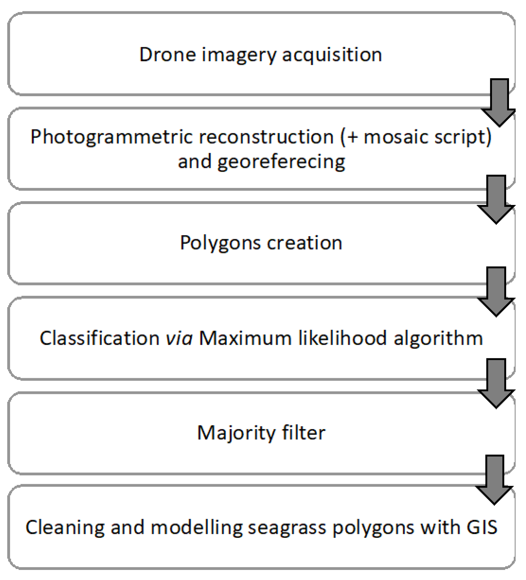
2. Materials and Methods
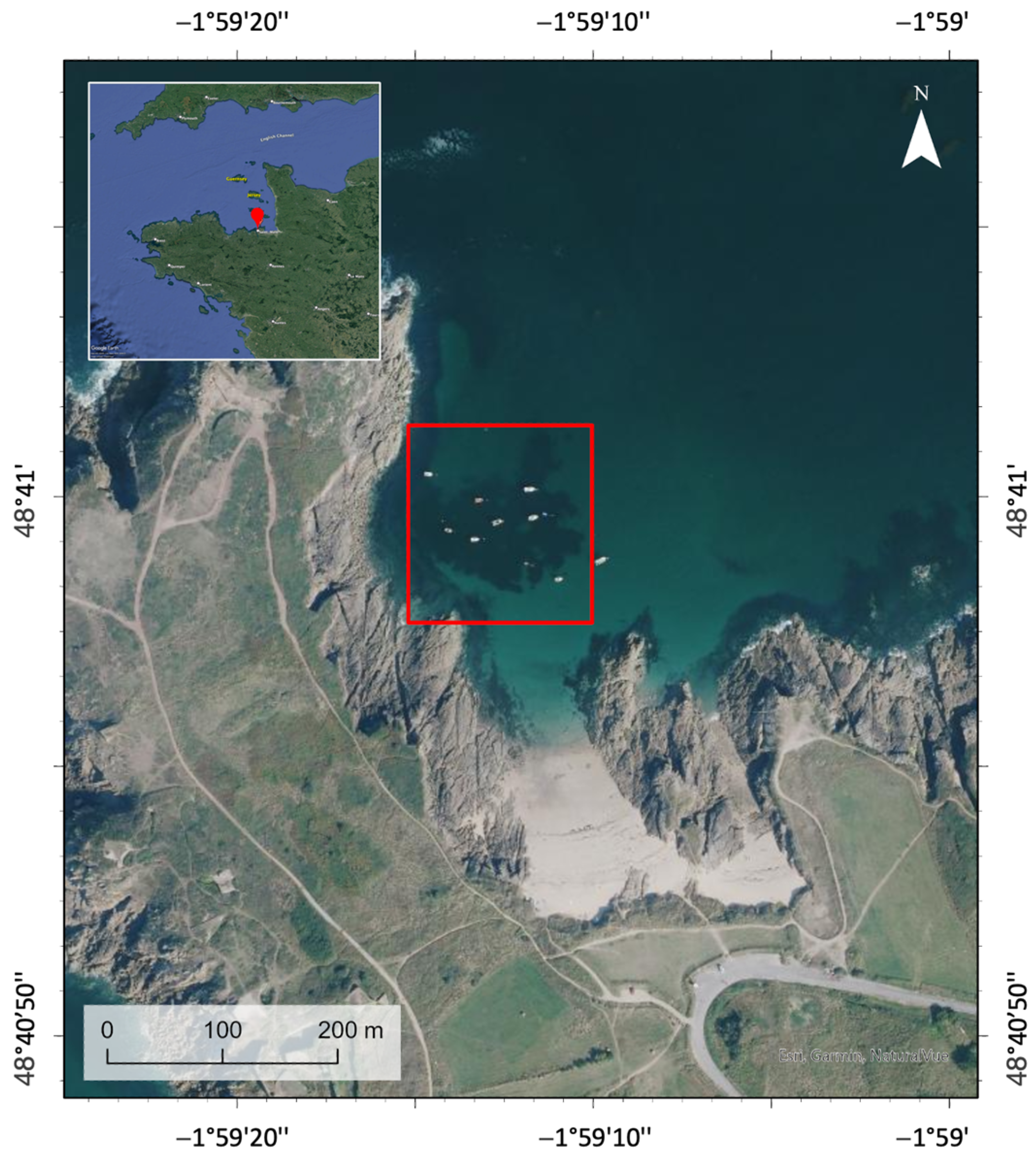
2.1. Study Site
2.2. Data Collection
2.3. Machine Learning Algorithm
3. Results and Discussion
3.1. Classification Results
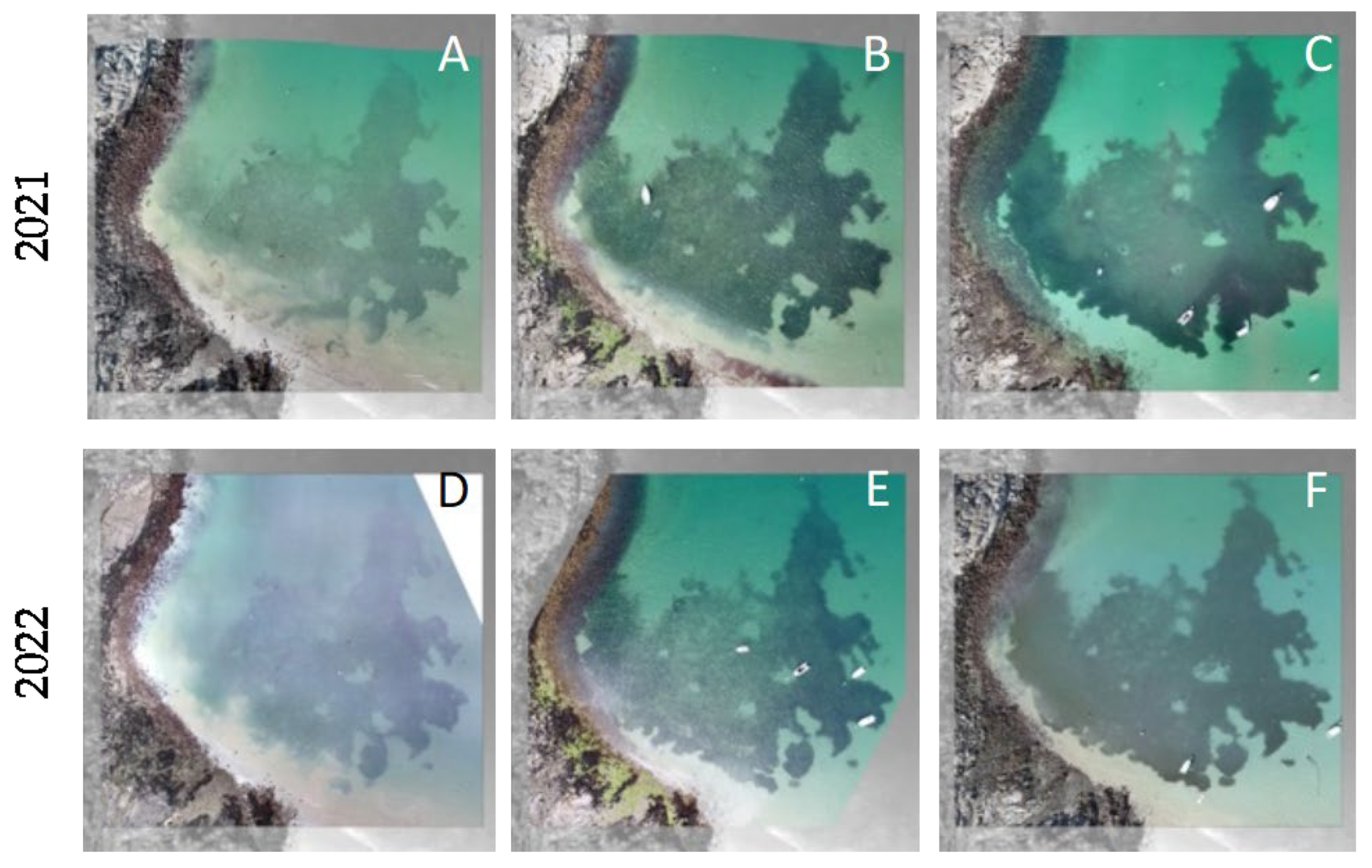
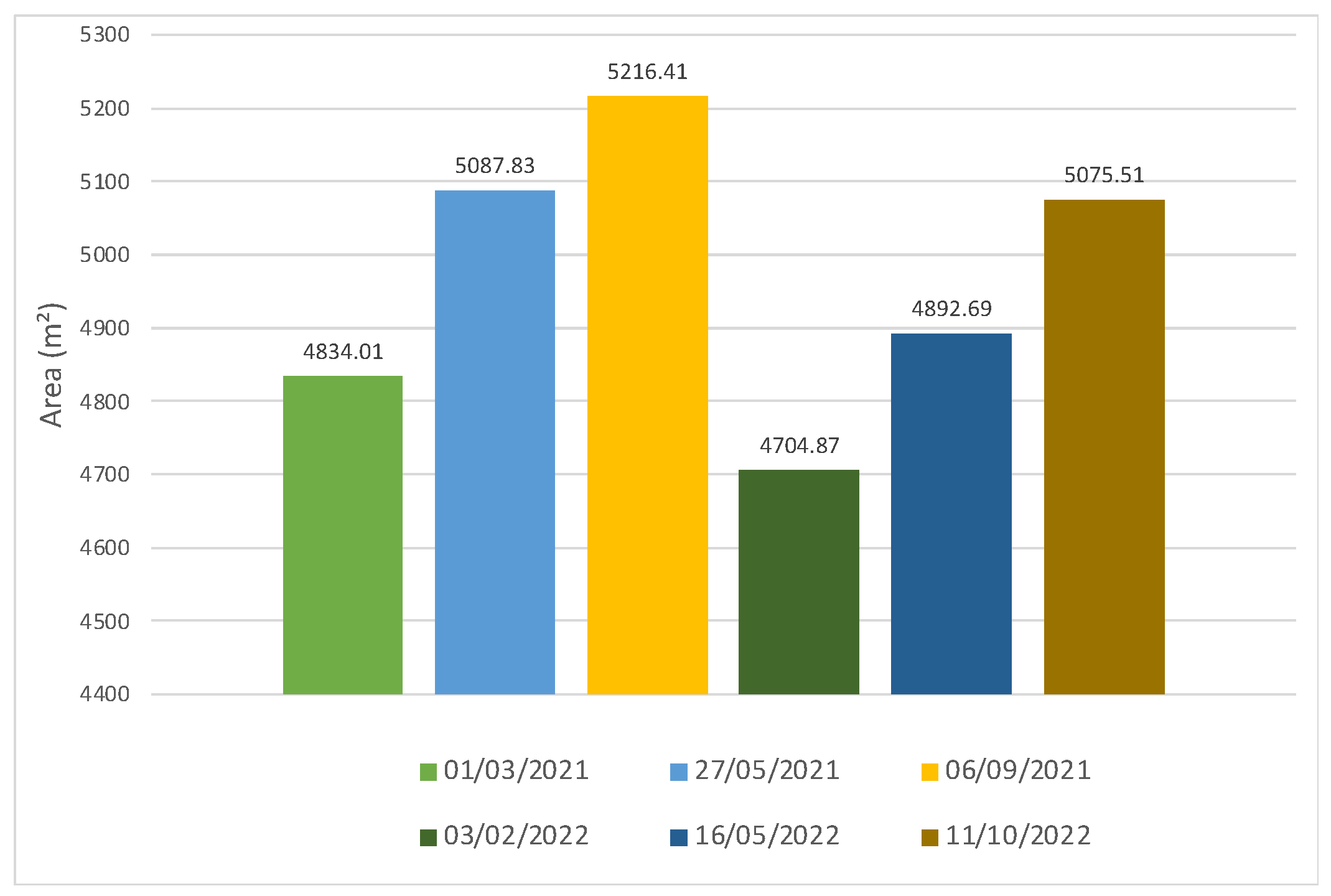
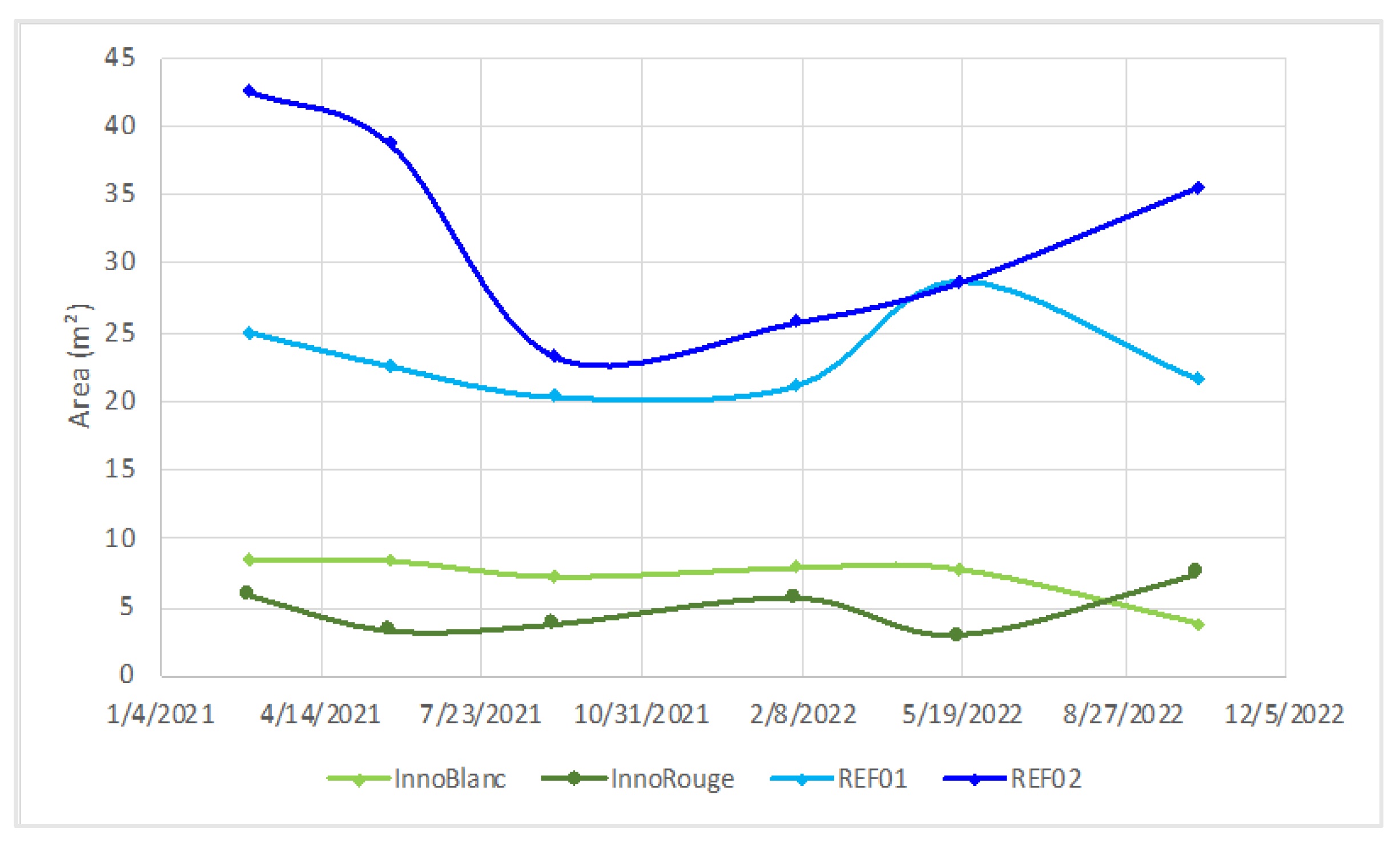
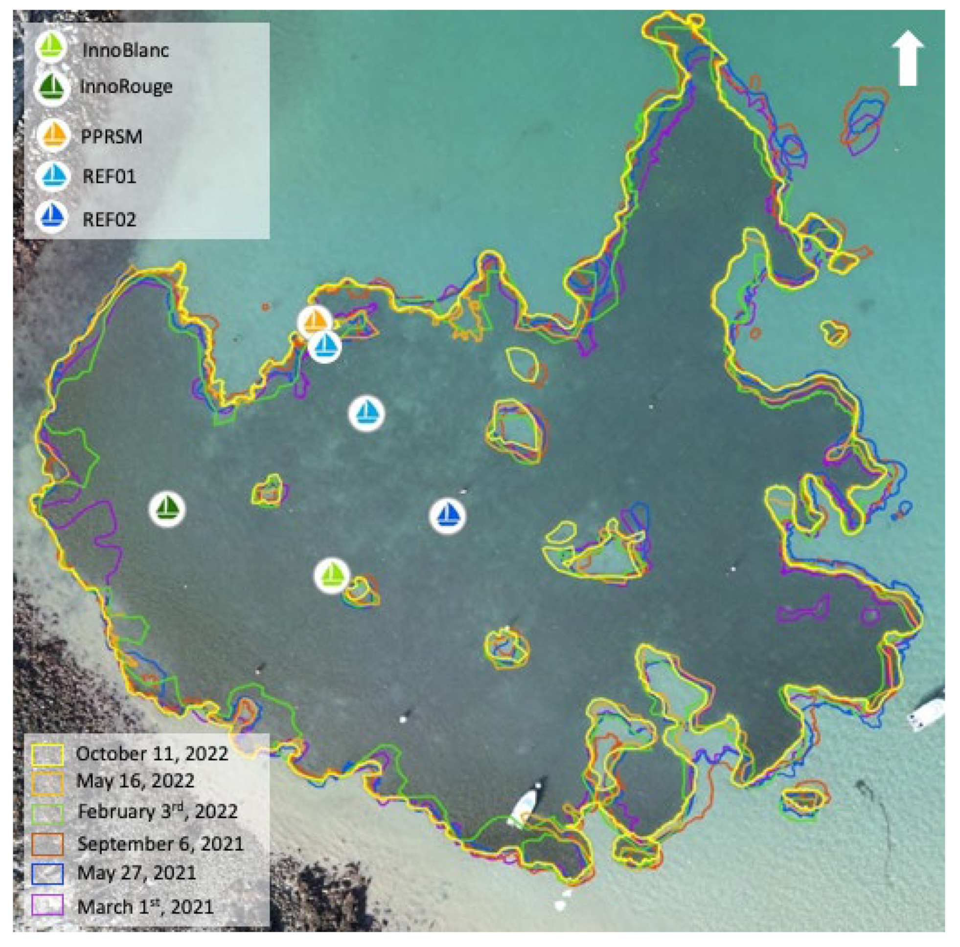
3.2. Annual and Seasonal Dynamics
3.3. Fragmentation Analysis
4. Conclusions
Author Contributions
Funding
Institutional Review Board Statement
Informed Consent Statement
Data Availability Statement
Acknowledgments
Conflicts of Interest
References
- Duarte, C.M.; Losada, I.J.; Hendriks, I.E.; Mazarrasa, I.; Marbà, N. The role of coastal plant communities for climate change mitigation and adaptation. Nat. Clim. Change 2013, 3, 961–968. [Google Scholar] [CrossRef]
- Leatherbarrow, K.E. Monitoring Environmental Impacts of Recreational Boat Anchoring on Eelgrass (Zostera marina L.) and Benthic Invertebrates in the Gulf Islands National Park Reserve of Canada. Doctoral Dissertation, University of Victoria, Victoria, BC, Canada, 2006. [Google Scholar]
- Baranano, C.; Fernández, E.; Morán, P.; Urbieta, P.; Méndez, G. Population dynamics of a fragmented subtidal Zostera marina population affected by shell fishing. Estuar. Coast. Shelf Sci. 2022, 269, 107818. [Google Scholar] [CrossRef]
- Ivajnšič, D.; Orlando-Bonaca, M.; Donša, D.; Grujić, V.J.; Trkov, D.; Mavrič, B.; Lipej, L. Evaluating Seagrass Meadow Dynamics by Integrating Field-Based and Remote Sensing Techniques. Plants 2022, 11, 1196. [Google Scholar] [CrossRef]
- James, D.; Collin, A.; Houet, T.; Mury, A.; Gloria, H.; Le Poulain, N. Towards better mapping of seagrass meadows using UAV multispectral and topographic data. J. Coast. Res. 2020, 95, 1117–1121. [Google Scholar] [CrossRef]
- Jacobs, R.P.W.M.; Pierson, E.S. Phenology of reproductive shoots of eelgrass, Zostera marina L., at Roscoff (France). Aquat. Bot. 1981, 10, 45–60. [Google Scholar] [CrossRef]
- Dahl, M.; Infantes, E.; Clevesjö, R.; Linderholm, H.W.; Björk, M.; Gullström, M. Increased current flow enhances the risk of organic carbon loss from Zostera marina sediments: Insights from a flume experiment. Limnol. Oceanogr. 2018, 63, 2793–2805. [Google Scholar] [CrossRef]

| Class Name | Thumbnail |
|---|---|
| Immersed seagrass |  |
| Emerged macroalgae | 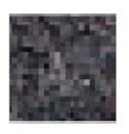 |
| Immersed macroalgae |  |
| Emerged rock | 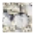 |
| Immersed sediment |  |
| Emerged sediment |  |
| Year | Area (m2) |
|---|---|
| 2021 | 15,138.25 |
| 2022 | 14,673.07 |
Disclaimer/Publisher’s Note: The statements, opinions and data contained in all publications are solely those of the individual author(s) and contributor(s) and not of MDPI and/or the editor(s). MDPI and/or the editor(s) disclaim responsibility for any injury to people or property resulting from any ideas, methods, instructions or products referred to in the content. |
© 2023 by the authors. Licensee MDPI, Basel, Switzerland. This article is an open access article distributed under the terms and conditions of the Creative Commons Attribution (CC BY) license (https://creativecommons.org/licenses/by/4.0/).
Share and Cite
James, D.; Collin, A.; Bouet, A. Drone-Based Spatio-Temporal Assessment of a Seagras Meadow: Insights into Anthropogenic Pressure. Environ. Sci. Proc. 2024, 29, 41. https://doi.org/10.3390/ECRS2023-15851
James D, Collin A, Bouet A. Drone-Based Spatio-Temporal Assessment of a Seagras Meadow: Insights into Anthropogenic Pressure. Environmental Sciences Proceedings. 2024; 29(1):41. https://doi.org/10.3390/ECRS2023-15851
Chicago/Turabian StyleJames, Dorothée, Antoine Collin, and Agathe Bouet. 2024. "Drone-Based Spatio-Temporal Assessment of a Seagras Meadow: Insights into Anthropogenic Pressure" Environmental Sciences Proceedings 29, no. 1: 41. https://doi.org/10.3390/ECRS2023-15851
APA StyleJames, D., Collin, A., & Bouet, A. (2024). Drone-Based Spatio-Temporal Assessment of a Seagras Meadow: Insights into Anthropogenic Pressure. Environmental Sciences Proceedings, 29(1), 41. https://doi.org/10.3390/ECRS2023-15851